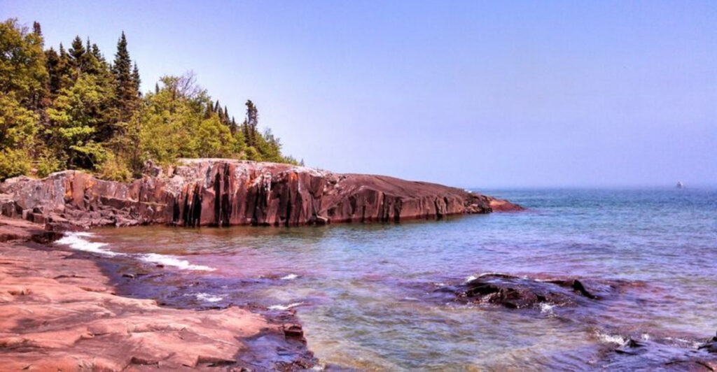
The quieter side of Pictured Rocks begins where many travelers barely think to slow down. Along the eastern edge of the national lakeshore, this small Alger County community sits on the shore of Lake Superior with cold blue water, wide-open skies, and a refreshingly unpolished feel that has not been swallowed by the tourist machine.
While plenty of visitors hurry toward the famous cliffs, they often miss the fact that Grand Marais has its own kind of magic waiting right at the gateway. With shoreline views, small-town character, and the kind of stillness that makes you pay attention, this Michigan village rewards anyone curious enough to stop, wander, and let the place reveal itself.
Where Lake Superior Meets the Sand Spit
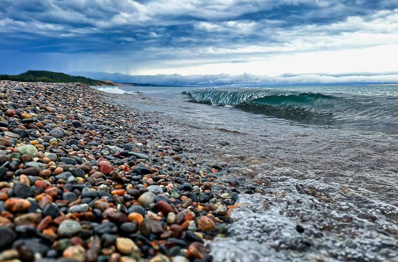
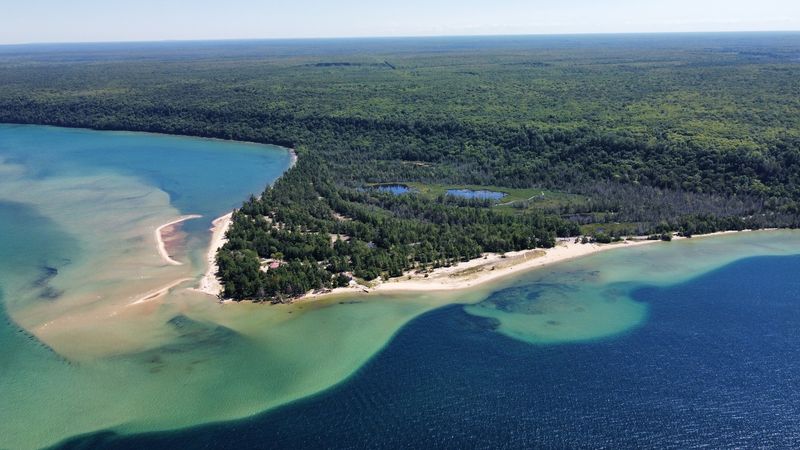
Standing at the edge of the Grand Marais harbor, the first thing that grabs attention is the sand spit curling out into Lake Superior like a long, lazy arm. The harbor sits sheltered behind this natural barrier, creating a pocket of calm water that contrasts sharply with the open lake just beyond.
On a clear morning, the surface reflects the tree line so cleanly it looks like two forests stacked on top of each other.
The sand spit itself is accessible on foot, and walking it gives a perspective that no overlook or parking lot can match. On one side, the harbor hums with the occasional fishing boat or kayak.
On the other, Lake Superior opens up without apology, its horizon stretching farther than the eye can comfortably process.
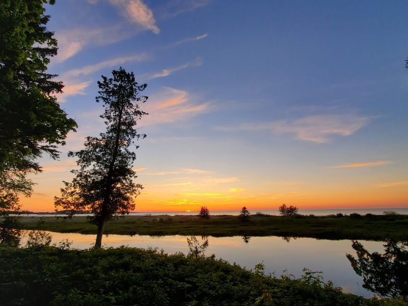
Grand Marais sits at roughly 46.67 degrees north latitude, which means the light here behaves differently than it does farther south. Summer sunsets linger well past nine in the evening, painting the harbor in shades of amber and rose that shift every few minutes.
Photographers who know about this spot return year after year specifically for that light.
The harbor area is also one of the best spots in the eastern Upper Peninsula to watch weather roll in off the lake. Storm fronts build visibly on the horizon, giving watchers several minutes of dramatic sky before the rain arrives.
Even in foul weather, the harbor holds a kind of raw, cinematic energy that feels completely different from anything found along Michigan’s lower shorelines.
For a community with fewer than 300 year-round residents, the harbor carries an outsized sense of place. It anchors the town visually and practically, and nearly every visit to Grand Marais begins and ends with at least one long look at the water.
H-58: The Road That Defines the Region
County Road H-58 is the kind of road that changes how you think about driving. Running roughly 60 miles along the southern edge of Pictured Rocks National Lakeshore, it connects Munising in the west to Grand Marais in the east, and for much of its length, the pavement gives way to gravel and the forest closes in on both sides.
Grand Marais sits at the eastern terminus of H-58, which makes the town the logical starting point for anyone approaching Pictured Rocks from that direction. Driving west from town, the road climbs through stands of birch and maple before dipping toward creek crossings and trail access points scattered along the route.
There are no gas stations once you leave Grand Marais heading west, which is worth knowing before you go.
The road passes trailheads that connect to the North Country Trail and several backcountry campsites within the national lakeshore. Stopping at Hurricane River, roughly 12 miles west of Grand Marais, puts hikers on a short trail to the Au Sable Light Station, one of the most photographed lighthouses in the Upper Peninsula of Michigan.
H-58 was fully paved for the first time in 2015, though some sections still feel rougher than expected. Before that, the eastern half was notorious for washboard gravel that rattled vehicles and tested patience equally.
The paving opened access to more visitors but has not significantly changed the wild character of the corridor.
Driving the full length of H-58 in a single day is doable, but stopping at even three or four of the pull-offs along the way turns the drive into a full experience. Grand Marais is the quiet anchor at one end of one of Michigan’s most underrated scenic routes.
Sable Falls and the Dunes That Drop Into the Lake
Just outside Grand Marais, Sable Falls drops through a narrow sandstone gorge in a series of cascading steps before emptying into Sable Creek near the lakeshore. The trail from the parking area is short, under a mile round trip, but the payoff is immediate.
The gorge walls rise steeply on both sides, and the sound of the falls bounces off the rock in a way that makes the space feel larger than it actually is.
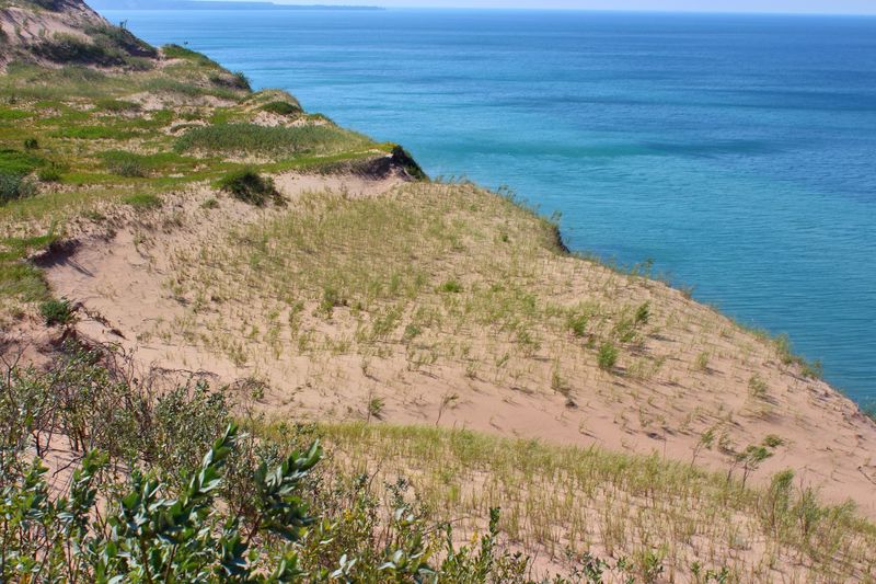
Most people stop at the main falls overlook and turn back. Continuing down the stairs to the creek mouth leads to a completely different scene: the Grand Sable Dunes rising dramatically to the east, their sandy faces dropping nearly 300 feet down to the Lake Superior shoreline.
The dunes are part of the national lakeshore and stretch for several miles along the coast, making them one of the largest perched dune systems in the world.
Climbing the dunes is not a casual stroll. The sand shifts underfoot, and the angle of the slope is steep enough to make the lungs work.
The reward at the top is a sweeping view of the lake and the dune field that feels genuinely remote, even on a busy summer weekend.
The Grand Sable Banks, as the dune face along the lake is called, can be seen from the water as well. Kayakers paddling the Pictured Rocks shoreline often cite the dunes as one of the most visually striking features of the entire route, partly because the scale only becomes clear when viewed from below.
Sable Falls and the surrounding dune complex form a natural exclamation point at the eastern edge of Pictured Rocks, and both are within easy striking distance of Grand Marais.
The Au Sable Light Station and Its Shipwreck Coast History
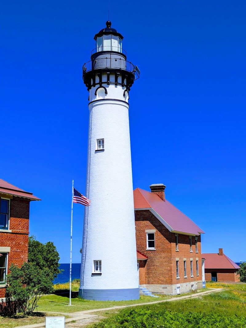
The Au Sable Light Station stands about 12 miles west of Grand Marais, accessible only by a two-mile round-trip trail through the forest from the Hurricane River campground. Built in 1874, the lighthouse was constructed specifically to warn ships away from a stretch of Lake Superior coastline that earned the grim nickname Shipwreck Coast long before anyone thought to market it as a tourist draw.
The waters between Grand Marais and Grand Island swallowed dozens of vessels during the peak years of Great Lakes shipping in the late 1800s. Storms came fast off the open lake, and the sandstone cliffs offered no shelter.
The light station was staffed continuously until 1958, when the Coast Guard automated it. Park rangers now lead guided tours of the keeper’s quarters during summer months, walking visitors through the daily routines of lighthouse life in one of the most isolated postings on the Great Lakes.
Wrecks still lie on the lake bottom along this stretch of coast. The Alger Underwater Preserve, which encompasses the waters near Grand Marais, protects several of these sites and draws scuba divers from across the Midwest each summer.
The visibility in Lake Superior’s cold, clear water can exceed 30 feet, making wreck diving here a genuinely different experience from diving in warmer, murkier inland lakes.
The trail to the light station passes through second-growth forest recovering from a massive wildfire that swept through the area in 1908. Interpretive signs along the route explain how the forest has changed over the past century, adding an ecological layer to what might otherwise feel like a simple hike to a pretty building.
The light station visit is one of the more historically grounded experiences available near Grand Marais, connecting the present landscape to a specific and dramatic past.
Grand Marais, Michigan in Autumn: A Different Kind of Crowd
September hits the Upper Peninsula of Michigan with a particular urgency. The sugar maples shift from green to orange almost overnight, and the birch trees go yellow in long, shimmering columns along every road and trail.
Grand Marais, already quiet by summer standards, becomes even more so after Labor Day, when the campgrounds thin out and the parking areas at Sable Falls hold only a handful of cars.
Fall color in this part of Michigan typically peaks in late September, roughly a week or two earlier than in the Lower Peninsula. The combination of the colored forest against the deep blue of Lake Superior is the kind of visual contrast that photographers plan entire trips around.
The light is lower in the sky by late September, which means golden hour lasts longer and the colors read warmer in photographs.
The temperature drops noticeably at night, so layering becomes essential for anyone camping at the nearby Hurricane River or Twelvemile Beach campgrounds. Daytime temperatures in late September often stay in the 50s, comfortable for hiking but cool enough to keep the crowds down.
Trails that see heavy foot traffic in July feel almost private by the first week of October.
The town itself shifts into a slower rhythm after summer. Some seasonal businesses close, but the essentials stay open long enough to serve the fall visitors who know what they are doing.
Finding a parking spot in Grand Marais in October requires no strategy whatsoever, which is its own kind of luxury compared to the scramble of peak summer.
Autumn is arguably the most rewarding season to visit Grand Marais, not because it offers more, but because it asks less of you in return.
Paddling the Eastern Lakeshore: Kayak Routes from Town
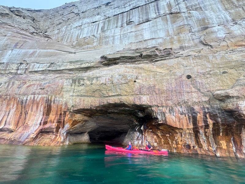
Launching a kayak from the Grand Marais harbor and heading west along the Lake Superior shoreline puts paddlers directly into some of the most dramatic coastal scenery in the eastern United States. The sandstone cliffs of Pictured Rocks begin a few miles out from town, and the eastern section of the lakeshore sees noticeably less kayak traffic than the heavily visited western sections near Munising.
Conditions on Lake Superior change fast. Even on calm mornings, the lake can build significant swells within an hour when wind picks up from the northwest.
Experienced paddlers treat the lake with appropriate caution, checking weather forecasts and staying close to shore when conditions are uncertain. The National Park Service recommends that paddlers on this stretch have open-water sea kayaking experience, not just flatwater skills.
The payoff for those with the skills and preparation is access to formations and coves that boat tours never reach. Paddling under the Pictured Rocks cliffs at water level, where the colored mineral streaks run straight down into the water, gives a completely different sense of scale than any view from above.
The water color shifts from dark blue in the open lake to bright turquoise near the pale sandy shallows, a transition that surprises people who expect Lake Superior to look uniformly cold and gray.
Several outfitters operate in the Pictured Rocks area during summer, and some offer guided trips that depart from or near Grand Marais. For those who prefer a shorter outing, the harbor itself and the nearby stretch of coast toward Pictured Rocks Inlet offer calmer paddling with good scenery and minimal exposure to open-lake conditions.
Starting a paddle from Grand Marais rather than Munising almost guarantees a less crowded experience on the water.
Why the Eastern Gateway Deserves Its Own Destination Status
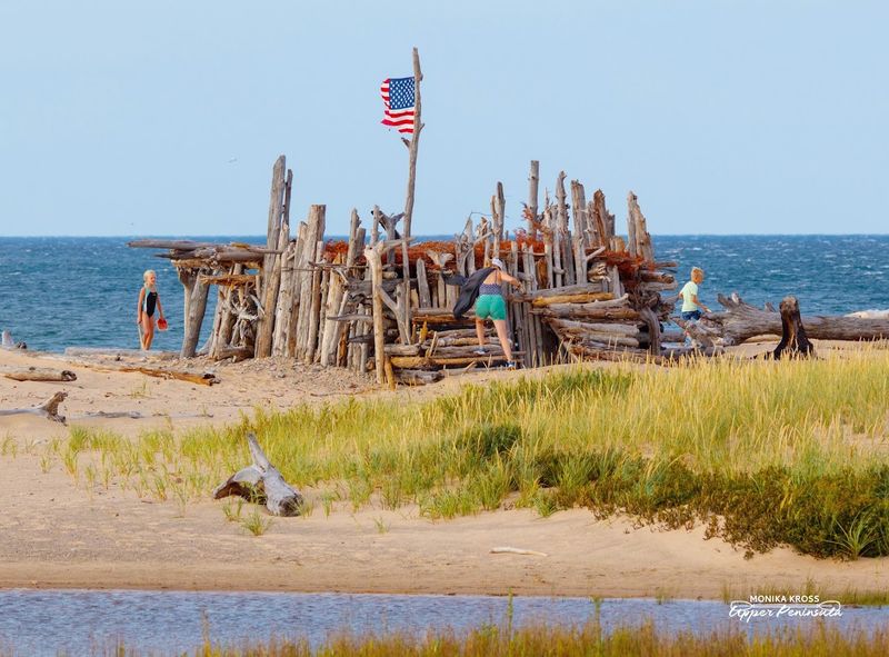
Most of the attention around Pictured Rocks flows west, toward Munising, where the cruise boats depart and the campgrounds book up months in advance. Grand Marais sits at the other end of the lakeshore, quieter by design and by geography, and the difference in experience is significant enough to justify treating it as a destination in its own right rather than just a pass-through point.
The town has a general store, a handful of small eateries, and a local brewery that operates seasonally. There is no chain restaurant, no resort hotel, and no waterpark pulling families in with discount coupons.
What Grand Marais offers instead is direct access to the eastern lakeshore with dramatically lower competition for parking, campsites, and trail space during the peak summer months.
The Woodland Park campground, operated by the township, sits right on the harbor and offers some of the most accessible lakeside camping in the Upper Peninsula. Waking up to Lake Superior fifty yards from your tent is an experience that fills quickly on summer weekends but remains genuinely achievable with even modest advance planning.
The community itself carries the particular character of a place that has not been optimized for tourism. Buildings show their age.
Signs are hand-painted. The pace of interactions in the local store runs slower than in towns built around visitor throughput. For some travelers, that friction is the point. It signals a place that exists for reasons beyond the hospitality industry.
Grand Marais works as a base camp for exploring the eastern half of Pictured Rocks, a day-trip destination from the Munising side, or simply a place to stop, sit by the water, and let the scale of Lake Superior recalibrate your sense of what counts as big.