The George Washington Bridge is still visible overhead when the road suddenly ducks beneath a wall of ancient-looking cliffs and begins curling beside the Hudson River. A few hours south, another two-lane route glides across salt marshes where herons stand motionless beside fishing boats.
Head west, and the pavement squeezes between the Delaware River and a canal built nearly two centuries ago. New Jersey’s backroads rarely announce themselves with grand entrances, yet they reveal a state that looks nothing like the one seen from the Turnpike.
These eight drives trade concrete dividers and crowded service plazas for pine forests, historic hamlets, barrier islands, rolling farmland, and river overlooks. Some can be completed before lunch, while others deserve an entire day of unhurried stops.
Bring sunglasses, clear some storage space on your phone, and resist the urge to calculate the fastest arrival time. On these roads, arriving quickly rather misses the point.
1. Henry Hudson Drive
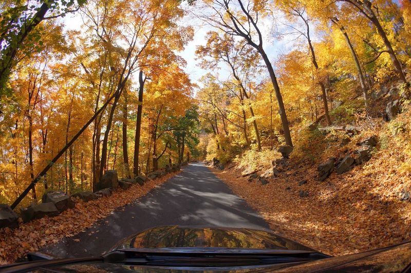
A massive steel bridge overhead, the Manhattan skyline across the water, and sheer rock rising beside the passenger window make the opening miles feel almost theatrical.
Henry Hudson Drive runs for roughly eight miles along the riverfront beneath the Palisades cliffs, connecting the Edgewater entrance of Palisades Interstate Park with Alpine.
Rather than viewing the Hudson from hundreds of feet above, drivers travel close to the shoreline, passing beneath the George Washington Bridge and through thick woodland that muffles much of the surrounding city noise.
The narrow roadway twists, dips, and climbs enough to demand attention, especially when cyclists are sharing the lane.
Pulling over is part of the experience. Ross Dock offers open river views, picnic tables, restrooms, and an excellent angle on the bridge, while Undercliff feels more secluded beneath the towering rock face.
Farther north, Alpine Picnic Area provides another waterfront break near the historic Kearney House. The drive generally opens to motor vehicles during the warmer months, from around May through November, although storms, rockfalls, maintenance, and emergency work can temporarily affect access.
Metered parking is used at several park areas, and weekend lots may fill early. Treat this as a slow scenic outing rather than a shortcut, watch carefully for bicycles, and check park advisories before leaving home.
2. Old Mine Road
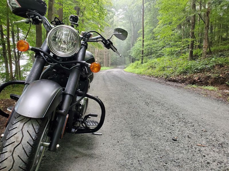
History does not sit politely behind glass along this road. It appears in weathered stone houses, quiet graveyards, abandoned village sites, and stretches of rough pavement that make speeding nearly impossible.
Old Mine Road forms the main north-to-south passage through the New Jersey side of Delaware Water Gap National Recreation Area, following a route shaped by Indigenous trails, colonial travel, farming, and early commerce. Its exact origins remain debated, but it is considered one of the country’s oldest continually used roads.
The best approach is to allow several hours and stop whenever curiosity wins. Millbrook Village preserves the look of a 19th-century farming community, while Walpack Center feels remarkably removed from modern New Jersey.
Van Campen Inn, Peters Valley, old churches, and stone homes add layers of history between stretches of forest and occasional Delaware River views. Spring brings wildflowers and rushing streams, summer fills the canopy, and fall turns the surrounding ridges into a wall of color.
Road conditions can be uneven, cell service is not guaranteed, and closures are fairly common after severe weather or during construction. In 2026, the northern portion between Route 206 and Jager Road is closed for rehabilitation, with possible delays near the Van Campen Brook bridge project.
Consult current park alerts and maps before choosing an entry point, then pack water, snacks, and more time than the mileage suggests.
3. County Route 563
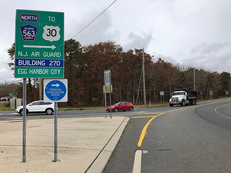
The transformation happens gradually. Shopping centers and busy intersections begin thinning out, houses grow farther apart, and then the pines close in until the road seems to have slipped into another region entirely.
County Route 563 stretches nearly 44 miles from Margate to Route 72 in Woodland Township, but its personality changes dramatically as it heads north.
The most memorable portion begins beyond the developed Atlantic County communities, where the route enters the Pine Barrens and continues toward Green Bank, the Wading River area, and Chatsworth.
Long straightaways alternate with easy curves beneath pitch pines and oak trees, while sandy side roads disappear into forests that seem to continue forever. There are no mountain overlooks or dramatic cliff edges here.
The appeal comes from the silence, the scale of the protected landscape, and the strange beauty of tea-colored rivers flowing through cedar swamps. A paddling stop can turn the drive into a full-day outing, with canoe access and outfitters located around Route 563 and the Wading and Oswego rivers.
Chatsworth makes a natural turnaround or rest stop, particularly when a coffee or something sweet sounds better than another hour behind the wheel. Fuel up before entering the quieter northern stretch, keep an eye out for wildlife near dawn and dusk, and download directions in advance.
Navigation signals can become unreliable exactly when the forest starts looking wonderfully empty.
4. Route 49
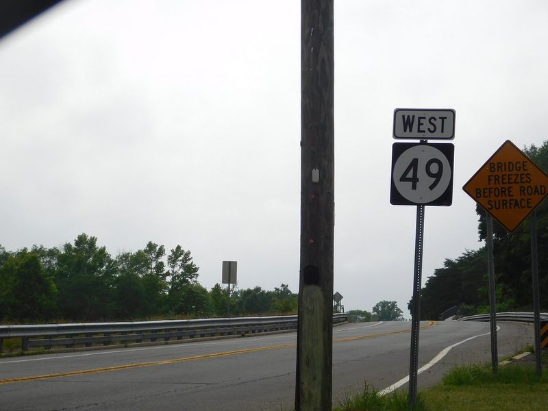
South Jersey begins to feel especially spacious west of Millville, where Route 49 crosses open farmland, low wetlands, and towns that rarely receive much attention from hurried Shore traffic.
The highway travels 53.8 miles from Pennsville to Upper Township, creating a broad east-west journey through Salem, Cumberland, and Cape May counties.
It is not uninterrupted wilderness, and that is precisely what gives the drive character. One minute brings a classic Main Street with old brick buildings; the next opens onto fields, creek crossings, weathered barns, and roadside produce stands.
Salem, Quinton, Bridgeton, Millville, Maurice River Township, and the Tuckahoe area each give the route a different rhythm. The western section feels rooted in the agricultural Delaware Bayshore, while the eastern miles gradually pick up pine forest and coastal influences.
Crossing the Salem River, Stow Creek country, the Maurice River region, and the Tuckahoe River makes water a recurring part of the landscape even when the Delaware Bay remains out of sight. Early autumn is particularly rewarding, combining colorful trees with farm stands and lighter Shore traffic.
This is still an active state highway, so do not expect a sleepy lane from beginning to end. Tractor traffic, town speed limits, roadwork, and summer beach-bound vehicles can slow progress.
That only creates a better excuse to stop in Bridgeton or Millville, grab lunch, and let the drive unfold at South Jersey’s preferred pace.
5. Palisades Interstate Parkway
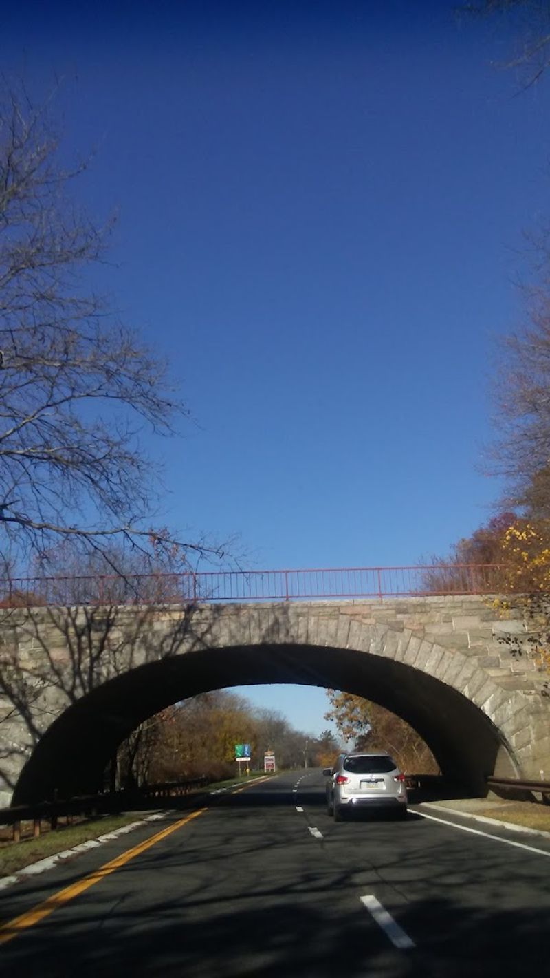
Leaving Fort Lee on this parkway feels like pulling a curtain across the metropolitan rush. The lanes climb north beneath a dense tree canopy, stonework appears along the roadside, and the usual parade of billboards and commercial exits disappears.
The full Palisades Interstate Parkway extends about 42 miles to the Bear Mountain Bridge, with roughly 11 miles running through New Jersey between the George Washington Bridge and the state line in Alpine.
That New Jersey portion is short enough for an easy afternoon drive but scenic enough to stretch much longer once the overlooks enter the plan.
State Line Lookout is the essential stop. Located near the highest point of the Palisades cliffs, it offers broad Hudson River views and, on clear days, a distant look toward the Manhattan skyline.
During fall migration, visitors may also spot hawks and other raptors moving above the ridge. The parkway’s wooded median, gentle curves, and carefully preserved surroundings make it feel more like a road through a park than a conventional highway.
Continue into New York for a longer outing toward Bear Mountain, or turn the trip into a loop by returning through nearby river towns. State Line Lookout has a dedicated northbound exit, restrooms, a café, and year-round metered parking.
Lots can reach capacity quickly on peak autumn weekends, so weekday mornings or late afternoons offer a calmer experience and better odds of securing a space.
6. Ocean Drive
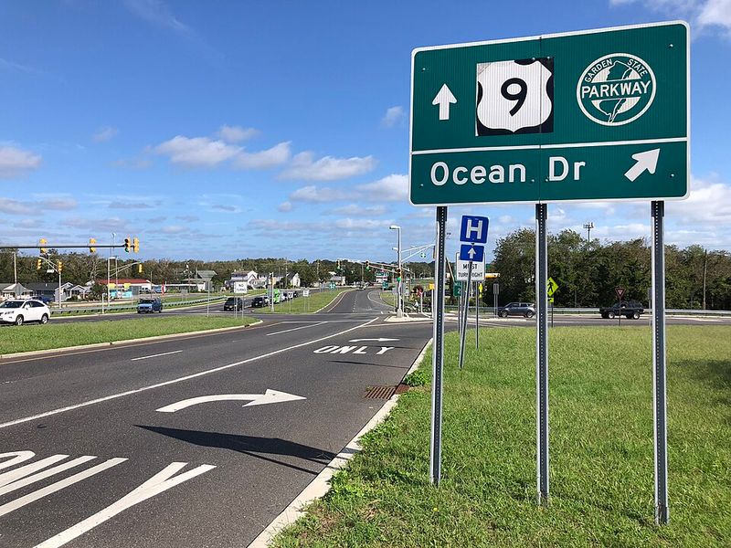
Windows down, salt air in the car, and fishing boats visible from a low bridge—Ocean Drive delivers the Shore without forcing drivers onto the Garden State Parkway. This coastal route links Cape May and Ocean City through a chain of barrier islands, bayside neighborhoods, wetlands, and bridge crossings.
The roadway is not a single uninterrupted state highway, so following the Ocean Drive signs matters as it moves through and around Wildwood Crest, North Wildwood, Stone Harbor, Avalon, Sea Isle City, Strathmere, and Ocean City.
Five toll bridges carry the route across tidal waterways, including Middle Thorofare, Grassy Sound, Townsends Inlet, Corsons Inlet, and the Ocean City–Longport crossing.
Those bridges provide the drive’s finest moments, lifting the view above marinas, marsh grass, broad channels, and clusters of waterfront homes. Leave time to pull into Stone Harbor or Avalon for a walk, stop near Corson’s Inlet for quieter coastal scenery, or finish with boardwalk time in Ocean City.
The entire corridor covers around 40 miles, but summer congestion, bridge openings, and tempting detours can easily turn it into a half-day adventure. Tolling is now cashless, using E-ZPass or Toll-by-Plate, and the standard passenger-vehicle toll is $2.50 per bridge.
E-ZPass is the easier option because Toll-by-Plate also carries a billing fee. Go early on a clear weekday and the route feels less like transportation and more like a private tour of the Cape May County coast.
7. County Route 519
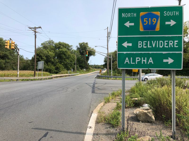
Few New Jersey roads show off the state’s rural range as convincingly as this one. County Route 519 begins near Route 29 just north of Stockton and continues for more than 88 miles to the New York state line in Sussex County.
Along the way, its name repeatedly changes while the familiar blue 519 shield leads through Hunterdon farm country, Warren County hills, small crossroads communities, and increasingly rugged northern woodland.
The southern miles around Delaware and Kingwood townships pass stone houses, old farms, creeks, and fields rolling away from the roadside.
Farther north, the terrain grows hillier, with tighter bends and long stretches where barns, silos, and wooded ridges dominate the view. This is not a drive built around one famous overlook.
Its strength is variety and the sense that every ten miles introduces another version of rural New Jersey. Plan a shorter segment around Hunterdon and Warren counties for an easy afternoon, or commit to the full route and finish near the forested state line in Wantage.
Because the road passes through working communities, drivers will encounter school zones, farm equipment, village centers, and occasional commuter traffic. The quieter sections can also have narrow shoulders and limited roadside services.
Start with a full tank, bring an offline map, and avoid rushing through unfamiliar curves. Autumn is spectacular, but late spring may be even better, when fields are bright green and the traffic is noticeably lighter.
8. Route 29 – Delaware River Scenic Byway
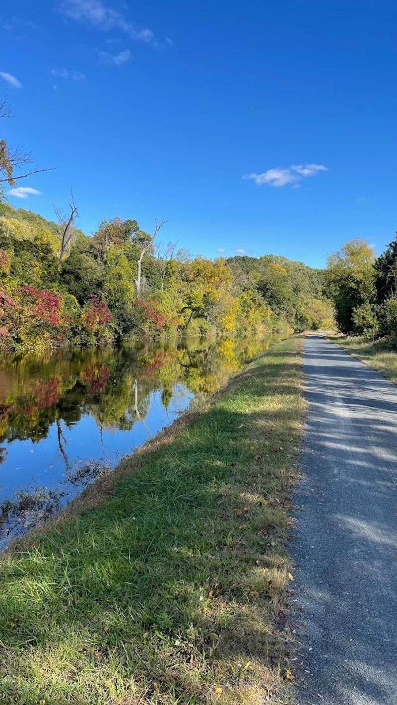
Between Trenton and Frenchtown, the Delaware River, Route 29, and the old D&R Canal travel together like longtime companions. The nationally recognized Delaware River Scenic Byway covers approximately 34 miles, passing Titusville, Lambertville, Stockton, Raven Rock, and Frenchtown while remaining close to the river for much of the journey.
This is the drive for people who cannot resist stopping. Washington Crossing State Park brings Revolutionary War history and towpath access.
Lambertville offers galleries, restaurants, antique shops, and a walkable downtown beside the bridge to New Hope. Stockton adds the stone buildings of Prallsville Mills, while Bull’s Island provides river access and trails before the road continues toward Frenchtown.
Between those destinations, Route 29 narrows against wooded bluffs, slips beside canal locks and historic houses, and opens periodically to beautiful Delaware River views. Drivers could cover the mileage quickly, but doing so would waste the route’s best feature: easy access to places worth exploring on foot.
Park near the canal and walk a section of the towpath, cross one of the pedestrian-friendly bridges, or linger over lunch in a river town. Weekends can become busy around Lambertville, particularly during festivals and peak foliage, so begin in Trenton and head north early.
Ending in Frenchtown allows time for coffee, browsing, and a riverside walk before deciding whether to retrace the byway or return by a faster inland route.