
A wooden path curls through shoulder-high reeds, a suspension bridge gives a gentle bounce underfoot, and then—because New Jersey enjoys changing the rules—the same route points straight up a rocky mountain. That is the sweet spot these trails occupy.
They are more interesting than a flat stroll around a field, but they do not require ropes, permits, or a heroic speech before setting out. Some cross cranberry bogs on narrow bridges.
Others use stepped boardwalks to climb through forests, skim the edge of salt marshes, or deliver hikers to wildlife blinds hidden above the water. The payoff may be a waterfall, a bay beach, a swinging bridge, or simply the satisfaction of keeping your shoes out of the mud.
Pack water, wear footwear that can handle roots and damp ground, and save these ten routes for the days when an ordinary walk will not quite do.
1. Pochuck Boardwalk and Stairway to Heaven — Vernon
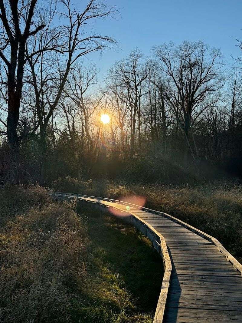
The first surprise is how little effort it takes to reach one of New Jersey’s most photographed trail structures. The Appalachian Trail’s Pochuck Boardwalk winds for more than a mile across Vernon Valley wetlands, carrying hikers over reeds, marshy ground, and Pochuck Creek.
Its 144-foot suspension bridge supplies the right amount of wobble without making the crossing feel intimidating, and the long stretches of weathered planks create a walk that is easy, scenic, and unusually memorable. That relaxed beginning is only half the story.
Hikers who want the “just enough adventure” part can continue toward Wawayanda Mountain and the rocky climb known as Stairway to Heaven. The route shifts from boardwalk and pasture to boulders, roots, and steep stone steps before a short spur reaches Pinwheel Vista.
From there, the view opens across Vernon Valley toward the Kittatinny Ridge. Treat the two portions according to your mood.
The boardwalk alone makes a satisfying, family-friendly outing of roughly two miles, while the full boardwalk-to-vista journey is a much longer and more demanding day. Parking near the popular access points can fill quickly, especially on fair-weather weekends, so an early start is wise.
After rain, expect damp planks and muddy transitions even though much of the wetland crossing sits safely above the ground.
2. Franklin Parker Preserve Red Trail — Chatsworth
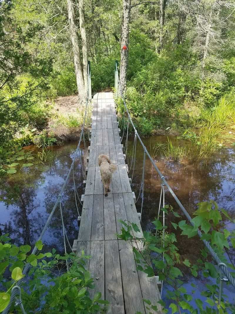
Former cranberry bogs make this six-mile Pine Barrens loop feel more like an expedition through a reclaimed landscape than a routine woodland hike.
The preserve was once a major cranberry farm, and the old agricultural geometry is still visible in the straight dikes, water-control channels, reservoirs, and broad open bogs now being reclaimed by native plants.
Sandy pine forest gives way to big skies with almost no warning. The route long known as the Red Footpath is identified on current preserve mapping as the Sam Lambert Trail.
It is the hiker-only option to choose when the goal is variety: narrow paths, bog edges, water crossings, and a suspension-style bridge that arrives as a genuine surprise in the middle of the South Jersey wilderness. The bridge is playful rather than frightening, but it gives the loop a clear centerpiece and makes the miles feel purposeful.
Do not mistake “flat” for “effortless.” Six miles is still six miles, and the open sections can feel exposed on hot days. Mosquitoes and ticks also take their jobs seriously here, so repellent and long, light clothing are sensible.
Download or photograph the current trail map before leaving the parking area because the preserve contains several intersecting loops and connectors. The best seasons are fall, when the bog grasses turn copper, and winter, when the bugs retreat and the wide-open former cranberry fields feel especially quiet.
3. River’s Edge Trail to the Swinging Bridge — Princeton

A suspension bridge hidden behind Princeton’s quietest paths is exactly the kind of reward that can turn an easy walk into a small adventure. River’s Edge Trail runs through Institute Woods, a preserved landscape of forest, wetlands, and farmland crossed by more than eight miles of paths.
The trail follows the edge of Stony Brook before reaching the Swinging Bridge, a narrow crossing that moves just enough to make children grin and cautious adults grip the cables a little tighter. This is not a strenuous hike.
The terrain is mostly flat, and a popular route from the Princeton Battlefield area to the bridge and back lands in the roughly two-to-three-mile range, depending on which connecting paths you choose. The fun comes from navigation and discovery rather than elevation.
Broad woods roads, narrower riverside stretches, old field edges, and the bridge itself keep the outing from feeling repetitive. Bring a map or keep a reliable trail map saved on your phone.
The network is extensive, and not every junction announces itself with a giant sign. After heavy rain, low sections near the brook can become muddy, so waterproof shoes earn their place in the car.
Parking at Princeton Battlefield State Park is a practical starting point and also gives the day a little historical texture. This is a strong pick for mixed-age groups, first-time hikers, or anyone who wants a bridge worth seeking without committing to a rugged climb.
4. Cedar Trail at Six Mile Run Reservoir Site — Somerset
Some trails advertise their engineering with a giant bridge visible from the parking lot. Cedar Trail saves its best hardware for later.
The white-blazed route at Six Mile Run Reservoir Site begins near the Jacques Lane parking area and travels through fields, young cedar groves, and upland forest. At just 1.6 miles, it is short enough for a casual outing, but the narrow path and changing scenery prevent it from feeling like a throwaway loop.
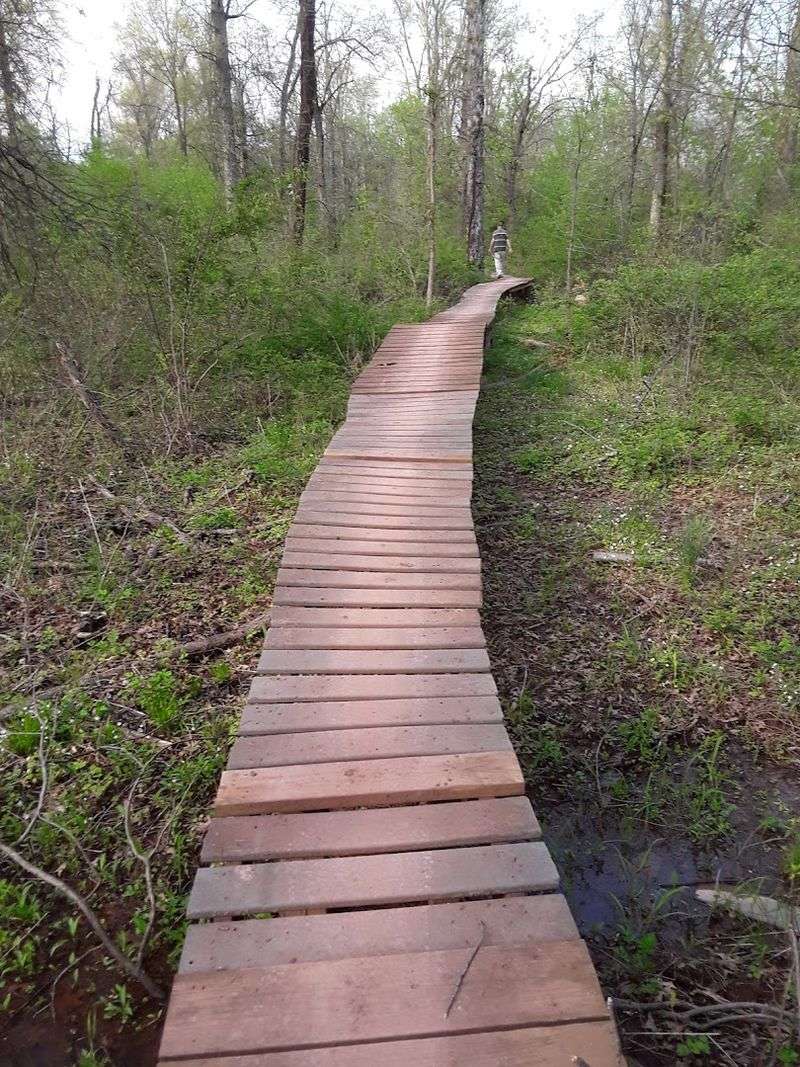
Near the end, the trail crosses a marsh on a 150-foot elevated wooden boardwalk. That long, straight run over wet ground is the visual highlight, followed by a stretch beside Six Mile Run and a metal bridge crossing that connects with the red-blazed Creek Trail.
Hikers can turn the Cedar Trail into a longer outing by using official connecting routes, while mountain bikers often treat the area as a compact playground of curves and quick terrain changes. The important word here is official.
Six Mile Run has accumulated unofficial social paths over the years, and park managers ask visitors to remain on the marked network shown on current maps. Start from the Jacques Lane lot, follow the white blazes, and resist any tempting unmarked shortcut.
The trail is multi-use, so listen for cyclists and step aside where the path narrows. Wet weather can leave the clay and low ground messy; choosing a dry day protects both your shoes and the trail surface.
5. Green Trail at Cheesequake State Park — Matawan
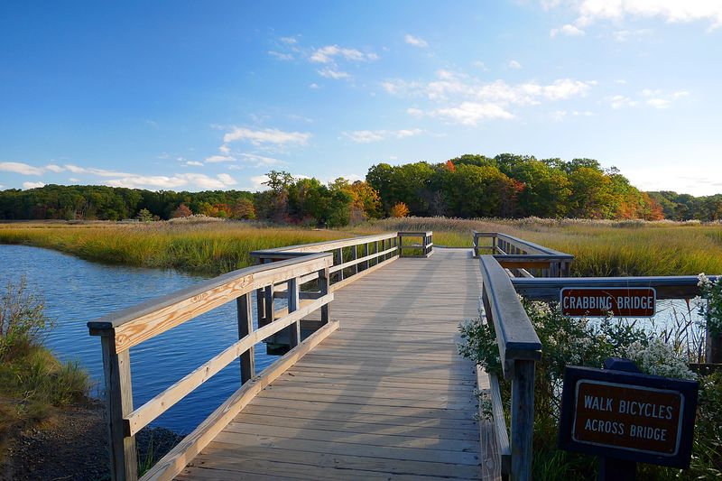
Central Jersey rarely changes ecosystems as quickly as Cheesequake State Park. On the Green Trail, hardwood forest, low wetlands, stream corridors, and sandy uplands appear within one 3.2-mile loop.
The route begins with a stepped boardwalk descending through oaks, sassafras, and sweet pepperbush, then crosses a small bridge and climbs toward the nature center. It is an opening that immediately delivers on the promise of bridges, boards, and manageable adventure.
The loop does not stay gentle. Beyond the nature center, a long staircase and several rolling hills add enough work to warm up the legs.
Roots, uneven ground, and seasonal mud keep the hike interesting, but there are no sustained mountain climbs. That balance makes the Green Trail useful for hikers ready to move beyond completely flat paths without turning the day into an endurance test.
Allow time to stop at the nature center when it is open. Even a quick look adds context to a park where salt marsh, pine barrens, lake, meadow, and forest sit surprisingly close together.
The main trailhead parking area serves the hiking loops, and the Green Trail is reserved for foot traffic rather than mountain bikes. Summer weekends can be busy, and state park entrance fees may apply during the peak season.
Spring brings wet ground and active insects; fall offers cooler walking weather and better color on the boardwalk descent.
6. Tillman Ravine Trail at Stokes State Forest — Branchville
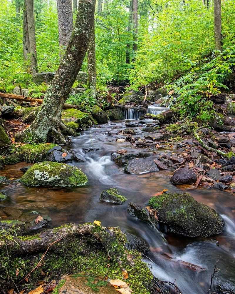
Water sets the pace at Tillman Ravine. Tillman Brook slips over ledges, gathers in dark pools, and breaks into small cascades beneath eastern hemlocks, while the trail threads across roots, rocks, and several little wooden bridges.
The ravine sits within Stokes State Forest, but it feels enclosed and intimate, with mossy boulders and fern-covered slopes blocking out much of the wider world. A short loop of about two miles is enough to experience the best of it.
The white-blazed Tillman Ravine Trail descends toward the brook, and connecting paths can add the Tea Cup—a swirling feature below a cascade—and the old Walpack Cemetery. The terrain is not extreme, but it deserves attention.
Rocks can be slick, roots crowd the path, and the return from the lower ravine includes a noticeable climb. This is exactly the sort of trail where sturdy shoes matter more than impressive mileage.
Go after a period of normal rainfall if you want lively cascades without dangerously high water. In summer, the hemlock shade keeps the ravine cooler than many exposed trails, though insects remain part of the deal.
Vehicle access to the ravine is restricted from December 15 through April 15, or whenever weather creates hazardous conditions; winter visitors may need to park farther away and walk in. Keep the pace slow, especially on wet bridges and stone, and the route feels adventurous without becoming technical.
7. Cattus Island County Park Trails — Toms River
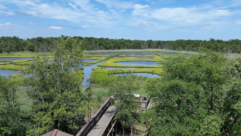
Salt marsh, pine woods, and a quiet strip of Barnegat Bay shoreline share the same 530-acre park at Cattus Island. The trail system offers roughly seven miles to mix and match, but there is no need to chase the biggest number.
A walk from the Cooper Environmental Center toward the bay gives the strongest introduction, using broad paths and boardwalk sections to cross low, damp terrain before reaching open water. The 1,000-foot accessible boardwalk is especially useful for families, strollers, and anyone who wants wetland scenery without uneven footing.
Farther out, the paths feel wilder. Marsh grasses press close to the trail, ghostly dead trees rise above the wetlands, and osprey activity can turn an ordinary pause into a long session of looking skyward.
The small bay beach is better for sitting, birdwatching, and taking in the view than planning a swim. Begin near the environmental center, where the parking is straightforward and indoor exhibits explain the surrounding salt-marsh and maritime habitats.
Live reptiles and fish, a bird-viewing area, and an osprey camera make the center more than a rainy-day backup. Trails can hold water after storms, and biting insects are enthusiastic in warm weather, so repellent belongs in the day pack.
For the best combination of cooler temperatures and active birdlife, aim for morning or late afternoon rather than the middle of a humid summer day.
8. Manasquan Reservoir Perimeter Trail — Howell
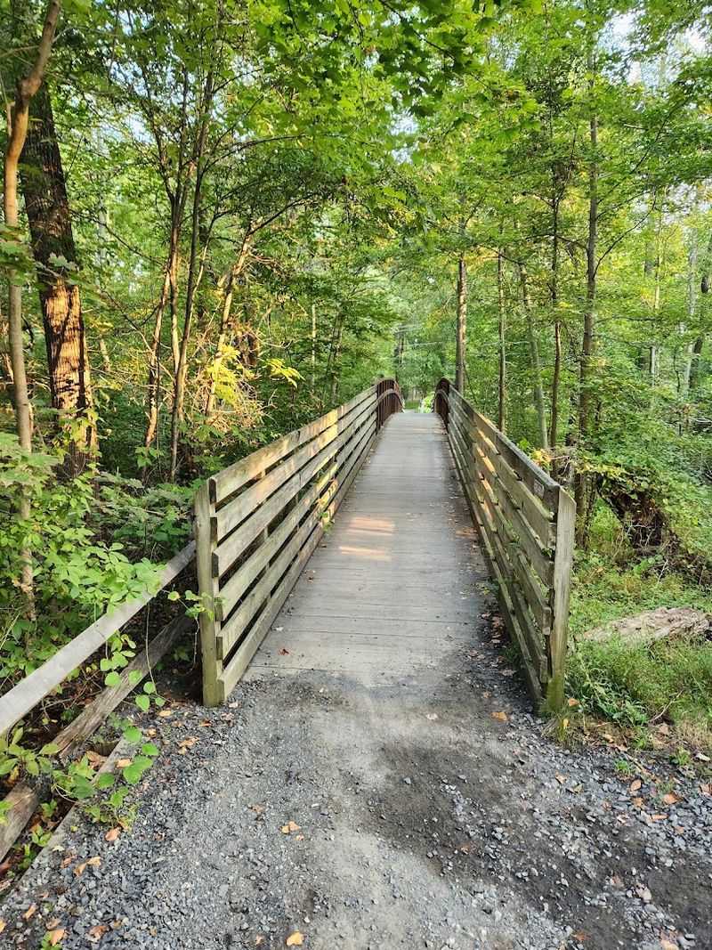
Five miles around open water sounds straightforward until the Perimeter Trail starts slipping between forest, wetlands, dikes, and a sequence of bridges. The route circles the 770-acre Manasquan Reservoir on a mostly level, crushed-stone path wide enough to accommodate walkers, runners, cyclists, and equestrians.
It is less rugged than a mountain trail, but the full loop has enough distance to feel earned. Bridges and raised crossings break up the shoreline miles, while wildlife blinds and occasional side paths encourage detours.
The broad reservoir views are the main attraction, especially when herons work the shallows or an osprey crosses above the water. Mile markers make pacing simple, and the mostly even surface is forgiving for hikers who want a longer outing without rocky footing.
Start at the Visitor Center, where the main trailhead, restrooms, and ample parking make logistics easy. The loop can also be accessed from other park lots, but beginning at mile zero keeps the day simple.
Bring water because five miles can feel surprisingly long in exposed summer sections. Cyclists use the trail regularly, so stay to the right and avoid spreading across the entire path.
The Environmental Center is currently closed for renovations, but the reservoir, trail, Visitor Center, fishing areas, and boating facilities remain the core draw. Sunrise and late-day light provide the best views across the water, while midday weekends bring the heaviest traffic.
9. Wildlife Observation Center Boardwalk Trails at Great Swamp National Wildlife Refuge — Harding Township
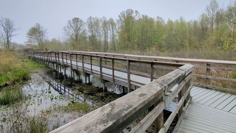
Bring binoculars, but do not expect to cover many miles. The boardwalks at the Wildlife Observation Center are built for stopping.
About a mile and a half of boardwalk and compacted trails carry visitors directly into Great Swamp National Wildlife Refuge, with observation blinds positioned for quiet views of birds, turtles, frogs, snakes, and mammals. A ten-minute walk can easily become an hour once something starts moving in the cattails.
The route is nearly flat and largely accessible, making it one of the easiest entries on this list. Wood and composite boardwalk sections alternate with stone-dust paths, and most inclines are limited.
The adventure comes from proximity: water sits directly below the boards, wetland plants crowd the railings, and each blind creates the feeling of slipping backstage in a busy ecosystem. Use the Wildlife Observation Center entrance at 220 Long Hill Road in Harding Township rather than assuming the refuge visitor center and boardwalks are in the same place.
The observation area is open from sunrise to sunset and includes parking, restrooms, and an information kiosk. Pets are not permitted on these trails, so leave the dog at home.
Move slowly and keep voices low near the blinds; patience produces more sightings than speed. Early morning is excellent for bird activity, while sunny afternoons can bring turtles onto logs.
Even after rain, the raised route keeps the outing manageable, though the boards may be slick.
10. Donald and Beverley Jones Memorial Footpath at Wickecheoke Creek Preserve — Stockton
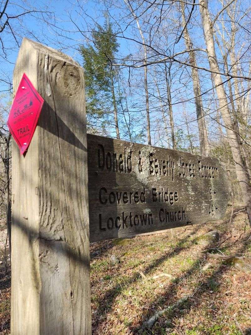
This is the outlier of the group, and that is part of its charm. The Donald and Beverley Jones Memorial Footpath is not one tidy loop with a single trailhead.
It meanders through preserved parcels along Wickecheoke Creek, moving on and off quiet Hunterdon County roads and linking fields, woods, hemlock groves, shale cliffs, waterfalls, and historic landmarks. Choosing a section feels more like assembling a country ramble than following a park circuit.
Several mapped loops let hikers tailor the day. The southern loop near Prallsville Mills is roughly a mile through fields.
Other options add creekside woods, steep slopes, road walking, and crossings that may require stepping stones when water is low. The larger preserve corridor also includes Green Sergeant’s Covered Bridge, the last historic covered bridge in New Jersey, along with Locktown Stone Church and Prallsville Mills.
The bridge is a destination in its own right, even when it is not directly on the chosen footpath loop. Study the northern, central, and southern maps before leaving home, then decide exactly which segment fits the group.
Parking is generally in small pull-offs rather than one enormous lot, and trailhead signs mark transitions between preserved land and roads. Sturdy shoes are essential, and creek crossings should be skipped when water is high.
For hikers who enjoy a little route planning, local history, and scenery that keeps changing, Wickecheoke delivers a satisfying final dose of adventure.