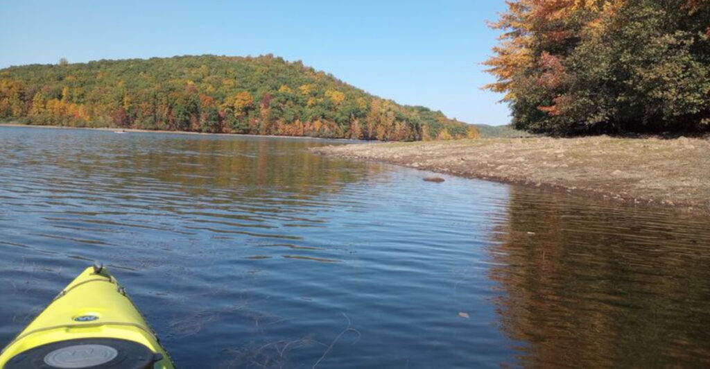
A row of bare tree trunks rises from the northern end of Monksville Reservoir like the remains of a forest that forgot to fall down. On a misty morning, kayaks slip between them while great blue herons watch from branches polished silver by decades of weather.
The scene looks wonderfully eerie, but the real story is beneath the water. Before this 505-acre reservoir spread across the Wanaque River valley, a small community occupied the land between what are now Ringwood and West Milford.
Families lived in farmhouses, motorists followed old roads toward Greenwood Lake, and restaurants welcomed travelers long before anyone arrived carrying a paddleboard. Then northern New Jersey needed more drinking water, and the valley was chosen for a major reservoir project.
Buildings vanished, roads shifted, graves were moved, and Monksville disappeared from the map. Today, the lake is a favorite for paddling and fishing, but its calm surface covers one of the Garden State’s most unusual lost landscapes.
Monksville Reservoir Looks Peaceful Until You Learn What Lies Below
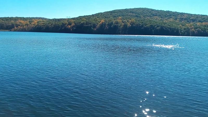
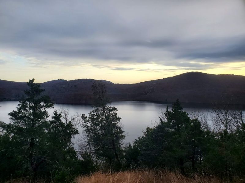
From the South Boat Launch, Monksville Reservoir presents a convincing impression of untouched North Jersey wilderness. Forested slopes crowd the shoreline, Monks Mountain rises inside the lake’s broad horseshoe curve, and the water can become so still that every ridge appears twice.
Nothing about the view immediately announces that it was engineered during the 1980s—or that people once lived where anglers now cast for muskellunge. The reservoir stretches across roughly 505 acres within Long Pond Ironworks State Park, straddling the Ringwood and West Milford area of Passaic County.
It holds about seven billion gallons and reaches a maximum depth of approximately 90 feet. Water from the Wanaque River enters from the north before being held behind Monksville Dam, which sits immediately upstream from the much larger Wanaque Reservoir.
Those numbers explain the scale of the project, but not the strange feeling of being there. The lake curves around mountains rather than opening into one simple oval, creating narrow passages, sheltered coves, and long stretches where the road disappears from view.
Paddle north of the Route 511 bridge and the landscape becomes especially atmospheric, with flooded timber, underwater stumps, and marshy edges replacing the wider water near the dam. The popular description of Monksville as a submerged ghost town needs one important footnote.
Visitors should not expect to peer over the side of a kayak and spot an intact steeple or a row of houses. Most buildings were demolished or relocated before flooding.
What remains below is the altered footprint of the community—its former ground, pieces of its road network, tree stumps, and traces of a valley that no longer exists in its original form. That reality is less theatrical than a perfectly preserved town, but somehow more affecting.
This was not an abandoned movie set swallowed overnight. It was a lived-in place deliberately cleared, reshaped, and covered because millions of people needed a dependable water supply.
The Small Community That Once Filled This North Jersey Valley
Monksville was never a bustling municipality with a courthouse, grand hotel, and blocks of storefronts. It was a small rural settlement shaped by family land, farms, roadside businesses, and the routes connecting Ringwood with Hewitt and Greenwood Lake.
That modest scale is exactly what makes its disappearance feel personal. The reservoir did not erase a famous city; it erased the kind of neighborhood that survives mostly through family stories and old photographs.
The community took its name from the Monks family, whose presence in the area reached back generations. Other local families, including the Rhinesmiths and Vreelands, also owned homes and property in the valley.
Around 15 residences were eventually acquired for the reservoir project, with occupants relocated before construction and flooding changed the landscape permanently.
Greenwood Lake Turnpike carried travelers through the area, while the old alignment of Stonetown Road passed near the place where the dam would later rise.
This was a practical corridor rather than an isolated backwoods pocket. People heading toward the Greenwood Lake resort area traveled through the valley, stopping at inns and restaurants along the way.
One memorable landmark was the Wanaque Valley Inn, a building dating to the late 1760s that later operated as a restaurant called the Holy Mackerel. Instead of being demolished, the historic structure was moved to the nearby Long Pond Ironworks historic district.
Other familiar places were not as fortunate. Farmhouses, cabins, outbuildings, and roadside structures either came down or disappeared as the reservoir site was prepared.
Former residents remembered country childhoods filled with long walks, neighboring farms, fishing, local businesses, and the ordinary freedom of growing up where woods and fields began close to the doorstep. There is no dramatic ruin left to represent all of that.
The surviving evidence is scattered: a relocated building, an old road segment, family names in historical records, and the reservoir itself carrying Monksville’s name. That name now appears on maps more prominently than the community ever did.
Ironically, flooding Monksville ensured that it would not be completely forgotten.
How a Water Crisis Sealed Monksville’s Fate
By the early 1980s, northern New Jersey had a problem that scenic mountain views could not solve. Repeated drought conditions and growing demand were putting serious pressure on the region’s drinking-water system.
The Wanaque Reservoir was already a crucial source, but planners wanted additional storage immediately upstream. The Wanaque River valley at Monksville offered the geography needed to hold another seven billion gallons.
The decision transformed land that had previously been considered for park preservation into the site of a major public-works project. Construction began during the middle of the decade, with a formal groundbreaking held in 1985.
Engineers cleared the valley, shifted sections of existing roads, prepared the dam site, and crushed material from the area for use in construction. The dam itself was an impressive piece of engineering.
Approximately 2,200 feet long and around 150 feet high, it was built using roller-compacted concrete, a relatively efficient method that allowed crews to place a dry concrete mixture with equipment more commonly associated with large earthmoving projects.
Using this technique helped reduce both the construction schedule and total cost compared with several alternatives under consideration.
Stonetown Road was rerouted across the completed dam, while part of Greenwood Lake Turnpike was shifted to higher ground. The reservoir was designed not as a stand-alone recreational lake but as part of the regional water system.
During periods of low flow, water can be released from Monksville into the Wanaque Reservoir below, increasing the amount available to the communities that depend on the system. By 1987, the dam was complete and the reservoir began filling.
Water moved across fields, former house sites, old lanes, and sections of the Wanaque River valley. The transformation happened quickly enough that Monksville’s old landscape passed from familiar to unreachable within the living memory of its former residents.
Northern New Jersey gained a valuable buffer against water shortages. The cost was measured not only in dollars and concrete, but in the permanent removal of a community whose residents had little power to stop the project once their properties were condemned.
Homes Were Cleared and a Family Cemetery Was Moved
Long before water reached the valley, Monksville had to be taken apart piece by piece. Houses could not simply be left standing in a reservoir intended to supply drinking water.
Families moved, salvageable structures were relocated, and demolition crews cleared most of what remained. Approximately 15 residences were affected, many connected to the Rhinesmith and Vreeland families.
Two historically significant homes were saved by being physically moved, while other houses were demolished. A local business was also relocated before its building came down.
The Wanaque Valley Inn was among the fortunate structures preserved elsewhere, giving visitors to the Long Pond Ironworks area a rare architectural link to the landscape that existed before the reservoir. The most delicate task involved the Monks family cemetery.
A reservoir can cover an old road or farm field, but leaving a known burial ground beneath the water was not considered acceptable. In the early 1980s, the graves were carefully removed from the future reservoir site and transferred to a new setting about a mile away, near the Wanaque Reservoir.
Historical accounts identify the remains of 15 Monks family members, along with 15 additional people whose identities were unknown. The cemetery had been documented decades earlier, but some markers and names had already been lost to time.
Moving the burial ground preserved what could still be identified while ensuring that the people buried there would not be left beneath the new lake. There is something sobering about that part of the story.
Reservoir construction was often described in terms of capacity, drought protection, engineering schedules, and regional necessity. For residents, it came down to boxes, deeds, family property, familiar rooms, and ancestors whose resting place had to be disturbed.
That distinction is worth remembering when Monksville is described casually as a ghost town. The community did not fade away because everyone slowly left.
It was dismantled through a planned process, with residents watching a public necessity overtake private history. The water arrived only after nearly every visible sign of their former neighborhood had been removed.
Ghostly Trees Still Mark the Landscape That Disappeared
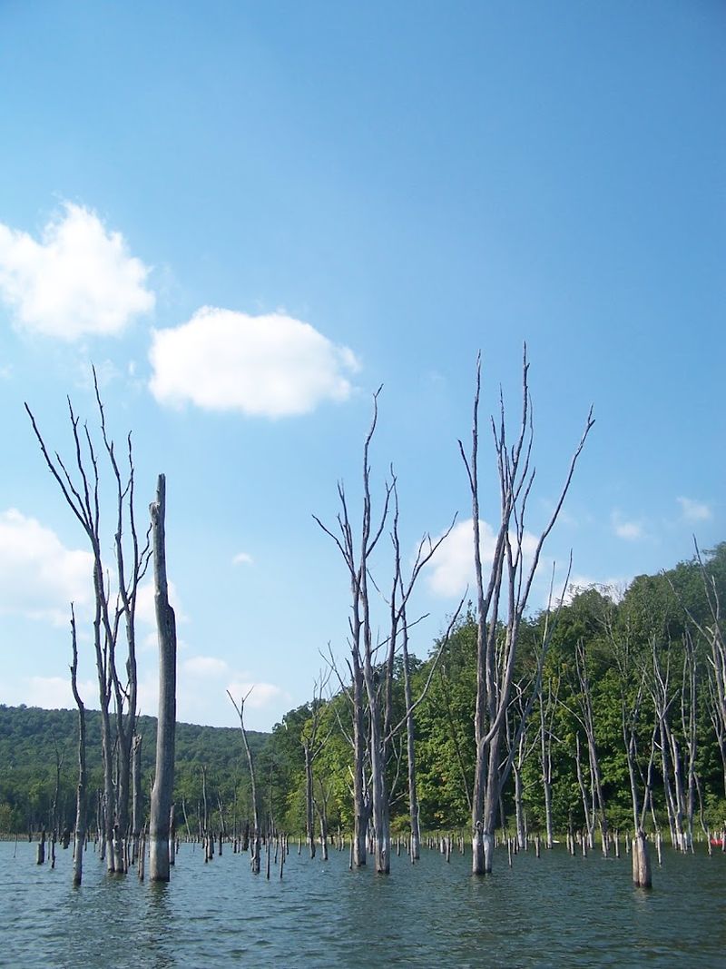
The northern end of the reservoir is where Monksville’s past becomes visible without an old photograph or history book. Beyond the Route 511 bridge, bare trunks stand directly in the water, their broken limbs reaching above the surface like oversized driftwood planted upright.
On a bright afternoon, they are simply unusual. Add low fog, fall color, or the call of a distant bird, and the scene earns every ghostly description it receives.
These trees grew in the Wanaque River valley before it was flooded. When the reservoir filled, the submerged root systems died, but some trunks remained standing.
Decades of exposure stripped away their bark and smaller branches, leaving pale columns surrounded by open water. Kayakers can weave through parts of the flooded grove, although this is not the place for careless speed.
Stumps and submerged wood can sit just below the surface, particularly when water levels change. A hard-sided kayak offers more confidence than an inflatable craft, and stand-up paddleboarders may find the obstacle-filled water less forgiving.
The Beech Road cartop launch provides the most direct access to this quieter northern section. Wildlife has made excellent use of what the flooding left behind.
Great blue herons perch on the trunks while scanning the shallows. Ospreys use the higher branches as lookout points, and paddlers may also spot turtles, waterfowl, beavers, or bald eagles around the reservoir and neighboring parkland.
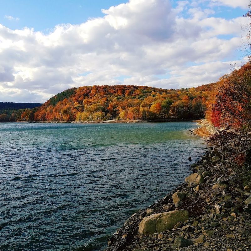
In October, the gray timber stands against red, orange, and yellow ridges, creating one of the lake’s most striking contrasts. The dead trees are not necessarily the remains of the community’s streets or yards, and they should not be treated as proof that intact buildings sit directly beneath them.
They are remnants of the broader flooded valley—the woods and river margins that surrounded Monksville before the dam changed the waterline. Even so, they perform the work of a monument.
No plaque is needed to explain that this landscape has been interrupted. The trees make the reservoir’s history visible, marking the height of a lake where dry ground once supported an entirely different world.
Kayaking and Fishing Above New Jersey’s Forgotten Community
A fishing line disappears into 90 feet of water. A rowing shell glides beneath the Route 511 bridge.
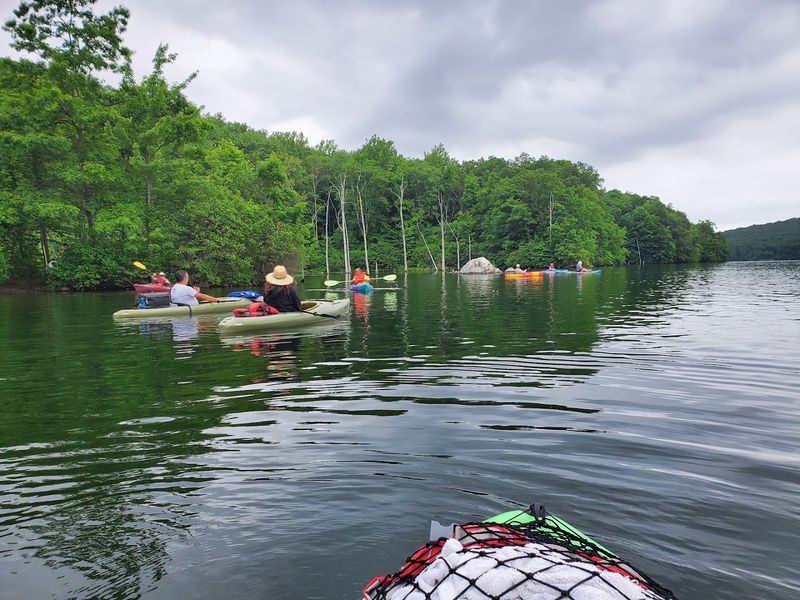
Near the shoreline, a first-time kayaker works out how to turn without splashing everyone nearby. Monksville Reservoir may carry a haunting history, but it is very much alive as one of North Jersey’s most rewarding freshwater recreation spots.
Three access points serve different kinds of outings. The South Boat Launch reaches the widest portion of the reservoir and has traditionally been a convenient starting point for paddlers exploring the open water near the dam.
The North Boat Launch works well for reaching the narrower middle section, while the Beech Road Cartop Launch places canoes and kayaks closer to the flooded trees. Launch availability and operating conditions can change seasonally, so checking current state park notices before arriving is sensible.
Motorboats are permitted on Monksville Reservoir with engines of 10 horsepower or less, helping keep the water noticeably calmer than many large New Jersey lakes. Jet skis are prohibited.
Paddlers can cover about five miles on a relaxed loop, but the reservoir’s coves and horseshoe shape allow longer explorations. Wind tends to become more noticeable across the broad water near the dam, so the return trip can feel considerably different from the easy outbound paddle.
Anglers come for serious fish. Monksville is known for muskellunge, walleye, bass, and trout, with its trophy muskie fishery carrying a particularly strong reputation.
Anyone age 16 or older generally needs a valid New Jersey fishing license, and species-specific seasons, size limits, and catch-and-release rules apply. The reservoir works equally well as a history trip and a quiet morning outside, but the two experiences are difficult to separate once you know the story.
Every paddle crosses former ground. Every cast drops through water that replaced roads, houses, and family land.
Monksville is gone, yet its name remains attached to the lake, the dam, and the landscape that took its place—a forgotten community remembered each time someone asks what lies beneath the surface.