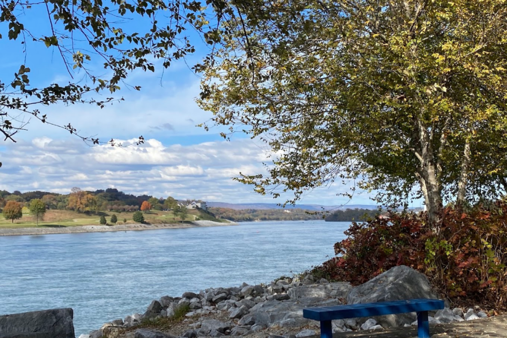
Tennessee’s landscape is famous for its dramatic peaks, deep valleys, and towering ridges that stretch across the eastern half of the state. Some communities didn’t just grow near these natural wonders—they were built right in the middle of them, squeezed between cliffs, tucked under mountain walls, or cradled in narrow river valleys.
These towns offer stunning views, unique geography, and a sense of being surrounded by nature’s most powerful forces. From the misty hollows of the Smokies to the sheer walls of the Cumberland Plateau, these seven Tennessee towns show what happens when people choose to build their lives in the most rugged, beautiful spots imaginable.
1. Chattanooga
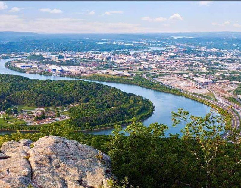
Chattanooga sits in a natural bowl carved by the Tennessee River, with mountains rising on nearly every side like the walls of an ancient amphitheater. Lookout Mountain looms to the southwest, Signal Mountain guards the northwest, and Missionary Ridge runs along the eastern edge, creating one of the most visually striking urban settings in the South.
The city feels contained and sheltered, yet the river keeps it open and connected to the wider world.
Walking through downtown, you can glance up almost any street and see ridgelines framing the skyline. The mountains aren’t just backdrop—they’re part of daily life.
Locals hike up Lookout Mountain for sunrise views, bike along the riverfront with Signal Mountain in sight, and drive winding roads that climb steep grades to reach neighborhoods perched on the ridges. The terrain shapes everything from commute times to weekend plans.
Historically, this geography made Chattanooga a strategic location during the Civil War. The high ground of Lookout Mountain and Missionary Ridge became famous battlefields, and today you can still visit historic sites that tell the story of those clashes.
The same ridges that once provided military advantage now offer some of the best hang gliding, rock climbing, and paragliding spots in the region.
The Tennessee River cuts through the valley in broad, sweeping bends, and the city has transformed its riverfront into a network of parks, trails, and attractions. The river reflects the mountains on calm days, doubling the drama of the landscape.
Bridges cross the water at several points, connecting neighborhoods and offering views that remind you just how tightly the city is tucked into its rocky frame.
Chattanooga’s mountain setting also creates microclimates and weather patterns that can shift quickly. Fog rolls down from the ridges in the morning, storms build over the peaks in summer afternoons, and temperature differences between the valley floor and mountaintops can be noticeable.
It’s a city where the land doesn’t just sit beneath you—it wraps around you, rises above you, and reminds you constantly that you’re living in a place shaped by powerful natural forces that have been carving this valley for millions of years.
2. Gatlinburg
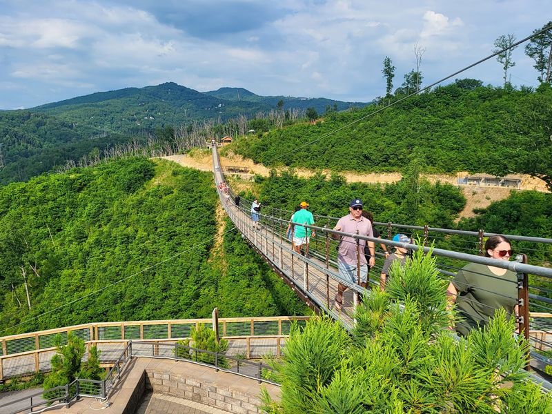
Gatlinburg occupies one of the tightest mountain settings in Tennessee, squeezed into a narrow valley with the Great Smoky Mountains pressing in from three directions. The town stretches along a single main corridor that follows the West Prong of the Little Pigeon River, and when you look up from almost anywhere in town, you see forested slopes climbing steeply toward rocky peaks.
There’s no room to sprawl—Gatlinburg grew vertically and creatively, stacking hotels, shops, and attractions wherever the land allowed.
The national park boundary comes right up to the edge of town, which means you can walk from a pancake house to a trailhead in minutes. That proximity is rare and gives Gatlinburg a unique character.
Bears occasionally wander through parking lots, creeks rush down from the mountains and flow under bridges in the middle of downtown, and the scent of pine and rhododendron mixes with funnel cake and woodsmoke. It’s a collision of wilderness and tourist energy that only works because the geography forces everything into such close quarters.
Mountain ridges frame every view and create natural barriers that channel traffic, weather, and even sound. Storms roll over the peaks and dump rain suddenly, fog drifts down from the heights and blankets the streets, and temperatures can drop sharply as you climb the winding roads that lead up to overlooks and cabins.
The mountains don’t just surround Gatlinburg—they control its rhythm and shape its identity.
Visitors often arrive expecting a typical tourist town and are surprised by how dramatic the landscape feels. The ridges rise so steeply that shadows fall early in the afternoon, and sunrise comes later than in flatter areas.
Cable cars lift people up to mountaintop attractions, ski resorts cling to north-facing slopes, and scenic drives twist up grades that test brakes and nerves. The town exists because of the mountains, not despite them.
Gatlinburg’s layout reflects its geography. There’s one main road through town, and everything branches off it in short, steep streets that dead-end into hillsides or creek beds.
Parking is tight, buildings are stacked, and every inch of usable land has been claimed. Yet that compression creates energy and focus.
You’re never far from the next thing, and the mountains keep pulling your eyes upward, reminding you that this town is entirely at the mercy of the peaks that hold it in place.
3. Cumberland Gap
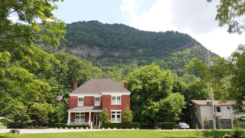
Cumberland Gap is more than a town—it’s a geographic landmark that has shaped American history for centuries. The gap itself is a natural break in the towering wall of Cumberland Mountain, where erosion carved a passage through the Appalachian chain.
The town sits right beneath this massive notch, dwarfed by cliffs and ridges that rise hundreds of feet on either side. Standing in the gap, you feel the weight of the mountains pressing in, and it’s easy to understand why this spot became such a critical route for early settlers.
Native Americans used the gap for thousands of years before European explorers arrived. Daniel Boone famously blazed the Wilderness Road through here in 1775, opening a route for westward migration that brought more than 300,000 settlers through the gap over the next few decades.
The town that grew up around this passage has always been defined by its position at the foot of the mountain. Everything here is oriented toward the gap—roads, trails, and even the local economy.
The Cumberland Mountain ridges create a dramatic skyline that shifts depending on where you stand. From some angles, the gap looks like a simple dip in the ridgeline.
From others, it appears as a deep notch flanked by steep, forested slopes that seem almost vertical. The geology here is ancient, formed by millions of years of tectonic pressure and erosion, and the rock layers are visible in exposed cliffs and roadcuts.
Cumberland Gap National Historical Park preserves much of the area, and hiking trails climb up to overlooks where you can see three states at once—Tennessee, Kentucky, and Virginia all meet near the gap. The views from these heights show just how rugged and unbroken the Appalachian ridges are, and how rare and valuable a natural passage like this would have been to anyone trying to cross the range.
The town itself is small and quiet, with a population that has never grown large. The mountains limit development, and the national park protects the surrounding land from sprawl.
What remains is a community that feels timeless, where the landscape still dominates and the gap still serves as the organizing feature. Driving through, you pass under the mountain’s shadow and feel the history of the place—the countless footsteps, wagon wheels, and hoofbeats that have crossed this same ground, all guided by the same rocky walls that rise above the town today.
4. Jasper
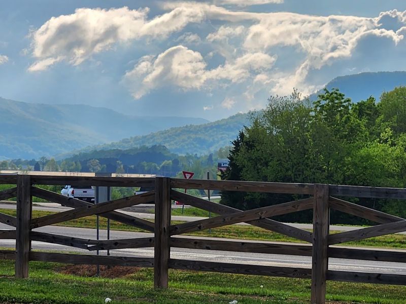
Jasper sits at the bottom of the Sequatchie Valley, one of the longest and straightest valleys in the Appalachian region, and the ridges on either side rise so abruptly that the town feels like it’s at the bottom of a massive trench. The Cumberland Plateau walls stretch north and south for miles, creating a narrow corridor of flat land where the Sequatchie River flows and the town spreads out.
Looking east or west, you see nothing but steep, forested slopes climbing toward the plateau rim hundreds of feet above.
The valley’s formation is a geological curiosity. Unlike most valleys carved by rivers over time, the Sequatchie Valley was created by a combination of folding and erosion that exposed older rock layers and created this long, linear depression.
The result is a landscape that feels orderly and dramatic at the same time—straight ridges, a flat valley floor, and a clear sense of being enclosed by walls that run for miles without breaking.
Jasper’s location in the valley has shaped its history and economy. Farming has always been important here because the valley floor offers fertile soil and flat land, both rare in this part of Tennessee.
The ridges, meanwhile, provided timber, coal, and isolation. For much of its history, Jasper was harder to reach than towns on the plateau, and that remoteness gave the valley a distinct character and culture.
Today, driving into Jasper from either direction means descending steep, winding roads that drop from the plateau rim down into the valley. The descent is dramatic, with switchbacks and overlooks that reveal the full length of the Sequatchie Valley stretching into the distance.
Once you reach the valley floor, the ridges tower on both sides, creating a skyline that never changes no matter where you go in town.
The Sequatchie River runs through the middle of the valley, and the town has grown up along its banks. The river is small and slow-moving, but it’s a constant presence, reflecting the ridges and marking the low point of the valley.
Trails and back roads follow the base of the plateau walls, and adventurous hikers can climb up to the rim for views that show just how deep and narrow the valley really is. Jasper lives in the shadow of those ridges, and the sense of being surrounded by high ground is something you never forget while you’re there.
5. Townsend
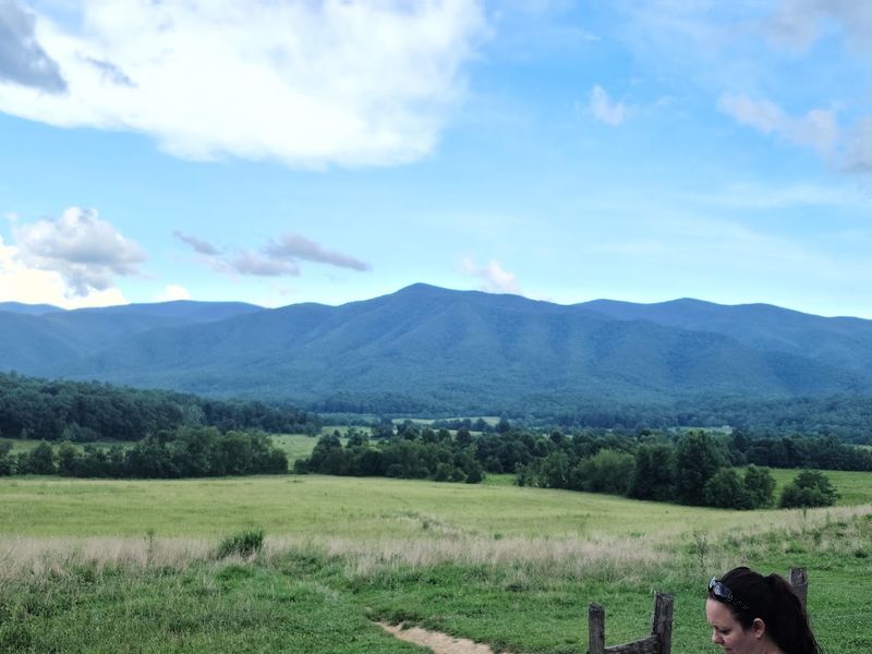
Townsend rests in Tuckaleechee Cove, a bowl-shaped valley ringed by the foothills and higher peaks of the Great Smoky Mountains. The cove is one of several such valleys in the Smokies, formed by erosion of softer limestone beneath harder sandstone ridges, and the result is a flat, fertile area surrounded on all sides by rising slopes.
The mountains don’t just frame Townsend—they encircle it, creating a sense of shelter and seclusion that’s rare even in East Tennessee.
The Little River flows through the cove, tumbling down from the higher elevations of the national park and providing the valley with water, beauty, and a constant soundtrack of rushing current. The river is famous among fly fishermen and kayakers, and it’s one of the main reasons people visit Townsend.
The water is cold and clear, fed by mountain springs and snowmelt, and it reflects the ridges that rise above the valley.
Townsend calls itself the “Peaceful Side of the Smokies,” a reference to its quieter, less commercialized atmosphere compared to Gatlinburg and Pigeon Forge. The cove’s geography has helped preserve that character.
There’s only so much flat land available, and the mountains limit how much the town can grow. Development has stayed modest, and the national park boundary comes close to town, protecting the surrounding slopes from logging or sprawl.
The ridges around Tuckaleechee Cove create distinct microclimates. Cool air drains down from the peaks at night, pooling in the valley and creating heavy morning fog that burns off slowly.
Rain comes more frequently here than in the lowlands, and snow is common in winter, especially on the higher slopes. The mountains trap moisture and moderate temperatures, making the cove feel lush and green even in dry seasons.
Driving into Townsend, you pass through gaps in the ridges and descend into the cove, and the change in landscape is immediate. The valley opens up, the river appears, and the mountains close in around you.
The sense of being in a protected, enclosed space is strong, and it’s easy to see why early settlers chose this spot. The cove offered water, fertile soil, and shelter from harsh weather, all surrounded by ridges that provided timber, game, and natural defense.
Modern Townsend still benefits from that same geography, and the mountains continue to define the town’s identity, its economy, and its quiet, timeless appeal.
6. South Pittsburg

South Pittsburg occupies a narrow strip of land between the Tennessee River and the sheer bluffs of the Cumberland Plateau, and there’s no mistaking the town’s geography. The plateau rises abruptly just south of downtown, a wall of rock and forest that climbs hundreds of feet in a matter of minutes.
The river flows along the northern edge of town, wide and slow, creating a natural boundary that has shaped the town’s layout and history since its founding.
The Cumberland Plateau isn’t a single ridge—it’s a massive elevated tableland that stretches across Tennessee, and South Pittsburg sits right at its edge where the plateau drops steeply to the river valley below. That drop creates dramatic scenery and challenging terrain.
Roads that climb the bluff twist through tight switchbacks, and the views from the top reveal the full sweep of the river valley and the ridges beyond.
South Pittsburg’s history is tied to its location. The river made it a natural spot for industry and transportation in the 19th and early 20th centuries, and the town became known for iron and steel production.
The bluffs provided limestone and other minerals, while the river offered water and a route for shipping. The town’s most famous product is probably Lodge Cast Iron cookware, which has been made here since 1896 and is still manufactured in the same location.
The plateau’s edge creates a hard limit on how far south the town can expand. There’s simply no room to build on the steep slopes, and the flat land between the river and the bluff is finite.
That compression gives South Pittsburg a compact, linear layout, with most streets running parallel to the river and the bluff always looming in the background.
The Tennessee River here is wide and calm, part of the reservoir system created by TVA dams downstream. The water reflects the bluffs on sunny days, and the river serves as a recreational resource for boating, fishing, and birdwatching.
The plateau’s shadow falls over parts of town in the late afternoon, and the rock face changes color with the light—gray in the morning, warm gold at sunset.
Living in South Pittsburg means living with the plateau as a constant presence. It blocks southern views, channels weather patterns, and creates a physical barrier that has shaped the town’s development for more than a century.
The river and the bluff define the town’s boundaries and its character, and there’s no escaping the sense that you’re in a place where the land calls the shots.
7. Erwin
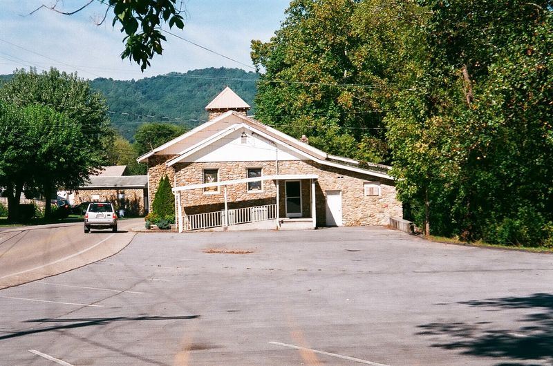
Erwin sits in the Nolichucky River Valley, hemmed in by the rugged ridges of the Unaka Mountains that rise sharply on both sides. The river flows through the middle of town, carving a path between steep, forested slopes that define the landscape and create one of the most dramatic small-town settings in East Tennessee.
The Unakas are part of the larger Appalachian chain, and the ridges here are high, rocky, and wild, with peaks that top 5,000 feet just a few miles from town.
The Nolichucky River is the lifeblood of the valley, and it’s known as one of the best whitewater rivers in the Southeast. Rafters and kayakers come from all over to run the Nolichucky Gorge, a section downstream from Erwin where the river cuts through the mountains in a deep, narrow canyon with Class III and IV rapids.
The river’s energy and wildness are part of Erwin’s identity, and the town has built much of its tourism economy around outdoor recreation.
The valley itself is narrow, with the river and the railroad running parallel through the center and the ridges rising steeply on either side. There’s limited flat land, and the town has grown in a linear pattern, following the river and the valley floor.
The ridges create natural boundaries that have kept Erwin compact and focused, and the mountains are visible from almost every street and window.
Erwin’s location in the Unakas gives it a climate that’s cooler and wetter than the lowlands. The mountains trap moisture from passing weather systems, and rain and fog are common.
Winters bring snow to the higher elevations, and the ridges stay green and lush through most of the year. The valley’s orientation also affects sunlight—shadows fall early in the afternoon as the western ridges block the sun, and mornings can be cool even in summer.
The Appalachian Trail crosses the ridges near Erwin, and hikers often stop in town to resupply or rest before tackling the next section of the trail. The mountains here are steep and challenging, with rocky outcrops, dense forests, and few easy routes.
The ridges are a barrier and a resource at the same time, providing beauty, recreation, and a sense of isolation that has shaped the town’s culture and character for generations. Erwin lives in the shadow of the Unakas, and the mountains are as much a part of the town’s story as the river that flows through it.