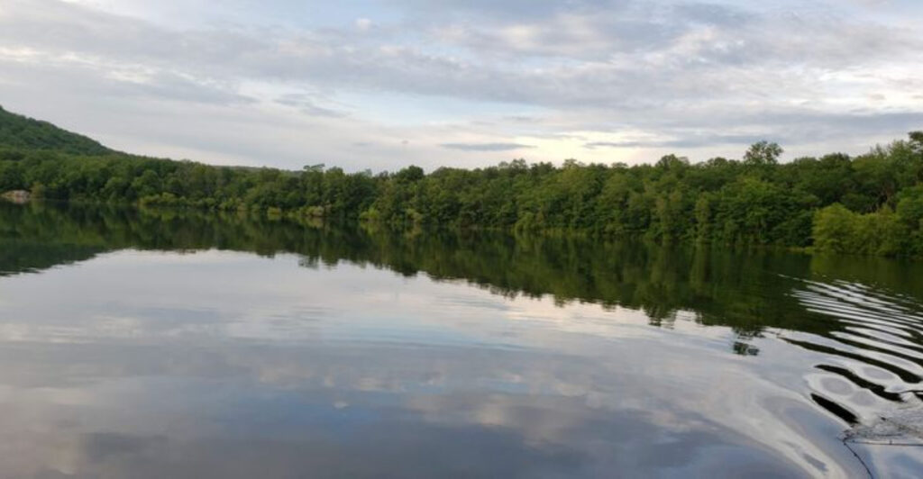
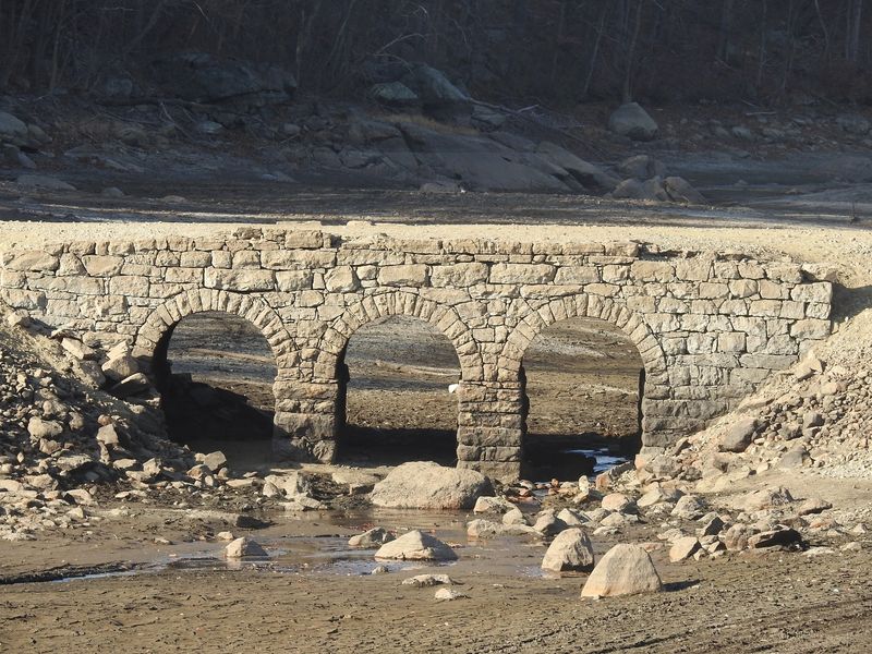
Three stone arches rose from the mud at Oak Ridge Reservoir, looking less like a ruin than a road that had simply missed its exit. For most of the year, this bridge sits underwater beside Route 23, hidden beneath one of the reservoirs that supplies Newark.
But when the water was lowered in November 2024, the so-called Ghost Bridge appeared in full, along with traces of the old route once used by horses, wagons, and early automobiles. The scene was wonderfully strange.
Modern traffic rushed past above while visitors stared down at a piece of northern New Jersey transportation history that predates the highway beside it. Despite the timing, drought was not responsible for the reveal.
Planned maintenance emptied enough of the reservoir to uncover a landscape deliberately flooded more than a century ago. What surfaced was not a paranormal mystery, but something better—a remarkably intact link to two villages, an old turnpike, and the creation of Newark’s water system.
The Ghost Bridge Emerges From Oak Ridge Reservoir
By early November 2024, Oak Ridge Reservoir hardly resembled the quiet body of water familiar to drivers along Route 23.
Broad stretches of exposed earth replaced the usual surface, and near the old channel of the Pequannock River stood a three-arched masonry bridge that is normally concealed beneath several feet of water.
Locals have called it the Ghost Bridge for years, although its nickname has more to do with disappearing water levels than wandering spirits. The exposed structure looked remarkably substantial.
Three rounded arches supported a broad stone deck, while mud, grasses, and shallow pools surrounded its base. From certain angles, it appeared ready to carry another wagon across the river.
Only the empty reservoir bed and the raised lanes of modern Route 23 gave away just how thoroughly the landscape had changed. The location sits around the boundary area of Jefferson Township in Morris County and West Milford in Passaic County, near the Oak Ridge community.
It is easy to understand why passing motorists became curious. Most roadside discoveries amount to a loose muffler or somebody’s abandoned patio chair.
This one was a bridge from the horse-and-buggy era. Its reappearance also exposed fragments of the older road system around it.
Before the reservoir covered the valley, roads followed the terrain closer to the Pequannock River. The bridge connected the village of Oak Ridge with the main turnpike, making it an everyday piece of infrastructure rather than a decorative landmark.
That ordinary purpose is part of what makes the sight so compelling. People crossed this span to reach neighboring settlements, conduct business, and continue toward larger towns.
Then the water rose, newer roads took over, and the bridge slipped out of daily life. More than a century later, it returned looking battered and muddy, but still unmistakably capable of telling the story.
Why the Reservoir Was Drained
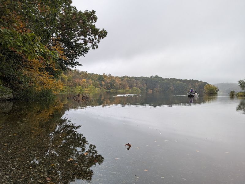
New Jersey was experiencing dry conditions when the bridge appeared, so the obvious explanation seemed to be drought. It was also the wrong explanation.
Newark Watershed Superintendent Kevin Greer clarified at the time that operators had intentionally lowered Oak Ridge Reservoir to perform maintenance on its dam and gatehouse. Once the project was finished, the plan was to refill it.
A gatehouse is one of those practical structures most people never think about until a reservoir suddenly starts revealing bridges. It helps control how water moves through the system, while the dam holds and regulates the reservoir itself.
Inspection, repair, and maintenance can require a significant drawdown so crews can safely reach components that normally sit at or below the waterline. That work produced an unusually dramatic side effect.
As the reservoir receded, the old river course became visible, followed by the bridge, abandoned roadbeds, and pieces of a landscape erased from the modern map. The water did not uncover some previously unknown archaeological site; local historians were well aware of the bridge.
Still, seeing the entire structure in open air was rare enough to turn routine infrastructure work into a northern New Jersey spectacle. Oak Ridge Reservoir is part of the larger Newark watershed system in the Highlands.
Its protected forests and linked reservoirs collect and safeguard drinking water for the city, even though the system lies many miles northwest of Newark. That relationship dates to the late 19th century, when industrial growth and pollution pushed the city to seek a cleaner, more dependable supply beyond the Passaic River.
The November drawdown therefore connected two forms of infrastructure separated by generations. Crews were caring for a working water system built in the 1890s, and that work uncovered a crossing associated with the transportation network that came before it.
Not bad for scheduled maintenance.
The Lost Turnpike Beneath the Water
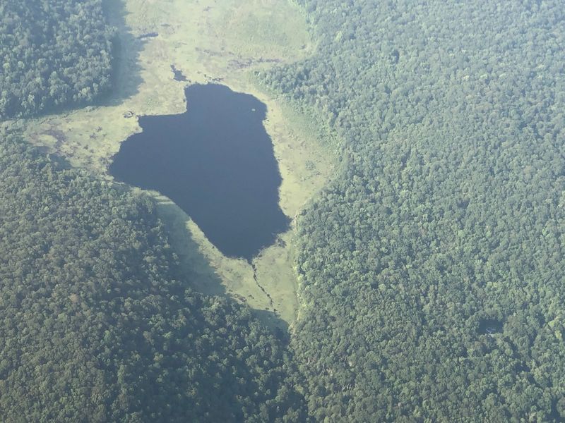
Long before Route 23 carried commuters and weekend traffic through the Highlands, the Paterson–Hamburg Turnpike served as a major overland route through this corner of New Jersey. Chartered in 1806, it linked communities in the state’s industrial north with settlements farther inland.
Travelers paid tolls for the privilege of using an improved road, though “improved” in the early 1800s did not include lane markings, guardrails, or a convenient place to grab coffee. The road passed through the Pequannock River valley and near the small communities of Oak Ridge and Wallace Corner.
The stone bridge provided a connection between Oak Ridge and the turnpike, carrying local traffic across an arm of the river. Historical material from 1891 described it as a three-arch bridge carrying a highway across what would become part of the reservoir.
Calling the exposed route a lost highway is accurate, but it helps to picture the word as people used it then. This was not a buried interstate with six lanes and exit ramps.
It was a public road used by pedestrians, riders, horse-drawn wagons, and eventually early motor vehicles. Its path followed the shape of the valley because moving enormous amounts of rock to straighten a road was neither easy nor cheap.
The reservoir changed that arrangement. Newark’s water project required flooding low ground along the Pequannock, including the sites of Oak Ridge and Wallace Corner.
Buildings were removed, residents relocated, and familiar roads vanished beneath the new waterline. The bridge survived because it remained useful while the dam and related works were under construction.
The old turnpike alignment continued along the reservoir’s eastern side before the highway was eventually shifted to higher ground and straightened around 1927. Today’s Route 23 runs above and close to portions of that earlier path.
When the reservoir is full, thousands of drivers pass a submerged chapter of the same road story without realizing it is there.
How the Stone Bridge Survived for Generations
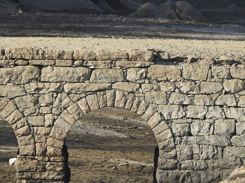
Stone arches are stubborn things. Instead of relying on long beams that can bend, rot, or corrode, an arch transfers weight outward and downward into its supports.
Each stone presses against its neighbors, turning compression into strength. The Romans understood the trick, and New Jersey bridge builders made good use of it centuries later.
That basic design helps explain why the Oak Ridge bridge remained recognizable after generations underwater. Its three arches distribute the load through thick masonry rather than depending on exposed timber or steel.
Water can pass through the openings, reducing some of the direct pressure that a solid wall would face. The reservoir also spared the structure from several enemies of old bridges, including truck traffic, road salt, snowplows, and repeated widening projects.
Submersion was hardly a spa treatment, of course. Seasonal changes, sediment, moving water, ice, plant growth, and freeze-thaw cycles all worked on the masonry.
The exposed bridge showed the wear plainly. Its surface was uneven, vegetation had found footholds, and mud coated areas that once carried regular traffic.
Yet the overall form remained impressively complete. Its survival also came down to one practical decision made during reservoir construction.
Workers did not demolish the crossing after using it as part of the project. Tearing apart a heavy masonry bridge would have consumed time and labor, while rising water was about to remove it from service anyway.
Leaving it in place was the simplest choice. That bit of 19th-century efficiency became an accidental act of preservation.
Had the bridge remained on an active roadway, it might have been replaced as vehicles grew larger and traffic increased. Underwater, it was obsolete but largely left alone.
The reservoir did not preserve it perfectly, yet it protected the bridge’s basic shape well enough that people in 2024 could stand above the old riverbed and immediately understand what they were seeing.
The Rare Discovery Draws Curious Visitors
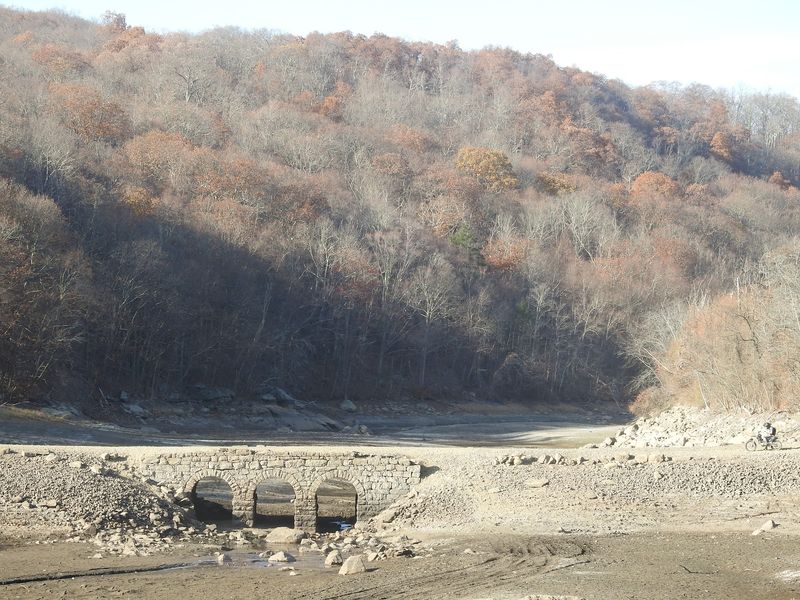
Onlookers described the drained reservoir bed as almost lunar. That comparison made sense when the familiar waterline gave way to broad flats of pale mud, scattered pools, and the dark outline of a bridge that was never supposed to be part of the everyday view.
Photographers arrived, longtime residents compared the sight with older low-water years, and newcomers tried to work out how a complete stone crossing had ended up beneath a reservoir. The bridge was fully exposed by November 4, and attention grew quickly in the days that followed.
Its position near Route 23 made the reveal particularly tempting. Drivers could pass the modern highway, glance toward the lowered reservoir, and see the transportation network it had displaced.
Few history lessons come with such a tidy before-and-after view. There was an important catch.
Oak Ridge Reservoir is part of an active, protected drinking-water watershed, not an open public park. Access to Newark watershed property is controlled, and permits are required for authorized activities such as fishing and hiking in designated areas.
During the 2024 drawdown, local warnings made clear that walking onto restricted land or down to the bridge could result in a trespassing ticket. The exposed reservoir bed brought hazards of its own.
Mud that appears firm from above can be deep and unstable, old road surfaces may be broken or slick, and the masonry was never designed for crowds scrambling over it with phones in hand. Parking along busy Route 23 or climbing its steep roadside slopes added another layer of risk.
None of that diminished the bridge’s appeal. In fact, being able to view it only under unusual conditions is exactly how it earned the Ghost Bridge name.
It does not need a spooky legend to hold attention. A real road, built for a vanished landscape and briefly visible beside a busy state highway, is strange enough on its own.
Why the Ghost Bridge Will Disappear Again
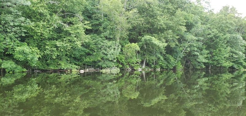
The same water that concealed the bridge for decades still has an important job to do. Oak Ridge Reservoir was not permanently emptied, and its drawdown was never intended to create a new attraction.
After maintenance on the dam and gatehouse, operators planned to raise the water level again, returning the reservoir to its place in Newark’s drinking-water system. As the basin refills, the transformation happens in reverse.
Shallow pools spread across the old riverbed. Water gathers around the bases of the arches, climbs over the stonework, and eventually covers the deck.
The traces of the former road soften beneath the surface until the modern reservoir view looks ordinary again. That disappearing act is part of a cycle.
The bridge has surfaced during earlier periods of exceptionally low water, including the severe drought of the 1960s, and portions of it have appeared during other drawdowns. There is no dependable public schedule for the next full reveal.
It depends on reservoir conditions, operational needs, and whether future maintenance requires the water to be lowered far enough. Its return underwater is also a useful reminder that this is working infrastructure layered over older infrastructure.
The reservoir represents Newark’s response to the public-health and water demands of a growing industrial city. The turnpike and bridge represent an earlier New Jersey, when roads hugged river valleys and regional travel moved at the pace of a horse.
Neither story cancels the other; they occupy the same ground. For a short time in 2024, both eras were visible at once.
Cars streamed along elevated Route 23 while the old stone arches stood below in the drained basin, still aligned with a road that no longer appears on modern maps. Then the water began reclaiming the scene, leaving the bridge where it has spent most of the past century—intact, out of sight, and waiting beneath the reservoir.