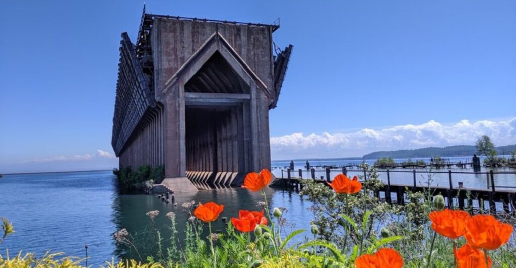
Few waterfront landmarks in Michigan make a first impression quite like Marquette’s massive Lower Harbor Ore Dock. Stretching 969 feet into the harbor, the concrete structure once played a major role in moving iron ore from Upper Peninsula mines onto lake freighters bound for other cities.
Today, it stands as one of the most striking reminders of Marquette’s industrial past and gives the shoreline a look that is hard to confuse with anywhere else. The appeal comes from seeing something built for heavy work become part of the city’s everyday scenery.
For anyone exploring Marquette, this giant ore dock is worth slowing down to understand.
The View That Stops You Midwalk
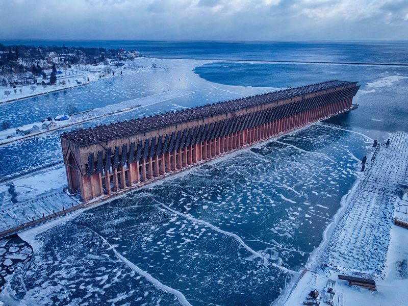
One minute you are looking across a harbor. The next, a long wall of concrete seems to claim the whole view.
Marquette’s Lower Harbor Ore Dock is 969 feet long, so taking it in from one spot is harder than it sounds.
Its shape does the heavy lifting. A broad upper section runs above repeated openings and sturdy supports, giving the dock a strong pattern against the water.
Stand back along the shore and you can follow that pattern toward the far end, where the structure begins to look almost impossibly long.
Try viewing it from more than one point on the waterfront path. As you move, the gaps between its supports appear to shift, and a flat side view turns into a deeper look at its length.
You do not need special equipment or a guided tour to notice the difference. A slow walk is enough.
For photos, include a bit of shoreline or sky rather than filling the frame with concrete. Those ordinary surroundings show how unusual the dock’s size is.
A person on the path can provide scale, but give others room and avoid blocking the route while setting up your shot.
The first view may raise a simple question: Why build something so big over the harbor? Its size was tied to a demanding job, not decoration.
Ore had to move from land onto ships that could carry heavy loads across the Great Lakes. The dock’s height and length helped make that transfer possible.
That working purpose is still easy to read in its outline. From shore, the giant is more than a backdrop for a quick picture.
Its repeated supports and long reach show how much space Marquette once devoted to moving ore by water.
How Ore Reached the Freighters
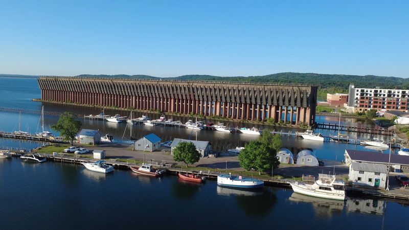
Picture a lake freighter waiting beside the dock, ready to take on iron ore. The structure was built for that kind of work.
It helped move a heavy product from land to a ship without asking workers to carry it piece by piece.
Iron ore was an important raw material for making steel. Getting it out of the ground was only part of the task.
It also had to travel from inland mining areas to the harbor, then onto vessels large enough to move it across the Great Lakes. The Lower Harbor Ore Dock belonged to that shipping chain.
Look at the dock’s height as well as its length. Ore docks used gravity to help send their loads down into ships alongside them.
That explains why this landmark rises so high above the water. Its size was a practical answer to an enormous transport job.
The dock no longer loads ore, so you will not see the old process in action here. Instead, use the structure itself as a guide.
Imagine a vessel pulled up beside its long edge, with loading taking place above its cargo hold. The empty water next to the concrete gives you room to picture the scale of the operation.
It also helps to remember that a ship’s arrival was not the start of the story. Ore first had to be mined and brought toward this waterfront.
The dock marks the point where land transport met lake transport, two systems that depended on each other.
You do not need to know every part of the old equipment to appreciate the idea. The harbor was a place where tons of material changed hands.
Once you understand that job, the dock’s unusual shape stops looking mysterious and starts looking useful.
Michigan History Written in Concrete
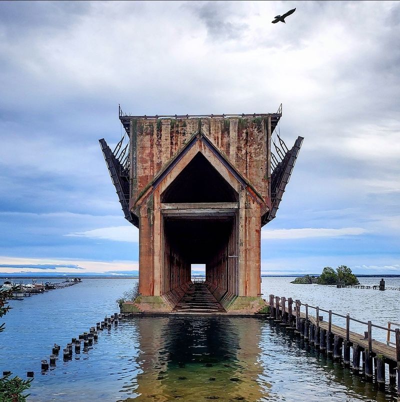
Concrete can tell a story without a single word on a sign. At the Lower Harbor Ore Dock, its long rows and heavy supports point to the industrial work that shaped Marquette’s waterfront.
This was a tool for shipping, built on a scale that still catches the eye.
The dock is a historical landmark, but it is not a tidy indoor display. You see it in the place where it worked, beside the harbor it served.
That setting helps connect two parts of the local story: the iron ore carried toward the water and the freighters that took it away.
Stand where you can see both the shore and the far end of the dock. The distance between them makes an abstract phrase like ore shipping easier to grasp.
Moving a huge amount of rock demanded more than a small pier. It called for space, strong construction, and a direct link to deep water.
Details become clearer when you stop rushing. Notice how the openings repeat instead of appearing at random.
Look at the solid stretches above them, then compare those hard lines with the changing water below. The design was driven by work, yet its rhythm now gives the harbor one of its most recognizable views.
A short visit can also bring up questions about what remains and what has changed. The dock is still here, but its original loading role has ended.
Keeping that difference in mind prevents a common mix-up: a preserved industrial structure is not the same as an operating one.
If you want more context, take time to read any available local interpretive material during your waterfront walk. Even without it, the main lesson is visible.
Marquette’s connection to mining and lake shipping was large enough to leave a 969-foot mark on the shoreline.
A Shore Walk With a Moving Perspective
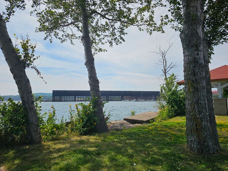
Your feet can do more for this view than a zoom lens. The Lower Harbor Ore Dock looks different as you follow the waterfront beside it.
A straight-on glimpse shows its broad face, while a position farther along the shore helps reveal how far it reaches into the harbor.
The City Multi Use Path gives you a straightforward way to explore the area on foot. Treat the dock as the center of a short walk rather than a single stop for a photograph.
You can pause, change your angle, and look back to see how its outline sits against the water.
Walking also lets you notice what a car window would miss. Watch for the repeated spaces beneath the main body of the dock.
Pay attention to where its supports meet the water and how much open harbor surrounds it. Those details help explain why the structure appears so striking from a distance.
Keep the shared path comfortable for everyone. Step out of the main flow before taking a long photo or studying the view, and stay aware of cyclists and other walkers.
If you are visiting with children, make the walk a simple spotting game: count visible openings or compare the dock’s height with nearby features.
There is no need to get onto the dock to enjoy it. This is a shore-based landmark, and a view from the path gives you the broad perspective that makes its scale clear.
Respect barriers and posted directions wherever you find them.
A quick stop will show you the landmark. A slower pass shows you its changing shape, which is the better reason to walk.
By the time you turn around, even the familiar side can look different because your position along the harbor has changed.
Light Changes the Whole Structure
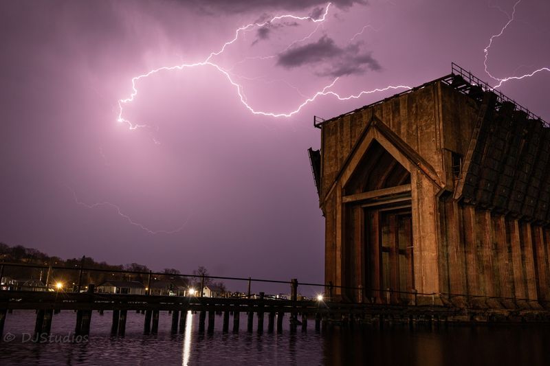
Clouds can make the dock look stern and solid. Clear, low sunlight picks out the edges of its supports and throws shadows into the openings below.
Neither view is the correct one; they simply reveal different sides of the same enormous structure.
If you are bringing a camera, think about the light before choosing your spot. Early or late in the day, sunlight often comes from a lower angle, which can make the dock’s repeating shapes easier to see.
Under a bright midday sky, a wider view may work better than a tight shot of dark openings.
Reflections offer another option when the harbor surface is calm. Include both the dock and the water beneath it, then check whether the reflection adds to the picture or makes it too busy.
On windy days, skip the hunt for a mirror image. Ripples can give the water texture of its own.
You can make a stronger picture without stepping anywhere risky. Move along the public shore until the length of the dock reads clearly, then keep the horizon level.
Try one frame with the full structure and another focused on a small group of supports. Those two images tell different parts of the same story.
Phone cameras can handle this stop well. Tap the screen on the concrete if the sky is washing out the dock, or tap the sky if you want the structure to become a dark shape.
Take a moment to check the result before moving on.
Weather changes quickly beside a large lake, so dress for the conditions you have, not just the forecast you saw earlier. Even a gray day can be useful here.
Flat light brings attention to the dock’s size and pattern instead of competing with a colorful sky.
Plan a Visit Without Overthinking It
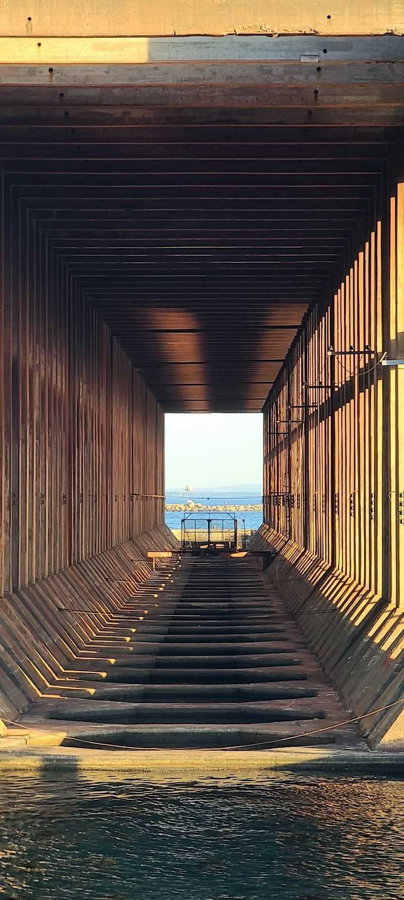
No ticketed tour is needed to look at a dock this large. The Lower Harbor Ore Dock is an outdoor landmark beside Marquette’s waterfront, and the listed area is open around the clock.
That freedom makes it easy to fit into a walk, a photo stop, or a longer pause by the water.
Start with the weather. Wind off Lake Superior can make a mild-looking day feel cooler, especially if you plan to stand still and study the structure.
Bring a layer you can put on or take off. Shoes suited to a paved walk are more useful than anything fancy.
Allow enough time to change viewpoints. Ten minutes may be enough for a quick look, but a relaxed visit gives you a better sense of the dock’s length.
If photographs matter to you, leave extra time for changing light and for other path users to pass through your frame.
Daylight is the simplest choice for a first visit because you can make out the dock’s form and the water around it. The site may be listed as open at night, but that does not mean every part of the shoreline will be equally easy to see.
Use common sense about visibility and footing.
Winter calls for special care. Ice on the harbor may look solid in a picture, yet appearance cannot tell you whether it is safe.
Stay on shore rather than walking onto frozen water for a closer angle. The concrete giant is already easy to appreciate from land.
Finally, plan for a viewing stop, not access inside an old industrial structure. Follow any signs or barriers you encounter, and keep the shared path clear when you pause.
A little planning leaves your attention free for the dock itself, which is the point of coming here.
The Giant That Gives the Harbor Its Scale
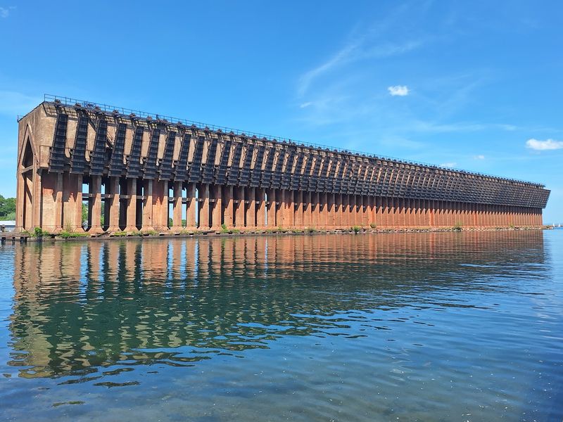
After a while, the dock starts changing how you judge everything around it. A stretch of open water looks narrower when 969 feet of concrete runs beside it.
Even from shore, the structure makes the harbor’s working past hard to overlook.
Its power comes from a clear purpose. The dock was made to help load iron ore onto lake freighters, and its shape follows that job.
Long lines, heavy supports, and space for ships tell a more direct story than a decorative monument could. You can read much of that story just by looking.
Yet the best final view is not always the closest one. Step back far enough to fit the dock, the water, and a little shoreline into one scene.
Now the building-sized structure has context. You can see how an industrial tool became a fixed part of Marquette’s waterfront view.
That contrast is useful if you are showing the place to someone younger. Ask them what they think the dock once carried, then point out where a ship would have waited.
Its size gives you an easy way to talk about mining, transport, and the work behind familiar steel objects without turning the walk into a lesson.
The dock also rewards a second glance on your way back. Once you know its former job, those repeating openings no longer look like an odd design choice.
They belong to a system built to move an immense amount of ore from land toward water.
Some landmarks need an explanation before they become interesting. Here, the explanation deepens a view that is already hard to miss.
Give the Lower Harbor Ore Dock a few unhurried minutes from the public shore, and Marquette’s mining history has a clear, concrete shape.