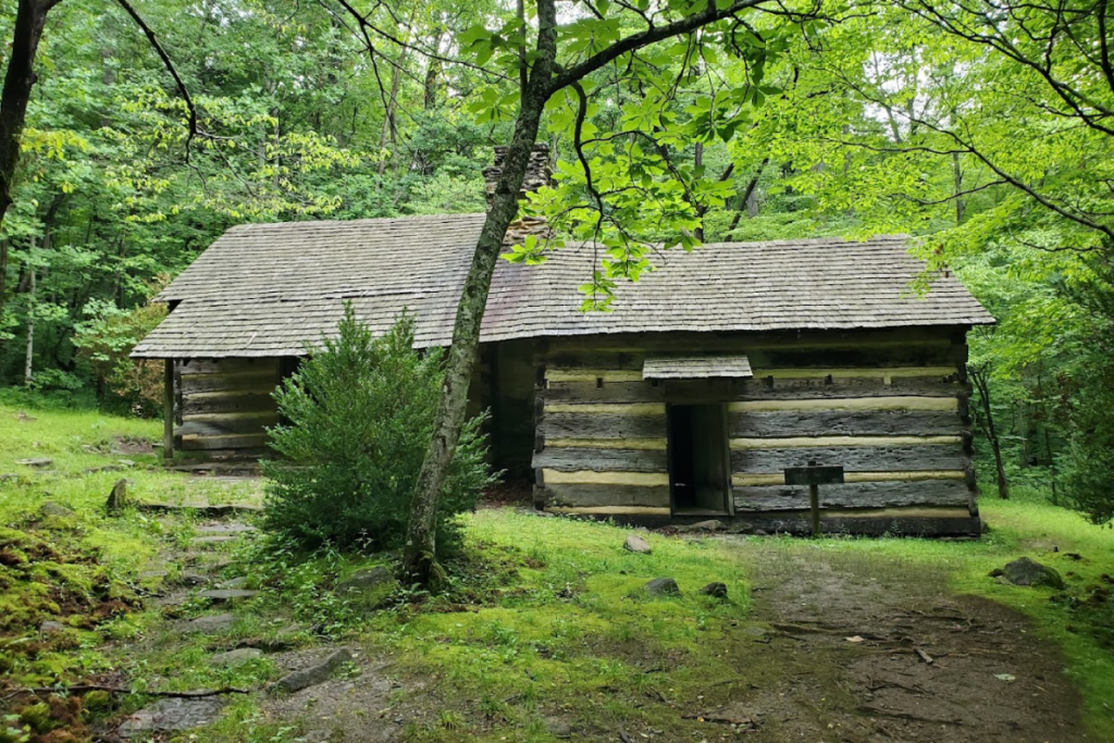
Tennessee’s trails do more than climb hills and cross creeks. Some of them wander right into the leftovers of lost towns, busy logging camps, and coal country.
Old chimneys, stone walls, and rusty machines are still out there, waiting for curious hikers. Lace up your boots and follow these paths into the past.
1. Little River, Cucumber Gap, and Jakes Creek Loop in Elkmont
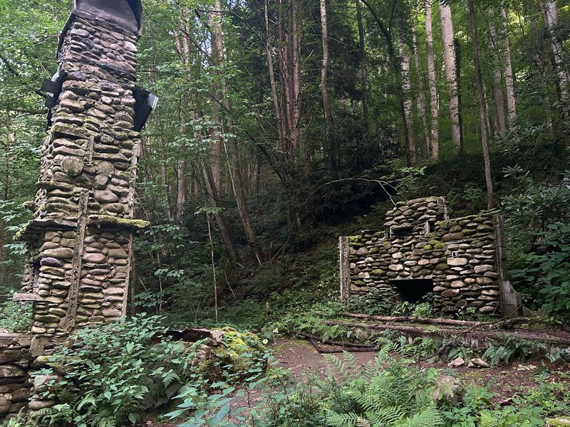
Picture a summer party in the mountains a century ago. Families in fancy clothes rolled into Elkmont, tucked into cabins, and escaped the heat of the lowlands.
Today the cabins are quiet, and you get to stroll right through the scene.
This 5.4-mile loop is a strong way to start your ghost town tour. It links Little River, Cucumber Gap, and Jakes Creek, so you get creek views, shady forest, and history in one outing. Start early, because the parking area fills up fast on nice days.
Elkmont began as a logging town and later turned into a resort community. What remains today includes preserved cabins, stone walls, chimneys, and spots where buildings used to stand.
Some structures look ready for a family to walk back in, while others have shrunk to a foundation and a few stones.
Keep your eyes open along the trail. Flat clearings in the woods often mean a home once sat there. A tidy line of rocks can be a garden wall, and a lonely chimney is often all that is left of a whole cabin.
The hiking itself is moderate. You will climb a bit, then ease back down beside rushing water that sounds louder than it looks.
Wear shoes with good grip, since roots and damp rocks can be slick after rain. Pack a snack, a water bottle, and a light jacket. The temperature can drop under the trees even when the parking lot feels warm.
A small notebook is handy too, because you will want to jot down the cabins that catch your eye.
Please treat every building like a museum piece. Do not climb on walls, carry off souvenirs, or carve names into anything. Leave it as you found it so the next hiker gets the same goosebump moment you did when you first spotted that old porch through the trees.
Give yourself three to four hours so you can wander without rushing. Take side steps to peek at each site, and let the loop unfold slowly.
The best part is the feeling that you are walking through a story that stopped mid-sentence.
2. Old Settlers Trail in Greenbrier
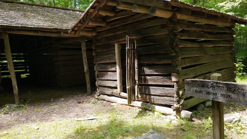
Long before the national park existed, real neighbors lived along these hills. They farmed small plots, raised kids, and buried loved ones on quiet slopes.
Old Settlers Trail lets you follow in their footsteps, mile after mile.
This is a long hike, so plan for a full day and bring more food than you think you need. The route winds along the edge of the park and passes traces of the communities that once called this corner of the Smokies home.
It is one of the best lost settlement walks in the state.
Along the way, you can spot old homesteads, stone walls, chimneys, and cemeteries. Each one hints at daily life in a place with no paved roads and no quick trips to town.
Chimneys stand out most, because they often outlasted the wooden homes built around them. Cemeteries deserve a quiet moment. Read the names if you can, notice the dates, and step lightly.
These are family resting places, not photo props, so keep voices low and hands off the stones.
Since the trail is lengthy, pace yourself. Start early, take breaks at creek crossings, and check the weather before you leave. Cell service can be spotty, so tell someone your plan and carry a paper map.
Spring brings wildflowers that seem to pop up right beside old foundations. Fall paints the ridges in warm colors, and winter opens views through bare trees so ruins are easier to spot. Every season gives the hike a different mood.
Bring sturdy boots, extra socks, and a small first aid kit. A trekking pole can help on muddy stretches. Most of all, bring patience, because the best details are small and easy to miss if you hurry.
By the end, you will look at the forest differently. Those tall trees grew where kitchens once smelled like cornbread, and that thought sticks with you all the way to the parking lot.
3. Laurel-Snow Trail in Dayton
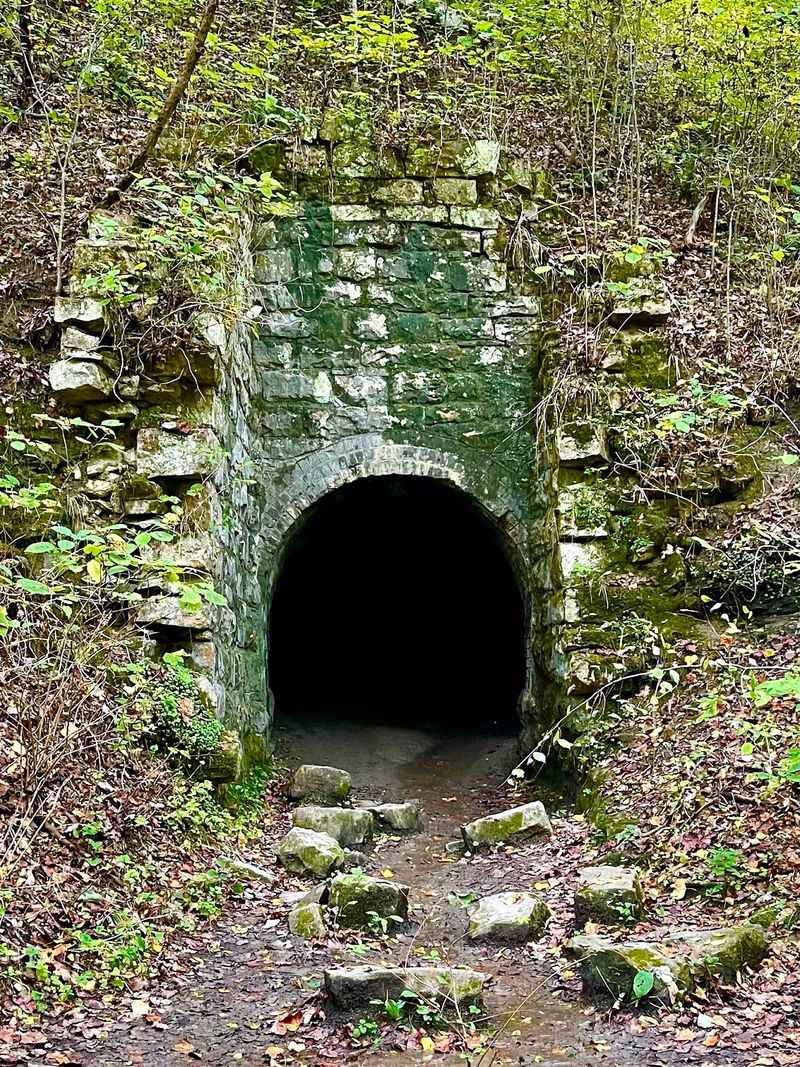
Most people come to Laurel-Snow for waterfalls. Fewer realize they are stepping through an old industrial neighborhood.
Once you know the story, every rock wall and flat spot looks a little different.
The route follows terrain once used by the Dayton Coal and Iron Company. That business needed coal, and the gorge offered plenty of it.
Workers carved out paths, dug into the hillside, and left behind reminders of that busy era.
As you hike, watch for old mine workings and other industrial remnants tucked beside the trail. Some are simple piles of stone, while others are shaped openings in the hillside.
Admire them from the trail and keep your distance, since old mine areas can be unstable.
The trail climbs steadily, and the rocky footing can be tricky. Take your time on steep bits and stop often to look around. Your legs will thank you, and you will notice more than hikers who rush ahead.
Those famous waterfalls make a great reward. After a rainy week, they roar, and in dry weather they slim down to a delicate ribbon.
Overlooks at the top give wide views of the gorge and the valley beyond.
Pack layers, plenty of water, and shoes with real tread. Spring is lovely because the creeks are full, but the rocks are wet, so slow down. Fall is a fine choice for cooler climbing.
Try this little game on the way up. Every time the trail levels out unexpectedly or a wall of stacked rock shows up, ask yourself what job it did. Suddenly the gorge feels like a workplace instead of just scenery.
Finish with a snack at an overlook and picture the noise that once filled the canyon. Then enjoy the quiet you have now.
4. Lower Piney River Trail in Spring City
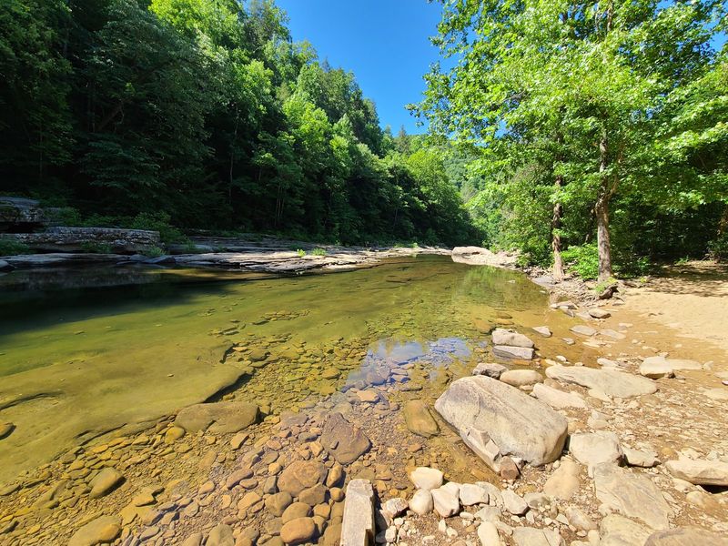
Here is a fun twist: the trail you are hiking used to be a work zone. The Lower Piney River section of the Cumberland Trail follows an old industrial corridor near Spring City.
Nature has been busy reclaiming it ever since.
Along the way, you will pass the remains of former mining activity. Look for rubble, chunks of concrete, and other leftovers that blend into the woods. They are easy to walk past if you are not paying attention, so slow your pace and scan the sides of the path.
Two mine openings sit above the trail. They are worth a look from below, but they are not for entering.
Old mines can hide falling rock, bad air, and unstable ground, so treat them as look-only sights.
Meanwhile, the Piney River keeps you company with plenty of sound. Water tumbles over rocks, and the forest feels cool and green even on a warm day.
It is a nice contrast with the gritty history along the banks.
Wear shoes that can handle rocky, uneven footing. Trekking poles help when the trail gets rough near the water.
Bring a map or download one ahead of time, since signal can drop in the valley.
Photographers will enjoy the mix of moss, metal, and stone. Try shooting a concrete slab with ferns growing through the cracks.
It shows how quickly the forest takes back what people leave behind.
Pack out every scrap of trash, and skip the urge to pick up souvenirs. Remnants like these help tell the story of the valley, and they belong right where they are.
Allow a relaxed half day for the outing. Bring lunch, sit on a flat rock by the river, and enjoy the odd mix of wild scenery and industrial history all around you.
5. Dunlap Coke Ovens Trails in Dunlap
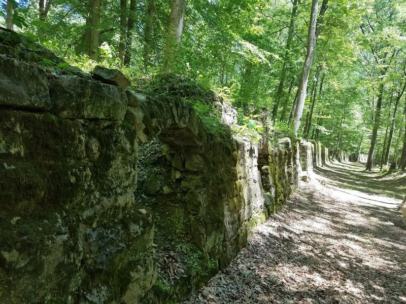
Two hundred sixty-eight. That is how many historic coke ovens sit in the woods near Dunlap.
It is a jaw-dropping number, and seeing them lined up is even better.
Instead of one lonely ruin, this place is an entire industrial landscape. Coke ovens turned coal into fuel for making iron and steel, and the site once hummed with activity.
Now the ovens sit quietly, wrapped in moss, leaves, and roots.
Wander the trails and you will find more than ovens. Railroad beds still cut through the forest, and you can trace where trains once rolled. Coal-washer ruins and old mining equipment add extra clues about how the place worked.
For a bigger challenge, try the steep incline trail toward former mining areas on Fredonia Mountain. It climbs hard, so bring water and take breaks.
The effort pays off with a stronger sense of how coal traveled from the mountain to the ovens.
The ovens themselves have a curved, beehive look that makes them fun to photograph. Try framing one with the trail in the foreground for a sense of scale.
Early morning light gives the stone a warm glow.
Wear boots with good grip, because leaves and loose rock hide uneven ground. Keep an eye on kids near the ovens and steep areas.
Staying on marked routes protects both you and the ruins.
Give yourself a few hours to explore without rushing. Bring a picnic and make a game of counting ovens in a single row. You will lose count quickly, and that is part of the charm.
Leave everything exactly where you find it. These ruins are a big piece of local history, and they only stay impressive if visitors treat them with care.
6. No Business and Boyatt Home Place Loop in Big South Fork
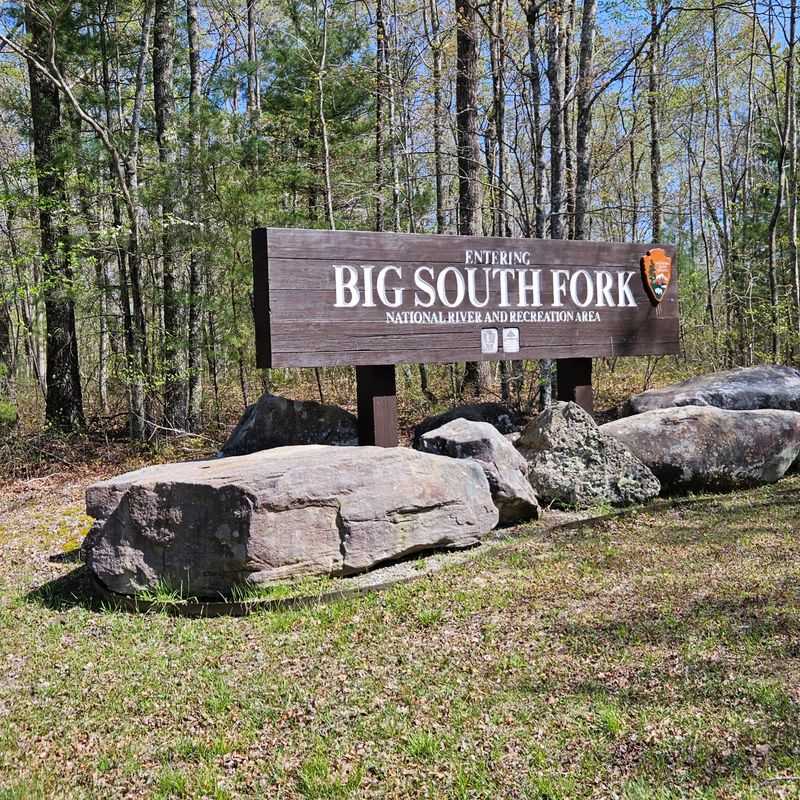
The name sounds like a joke, but the story behind it is real. No Business was once a sizable backcountry settlement, with 300 or more residents at its height.
The last resident left in 1960, and the woods have been quietly moving in ever since.
Hiking here feels like stepping into a neighborhood with the people gone. The trails around the Boyatt home place and the cemetery lead you through what is now an almost vanished community.
You will not find a big town sign, so part of the fun is spotting the clues yourself.
Look for level clearings, old roadbeds, and stones set in tidy lines. These small details reveal where homes, gardens, and paths once stood.
The cemetery is the most touching stop, so visit with quiet respect.
Big South Fork is rugged country, and it is easy to see why folks lived so far from the crowds. Ridges roll on in every direction, and the forest is thick and green.
Bring a trail map, since it is a remote area and cell coverage can be poor. Pack more water than usual and wear sturdy shoes. Some parts of the trail can be muddy after rain.
Tell someone where you are headed before you leave.
Try to imagine daily life without a nearby store. Families grew food, hauled water, and relied on neighbors for nearly everything. That thought makes each stone wall feel a lot more meaningful.
This loop works well for hikers who love quiet places and slow discoveries. Take your time, read any signs you find, and let the silence do some of the talking. By the end, the strange name will make perfect sense.
7. Grapeyard Ridge Trail in the Great Smoky Mountains
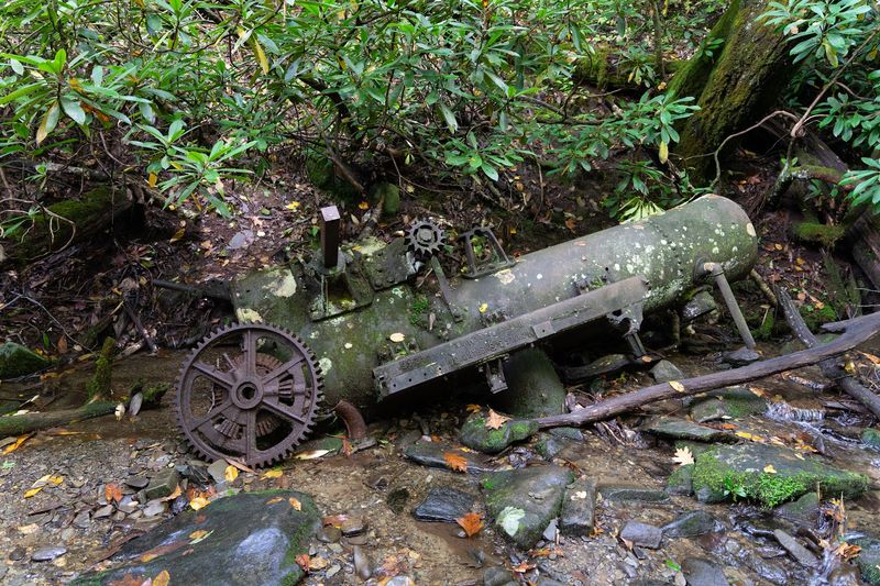
Somewhere deep in the woods, a machine is taking a very long nap. The rusting wreckage of an old steam engine sits along Grapeyard Ridge Trail, a leftover from the logging era in the Smokies.
Finding it feels like discovering a secret.
Rather than a whole town, this hike gives you one striking artifact. The engine looks like the forest slowly swallowed it, with rust, moss, and leaves covering its heavy metal shape.
It is a strange and wonderful sight in the middle of green wilderness.
Getting there takes some effort. The trail moves through quiet backcountry, with creeks to cross and ridges to climb. Pack plenty of water, snacks, and a map, because you will be far from busy roads.
Logging once shaped this whole region. Crews cut giant trees, and steam-powered equipment helped haul timber out of steep hollows.
Seeing a piece of that machinery today helps you understand how big the work really was.
Look, snap photos, and leave everything in place. Rusty metal can be sharp and unstable, so do not climb on it.
Park rules also protect historic items, and taking pieces is not allowed.
Wear waterproof boots if the weather has been wet, since crossings can be slippery. Trekking poles are a helpful friend on rooty sections.
Start early so you have time to linger at the engine and still get back before dark.
The best part is the contrast. Bright green leaves rise around a hunk of dark, aging metal, and the quiet is almost total. It is a scene that stays with you long after your boots are dry.
8. Little Greenbrier School at Metcalf Bottoms
Ring the bell, grab a seat, and imagine lessons in a room heated by one stove. Little Greenbrier School is a small building with a big personality. It gives hikers a peek into how kids in the mountains once learned.
The school sits near Metcalf Bottoms, and the walk to reach it is short and pleasant. That makes it a great pick for families or anyone who wants history without a giant climb.
Wear comfortable shoes and bring a water bottle anyway.
The building was also used by the community for gatherings, which shows how important it was. A single structure could serve as classroom, meeting spot, and social hub.
Nearby ridges and forest paths add to the feeling of a close, connected neighborhood.
Take a slow walk around the outside and notice the details. Look at the windows, the simple lines, and the way the building sits in the trees.
Peek inside if it is open, and imagine desks lined up and children reciting lessons.
Little Greenbrier is also a good starting point for longer hikes in the area. Trails nearby lead into forest that once held homes and farms. If you have the energy, you can turn a quick visit into a half day of wandering.
Bring a picnic and sit nearby for a while. It is easy to picture a lunch break and a game of tag out front.
The setting is peaceful, so use quiet voices out of respect for the site. Follow park rules, stay off fragile parts, and take only photos. Historic buildings like this one last only when visitors help protect them.
9. Twin Arches Loop in Big South Fork
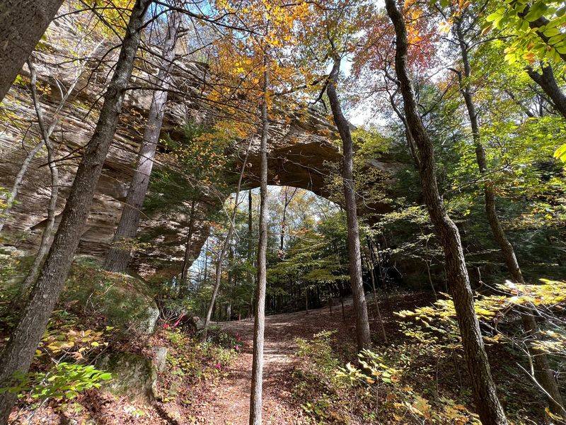
Giant rock arches steal the show here, but the quieter history is what makes the loop special. The 4.5-mile Twin Arches Loop blends huge natural formations with traces of human life.
It is less ghost town than some entries, yet it fits the forgotten settlement theme nicely.
Start with the arches. They tower overhead, and standing beneath them makes you feel tiny in the best way. Bring a camera and try shots from a few angles.
Then look for the human side of the story. An old homesite tucked along the route reminds you that people once built lives among these cliffs.
The loop also includes historic Charit Creek, a spot with a long past in this rugged area.
The hike is moderate, with some rocky steps and a few climbs. Sturdy shoes make a big difference.
Give yourself a few hours so you can linger at the big features without hurrying.
Fall is a lovely season for this trail because color spreads across the ridges. Spring brings fresh green leaves and flowing creeks. Summer is shady, though bring extra water when it is hot.
Think about how travelers and families once moved through this land. There were no highways, only footpaths and hard work.
That view makes the arches feel like landmarks on a very old map.
Pack snacks and enjoy a rest near the arches. Keep to marked paths to protect fragile rock and plants. Leave the homesite as you found it, so others can enjoy the same discovery.
When you finish, you will have seen both the bold work of nature and the small footprints of people who lived nearby. Not a bad combo for one afternoon.
10. Porters Creek Trail in Greenbrier
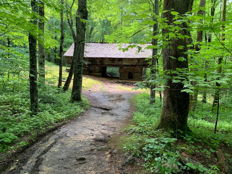
Sometimes the best history hikes are the calm ones. Porters Creek Trail offers a quieter stroll through an area once occupied by Smokies families.
The forest is lovely, the creek is loud, and the past is never far away.
As you walk, keep your eyes open for surviving traces of the old community. Stone walls, foundations, and other remnants pop up beside the trail. Each one hints at a household that once lived, worked, and played here.
The route also includes historic structures, such as the hiking club cabin. It gives the hike a friendly landmark and a sense of how people have enjoyed these woods for generations.
Admire it from the outside and follow any posted guidelines.
The trail follows Porters Creek for a good stretch, so water is a constant companion. Bridges and rocky sections add variety.
Take care on damp stones, which can be slick.
Fern Branch Falls is a highlight along the way. It slips down a rock face in a soft, lacy sheet, and it makes a perfect turnaround for a snack.
Bring a light layer, since the air near the falls can feel cool.
Wildflowers are a big draw in spring, and fall color lights up the hills. Winter hikes are quiet and open, with views through the bare trees. Any season can be a good one.
The hike is fairly gentle, so it is a nice choice for beginners and families. Bring water, wear decent shoes, and stay on the trail. Leave old walls and buildings untouched so they keep telling their story for years to come.