A fall walk in Pennsylvania can change your whole day. The air feels cooler, the woods smell fresh, and bright leaves make even a familiar path look new. Away from busy roads and crowded schedules, a forest trail gives you room to slow down and notice what is around you. Pennsylvania has many kinds of walking routes, from wide rail trails beside flowing water to narrow paths climbing rocky hills. Some welcome beginners who want an easy afternoon outside. Others ask for strong legs, careful planning, and a willingness to turn back before getting tired. Choosing the right section matters more than finishing a famous route.
The trails below offer different ways to enjoy the season. You might follow Pine Creek through a deep valley, look across the mountains from a rocky ledge, or wander beneath tall trees where the loudest sound is a leaf landing nearby. Several routes are long backpacking trails, but a short out-and-back walk can still bring plenty of calm. Before leaving home, check the latest trail map, weather forecast, and any posted closures. Wear shoes with good grip, carry water, and bring a warm layer because shady woods can feel chilly. Fall also overlaps with hunting seasons, so review local rules and wear bright clothing where hunting is allowed. Give yourself extra time for early sunsets, muddy spots, and photo stops. A little preparation lets you spend less time worrying and more time enjoying the colorful, quiet corners of Pennsylvania that make an ordinary walk feel special again.
1. Loyalsock Trail: Waterfalls and Woodland Quiet
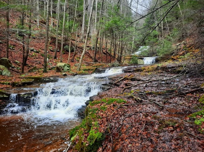
A stream slipping over stones can make a busy week feel much farther away.
Along the Loyalsock Trail, that small sound often shares the woods with rustling leaves, birds, and the crunch of boots on rocky ground.
The roughly 59-mile route crosses rugged country in north-central Pennsylvania, with much of it passing through Loyalsock State Forest.
Nobody needs to tackle the entire trail to enjoy it.
A carefully chosen section can provide a satisfying morning among hardwood trees, shaded hollows, and changing fall colors.
Waterfalls and stream valleys are part of the area’s appeal, but they should not be treated as guaranteed stops on every short walk.
Use a current trail guide to select an access point and confirm which features lie within your planned distance.
The distinctive LT markers help identify the route, though a map remains essential.
Expect roots, uneven stones, and some steep slopes rather than a smooth park walkway.
Wet leaves can hide slippery rock, especially near water.
Shoes with reliable tread and a walking pole can make these sections more comfortable without turning the outing into a race.
For a peaceful visit, choose a modest turnaround point and leave time to sit somewhere safe beside the path.
Listen before reaching for your phone; the forest offers plenty worth noticing without a screen.
Keep away from waterfall edges, avoid climbing wet ledges, and never assume shallow-looking water is safe to cross.
Pack drinking water, snacks, a warm layer, and an offline map because service can be unreliable.
Check weather and access conditions before heading out, and wear bright clothing during hunting seasons.
Starting early gives you a better daylight cushion and lets the walk end with energy left over, which is often the difference between a restful escape and a tiring scramble back to the car at dusk.
2. Pine Creek Rail Trail: An Easy Pace Beside the Water
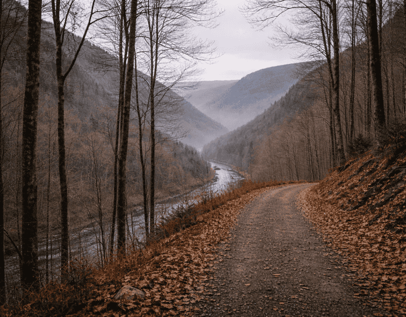
Not every peaceful outing needs a steep climb or a heavy backpack.
A broad path, moving water, and a valley full of autumn trees can be enough, especially when you want conversation to come as easily as the walking.
The Pine Creek Rail Trail follows a former railroad corridor for about 62 miles through north-central Pennsylvania.
Its gentle grades and crushed-stone surface make many sections approachable for casual walkers.
Portions travel through the dramatic Pine Creek Gorge, often called the Pennsylvania Grand Canyon, while others pass small communities and open riverside scenery.
Pick a trailhead near the landscape you want rather than choosing the longest possible walk.
Access around places such as Darling Run or Blackwell offers different starting options, but parking, services, and distances vary.
Consult the official trail map before deciding where to begin and where to turn around.
Because bicycles also use the route, stay aware of approaching riders and keep your group from spreading across the whole path.
Move aside for breaks instead of stopping in the travel lane.
The shared setting can still feel wonderfully calm when everyone leaves room for others.
Fall color here comes with a useful bonus: the creek creates reflections and moving patterns that remain interesting even when the brightest leaves have dropped.
Bring binoculars if you enjoy watching birds, and look from the trail rather than stepping onto unstable banks.
A small snack stop can become the highlight of an otherwise simple afternoon.
The route is easier than many mountain footpaths, but distance still counts.
Carry water, check the forecast, and remember that a pleasant breeze can feel colder after you stop moving.
For a relaxed first visit, walk out for a set amount of time, then return the same way before your legs or the daylight begin running short unexpectedly.
3. Donut Hole Trail: A Remote Slice of Autumn
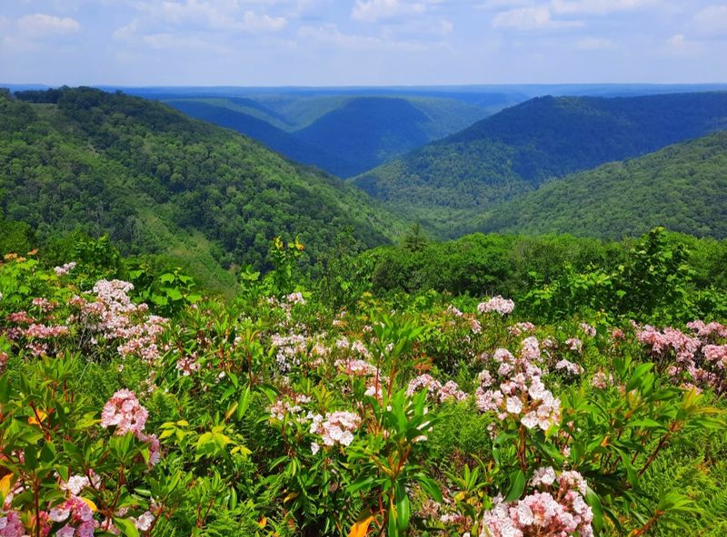
Despite its playful name, the woods here are not a quick stop for something sweet.
They offer a deeper kind of break, with long stretches of forest where careful planning matters more than checking off a popular attraction.
The Donut Hole Trail runs roughly 90 miles through north-central Pennsylvania, largely within Sproul State Forest.
It is a serious long-distance route, not a single easy loop.
Day walkers should choose a short, well-mapped section with confirmed road access instead of assuming any nearby forest road provides a useful starting point.
Autumn brings warm color to the hardwood canopy and a fresh layer of leaves to the ground.
That beauty can also make the trail harder to follow.
Watch for blazes and junctions, and pause to check your map before a small uncertainty turns into a long detour.
Some sections involve steep hills, rocky footing, or stream crossings.
Conditions change after rain, so a route that looks manageable on paper may take more time than expected.
Choose a turnaround point based on daylight and comfort, not on the urge to reach one more ridge.
The real reward is the feeling of distance from everyday noise.
You may notice a woodpecker tapping, a squirrel moving through dry leaves, or wind passing high above the path.
Keep your own sound low, leave wildlife alone, and let those small details shape the outing.
Carry an offline map, extra food, drinking water, and a headlamp even for a shorter visit.
Tell someone your planned access point and return time because cell service may be limited.
Check current forest notices and hunting seasons before departure, and wear bright colors when appropriate.
If you are new to remote hiking, bring an experienced companion and save the longer sections for another day when your skills and confidence have grown together.
4. Susquehannock Trail System: A Big Loop, a Small Escape
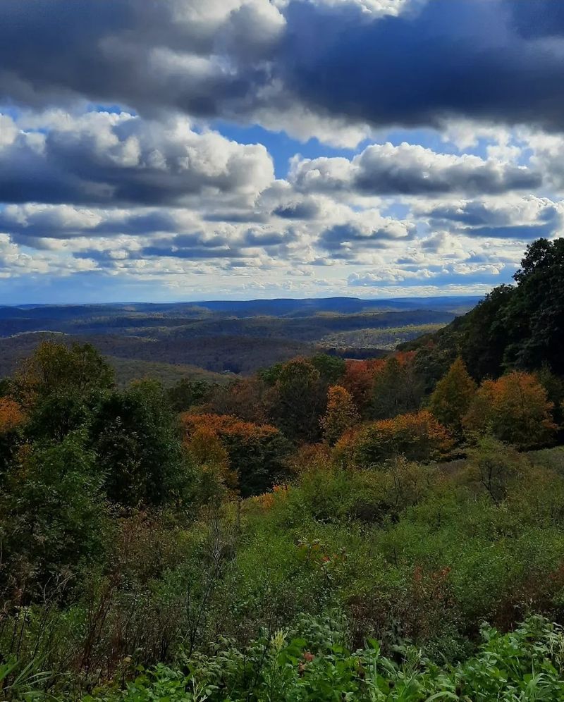
Eighty-five miles sounds like a major commitment, but a quiet afternoon can begin with just one small piece.
The trick is to borrow a manageable stretch of this large forest loop and leave the full circuit for another adventure.
The Susquehannock Trail System winds through Potter County and surrounding northern Pennsylvania forest country.
Much of the route lies in Susquehannock State Forest, linking wooded ridges, stream valleys, and remote hollows.
Its orange blazes guide hikers through terrain that feels far removed from busy town streets.
For a day walk, locate an established access point on the current trail map and choose an out-and-back route.
A loop on the map does not mean there is a short loop available from every parking area.
Distances between roads can be substantial, so arranging a casual pickup without checking mileage is risky.
Fall suits this landscape especially well because different slopes and tree species create changing pockets of color.
One hollow may glow yellow while another stays shaded beneath evergreen branches.
Walk slowly enough to see those shifts, rather than expecting a single grand overlook to provide the whole experience.
Rolling ground can become tiring after several miles, and fallen leaves may cover roots or wet patches.
Keep your steps deliberate and leave room in your schedule for breaks.
A dry spot beside the trail makes a fine place for lunch, provided you avoid blocking the path or disturbing plants.
Check trail conditions, carry navigation tools, and do not rely on finding a phone signal.
Bring water rather than drinking untreated stream water, and pack a layer for cooling afternoon temperatures.
During hunting seasons, bright clothing helps you remain visible.
The best short visit ends with a clear sense of the woods, not a desperate push to complete mileage that looked easier while planning at home beforehand.
5. Allegheny Front Trail: Cool Air Along the Plateau
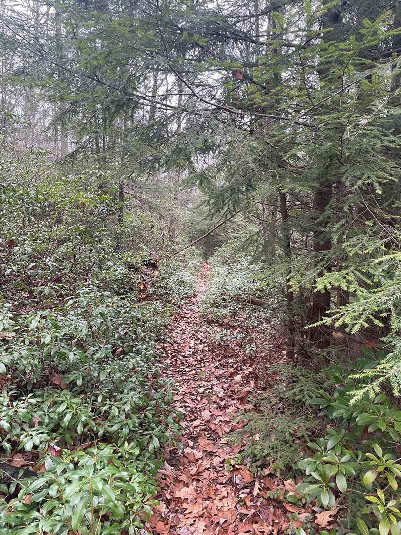
Cool air and a wide stretch of sky can clear your head surprisingly fast.
In the woods around the Allegheny Front, fall walks mix that open feeling with shaded passages where the trees close around the trail again.
The Allegheny Front Trail forms a roughly 42-mile loop in Moshannon State Forest near Black Moshannon State Park.
Its route includes forested uplands, stream corridors, and sections near the plateau’s edge.
The full loop belongs in the backpacking category, but selected portions can work for prepared day hikers.
Choose your starting point with a current map and a realistic distance in mind.
Do not assume that beginning near the state park makes every section flat or simple.
Terrain and footing vary, and a short route can still include enough roots and rocks to slow your pace.
Autumn adds contrast rather than just color.
Bright hardwood leaves may stand beside dark evergreens, while thinner branches reveal shapes that summer foliage kept hidden.
If your chosen segment reaches a viewpoint, enjoy it from stable ground and keep clear of exposed edges, especially during strong wind.
Some parts of this region can stay damp, so waterproof footwear may be helpful after rain.
Step through muddy areas on the established tread where practical instead of widening the path around them.
Walking poles can help with balance, but they do not replace careful foot placement on slick surfaces.
Pack a wind-blocking layer, food, water, and an offline route map.
Check official notices for closures or maintenance before leaving, and allow extra time for shorter fall days.
There is no need to turn a quiet visit into a mileage contest.
Pick one worthwhile section, stop when the setting invites it, and return while the afternoon still has enough light for a comfortable walk back to your vehicle without unnecessary hurry.
6. Black Forest Trail: Peace With a Steep Price
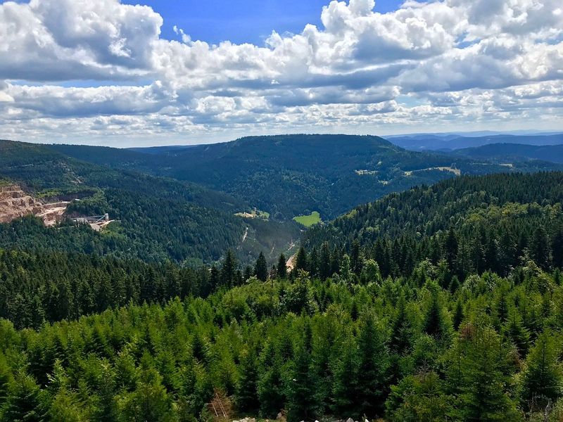
Your legs may complain before your mind finally goes quiet.
That is part of the bargain on this rugged route, where demanding climbs can lead to forest views that make you forget your phone for a while.
The Black Forest Trail is a roughly 42-mile loop in Tiadaghton State Forest near Slate Run.
It is known for steep elevation changes, rocky tread, and broad views of the Pine Creek region.
Calling it peaceful does not make it easy, and beginners should approach its tougher sections with care.
A full circuit takes substantial planning and is usually a backpacking undertaking.
For a fall day hike, study the official map and select a short section that matches your fitness.
Confirm both parking and the return route, since a downhill start can leave the hardest climbing for the trip back.
Leaf season brings rich color to the ridges, but wet foliage creates slippery footing.
Take smaller steps on descents and use poles if they help your balance.
At overlooks, stay back from drop-offs and avoid moving onto unstable rocks just to improve a photograph.
The trail’s name reflects the area’s dark forest character, yet the landscape offers more than one mood.
Open views feel bold and airy, while sheltered hollows can be still and close.
Giving yourself permission to pause lets you enjoy both instead of rushing between scenic stops.
Bring more water and food than you would for a flat walk of the same distance.
Carry a headlamp, navigation tools, and a warm layer, and tell someone where you are going.
Check weather, current conditions, and hunting information before departure.
If a climb feels harder than expected, turn around early; the forest will remain here for a future visit when daylight, weather, and your energy offer a better match for the route you originally planned.
7. Kennerdell’s River View: A Quiet Look Above the Allegheny
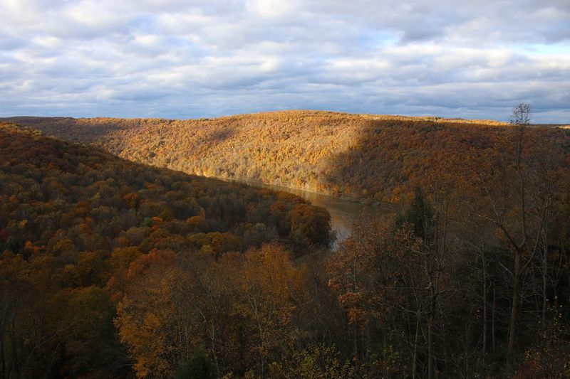
A river bend can hold your attention longer than any screen.
Near Kennerdell, the Allegheny River gives the surrounding woods a gentle center, and a carefully planned hillside walk can reveal that landscape from a fresh angle.
The Kennerdell Tract of Clear Creek State Forest contains a network of trails in Venango County.
For this outing, treat Kennerdell’s River View as a description of the experience, not a promise of one officially named trail.
Use the current forest map to choose an established route toward a mapped viewpoint or river-facing slope.
That distinction matters because local trail names and online route labels may differ.
Confirm your starting location, intended junctions, and return distance before leaving the parking area.
Avoid following an unmarked side path simply because it appears to head toward the water.
Fall brings warm tones to the hills above the river, and breaks in the canopy can offer glimpses that summer leaves hide.
A visible river view is not guaranteed from every section, however.
The wooded walk itself provides plenty of interest through changing light, textured bark, and the sounds of the valley.
Expect hillside grades and uneven ground rather than assuming a riverside setting means level walking.
Leaves may cover stones, and rain can make descents slick.
Keep away from steep banks and exposed edges, especially while taking photos or trying to see around branches.
Pack water, a light meal, and a warmer layer for a slow stop along the route.
Download the map ahead of time, review access notices, and wear bright clothing during hunting seasons where needed.
A modest route leaves room for lingering without creating a late return.
Let the river shape the mood, but let the map and your own comfort shape the actual walk from the first step back to the final uphill stretch home.
8. Pole Steeple Trail: A Short Climb With a Big View
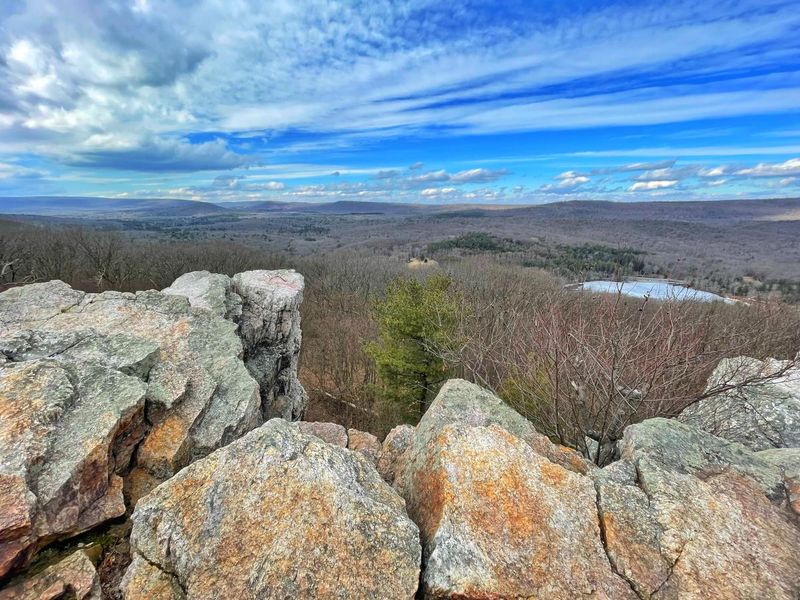
Sometimes a short walk delivers a view that feels much bigger than the effort.
Here, the effort is still real: a steady uphill climb ends at a rocky overlook with a broad look across the surrounding autumn woods.
Pole Steeple Trail lies in Michaux State Forest near Pine Grove Furnace State Park.
The direct trail is about three-quarters of a mile each way, making the usual out-and-back roughly a mile and a half.
Its modest distance should not be confused with an easy, level stroll.
The climb includes steep sections and rough footing, so plan to move slowly.
A current map can help you understand trail choices and any connections, including routes toward the Appalachian Trail.
Stick with the straightforward return unless you have planned a longer outing and know exactly where it leads.
At the top, quartzite outcrops open views toward Laurel Lake and the forested landscape around it.
Autumn colors can make the hills look patchworked with gold, red, and green.
Clear weather improves the view, but cloudy conditions can still create a soft, quiet scene worth enjoying.
The overlook has serious drop-offs and uneven rock.
Keep children close, maintain a safe distance from edges, and avoid climbing onto exposed surfaces for pictures.
Wind, rain, and damp leaves can change a comfortable stopping place into a risky one very quickly.
Wear sturdy shoes and bring water even though the mileage is short.
Weekends during peak foliage may draw other visitors, so an early weekday visit can offer a calmer experience, though solitude is never guaranteed.
Check parking and current notices before arrival, and give the descent as much attention as the climb.
A few careful steps and an unhurried break can turn this compact outing into a memorable reset without requiring an entire day on the trail or elaborate travel plans.
9. Golden Eagle Trail: A Rewarding Challenge Above Pine Creek
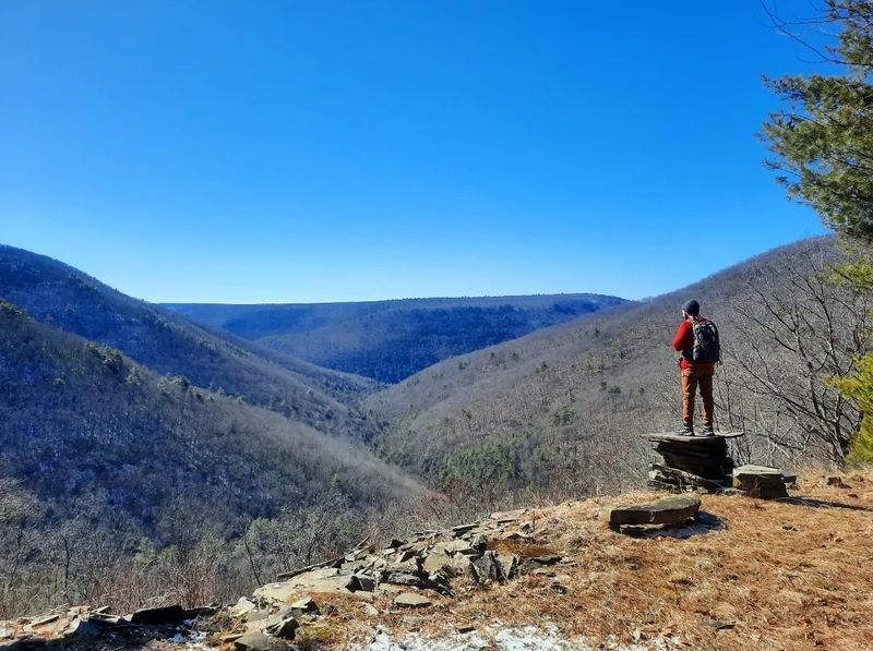
There is a special kind of silence after a hard climb, when you stop, catch your breath, and finally notice the view.
On this route, that moment can feel earned rather than handed over beside a parking lot.
The Golden Eagle Trail forms a roughly nine-mile loop in Tiadaghton State Forest near the Pine Creek community of Cammal.
It combines steep slopes, wooded valleys, and striking overlooks, including Raven’s Horn.
This is a demanding day hike, not the best choice for someone seeking an effortless afternoon stroll.
Study the route before starting and allow a generous amount of daylight.
Hills and rough footing can make the mileage take longer than expected, especially when every viewpoint invites a pause.
Check official information for current access, trail conditions, and any suggested routing before deciding how to tackle the loop.
Fall color spreads across the surrounding ridges, while shaded sections offer a closer look at leaves, roots, and streamside forest.
The contrast keeps the walk interesting even between the major scenic stops.
You do not need to chase every photograph to feel that change in atmosphere.
Rocky overlooks demand caution, especially when wet or windy.
Stay well away from edges and never step backward while looking through a camera.
On the trail, short strides and steady pacing will serve you better than rushing a descent because the climb took extra time.
Bring enough water, a substantial snack or lunch, layers, and a headlamp.
Keep an offline map available and tell someone your plans, since service may be limited.
If your group is not ready for the full loop, choose another shorter route rather than improvising an unknown shortcut.
The most relaxing part of a challenging hike often comes from knowing that your preparation, pace, and daylight leave enough room to enjoy the woods without pressure on the return.
10. Thunder Swamp: Small Details in the Pocono Woods
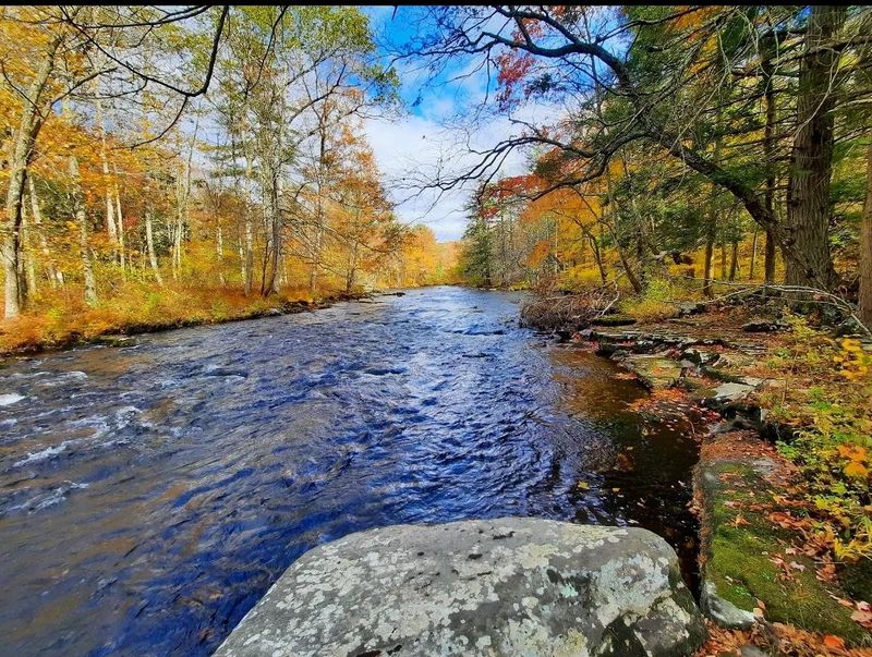
The best thing to notice here might be smaller than a scenic overlook.
A bright leaf beside dark water, a fern tucked between rocks, or a bird moving through low branches can become the reason you slow down.
The Thunder Swamp Trail System lies in Delaware State Forest in northeastern Pennsylvania.
Its network covers about 45 miles, including loops and connecting trails through Pocono woodland and wetland settings.
Day visitors should choose a specific mapped segment rather than treating the entire system as one simple walk.
Water is a strong part of the landscape, but that does not mean the footing is smooth.
Rocky tread, roots, and damp sections can require close attention.
After rain, allow extra time and consider a shorter plan if conditions are likely to make the route uncomfortable or difficult.
Autumn brings color at several levels, from the overhead canopy to shrubs near the ground.
Evergreen trees add darker patches, giving the woods a different look from forests dominated only by hardwoods.
Cloudy weather can suit this quieter scenery, provided the forecast does not bring unsafe conditions.
Wear shoes with grip and expect that some areas may be muddy.
Remain on established trails rather than stepping into wetlands or creating new paths around wet spots.
Keeping the route intact protects fragile plants and makes navigation clearer for the next person who comes through.
Download a current map, note your junctions, and bring water, snacks, layers, and a headlamp.
Check forest notices and hunting information before leaving, and do not count on steady cell service.
Choose a return time that gives you a wide daylight margin.
This outing works best when you stop measuring success by dramatic views and start paying attention to the smaller sights that a hurried walker might miss completely along the shaded path beneath the changing canopy above.
11. Bucktail Path: A Quiet Route Through Elk Country
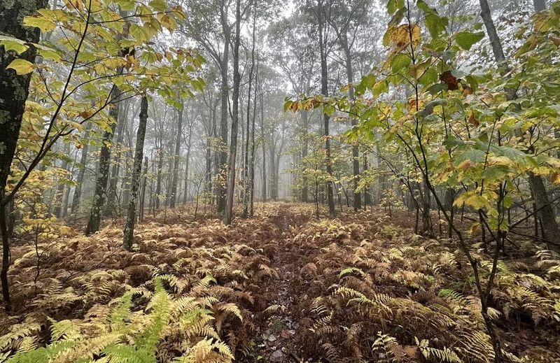
Quiet feels different when the forest stretches well beyond the next bend.
A walk in this part of Pennsylvania invites patience, with fewer reasons to hurry and more reasons to pay attention to the ground beneath your boots.
Bucktail Path runs roughly 34 miles through Elk State Forest, connecting the Sizerville State Park area with the village of Sinnemahoning.
The route crosses rugged terrain in north-central Pennsylvania.
It is better understood as a remote hiking trail than as a casual path with frequent services or easy exits.
A shorter out-and-back can offer a taste of the landscape without committing to the full route.
Select an established access point from the current official map and confirm the road is open and suitable for your vehicle.
Forest-road access deserves special attention after storms or during seasonal changes.
Hardwood slopes provide autumn color, while hollows offer shelter from the wind and a closer view of the forest floor.
Leaves can soften the look of the trail without softening its rocks or roots.
Keep checking the tread and blazes, particularly where fresh leaf cover makes the route less obvious.
The surrounding region is known for Pennsylvania’s elk, but a sighting should never be promised or pursued.
If you encounter elk or other wildlife, give them generous space and let them move freely.
Avoid approaching for photos, feeding animals, or following them away from the established trail.
Bring navigation tools, ample water, food, and clothing for changing temperatures.
Tell someone your route and expected return, carry a headlamp, and check hunting rules before heading into the woods.
A realistic turnaround time matters more than reaching an ambitious landmark.
End while you still feel comfortable, and the memory will be of crisp air, rich color, and room to breathe rather than a hurried struggle through fading light on unfamiliar ground far from help.
Share this story