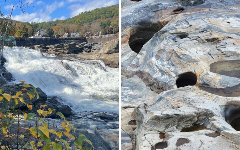
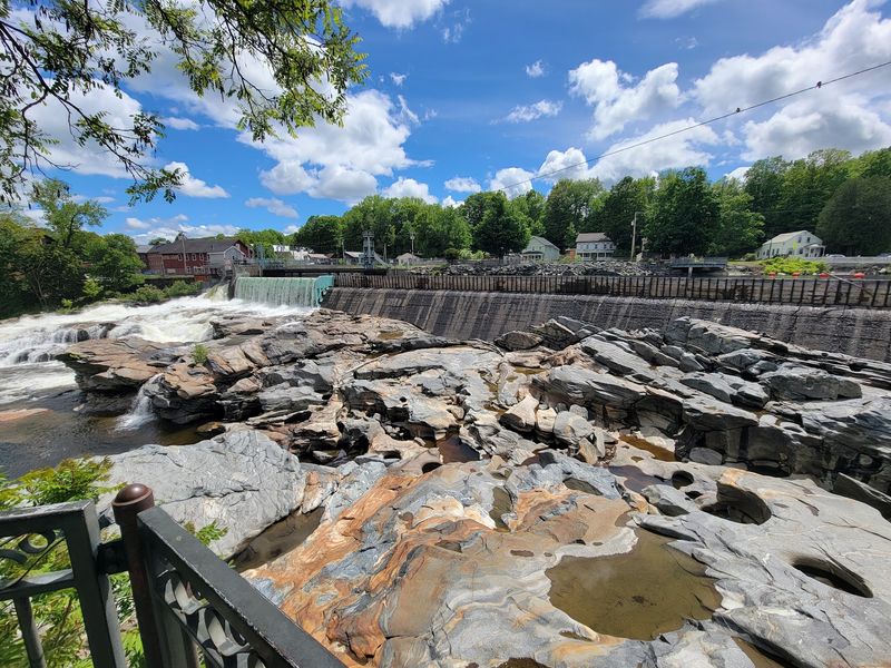
Some of the strangest holes in Massachusetts were carved without a single tool. Below a rushing waterfall in western Massachusetts, swirling water and grinding stones slowly drilled deep pockets into the riverbed during and after the last Ice Age.
Around 50 glacial potholes crowd the rock here, including some large enough to make you stop and wonder how they formed at all. I love that this geological oddity sits right in the middle of a small village instead of hiding miles into the wilderness.
The river also divides the village between two towns, while a flower-covered bridge connects the scene just upstream. That means one quick stop can give you waterfalls, unusual rock formations, village views, and one of the prettiest crossings around.
For something created by water, stone, and a lot of time, these potholes make a surprisingly dramatic reason to pull over and explore.
These Holes In The Rock Took Thousands Of Years To Dig
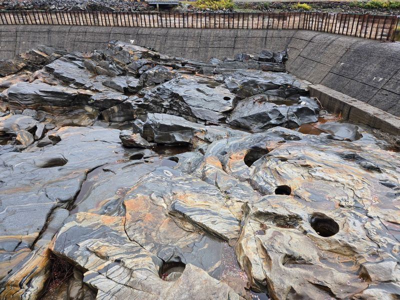
Salmon Falls sits on the Deerfield River in the village of Shelburne Falls, Massachusetts. Its biggest claim to fame is the cluster of glacial potholes carved into the rock below the falls.
Melting glaciers sent huge amounts of water rushing through this valley. Stones caught in whirlpools spun around and around, grinding the bedrock like a slow-motion blender.
Over a very long time, those spinning stones wore smooth, round holes into the rock. Some are small, like a bowl.
Others are wide and deep enough to hide a grown adult.
Around 50 potholes have been counted here. Geologists consider the group one of the largest known collections in the world.
That’s a big title for a spot you can see in a few minutes.
The shapes look almost too perfect to be natural. Many have curved walls and swirled edges that show exactly how the water moved.
Kids usually ask how the holes got there before anything else. It’s a great chance to talk about glaciers without opening a textbook.
Science is a lot more fun when you can point right at it.
A Waterfall That Splits Its Time Between Two Towns
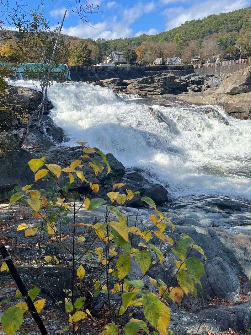
Ever stood next to a waterfall that technically belongs to two towns at once? The Deerfield River forms the line between Buckland and Shelburne.
Salmon Falls tumbles right along that border.
The village of Shelburne Falls covers both banks. It shares one name, one main street feel, and one river, even though two town governments are involved.
That makes the falls a kind of shared backyard. Neither town gets to keep the view all to itself, and honestly, that seems fair.
The water drops over rocky ledges and pours into the pothole area below. After heavy rain or spring melt, the river looks much stronger and louder.
During drier stretches, more of the rock shows. That’s actually a plus, because you can see more potholes when the water runs lower.
The river here is also controlled by an upstream dam. Water levels can change, sometimes quickly.
Treat the riverbed with respect and stay in safe viewing areas.
Every visit can look a little different depending on the season. That’s a good reason to come back more than once.
Grab A Picnic Table With A Front-Row View
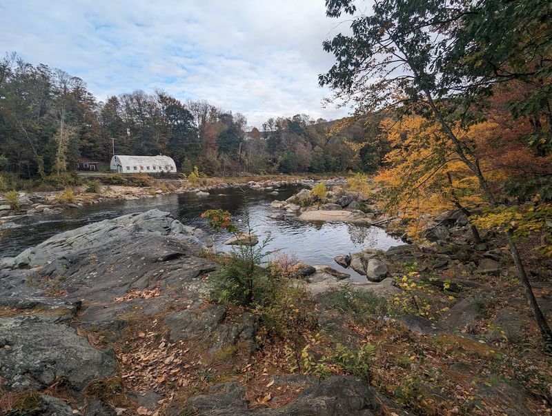
Best seat in the house? That goes to the Salmon Falls Overlook on the Buckland side of the river.
The overlook gives you a clear view of the waterfall and the potholes from above. Public picnic tables make it easy to sit down and stay a while.
You can find it at 45 Conway St, Buckland, MA 01338. It sits close to the Mill at Shelburne Falls, a historic mill building with shops inside.
The overlook is generally open from 6 AM to 8 PM daily. That gives you plenty of daylight hours for a visit, especially in summer.
Bring a sandwich from town and make it a lunch break with a view. Few picnic spots come with an Ice Age science lesson included.
Photographers will like the angle, too. From up here, you can capture the round holes, the rushing water, and the rock ledges in one shot.
Arrive with a charged phone or camera. The scene changes with the light, and you’ll probably take more pictures than planned.
Bring A Book And Thank The Shop Next Door
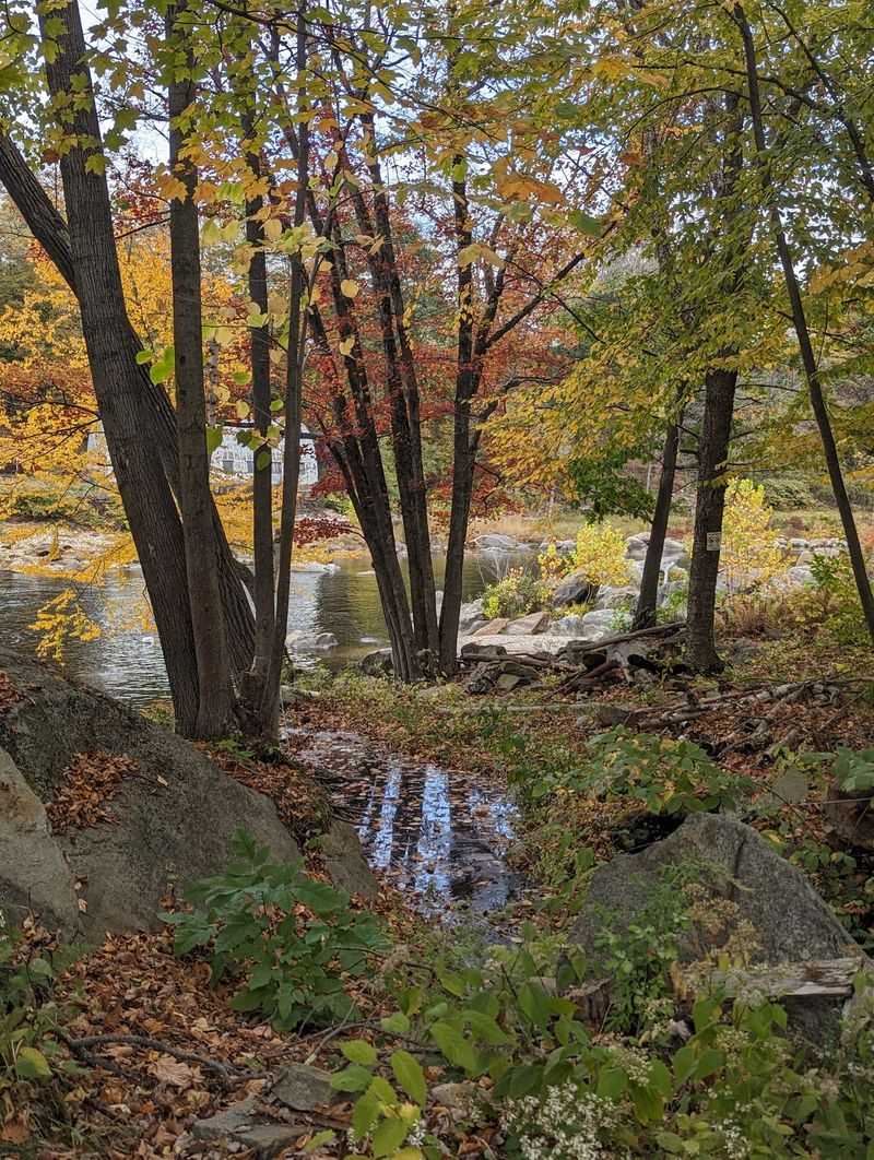
Reading next to a waterfall sounds like something from a movie. At Salmon Falls, it’s a real option.
Raven Used Books sits right by the overlook area in the Mill at Shelburne Falls. That means you can browse shelves first and carry a new find to the picnic tables.
Choosing a book might take longer than seeing the falls. Used bookstores tend to work that way, and nobody’s complaining.
The mill building also houses other businesses. A Lamson and Goodnow outlet store sits nearby, connected to a cutlery company with deep roots in the area.
Lamson has made kitchen knives in Shelburne Falls since the 1800s. It’s one of the oldest cutlery makers in the country.
So a quick trip can turn into a small adventure. Look at potholes, shop a little, then read by the roar of moving water.
Store hours can differ from overlook hours. Check before you go if shopping is part of the plan.
Either way, the setting makes even a short chapter feel special. Your book will remember the trip, too, with a little river mist.
Mind The Rules Before You Climb Anything
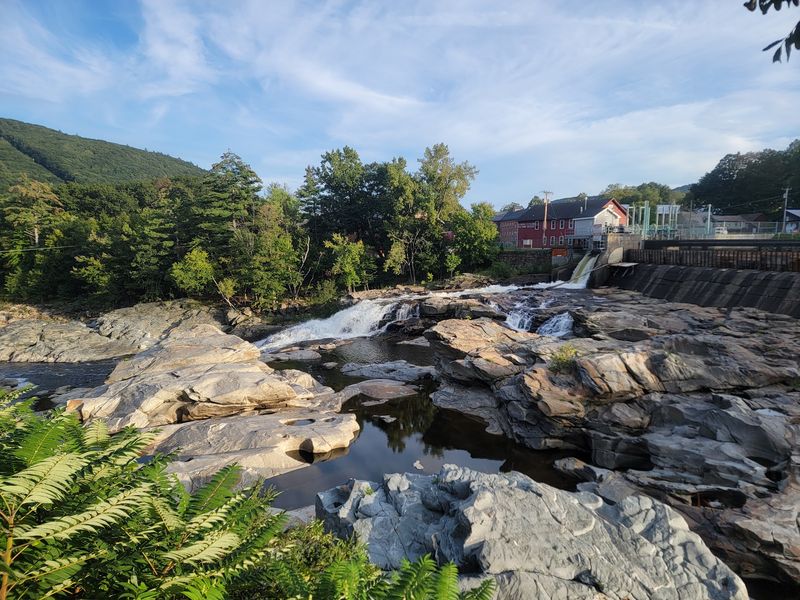
Smooth rock and still pools look inviting on a hot day. Still, this riverbed calls for caution.
An upstream hydroelectric dam controls the river flow here. Water can rise fast when releases happen, turning a calm pool into a strong current.
Wet rock gets slippery, too. Those polished pothole walls are smooth for a reason, and that same smoothness makes footing tricky.
Swimming and climbing in the pothole area are not allowed. Posted signs and local rules help keep visitors safe, so follow them closely.
Watching from the overlook is the smart move. You’ll still get a great view without needing to step anywhere risky.
Parents should keep little ones close near railings and edges. Curious kids love to explore, and rocks can tempt anyone.
Pets should stay leashed as well. A dog chasing a splash could end up somewhere tricky in seconds.
None of this ruins the fun. The potholes look most impressive from above anyway, where you can see the full pattern.
Safe and smart beats soggy and sorry every time.
A Bridge Covered In Flowers Is Steps Away
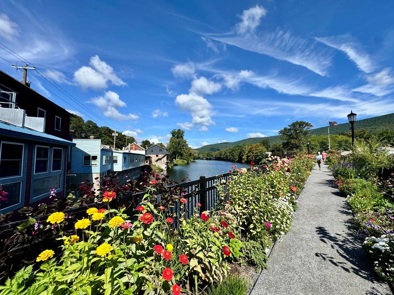
Flowers growing on a bridge? Just upstream from Salmon Falls, that’s exactly what happens.
The Bridge of Flowers is an old trolley bridge that now carries gardens instead of trains. It opened as a flower bridge in 1929 after trolley service ended.
Volunteers and gardeners care for the plantings. The bridge welcomes walkers during its seasonal months, usually spring through fall.
The walk across connects the two sides of the village. Here’s another way the river links Buckland and Shelburne in one easy stroll.
Blooms change through the season. Early visits show spring color, while later months bring different plants and fresh shades.
Pair the bridge with a stop at the potholes for a full village loop. Both spots sit close enough that you won’t need the car.
The bridge is a pedestrian path, so take your time. Slow walking is basically the whole point.
Bring your camera here as well. Between flowers, river, and potholes, your photo roll is going to need a nap.
Trolleys Once Rumbled Through This Village
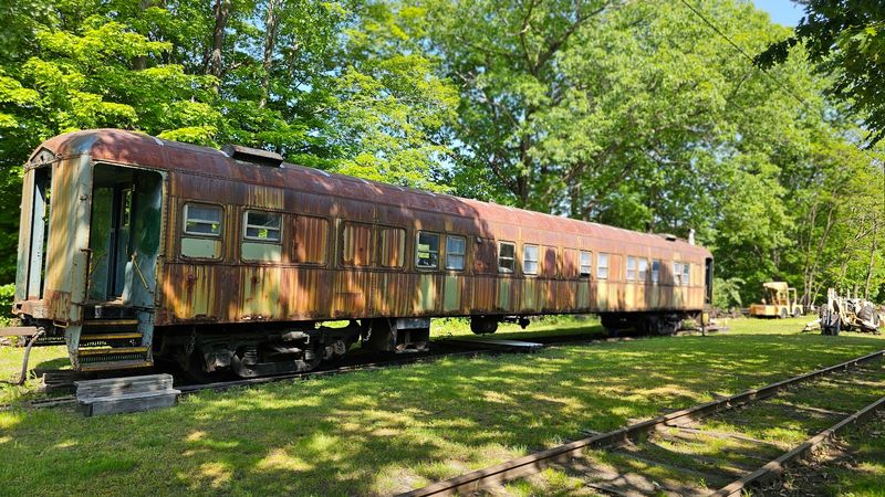
Long before visitors came for potholes, trolleys carried freight and passengers through this valley. The Shelburne Falls and Colrain Street Railway once ran here.
Today, the Shelburne Falls Trolley Museum keeps that story alive on the Buckland side. Its star is Trolley Car No. 10, a restored car that once served this very line.
The museum offers rides on its track during its operating season. Kids and grown-ups alike tend to grin at the clang of an old trolley bell.
The connection to the Bridge of Flowers makes the history even better. That bridge was built to carry these trolleys across the river.
So the falls, the bridge, and the museum all share one story. Learning that makes the whole village feel like a puzzle snapping together.
Check the museum schedule before planning your day. Hours change by season and weekend.
It fits nicely into a visit that already includes the overlook. Rocks from the Ice Age, then rails from the early 1900s, all in an afternoon.
That’s a lot of time travel for one small village.
The Name Comes With A Fishy Little Mystery
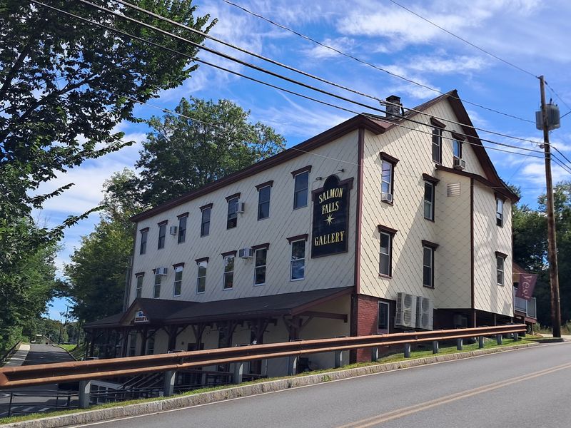
Salmon Falls sounds like a place where fish leap through the air. Visitors today shouldn’t expect a fish show, though.
Atlantic salmon once swam up rivers across New England to spawn. Dams, pollution, and changes to rivers over the 1800s pushed those runs into steep decline.
The name stuck around even after the fish mostly vanished. It’s a reminder of what the river used to be like.
Spotting a salmon here now would be quite a surprise. Even so, the name gives the falls a bit of storytelling charm.
Restoration efforts for Atlantic salmon in the Connecticut River system ran for decades. The Deerfield River feeds into that larger system.
Thinking about the fish adds another layer to the view. You can picture the river in a different era, full of different life.
Talk with kids about why rivers change. It’s a simple way to explain how people affect nature, for better and worse.
Come for the potholes, stay for the scenery. Just leave the fishing net at home.
Every Season Paints These Rocks A New Way
Fall foliage in western Massachusetts turns hills into a patchwork of red, orange, and gold. Around Salmon Falls, that color frames the gray rock beautifully.
The village sits near the Mohawk Trail, a scenic route along Route 2. Many leaf-peepers pass through this area each autumn.
Spring brings a different mood. Melting snow and rain can push more water over the falls, making the river look powerful.
Summer offers long days and easy picnic weather. With the overlook open until 8 PM, evening visits become a relaxing option.
Winter can be quiet and frosty. Ice may form along the rocks, though footing deserves extra care in cold weather.
Each season shows the potholes in fresh light. Low water exposes more holes, while high water hides them under foam.
Plan around what you want to see. Bigger water means drama, while lower water means more rock to study.
The best answer might be visiting twice. These potholes waited thousands of years, so they won’t mind another visit from you.
Share this story