Texas is massive, and sometimes the best way to see it isn’t by rushing from city to city on the interstate. The real magic happens when you slow down and take the back roads, where wildflowers carpet the hillsides, mountains rise out of nowhere, and every mile feels like a postcard. These scenic byways aren’t just shortcuts or detours—they’re destinations in themselves, offering some of the most stunning landscapes in the Lone Star State.
Whether you’re chasing bluebonnets in spring or watching the sun set over desert peaks, these drives will remind you why Texas is worth exploring at a leisurely pace.
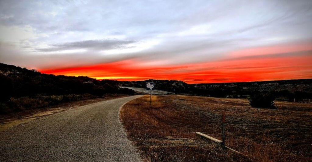
1. Willow City Loop (Fredericksburg)
")
Every spring, this 13-mile loop becomes one of the most photographed stretches of pavement in Texas. Wildflowers explode across the hillsides in waves of blue, red, and yellow, turning the Hill Country into a living canvas. The road itself winds through private ranch land, so you’re seeing working Texas, not some manicured tourist trap.
The best time to visit is late March through April, when the bluebonnets are at their peak. But timing wildflowers is tricky—they depend on winter rains and temperature, so checking local bloom reports before you go is smart. The drive takes about 30 minutes without stops, but you’ll want to budget at least two hours because you’ll be pulling over constantly.
There are no services along the loop, so fill up your gas tank and pack snacks in Fredericksburg before you head out. The road is narrow and winding, with some steep sections, so take it slow and watch for oncoming traffic. Weekends during peak bloom can get crowded, so early morning or late afternoon visits offer better light and fewer people.
Photographers love the old barns and limestone fences that pop up along the route, providing perfect foreground elements for wildflower shots. Respect private property—most of the land is privately owned, so stay on the road or designated pullouts. The loop connects back to Highway 16, making it easy to incorporate into a larger Hill Country road trip.
This isn’t a paved highway with guardrails and rest stops. It’s a genuine country road that happens to cut through some of the prettiest ranch land in Texas. Bring your camera, slow down, and let the scenery do the talking.
2. Highway 90/385 — Marathon to Big Bend

This route drops you into the kind of landscape that makes you understand why West Texas has its own mystique. Driving from Marathon toward Big Bend, you’ll cross wide-open desert where the sky seems twice as big and the silence is almost physical. The Chisos Mountains rise in the distance like a mirage, getting closer with every mile.
Marathon itself is worth a stop—it’s a tiny town with an outsized reputation thanks to the Gage Hotel, a beautifully restored 1920s property that attracts artists, writers, and anyone looking to unplug. From there, Highway 385 heads south through ranch country so vast you can drive for 20 minutes without seeing another car. This is working ranch land, where cattle outnumber people by a wide margin.
The landscape shifts as you approach the park, becoming more rugged and mountainous. You’ll pass through the community of Terlingua, a former mining ghost town that’s been reborn as an eccentric artist colony. Stop for lunch at one of the local spots—the chili is legendary, and the characters you’ll meet are worth the detour.
Big Bend National Park marks the end of this drive, but it’s really just the beginning of your adventure. The park offers hiking, river trips, and some of the darkest night skies in the continental United States. If you’re camping, book well in advance—sites fill up fast, especially in the cooler months from November through March.
This drive isn’t about constant scenery changes or roadside attractions. It’s about immersion in a landscape that feels untouched and timeless, where you can go hours without seeing a billboard or strip mall.
3. River Road (Palo Duro Canyon)
")
Most people don’t expect to find the Grand Canyon’s little cousin in the Texas Panhandle, but Palo Duro Canyon is exactly that—a massive gash in the flat prairie that drops 800 feet and stretches for 120 miles. River Road runs along the canyon floor, giving you front-row access to towering red rock walls, layered like a geology textbook come to life.
The drive starts at the park entrance near Amarillo and descends in switchbacks that reveal more of the canyon with each turn. Once you reach the bottom, River Road follows the Prairie Dog Town Fork of the Red River, winding through cottonwood groves and past multicolored rock formations. The canyon walls rise on both sides, striped in shades of red, orange, and white.
Stop at the various pullouts to hike short trails or just soak in the scale of the place. The Lighthouse Trail is the park’s most popular hike, leading to a distinctive rock formation that looks like—you guessed it—a lighthouse. It’s a moderately challenging 6-mile round trip, but the views from the top are worth every step.
Summer temperatures can hit triple digits, so spring and fall are ideal times to visit. Early morning light is especially beautiful, casting long shadows across the canyon floor and making the red rocks glow. Wildlife is surprisingly abundant—watch for mule deer, roadrunners, and the occasional bobcat.
The park offers camping if you want to extend your visit, and the outdoor musical drama “Texas” runs during summer months in the canyon’s amphitheater. River Road itself is paved and easy to navigate, making it accessible for most vehicles. Just remember to bring plenty of water and sun protection, because the Panhandle sun doesn’t mess around.
4. Davis Mountains Scenic Loop (Fort Davis)
")
West Texas isn’t all desert and flatland—the Davis Mountains rise like an island of green in a sea of brown, offering cooler temperatures and landscapes that feel more Colorado than Chihuahuan Desert. This 74-mile loop climbs through mountain passes, crosses high-altitude grasslands, and delivers views that stretch for miles in every direction.
Starting in Fort Davis, the loop takes you past historic Fort Davis National Historic Site, where you can explore one of the best-preserved frontier military posts in the Southwest. The fort protected travelers and mail routes in the 1800s, and the restored buildings give you a genuine sense of what life was like for soldiers stationed in this remote outpost.
As you climb higher, the landscape transforms. Ponderosa pines and junipers replace desert scrub, and the air gets noticeably cooler. McDonald Observatory sits at one of the highest points, offering public tours and some of the best stargazing in North America.
The observatory hosts star parties several nights a week, where you can look through research-grade telescopes and learn about the cosmos from actual astronomers.
The loop continues through Madera Canyon and past Prude Ranch, a historic guest ranch that’s been welcoming visitors since 1921. The road winds through private ranch land, so respect gates and property boundaries. Pullouts along the route offer chances to stop and take in the panoramic views—on clear days, you can see mountain ranges stretching into Mexico.
Fall brings golden aspens to the higher elevations, while spring wildflowers carpet the meadows. Summer offers an escape from the brutal heat of lower elevations—temperatures here can be 15-20 degrees cooler than in nearby towns. Pack layers, because mountain weather can change quickly.
5. Highway 16 (Kerrville to Fredericksburg)
")
Highway 16 cuts straight through the heart of Hill Country, connecting two of the region’s most popular towns with 25 miles of classic Texas scenery. Rolling hills covered in live oak and juniper line both sides of the road, and limestone outcroppings poke through the thin soil like bones of an ancient landscape. This is the Texas that shows up in tourism brochures, and it lives up to the hype.
Leaving Kerrville, you’ll climb into higher elevations where ranches sprawl across the hillsides. Many of these properties have been in the same families for generations, passed down through decades of hard work and careful stewardship. The road rises and falls with the terrain, offering new views around every curve.
Spring wildflower season transforms this drive into something special. Bluebonnets, Indian paintbrush, and wine cups create natural gardens that stretch for miles. Local photographers stake out favorite spots at sunrise and sunset, when the light turns everything golden.
If you’re visiting during peak bloom, plan for slower traffic as people stop to take photos.
The drive takes less than 30 minutes without stops, but rushing through defeats the purpose. Pull off at roadside parks or wide shoulders to soak in the views. Watch for wildlife—white-tailed deer are common, especially at dawn and dusk, and you might spot wild turkeys or roadrunners.
Fredericksburg itself is worth exploring, with its German heritage visible in the architecture and local cuisine. Wineries dot the surrounding countryside, offering tastings and tours. Kerrville hosts festivals throughout the year, including a renowned folk music festival each spring.
This drive works as a standalone outing or as part of a larger Hill Country loop taking in other scenic roads in the area.
6. Lonesome Highway (West Texas)
")
Sometimes called the loneliest road in Texas, this stretch of highway lives up to its name. Driving across the far western reaches of Texas, you’ll understand what people mean when they talk about wide-open spaces. The horizon seems impossibly distant, and you can drive for an hour without seeing another car.
It’s simultaneously beautiful and slightly unnerving.
The exact route varies depending on who you ask—some say it’s Highway 54 north of Van Horn, others point to remote stretches of Highway 118 near the Mexico border. What they all have in common is isolation, dramatic desert landscapes, and a sense of being truly alone in a vast wilderness. The mountains rise without warning from the flat desert floor, their peaks sharp against the endless sky.
This isn’t a drive for everyone. There are no services for long stretches, so make sure your vehicle is in good condition and your gas tank is full before you head out. Cell service is nonexistent in many areas, and if you break down, help could be hours away.
But for those who crave solitude and raw, unfiltered landscape, this drive delivers.
The light in West Texas is different—clearer and more intense than in other parts of the state. Photographers love the stark contrasts and dramatic shadows that play across the desert. Sunrise and sunset are particularly spectacular, when the mountains glow in shades of purple and gold.
Wildlife is more abundant than you might expect. Keep an eye out for pronghorn antelope, which can run at speeds up to 60 mph. Coyotes, roadrunners, and golden eagles are also common.
The desert plants—yucca, ocotillo, and various cacti—have their own harsh beauty, adapted to survive in an environment that gets less than 10 inches of rain per year.
7. Highway 207 (Claude)
")
Highway 207 runs north from Claude toward the Oklahoma border, cutting through the kind of landscape that defines the Texas Panhandle. Flat agricultural land stretches to the horizon, interrupted only by the occasional windmill or grain elevator. This is wheat and cattle country, where the economy still depends on what the land can produce and what the sky decides to deliver.
Claude itself is a small town that most people blow past on their way to somewhere else, but it’s worth a stop. The Armstrong County Museum houses an impressive collection of frontier artifacts and local history. The downtown still has that classic small-town Texas feel, with a courthouse square and locally owned businesses that have been serving the community for decades.
Heading north on 207, you’ll pass working ranches and wheat fields that turn golden in early summer. The Panhandle sky dominates everything—massive and ever-changing, with cloud formations that seem to go on forever. Thunderstorms here are legendary, building on the horizon and marching across the plains with visible curtains of rain beneath dark clouds.
This drive is about appreciating simplicity and scale. There are no dramatic mountain vistas or crashing waterfalls—just honest, working Texas where people still make their living from the land. The small communities along the way reflect that reality, with grain elevators serving as the tallest structures for miles around.
Spring brings wildflowers to the roadside ditches—not the famous Hill Country displays, but more modest shows of Indian blanket and Mexican hat that add splashes of color to the green wheat fields. Summer heat can be intense, with temperatures regularly hitting the upper 90s. Fall harvest season is particularly interesting, when combines work the fields and grain trucks rumble along the highway.
Winter can bring fierce northers that drop temperatures 30 degrees in an hour.
8. Texas Swiss Alps Scenic Drive (Fort Davis)
")
The name might sound like marketing hype, but when you’re winding through these mountains on a cool morning with fog drifting through the pines, you’ll understand the comparison. The Davis Mountains create their own microclimate, with elevations reaching over 8,000 feet and vegetation that’s more mountain than desert. It’s an unexpected pocket of alpine character in the middle of West Texas.
This scenic loop overlaps with parts of the Davis Mountains Scenic Loop but focuses on the higher elevations where the landscape takes on that Swiss-like quality. The road climbs through pine forests and past rocky outcroppings, with pullouts offering panoramic views of valleys and distant peaks. On clear days, you can see mountain ranges stretching into Mexico.
The area around Fort Davis has been attracting visitors since the late 1800s, when people discovered that the higher elevations offered escape from the brutal summer heat of lower Texas. Historic hotels and lodges still operate in the area, some dating back over a century. The town of Fort Davis maintains its frontier character, with historic buildings and a laid-back vibe that encourages you to slow down.
Balmorhea State Park lies about 40 miles north and makes an excellent addition to this drive. The park features a spring-fed swimming pool that stays a constant 72-76 degrees year-round, fed by the San Solomon Springs that pump out 15-20 million gallons of water daily. After a day of mountain driving, floating in that crystal-clear water feels like heaven.
Wildlife in these mountains includes black bears—yes, Texas has bears—along with elk, mule deer, and a variety of bird species. The Davis Mountains Preserve protects much of this habitat, and guided nature tours are available through the preserve’s programs. Mountain biking and hiking trails wind through the forests, offering closer access to the landscape.
9. Bluebonnet Trail (Ennis)
")
Every April, the small town of Ennis transforms into the bluebonnet capital of Texas. Fields explode in waves of blue as far as you can see, and thousands of visitors descend on this community of about 20,000 to witness the show. The official Bluebonnet Trail winds through rural roads around town, passing through some of the most reliable wildflower viewing areas in the state.
Unlike some wildflower drives where you’re hoping to catch the bloom at the right time, Ennis makes it easy. The city maintains a trail map with multiple routes of varying lengths, all marked and easy to follow. You can do a quick 10-mile loop or spend the whole day exploring back roads and discovering your own favorite spots.
The landscape here is classic North Texas—gently rolling farmland with red barns, white fences, and old homesteads providing perfect photo backdrops. Local farmers know that bluebonnet season brings visitors, and most are welcoming as long as you respect their property and close gates behind you. Some even set up designated parking areas and photo spots on their land.
Ennis celebrates with a festival that includes a parade, arts and crafts vendors, live music, and enough fried food to satisfy any appetite. The festival typically falls on the third weekend in April, but bloom timing varies depending on winter weather. Check the Ennis Bluebonnet Trail website or their social media for current bloom status before planning your trip.
Besides bluebonnets, you’ll see Indian paintbrush, wine cups, and other wildflowers that complement the blue carpet. Early morning and late afternoon offer the best light for photography, and weekdays are less crowded than weekends. Bring your camera, pack a picnic, and plan to spend at least half a day exploring the trails.
The blooms typically last two to three weeks, so there’s a decent window to catch them at their peak.