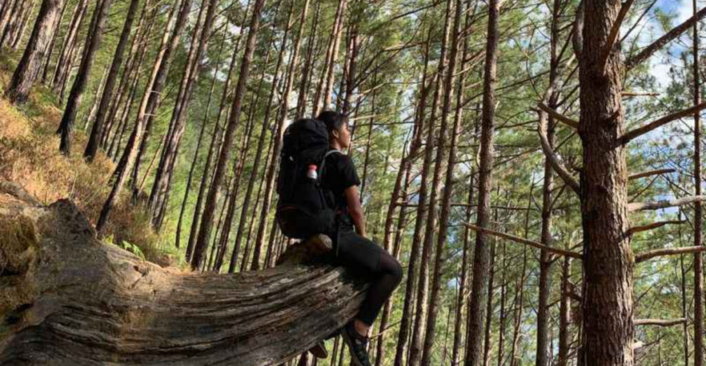
Somewhere above the Delaware River, the ground turns into a staircase of loose rock and the highway below shrinks into a silver thread.
Elsewhere, a massive boulder rests on three smaller stones as though a giant carefully arranged it, while deep in the Pine Barrens, sandy paths slip between dark cedar water and abandoned cranberry bogs.
New Jersey hiking has a habit of getting wonderfully strange. These are not interchangeable walks through pleasant woods.
They lead to cliff-top panoramas, mysterious ruins, glacial oddities, hidden waterfalls, mountain ponds, and landscapes that look more like another region—or another planet—than the most densely populated state in America.
Some require serious climbing, while others trade elevation for quiet, distance, and a good chance of getting sand in your shoes.
Check current maps and trail notices before leaving, bring more water than seems necessary, and prepare to see a side of the Garden State that does not feel remotely ordinary.
1. Mount Tammany Red Dot Trail – Worthington State Forest
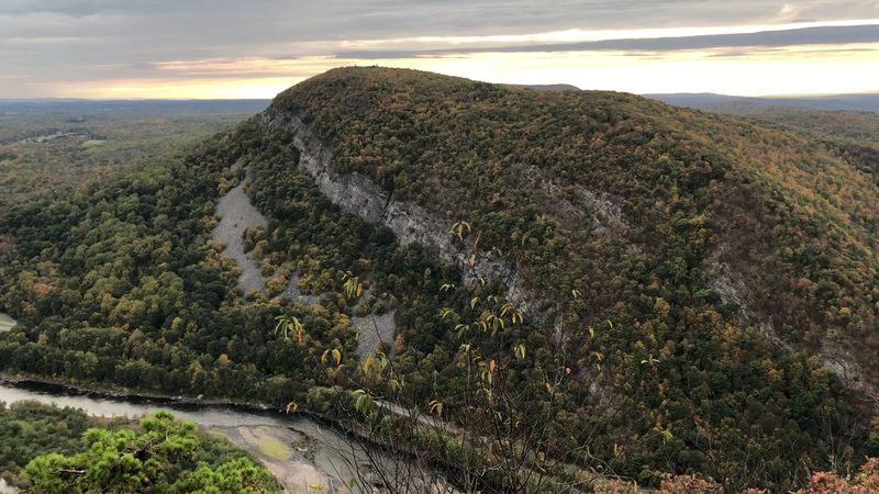
Loose rocks start making demands almost immediately. The Red Dot Trail does not ease hikers toward Mount Tammany’s summit with long, forgiving switchbacks; it climbs steeply through boulder fields and rocky forest, repeatedly reminding you that the view at the top must be earned.
This is one of New Jersey’s classic challenge hikes, and it feels far more mountainous than its location beside Interstate 80 might suggest. The reward is a wide-open look into the Delaware Water Gap, where the river curves between Mount Tammany and Pennsylvania’s Mount Minsi.
Roads, boats, and buildings become tiny details below the ridge, while layers of green hills stretch toward the horizon. The contrast is half the fun: one moment you are scrambling over rock, and the next you are sitting above one of the state’s most recognizable natural landmarks.
Most hikers make a roughly three-mile loop by climbing the red-blazed route and descending on the blue-blazed Pahaquarry Trail. That direction is generally the more comfortable choice because the Red Dot’s steepest sections are awkward to descend.
Sturdy footwear is not optional, and extra water matters on hot days when exposed rock holds the heat. The Dunnfield Creek parking area can fill very early on weekends, especially during fall foliage season, so this is one hike where sunrise enthusiasm pays off.
2. Stairway to Heaven and Pinwheel Vista – Wawayanda State Park
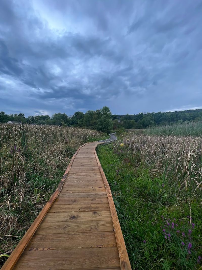
A wooden boardwalk over wetlands, a suspension bridge, open farmland, grazing cattle, and a rocky mountain climb should not logically belong to the same New Jersey hike. Yet the longer approach to Pinwheel Vista connects all of them, turning a day on the Appalachian Trail into a constantly changing little adventure.
The famous “stairway” arrives near Wawayanda Mountain, where broad stone steps and rock slabs climb sharply through the forest. It is a sweaty transition from pastoral valley scenery to genuine ridge hiking, but the overlook explains the trail’s popularity.
Pinwheel Vista opens above Vernon Valley, with farmland spread below and the Kittatinny Ridge visible across the landscape. On especially clear days, High Point Monument can be picked out in the distance.
There are two common ways to experience it. The shorter version begins near Route 94 and concentrates on the steep climb, making it a manageable outing for hikers who mainly want the overlook.
The longer out-and-back begins around the Pochuck Valley boardwalk and covers roughly seven miles, adding the wetlands, fields, bridge, and flatter Appalachian Trail miles before the ascent. Parking is limited around the mountain trailhead, and the route can become crowded during pleasant weekends.
Go early, stay on the established switchbacks, and resist the temptation to treat the rock staircase like a race. The scenery is better when you occasionally stop breathing hard enough to notice it.
3. State Line and Ernest Walter Trail Loop – Abram S. Hewitt State Forest
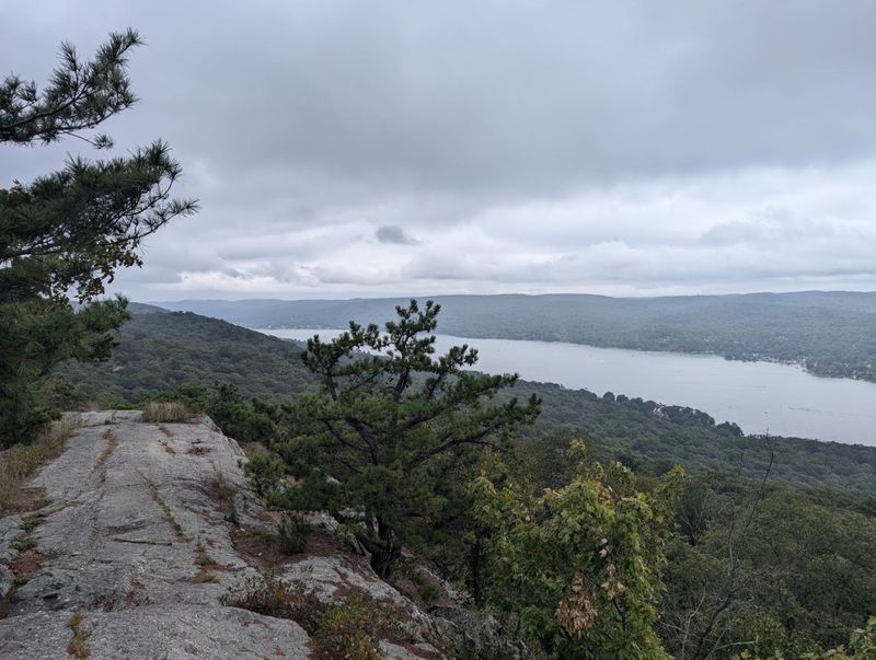
This is the hike for anyone who believes New Jersey trails are not rugged enough. The loop over Bearfort Ridge packs steep climbing, uneven rock, narrow ledges, lake views, and stretches where choosing the next foothold becomes more important than conversation.
It feels remote, adventurous, and occasionally a little mischievous. The State Line Trail wastes little time gaining elevation, climbing roughly 600 feet toward the ridge.
Once higher, the Ernest Walter Trail moves through a landscape shaped by exposed bedrock, scrubby vegetation, and natural viewpoints above Greenwood Lake. The water spreads below like a long blue corridor between the hills, with New York on one side of the state line and New Jersey on the other.
Several outlooks appear along the route, so the hike never depends on one crowded summit moment. At around six and a half miles, this loop is not enormous, but mileage is misleading here.
Rocky footing, scrambles, and frequent elevation changes slow the pace and make the route feel substantial. Allow more time than you would for a smoother trail of the same distance.
Dry conditions are preferable because wet stone can turn tricky sections into slick ones, and a downloaded map is a wise move where multiple paths meet. The appeal is not polish.
Bearfort Ridge is rough around the edges, exactly as it should be. It delivers one of North Jersey’s most satisfying combinations of physical challenge and wide-open scenery.
4. Terrace Pond Loop – Wawayanda State Park
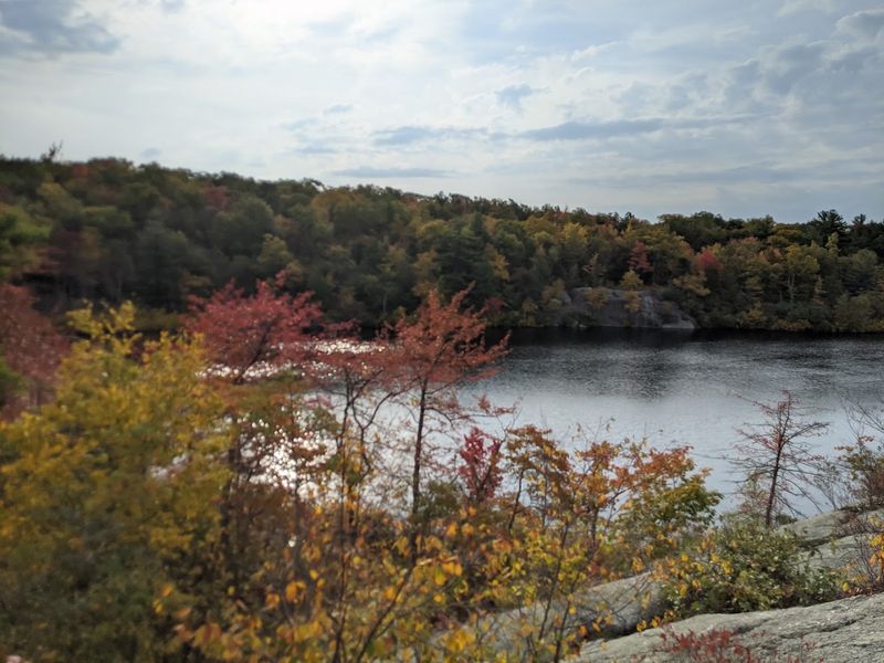
Terrace Pond appears with almost no warning, a dark mountain lake tucked inside a bowl of exposed rock and thick forest. After a rugged approach over uneven ridges, the still water feels strangely hidden from the rest of New Jersey.
It is easy to understand why hikers reach the shoreline and immediately start looking for the best flat rock on which to sit. The journey is as memorable as the destination.
Trails around the pond cross boulder-strewn terrain, rocky rises, wetlands, and stretches of dense woodland that can feel surprisingly wild. In places, the route demands careful foot placement rather than casual strolling.
The surrounding Bearfort Mountain landscape has a hard, glacial character, with low vegetation growing between slabs of stone and unexpected openings through the trees. Several route combinations reach Terrace Pond, so a current trail map is essential rather than something to glance at in the parking lot.
Trail alignments and blaze patterns have been improved over the years, including work around the notoriously wet outlet area, but this remains a hike where mud, water, and rock are part of the experience. It is best approached in proper hiking shoes and with enough time to move slowly.
The pond is the visual centerpiece, but the real attraction is the sense of discovery. Even when other hikers are nearby, the rocky shoreline and enclosed water create the impression that you have wandered into a place the surrounding suburbs somehow forgot.
5. Castle Point and Van Slyke Castle Loop – Ramapo Mountain State Forest
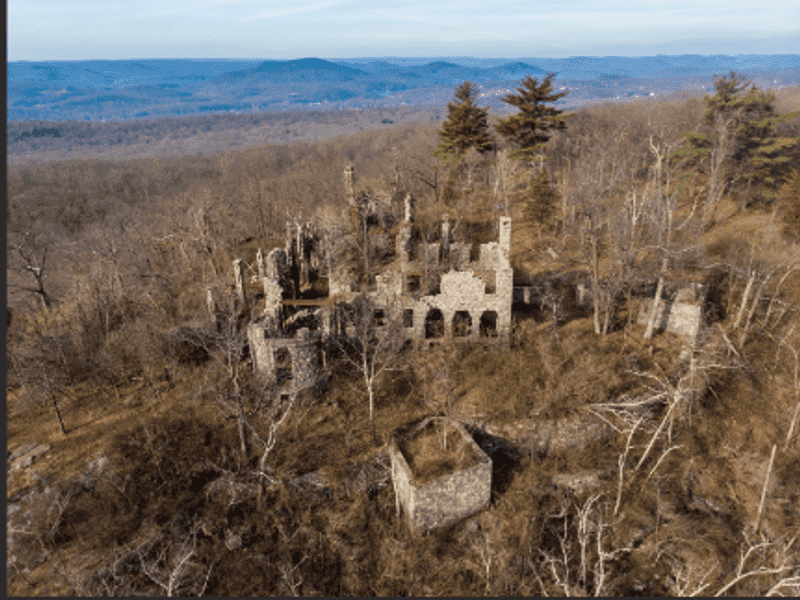
The payoff here is not simply a viewpoint or a historic ruin. It is the odd pleasure of finding both at once.
Stone walls, arches, foundations, and a lonely tower stand above Ramapo Lake, turning an ordinary forest climb into something resembling the remains of a forgotten hilltop kingdom. Van Slyke Castle was once part of a grand estate, but nature has long since taken control.
Trees grow around the masonry, fallen leaves collect inside roofless rooms, and openings in the ruins frame views across the surrounding Highlands. The tower area is especially atmospheric, though the exposed stone and drop-offs call for sensible footing rather than dramatic posing.
The marked Castle Loop covers a little more than three miles and combines moderate climbing with sections along scenic Ramapo Lake. That balance makes it a good choice for hikers who want a satisfying outing without committing to an all-day trek.
The forest itself changes character along the way, shifting between old roads, rocky slopes, piney sections, and open ledges where the landscape suddenly spreads out below. Parking along Skyline Drive can become tight, particularly on fall weekends.
Starting early helps, as does carrying a current map because Ramapo Mountain State Forest contains a busy network of intersecting trails. Save enough time to explore the ruins without rushing.
This is one of those places where wandering carefully through the old stonework is not a distraction from the hike—it is the reason the hike sticks with you.
6. Tripod Rock Hike – Pyramid Mountain Natural Historic Area
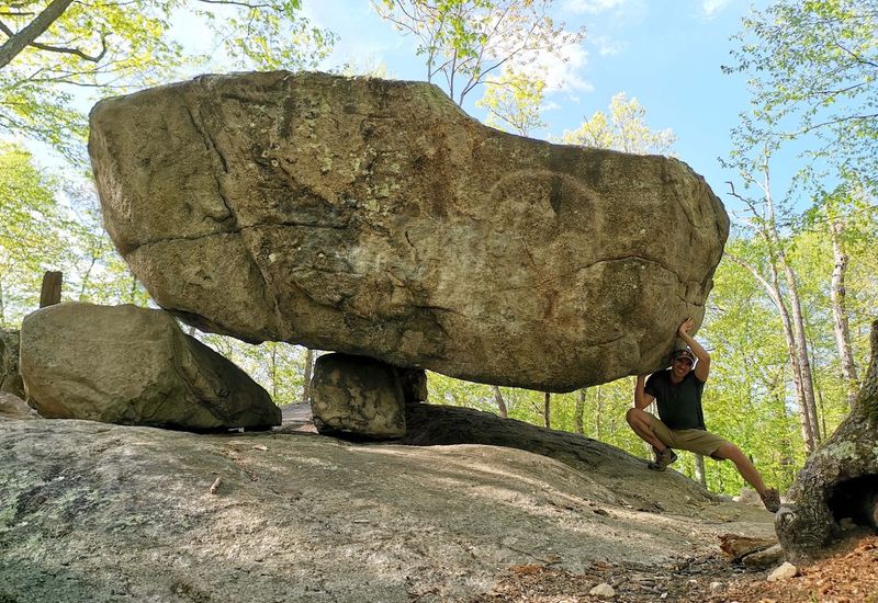
A boulder weighing roughly as much as a small building rests on three much smaller stones, leaving daylight visible underneath. It looks staged, balanced, or perhaps dropped there during a particularly careless afternoon by something enormous.
The actual explanation involves glacial movement, but Tripod Rock still has the visual logic of a folktale. The giant glacial erratic is the headline attraction at Pyramid Mountain, yet the surrounding landscape gives the hike more depth than a single photo stop.
Trails pass additional oversized boulders with names such as Bear Rock and Whale Head Rock, along with wetlands, hardwood forest, rocky ridges, and occasional viewpoints. These formations were left behind as the Wisconsin Glacier retreated more than 18,000 years ago, scattering geological surprises across what is now Morris County.
A suggested route from the Boonton Avenue visitor center reaches Tripod Rock in a loop of about 3.3 miles. A longer option from the Kincaid Road area adds an overlook and approaches six miles.
The shorter route is manageable for many hikers, although roots, rocks, and elevation changes keep it from feeling like a park stroll. The visitor center and well-developed trail system make Pyramid Mountain an approachable place to explore unusual geology without heading deep into the backcountry.
Still, the woods quickly feel removed from nearby neighborhoods. Arrive early on popular weekends, bring a map, and give yourself time to inspect the balancing act from every angle.
It remains delightfully difficult to believe.
7. Wyanokie High Point Loop – Norvin Green State Forest
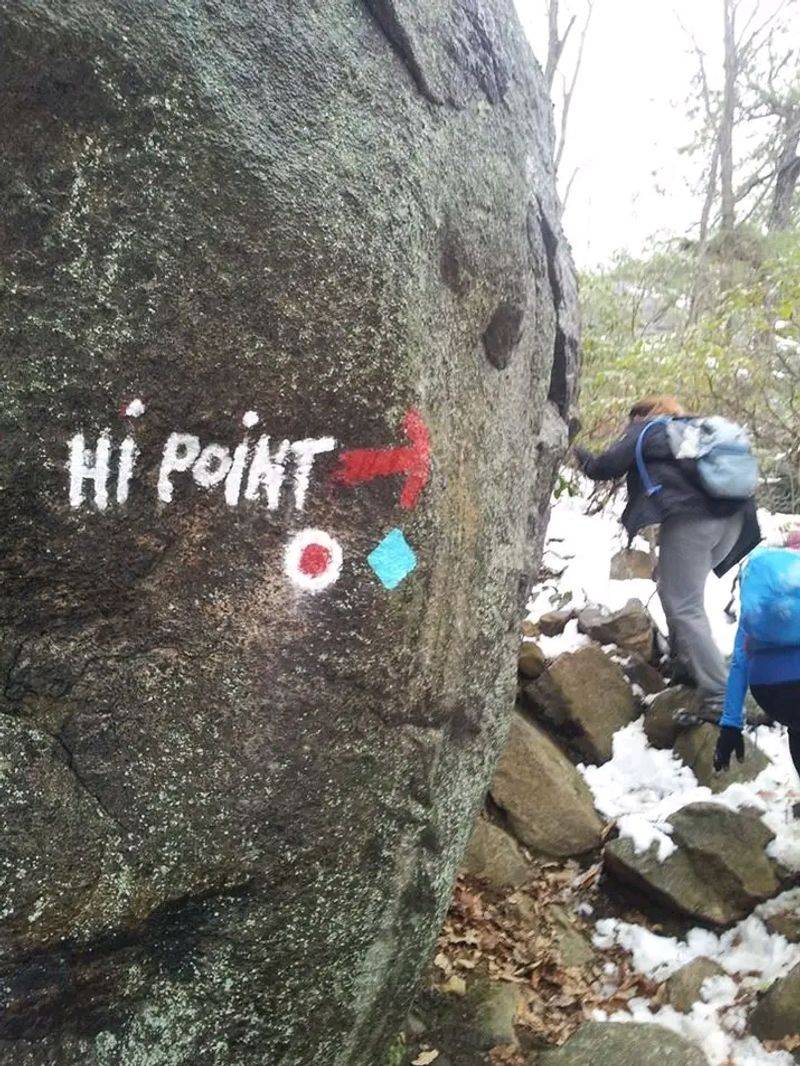
North Jersey gets wonderfully unruly in Norvin Green State Forest. Trails climb over rough ridges, dip through shaded hollows, and emerge onto viewpoints where reservoirs and rolling Highlands spread in several directions.
Wyanokie High Point is one of the forest’s best rewards, but reaching it requires attention and a willingness to work. The landscape has an untamed personality.
Much of the trail network follows old logging roads or volunteer-built footpaths across rocky terrain, and nearly every route seems determined to include one more climb than expected. From the higher ledges, hikers can look toward the Wanaque Reservoir, surrounding mountains, and, under clear conditions, the distant New York City skyline.
Trail markings in the southern portion of Norvin Green were significantly reorganized and reblazed in late 2025. The current High Point Loop is marked in purple, with a purple-and-black access spur beginning near the New Weis Center.
That change makes an updated map especially important; an old screenshot or faded guide may show blaze colors and connections that no longer match what is on the trees. Good boots, water, and extra time belong in the plan.
The forest’s many intersections can slow hikers who are not watching carefully, while wet rock adds difficulty after rain. This is not the smoothest or easiest overlook hike in New Jersey, which is precisely why it belongs here.
Wyanokie High Point feels discovered rather than delivered.
8. Forest View and Closter Dock Trail Loop – Palisades Interstate Park
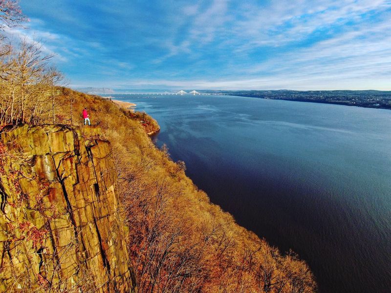
A few miles from some of the busiest roads in the country, sheer cliffs rise above the Hudson River and wooded trails drop toward an unexpectedly wild shoreline. That urban-wilderness contrast gives the Palisades their strange power.
Manhattan is close enough to feel present, yet the basalt walls, river views, and steep forest make the loop feel far removed from city life. Beginning near Alpine, the route follows part of the aqua-blazed Long Path along the top of the cliffs.
Spur paths lead toward viewpoints where the Hudson stretches north and south beneath the Palisades. The Forest View Trail then changes the perspective by descending toward river level, revealing the height of the cliffs from below.
The return climb on the Closter Dock Trail brings the elevation back quickly, so save some energy for the final push. The loop runs roughly five and a half miles and mixes broad paths with steep grades, stone steps, and potentially slippery sections.
It is a genuine workout rather than a scenic promenade. The riverfront also carries traces of the Palisades’ transportation and recreation history, adding another layer to the natural drama.
This route does not use the Giant Stairs, a separate Palisades section that closed after a major rockfall in January 2026. Conditions elsewhere in the park can also change, so checking current advisories before arriving is important.
Pack a map and expect your legs to notice every foot of the climb back to the cliffs.
9. Buttermilk Falls Trail – Delaware Water Gap National Recreation Area
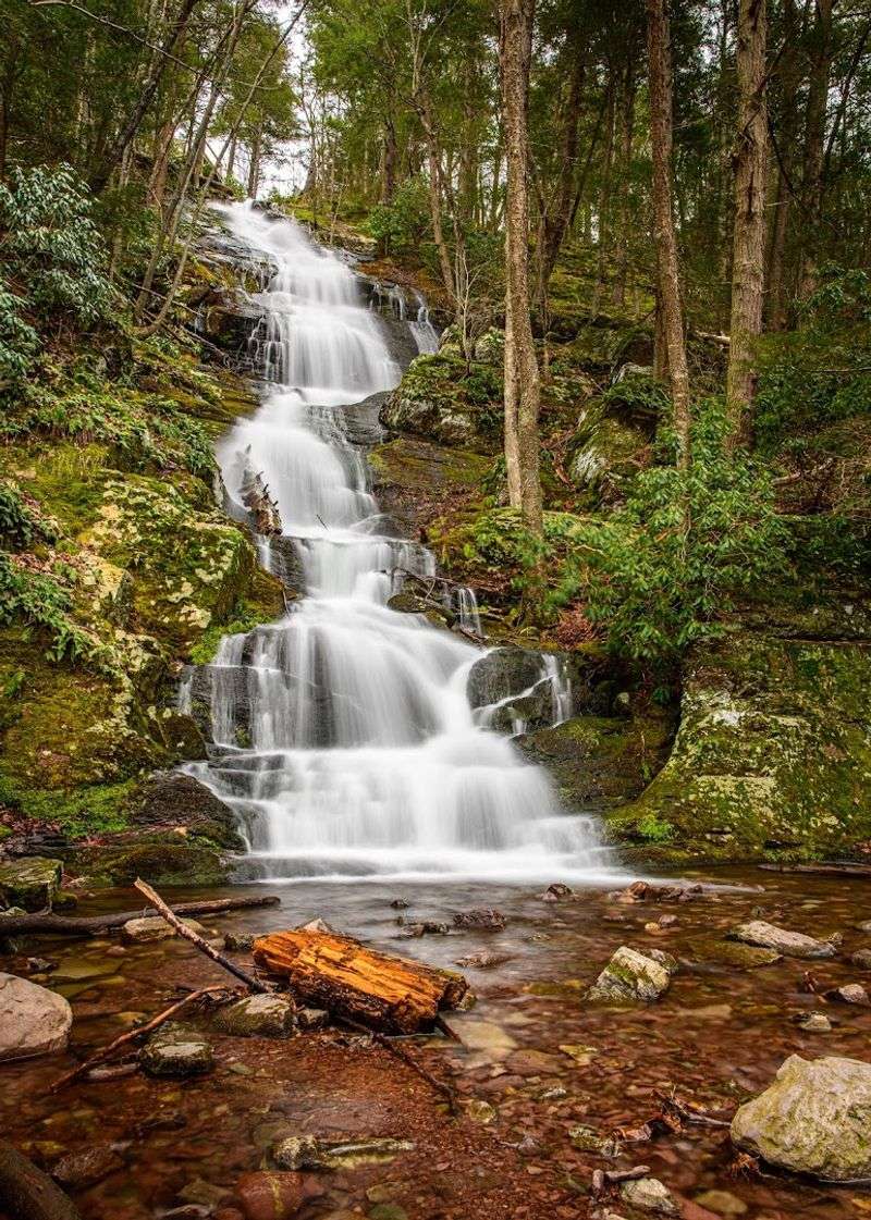
The waterfall appears almost directly beside the road, tumbling down a rocky face with a wooden staircase climbing alongside it. That immediate spectacle fools some visitors into thinking Buttermilk Falls is merely a quick roadside stop.
The trail above it has other plans. After reaching the top of one of New Jersey’s tallest waterfalls, the route continues steeply uphill toward the Appalachian Trail.
The climb passes through forest and gains enough elevation to open views over the valley. Hikers who keep going can connect with longer routes toward Crater Lake and Hemlock Pond, turning a waterfall visit into a substantial ridge adventure.
Even a shorter outing deserves care. Wooden steps can be slick, the hillside is steep, and the trail beyond the falls is much more demanding than the easy access to the base suggests.
Water flow also varies with rainfall, so the falls are generally at their most dramatic after wet weather—exactly when surrounding surfaces may be slippery. Access requires planning.
Mountain Road currently reaches the falls only from the Struble Road side in Stokes State Forest, and that approach is seasonally closed from December 15 through April 15. Remote roads in the area may also have limited service and unreliable reception, so download directions and park information beforehand.
The combination of a towering cascade, immediate vertical climb, and Appalachian ridge scenery gives this hike far more personality than its sweet-sounding name suggests.
10. Monument Trail – High Point State Park
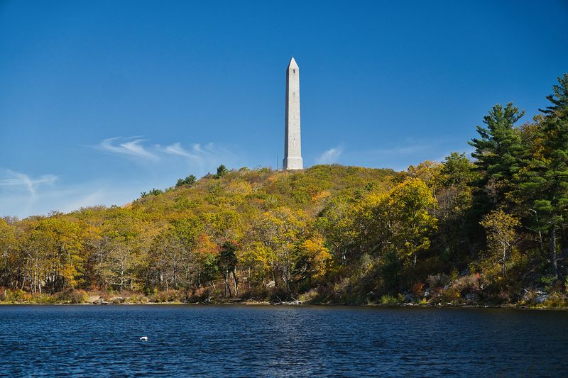
New Jersey’s highest landscape does not look particularly New Jersey-like. At 1,803 feet above sea level, the ridge around High Point Monument opens toward three states, with the long stone obelisk rising above forest, farmland, lakes, and distant mountains.
On a clear day, the panorama feels closer to New England than Sussex County. The Monument Trail turns the landmark into part of a complete hike rather than a quick drive-up photo.
The roughly 3.5-mile loop moves through woods and along the high ridge before reaching the monument area. Along the way, the terrain shifts between rocky trail, quieter forest, and open viewpoints where wind and weather can be noticeably stronger than at lower elevations.
The monument commemorates veterans of American wars and remains the unmistakable focal point of the park. Depending on seasonal operations, visitors may be able to access the interior, but the outside setting alone earns the trip.
Lake Marcia nearby provides another scenic stop and makes the area easy to turn into a relaxed half-day outing. This route is moderate rather than punishing, although roots, stones, and elevation changes require normal trail awareness.
Conditions can also differ sharply from towns below; fog, wind, ice, or lingering snow are possible when lower areas seem clear. Bring a layer, even when that feels overly cautious in the parking lot.
High Point’s great trick is making the top edge of New Jersey feel much farther north.
11. Hemlock Falls – South Mountain Reservation
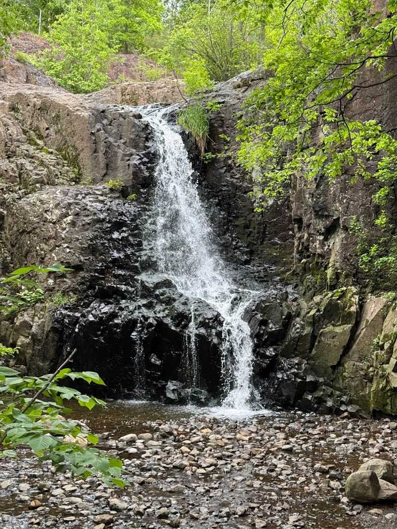
On the right day, you hear Hemlock Falls before you see it. Water drops roughly 25 feet through a wooded ravine, creating a surprisingly secluded scene inside one of Essex County’s busiest corners.
The fact that major roads, suburbs, and recreation attractions sit nearby only makes the waterfall feel more improbable. South Mountain Reservation covers more than 2,100 acres between the Watchung ridges, offering enough intersecting paths to create anything from a short waterfall walk to a longer loop through the forest.
Routes to the falls often use portions of the Lenape Trail and pass streams, footbridges, rocky slopes, and stands of tall trees. After rainfall, the cascade gains volume and drama; during dry stretches, it becomes quieter and more delicate.
This is a good choice for hikers who want visual payoff without a northern New Jersey mountain expedition. Families regularly make the trip, but rocky and muddy stretches still call for decent shoes.
The dense trail network can be confusing at junctions, so use a current reservation map rather than assuming every path eventually circles back to the same parking lot. Construction and maintenance occasionally affect individual parking areas and connecting attractions within the reservation.
Checking current access information before leaving can prevent an unnecessary detour. Once on the trail, though, Hemlock Falls offers a convincing little escape—proof that an otherworldly New Jersey hike does not always require driving to the state’s farthest corner.
12. Ken Lockwood Gorge – Lebanon Township
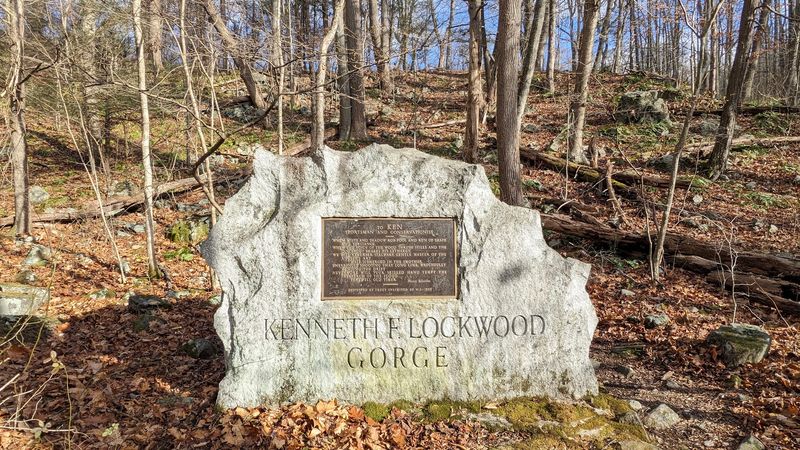
Some trails impress by climbing above the landscape. Ken Lockwood Gorge pulls hikers down into it.
The South Branch of the Raritan River rushes through a narrow, wooded corridor here, sliding over rocks and curling around enormous boulders while steep slopes rise on either side. The main route follows an unpaved road beside approximately two and a half miles of river.
It is less technically difficult than the mountain loops on this list, but the scenery has a ruggedness all its own. Mossy stone, evergreen shadows, churning water, and old-growth-feeling woodland create a setting that seems closer to a remote Appalachian stream than central Hunterdon County.
Spring brings energetic water, summer fills the gorge with deep green, and fall turns the river corridor into one of the state’s best color walks. Because the path is broad and the grade is generally manageable, visitors can choose their distance rather than committing to a fixed loop.
The road surface can be rough, muddy, or icy depending on conditions, and parking near access points is limited. Weekday mornings offer the best chance of finding the gorge at its quietest.
This is a wildlife management area rather than a traditional county park. Visitors should review current regulations and hunting schedules, and wearing blaze orange during hunting seasons is a smart precaution.
Treat the river carefully as well; fast current and slippery rocks are better admired from stable ground.
13. Franklin Parker Preserve Trails – Woodland and Tabernacle Townships
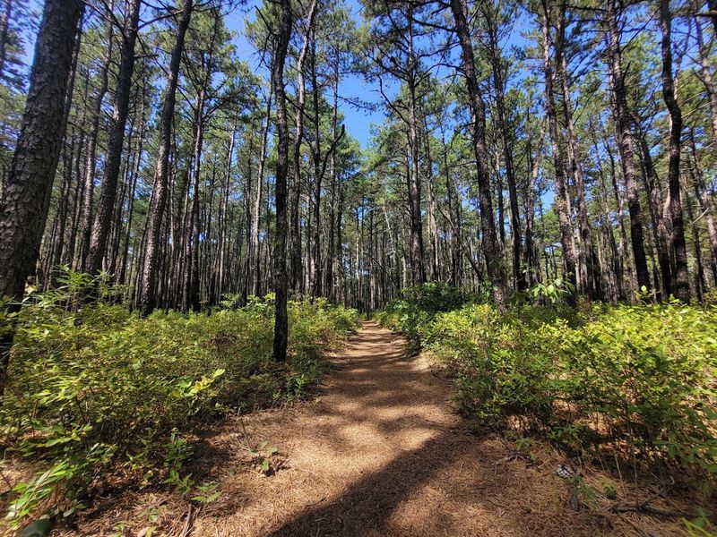
The Pine Barrens do not need mountains to feel wild. At Franklin Parker Preserve, sandy roads pass shallow lakes, restored wetlands, pitch pine forest, blueberry fields, and cedar swamps where the water turns the color of strong tea.
The horizon stays low and broad, creating a landscape that feels beautifully detached from the rest of the state. This 9,400-acre preserve occupies land once shaped heavily by cranberry farming.
Today, old agricultural features blend with restored habitat, giving hikers an unusual combination of natural scenery and visible human history. Dikes, reservoirs, bog edges, and straight sandy tracks create long views that are rare on New Jersey forest trails.
Wildlife sightings may include waterfowl, turtles, deer, and birds associated with Pine Barrens habitats. Four main marked routes total nearly 21 miles.
Options include the 3.25-mile White Trail, five-mile Yellow Trail, six-mile Sam Lambert Trail, and 6.5-mile Green Trail, while a section of the long-distance Batona Trail also crosses the preserve. The terrain is mostly flat, but soft sand makes distance feel more demanding than the elevation profile suggests.
Bring plenty of water, insect repellent, and a downloaded map. Shade can be inconsistent around open wetlands, and trail junctions may look deceptively similar.
After heavy rain, low areas can become wet, while summer brings ticks and enthusiastic mosquitoes. This is not a summit hike.
It is stranger and quieter than that—a walk into the spacious, tea-colored heart of South Jersey.