Tennessee is packed with stunning state parks where waterfalls tumble over cliffs, rivers carve through ancient gorges, and mountain trails wind through rugged backcountry. But that natural beauty comes with real risks that catch plenty of visitors off guard every year.
Flash floods, slick rocks, steep drop-offs, and rapidly changing weather can turn a perfect day into a serious emergency faster than you’d think. Knowing what you’re up against before you go can make all the difference between an unforgettable adventure and a dangerous situation.
1. Cummins Falls State Park
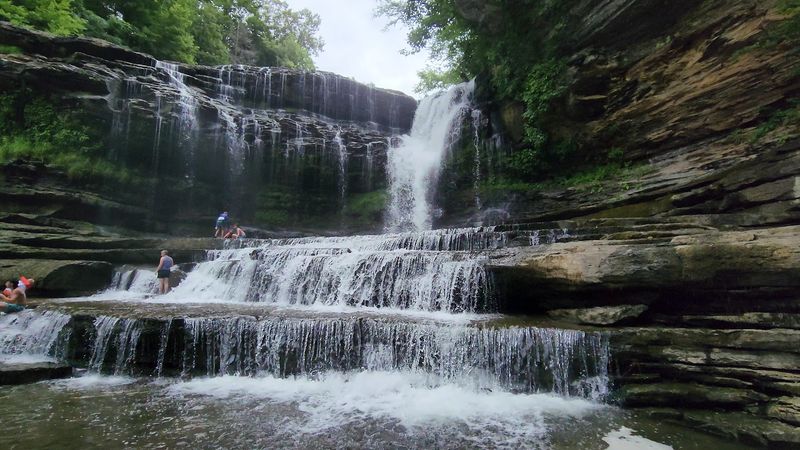
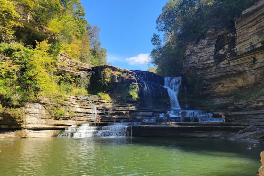
Cummins Falls draws crowds for good reason. The 75-foot waterfall plunging into a swimming hole surrounded by rock walls makes for one of the most photogenic spots in Middle Tennessee.
But that gorgeous gorge has a darker side that’s serious enough to require a special permit just to enter.
Flash flooding is the biggest threat here, and it happens faster than most people realize. A storm miles upstream can send a wall of water through the gorge while the sky overhead stays blue.
The currents turn vicious in minutes, sweeping swimmers off their feet and pinning them against boulders. Rangers have pulled countless people from the water over the years, and not everyone makes it out.
The hike down involves scrambling over wet rocks that stay slippery year-round. Moss, algae, and constant spray from the falls create surfaces as slick as ice. One wrong step can send you tumbling into the creek or crashing onto stone.
The gorge itself presents unique challenges. Steep walls limit escape routes if water rises suddenly.
Cell service is spotty at best, making it hard to check weather updates or call for help. The rocky terrain slows down rescue teams, so if something goes wrong, you might wait a while before anyone reaches you.
Tennessee State Parks started requiring Gorge Access Permits to manage crowds and make sure visitors understand the risks. Don’t skip reading the safety information when you register.
Check the weather forecast before you leave home, not just for the park but for areas upstream. Wear shoes with serious grip, never jump from the rocks, and keep an eye on the water level the entire time you’re down there.
If the current picks up or the water starts rising, get out immediately and head for higher ground.
2. Fall Creek Falls State Park
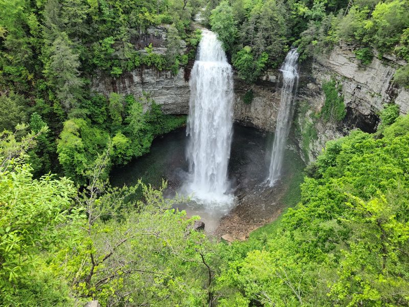
Fall Creek Falls drops 256 feet, making it one of the tallest waterfalls east of the Mississippi. The park’s collection of waterfalls, gorges, and overlooks creates scenery that belongs on postcards.
But those same dramatic features come with drop-offs that don’t forgive mistakes.
Sheer cliffs line the trails around the waterfalls, and the edges can crumble without warning. Sandstone and limestone erode constantly, so what looks like solid ground might give way under your weight.
Guardrails exist at popular overlooks, but plenty of spots have nothing between you and a fatal fall except your own good judgment.
The waterfall areas stay wet and slick throughout the year. Spray drifts across the rocks, moss grows thick, and leaves pile up on the trail creating a skating rink effect. People slip here all the time, and a fall near the edge of a gorge leaves no room for recovery.
Some trails involve steep descents with loose rocks and exposed roots. The climb back up tests your endurance, especially in summer heat. Plenty of hikers overestimate their fitness level and end up exhausted halfway through, which is when injuries happen.
The park’s size works against you in emergencies. With over 26,000 acres and miles of trails, rescue teams need time to reach remote areas. Getting a helicopter in can be tricky with all the tree cover.
Stick to marked trails even when they seem to take the long way around. The shortcuts people cut through the woods often lead straight to cliff edges.
Watch your footing constantly, especially on descents and anywhere near water. Bring more water than you think you’ll need because dehydration makes you clumsy and clouds your judgment. Tell someone your hiking plan before you head out, and don’t push yourself beyond your actual ability level just to see one more waterfall.
3. Rock Island State Park
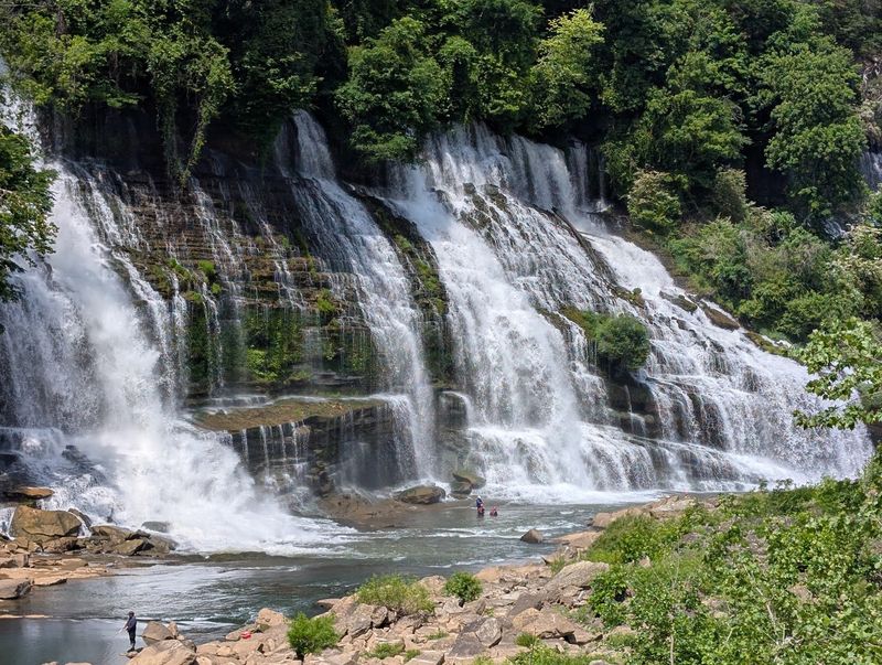
Rock Island sits where the Caney Fork River meets the Collins River, creating the spectacular Great Falls. The water looks inviting on a hot day, and plenty of people treat it like a regular swimming hole.
That assumption has cost lives.
The currents here are deceptively powerful. What appears calm on the surface often hides strong underwater flows that can pull swimmers under and hold them down.
The rivers converge with force, creating swirling currents and undertows that even strong swimmers struggle against. People get swept downstream before they realize they’re in trouble.
Water conditions change rapidly based on rainfall and dam releases upstream. The river can rise several feet in less than an hour, transforming lazy pools into raging torrents.
The color of the water offers clues, but by the time it turns muddy and fast, you’re already in danger if you’re still in it.
Rocks below the surface create additional hazards. Some are sharp enough to gash you open. Others form underwater caves and crevices that trap swimmers. The force of the current can pin you against boulders, making it impossible to break free.
Jumping from rocks is popular here, but the depth changes constantly as water levels shift. What was deep enough last week might be three feet shallower today.
Submerged logs and debris collect in areas that look clear from above.
The terrain around the falls gets slick from constant spray. Algae-covered rocks near the water’s edge offer zero traction. A slip here means going into fast-moving water in the worst possible spot.
Never enter the water without checking current conditions with park staff. Wear a life jacket even if you’re a confident swimmer, because confidence doesn’t beat physics.
Stay completely out of the water if levels are rising or if the current looks stronger than usual. Keep kids within arm’s reach at all times, and don’t let the beautiful scenery distract you from watching the water conditions.
4. Burgess Falls State Park
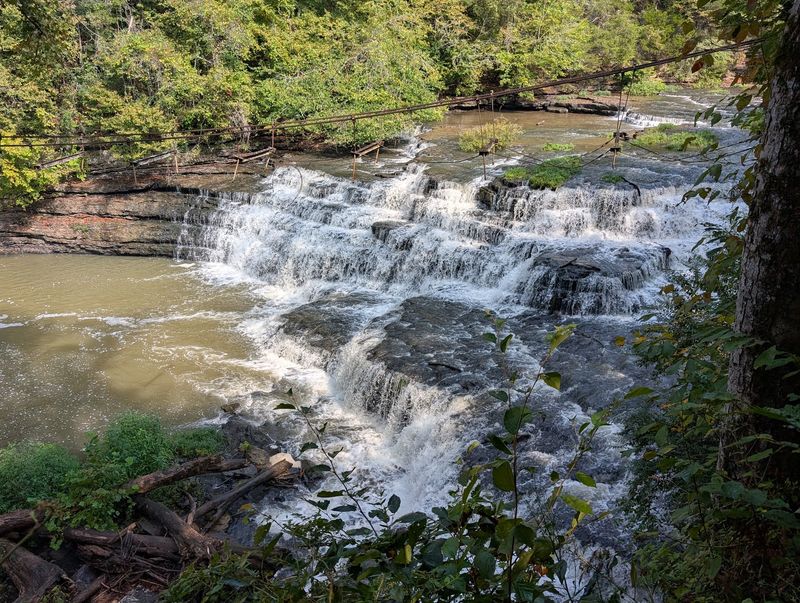
Burgess Falls features a series of four waterfalls, with the main cascade plunging 136 feet into a gorge. The trail to the base is relatively short, which gives people a false sense of security.
But those steep bluffs and wet rocks create plenty of chances for things to go sideways.
The overlook platforms offer stunning views, but they also sit right at the edge of serious drop-offs. Leaning over for a better photo or stepping off the platform for a different angle puts you on unstable ground above a fatal fall.
Every year, people ignore the barriers and end up in precarious positions that require rescue.
Rocks throughout the park stay perpetually wet from waterfall spray and creek mist. The moisture feeds thick moss and algae growth that turns every surface into a slip hazard. The closer you get to the waterfalls, the worse the footing becomes.
Strong currents flow above and below each waterfall. The creek looks manageable in spots, but the current can knock you off your feet and carry you toward the edge faster than you can react.
Once you’re in the water, stopping yourself before you go over becomes nearly impossible.
The trail down to the lower falls involves steep sections with loose gravel and exposed tree roots. Going down tests your balance, and coming back up exhausts people who aren’t prepared for the climb.
Fatigue leads to sloppy footing, which leads to falls.
Limited cell service in the gorge means calling for help isn’t guaranteed. The steep terrain slows rescue response times significantly. If you get hurt at the bottom, getting you out involves a complicated operation.
Take the trail slow and watch every step, especially on the descent. Don’t climb on wet rocks or try to get closer to the waterfalls than the designated viewing areas allow.
Keep children and pets under close control because they can slip away in seconds. If the rocks are wet, assume they’re slippery and plan your route accordingly.
Bring hiking boots with good tread instead of wearing sandals or smooth-soled shoes that can’t grip properly.
5. Savage Gulf State Park
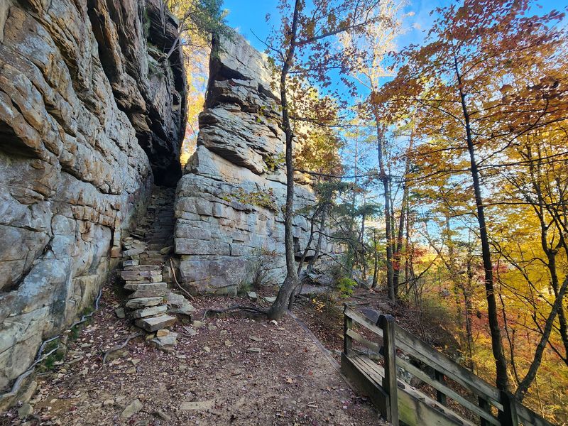
Savage Gulf sprawls across more than 15,000 acres of wild, rugged terrain cut by deep gorges and towering bluffs. This isn’t a park where you stroll for an hour and head home.
The trails here demand serious preparation, and the backcountry setting means help is far away if you need it.
The hikes are long and strenuous, with some loops covering over 15 miles through challenging terrain. Rocky paths, constant elevation changes, and primitive trail conditions wear people down faster than they expect.
Running out of energy miles from the trailhead with hours of hiking still ahead creates a dangerous situation.
Cliffs line many of the trails, and the edges aren’t always obvious until you’re right on top of them. Vegetation can hide drop-offs, especially in summer when everything grows thick.
Step off the trail to investigate something interesting, and you might find yourself teetering at the edge of a hundred-foot fall.
The rocky terrain twists ankles and batters knees relentlessly. Loose stones shift underfoot, and tree roots create natural tripwires across the path. One bad fall in a remote section means you might need to limp several miles before reaching help.
Cell service is nonexistent in most of the park. You can’t call for rescue, check GPS, or look up trail information once you’re deep in the backcountry. If you get lost or injured, you’re on your own until someone notices you’re missing and organizes a search.
Weather can change the difficulty level dramatically. Rain turns trails into slick mud runs and swells creeks that you need to cross.
Summer heat combines with strenuous climbs to cause heat exhaustion. Winter ice makes already tricky sections downright treacherous.
Bring detailed maps and know how to use them without cell service. Pack more water and food than you think you’ll need, plus a first aid kit and emergency supplies.
Tell someone exactly where you’re hiking and when you expect to return. Wear proper hiking boots and bring trekking poles for stability.
Don’t attempt the longer trails unless you’re genuinely in good shape and experienced with backcountry hiking. Turn back early if you’re getting tired rather than pushing through and risking injury miles from help.
6. Frozen Head State Park
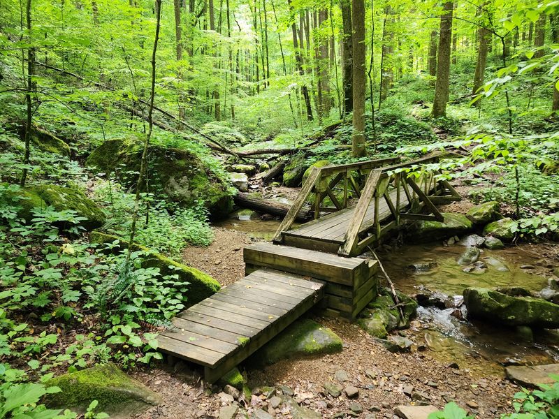
Frozen Head rises to over 3,300 feet in the Cumberland Mountains, offering some of the most remote and challenging hiking in Tennessee. The park’s backcountry trails climb relentlessly, and the mountain environment creates conditions that catch unprepared hikers completely off guard.
Elevation changes here are brutal. Some trails gain over 2,000 feet in just a few miles, pushing your cardiovascular system and leg muscles to their limits.
The climbs just keep coming, and the descents hammer your knees and test your balance on steep, rocky sections.
Mountain weather shifts without warning. You might start a hike in sunshine and hit fog, rain, and dropping temperatures before you reach the summit.
Conditions at the top can be radically different from the trailhead, with wind chill making it feel 20 degrees colder than the valley.
The remote nature of the trails means you’re truly on your own out there. Some routes see very few hikers, so you can’t count on running into someone if you need help. Cell service is unreliable at best, and rescue operations in this terrain take time to organize and execute.
Trail conditions vary wildly depending on the season. Spring brings slick mud and swollen creeks. Summer heat and humidity turn climbs into endurance tests that cause heat exhaustion. Fall leaves hide rocks and roots. Winter ice makes steep sections extremely dangerous, and snow can obscure the trail completely.
The length of some routes creates additional risk. Longer backcountry hikes mean you’re committed for hours, and turning back might take just as long as pushing forward.
Getting injured or exhausted halfway through a ten-mile loop leaves you with no easy options.
Check the weather forecast for the mountain, not just the general area, before you go. Dress in layers and pack rain gear even if the sky looks clear.
Bring a headlamp in case you’re out longer than planned. Make sure you’re physically ready for serious elevation gain, and don’t be too proud to turn around if the trail is beyond your ability.
Carry extra food and water, and let someone know your route and expected return time. Consider bringing trekking poles for the steep sections, and never hike alone in the backcountry if you can avoid it.
7. South Cumberland State Park
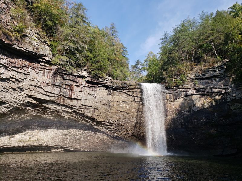
South Cumberland encompasses multiple natural areas spread across the Cumberland Plateau, featuring deep gorges, high bluffs, waterfalls, and some seriously strenuous trails. The wilderness areas here include terrain that Tennessee State Parks specifically labels as strenuous due to major elevation changes, and that’s not an exaggeration.
Rocky gorges cut through the landscape, creating dramatic scenery and equally dramatic hazards. Bluff edges line many trails, with sheer drops that offer no second chances.
Some overlooks have railings, but plenty of spots leave you responsible for staying back from crumbling edges.
The waterfalls attract crowds, but getting to them often involves challenging descents on steep, rocky trails. Roots and loose stones make footing tricky, and the climb back up tests your endurance.
Wet conditions turn these sections into slip-and-slide nightmares.
Isolated trail sections mean you might not see another person for hours. If you get hurt in one of these remote areas, you could wait a long time before someone comes along. Cell service is spotty throughout the park, making it hard to call for help even if you have reception at the trailhead.
The strenuous nature of many hikes catches people off guard. The elevation changes are relentless, with steep climbs followed by equally steep descents that destroy your knees.
People underestimate how much these trails will take out of them and end up exhausted miles from their car.
Creek crossings can become impassable after heavy rain. What was an easy hop across stones in the morning might be a dangerous ford by afternoon if storms roll through. Getting stuck on the wrong side of a swollen creek creates a serious problem.
Weather in the gorges can differ significantly from conditions at higher elevations. Temperature swings, sudden fog, and afternoon thunderstorms all change the game quickly.
Study trail descriptions carefully and choose routes that match your actual fitness level, not your aspirational one. Bring plenty of water because the climbs will drain you.
Wear boots with excellent traction and ankle support. Pack a map and compass as backup navigation tools.
Start early so you have daylight to spare if things take longer than expected. Watch your footing constantly, especially near bluff edges and on descents.
Don’t attempt creek crossings if the water is high or moving fast, and always have a bailout plan if conditions deteriorate.
8. North Chickamauga Creek Gorge State Park
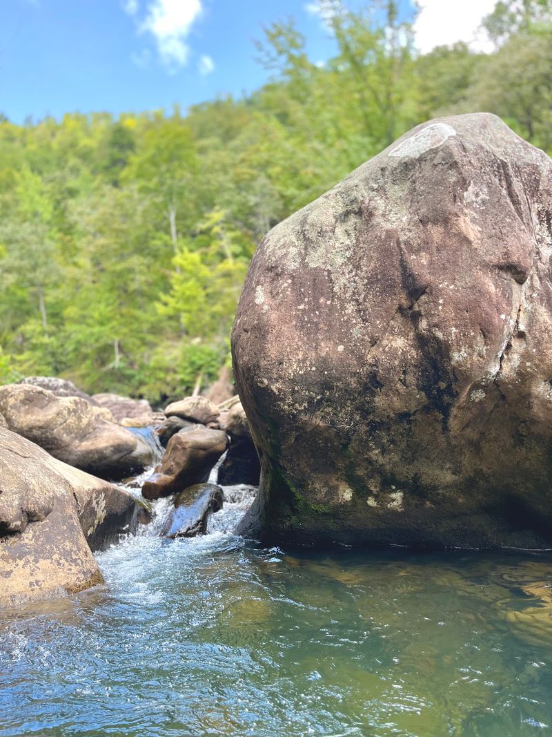
North Chickamauga Creek Gorge opened in 2024, making it one of Tennessee’s newest state parks. Don’t let that fool you into thinking it’s tame. This rugged gorge packs steep terrain, cliffs, creek crossings, and slippery rocks into a landscape where water conditions can change in a hurry.
The gorge setting creates natural hazards at every turn. Steep slopes rise on both sides of the creek, limiting escape routes if water rises suddenly.
The terrain channels runoff efficiently, so upstream rain translates to higher water levels fast.
Creek crossings are a major feature of trails here, and they range from simple stone-hops to potentially dangerous fords depending on recent rainfall. Water levels can spike quickly after storms, turning easy crossings into hazardous situations.
The current picks up speed in the narrow gorge, making it harder to keep your footing.
Slippery rocks are everywhere, both in the creek and along the banks. Algae, moss, and constant moisture create surfaces with zero grip.
Step confidently on the wrong rock, and you’ll find yourself flat on your back or sliding into the water.
Cliffs and steep drop-offs line sections of the gorge. Some trails run close to edges, and vegetation can obscure exactly where solid ground ends.
The rocky terrain makes falls especially dangerous because you’re hitting hard surfaces, not soft dirt.
Being a newer park means infrastructure is still developing. Trail markings might not be as comprehensive as older, more established parks.
Rescue protocols are in place, but emergency response in a new park might face challenges that more developed areas have already worked out.
The rugged nature of the gorge attracts adventurous types who sometimes take unnecessary risks. Rock scrambling, exploring off-trail, and pushing limits near the water all increase the danger level.
Check water conditions before you go, and don’t attempt creek crossings if the water is high or moving fast. Wear water shoes or boots that will grip wet rocks, not hiking sandals that slip off.
Bring trekking poles for stability during crossings. Stay on marked trails since you’re in relatively new territory where unofficial paths might lead to dead ends or dangerous spots.
Watch kids closely because the creek and rocks will draw them like magnets. If conditions look sketchy, don’t be stubborn about turning back.
9. Roan Mountain State Park
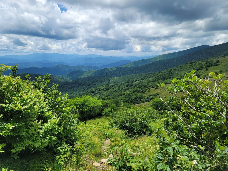
Roan Mountain straddles the Tennessee-North Carolina border at elevations over 6,000 feet, creating an environment where mountain weather rules everything. The high elevation and exposed ridges mean conditions can shift from pleasant to dangerous faster than you can hike back to safety.
Weather changes happen with startling speed up here. Clear skies can give way to fog, wind, rain, and plummeting temperatures in less than an hour.
The mountain creates its own weather patterns, and what’s happening in the valley bears little resemblance to conditions on the ridge.
Cold temperatures catch people off guard, especially outside of winter. Even summer days can turn chilly at elevation, and if you get wet from rain or creek crossings, hypothermia becomes a real risk. Spring and fall bring legitimate cold that can be dangerous if you’re not dressed properly.
Slick trails are common year-round. Rain, morning dew, and fog all contribute moisture that makes rocks and roots treacherous. Winter ice turns trails into skating rinks, and the elevation means ice can linger long after it’s melted at lower elevations.
The strenuous nature of many hikes combines with elevation to create serious physical challenges. Thin air at altitude makes climbs harder, and people who are fine at sea level might struggle with endurance up here.
Add in steep terrain and long distances, and you’ve got a recipe for exhaustion.
Exposed sections of trail offer no shelter from wind, rain, or lightning. When storms roll in, you’re stuck in them with nowhere to hide. Lightning is particularly dangerous on ridges and peaks where you’re the tallest object around.
The remote backcountry areas see few visitors, especially outside peak season. Getting hurt on an isolated trail means you might wait hours before anyone finds you.
Cell service is unreliable, and the terrain complicates rescue efforts.
Always pack layers, including warm clothing and rain gear, regardless of how nice it looks when you start. Check the mountain weather forecast specifically, not just the general area.
Bring extra food and water in case you’re out longer than planned. Start hikes early so you’re not caught on exposed ridges during afternoon thunderstorms.
Know your limits because the elevation will make everything harder. Turn back if weather deteriorates, and don’t push through just to finish a hike. Wear boots with good traction for slick conditions, and consider microspikes if there’s any chance of ice.
10. Reelfoot Lake State Park
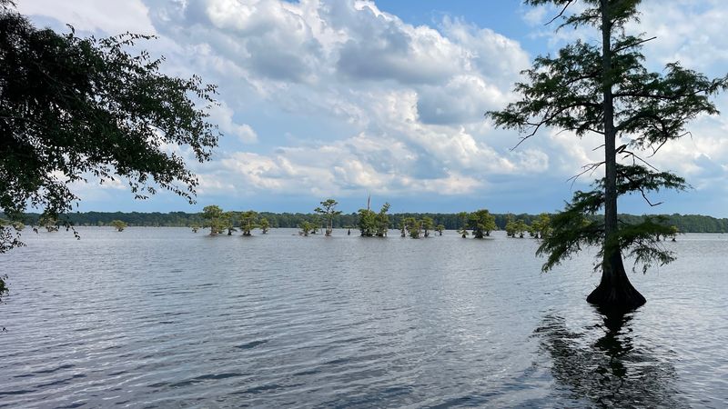
Reelfoot Lake sits in the northwest corner of Tennessee, formed by earthquakes in the early 1800s. Unlike the other parks on this list, the dangers here aren’t about cliffs and waterfalls.
Instead, open-water conditions, sudden weather, boating hazards, and wildlife create a different set of risks that are just as serious.
The lake covers about 15,000 acres of shallow water dotted with cypress trees and submerged stumps. That maze of obstacles creates major hazards for boaters.
Hit a stump at speed, and you can damage your boat, get thrown overboard, or worse. The stumps hide just below the surface in many areas, making them nearly impossible to spot until you’re on top of them.
Weather on the lake can change dramatically and quickly. The open water offers no protection from wind, which can whip up waves and make conditions dangerous for small boats.
Thunderstorms develop fast in this part of Tennessee, bringing lightning that’s especially dangerous when you’re on the water with no place to take cover.
The shallow depth might seem safer, but it creates its own problems. You can’t always swim to safety if you end up in the water, especially if you’re tangled in vegetation or disoriented. The murky water makes it hard to see hazards below the surface.
Wildlife encounters add another layer of risk. The lake is home to plenty of snakes, including venomous species like cottonmouths that swim well and sometimes climb into boats. Bald eagles, while beautiful, can be aggressive near nests.
Fishing from boats or the shore means you’re focused on the water and your line, not on your surroundings. People slip on wet docks, fall from boats, or step backward off banks while fighting a fish.
Boating accidents happen regularly, often involving inexperienced operators who don’t know the lake’s hazards. Alcohol and water make a dangerous combination that leads to poor decisions and slower reactions.
Wear a life jacket anytime you’re on the water, period. Learn the lake’s layout and hazard areas before you venture out, or hire a guide who knows where the stumps are.
Check the weather forecast and get off the water immediately if storms approach. Watch where you step on docks and banks.
Give wildlife plenty of space and never try to handle or feed animals. Boat at moderate speeds so you have time to react to submerged obstacles. Tell someone your plans and when you expect to return, especially if you’re heading to remote parts of the lake.
Share this story