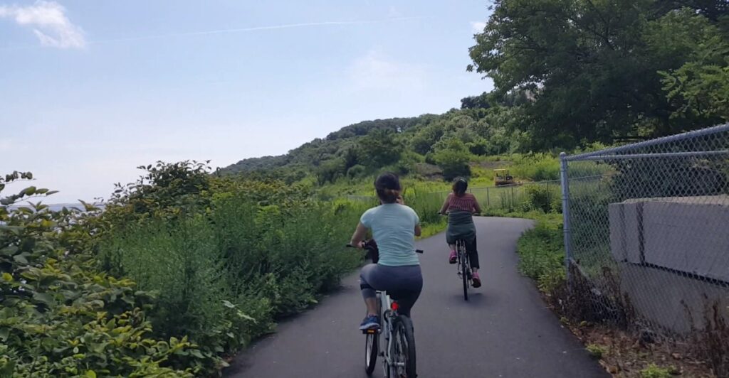
One minute, you are pedaling beneath Hoboken’s apartment towers; the next, the Empire State Building is floating across the Hudson like part of an oversized movie set. That sort of quick scenery change is what makes biking beside New Jersey’s waterways so rewarding.
The state has routes tracing busy harbors, quiet canals, rocky river gorges, salt marshes, and bays where the horizon seems to stretch forever. Some are smooth, forgiving paths made for an easy family outing.
Others mix pavement, crushed stone, dirt, bridges, and road riding into a proper daylong adventure. Along the way, riders can pass historic military batteries, Victorian towns, old railroad stations, waterfalls, working marinas, and enough waterfront picnic spots to justify packing more snacks than strictly necessary.
Whether you want Manhattan views without Manhattan traffic or a peaceful riverside ride through the countryside, these 11 New Jersey bike routes put the scenery right beside your handlebars.
1. Hudson River Waterfront Walkway – Bayonne to Fort Lee
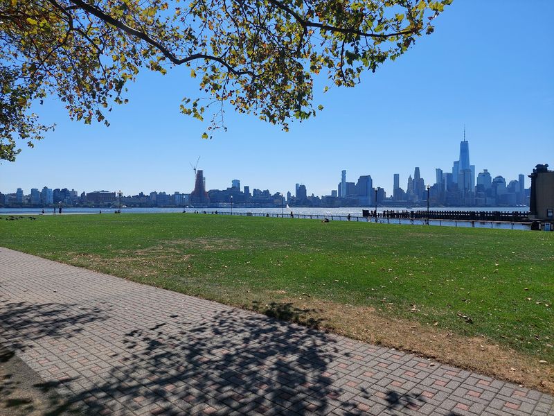
Few bike rides deliver a first impression quite like the stretch around Exchange Place, where Lower Manhattan rises almost directly across the Hudson.
One World Trade Center dominates the view, ferries cut white lines through the water, and the river breeze makes even an ordinary weekday ride feel like an event.
The wider Hudson River Waterfront Walkway extends for roughly 18.5 miles between Bayonne and the George Washington Bridge, though gaps and temporary detours mean cyclists should not expect one perfectly continuous trail.
The most satisfying riding is concentrated around Jersey City, Hoboken, Weehawken, and portions of North Bergen and Edgewater.
Start near Exchange Place or Liberty State Park, then head north past the Colgate Clock, Newport, Hoboken Terminal, Pier A Park, and the promenades along Sinatra Drive. The scenery keeps shifting from Lower Manhattan to Midtown, with the Empire State Building eventually taking center stage.
This is a shared urban walkway rather than a high-speed cycling track, so slow down near playgrounds, ferry terminals, restaurant patios, and crowded piers. Early mornings are wonderfully quiet, while evening rides come with illuminated towers reflected across the river.
PATH, light rail, and ferry connections make the route unusually accessible, and bike-share stations offer an easy option for anyone who does not want to haul a bicycle into Hudson County.
2. Liberty State Park Waterfront Loop – Jersey City
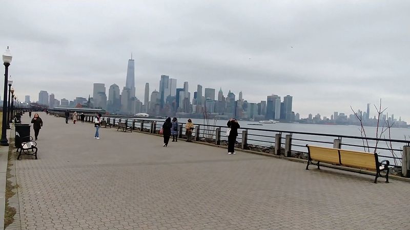
The Statue of Liberty appears close enough to study from the saddle on this flat, open ride through Jersey City’s biggest waterfront escape. A loop through Liberty State Park trades tight city streets for broad paths, grassy fields, tidal flats, and unobstructed views across New York Harbor.
Riders can link Freedom Way, Audrey Zapp Drive, and the waterfront promenade into a relaxed circuit, adding extra mileage by exploring the park’s interior roads or continuing north toward Exchange Place. The historic Central Railroad of New Jersey Terminal gives the ride a handsome centerpiece.
Millions of immigrants once passed through this station after arriving at Ellis Island, and its old train sheds still carry a powerful sense of departure and possibility.
Nearby, the Empty Sky memorial frames the former site of the Twin Towers, while the waterfront opens toward Ellis Island, the Statue of Liberty, and Lower Manhattan.
The terrain is almost entirely level, making this one of the easiest choices for families, newer cyclists, or anyone more interested in the view than a workout. Wind can be the real challenge, especially along exposed sections near the harbor.
Parking is available within the park, and arriving earlier on a weekend avoids the busiest picnic crowds. Bring a camera, but also bring patience—the temptation to stop at every overlook is strong.
3. Sandy Hook Multi-Use Path – Highlands
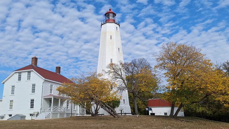
Salt marsh on one side, beach grass on the other, and old military buildings waiting near the end—Sandy Hook manages to pack several distinctly New Jersey landscapes into a seven-mile path.
Beginning near the entrance to the Sandy Hook unit of Gateway National Recreation Area, the flat multi-use route travels north through the slender peninsula before looping around Fort Hancock.
Riders pass beach access points, maritime forest, coastal wetlands, former gun batteries, and the red-roofed homes of Officers Row. The Sandy Hook Lighthouse, first lit in the 18th century, makes a natural turnaround stop, although curious cyclists can spend much longer wandering around the historic district.
On clear days, the northern end offers views across Lower New York Harbor toward the distant Manhattan skyline. This is not a ride that demands racing tires or heroic fitness.
The surface is paved and level, and a leisurely out-and-back leaves plenty of energy for exploring the fort or walking down to the bay. Summer brings heavier traffic and busy parking lots, so spring and fall are especially appealing.
Cyclists share the path with walkers, runners, skaters, children, and the occasional beachgoer carrying an ambitious amount of gear, making a moderate pace essential. Pack water and expect wind, particularly on the return journey.
If the breeze is behind you at the start, it may collect its payment later.
4. Henry Hudson Trail’s Bayshore Section – Aberdeen to Highlands
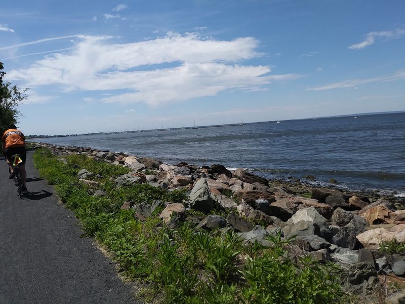
A former railroad corridor turns into a front-row seat for Sandy Hook Bay near the eastern end of the Henry Hudson Trail. The northern section begins around the Aberdeen and Keyport area, passes through wetlands and wooded communities, and eventually reaches the Atlantic Highlands waterfront.
Its most scenic payoff comes after the route resumes near the Atlantic Highlands Marina and follows the shoreline toward Popamora Point. Here, the trees open to reveal sailboats, working docks, the long curve of Sandy Hook, and New York City on the horizon.
Most of the trail is paved, relatively flat, and comfortably separated from traffic, although riders encounter road crossings, root bumps, and an on-road connection between certain segments. That changing character is part of the appeal.
One stretch feels like a shaded neighborhood greenway; another runs beside marshes filled with birds; the final bayside portion feels unmistakably coastal. Atlantic Highlands makes an excellent break, with places to grab coffee or lunch close to the marina.
Stronger riders can connect the route with Sandy Hook for a much longer outing, creating a day that combines rail-trail cruising with harbor and ocean scenery. Check current detours before leaving, as construction can affect parts of the northern trail.
For the best balance of comfortable temperatures and clear views, ride on a crisp spring or fall morning when the bay is bright and the summer crowds have thinned.
5. Delaware and Raritan Canal Towpath – Trenton to New Brunswick
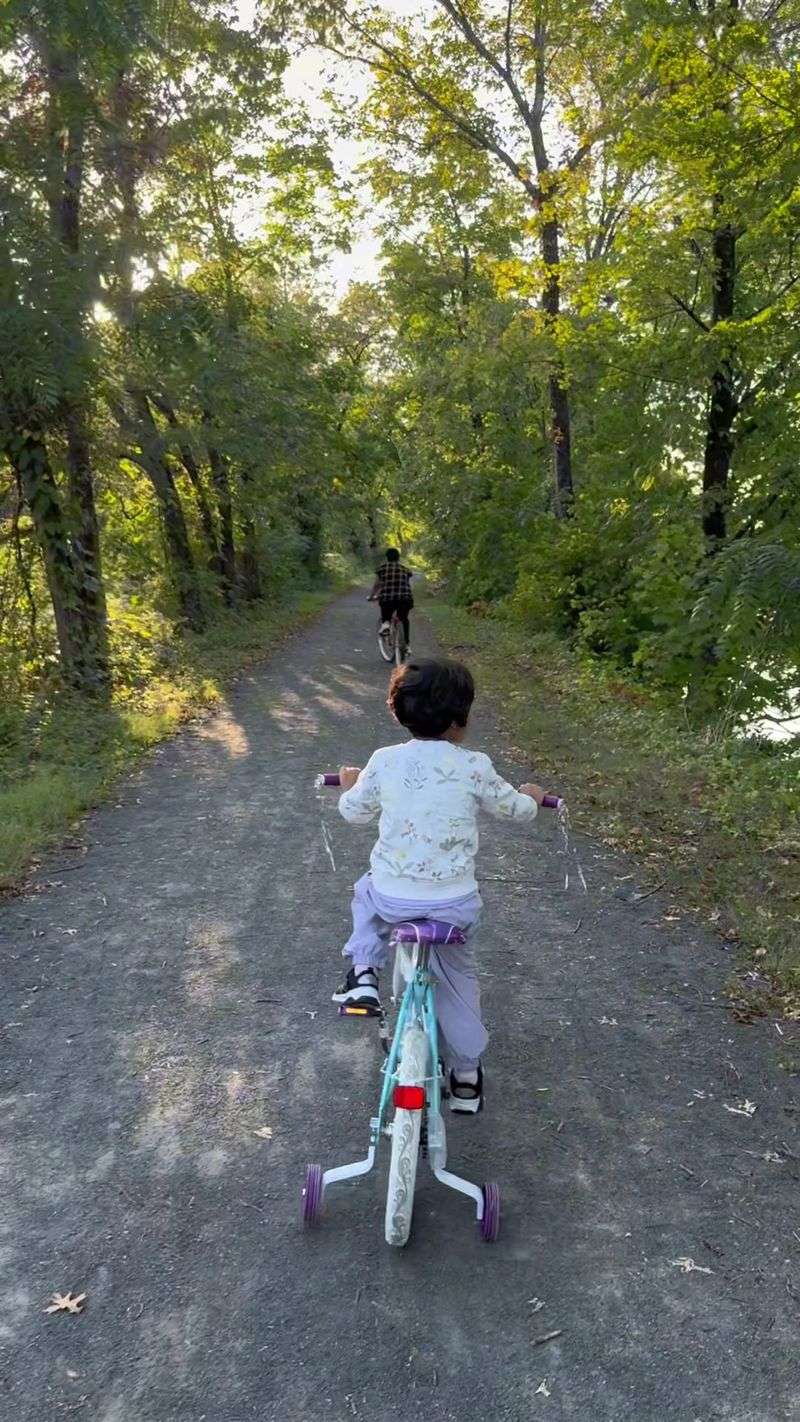
Old lockkeeper houses, stone culverts, and a narrow ribbon of canal water accompany riders for mile after mile on this historic route.
The Delaware and Raritan Canal State Park contains roughly 60 miles of paths, giving cyclists plenty of freedom to build anything from a short afternoon outing to an ambitious full-day ride.
The main canal connects Trenton and New Brunswick, while the feeder canal follows the Delaware River north through Lambertville, Stockton, Bulls Island, and toward Frenchtown. For the strongest combination of water views and appealing stops, the Delaware-side section is hard to beat.
The towpath’s compacted surface is generally comfortable, but wider tires handle loose grit, puddles, and rougher patches better than narrow road-bike tires. Lambertville makes a convenient starting point, with food, restrooms, and shops close to the trail.
From there, riders can head north past quiet river scenery, historic properties, and small communities where stopping for lunch does not require a complicated detour. The route is mostly level because canal boats were not fond of hills, a piece of 19th-century engineering that modern cyclists can appreciate.
Road crossings and a few exposed edges require attention, and rain can leave muddy sections behind. Still, the combination of easy grades, deep shade, wildlife, and constant reminders of the canal’s industrial past makes this one of New Jersey’s most satisfying waterside rides.
6. Delaware River Heritage Trail – Camden to Trenton
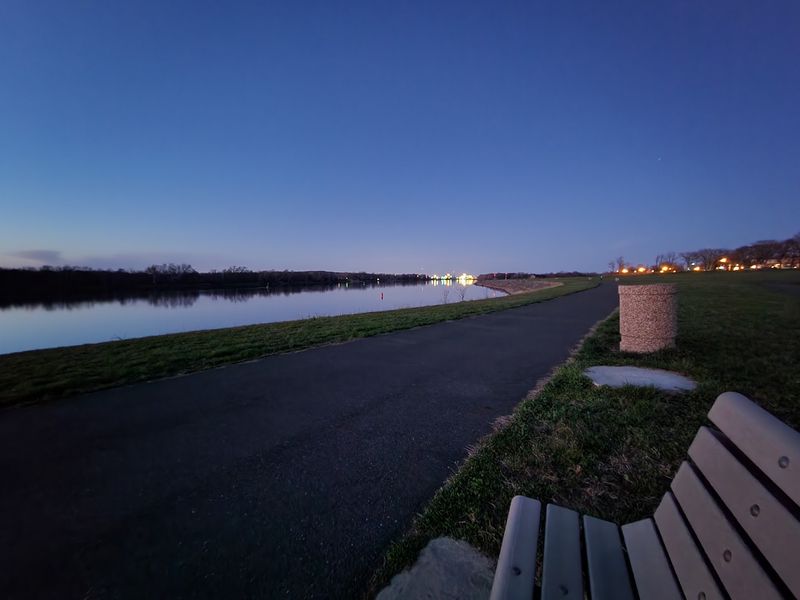
Philadelphia’s skyline looks especially good when seen from the quieter side of the Delaware.
In Camden, sections of the Delaware River Heritage Trail carry riders along the waterfront near Wiggins Park, the marina, and the towering Battleship New Jersey, with the city’s office towers and bridges spread across the water.
The Ben Franklin Bridge provides the most dramatic landmark, its blue suspension structure appearing from changing angles as the route moves along the river.
Despite the Camden-to-Trenton vision associated with the trail, this is still a developing network of completed paths, park routes, and on-road connections rather than one uninterrupted traffic-free ride.
That makes it best approached in manageable sections. A Camden waterfront outing is the easiest choice for skyline seekers, while farther north, riders can explore riverfront segments in communities such as Burlington and Bordentown.
The scenery gradually changes from urban harbor views to marshes, historic neighborhoods, and quieter stretches of the Delaware. Experienced cyclists can plan a longer route using existing connections, but casual riders should select a completed segment and enjoy it as an out-and-back.
Camden’s waterfront attractions make natural stopping points, and the nearby bridge path can extend the adventure into Philadelphia for riders comfortable with the climb. Conditions and connections continue to evolve, so checking the latest route map is wise.
Think of this trail as a growing collection of river experiences rather than a single finished line.
7. Cooper River Park Loop – Pennsauken and Collingswood
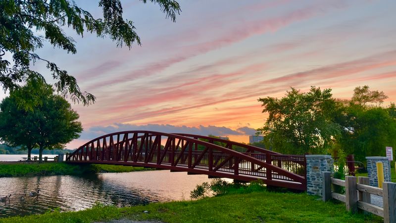
Rowers slice through the water while cyclists trace the shoreline around one of Camden County’s busiest recreation spaces. The paved loop at Cooper River Park runs for just under four miles, making it an easy choice for a quick ride, several training laps, or a low-pressure outing with children.
The route circles a long, narrow stretch of the Cooper River between Pennsauken, Collingswood, and Cherry Hill, passing athletic fields, boathouses, playgrounds, picnic areas, and open lawns.
Because the park hosts competitive rowing events, there is often something happening on the water beyond the usual parade of ducks and geese.
Views open across the river for much of the loop, with bridges and distant buildings adding an urban edge without overwhelming the greenery. This is not the place for an uninterrupted high-speed run on a busy Saturday.
Walkers, runners, strollers, and dogs all share the path, and activity increases around playgrounds and event areas. Go early in the morning for clearer pavement and calmer water, or arrive near sunset when the river catches the changing light.
Parking areas are distributed around the park, making it simple to begin from several points. Riders who want more distance can connect surrounding streets or repeat the loop, while everyone else can finish with a picnic beside the water.
Sometimes a memorable bike ride does not need to be complicated—or particularly long.
8. Columbia Trail – High Bridge to Bartley
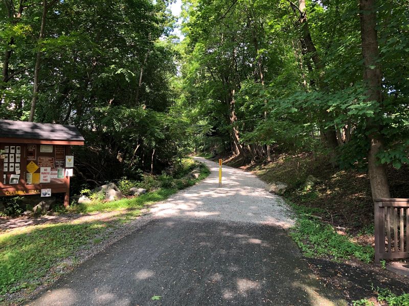
Just beyond High Bridge, the Columbia Trail settles into the woods beside the South Branch of the Raritan River and seems to leave modern traffic behind.
The 15-mile rail trail stretches north toward the Bartley Road area near Mount Olive, following a former railroad bed through High Bridge, Califon, and Long Valley.
Its crushed-stone surface and gentle grade make it approachable, although a hybrid, gravel, or mountain bike is more comfortable than a skinny-tire road bike. River glimpses appear throughout the route, but the most memorable option is the southern alternative through Ken Lockwood Gorge.
This detour follows River Road beside tumbling water, boulders, hemlocks, and steep wooded slopes, with part of the road closed to motor vehicles. It creates a loop between High Bridge and Califon that feels wilder than its mileage suggests.
Back on the main trail, riders cross old bridges, pass the restored Califon station, and roll through countryside that shifts between forest, farms, and small-town backyards. High Bridge’s Commons Park is a convenient starting point, while Califon offers a natural pause for refreshments.
The trail can become soft or muddy after heavy rain, and occasional gravel sections reward wider tires.
Ride the full length for a substantial outing, or concentrate on the High Bridge-to-Califon portion for the best mix of river scenery, railroad history, and places to stop without committing the entire day.
9. Paulinskill Valley Trail – Knowlton Township to Sparta
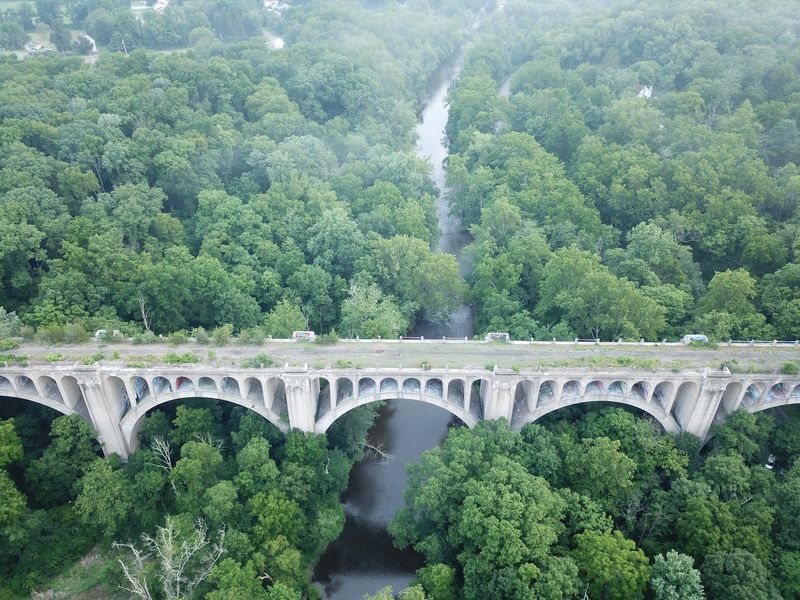
The remains of the Paulins Kill Viaduct suddenly rise above the trees like something borrowed from an ancient empire.
Built of reinforced concrete in the early 20th century, the enormous railroad structure provides the visual high point of the Paulinskill Valley Trail, a 27-mile route across rural Sussex and Warren counties.
The trail follows another former rail corridor, paralleling the Paulins Kill through farmland, forest, wetlands, and small communities including Blairstown and Lafayette.
Water views vary along the route—sometimes the river runs close beside the trail, while elsewhere trees and fields fill the space between—but the quiet valley setting remains consistent.
Surfaces range from packed cinders and dirt to grassier or rougher stretches, so this is better suited to hybrid, gravel, or mountain bikes than delicate road tires. Horseback riders also use the trail, and riders should slow down, announce themselves, and give horses ample room.
Blairstown works well as a base for a shorter out-and-back, with food and town amenities nearby. Those seeking the viaduct should plan their starting point carefully rather than assuming it will appear immediately.
The trail’s length makes it tempting to tackle everything at once, but conditions can slow progress more than expected, especially after rain. Take a measured pace, watch for muddy patches, and enjoy a side of New Jersey where old rail history and river country still fit together beautifully.
10. Lamington River Valley Ride – Pottersville to Lamington
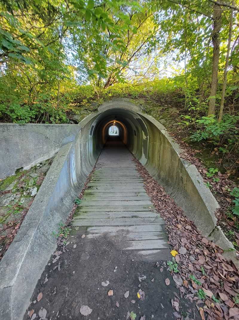
Black River Road curls beside the Lamington River beneath a canopy that can make midday feel like early evening.
This 16-mile road route links the Pottersville, Oldwick, and Lamington areas, showing off a gentler side of Hunterdon and Somerset counties through horse country, wooded riverbanks, old homes, and narrow country lanes.
Unlike the state’s rail trails and waterfront promenades, this ride takes place on public roads. Cyclists need to be comfortable riding with traffic, handling intersections, and navigating without frequent trail markers.
The reward is a route with relatively modest hills and long stretches where the river, stone walls, farms, and overhanging trees create an almost hidden-valley feeling. Black River Road provides the signature scenery as it follows the water near the boundary of several counties.
Pottersville adds historic character, while the broader loop passes close to countryside that feels surprisingly remote considering Interstate 78 is only a few miles away.
Road conditions and traffic volumes can change, so quieter weekend mornings are preferable, and bright clothing is a smart choice under the dense shade.
There are fewer convenient services directly along the route than on an urban greenway, making it worth carrying water, a snack, and basic repair supplies. This is a ride for cyclists who enjoy the rhythm of a country road: river on the shoulder, barns beyond the trees, and no need to rush the next curve.
11. Cape May Shoreline Ride – Cape May and Lower Township
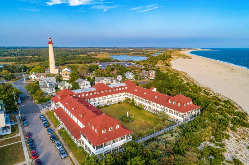
Cape May Point begins this ride with a lighthouse, a broad sweep of ocean, and the strange pleasure of standing where the Atlantic meets Delaware Bay. From there, the Cape May Shoreline Ride turns into a substantial tour of the county’s coastal personality.
The full route travels through bayside communities, wetlands, Cape May Court House, Stone Harbor, the Wildwoods, and Cape May before returning to the lighthouse area.
Along the way, cyclists pass the Cape May–Lewes Ferry terminal, cross tidal waterways, skirt back-bay marshes, and ride through streets lined with Victorian architecture.
The terrain is remarkably flat, with wind providing most of the resistance. That can be a minor nuisance or a full workout depending on the day, particularly on exposed bridges and roads beside open marshland.
This is largely an on-road ride, so it suits experienced cyclists who are comfortable with traffic, navigation, and a longer distance. Riders who prefer something gentler can sample a shorter section around Cape May Point, Sunset Beach, the canal, and Cape May City.
Starting near the lighthouse provides parking and an unmistakable landmark for the return. Early fall is arguably the sweet spot: summer traffic eases, the air remains pleasant, and migrating birds add movement above the marshes.
Between harbor boats, ferry traffic, lighthouses, and saltwater views, this route delivers a fittingly big finish to the list.
Share this story