The puddle is only a few steps wide. Walking around it feels harmless, especially when you’re trying to keep your socks dry.
But as more hikers make the same choice, the path grows wider, and the plants along its edge lose ground.
It’s a small example of what happens when a beautiful place becomes everyone’s weekend plan. Trailheads fill early.
Shortcuts flatten fragile meadows. At some destinations, getting an overnight permit means entering a lottery, with more hopeful campers than available spots.
I understand the pull. A lake tucked into the mountains can make an early alarm and a long climb feel entirely reasonable.
Wanting to see it for yourself is easy to relate to.
The harder part is noticing what our visits leave behind. Some damage can take years to repair, long after the photographs have been shared and the boots put away.
Looking closely at that wear gives us something useful to work with. From the route across a meadow to the few steps beside a puddle, ordinary decisions help shape what the next hiker finds.
1. Skyline Trail
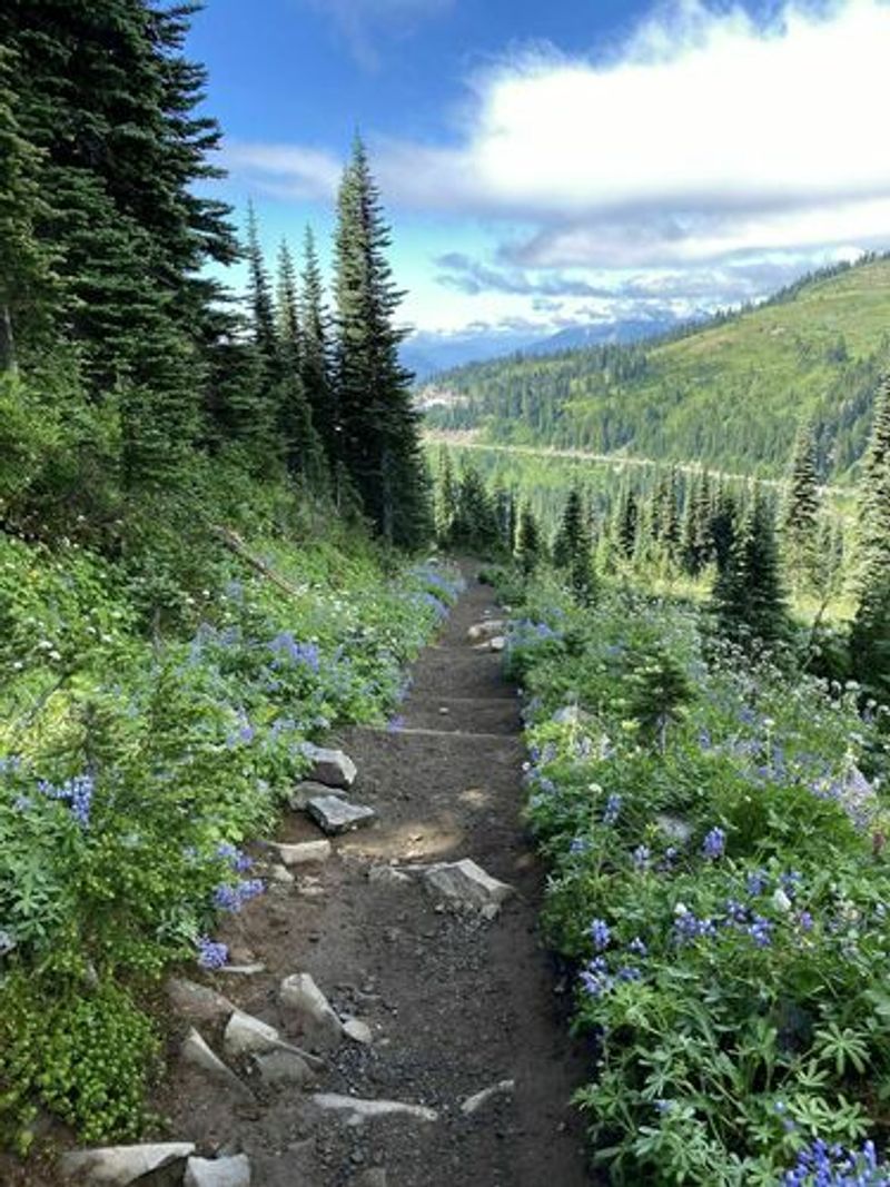
Mount Rainier’s Paradise area has wildflower meadows so pretty they almost look fake. Sadly, those meadows are also some of the easiest places on the mountain to damage.
The Skyline Trail loops above the Henry M. Jackson Memorial Visitor Center.
It climbs through subalpine meadows with huge views of the volcano.
Here’s the problem. When hikers step off the path for a better photo, their boots crush plants that have a very short growing season.
Subalpine plants spend much of the year under snow. That leaves only a small window each summer to grow, bloom, and recover.
One trampled patch can turn into bare dirt. Then rain washes the soil away, and the scar spreads.
The National Park Service asks visitors to stay on trails at Paradise for this exact reason. You’ll see signs reminding you, and they aren’t just there for decoration.
Park crews have spent years restoring damaged meadows in this area. That work takes patience, because new plants grow slowly at this elevation.
So how can you help? Stick to the marked path, even when it’s muddy or snowy.
If you need a break, find a rock or a wide spot on the trail. Your snack tastes the same there, and the meadow stays healthy.
Group photos work best on paved or rocky sections too. You can still get Rainier in the background without flattening a single flower.
Another tip is timing. Summer weekends are packed, so a weekday visit often feels calmer and puts less strain on busy sections.
Think of the meadow like a library book. You can enjoy it fully, but you hand it back in good shape for the next reader.
Address: Henry M. Jackson Memorial Visitor Center, Paradise Rd E, Ashford, WA 98304
2. The Enchantments
Getting a permit here can feel harder than winning concert tickets. The Enchantments use a lottery for overnight trips during the main season.
The U.S. Forest Service manages this area in the Alpine Lakes Wilderness near Leavenworth.
Limits exist because too many campers once harmed the lakes, soil, and plants.
Day hikers don’t need that lottery permit. That has created a new trend: people trying to cross the whole area in one very long day.
The through-hike covers roughly 18 to 20 miles with big elevation gain. Lots of extra feet on fragile granite basins add up fast.
Thin soil is the big concern. Alpine plants grow in tiny pockets between rocks, and a careless step can wipe them out.
Human waste is another challenge here. The Forest Service gives clear rules about packing out toilet paper and using the designated toilets where available.
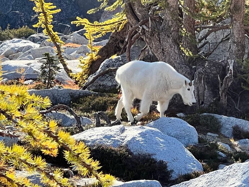
Mountain goats live in this area too. They are drawn to salt from human sweat and urine, which can make them bold around people.
Keep a respectful distance from goats. Never feed them, and don’t let them get comfortable near your gear.
If you plan a one-day push, be honest about your fitness. Rescues on long routes put stress on volunteers and pull resources from other emergencies.
Walk on rock or established trail whenever possible. Granite slabs can handle your boots far better than the green stuff can.
Not lucky in the lottery? Washington has many other alpine trails that need less planning and see fewer crowds.
Address: Snow Lakes Trailhead, Icicle Rd, Leavenworth, WA 98826
3. Mount Si
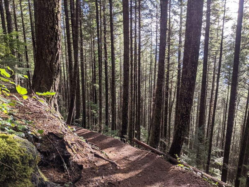
Mount Si is basically the neighborhood gym for Seattle-area hikers. Lots of people train here, and the trail feels it.
The route climbs about 3,150 feet in roughly four miles to the top area. That steady grade makes it popular for anyone getting in shape for bigger peaks.
Heavy use brings a few specific problems. One of the biggest is people cutting switchbacks to save a few steps.
Switchbacks exist to slow down water as well as hikers. When you cut straight downhill, you create a channel for rain to rush through.
That rushing water carries soil away. Over time, roots get exposed and new gullies form.
Parking is the other headache. Crowded trailhead lots mean cars spill onto roadsides, which can cause safety issues for drivers and walkers.
The Washington Department of Natural Resources manages the Mount Si Natural Resources Conservation Area. A Discover Pass is needed to park at the trailhead.
So what’s a smart move? Try going early on a weekday, or carpool with friends.
Stay on the switchbacks even if your legs are begging you to shortcut. Your knees may actually thank you on the way down.
Hiking poles help on the descent. They take pressure off your joints and help you stay steady on the rocky tread.
And if the lot is full, have a backup plan. North Bend has other trails nearby, and a quieter one might surprise you.
Address: Mount Si Trailhead, SE Mount Si Rd, North Bend, WA 98045
4. Rattlesnake Ledge
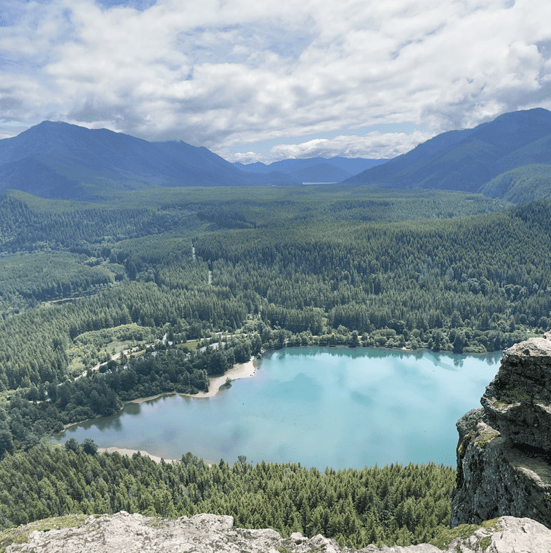
That famous photo of a lake far below a rocky ledge? Plenty of people want it, and the trail shows the wear.
Rattlesnake Ledge sits above Rattlesnake Lake in the Cedar River Watershed area. The hike is about four miles round trip with a solid climb.
Short and scenic is a powerful mix. It draws beginners, families, and visitors who only have a free morning.
Mud is the sneaky culprit here. When a trail gets soggy, people step to the edges to keep their shoes clean.
That small sidestep widens the path. Repeat it thousands of times, and a narrow trail turns into a wide muddy strip.
The fix sounds gross but works. Walk straight through the mud, and wear shoes you don’t mind getting dirty.
Waterproof boots or gaiters make this much easier. Suddenly puddles stop being a crisis.
The ledge itself deserves respect too. The rock drops off steeply, and the area has seen falls and rescues over the years.
Hang back from the edge for your photo. The lake looks just as stunning from a safe spot.
Crowds peak on sunny weekends. Arriving early helps you avoid the busiest hours and reduces crowding at the ledge.
Bring a bag for your trash, including fruit peels. Orange peels may seem natural, but they break down slowly and attract animals.
Address: Rattlesnake Lake Recreation Area, Cedar Falls Rd SE, North Bend, WA 98045
5. Lake Serene
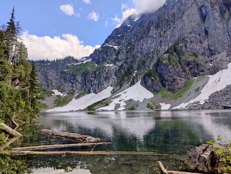
Few hikes pay off quite like a lake sitting under a giant granite wall. That’s exactly why so many people head to Lake Serene.
The trail starts off US Highway 2 near Gold Bar. It also offers a side trip to Bridal Veil Falls, which adds to its appeal.
The round trip is around eight miles with plenty of stairs near the top. Those stairs help protect the slope, but crowds still take a toll.
Litter is a common complaint at busy lakes. Snack wrappers, bottle caps, and tissues tend to collect around popular rest spots.
Human waste creates an even bigger issue. Near a lake, it can wash into the water and affect wildlife and other visitors.
Here’s a simple rule to remember. Pack out what you pack in, and plan your bathroom breaks around toilets when they’re available.
If toilets aren’t available, bury solid waste in a hole 6 to 8 inches deep, at least 200 feet from water, campsites, and trails. Cover the hole afterward and pack out your toilet paper.
Those guidelines come from Leave No Trace. They sound fussy until you picture the lake you just hiked to see.
Shoreline plants can also get trampled, leaving soil exposed. Stick to bare rock or durable spots when you sit down to eat.
A Northwest Forest Pass is needed to park at this trailhead. Check road and trail conditions before you go, since weather here can shift fast.
Leave the lake a little cleaner than you found it. Picking up one stray wrapper is a tiny gift to the next hiker.
Address: Lake Serene Trailhead, Mount Index Rd, Gold Bar, WA 98251
6. Hoh Rain Forest
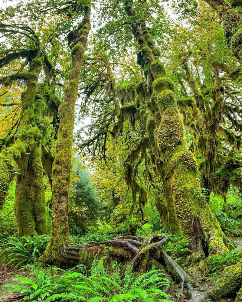
Moss drapes the trees here like shaggy green sweaters. The Hoh Rain Forest feels like a storybook, and it’s one of the wettest spots in the lower 48.
Located in Olympic National Park, the Hoh gets around 140 inches of rain a year. That moisture feeds giant trees, ferns, and thick moss carpets.
The Hall of Mosses and Spruce Nature Trail are short loops near the visitor center. Their easy access makes them very popular.
Popularity brings long entrance lines in summer. The single road in can back up, especially on busy weekends.
Moss is the quiet victim. People touch it, pull it, or step on it for a closer look.
Moss grows slowly and is easy to tear. Once ripped off a log or branch, it may take years to return.
Look closely, but keep your hands to yourself. A zoomed-in photo captures plenty of detail without harming anything.
Pets are another rule worth knowing. Olympic National Park doesn’t allow pets on most trails, including those in the Hoh.
That rule protects wildlife like elk, which roam this forest. Leaving your dog home keeps animals calmer and the ecosystem healthier.
Heading out early or late in the day can help. You’ll likely face a shorter line and a quieter forest.
Stay on the path, even if a mossy log looks tempting to explore. The forest has done fine for centuries without our boot prints.
Address: Hoh Rain Forest Visitor Center, 18113 Upper Hoh Rd, Forks, WA 98331
7. Palouse Falls State Park
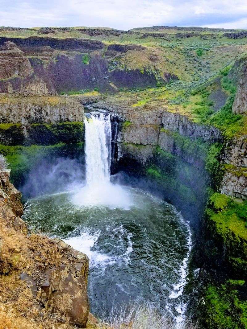
A waterfall dropping about 200 feet into a basalt canyon is bound to attract a crowd. Palouse Falls became Washington’s official state waterfall in 2014.
The park sits in the dry hills of southeastern Washington. Its dramatic canyon was carved by the massive Ice Age floods.
Fame came with a downside. Unofficial paths leading down to the river and the top of the falls spread across the steep slopes.
Those paths are dangerous. People have been hurt and some have lost their lives in falls here.
Washington State Parks closed access to the canyon and the brink of the falls. Signs and fencing mark the safe areas.
Unofficial trails also cause erosion. Loose soil and rock on steep canyon walls wear away quickly under lots of feet.
The good news? The official overlooks offer amazing views, and you won’t miss much by staying behind the fence.
The canyon walls glow in the evening light, drawing photographers to the overlooks. Plan to leave by dusk, when the park closes.
Bring water and sun protection. The area can get very hot, and shade is limited.
Rattlesnakes live in this region too. Watch where you step, especially in tall grass or around rocks.
A Discover Pass is needed for parking. Then grab a spot at the overlook and let the waterfall do the showing off.
Address: Palouse Falls State Park, Palouse Falls Rd, LaCrosse, WA 99143
8. Ruby Beach
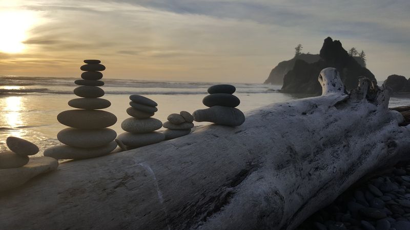
Rock stacks look calm and artsy. On a wild coastline, though, they can cause more trouble than you’d expect.
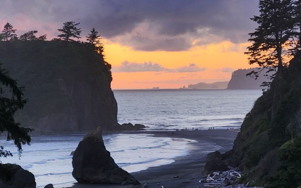
Ruby Beach sits along US Highway 101 in Olympic National Park. Sea stacks, driftwood, and smooth stones make it a favorite stop for road trippers.
Visitors often build small towers of rocks, called cairns. They seem harmless and make fun photos.
Moving rocks disturbs tiny creatures that live underneath. It can also change how sand and stones shift along the shore.
Leave No Trace guidance asks people not to build cairns. On trails, extra cairns can even confuse hikers who rely on real route markers.
Driftwood here deserves some caution too. Huge logs can roll when waves hit them, and that’s a real safety risk.
Check tide charts before you explore. Some areas along the coast can get cut off when water rises.
The short path from the parking lot down to the beach sees heavy foot traffic. Staying on it helps protect the bluff from erosion.
Tide pools can be fun to peek into at low tide. Look, but don’t pull creatures off rocks or carry them away.
Want a souvenir? Take photos instead of stones or shells, since collecting is restricted in national parks.
Let the beach stay a little messy and natural. That untouched look is the whole reason you stopped.
Address: Ruby Beach, US-101, Forks, WA 98331
9. Naches Peak Loop
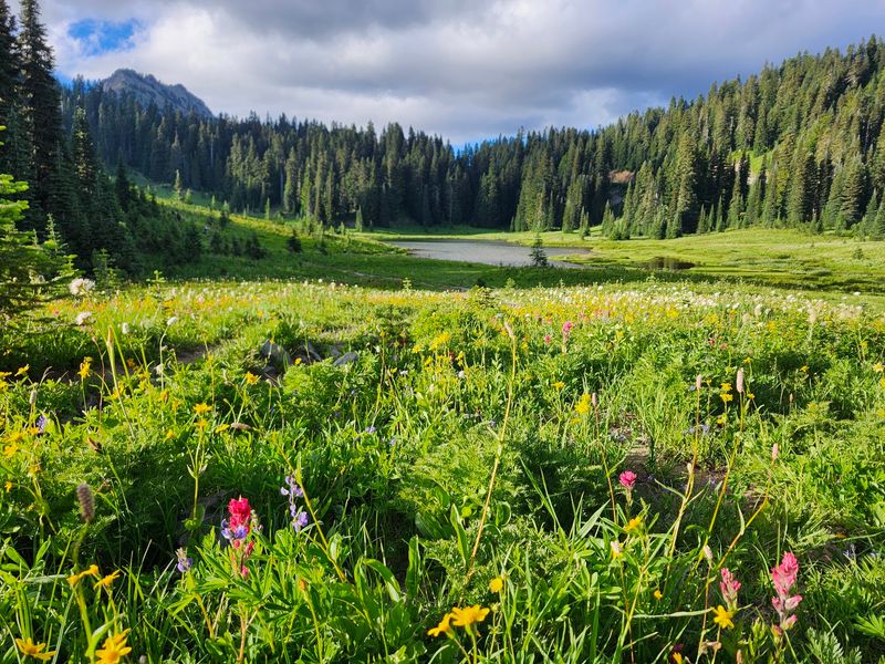
Wildflowers, a small lake, and Rainier peeking over the ridge make this loop feel like cheating. You get all that for around 3.5 miles.
The Naches Peak Loop starts near Chinook Pass on State Route 410. Part of it runs inside Mount Rainier National Park, and part lies in national forest land.
Easy access means big summer crowds. Parking near the pass fills quickly on nice days.
Wildflower season is the busiest time. Lupine and other blooms tempt visitors to wander into the meadows for photos.
One person stepping in might not seem like much. Hundreds of people doing it leave flattened patches and new mini trails.
Fun fact: a section of the loop overlaps the Pacific Crest Trail. Thru-hikers heading between Mexico and Canada pass right through.
Dogs are allowed on the national forest section but not inside the national park. Plan ahead if you bring a furry friend.
Going clockwise is a common suggestion for better Rainier views. You’ll also face the mountain more often as you walk.
State Route 410 over Chinook Pass closes in winter. Check road conditions before you head out early or late in the season.
Stay on the trail, even near the lake. Sit on rocks instead of fragile plants when you take a snack break.
These meadows bloom for only a short stretch each summer. Giving them space lets them put on the same show next year.
Address: Naches Peak Loop Trailhead, Chinook Pass, SR 410, Naches, WA 98937
10. Lake 22
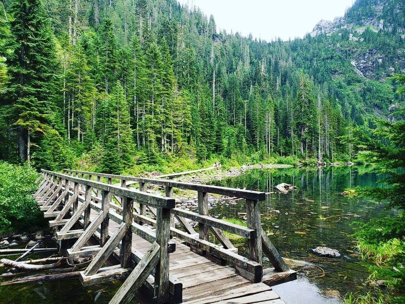
A lake with a boring number for a name turns out to be stunning. Lake 22 rests below the steep north face of Mount Pilchuck.
The trail sits along the Mountain Loop Highway near Granite Falls. It’s about 5.4 miles round trip with old-growth forest and waterfalls along the way.
The area is part of the Lake Twenty-Two Research Natural Area. That label means it’s protected for scientific study and natural processes.
Lakeshores take a lot of abuse. People spread out along the edge, and the plants there get trampled down to dirt.
Bare shoreline erodes faster. Soil can then wash into the water and affect the lake’s health.
Look for established paths and rocky spots around the lake. Those durable surfaces can handle crowds better than soft banks can.
Winter brings a different concern. Avalanches can sweep down from the slopes above, and the lake basin sits in risky terrain.
Check avalanche forecasts before any snowy season visit. The Northwest Avalanche Center is a helpful resource for this.
A Northwest Forest Pass is needed to park at the trailhead. Weekends get busy, so earlier arrival helps.
Bring layers, since the lake area can feel much cooler than the trailhead. Mist often hangs around the cliffs, which adds to the mood.
Treat the shore like a front porch, not a playground. Sit, soak in the view, and leave the edges green.
Address: Lake 22 Trailhead, Mountain Loop Hwy, Granite Falls, WA 98252
11. Wallace Falls State Park
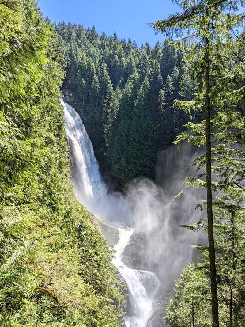
Nine waterfalls on one river sounds almost greedy. Wallace Falls State Park offers a string of them along the Wallace River.
The park sits near Gold Bar, close to US Highway 2. Its main trail climbs to lower, middle, and upper falls viewpoints.
The middle falls drop about 265 feet. That big payoff keeps the trail busy through much of the year.
Steady traffic wears down tread fast. Roots get exposed, rocks loosen, and wet sections turn into soup.
Fixing trails takes real people and real money. Groups like the Washington Trails Association send volunteers to repair paths across the state.
Volunteers dig drainage, rebuild steps, and clear brush. It’s hard work, but crews often say it’s surprisingly fun.
You can join a work party yourself. Many trips welcome beginners and provide tools and training.
Spending even one day fixing a trail changes how you hike. You start spotting drainage ditches and thanking whoever built them.
A Discover Pass is required for parking at the park. The lot can fill on sunny weekends, so plan to arrive early.
Stay on the trail and avoid cutting corners near viewpoints. Those slopes are steep and easy to erode.
Love these trails enough to give a little back. Your boots wear the path down, and your hands can help build it up.
Address: Wallace Falls State Park, 14503 Wallace Lake Rd, Gold Bar, WA 98251
Share this story