A boulder the size of a small house balances on three stone points in Morris County. Deep beneath Ogdensburg, ordinary-looking rock flashes electric green and red under ultraviolet light.
Near the Shore, a forest of fully mature trees barely reaches above your head. These are not movie sets, optical illusions, or badly explained roadside legends.
They are pieces of New Jersey’s surprisingly wild natural history. Glaciers dragged enormous rocks across the landscape, rivers sliced passages through mountain ridges, molten material hardened into towering cliffs, and coastal winds built dunes that continue to shift with every storm.
Some of these places require a tough climb, while others appear beside a parking area or along a short boardwalk. Together, they reveal a Garden State that is stranger, older, and far less predictable than its crowded highways suggest.
Bring sturdy shoes, a little curiosity, and enough time to stare. These 17 natural wonders genuinely do not look real.
1. The Palisades Cliffs and Giant Stairs – Alpine
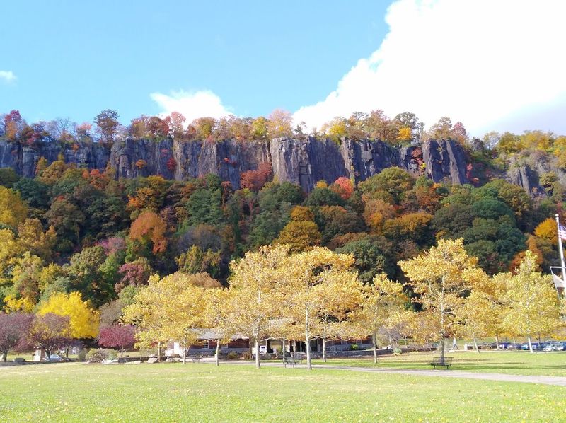
Stand at State Line Lookout and the Hudson suddenly appears hundreds of feet below, pressed against a wall of dark rock that looks almost too straight to be natural. The Palisades are made of diabase, an igneous rock related to basalt, with light feldspar and dark augite creating a salt-and-pepper pattern visible up close.
Erosion exposed the rock in tall vertical columns, producing the stockade-like profile that gave the cliffs their familiar name. Alpine’s Point Lookout rises about 520 feet above sea level, but the view is only the polite introduction.
Below it lies the Giant Stairs, an enormous field of broken boulders where the route becomes more scramble than conventional hike. Under normal conditions, experienced hikers pick their way across nearly a mile of angular rock while the river flashes through the trees below.
This is not a casual sneaker stroll, especially when surfaces are wet or icy. A recent rockfall forced the park to close the Giant Stairs section between Peanut Leap Cascade and Forest View, and the closure remained in effect at the time of publication while stability and repair work were assessed.
The cliffs and overlooks are still worth the trip, but check current advisories before building a day around the scramble. Even from solid ground, this slice of Alpine feels more like the edge of a western canyon than a viewpoint minutes from Bergen County traffic.
2. Paterson Great Falls – Paterson
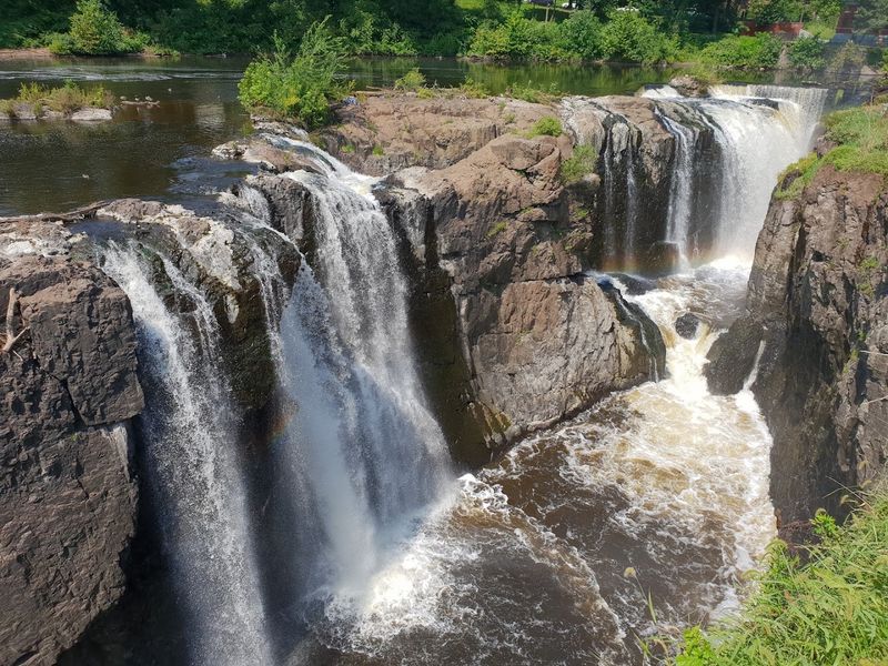
The sound arrives first: a deep, steady roar that grows louder until the Passaic River drops into a rocky chasm beside old brick mills and iron bridges. That collision of raw power and city history is what makes Paterson Great Falls so unusual.
The waterfall spills across ancient volcanic rock shaped by lava flows, continental upheaval, erosion, and the geological breakup of Pangaea. Yet it does not sit in an isolated mountain preserve.
Apartment buildings, former factories, streets, and industrial canals crowd around it, creating a scene in which nature and machinery seem to occupy the same frame. Alexander Hamilton recognized the river’s power and backed the creation of Paterson in 1792 as the country’s first planned industrial city.
Water diverted from the falls helped drive mills that produced textiles, locomotives, paper, firearms, and aircraft engines. Today, the best visit combines the overlooks with a walk through the surrounding historic district, where channels and raceways show how people attempted to harness the force in front of them.
The park grounds are generally open from sunrise to sunset, although some facilities and paths may close seasonally. Water volume changes dramatically with rainfall, so the falls can shift from a broad, thunderous curtain to narrower streams exposing more of the dark ledges.
Either way, seeing such a powerful waterfall wedged into the middle of North Jersey remains wonderfully disorienting.
3. Delaware Water Gap and Mount Tammany – Knowlton Township
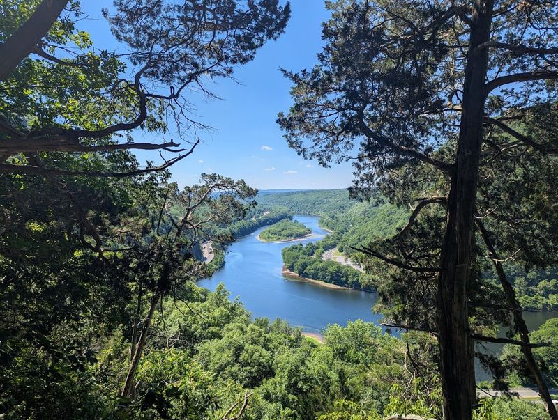
From Mount Tammany, the Delaware River looks as though it found the only available doorway through the mountains and calmly slipped through it. The reality took considerably longer.
Water and erosion carved a dramatic passage between New Jersey’s Kittatinny Ridge and Pennsylvania’s Mount Minsi, leaving steep forested walls on either side of the river. The classic New Jersey view comes from the Red Dot Trail, a rocky climb that gains elevation quickly and rewards the effort with a sweeping look into the Gap.
It is one of those hikes where the summit photo may look peaceful even though the person taking it was breathing hard five minutes earlier. The route demands sturdy footwear, careful footing, and more water than its compact appearance on a map might suggest.
Parking near the trailhead fills quickly on summer weekends, making an early arrival the smartest move. Those who prefer to admire the formation without climbing can stop at Kittatinny Point for a river-level perspective or explore gentler trails elsewhere in the recreation area.
The surrounding park protects 40 miles of a free-flowing Delaware River and supports hiking, paddling, fishing, and scenic drives. Autumn brings the obvious color show, but bare winter trees reveal the shape of the ridges particularly well.
From either the water or the summit, the Gap looks less like a New Jersey landscape and more like somebody pulled two mountains apart to let the river pass.
4. Sunfish Pond – Worthington State Forest
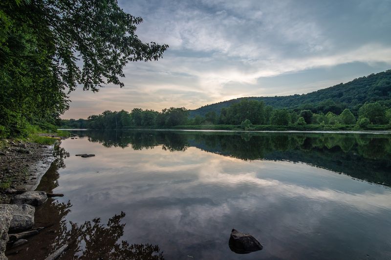
After a steep climb through rocky forest, finding a quiet lake sitting high on Kittatinny Ridge feels like discovering water where water has no business being. Sunfish Pond is a natural glacial lake, left behind by the ice that reshaped northern New Jersey.
Its boulder-lined shore and dark reflective water have an almost northern-wilderness quality, despite the Appalachian Trail passing directly beside it. The shortest approach follows the Garvey Springs Trail, which covers only about 1.2 miles one way but climbs more than 1,000 feet.
In other words, “shortest” should not be mistaken for “easy.” A longer approach along Dunnfield Creek trades some of that direct uphill punishment for a beautiful ravine filled with hemlocks, stream crossings, small cascades, and native brook trout habitat. The pond’s modern history is nearly as interesting as its glacial origin.
In the 1960s, proposals threatened to alter it for water storage, prompting a major preservation effort. Supreme Court Justice William O.
Douglas joined more than a thousand people on a protest hike in 1967, and the pond was acquired by New Jersey two years later. Give yourself time to walk part of the shoreline instead of immediately turning around after the obligatory photo.
The stillness is the whole point. On a calm day, the surrounding ridge reflects so cleanly that the lake seems to open a second forest beneath the first one.
5. Buttermilk Falls – Layton
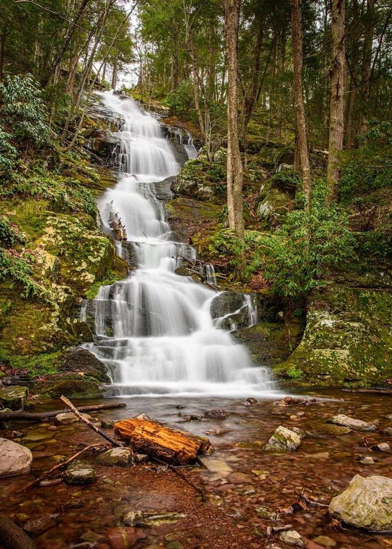
No long buildup is required here. A gravel backroad bends through the woods, and suddenly one of New Jersey’s tallest waterfalls is tumbling down the mountainside almost beside the road.
Buttermilk Falls changes personality with the weather. After heavy rain or spring snowmelt, water spreads across the rock in a forceful white cascade.
During a dry stretch, the flow can thin considerably, exposing the ledges underneath. A viewing platform makes the lower portion approachable for visitors who are not planning a major hike, while wooden stairs climb beside the falls for a higher perspective.
Anyone continuing beyond the top should be ready for real elevation. The Buttermilk Falls Trail runs roughly 1.4 miles one way to the Appalachian Trail and gains more than 1,100 feet, with much of the effort packed into the climb above the cascade.
From there, experienced hikers can extend the day toward Crater Lake or Hemlock Pond. The waterfall sits along Mountain Road near Walpack Center, where surfaces can be rough and seasonal conditions may affect access.
Swimming and wading are prohibited in the waterfall and within 50 feet upstream, which is sensible given the slippery rock and changing current. Arrive after a wet spell for the biggest show, but do not dismiss it in lower water.
Even then, the sight of a tall cascade emerging from dense Sussex County forest just steps from a backroad feels like a landscape glitch in the best way.
6. Tripod Rock – Pyramid Mountain Natural Historic Area
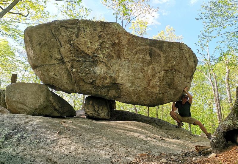
At first glance, the boulder appears to be performing a trick. An enormous slab rests above the ground on three much smaller stones, leaving open space beneath it and inviting immediate questions about how it has not toppled.
Tripod Rock is a glacial erratic, meaning moving ice transported and deposited it during the last Ice Age. The Wisconsin Glacier left this and other oversized rocks around Pyramid Mountain more than 18,000 years ago, including Bear Rock and Whale Head Rock.
That scientific explanation is convincing right up until you stand beside Tripod Rock and see how carefully balanced it looks. Reaching it adds to the fun.
Pyramid Mountain covers more than 1,600 acres of ridges, wetlands, forest, and rocky outcrops, with multiple routes to the formation. A suggested hike from the Boonton Avenue visitor center covers about 3.3 miles and takes roughly two and a half hours, while a longer route from Kincaid Road combines the rock with additional overlooks.
Trail intersections can be confusing, so photograph the map or carry a downloaded copy rather than relying on spotty service. Weekends bring plenty of curious hikers, but an early start can buy a quieter few minutes with the boulder.
Resist the urge to climb on or wedge anything beneath it. The strange arrangement has survived thousands of years without assistance, and its improbable balance is much more impressive when everyone leaves it exactly as the glacier did.
7. Ken Lockwood Gorge – Lebanon Township
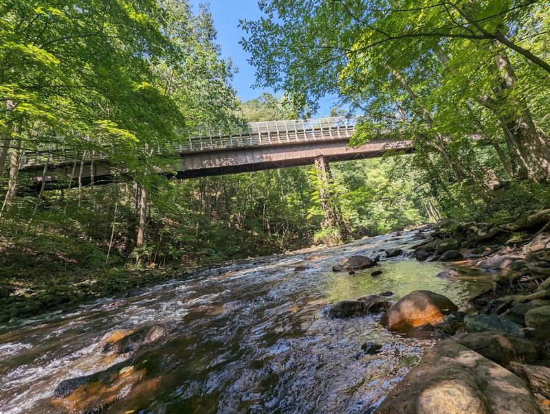
Cold river water races around house-sized rocks while hemlocks lean over the banks and steep wooded slopes rise on both sides. It is an unexpectedly rugged scene for Hunterdon County, especially when reached from the gentler farmland surrounding it.
Ken Lockwood Gorge protects 563 acres, with roughly 2.5 miles of the South Branch of the Raritan River running through its center. The river cut deeply into the underlying bedrock, creating a narrow corridor that feels distinctly more mountainous than the nearby countryside.
Follow the water and the scenery keeps changing: quiet pools give way to choppy runs, exposed stones interrupt the current, and fallen trunks gather along the banks after storms. Anglers know the gorge for its trout habitat, including a regulated catch-and-release section where artificial lures are required.
Non-anglers can simply walk the river corridor, photograph the rapids, or claim a rock at the edge and listen to the water. Spring offers strong flow and fresh green growth, while autumn places the river beneath a tunnel of color.
Because this is a wildlife management area rather than a manicured county park, visitors should expect limited facilities, uneven ground, and seasonal hunting activity. Wear visible clothing during hunting seasons and leave room for anglers casting from the banks.
The gorge’s appeal comes from that lack of polish. It does not feel arranged for visitors; it feels like the river has been allowed to keep its sharp edges.
8. Musconetcong Gorge Preserve – Bloomsbury and Holland Township
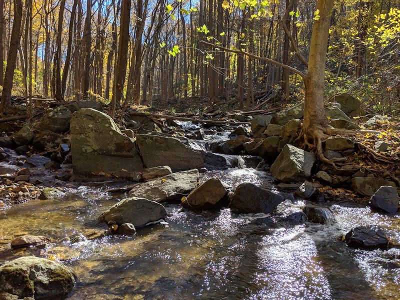
One trail follows the remains of an old rail line. Another climbs a wooded ravine to a waterfall.
A third heads for the ridge and joins a long-distance route across the New Jersey Highlands. That variety makes Musconetcong Gorge Preserve feel much larger than its 523 acres.
The main parking address is in Bloomsbury, while the protected land stretches through Holland and Bethlehem townships beside the Musconetcong River. For the quickest payoff, take the orange-blazed Waterfall Trail, which climbs through the ravine to a scenic cascade.
The flow is most impressive after rain, when the small stream moves noisily over dark rock and the surrounding forest drips with moisture. Hikers seeking elevation can continue toward the ridge, where the terrain becomes moderate to difficult and portions overlap with the teal-blazed Highlands Trail.
The abandoned rail corridor offers a gentler alternative and a glimpse of how transportation once followed the shape of the gorge. This is a free, sunrise-to-sunset preserve with two parking areas, but it has no restrooms and follows a carry-in, carry-out policy.
Bring a map because the network offers several ways to link trails, and download it before arrival. The preserve is particularly good in late spring, when the ravine turns intensely green, or after autumn leaves expose more of its rock walls.
It is not New Jersey’s biggest gorge, but its waterfall, river, ridge, and old railroad grade fit an impressive amount of wild character into one compact hike.
9. Marble Hill Ice Cave – Phillipsburg
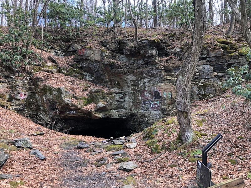
The first surprise is that the “cave” is not entirely natural. The second is that this makes it more interesting, not less.
Hidden within Warren County’s Marble Hill Natural Resource Area, the opening is associated with the former Fulmer iron mine, also known as the Marble Mountain Mine.
Workers blasted into iron-bearing rock during the 19th century in search of hematite, leaving a deep stone chamber where cool air collects and ice can linger unusually late into warm weather.
The result feels like a natural refrigerator tucked into a forested hillside. Reaching it requires a short hike through a 288-acre preserve north of Phillipsburg, where trails also provide seasonal wildflowers, upland forest, migratory bird habitat, and views toward the Delaware River.
A section of the Warren Highlands Trail passes through the property, with colored side trails leading toward the former mine area. Keep expectations realistic: this is not a commercial cavern with lighting, handrails, or guided underground rooms.
It is an abandoned mining feature, and visitors should remain outside unstable openings, respect any barriers, and stay on marked routes. Hunting is permitted in Warren County’s natural resource areas by permit, so visible clothing is sensible during the relevant seasons.
The scene works best as part geology lesson, part industrial relic, and part woodland mystery. Cold air spilling from a dark opening on a warm afternoon is strange enough without pretending the miners had nothing to do with it.
10. Sterling Hill’s Fluorescent Mineral Deposits – Ogdensburg
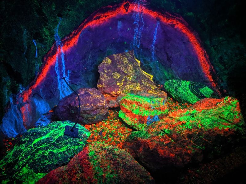
Then the ultraviolet lights switch on. Gray and white mine walls suddenly blaze red and bright green, making the underground passage look less like New Jersey bedrock and more like a science-fiction set.
The colors at Sterling Hill are caused by fluorescent minerals responding to ultraviolet energy. Manganese activates red fluorescence in calcite and green fluorescence in willemite, one of the principal zinc ores extracted here.
Together, the Sterling Hill and nearby Franklin deposits contain more than 360 identified mineral species. Around 90 fluoresce, and more than two dozen have been found nowhere else on Earth.
The most memorable place to see them is the Rainbow Tunnel, where exposed ore glows directly from the walls during a guided mine tour. Above ground, the Warren Museum of Fluorescence contains more than 700 minerals and objects, including a floor-to-ceiling color wall displaying 100 specimens.
This is the rare natural wonder that comes with hard hats, mining equipment, and a lesson in industrial history. Sterling Hill operated as a zinc mine until 1986, eventually reaching thousands of feet below the surface with miles of tunnels, although only an upper, dry section is open to visitors.
Tours are paid and scheduled, so check availability before driving to Ogdensburg. Wear closed-toe shoes and bring a light layer; underground temperatures do not care how hot the parking lot feels.
The glow may look artificial, but the chemistry belongs entirely to the rocks.
11. High Point and the Kittatinny Ridge – Sussex
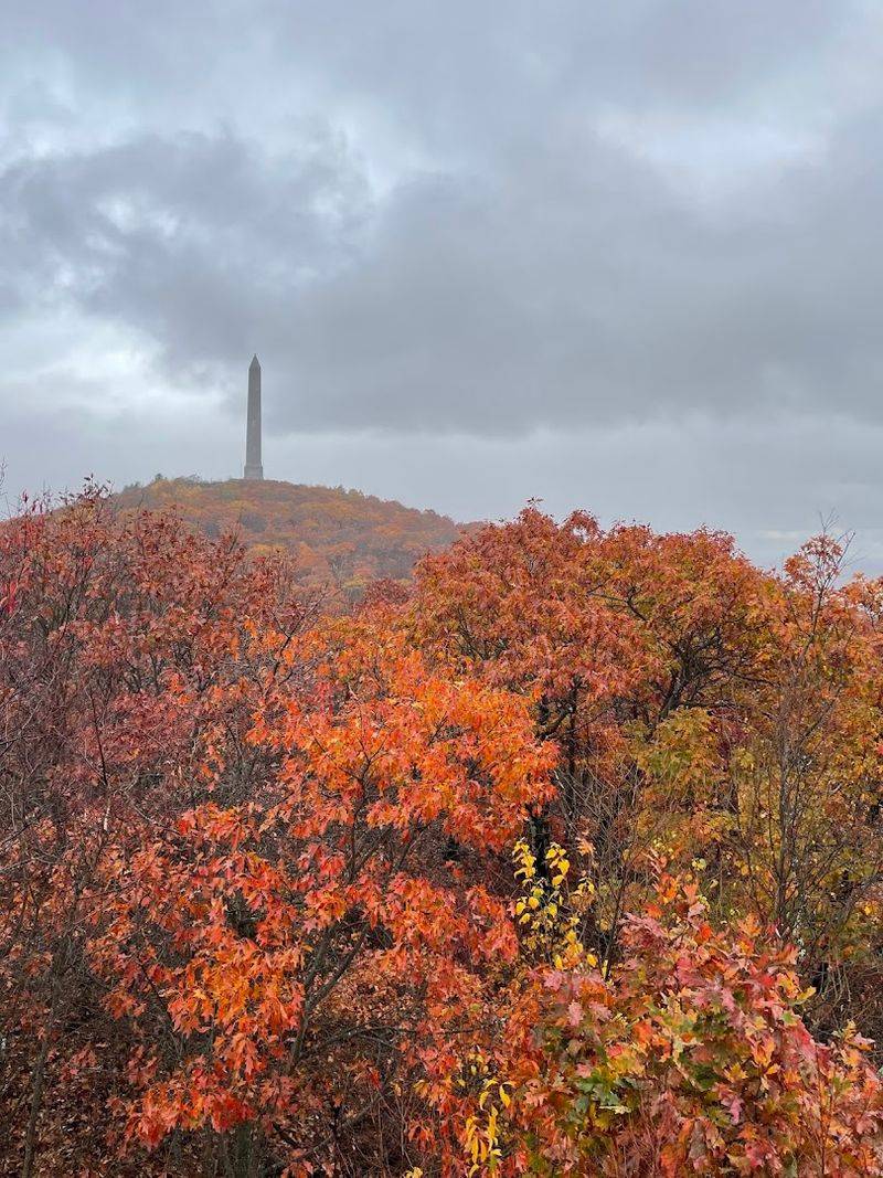
New Jersey’s highest ground does not rise as one dramatic peak. Instead, the Kittatinny Ridge rolls across the northwest in a long, rocky backbone, finally reaching 1,803 feet at High Point.
Its creation involved continental collisions that folded and fractured the Earth’s crust, mile-high ice sheets that scraped across the landscape, and erosion that removed softer material from the surrounding valleys. The result is a ridge that seems to hover above three states.
From the summit area, forests and farmland spread toward Pennsylvania and New York, with distant ridgelines layering into the horizon on clear days. The 220-foot veterans’ monument makes the location easy to recognize, but the surrounding landscape is the real wonder.
Visitors can drive close to the summit for a relatively easy look, then explore trails that reveal quieter sections of the ridge. The Appalachian Trail crosses the park, while shorter paths connect overlooks, woods, and Lake Marcia.
Wind can be noticeably stronger and temperatures cooler at the top, even when lower Sussex County feels mild, so keep an extra layer in the car. Autumn weekends are understandably busy; early mornings provide clearer parking, softer light, and a better chance of hearing birds instead of car doors.
High Point earns its place not because 1,803 feet sounds enormous, but because the ridge turns familiar New Jersey countryside into a vast topographic map. From up here, the state’s crowded image falls away and the ancient folds of the land take over.
12. Island Beach State Park’s Barrier Dunes – Berkeley Township
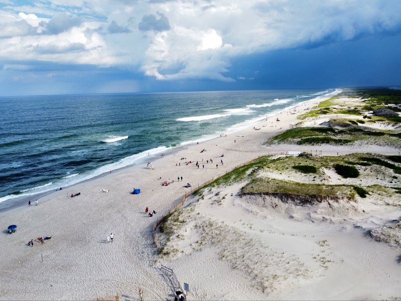
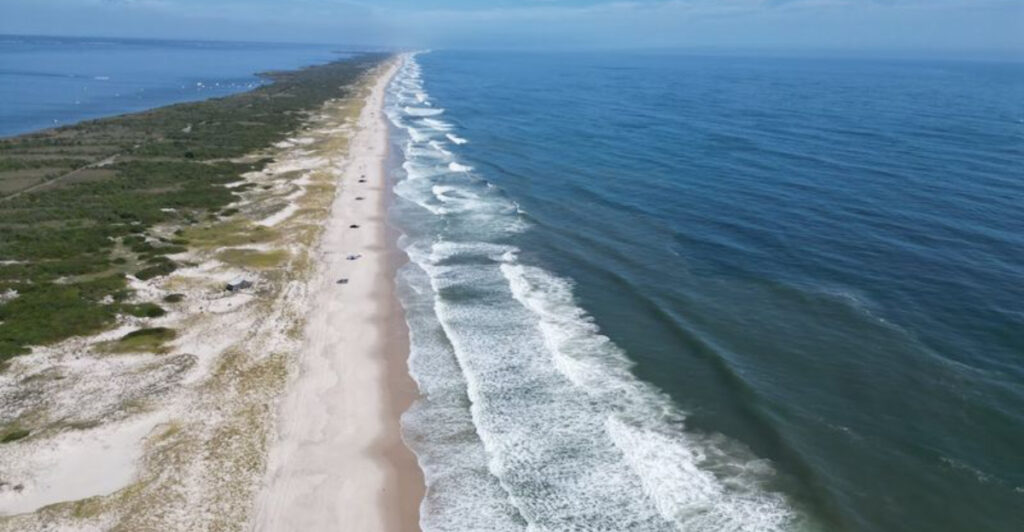
Past the last dense stretch of Shore development, the buildings abruptly stop and the dunes keep going. Island Beach State Park protects more than 3,000 acres along a barrier island stretching nearly 10 miles between the Atlantic Ocean and Barnegat Bay.
It is one of the Northeast’s few remaining undeveloped barrier beaches and a rare look at what much of New Jersey’s coast resembled before boardwalks, motels, and oceanfront houses filled the shoreline. The landscape is not simply sand.
Short trails cross coastal thickets, maritime forest, tidal marshes, beach-heather fields, and rolling dunes anchored by tough vegetation capable of surviving salt spray, wind, heat, and shifting ground. More than 400 plant species have been identified here.
Walk one of the marked nature trails to see how quickly the habitat changes between bay and ocean, or use the Fisherman’s Walkway near parking area 7 for access across the narrow island. The dunes are fragile despite their rugged appearance, so stay on boardwalks and designated crossings rather than cutting paths through the grass.
Summer brings swimming and beach crowds near the developed areas, but driving farther south usually reveals a quieter, wilder scene. In winter, wind reshapes the sand and the absence of umbrellas makes the island feel almost empty.
The wonder is not a single formation but an entire moving coastline, still rearranging itself between two bodies of water while the rest of the Jersey Shore stands comparatively still.
13. The Pine Barrens and Pygmy Forest – Burlington and Ocean Counties
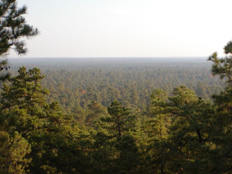
Imagine looking across a mature forest without lifting your chin. In the central Pine Barrens, repeated fire, sandy soil, wind, and demanding growing conditions have produced the Pine Plains, better known as the Pygmy Forest.
The pitch pines and oaks here are not seedlings. Many are fully mature trees that remain remarkably short, with some areas low enough for an adult to see across the canopy while standing on the ground.
More than 12,000 acres of this unusual forest survive within the broader Pinelands, a 1.1-million-acre region of pine-oak woods, cedar swamps, tea-colored rivers, cranberry bogs, and rare plant communities. Fire is essential to the ecology.
Pitch pines can resprout after burning, and recurring wildfire has helped maintain the open, stunted landscape over generations. The Warren Grove Recreation Area provides access to the central Pine Barrens and puts visitors near some of its most striking dwarf-growth areas.
Approach carefully. Sandy roads can become difficult for ordinary cars, mobile service may disappear, and the vegetation is more fragile than it looks.
Stay on legal roads and marked paths rather than driving or walking directly through low-growth stands. The Pygmy Forest is most impressive when seen in context: ordinary-height woods gradually shrink until the horizon opens over treetops that should be far above eye level.
It feels less like a New Jersey forest than a bonsai landscape stretched across thousands of acres.
14. Franklin Parker Preserve’s Atlantic White Cedar Swamps – Chatsworth
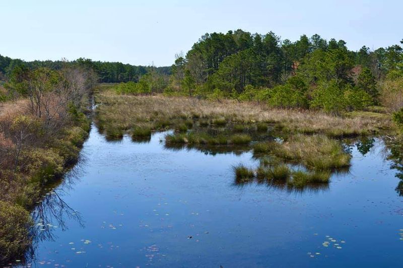
Dark water, pale trunks, and dense evergreen foliage turn portions of Franklin Parker Preserve into something resembling a flooded cathedral. Atlantic white cedar swamps once covered far more of southern New Jersey, but centuries of logging, altered water levels, wildfire, and land conversion reduced them dramatically.
At this preserve outside Chatsworth, conservation work is helping the forest return. Thousands of cedar seedlings have been planted in former cranberry bogs, and protected older stands line shallow lakes and tributaries of the West Branch of the Wading River.
Franklin Parker encompasses roughly 9,400 acres in the heart of the Pine Barrens, making it large enough for a hike to feel genuinely remote. Sandy roads and marked trails pass pitch-pine forest, blueberry fields, wetlands, open water, and stretches of cedar restoration.
The Yellow Trail provides one of the clearest looks at the recovering cedar habitat. Bring water, insect repellent, and a downloaded map; trail junctions and old bog roads can become confusing, and facilities are limited.
Winter is especially striking, when bald eagles may appear above open water and evergreen cedars stand out against the muted bogs. Spring and summer bring richer color but also more ticks and mosquitoes.
What makes this place extraordinary is its timeline. Some cedars can live for centuries, yet the youngest restored sections are only beginning their long transformation.
Visitors are not merely seeing a swamp. They are walking through the early chapters of a forest being rebuilt tree by tree.
15. Great Swamp National Wildlife Refuge – Morris County
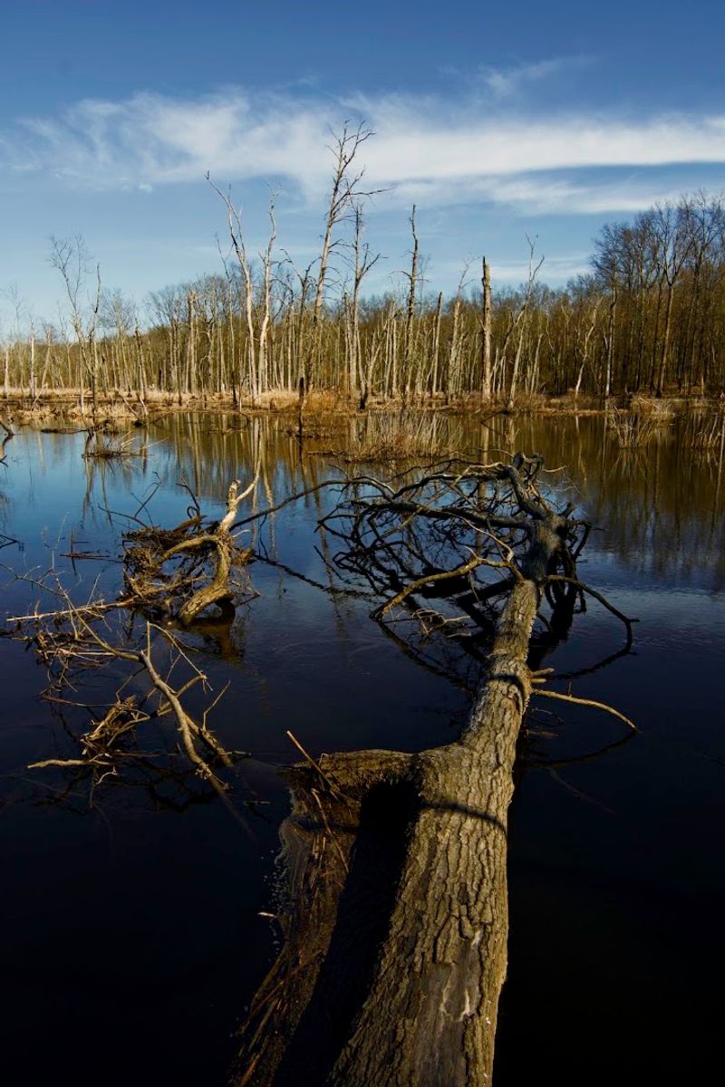
Only 26 miles from Times Square, nearly 8,000 acres of marsh, woodland, grassland, and open water interrupt the suburban map. That proximity is the first unbelievable thing about Great Swamp National Wildlife Refuge.
The second is how completely it absorbs the surrounding development. Step onto a boardwalk and roads give way to cattails, shallow pools, frogs, turtles, waterfowl, and the occasional white-tailed deer watching from the trees.
The refuge covers about 12 square miles and provides an important resting and feeding place for migrating birds. Its terrain was shaped in part by glacial activity and drainage patterns around the Passaic River, creating wetlands that later survived a proposal to build a major airport here.
Today, visitors can explore designated public areas on foot, use observation blinds, or treat a slow drive as a wildlife-viewing opportunity. A car can work surprisingly well as a blind because animals may tolerate a stopped vehicle more readily than approaching footsteps.
Begin at the Helen C. Fenske Visitor Center when it is open for orientation and current trail conditions.
The refuge itself is generally open year-round from sunrise to sunset, although flooding, snow, or management activities can affect access. Bring binoculars and accept that the best sightings often come from standing quietly rather than covering maximum mileage.
Great Swamp does not overwhelm with cliffs or waterfalls. Its trick is subtler: it makes one of the nation’s busiest metropolitan regions disappear behind reeds and birdsong.
16. Cape May Point’s Natural Migration Funnel – Cape May Point
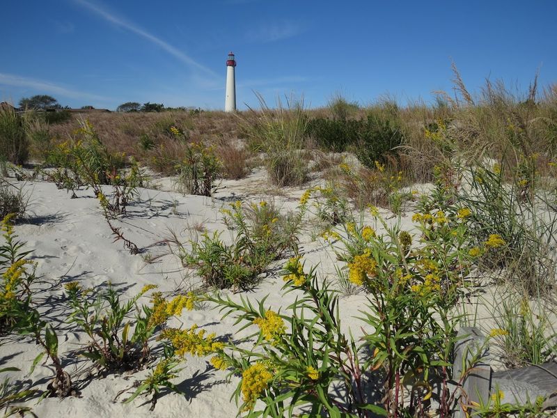
On the right fall morning, the sky above Cape May Point becomes a highway. Hawks, falcons, songbirds, seabirds, dragonflies, and monarch butterflies move through in waves, all responding to the shape of the peninsula.
With the Atlantic Ocean to the east and Delaware Bay to the west, southbound migrants are naturally funneled toward New Jersey’s narrow tip. Many birds hesitate before crossing open water, concentrating around the Point while they rest, feed, or wait for favorable winds.
That geographical bottleneck has made Cape May one of the world’s celebrated migration-watching locations. Fall is famous for raptors, including peregrine falcons, merlins, ospreys, kestrels, harriers, and sharp-shinned hawks.
Spring brings northbound songbirds and shorebirds, while monarchs gather during their coastal journey in September and October. The hawkwatch area at Cape May Point State Park offers a practical introduction because experienced observers are often scanning the same sky and calling out birds that beginners would miss.
Bring binoculars, arrive early, and look beyond the lighthouse; the spectacle may be happening high overhead or low across the dunes. Weather matters enormously.
A quiet afternoon can be followed by a huge flight after a cold front shifts the wind. There may be no single dramatic formation to photograph, but the invisible funnel becomes obvious when hundreds of animals follow the same route.
For a few weeks each year, the entire peninsula seems to point south.
17. The Mullica River-Great Bay Estuary – Tuckerton and Oceanville
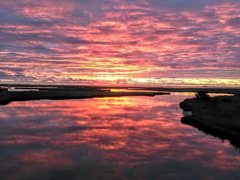
Fresh water leaves the Pine Barrens stained the color of strong tea, winds through tidal marshes, and gradually mixes with salt water before reaching Great Bay and the Atlantic. That uninterrupted transition makes the Mullica River–Great Bay estuary one of New Jersey’s most remarkable living systems.
The surrounding Jacques Cousteau National Estuarine Research Reserve encompasses approximately 116,000 acres of river, freshwater wetlands, salt marsh, shallow bay, coastal forest, barrier islands, and open ocean habitat. Little more than one percent of the reserve has been developed, an astonishing figure in the crowded Northeast.
From a kayak, the scale becomes easier to understand. Narrow creeks open into broad marshes, the current reverses with the tide, and the skyline is often made of little more than grasses, distant trees, and passing birds.
Paddlers should consult tide, wind, and weather conditions before launching because open marsh water can become challenging quickly. Those staying on land can explore public viewpoints and educational stops around Tuckerton, then follow the landscape toward Great Bay.
The Tuckerton Peninsula alone contains roughly 5,000 acres of Spartina salt marsh and serves as an important site for studying sea-level rise, storms, and changing coastal habitat. This wonder does not have a single entrance or obvious centerpiece.
Its magic lies in the connection: dark Pinelands water becoming tidal river, tidal river becoming bay, and bay becoming ocean with almost nothing interrupting the process.
Share this story