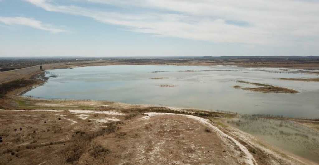
Texas lakes have been the heart of countless summer memories, weekend getaways, and family adventures for generations. But something troubling is happening beneath the surface—or rather, where the surface used to be. Across the Lone Star State, some of our most beloved reservoirs are disappearing at alarming rates, leaving behind cracked lake beds and stranded boat docks.
Climate shifts, persistent drought, and increased water demands are transforming these once-thriving waterways into shadows of their former selves.
1. Medina Lake
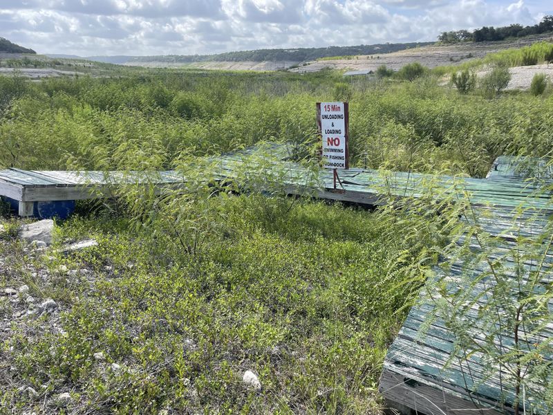
West of San Antonio sits a reservoir that once sparkled as one of the Hill Country’s crown jewels. Families flocked here for decades, creating memories on its shimmering waters. Today, the scene looks dramatically different, with boat ramps leading to nothing but dust and rocks.
Drought has hit this area particularly hard over recent years. Water levels have dropped so drastically that old structures from before the lake’s creation have emerged like ghosts from the past. Trees that were submerged for nearly a century now stand exposed, creating an eerie landscape that tells the story of just how much water has vanished.
The Medina River feeds this reservoir, but prolonged dry spells mean less water flowing in. Meanwhile, the growing communities around San Antonio keep needing more water, creating a tough balancing act. Local ranchers and farmers who depend on this water source have watched nervously as their lifeline shrinks.
Recreational businesses that once thrived along the shoreline have struggled or closed entirely. Marinas sit high and dry, their docks pointing toward water that’s hundreds of feet away. The economic impact ripples through surrounding communities that built their identities around lake activities.
Environmental experts point to this reservoir as a warning sign for water management challenges ahead. Recovery requires sustained rainfall over multiple years, not just a single wet season. Even when rains do come, the reservoir struggles to refill because upstream water rights and evaporation work against it.
The transformation serves as a stark reminder that water resources we’ve taken for granted aren’t guaranteed forever. Communities are now rethinking how they use and conserve water for future generations.
2. Lake Mackenzie
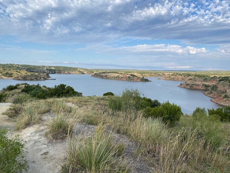
Up in the Panhandle, this reservoir served as an oasis in an otherwise arid landscape. Built to provide water for the communities of Silverton, Tulia, and surrounding areas, it became a recreational hotspot where people could escape the endless plains. Now, what remains looks more like a pond than the substantial lake it once was.
The numbers tell a sobering story. Water levels have plummeted to fractions of the reservoir’s capacity, leaving vast expanses of cracked earth where boats once cruised. The Tule Creek that feeds it simply can’t keep up with evaporation rates and water withdrawals in this windy, sun-baked region.
Farmers in the area face difficult decisions about crop irrigation. Every gallon pulled from the lake means less for everyone else, yet agriculture drives the local economy. The competing demands create tension in communities where neighbors have known each other for generations.
Wildlife that depended on this water source has been forced to adapt or relocate. Migratory birds that once stopped here during their journeys now find little to sustain them. The ecosystem that developed around the lake has been fundamentally disrupted.
Municipal leaders have explored alternative water sources, but options in this part of Texas are limited. Transporting water from distant sources costs money that small communities don’t have. Conservation measures help, but they can’t solve the underlying problem of too little water in too dry a climate.
Residents remember when the lake was full, when kids could swim and fish without worrying whether there’d be water next summer. Those days feel increasingly distant as the shoreline continues its steady retreat from what used to be waterfront property.
3. Choke Canyon Reservoir
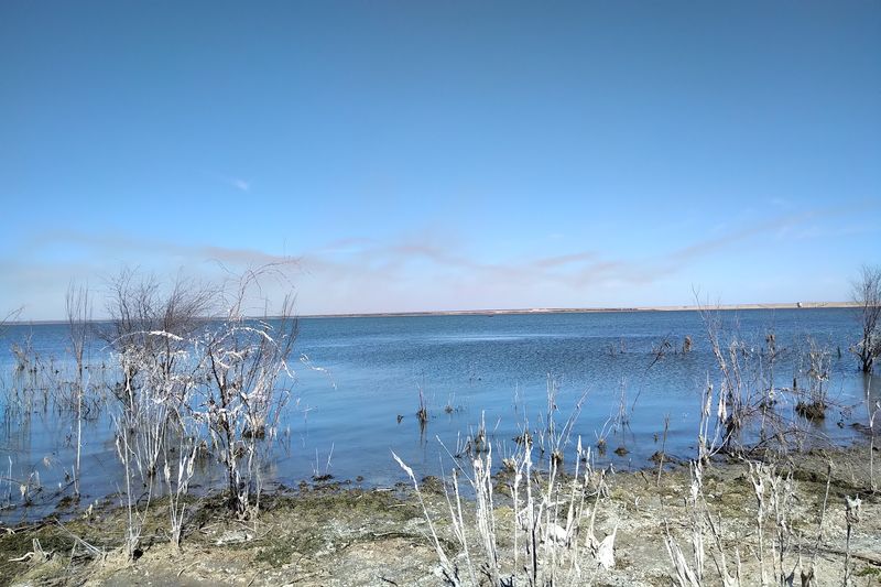
South Texas heat bears down relentlessly on this reservoir, which was created to supply water to Corpus Christi and surrounding communities. The Frio River flows into it, but in recent years, that flow has been more trickle than river. What was designed as a reliable water source has become a study in scarcity.
Anglers who once caught trophy bass here now find their favorite fishing spots high and dry. The state park that wraps around portions of the shoreline has had to close boat ramps and beach areas repeatedly. Camping spots that offered lakefront views now overlook expansive mudflats instead.
The reservoir’s shrinkage affects more than just recreation. Corpus Christi’s water supply depends heavily on this source, and low levels have triggered conservation measures throughout the city. Residents face restrictions on lawn watering and car washing, small sacrifices that add up when millions of gallons are at stake.
Water quality becomes another concern when levels drop. Concentrated pollutants and algae blooms increase in shallow, warm water. Treatment costs rise for municipalities trying to make the remaining water safe to drink.
The problems compound in ways that aren’t immediately obvious to casual observers.
Wildlife refuges near the reservoir have documented changes in bird populations and animal behavior. Species that need specific water depths for feeding or nesting find their habitats disappearing. The interconnected nature of the ecosystem means one species’ struggle affects many others.
Recovery predictions vary wildly depending on rainfall patterns. Some experts suggest the reservoir might never return to historical levels given changing climate conditions. Others remain hopeful that wet cycles will eventually refill it, though nobody can say when that might happen.
4. Lake Amistad
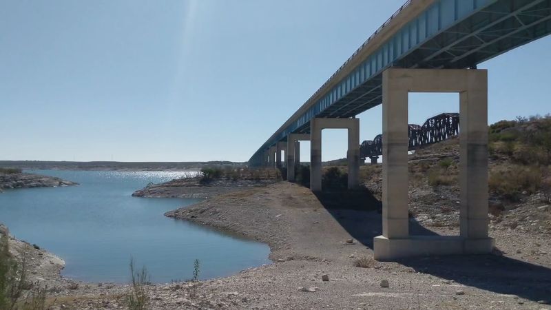
Straddling the border between Texas and Mexico, this massive reservoir was created by damming the Rio Grande. International cooperation built it, and both countries depend on its waters for agriculture, municipalities, and recreation. Watching it shrink creates complications that cross national boundaries.
The white rings of mineral deposits on the surrounding cliffs tell the story of declining water levels. These bathtub rings mark where the waterline used to rest, each layer representing another year of drought. They’ve become increasingly prominent as the reservoir drops to levels not seen since its creation.
Bass fishing tournaments that brought tourists and their dollars to the area have been affected. Trophy fish still swim these waters, but access points have changed as boat ramps are left stranded above the waterline. Marinas have had to extend their docks repeatedly, investing money to chase receding waters.
The reservoir serves multiple purposes beyond recreation. Hydroelectric power generation depends on sufficient water levels to turn the turbines. As levels drop, power output decreases, affecting the grid and revenue that helps maintain the dam and facilities.
Archaeological sites that were submerged during the reservoir’s creation have begun emerging. Ancient rock art and artifacts offer glimpses into the past, but their exposure also makes them vulnerable to damage and theft. What’s a scientific opportunity also presents preservation challenges.
Water allocation agreements between the United States and Mexico add complexity to management decisions. Both nations have rights to the water, but there’s not enough to satisfy everyone’s needs during extended droughts. Diplomatic negotiations occur while communities on both sides of the border watch anxiously.
The reservoir’s importance to the region means its health affects everything from property values to agricultural productivity across thousands of square miles.
5. O.C. Fisher Lake
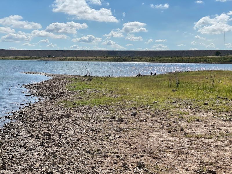
Near San Angelo, this reservoir has experienced some of the most dramatic declines in the entire state. There have been periods when it went completely dry, transforming from a 5,440-acre lake into a dusty basin. Seeing a reservoir vanish entirely drives home the severity of Texas water challenges in ways statistics never could.
Built on the North Concho River, the reservoir was supposed to provide flood control, water supply, and recreation. For years it did exactly that, becoming a beloved spot for locals to cool off during brutal West Texas summers. Then the drought came and didn’t leave.
When water disappeared completely, the exposed lake bed revealed unexpected problems. Invasive vegetation took root in the moist soil, creating a different kind of environmental headache. Efforts to control these plants required resources that could have been spent elsewhere.
The complete drying also concentrated pollutants that had settled in the lake bottom over decades. Dust storms picked up these contaminants and spread them across the region. What seemed like just a water shortage became an air quality issue too.
Wildlife that depended on the reservoir faced a crisis. Waterfowl vanished, and fish populations were completely wiped out. When water eventually returned in small amounts, restocking efforts had to start from scratch.
The ecosystem’s recovery will take years even with adequate water.
The city of San Angelo had to lean more heavily on other water sources, straining systems that were already working at capacity. Water bills increased as treatment costs rose and conservation programs expanded. Residents adjusted to a new normal that included constant awareness of every drop used.
Recent rains have brought some water back, but the reservoir remains far below capacity. The experience of watching it go completely dry has left a lasting impression on everyone who witnessed it.
6. Falcon Lake
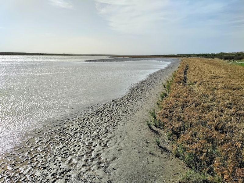
Down in the Rio Grande Valley, this international reservoir serves communities on both sides of the border. Created by damming the Rio Grande, it became famous for bass fishing that attracted anglers from across the continent. Trophy largemouth bass made this a destination lake, but declining water levels have changed the fishery dramatically.
The reservoir’s binational nature complicates every aspect of its management. Water rights, security concerns, and environmental regulations involve multiple agencies from two countries. When water gets scarce, these complications multiply as everyone tries to protect their interests.
Lakeside businesses that catered to fishing enthusiasts have struggled as visitor numbers declined. Guides who once booked months in advance now have empty calendars. The economic impact extends beyond the immediate shoreline to hotels, restaurants, and shops throughout the region.
Agricultural operations that depend on water from the reservoir have faced difficult choices. Farmers must decide which crops to plant knowing irrigation might not be available when needed. Some have switched to less water-intensive crops, while others have reduced their acreage entirely.
The receding waterline has exposed infrastructure that was meant to remain submerged. Old fences, roadbeds, and building foundations emerge like artifacts from a lost civilization. These remnants tell stories of communities that were relocated when the reservoir was created decades ago.
Security issues have also intensified as water levels dropped. Shallow areas that were once impassable by boat can now be crossed on foot in some places. Border patrol operations have had to adapt to these changing conditions along this international boundary.
Climate predictions suggest the region may face longer dry periods interspersed with intense rainfall events. This pattern makes reservoir management even more challenging, as the lake swings between extremes rather than maintaining steady levels that communities can plan around.
7. Lake Abilene
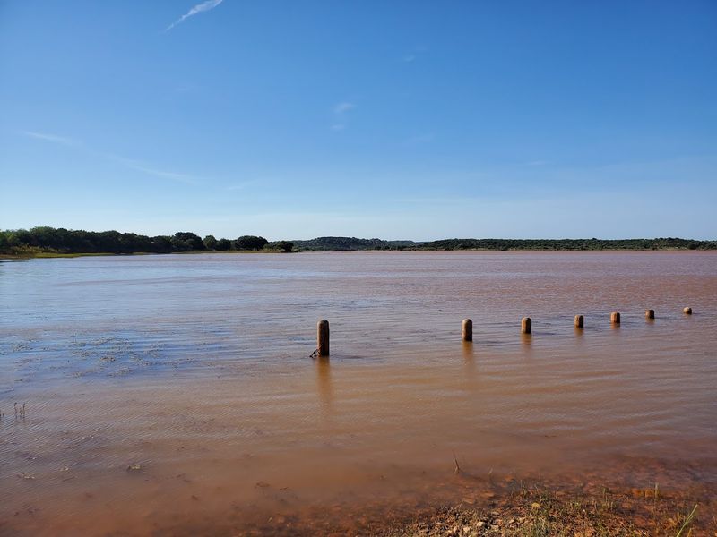
This reservoir serves as the primary water source for the city of Abilene, making its health a critical concern for over 120,000 people. When levels drop, the entire community feels the impact through water restrictions, increased costs, and anxiety about long-term supply. The lake’s struggles mirror challenges facing many West Texas communities.
Elm Creek feeds the reservoir, but consistent drought means inflow has been minimal for extended periods. Evaporation in the hot, windy climate can exceed inflow, causing levels to drop even without any water being withdrawn for municipal use. It’s a losing battle against nature’s basic physics.
The city has invested heavily in alternative water sources to reduce dependence on this single reservoir. Pipeline projects, water recycling programs, and conservation initiatives all aim to stretch available supplies further. These efforts require significant financial investment that ultimately gets passed to water customers.
Recreational use of the reservoir has been severely limited during low-water periods. The city park surrounding it remains open, but activities like boating and swimming become impossible when there’s barely enough water for drinking. Residents have had to find other ways to enjoy outdoor recreation.
Water quality monitoring becomes more intensive when levels drop. Concentrated pollutants, increased water temperature, and algae growth all require careful management to ensure the water remains safe to treat and distribute. Laboratory testing and treatment costs increase accordingly.
Local officials have explored creative solutions including cloud seeding to increase rainfall. While results from such efforts are difficult to measure, they demonstrate how seriously the community takes its water challenges. Every possible option gets consideration when your primary water source is disappearing.
The reservoir’s condition serves as a daily reminder to Abilene residents that water security isn’t guaranteed. Conservation has shifted from suggestion to necessity, changing behaviors and attitudes across the community in ways that may persist even if the lake eventually refills.
8. Lake Corpus Christi
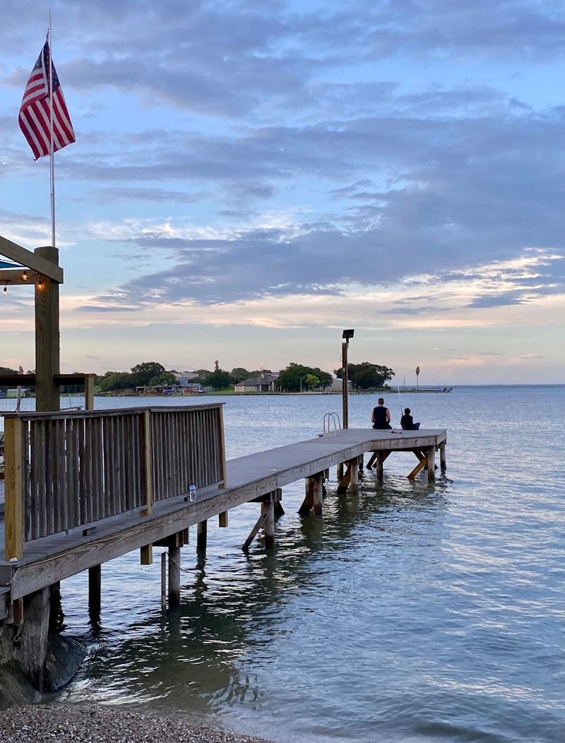
Formed by damming the Nueces River, this reservoir was designed to supply water to Corpus Christi and surrounding communities. Its importance to the coastal region cannot be overstated—hundreds of thousands of people depend on it. Watching it shrink creates genuine concern about the area’s future water security.
The reservoir has experienced dramatic fluctuations over the years, but recent droughts have pushed it to historic lows. Entire coves that once sheltered boats now sit empty, their bottoms cracked and dry. The transformation happens gradually until suddenly people realize how much has been lost.
State park facilities around the reservoir have had to adapt constantly. Campgrounds that offered lakefront sites now overlook empty expanses. Park rangers have closed access points and rerouted trails as the shoreline shifted.
Visitor numbers have declined as recreational opportunities diminished.
The Coastal Bend region’s economy depends partly on tourism, and the reservoir’s condition affects that industry. Fishing guides, boat rental operations, and lakeside resorts all struggle when water levels drop. The ripple effects touch businesses that might seem unconnected to the lake itself.
Municipal water planning has become increasingly complex as officials try to balance current needs with future growth. New residential and commercial development requires water commitments that may be difficult to fulfill. Tough decisions about growth management become necessary when resources are limited.
Environmental groups have raised concerns about the ecosystem impacts of prolonged low water levels. Native species struggle while invasive species sometimes thrive in altered conditions. The biological community that developed over decades gets disrupted in ways that may take generations to reverse.
Hope remains that wet weather cycles will eventually refill the reservoir, but climate uncertainty makes predictions difficult. Meanwhile, communities continue adapting to a reality where water abundance can no longer be assumed, reshaping how they plan for tomorrow.
Share this story