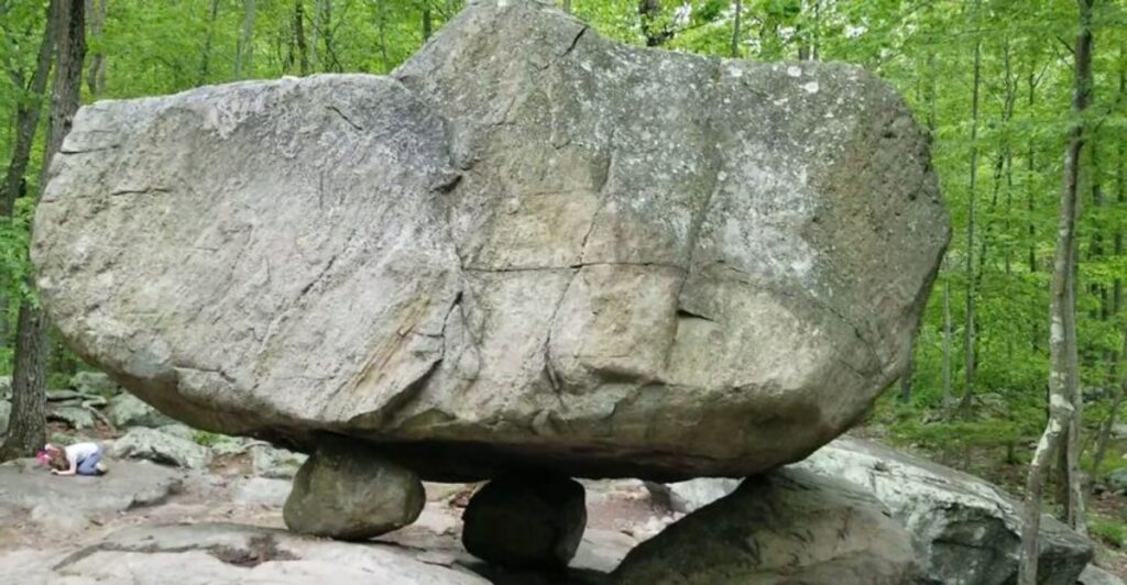
A waterfall thunders beside a parking area. A massive boulder balances on three smaller stones.
An Atlantic white cedar swamp appears more suited to the Canadian wilderness than northern New Jersey. These are not rewards reserved for hikers willing to grind through ten difficult miles.
Across the Garden State, some of the strangest and most impressive natural features sit remarkably close to the places where visitors leave their cars and lace up their boots.
That makes them perfect for curious hikers, families, photographers, and anyone who enjoys a memorable payoff without turning every park visit into an endurance test.
Some destinations on this list reveal their main attraction almost immediately, while others require a short walk through forests, wetlands, or sandy coastal scrub.
From glacial boulders and basalt cliffs to hidden ravines and storm-shaped dunes, these nine parks prove that New Jersey’s geological oddities often begin right where the trail does.
1. Delaware Water Gap National Recreation Area: Dingmans Falls
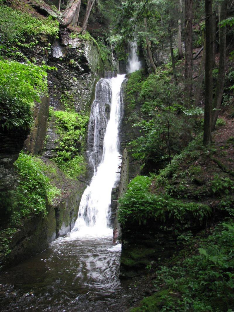
You can hear Buttermilk Falls before taking more than a few steps from the roadside. Water spills down a steep rock face beside Mountain Road, placing one of New Jersey’s tallest waterfalls practically at the trailhead.
A wooden staircase climbs alongside the cascade, offering changing views as it rises through a cool, shaded pocket of forest. After heavy rain, the water charges down the ledges with enough force to throw mist into the surrounding greenery.
During drier stretches, it becomes a thinner ribbon that exposes more of the rock underneath. Visitors looking for a quick encounter can admire the falls from below without committing to a major hike.
Anyone with energy to spare can continue up the Buttermilk Falls Trail, which climbs sharply for 1.4 miles before meeting the Appalachian Trail. That extension is far more demanding than the easy roadside view, gaining more than 1,000 feet in elevation.
The gravel roads leading into this remote section of the recreation area can be rough, and seasonal closures may limit vehicle access during winter. Weekend parking also disappears quickly in warmer months.
Arrive early, bring sturdy footwear, and resist the temptation to scramble into the water. The best part is already waiting in plain sight.
2. Paterson Great Falls: A City-Sized Waterfall
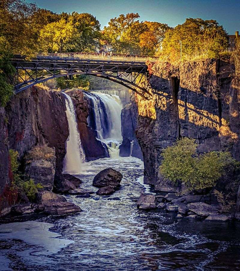
Few trailheads deliver a first impression as loud as this one. Step out of the Overlook Park parking area and the Passaic River suddenly drops 77 feet into a rocky gorge, sending up spray in the middle of one of New Jersey’s most densely built cities.
The contrast is the real surprise: brick mills, bridges, streets, and industrial ruins surround a waterfall powerful enough to have shaped an entire city. Several short walkways and viewing areas reveal different sides of the gorge without requiring a traditional hike.
Overlook Park provides the broad, classic view, while the paths around Mary Ellen Kramer Park bring visitors closer to the river and the churning water below. Flow varies with rainfall, so a visit after wet weather can be especially dramatic.
This is also a smart choice for anyone who wants a remarkable natural feature without rocky terrain, steep climbs, or hours in the woods. Free two-hour parking is generally available at Overlook Park, though the small lot fills quickly on weekends and holidays.
Additional parking can be found downtown within walking distance. The grounds remain accessible even when ranger services are limited, but daylight is the best time to explore.
Bring a camera and give yourself longer than expected; the falls have a habit of holding people at the railing.
3. High Point State Park: The View Above Three States
An Atlantic white cedar swamp is not what most hikers expect to find near the highest point in New Jersey. Yet the Cedar Swamp Trail leads into a cool, boggy ecosystem that feels strikingly different from the surrounding hardwood forest.
Dense evergreens darken the path, sphagnum moss spreads across the wet ground, and tannin-stained water gathers beneath the trees. The setting has an almost northern quality, as though a piece of the Adirondacks drifted south and settled in Sussex County.
Wooden walkways help hikers cross the wettest portions while protecting the fragile plant community below. The trail is gentle compared with the park’s more demanding ridge routes, making it a good option for families and casual walkers who still want to see something genuinely unusual.
Conditions can be damp even when the weather has been dry, so shoes with decent traction are a better choice than sandals. Bug spray earns its place in the backpack during warmer months.
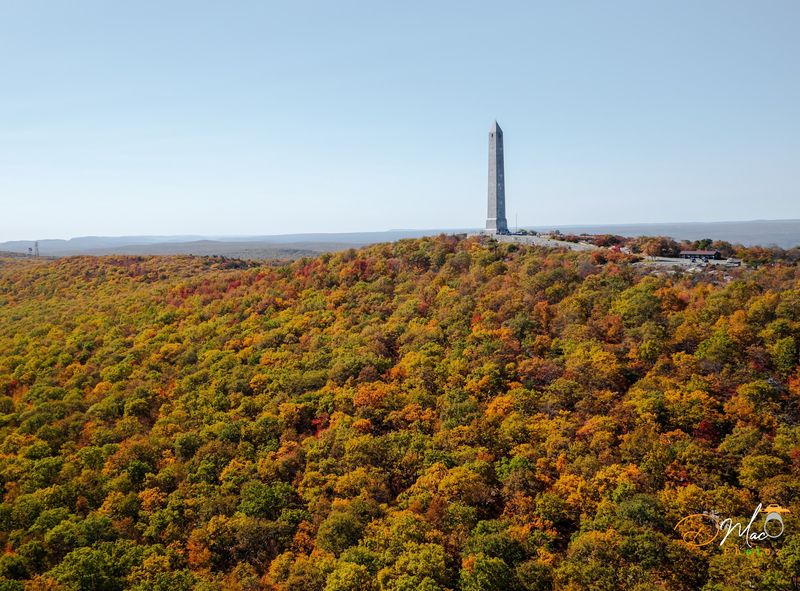
After the swamp, it is worth driving to the High Point Monument area for the park’s other great natural spectacle: long views across New Jersey, New York, and Pennsylvania. Parking areas are spread throughout the park, and entry fees may apply seasonally.
Check posted conditions before heading out, particularly after storms or during winter weather.
4. Cheesequake State Park: Two Landscapes Collide
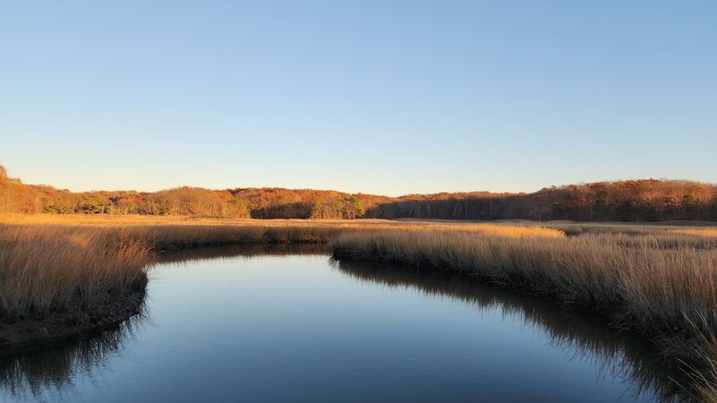
The landscape seems unable to make up its mind here, and that is precisely the attraction. Cheesequake sits where northern hardwood forest, coastal salt marsh, freshwater wetlands, and Pine Barrens-style vegetation overlap.
Within a relatively short walk, hikers can pass beneath oaks, cross damp lowlands on boardwalks, and encounter sandy soil supporting pitch pine and shrubs more commonly associated with South Jersey. That ecological mash-up gives the park an impressive amount of variety for a property surrounded by busy roads and suburban development.
The trails begin near established parking areas and quickly enter the woods, so the shift from traffic noise to bird calls and rustling marsh grass happens faster than expected. The Red, Yellow, Green, and Blue trails offer different combinations of forest, wetlands, and elevation, with several routes short enough for an easy morning outing.
Boardwalk sections can become slick after rain, while exposed roots and muddy patches reward careful footing. The park’s nature center adds useful context to the plants and wildlife found along the trails, particularly for visitors curious about why so many habitats meet here.
Summer weekends can be busy because Cheesequake also has camping, fishing, and picnic facilities. Visit early or choose a weekday if you want the boardwalks and unusual habitat transitions mostly to yourself.
5. Hacklebarney State Park: A Ravine Full of Motion
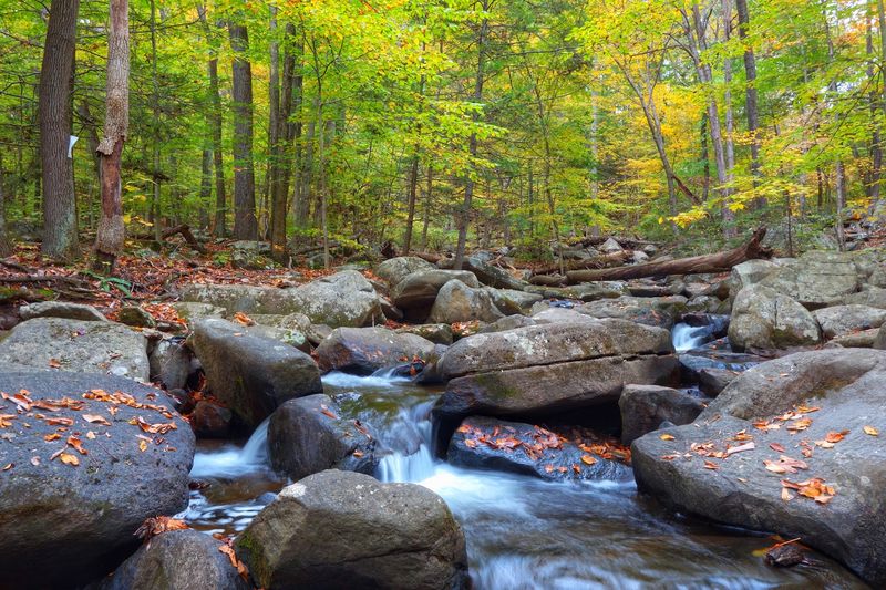
Cool air rising from the Black River is often the first clue that the terrain ahead is about to change. A broad path descends from the parking area into a rocky ravine where water tumbles around enormous boulders, slips over ledges, and squeezes through channels carved into the valley floor.
The gorge feels surprisingly deep and secluded considering how quickly hikers can reach it. Hemlocks shade portions of the river, while ferns and moss soften the jumble of stone along the banks.
The Main Trail provides the most direct approach, and connecting paths allow visitors to build anything from a short walk to a longer loop through the surrounding forest. Some sections include stone steps, uneven surfaces, and wet rocks, so this is not the place for smooth-soled shoes.
Spring runoff and recent rainfall make the cascades especially energetic, though autumn brings its own reward when fallen leaves collect between dark boulders. Families often gather near the picnic area above the ravine, making it easy to combine lunch with a manageable hike.
Parking can fill on peak fall weekends, and the descent feels considerably easier than the climb back. Take your time beside the river, but stay on marked paths; the rocks nearest the water can be far more slippery than they look.
6. Stokes State Forest: Tillman Ravine’s Rocky Surprise
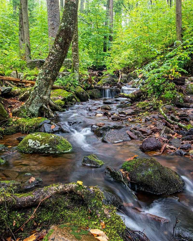
Tillman Ravine wastes very little time getting interesting. From its small parking area, a short trail enters a narrow natural area filled with hemlocks, mossy boulders, small cascades, and the constant sound of Tillman Brook moving through the gorge.
The forest canopy filters the sunlight, keeping the ravine noticeably cooler than the surrounding landscape. In places, exposed tree roots curl around rocks while water slips beneath footbridges and over shallow ledges.
It is the kind of setting that looks remote in photographs but requires only a modest walk to experience. The ravine loop is manageable for most hikers, though rocks, roots, and damp surfaces make sturdy footwear essential.
After rain, the stream becomes livelier and the greenery deepens, but the path can also turn muddy. Photographers will find plenty to work with without hauling equipment for miles.
Tillman Ravine occupies just one corner of the much larger Stokes State Forest, which contains more than 60 miles of trails, mountain overlooks, lakes, and connections to the Appalachian Trail. That makes it easy to pair this short gorge walk with a longer adventure.
Parking beside the ravine is limited, so early arrival helps on pleasant weekends. Winter access can change with road conditions, making a pre-trip check worthwhile.
7. Pyramid Mountain: Tripod Rock’s Giant Balancing Act
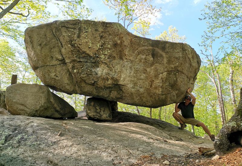
Tripod Rock looks like someone attempted an impossible balancing trick and then abandoned it in the forest. The enormous glacial erratic rests on three smaller stones, creating a narrow gap beneath a boulder estimated to weigh roughly 160 tons.
It was not carefully positioned by people, despite the tempting theories. Glacial ice transported and deposited the rock thousands of years ago, leaving it perched in a formation that still appears one hard shove away from collapse.
The hike begins at the visitor center on Boonton Avenue and introduces the park’s rocky character almost immediately. Reaching Tripod Rock requires a moderate outing over uneven terrain, but other glacial erratics appear closer to the trailhead, turning the approach into more than a walk toward one headline attraction.
Bear Rock and Whale Head Rock add still more geological personality, while exposed ridges and wetlands keep the scenery changing. Trails are well marked, but the network is extensive enough that carrying a map is wise.
The ground can be rugged, with roots, stone steps, and slick rock after rain. Trails are open from sunrise to sunset, and parking near the visitor center can fill early on weekends.
Climbing on the boulders is prohibited, so admire the glacier’s handiwork without trying to improve upon its balancing act.
8. Island Beach State Park: Dunes That Keep Moving
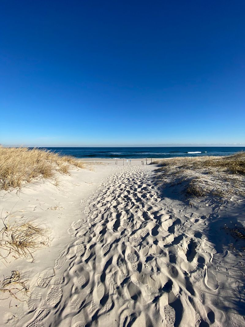
Sand begins reshaping itself almost as soon as visitors leave the pavement. Short trails lead from roadside parking areas through coastal thickets, over rolling dunes, and toward either the Atlantic Ocean or Barnegat Bay.
These dunes are not simply piles of beach sand. Wind, waves, storms, and dune grasses constantly rebuild the landscape, creating ridges and hollows that can look different after a single rough season.
Trails such as Spizzle Creek, Reed’s Road, and the Johnny Allen’s Cove route reveal different pieces of the barrier island, including maritime forest, salt marsh, freshwater wetlands, and dense stands of bayberry and beach plum. Several paths are brief enough to explore without turning the visit into a long hike, yet they quickly feel removed from the road.
Ospreys, herons, foxes, and diamondback terrapins may appear depending on the season. Stay on designated paths and boardwalks, since dune vegetation is fragile and ticks thrive in the brush.
Summer admission fees and beach crowds make early mornings particularly appealing. Outside peak season, the park becomes quieter, and its unusual geography is easier to appreciate.
Few places show so clearly that a barrier island is not fixed land but a living strip of sand continually negotiated by wind and water.
9. Sourland Mountain Preserve: A Boulder Field in the Woods
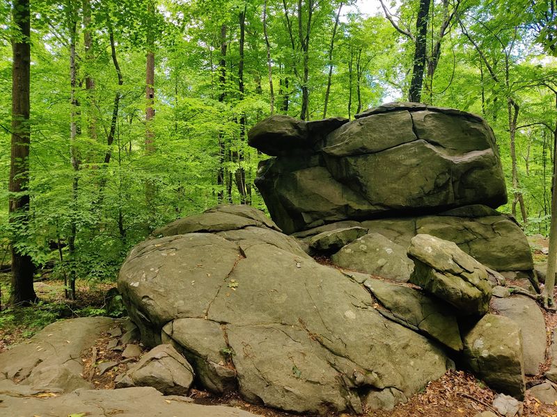
The first boulders appear before the legs have much chance to warm up. Scattered through the woods beyond the Rileyville Road parking area, these blocks of dark diabase hint at the volcanic forces that shaped the Sourland Ridge nearly 200 million years ago.
The broad Orange Trail enters a deciduous forest strewn with rock, and the Yellow Trail branches away about a quarter-mile from the lot. Farther along, larger formations crowd the slopes, creating the jumbled landscape responsible for the preserve’s famously stubborn terrain.
Early farmers called this the “sour land” because its rocky soil resisted cultivation. That frustration ultimately helped preserve a forest that now shelters native plants, wetlands, streams, and abundant birdlife.
The main trail is relatively flat, but “flat” does not mean smooth here. Embedded stone, loose rocks, muddy stretches, and seasonal stream crossings keep hikers watching every step.
Quarry marks visible on some boulders add another layer to the story, showing how the same hard stone was once cut for road building and railroad ballast. The parking area is small, and no restroom facilities are available, so plan accordingly.
Dogs must remain leashed, and climbing on the preserve’s rock faces and boulders is prohibited. Come for an easy woodland walk, but expect the geology to steal the show.
Share this story