In an old aerial view of Rand’s Marina, dozens of boats fill narrow slips beside a white waterfront building with RAND’S painted across its roof. That busy scene has disappeared from Great Bay Boulevard, but the location has not lost its pull.
At 600 Great Bay Boulevard in Little Egg Harbor Township, the former marina now feels like a weathered outpost between solid ground and an enormous sweep of tidal marsh. The concrete ramp is badly deteriorated, old pilings remain scattered near the shoreline, and the state is planning a substantial renovation.
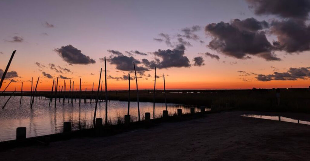
Still, the public parking area and broad water views keep this forgotten corner connected to the bay. Arrive late in the day and the practical details fade behind long reflections, rustling marsh grass, and a sky with very little standing in its way.
Rand’s may no longer be a working marina, but when the sun drops behind South Jersey’s wetlands, the waterfront still knows how to put on a show.
The Former Rands Marina That Still Opens the Door to Great Bay
Long before it became an intriguing name on a map, Rand’s Boats was a genuine working waterfront operation.
Historical aerial images show a basin lined with slips, small motorboats tied along floating docks, vehicles scattered across the gravel lot, and the marina’s name displayed in enormous letters where nobody approaching by water could miss it.
Its position beside Big Thorofare Inlet made practical sense. From this stretch of Great Bay Boulevard, local waterways lead through a maze of creeks, marsh channels, and shallow bays toward the wider Great Bay estuary.
Today, the business is closed and the orderly rows of boats are gone, leaving behind a location that feels more like the outline of a marina than the real thing. New Jersey now owns the property as part of the Great Bay Boulevard Wildlife Management Area, and state planning documents officially identify it as the former Rand’s Marina site.
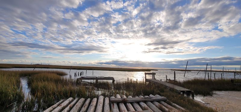
Those same records paint an unvarnished picture of its condition: broken concrete, abandoned cedar shore timbers, wooden debris, an unsafe pier, and old pilings scattered along the inlet. That may not sound glamorous, but it explains why the place has such a strong sense of history.
The wide lot, bulkhead, basin, and water beyond it still reveal exactly why generations of boaters used this spot. It was never positioned beside a polished resort or busy boardwalk.
Rand’s served people who wanted to get onto the water without ceremony, whether they were fishing, checking crab traps, or running a small boat through the back bays. The marina may have stopped operating, but its location remains useful.
Public parking is still available, and the state’s renovation plans are intended to restore safe boating and fishing access rather than erase the site’s waterfront purpose. Rand’s is not being transformed into something unrelated.
It is slowly being prepared to do its old job again.
The Seven Bridges Road Drive Through South Jersey’s Salt Marshes
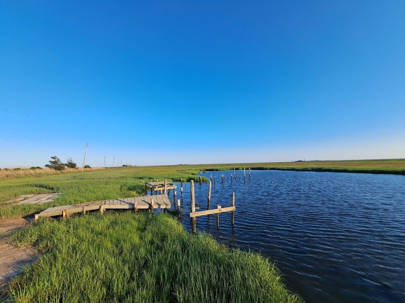
Leave the developed part of Little Egg Harbor Township behind and Great Bay Boulevard begins shedding the usual signs of civilization one by one. Houses become scarce.
The center lines disappear. Trees give way to reeds, tidal creeks, and huge sections of open sky.
The road continues for roughly five miles across brackish marshland, narrowing as it reaches a series of wooden bridges where posted speeds can drop to 10 miles per hour. Locals call this Seven Bridges Road, although counting them produces one of South Jersey’s favorite little surprises.
Only five bridges were completed. The original early-20th-century vision was far more ambitious, with a roadway intended to continue across the marshes toward Brigantine and Atlantic City.
Bridges six and seven never arrived, leaving the boulevard to end near Little Egg Inlet instead. The unfinished plan turned out to be a gift for anyone who prefers salt marsh to another strip of development.
Driving here is less about covering distance and more about noticing what is beside the pavement. Osprey platforms rise above the grass.
Great blue herons stand in shallow water with the patience of statues. Diamondback terrapins regularly cross the road during the warmer months, sometimes forcing drivers to stop while a determined turtle completes its commute.
The route is also unusually exposed to tides and coastal weather. Water can cover low sections, and what looks like an ordinary roadside puddle may be connected to a rising marsh creek.
That vulnerability is part of the landscape rather than a design flaw that can easily be paved away. Great Bay Boulevard exists directly inside a working tidal system, where the water changes the view several times each day.
By the time Rand’s appears around 600 Great Bay Boulevard, the ride has already delivered miles of marsh, wooden spans, and wide-open scenery without demanding a single scenic overlook sign.
The Public Boat Ramp That Puts Great Bay Within Easy Reach
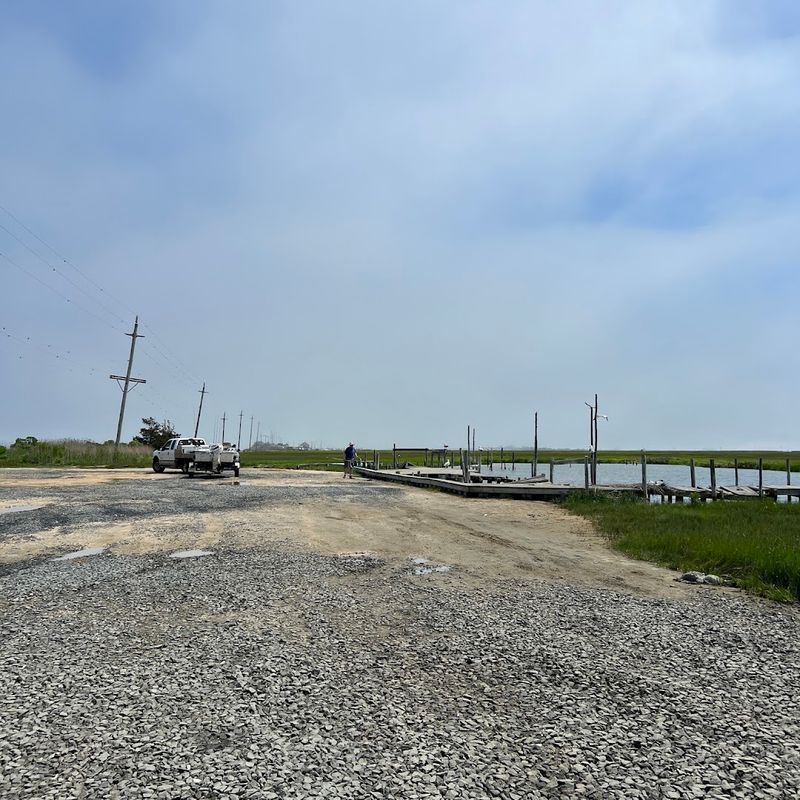
Here is the important 2026 reality check: the boat launch at the former marina is public, but the old ramp itself is not currently in usable condition. New Jersey Fish and Wildlife maintains the site at 600 Great Bay Boulevard, just beyond the bridge over Big Thorofare Inlet, and the surrounding parking area remains open to the public.
A state inspection found that much of the concrete ramp was broken, while the adjacent wooden pier, cedar pilings, and debris had become unsafe and nonfunctional. In other words, this is not the place to arrive with a trailer and assume you can back straight into the water.
The encouraging news is that the state is not abandoning it. In March 2026, New Jersey awarded a $336,555 design contract for a complete renovation of the boating access area.
Plans call for the deteriorated ramp to be replaced with a reinforced concrete launch, along with a functional fishing dock, improved access, new bulkhead decking, and removal of abandoned wood from the shoreline and water. The overall working estimate for design, permitting, construction, and related costs is about $729,500.
Once finished, the location should again make excellent geographic sense for small-boat access. Big Thorofare connects with the channels and shallow waters surrounding Great Bay, an estuary known for recreational fishing, shellfish, and broad stretches of protected marsh.
The proposed project is also expected to use the same general ramp dimensions rather than dramatically enlarging the footprint, helping the site remain appropriately low-key. Construction timing has not been pinned to a simple public opening date, and the property will close while physical work is underway.
For now, the former marina is best understood as an access point in transition: public land with a valuable waterfront position, a worn-out launch, and a funded plan to make the old gateway functional again.
Crabbing, Birdwatching, and Wildlife Along the Quiet Shoreline
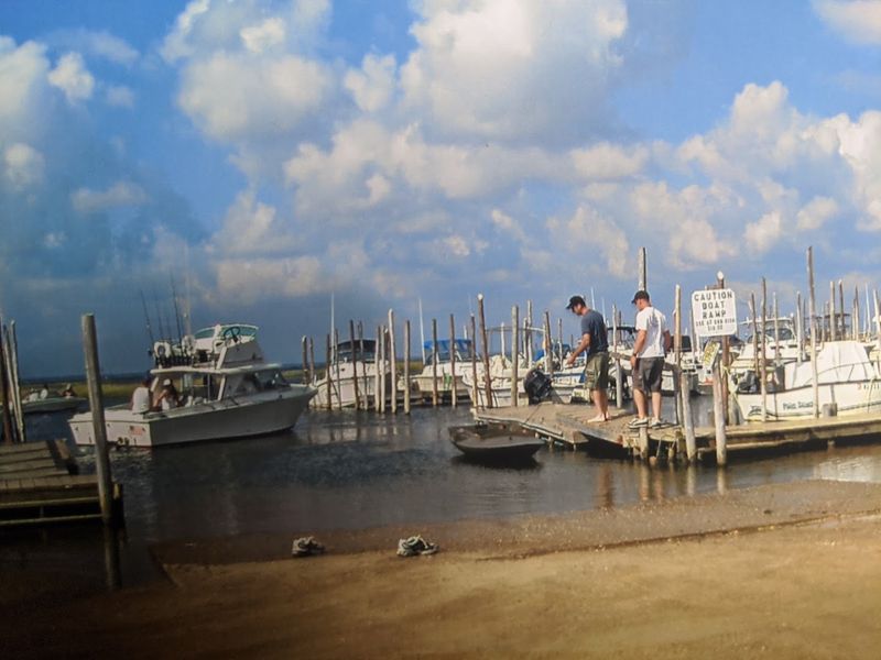
Watch the marsh for five minutes and something will usually move. It may be an osprey carrying nesting material, a terrapin edging toward the pavement, or a black skimmer flying low enough that its oversized lower bill nearly touches the water.
Great Bay Boulevard Wildlife Management Area protects approximately 5,982 acres of freshwater, brackish, and saltwater estuary, so the former marina is surrounded by habitat rather than landscaped waterfront property.
New Jersey Fish and Wildlife identifies the area as especially important for raptors, wading birds, and shorebirds, including willets, plovers, yellowlegs, oystercatchers, sandpipers, and black skimmers.
Great blue herons are the easiest celebrities to recognize, frequently standing beside a creek as though somebody placed them there for a photograph. Beneath the surface, Great Bay supports weakfish, summer flounder, bluefish, black drum, shellfish, and the smaller aquatic life that makes the estuary such an important spawning and nursery area.
Crabbing is part of the local rhythm, too. People have long come to these tidal channels with traps, hand lines, bait, and the optimistic belief that the next pull will produce an especially impressive blue crab.
The trick is using an appropriate shoreline access point rather than treating the bridges as fishing platforms. Signs on the narrow spans prohibit crabbing, fishing, diving, jumping, and loitering, partly because there is barely enough room for vehicles to pass safely.
Around the former Rand’s site, the water’s edge also contains damaged materials awaiting removal, so the old structures deserve plenty of space. Wildlife watching requires far less equipment and usually provides more action anyway.
Low tide exposes mud, shell, and feeding areas, while higher water pushes birds toward the marsh edges. The quiet is not complete—there are gulls, insects, boat engines, and the occasional slap of something in the creek—but it is the busy sound of an estuary doing exactly what it is supposed to do.
The Wild Waterfront and Marine Field Station at the End of the Road
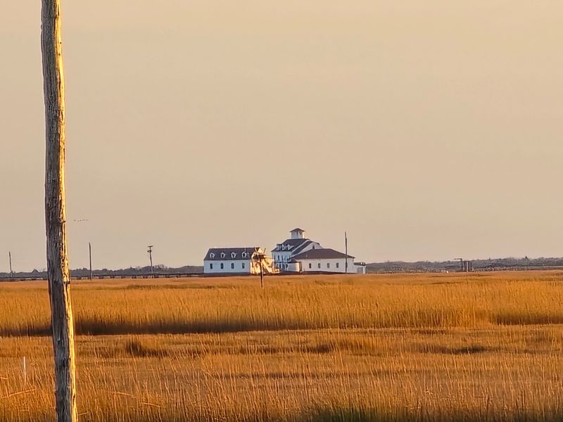
Five miles beyond Tuckerton’s familiar streets, Great Bay Boulevard reaches a destination that looks too improbable to be real estate. A long wooden walkway stretches across marsh and water toward a large white building with a red roof, wraparound porches, and the sturdy proportions of an old coastal station.
This is the Rutgers University Marine Field Station, a year-round research facility at 800 Great Bay Boulevard. The complex began life in 1937 as a U.S. Coast Guard lifeboat station.
Rutgers took over the property in 1972, renovated the main facility in 1995, and turned its unusual location into a serious base for studying marine and estuarine systems.
The numbers explain why researchers value it. The surrounding Mullica River–Great Bay estuary includes roughly 87 square kilometers of salt marsh and 56 square kilometers of shallow estuarine water, with an average depth of about two meters.
Much of the watershed is protected by the Pinelands, wildlife refuges, and the Great Bay Wildlife Management Area, helping make this one of the least disturbed estuaries in the densely populated Northeast.
Inside the station are analytical laboratories, flow-through seawater labs, a marine railway, offices, and equipment for studying fish and invertebrates.
Its fleet includes five smaller vessels measuring 15 to 24 feet, the 30-foot R.V. Caleta, and the 48-foot R.V. Arabella for work farther offshore. This is not a conventional visitor center with daily tours and a gift shop.
It is an active research campus where graduate students, scientists, and visiting researchers work throughout the year. That distinction matters because the best experience is the setting itself: the disappearing road, the surrounding grasses, the working boats, and the old Coast Guard architecture standing at the edge of Little Egg Inlet.
The station gives the end of Seven Bridges Road an unexpected purpose. The pavement may stop here, but decades of coastal research begin exactly where the dry land runs out.
Why Sunset Turns This Remote Bayfront Into the Main Event
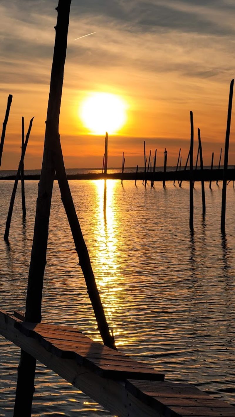
The best transformation begins when the marsh loses its midday glare. The flat landscape that can look almost severe under a high summer sun becomes softer by the minute, with warm light catching the tops of reeds, old pilings, tidal channels, and every ripple near the former marina.
There are few tall buildings along this section of Great Bay Boulevard and almost no commercial clutter. Instead of neon signs and rooftop decks, the horizon is formed by low marsh grass and distant tree lines.
That open space gives the evening sky room to spread sideways, not just upward. Clouds turn peach, rose, or deep orange while the water breaks those colors into moving pieces.
At low tide, narrow channels carry bright ribbons through dark mud and grass. At higher water, the inlet becomes a broader mirror, interrupted by birds, dock remnants, and an occasional boat heading home.
The location is especially compelling because nothing here appears arranged for spectators. The bulkhead was built for working boats.
The gravel lot served trailers and fishermen. The wooden structures were useful long before anybody considered how they might look in a sunset photograph.
Even the imperfections—the leaning posts, rough shoreline, and traces of the old marina—give the view more character than a perfectly landscaped promenade could manage. Future construction will change some of those foreground details, replacing unsafe materials with a new ramp, fishing pier, and accessible decking.
The essential view, however, comes from the marsh and water beyond the project boundary. That is the part no renovation needs to improve.
As daylight slips away, Great Bay Boulevard becomes quieter, the last birds cross overhead, and the former Rand’s Marina briefly regains the kind of presence it must have had when boats filled every slip. By then it no longer feels forgotten.
It is simply the place where the road ends and the whole western sky takes over.
Share this story