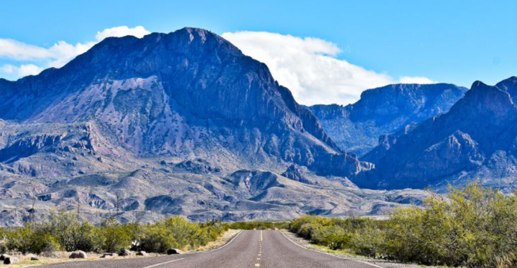
Texas highways get all the glory, but the real magic happens when you veer off onto those lesser-known backroads where the pavement gets quieter and the scenery gets wilder. These hidden routes wind through landscapes that most travelers never see, from wildflower-carpeted hills to desert canyons that look like another planet. Whether you’re chasing a sunset or just need a break from the interstate grind, these six backroads deliver views that’ll make you pull over and stare.
1. Willow City Loop (Fredericksburg)
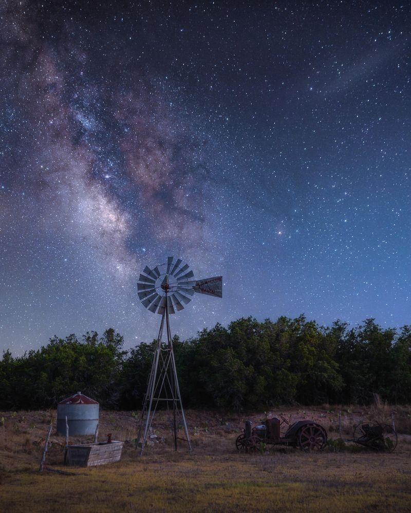
Spring in the Hill Country turns this 13-mile loop into something straight out of a postcard you’d actually want to send. Bluebonnets carpet the roadsides so thick you can barely see the grass underneath, mixed with Indian paintbrush that adds splashes of red and orange to the show. The road twists through ranch land where cattle graze like they don’t even notice the tourists stopping every fifty feet to take pictures.
Timing matters here. Hit it too early in March and you’ll see green fields with a few brave blooms. Show up in late April and you might catch the tail end, but mid-March through early April is when this route really earns its reputation.
The narrow road means you’ll want to drive slow anyway, which works out perfectly because you’ll be rubbernecking at every turn.
What makes this loop special isn’t just the flowers. The landscape rolls and dips in ways that create natural frames for whatever’s blooming, with old barns and stone fences adding that authentic ranch-country vibe. You’ll share the road with photographers, families on weekend drives, and locals who’ve been coming here for decades.
Pack water and snacks because there’s nothing commercial along the route. That’s part of the appeal. No billboards, no gas stations, just you and the wildflowers and whatever playlist you’ve got queued up.
The loop connects back to Ranch Road 1323, making it easy to turn this into a longer Hill Country adventure or just a quick escape from Fredericksburg’s wine-tasting crowds. Either way, your camera roll will thank you.
2. Texas State Highway 118 (Fort Davis to Study Butte)
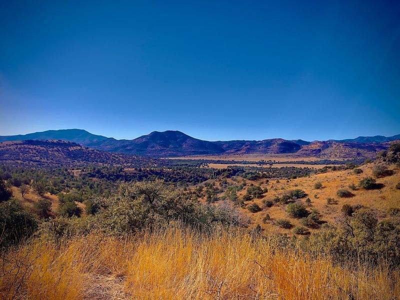
Out here, the mountains don’t mess around. Highway 118 cuts through some of the most dramatically empty country in West Texas, where the Davis Mountains give way to the Chihuahuan Desert and the landscape gets progressively more lunar. This 85-mile stretch feels like driving through a geology textbook, with rock formations that shift from pine-dotted peaks to bare volcanic plugs to endless desert flats.
The road starts in Fort Davis, where you might grab coffee and fuel before heading south. Once you leave town, civilization gets real scarce real quick. You’ll pass through Alpine, but otherwise it’s just you, the asphalt, and mountains that change color depending on the time of day.
Early morning light makes them purple-blue. Afternoon sun brings out the reds and oranges in the rock.
Wildlife sightings happen more often than you’d expect. Pronghorn antelope graze in the grasslands near the highway, and if you’re lucky (or unlucky, depending on your schedule), you might spot a black bear crossing the road in the higher elevations. The elevation changes keep things interesting, climbing over 5,000 feet in spots before dropping back down as you approach Study Butte.
Cell service is a joke out here, so download your maps beforehand. Gas stations are few and far between, meaning you’ll want a full tank before you start. The payoff is solitude that’s hard to find anywhere else in Texas, plus views that make you understand why people used to think West Texas was another country entirely.
By the time you roll into Study Butte near Big Bend, you’ll have seen more mountains than people.
3. Devil’s Backbone Scenic Drive (Wimberley to Blanco)
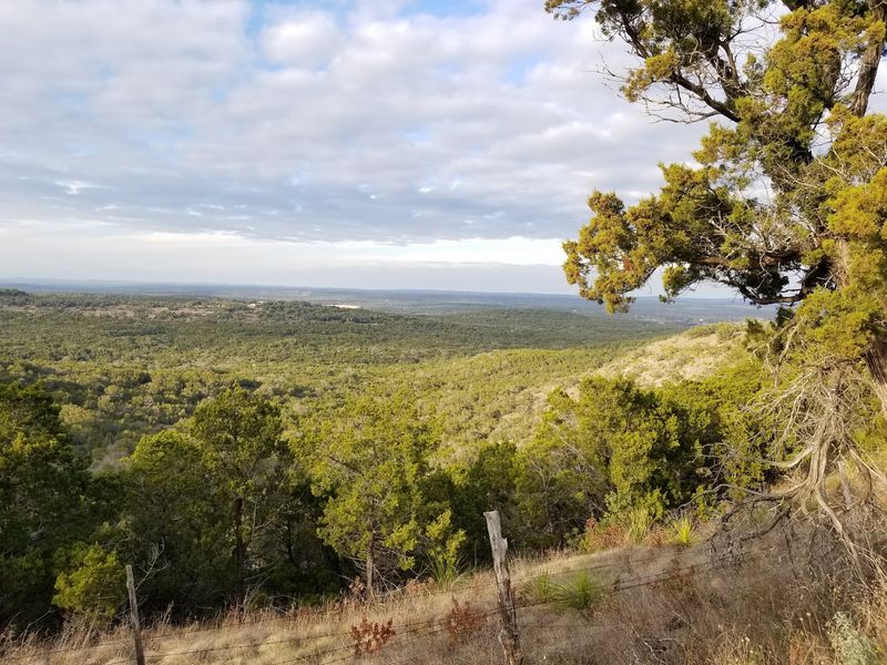
The name sounds ominous, but the only thing scary about this route is how quickly it becomes your favorite Hill Country drive. Ranch Road 32 follows a limestone ridge that drops off on both sides, giving you valley views that stretch for miles in every direction. On clear days, you can see all the way to the horizon, where the hills fade into that hazy blue-green that Texas does so well.
Starting from Wimberley, the road climbs gradually until you’re riding the spine of the ridge. That’s when the views kick in. The eastern side drops into the Blanco River valley, while the western slopes roll down toward Dripping Springs.
It’s the kind of scenery that makes you grateful for wide shoulders and pull-offs, because you’ll want to stop and just look.
Local legend says the name comes from early settlers who thought the ridge looked like a spine when viewed from below. Whether that’s true or just good marketing doesn’t really matter when you’re up there watching hawks circle below you. The road itself stays relatively level once you’re on top, making for an easy drive that rewards you with constant eye candy.
Weekends bring motorcyclists who love the curves and elevation changes. Weekdays are quieter, perfect for a leisurely cruise with the windows down. You’ll pass a few ranch gates and the occasional roadside stand selling honey or pecans, but mostly it’s just open country and big sky.
The 24-mile route ends in Blanco, a sleepy town where you can grab lunch before heading back or continuing deeper into the Hill Country.
4. Farm to Market Road 170 / El Camino del Rio (Presidio to Lajitas)
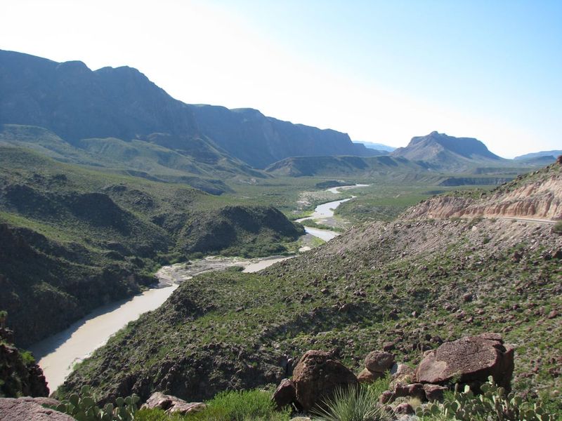
River roads don’t get much more spectacular than this 50-mile ribbon of asphalt hugging the Rio Grande through some of the most remote country in Texas. El Camino del Rio translates to “River Road,” which undersells it considerably. This route runs right along the border, with Mexico visible across the water and canyon walls rising hundreds of feet on both sides.
Starting in Presidio, the landscape looks harsh and uninviting. Give it a few miles. As you head southeast toward Lajitas, the road begins its dance with the river, twisting through Colorado Canyon and past rock formations that glow orange and red in the right light.
The Rio Grande isn’t the mighty waterway you might imagine, more like a wide creek in many spots, but the setting makes it feel significant.
This stretch earned recognition as one of the most scenic drives in America, and it’s not hard to see why. The pavement is good, the curves keep you engaged, and every bend reveals another postcard view. You’ll pass through tiny settlements that barely qualify as towns, just a few buildings clinging to the roadside like they’re not sure why they’re there either.
Watch for river rafters putting in or taking out at various access points. The canyon walls create microclimates that support surprising amounts of wildlife, including roadrunners that actually cross the road just like in the cartoons. Photography stops are plentiful, though you’ll want to be mindful of the narrow shoulders and occasional truck traffic.
By the time you reach Lajitas, you’ll understand why this road has cult status among Texas driving enthusiasts.
5. Texas State Highway 207 (Claude to Silverton)
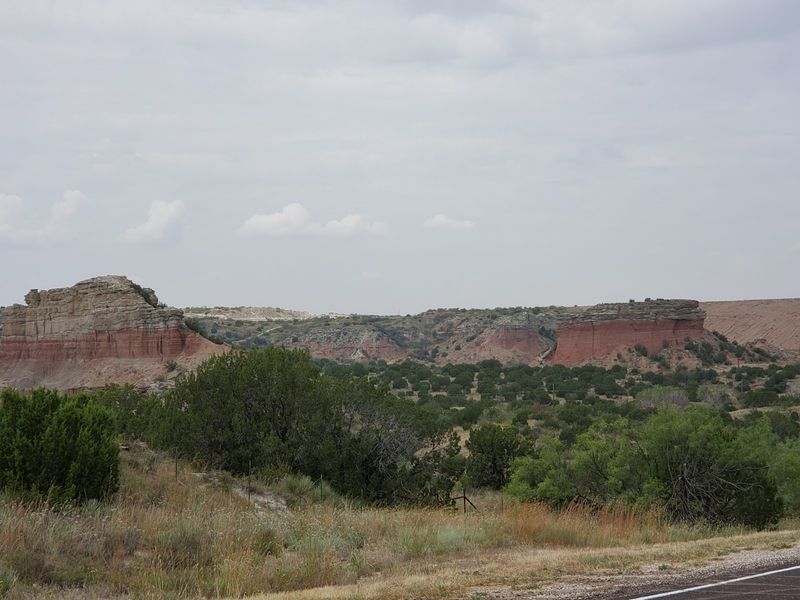
Up in the Panhandle, where most people assume Texas is nothing but flat wheat fields, Highway 207 proves the landscape has serious tricks up its sleeve. This route runs south from Claude down to Silverton, crossing the Caprock Escarpment in a way that’ll make you check your map to confirm you’re still in the same state. The transition from high plains to canyon country happens fast and dramatically.
Claude sits up on the flat part, surrounded by the kind of endless horizon that makes some people nervous and others feel free. Head south and you’re cruising through ranch land that looks pretty standard until you approach the escarpment. That’s when the ground just drops away, revealing layers of red rock and canyon systems that seem to appear out of nowhere.
The descent takes you through geology that spans millions of years, with each layer of rock telling a different story. Palo Duro Canyon State Park sits nearby, but this drive gives you the drama without the crowds. You’ll see the same kinds of formations and colors, just from a different angle and with a lot fewer tourists.
Small towns dot the route, places where the gas station doubles as the grocery store and the local café. Silverton marks the southern end, sitting in Briscoe County where cotton fields stretch to the horizon. The whole drive only takes about an hour if you don’t stop, but you’ll want to stop.
Pull over at the escarpment viewpoints and watch the light change the canyon colors from pink to orange to deep red as the sun moves across the sky.
6. Ross Maxwell Scenic Drive (Big Bend National Park)
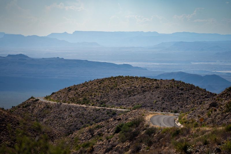
Big Bend’s main park road gets plenty of traffic, but Ross Maxwell Scenic Drive takes you deeper into the weird and wonderful geology that makes this park special. The 30-mile paved route runs from park headquarters down to Santa Elena Canyon, passing through landscapes that shift from desert scrub to volcanic badlands to riverside bottomlands. Every mile looks different from the last.
Named after the geologist who first mapped much of Big Bend, the drive includes pull-offs with interpretive signs explaining what you’re seeing. The rocks here tell stories spanning hundreds of millions of years, from ancient seas to volcanic eruptions to the river that carved Santa Elena Canyon. You don’t need a geology degree to appreciate it, but having one would probably make your head explode with excitement.
Mule Ears Viewpoint offers one of the park’s most photographed scenes, where two rock spires jut up from the desert floor like landmarks from another planet. Further along, the Sotol Vista overlook gives you panoramic views across miles of Chihuahuan Desert stretching into Mexico. On clear days, you can see mountain ranges that are technically in another country, which adds to the frontier feeling this place has never quite shaken.
The drive ends at Santa Elena Canyon, where the Rio Grande has sliced through 1,500-foot limestone cliffs to create one of the park’s signature sights. A short trail takes you right into the canyon mouth if you want to stretch your legs. Wildlife sightings are common along the route, especially in early morning or late afternoon.
Javelinas, roadrunners, and various raptors all make appearances. Bring plenty of water and start early to beat the heat and the crowds.
Share this story