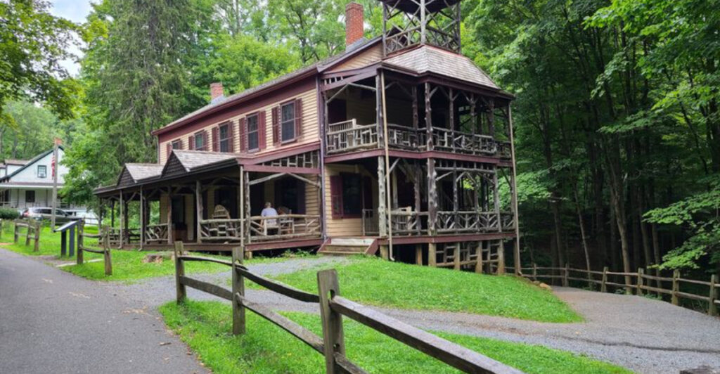
A stone castle crumbles above Ramapo Lake, a concrete railroad viaduct towers over a quiet Sussex County path, and abandoned workers’ cottages wait at the end of a woodland trail. New Jersey’s past rarely stays behind glass.
Much of it is hiding outdoors, where reaching it requires a pair of comfortable shoes and at least a little curiosity. Across the state, trails follow old canal beds, circle ironmaking villages, pass military bunkers, and retrace ground crossed by Revolutionary War soldiers.
Some routes deliver a substantial hike before revealing their historical prize; others are flat, family-friendly walks where the story begins almost immediately. Either way, the combination makes for an outing that feels more rewarding than an ordinary loop through the woods.
These 11 trails lead to places that shaped industry, transportation, warfare, and everyday life in New Jersey—along with a few ruins that look as though they belong in a much more mysterious corner of the world.
1. Castle Loop – Ramapo Mountain State Forest
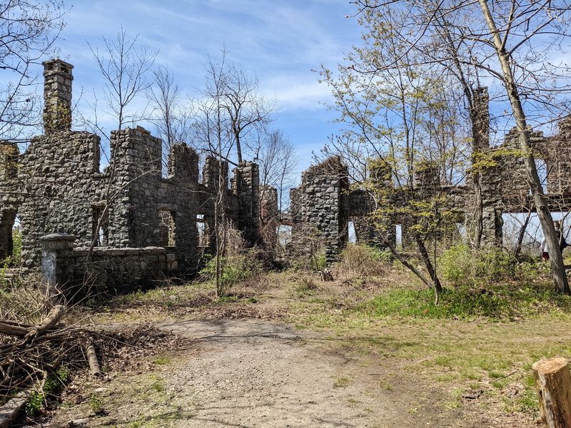
Ruined stone walls rise from the forest above Ramapo Lake like the remains of a forgotten European stronghold. They actually belonged to Van Slyke Castle, an early-20th-century estate originally called Foxcroft.
Built for wealthy stockbroker William Porter, the mansion later took the name of Porter’s widow, Ruth, and her second husband, Warren Van Slyke. Abandonment and a 1959 fire reduced the property to a roofless shell, but enough survives to make the destination genuinely dramatic.
Arched doorways, sections of turreted wall, a swimming pool and a separate stone water tower are scattered around the ridge. Reaching them requires following the white-blazed Castle Loop through Ramapo Mountain State Forest.
The roughly three-mile route begins near Skyline Drive, descends toward the lake and then makes a steep, rocky climb to the estate. That uphill push is the price of admission, but viewpoints over Ramapo Lake and the surrounding Highlands help soften the deal.
On clear days, hikers may even catch a distant glimpse of Manhattan. Sturdy shoes are a smart choice because the path can be rocky, eroded and slick after rain.
The forest also contains several intersecting trails, so carrying a current map prevents an accidental bonus hike. Visit in late fall or winter for clearer views of the ruins, when bare trees reveal just how large and elaborate this mountaintop home once was.
2. History Trail – Watchung Reservation
A company town, a summer resort and a “deserted village” all occupied the same patch of Union County woods. The six-mile History Trail in Watchung Reservation connects that layered story with other remnants of the area’s past, turning a day hike into a loosely arranged outdoor museum.
Its showpiece is Feltville, the community founded by businessman David Felt in 1845 beside the Blue Brook. Felt built a stationery mill along with housing, a store, a church and a school for his employees.
About 175 people lived there at its peak. The business changed hands after Felt left, and later attempts to produce silk, cigars and even sarsaparilla failed.
In 1882, the settlement received a second act as Glenside Park, a mountain resort with wide porches, dances, carriage rides and city families escaping the summer heat. That venture closed in 1916, leaving behind the nickname that stuck: the Deserted Village.
Today, several cottages, Masker’s Barn and the former church and general store survive. The larger History Trail also passes old foundations, mill sites and a small colonial cemetery.
Numbered markers help make sense of what would otherwise look like random stones in the undergrowth. Hikers wanting a shorter outing can take the approximately one-mile self-guided village walk instead.
The grounds are open from dawn to dusk, and parking near Glenside Avenue provides the easiest access to the historic district.
3. Yellow Trail – Jockey Hollow
Imagine building a log hut in frozen ground, then spending one of the coldest winters of the century inside it with eleven other soldiers. That was life at Jockey Hollow during the Continental Army’s 1779–1780 winter encampment, when thousands of troops endured snow, food shortages and miserable conditions outside Morristown.
The yellow-blazed trail gives visitors a close look at the landscape where they waited out the season. Replica soldier huts stand on the hillside where the Pennsylvania Line once camped, each small structure offering a blunt lesson in how little comfort the men had.
Wooden bunks filled most of the interior, a fireplace supplied heat, and privacy was essentially theoretical. The route also passes near the Wick House, the preserved 18th-century farmhouse that served as headquarters for Major General Arthur St. Clair.
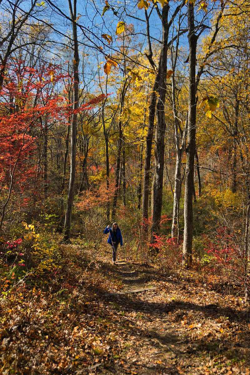
Depending on where hikers begin and which connections they use, the outing can be kept short or expanded into a longer loop through the park’s hardwood forest. The main trail intersections are well marked, but picking up a map at the visitor center makes planning easier.
Families can park near the soldier huts for a brief uphill walk, while anyone seeking more mileage can start near the visitor center or Wick Farm. Spring wildflowers and autumn color make the woods especially attractive, but a winter visit adds an appropriate chill to the story.
Even with modern boots and a warm coat, it is hard not to feel grateful for the drive home.
4. Hasenclever Iron Trail – Long Pond Ironworks State Park
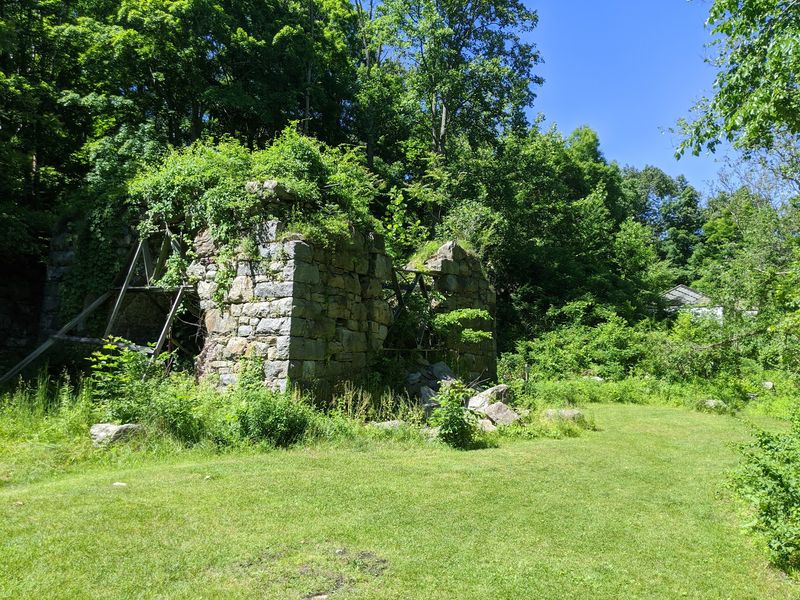
The quiet forest beside the Wanaque Reservoir once shook with waterwheels, hammers and furnaces. Long Pond Ironworks began operating in the 1760s under German ironmaster Peter Hasenclever, who established an industrial community in what was then a remote corner of northern New Jersey.
The trail bearing his name explores the landscape that supplied the operation with ore, timber, water and labor. Along the way, hikers encounter stone walls, cellar holes, old roadways and other clues left by a community that continued producing iron for generations.
The preserved historic district contains the remains of furnaces as well as workers’ homes, a store, a school, a church and the ironmaster’s house. Rather than presenting history as one tidy monument, the route shows how an entire village developed around the industry.
Forest reclaimed much of the site after production ended, and that mixture of machinery ruins and second-growth woods gives the hike its appeal. Parts of the trail are uneven and rocky, particularly where it climbs away from the historic core, so this is not the place for flimsy shoes.
Trail intersections also provide opportunities to extend the walk toward Monksville Reservoir or other parts of the state park. Begin near the Long Pond Ironworks visitor area, where parking puts the furnace ruins within easy reach.
Cooler months are ideal: fewer insects, less foliage covering the foundations and a much clearer look at the stonework that has survived more than two centuries.
5. Batsto Lake Trail – Wharton State Forest
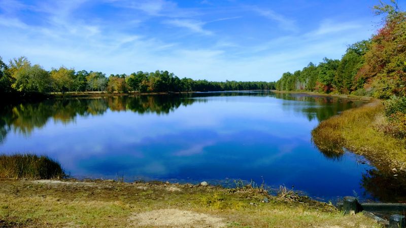
Tea-colored water flashes between pitch pines as the white-blazed path curves along Batsto Lake. The color comes from natural tannins, but the lake itself is tied to a much more industrious chapter of Pine Barrens history.
Batsto Village developed around an iron furnace established in 1766, producing household goods and supplies for the Continental Army during the Revolutionary War. When the local iron industry declined, Batsto shifted to glassmaking before eventually becoming part of Wharton State Forest.
The Batsto Lake Trail begins near the village and covers about four mostly level miles on packed sand and forest paths. It passes the Batsto River before hugging the lakeshore on the return, offering benches and several places to pause beside the water.
Save time after the hike for the historic village, where more than 30 structures preserve the former industrial community. The centerpiece is Batsto Mansion, expanded over the years from a modest ironmaster’s residence into an imposing Italianate house.
The sawmill, gristmill, general store, post office and workers’ homes fill out the picture of a settlement that had to provide nearly everything for itself. Because the trail is flat, it suits families and casual walkers, although sandy footing can make four miles feel longer than expected.
Shorter red and blue loops begin from the same area. The large village parking lot, visitor center and restrooms make this one of the easiest history hikes in the Pine Barrens to plan.
6. Double Trouble Historic District Nature Trail – Double Trouble State Park
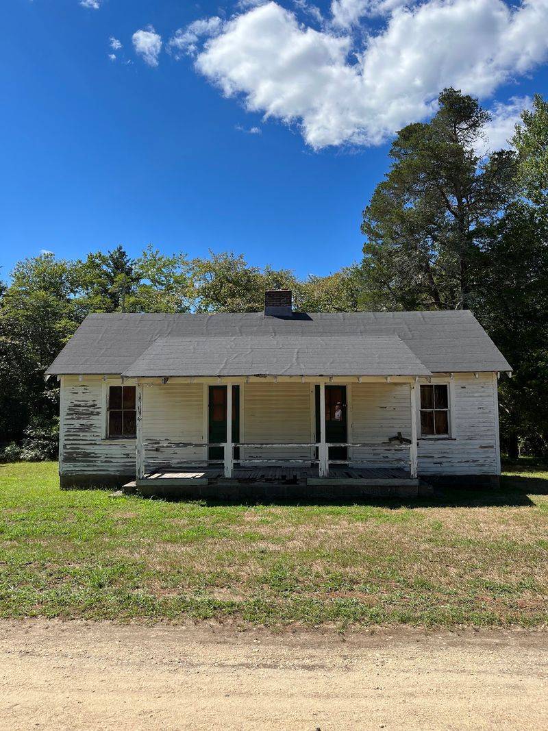
Cranberries, not calamity, built the village with New Jersey’s most wonderfully ominous name. Double Trouble developed around a sawmill and later became a major cranberry-growing operation, with narrow canals, reservoir systems and bogs spreading through the surrounding Pine Barrens.
The Historic District Nature Trail lets visitors explore that working landscape without committing to a difficult hike. The route begins near the village and follows sandy paths through pine forest and wetlands, passing waterways that were engineered to control the cranberry harvest.
Inside the historic district, the preserved sawmill and cranberry sorting and packing house show how the community earned its living. Workers once flooded the bogs, gathered floating berries and transported the crop into buildings where it could be cleaned, sorted and packed.
Houses, a schoolhouse and other structures remain from the village’s active years, giving the place more substance than a collection of isolated ruins. The source of the unusual name is still debated, though the favorite stories involve two problems happening at once—possibly a pair of mill breakdowns or simultaneous forest fires.
Whatever the truth, it makes an excellent trailhead conversation starter. The nature trail is generally flat and manageable, but wet weather can leave sections muddy, and mosquitoes take their work seriously in warmer months.
Parking is available near the village off Pinewald-Keswick Road. Check ahead if seeing the interiors matters, since guided village tours and building access may follow limited or seasonal schedules.
7. Rocky Point Trail – Hartshorne Woods Park
One enormous naval gun points silently toward the Atlantic from a hill above the Navesink River. It marks Battery Lewis, the most striking historical stop in Hartshorne Woods Park and the payoff on a route combining the Rocky Point and Battery Loop trails.
Built during World War II, the fortified position formed part of the Navesink Military Reservation, which protected the approaches to New York Harbor. The battery was designed to hold two 16-inch guns capable of firing shells roughly 25 miles out to sea.
Its reinforced concrete chambers were covered with earth and vegetation, making the structure difficult to spot from the air. Today, visitors can walk around the restored emplacement and see a 16-inch barrel once carried aboard the battleship USS New Jersey.
Interpretive displays explain the site’s role in coastal defense, while occasional tours allow a closer look inside the massive bunker. The surrounding trail system supplies plenty of scenery with views toward the rivers, Sandy Hook and the coastline.
Expect rolling terrain, exposed roots and several energetic climbs rather than a flat waterfront stroll. Combining the natural-surface Rocky Point Trail with the easier Battery Loop creates an outing of roughly three miles, though numerous junctions make longer variations possible.
The Rocky Point parking area in Highlands offers convenient access to the military site. Go when the leaves are down if views are the priority; the open sightlines help explain exactly why the Army chose this strategic piece of high ground.
8. Sandy Hook Multi-Use Path – Gateway National Recreation Area
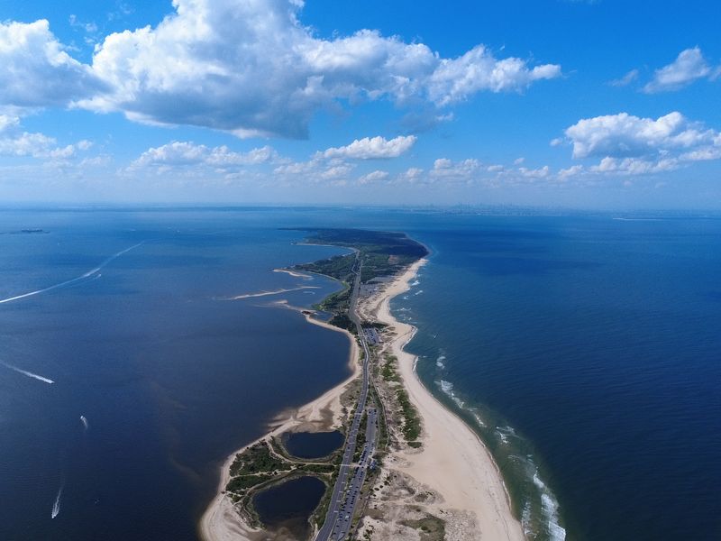
Few trails can deliver a beach, an 18th-century lighthouse, abandoned gun batteries and a row of handsome officers’ homes without asking hikers to climb a single hill. Sandy Hook’s seven-mile Multi-Use Path runs nearly the length of the peninsula, passing reminders of more than two centuries of maritime and military history.
The Sandy Hook Lighthouse, completed in 1764, is the oldest operating lighthouse in the United States. It now stands farther from the water than it did originally because shifting sand gradually extended the shoreline.
Farther north, the path reaches Fort Hancock, where yellow-brick buildings surround the parade ground and Officers Row faces Sandy Hook Bay. The Army established the fort to protect New York Harbor, and the peninsula later became an important proving ground for testing weapons.
Concrete batteries, including the formidable Battery Potter, remain scattered across the landscape. The paved path is level and shared by walkers, runners, cyclists and skaters, making a bicycle the easiest way to cover the entire route.
Starting near the park entrance allows the history to build gradually as the path heads toward Fort Hancock. Bring water, sun protection and some patience during summer, when beach traffic can be heavy and parking fees may apply.
Spring and fall visits are calmer, while brisk winter days provide empty paths and wide-open bay views. Allow extra time around the fort; the buildings invite wandering, and rushing past them misses half the fun.
9. Paulinskill Valley Trail – Knowlton Township
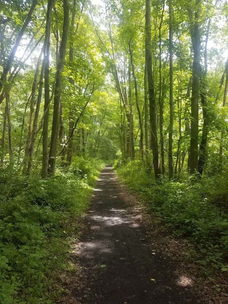
The Paulins Kill Viaduct does not politely appear on the horizon. Its giant concrete arches suddenly loom above the trees, turning a peaceful rail-trail outing into an encounter with one of New Jersey’s boldest feats of engineering.
Built by the Delaware, Lackawanna and Western Railroad as part of the Lackawanna Cut-Off, the viaduct was completed in 1910. At approximately 1,100 feet long and 115 feet high, it was considered the world’s largest reinforced-concrete structure when constructed.
The Paulinskill Valley Trail passes beneath this colossus near Hainesburg in Knowlton Township. The path itself follows a different former railroad corridor, once used by the New York, Susquehanna and Western Railway.
Its crushed-stone and dirt surface now carries hikers, cyclists and horseback riders through farmland, woods and small communities across Sussex and Warren counties. For an article-worthy historical payoff, the stretch between Warbasse Junction and the viaduct is the standout.
Old rail features and the level grade keep the transportation theme going long before those arches come into view. Because the full trail extends for more than 25 miles, visitors should select their access point carefully rather than treating it as a single end-to-end stroll.
Parking is available at several trailheads, though facilities are limited. The surface may become muddy after rain, and cyclists will appreciate wider tires.
Whatever the mode of travel, standing beneath the viaduct supplies a rare sense of scale—and makes modern infrastructure seem almost timid by comparison.
10. Morris Canal Greenway – Waterloo Village
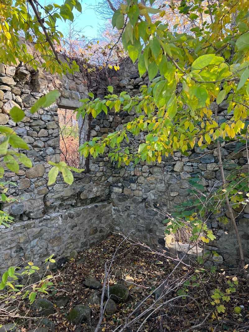
Mules once pulled cargo boats past the stone buildings of Waterloo, stopping here before continuing across northern New Jersey. The Morris Canal Greenway preserves portions of that transportation corridor, and the Waterloo Village section provides its richest concentration of visible history.
Opened in 1831, the Morris Canal carried Pennsylvania anthracite coal from Phillipsburg toward the industrial communities around Newark and Jersey City. Its famous system of locks and water-powered inclined planes allowed boats to overcome northern New Jersey’s dramatic changes in elevation.
Waterloo grew near the canal’s midpoint, becoming a busy stop where boat crews could rest, repair equipment, and purchase supplies. A walk through the village passes the canal, towpath, general store, gristmill, blacksmith shop, church, and historic homes.
The surviving structures make it much easier to picture the place when loaded boats and teams of mules moved steadily through. Trails around Waterloo also connect with the wider network in Allamuchy Mountain State Park, allowing visitors to pair the village with a longer woodland hike.
Those interested mainly in history can keep the outing gentle and remain near the canal and restored buildings. Parking is available near the village entrance in Stanhope, but access to building interiors and special programs can vary, so check the current schedule before making a long drive.
Even when the structures are closed, the grounds tell a strong story. Walk beside the old waterway and the logic of the village becomes immediately clear: this was New Jersey’s original roadside service stop, only the traffic floated past.
11. Continental Lane Trail – Washington Crossing State Park
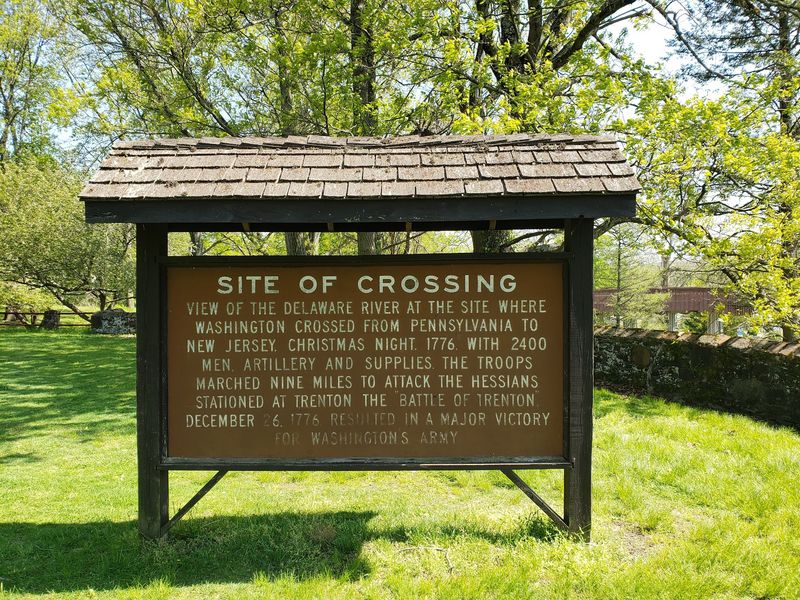
Boots, horses and artillery moved away from the Delaware River in bitter darkness on December 26, 1776. Hours earlier, George Washington and roughly 2,400 Continental soldiers had completed their famous crossing from Pennsylvania into New Jersey, beginning the march that led to victory at Trenton.
The Continental Lane Trail explores part of the landscape connected to that turning point in the Revolutionary War. Rather than focusing on one monument, the route passes through fields and woods that help visitors understand the movement of an army assembling after a dangerous nighttime crossing.
The park’s historical anchor is the Johnson Ferry House, an 18th-century farmhouse and tavern operated by Garrett Johnson, who ran the ferry service at the crossing. The preserved building contains period rooms and exhibits interpreting the operation and the military campaign.
Trails also connect different areas of the park, including wooded sections, open meadows and overlooks near the Delaware. Terrain is generally moderate, but distances vary depending on which of the park’s color-coded paths are combined with Continental Lane.
Stop at the visitor center or consult a current trail map before setting out, since the network includes numerous junctions. Parking is available near the museum and historic area along Washington Crossing-Pennington Road.
Late fall and winter bring the landscape closest to its 1776 appearance, though considerably better footwear is recommended. Walking here turns a familiar textbook scene into a physical journey: a cold river behind the troops, Trenton ahead and no guarantee that the gamble would work.