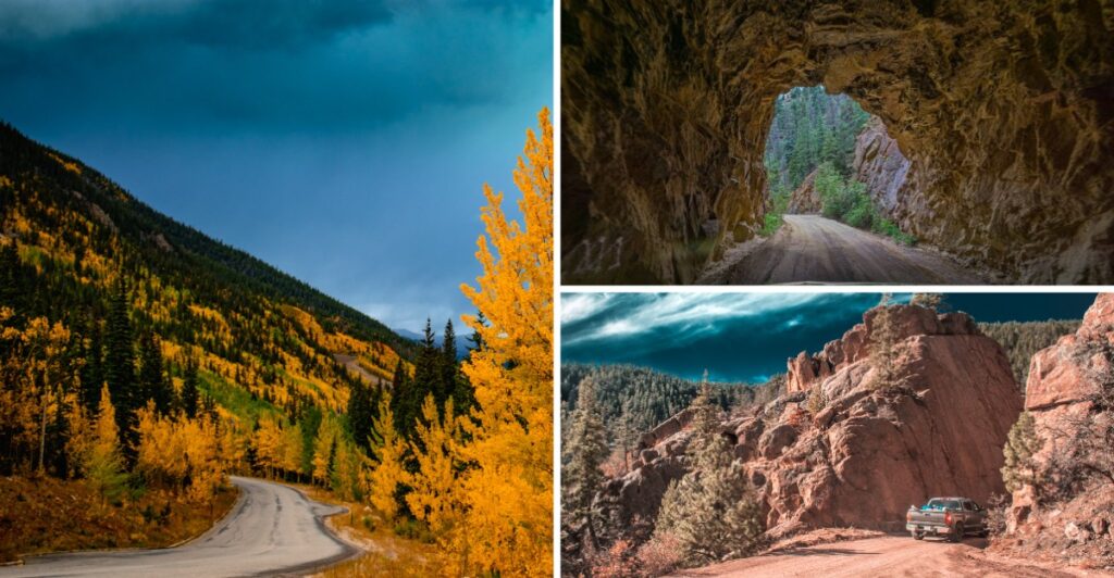
October darkness can transform an ordinary Colorado drive into something that feels straight out of a ghost story. Mountain passes disappear into shadow, lonely roads stretch through nearly empty landscapes, and old tunnels and historic routes carry legends that become much easier to imagine after sunset.
Some of these drives have long-standing spooky tales attached to them, while others simply feel unsettling because of steep drop-offs, isolation, or unpredictable mountain conditions. Either way, nighttime is when their eerie personalities really emerge. These 12 Colorado roads combine local lore and naturally haunting scenery for a memorable October drive—just keep safety ahead of the scares.
1. Riverdale Road (Thornton to Brighton)
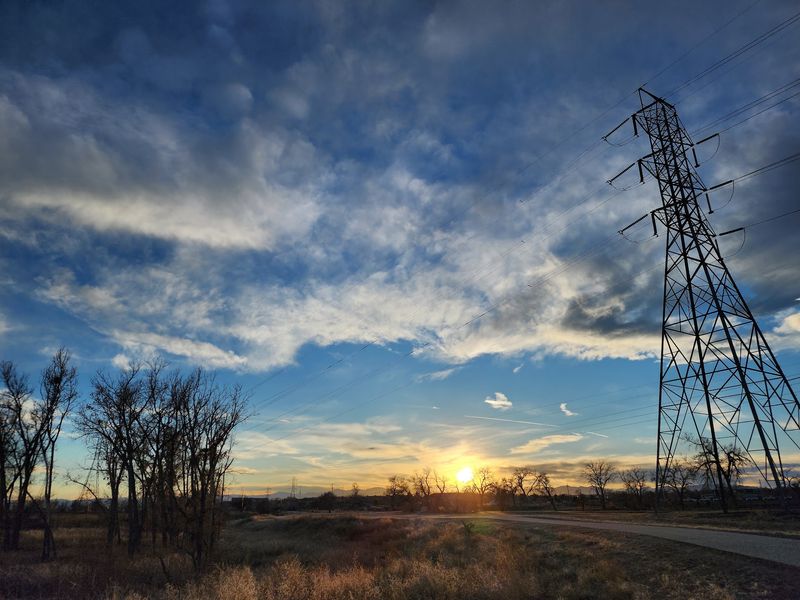
Ask around the north Denver suburbs about haunted roads, and one name pops up fast. Riverdale Road has collected more ghost stories than almost any drive in Colorado. The tales have been passed from older siblings to younger ones for decades.
The cast of characters is wild. There is a phantom jogger who appears and vanishes along the shoulder. There is a Camaro with only one working headlight that supposedly chases drivers, and a hitchhiker in white who shows up where nobody should be standing.
None of these stories come with proof, of course. They are folklore, the kind of legends that grow bigger every Halloween. Still, the road itself does a great job of setting the stage.
Riverdale runs about 11 miles between Thornton and Brighton, twisting past farmland, trees, and quiet open spaces. During the day, it seems like a pleasant back route. At night, the curves hide what is coming next, and the city lights drop away more quickly than you would expect.
That sudden sense of distance is a big part of the fun. You are close to busy neighborhoods, yet it seems like you have slipped into the countryside. Your brain starts filling the dark gaps with the stories you have heard.
If you plan an October cruise here, go slow and stay alert. The winding shape means other cars can appear suddenly, and wildlife like deer sometimes wander across. Keep your phone charged and let someone know your route.
A fun tip for groups is to share the legends before the drive, not during it. That way the driver can focus, and passengers can do the nervous watching out the windows. Just do not be surprised if everyone goes quiet whenever a single headlight shows up in the mirror.
2. Phantom Canyon Road (Florence to Victor)
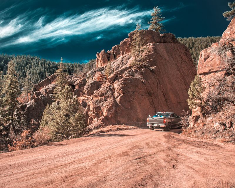
The name alone should tell you what kind of night you are in for. Phantom Canyon Road follows the old path of the Florence and Cripple Creek Railroad, a line that once hauled gold ore and passengers through this rough country. Today, cars travel where steam trains used to rumble.
Along the way, you will pass hand-cut tunnels, narrow bends, and old bridges. Crumbling signs of mining life show up here and there. Whole communities once lived along this route, and now only scattered traces remain.
Here is where the legend comes in. According to local lore, train passengers in the 1890s claimed to see the ghost of a recently executed prisoner walking along the tracks. Whether anyone really saw him, nobody can say for sure, but the story has stuck around for over a century.
Picture that tale while your headlights bounce off rough rock walls. The canyon gets very dark, very fast. Cell service can be spotty, and there are long stretches without another car in sight.
Much of the road is gravel, and parts are tight enough that passing another vehicle takes patience. A higher-clearance vehicle is a smart choice, and daylight is honestly the best time to learn the route. Save the nighttime version for a trip when you already know the curves.
Bring a paper map, extra water, and warm layers. October temperatures drop sharply once the sun goes down, and help can be far away. A full tank of gas before leaving Florence or Victor is a must.
Fun fact: the railroad that built this route only ran for a short time before floods damaged it. That quick rise and fall adds one more ghostly chapter to a canyon that already lives up to its name.
3. Gold Camp Road (Colorado Springs)
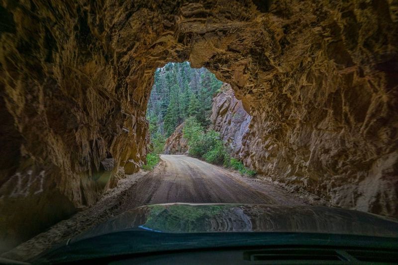
Few spots in Colorado Springs get more whispered about each Halloween. Gold Camp Road climbs into the mountains above the city along an old railroad grade. Its rocky tunnels and twisting route were built for trains heading to the gold camps of Cripple Creek.
Before any ghost story shows up, the setting already delivers. Stone tunnels swallow the road. Tall pines crowd the edges, and the city lights below seem farther away with every turn.
Now for the famous legend. Many people say the spirits of children haunt one of the tunnels, often tied to a story about a school bus accident. Visitors claim to hear laughter or find small handprints on their car windows.
Here is the catch. No historical evidence has ever been found to back up that tragic bus story. It is best to treat it as folklore, a spooky tale that has grown over many years of sleepovers and late-night drives.
That does not make the road any less creepy after dark. Some sections are rough dirt, and certain parts have been closed to vehicles over the years, so check current conditions before heading out. Plan your route ahead so you are not surprised by a gate in the dark.
If you want the thrill without the risk, consider visiting in late afternoon. You can explore the scenery in good light, then watch the shadows grow as the sun drops behind the peaks. That golden-to-gray shift is a treat on its own.
Always respect the land and any posted rules. Leave no trash, keep noise low, and skip the urge to pound on tunnel walls. The legends can stay spooky without anyone adding real trouble to the story.
4. Million Dollar Highway (Ouray to Silverton)
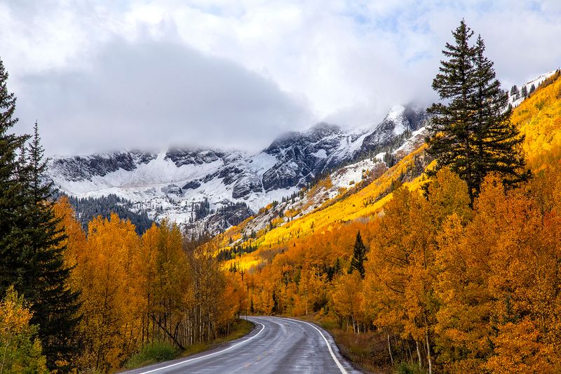
No ghost required. The Million Dollar Highway is spooky all on its own, and it knows it. This stretch of U.S. 550 connects Ouray and Silverton through the heart of the San Juan Mountains. By day, drivers gasp at jagged peaks, deep gorges, and waterfalls. The views are so huge they almost seem painted.
Then the sun sets. All that scenery disappears, and your world shrinks to whatever your headlights can reach. Suddenly, the tight curves and steep drop-offs become the stars of the show.
Parts of this road have little or no guardrail, with the mountain on one side and open air on the other. Hairpin turns come quickly. There are few places to pull over if you get nervous.
October brings extra challenges. Early snow can dust the high sections, and ice may form in shady corners long after the rest of the road dries. Temperatures can plunge in a matter of minutes.
Nobody agrees on exactly how the road got its nickname. Some say it cost a fortune to build, while others joke it would take a million dollars to get them to drive it again. Either way, the name fits its reputation.
For a night trip, slow down well below the speed limit and use lower gears on downhill stretches to save your brakes. Watch for rocks on the pavement, since slides happen in this terrain. Keep your eyes on the lane lines rather than the darkness beyond them.
A smart plan is to drive it once in daylight first. Knowing where the tricky bends are makes the nighttime version a lot less stressful. Then you can enjoy the eerie quiet of the mountains without white knuckles on the steering wheel.
5. Guanella Pass (Georgetown to Grant)
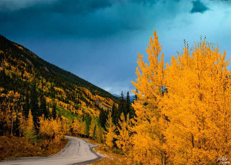
Georgetown sits quietly at the bottom, cozy and bright with old Victorian buildings. Just outside town, Guanella Pass begins its climb. Within minutes, that friendly small-town glow fades behind you.
This scenic byway runs about 22 miles between Georgetown and Grant. It winds up through thick forests, past lakes and streams, and finally breaks above timberline into wide alpine tundra. In daylight, hikers and photographers love every mile.
At night, the story changes. The forest turns into walls of black trees on both sides. Once you pass timberline, the open land feels empty and exposed, with nothing but wind and stars for company.
October is a moody month up here. Aspens have mostly dropped their leaves, and the high country starts sliding toward winter. A sunny afternoon can turn into a freezing, windy evening before you finish your snack.
Wildlife adds another layer of suspense. Elk, deer, and bighorn sheep are common in the area, and they do not care about traffic. Spotting glowing eyes at the edge of your headlights is a jolt, even when you know what it is.
The road is paved but has curves and switchbacks that deserve patience. Drive slowly, especially on the descent. If weather looks rough, it is fine to turn around and save the trip for another day.
Pack a warm blanket, a flashlight, and snacks just in case. Cell service can fade in spots, so download offline maps before leaving Georgetown. A thermos of hot cocoa also makes a great reward once you are back down among the town lights, laughing about every shadow that made you jump.
6. Shelf Road (Cañon City to Cripple Creek Area)
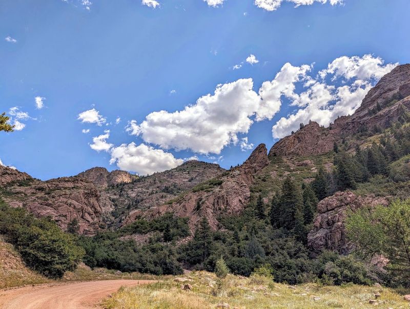
Picture a road squeezed onto a ledge, with rock rising on one side and empty space falling away on the other. That is Shelf Road in a nutshell. The name is not a joke.
This rugged backcountry route runs between the Cañon City area and the Cripple Creek region. It was an important path during Colorado’s mining boom, when wagons and stagecoaches carried people and supplies toward the gold fields. Traces of that era still shape the landscape today.
Rock climbers know the area well, thanks to its tall limestone walls. During the day, the canyon glows with warm colors. The scenery is rough, rocky, and wonderfully wild.
After sunset, those same features become intimidating. The road is narrow and unpaved in many places, and the edges can be steep. Your headlights catch only small pieces of the canyon, leaving the rest to your imagination.
Meeting another car on a tight section can get tense. Someone may need to back up to a wider spot. That is tricky enough in daylight, and much harder in the dark.
For safety, a sturdy, high-clearance vehicle is the smart pick. Check the weather first, since rain or snow can make dirt roads slick and muddy. Tell a friend or family member when you expect to arrive.
Honestly, many locals would suggest enjoying Shelf Road in the daytime and simply watching the sunset from a safe pullout. Once the sky fades from orange to purple, the canyon walls start to look like giant shadowy figures.
That view is plenty spooky without adding a nighttime drive to the adventure. Bring binoculars too. The rocky cliffs are fun to scan, and you might spot birds of prey circling overhead.
7. Kenosha Pass (Park County)
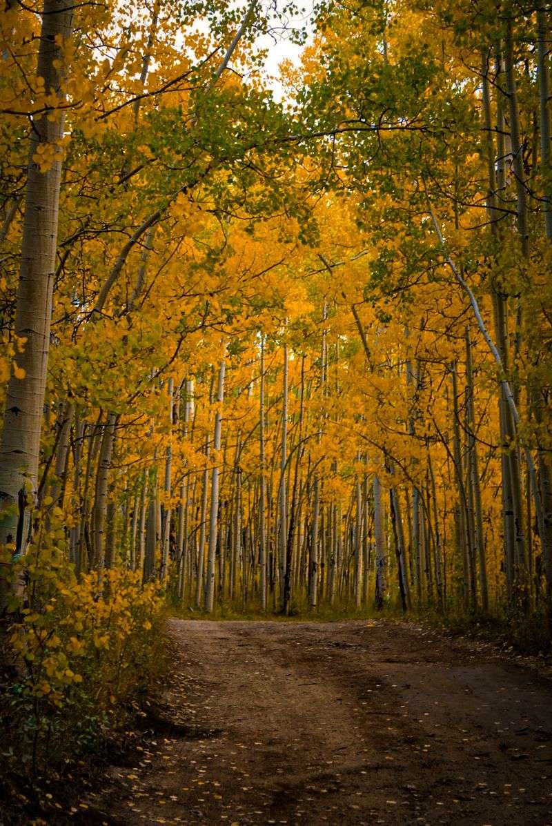
Every fall, Kenosha Pass turns into one of Colorado’s busiest leaf-peeping spots. Aspen groves blaze gold, and parking areas fill with cars, cameras, and happy families. It is about as cheerful as a mountain pass can get.
Wait until dark, though. The crowds head home, the colors disappear, and U.S. 285 takes on a completely different mood. Those bright aspens become pale trunks that seem to glow in your headlights.
Kenosha Pass sits at around 10,000 feet in Park County. At that height, October nights can be downright icy. Frost, fog, and sudden snow showers are all possible this time of year.
There is no famous ghost story attached to this pass, and that is perfectly fine. The forest does the spooky work by itself. Dark pines line the road, and the wide valley of South Park stretches out beyond, huge and mostly unlit.
Wildlife is a real concern here. Deer and elk often cross the highway at night, and hitting one can be dangerous. Keep your speed reasonable and scan both sides of the road.
Since U.S. 285 is a main route, you may also share the road with trucks and fast traffic. Stay patient and use pullouts if someone is tailgating. There is no reason to rush on a mountain highway.
A fun idea is to time your visit so you catch the aspens in late afternoon light. Walk a short trail, snap some photos, then start the drive home as dusk arrives.
You get the best of both worlds, bright golden leaves and a shivery twilight ride. Pack gloves and a hat. The temperature drop after sunset surprises plenty of visitors.
8. Loveland Pass (Clear Creek and Summit Counties)
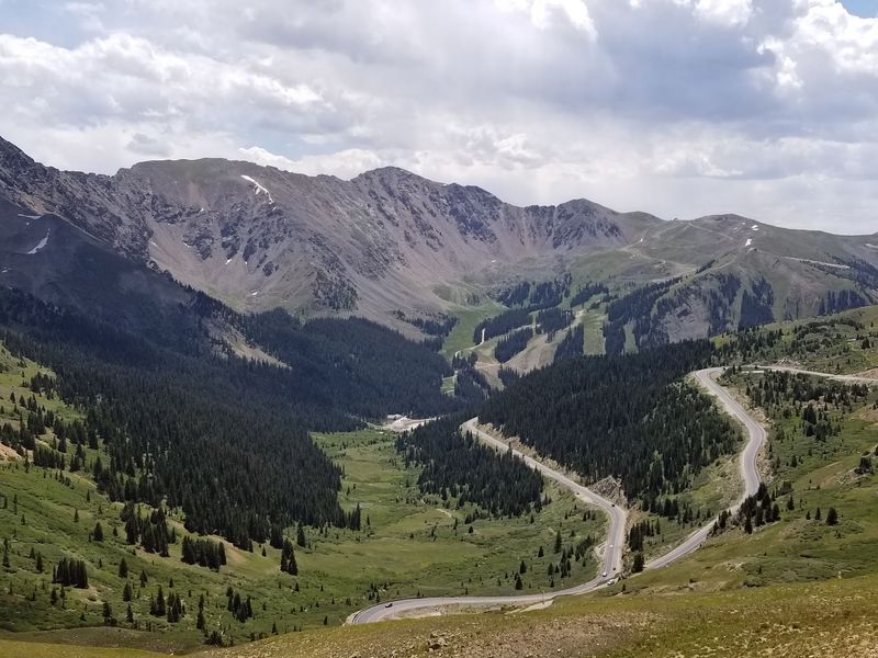
Nearly 12,000 feet up, the air gets thin and the wind gets loud. Loveland Pass crosses the Continental Divide between Clear Creek and Summit counties. It is one of the highest paved mountain passes you can drive in Colorado.
In daylight, the view is jaw-dropping. Peaks roll in every direction, and the tundra looks like a giant rumpled blanket. Skiers and sightseers often stop at the top for photos by the Continental Divide sign.
At night, most of that disappears. You are left with steep grades, tight switchbacks, and the edge of the road sliding by in your headlights. The high country becomes a dark, windy, very quiet place.
Weather is the biggest wild card. October can bring snow, ice, and sudden whiteout conditions at this elevation. One side of the pass might be clear while the other is getting hammered.
Here is a fun fact. Trucks carrying hazardous materials often have to use Loveland Pass instead of the nearby Eisenhower Tunnel. So even on a lonely night, you might see a big rig grinding slowly up the curves.
Before heading out, check road conditions with the Colorado Department of Transportation. Make sure your tires have good tread, and keep a scraper and warm clothes in the car. Downshift on the descent to avoid overheating your brakes.
If conditions look bad, the tunnel is usually the easier choice. There is no prize for fighting a snowstorm at the top of the Divide.
On a clear night, though, pulling over safely at the summit can be a thrill. With almost no city lights nearby, the stars look close enough to grab. Just keep that visit short, because the cold wind bites hard.
9. Independence Pass (Aspen to Twin Lakes)
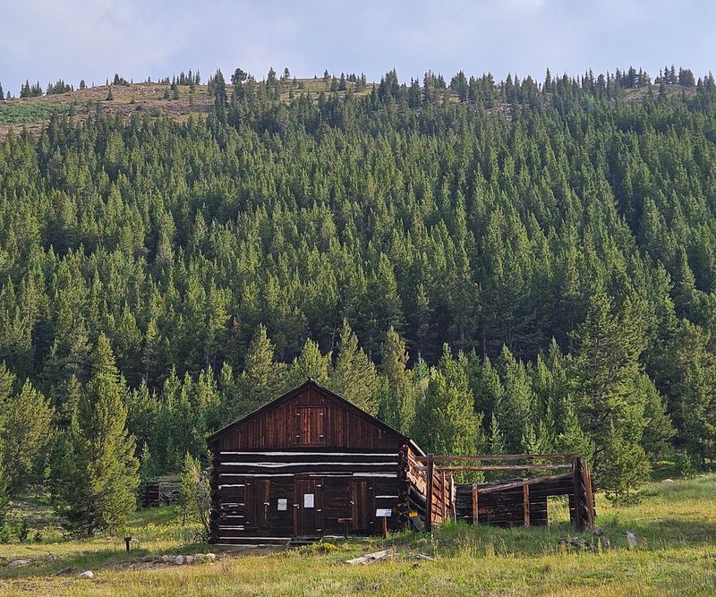
Legend or not, a ghost town sits right near the road. That alone makes Independence Pass a natural pick for October.
State Highway 82 climbs to 12,095 feet as it links Aspen with Twin Lakes. It is a seasonal route, usually closed in winter, which tells you how serious the conditions can get up here. Many drivers remember it for its narrow sections where the road seems barely wide enough for two cars.
Close to the pass, you will find the remains of Independence, a mining town from the 1800s. Weathered log cabins still stand in the open valley. By day, it is a fascinating slice of history, and by twilight, it looks like the set of a spooky movie.
The real reasons to respect this drive after dark have nothing to do with ghosts. Some stretches have tight curves and steep slopes. In spots, large vehicles are restricted because the road is so skinny.
October weather can flip without warning. Rain in Aspen can be snow at the summit. The road may even close for the season sometime in the fall, so always check before you go.
If you want to see the ghost town, visit during daylight. Walk the paths, read the signs, and imagine families living here through brutal mountain winters. It is a surprisingly moving stop.
Then plan to get over the pass before full dark if you can. Drive slowly, stay in your lane, and give oncoming traffic plenty of space on the tightest sections.
Keep an eye out for cyclists, who sometimes ride late in the day. With the cabins fading behind you and cold wind whistling past, the eerie mood arrives on its own.
10. Skyline Drive (Cañon City)
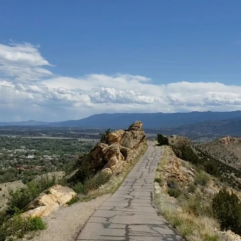
Imagine driving on the spine of a giant sleeping dragon. That is close to how Skyline Drive seems in Cañon City. The road runs right along the top of a narrow ridge, with the ground dropping away on both sides.
It is a short trip, only a few miles, but it packs a punch. The route is mostly one-way and one lane. There is not a lot of room for mistakes.
During the day, the views are huge. You can see Cañon City spread out below, plus the mountains and hills around it. Some visitors even spot dinosaur tracks preserved in the rock along the way, a fun bonus for curious kids.
After sunset, the ridge becomes a different beast. The city lights twinkle below, but right next to your car, everything is dark. Your headlights show the pavement and not much else.
That strange feeling of having nothing on either side is what gives Skyline Drive its October edge. It is easy to start wondering how steep those slopes really are. Spoiler: they are plenty steep.
If you are the driver, keep your focus locked on the road. Go slowly and resist the urge to look out at the view. Let passengers do the sightseeing.
Check whether the road is open before visiting, since hours and conditions can change. Large vehicles and trailers are not a good match for this route. A small or midsize car is the comfortable choice.
A great plan is to drive it around sunset, then park somewhere safe in town afterward to watch the ridge fade into a black silhouette. Grab a warm drink, look up at that thin line in the sky, and remember you were just perched on top of it.
11. Slumgullion Pass (Hinsdale County)
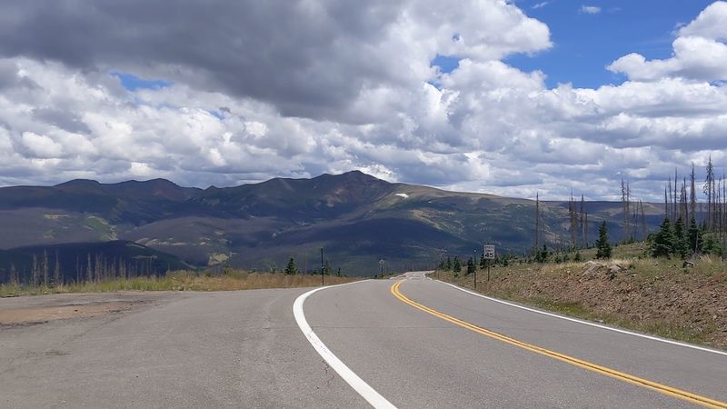
Say it out loud: Slumgullion. It sounds like something a witch would stir in a bubbling pot. Honestly, that makes it the perfect name for a spooky October drive.
Slumgullion Pass sits on Colorado Highway 149 in Hinsdale County, one of the least populated counties in the state. The road climbs through the San Juan Mountains near Lake City. Out here, towns are small and far apart.
A quick bit of trivia helps explain the name. The area is home to the Slumgullion Earthflow, a huge, slow-moving landslide. Some say its yellowish soil reminded early settlers of a thin, unappetizing stew called slumgullion.
Once night falls, this remote stretch gets very dark. You will see few porch lights, few gas stations, and sometimes no other cars at all. The mountains become big shadows against the stars.
That emptiness is the real source of the shivers. There is no need for a ghost when you realize the nearest help could be an hour away. The quiet can be both beautiful and unsettling.
Preparation matters a lot here. Fill your gas tank in Lake City or Creede, and bring food, water, and warm clothing. A small emergency kit with a flashlight and first aid supplies is a smart idea.
October storms can roll in quickly, dropping snow on the pass. Check the forecast and road reports before you leave. If things look iffy, wait it out in town.
On a calm, clear night, though, this drive can be unforgettable. The sky is often packed with stars thanks to the lack of city lights. Pull over only where it is safe, turn off the engine, and listen to how silent the San Juans can be.
12. Third Bridge / County Line Road (East of Aurora)
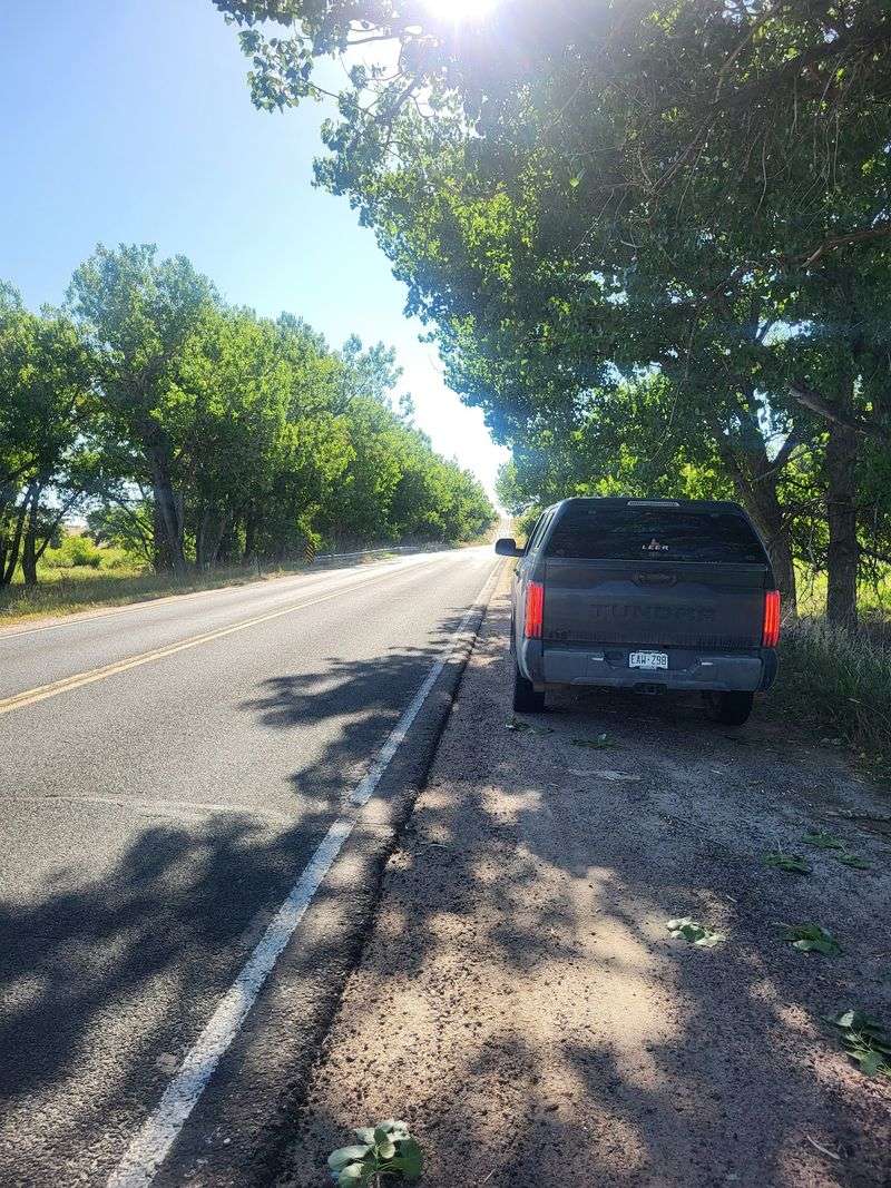
Out on the flat plains east of Aurora, there is a bridge people talk about in low voices. Locals call it Third Bridge, and some call it Ghost Bridge. It sits along a lonely stretch of County Line Road.
For generations, stories have floated around this spot. People describe strange sounds in the dark, shadowy figures, and cars acting oddly near the bridge. Teens have dared each other to visit for years, which only helps the legends grow.
Like most tales of this kind, these should be treated as folklore. There is no confirmed history behind the ghostly reports. What is real, though, is how isolated the area can seem at night.
Eastern Colorado is wide open. There are no mountains to block the wind, and houses can be few and far between. When darkness settles in, the sky seems enormous and the ground seems endless.
That lonely setting gives Third Bridge its creepy charm. A dry creek bed, some bare trees, and the sound of wind across the grass can do a lot to set your nerves tingling. Add a full moon, and you have the ideal October mood.
A few ground rules matter here. Much of the land around rural roads is private property, so stay on public roads and never trespass. Do not park in a way that blocks traffic or driveways.
Keep noise down and respect nearby residents, who likely get tired of ghost hunters. Leave the area just as you found it.
For the best experience, bring friends, share the legends, and enjoy the goosebumps from a safe spot. Sometimes the scariest part of a haunted bridge is simply realizing how far away everything else is.
Share this story