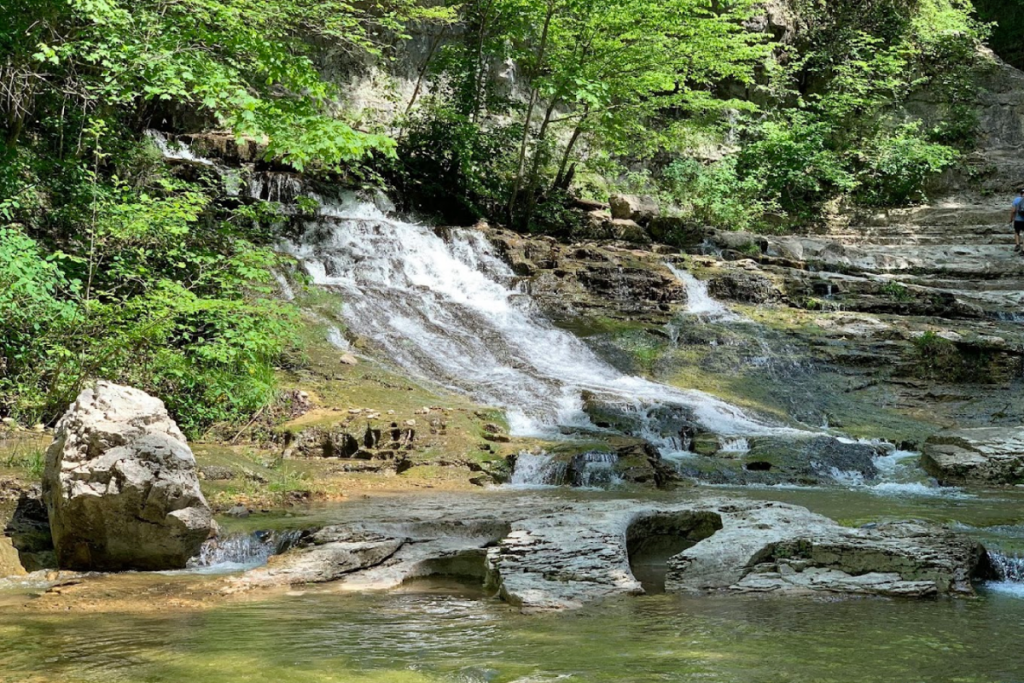
Tennessee’s landscape hides secrets millions of years in the making. Beneath your feet and towering above are rock formations, caves, and gorges shaped by water, wind, and time itself.
Each of these natural wonders tells a story of patience, pressure, and the slow but unstoppable forces that carved the state into the dramatic terrain you can explore today.
1. Twin Arches – Big South Fork
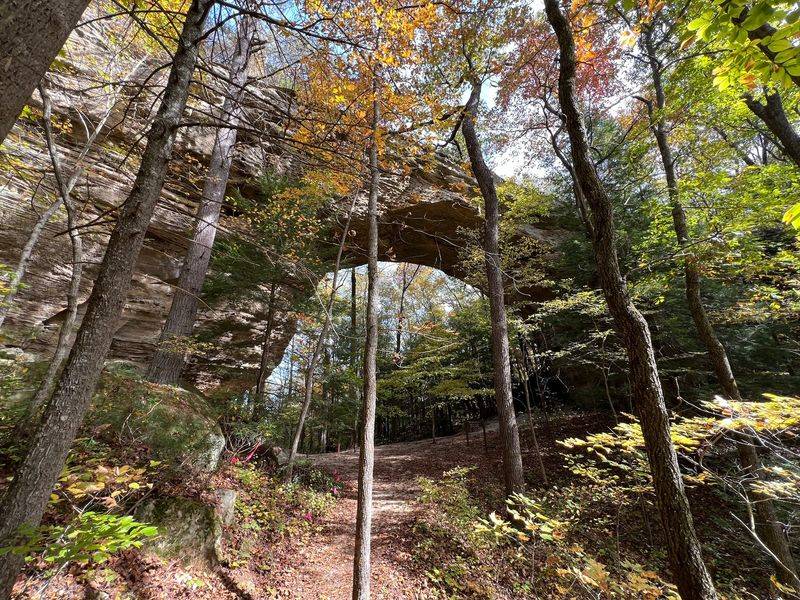
Standing beneath these twin sandstone spans feels like stepping into a cathedral built by nature itself. Twin Arches holds the title of Tennessee’s largest known natural bridge complex, and once you see them in person, the scale alone will take your breath away.
Each arch rises high enough to shelter entire picnic groups underneath, and the rock overhead has been hollowed out by countless centuries of weathering.
Water, wind, and frost worked in slow partnership to carve these twin openings from a single sandstone ridge. Rainwater seeped into tiny cracks, freezing and expanding during cold snaps, chipping away grain by grain.
Meanwhile, streams undercut the softer rock layers below, leaving the harder cap rock suspended in graceful curves. The result is two separate arches standing side by side, each with its own character and curvature.
Hikers who make the journey to Big South Fork are rewarded with more than just a photo opportunity. The trail leading to Twin Arches winds through dense hardwood forest, past moss-covered boulders and trickling creeks that hint at the erosive power still at work today.
You can walk right underneath both arches, touch the cool sandstone walls, and peer up at the layers of sediment that were laid down when this area was an ancient sea.
Geologists estimate these formations took millions of years to reach their current shape, but the process hasn’t stopped. Every rainstorm, every freeze-thaw cycle, every gust of wind continues the slow sculpture.
Twin Arches isn’t a finished masterpiece but an ongoing work of art, reminding visitors that the planet is always changing, even when we can’t see it happening. Bring sturdy shoes, a sense of wonder, and maybe a jacket since the shade beneath the arches stays cool even on warm days.
2. Virgin Falls – Sparta
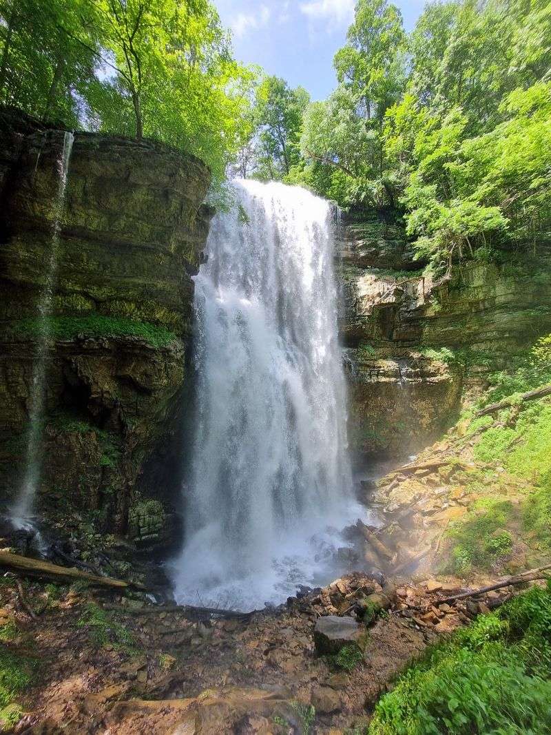
Water appears out of solid rock, tumbles 110 feet through the air, and then vanishes back into the earth as if it never existed. Virgin Falls is one of those rare natural oddities that makes you question what you thought you knew about how rivers work.
Most waterfalls start with a visible stream and end in a pool or creek that flows away downstream, but Virgin Falls skips both those steps entirely.
Deep inside the mountain, an underground stream winds through limestone passages carved over eons by dissolving rock. When the water finally finds an opening to daylight, it bursts out of a cave mouth and free-falls into a sinkhole below, where it disappears back into the subterranean maze.
The entire spectacle happens in a single vertical column, a fleeting moment of sunlight between two dark journeys. Geologists call this a “hanging valley” scenario, where erosion has exposed a perched stream that hasn’t yet connected to a surface drainage system.
Reaching Virgin Falls requires a moderately challenging hike through the Caney Fork Gorge, but the payoff is worth every step. The trail crosses several smaller creeks and passes other waterfalls along the way, each with its own story of erosion and time.
When you finally arrive at Virgin Falls, the sound hits you first, a constant roar echoing off the rock walls. Then you see the white ribbon of water suspended in midair, mist rising from the impact zone below.
This waterfall is a living lesson in karst hydrology, the science of how water moves through soluble rock. Limestone, which underlies much of Middle Tennessee, dissolves slowly in acidic rainwater, creating caves, sinkholes, and underground rivers.
Virgin Falls is just one visible piece of a vast hidden network, a snapshot of geological processes that have been shaping the landscape since long before humans arrived to marvel at them.
3. The Walls of Jericho – Belvidere
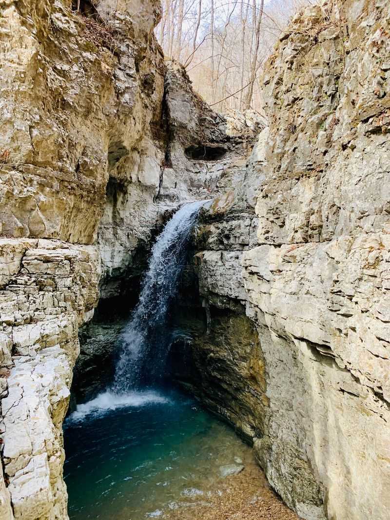
Picture a natural coliseum carved entirely by water, with sheer limestone cliffs rising in a near-perfect circle around a hidden valley floor. The Walls of Jericho earned its biblical name honestly, the rock walls do tower like ancient fortifications, and the sense of enclosure is almost spiritual.
This bowl-shaped amphitheater sits near the Tennessee-Alabama border, tucked into a remote corner of the southern Appalachian foothills.
Rainwater and streams have been chiseling away at this limestone for millions of years, exploiting weak points in the rock and gradually hollowing out the center. As the valley floor sank and the surrounding cliffs eroded back, the result was a natural arena roughly 200 feet deep.
The process is called differential erosion, where softer rock layers wear away faster than harder ones, leaving dramatic relief. In this case, the limestone yielded slowly but steadily to the patient work of flowing water.
Hiking down into the Walls of Jericho feels like descending into another world. The trail drops steeply through dense forest, crossing and recrossing a clear creek that babbles over limestone ledges.
As you go deeper, the walls close in around you, and the temperature drops a few degrees. Ferns cling to damp crevices, and moss blankets the rocks in shades of emerald and chartreuse.
At the bottom, you can stand in the center of the amphitheater and spin in a slow circle, marveling at the curved cliffs that seem to embrace the valley.
Geologists study places like this to understand how landscapes evolve over deep time. Every crack, every ledge, every overhanging lip tells part of the story.
The Walls of Jericho is still changing, though the pace is imperceptible to human observers. Rain continues to seep into fractures, frost wedges rocks apart, and roots pry open new spaces, ensuring that this natural wonder will look slightly different a thousand years from now.
4. Cumberland Caverns – McMinnville
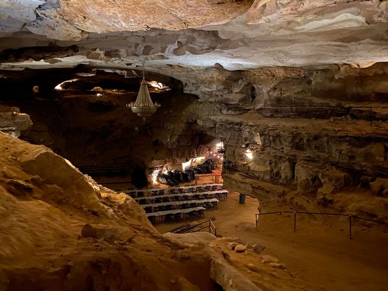
Miles of passageways twist beneath the hills near McMinnville, forming one of the longest cave systems in Tennessee. Cumberland Caverns is a labyrinth of rooms, tunnels, and galleries, all carved out by groundwater dissolving limestone over unimaginable stretches of time.
Some chambers are big enough to hold a concert hall, and in fact, the caverns do host underground music events in a space called the Volcano Room, where natural acoustics rival any man-made venue.
The story begins hundreds of millions of years ago when this region lay beneath a warm, shallow sea. Layers of marine sediment settled on the seafloor, compacting into limestone over eons.
When the sea retreated and the land rose, rainwater began seeping into cracks in the rock. Because rainwater is slightly acidic from dissolved carbon dioxide, it slowly dissolved the limestone, widening cracks into tunnels and tunnels into rooms.
The process is still happening today, though the pace is measured in millimeters per century.
Inside Cumberland Caverns, you can see the handiwork of dripping water in every direction. Stalactites hang from the ceiling like stone icicles, built up drip by drip as mineral-rich water evaporates and leaves behind tiny deposits of calcite.
Stalagmites rise from the floor to meet them, and in some places, the two have joined to form towering columns. Flowstone cascades down walls in frozen waves, and delicate soda straws dangle overhead, hollow tubes no thicker than a pencil but perfectly formed.
Tours of the caverns range from easy walks to challenging crawls through tight passages, depending on your sense of adventure. Guides point out formations with whimsical names like the Chandelier, the Hall of the Mountain King, and the Bacon.
Each shape is a record of water chemistry, temperature fluctuations, and the slow patience of geology. Cumberland Caverns is a reminder that some of the most spectacular landscapes exist where sunlight never reaches.
5. Ruby Falls Cave – Lookout Mountain
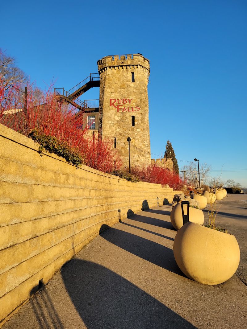
Deep inside Lookout Mountain, water cascades 145 feet down a limestone cliff in total darkness, or at least it did before electric lights and tourists arrived. Ruby Falls is one of the tallest and most famous underground waterfalls in the United States, and reaching it requires an elevator ride down through solid rock followed by a walk through winding cave passages.
The waterfall itself is fed by rainwater and snowmelt that percolate through cracks in the mountain above, eventually converging into a single underground stream.
The cave system housing Ruby Falls formed in much the same way as other limestone caverns, through the slow dissolution of rock by slightly acidic groundwater. Over millions of years, water carved out rooms and passageways, leaving behind the flowstone, stalactites, and draperies that visitors see today.
The waterfall itself is a more recent feature, geologically speaking, created when the underground stream found a vertical drop along a fracture or fault line in the rock. The water tumbles down, crashes into a pool at the base, and then continues its hidden journey through more passages deeper in the mountain.
When Leo Lambert discovered the falls in 1928, he named them after his wife, Ruby, and the cavern quickly became a tourist attraction. Before that, the waterfall had been dropping in darkness for untold centuries, witnessed only by bats and cave-dwelling insects.
Today, colored lights illuminate the cascade, and the sound of falling water echoes off the stone walls, creating a dramatic effect that feels both otherworldly and ancient.
Ruby Falls is part of a much larger network of caves and underground streams that honeycomb Lookout Mountain. The mountain itself is a remnant of an ancient plateau, carved by erosion into the distinctive shape visible from Chattanooga.
Inside, the cave environment remains stable year-round, cool and humid, a refuge from the seasons above. Every drop that falls from the ceiling is a tiny sculptor, adding to or subtracting from the formations that have been growing for millennia.
6. Fall Creek Falls Gorge – Spencer
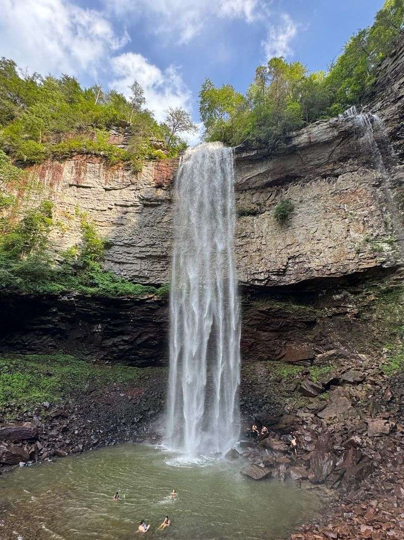
When water drops 256 feet in a single leap, you feel the impact in your chest before you even see the falls. Fall Creek Falls is one of the tallest waterfalls east of the Mississippi, and the gorge that cradles it is a masterpiece of erosion.
Millions of years of flowing water have sliced through layers of sandstone and shale, carving a chasm so deep that the sunlight barely reaches the bottom on cloudy days.
The Cumberland Plateau, where this gorge sits, is a flat-topped highland built from ancient sedimentary rock. Rivers and creeks that flow off the plateau edge often tumble over vertical cliffs where resistant caprock overlies softer layers below.
At Fall Creek Falls, the stream flows peacefully across the plateau until it reaches the brink, then plunges into empty air. The force of the water hitting the plunge pool below has hollowed out a deep basin, and over time, the falls have slowly migrated upstream as the cliff face erodes and collapses.
Hiking the trails around Fall Creek Falls Gorge gives you multiple perspectives on the geology at work. From the overlook at the top, you can peer down into the abyss and watch the ribbon of white water disappear into mist.
A trail down to the base lets you stand near the plunge pool and feel the spray on your face, while the roar of the falls drowns out every other sound. Along the way, you pass exposed rock layers that tell the story of ancient seas, river deltas, and shifting climates.
Geologists read these layers like pages in a history book, each one recording conditions that existed when the sediment was deposited. The sandstone at the top of the gorge is hard and resistant, which is why the plateau hasn’t eroded away entirely.
Below that, softer shale crumbles more easily, creating the undercut cliffs and overhanging ledges that make the gorge so dramatic. Fall Creek Falls Gorge is still evolving, every storm brings more water, more erosion, and more slow change to a landscape that has been transforming for eons.
7. Rock Island Gorge – Rock Island
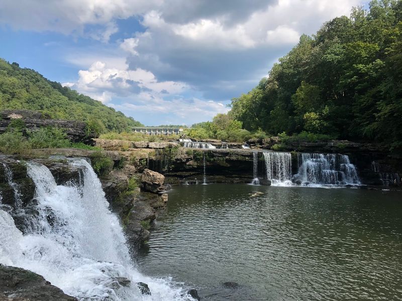
Where the Caney Fork River slices through layers of limestone, you get cliffs, cascades, potholes, and gorges all packed into a few dramatic miles. Rock Island Gorge is a textbook example of how persistent water can reshape solid rock, given enough time and enough flow.
The river here has been cutting downward for millions of years, exploiting fractures and weak zones in the limestone to carve a winding canyon that drops in a series of steps and plunges.
Limestone is especially vulnerable to erosion because it dissolves in weak acids, and rainwater is naturally acidic from carbon dioxide in the atmosphere. As the river flows over the rock, it doesn’t just wear it down mechanically, it also dissolves it chemically, grain by grain.
Over geological time, this dual attack has sculpted the gorge into a complex landscape of waterfalls, rapids, and deep pools. The exposed cliffs reveal horizontal layers of sedimentary rock, each one laid down in an ancient sea that covered this region hundreds of millions of years ago.
Rock Island State Park preserves much of the gorge, and visitors can explore trails that wind along the rim and down to the water’s edge. The Great Falls of the Caney Fork is the centerpiece, a powerful cascade where the river drops over a resistant ledge and crashes into a churning pool below.
During high water, the falls roar with enough force to shake the ground, but even in low flow, the scale of the erosion is impressive. Smooth potholes dot the riverbed, carved by swirling stones trapped in eddies and spun around by the current for centuries.
The gorge is also a reminder that erosion is an ongoing process, not a relic of the past. Every flood moves sediment, every freeze-thaw cycle cracks rock, and every rainstorm adds to the cumulative work of shaping the land.
Rock Island Gorge is a snapshot of a landscape in motion, caught in the middle of a transformation that started long before humans arrived and will continue long after we’re gone.
8. Savage Gulf – Cumberland Plateau
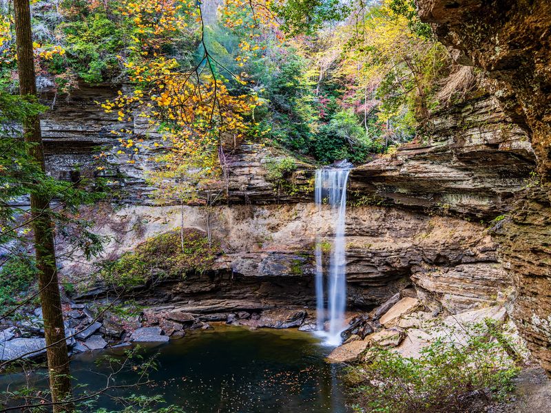
Savage Gulf lives up to its name with a tangle of narrow gorges, sheer cliffs, and rock shelters that make this one of the wildest corners of the Cumberland Plateau. Water has been the chief architect here, carving deep ravines into the sandstone bedrock over millions of years.
The result is a landscape of dramatic vertical relief, where streams tumble over waterfalls and disappear into boulder-choked canyons, and where hiking trails cling to cliff edges with dizzying drop-offs just a step away.
The sandstone that forms the cliffs and overhangs in Savage Gulf was deposited as sand in ancient river deltas roughly 300 million years ago. Over time, the sand was buried, compressed, and cemented into solid rock.
When tectonic forces later uplifted the region, streams began cutting down through the plateau, following fractures and zones of weakness. The harder sandstone resisted erosion and formed the cliffs, while softer shale layers underneath washed away, creating the undercut rock shelters that dot the gorge walls.
Exploring Savage Gulf means navigating a maze of interconnected canyons, each with its own character. Some are narrow and shadowy, with moss-covered walls and constant dripping water. Others open into wider valleys where sunlight filters through the canopy and wildflowers bloom in the spring.
Waterfalls appear around nearly every bend, some plunging over vertical drops and others cascading down stair-step ledges. The trails range from easy riverside walks to strenuous climbs up rocky slopes, and every route offers new perspectives on the geology.
Rock shelters in the gorge have provided refuge for wildlife and humans alike for thousands of years. Archaeological evidence shows that Native Americans used these overhangs as seasonal camps, taking advantage of the natural protection from rain and wind.
Today, the shelters are popular stops for hikers, offering a chance to rest in the shade and contemplate the slow work of erosion that hollowed out these spaces. Savage Gulf is still being shaped by water, frost, and gravity, a reminder that even solid rock is temporary on geological timescales.
9. Stone Door – Savage Gulf
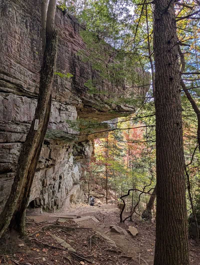
A crack in the sandstone cliff opens just wide enough for a person to squeeze through, and on the other side, the world drops away into empty air. Stone Door is a natural fissure in the rock, a vertical split that runs from the plateau rim down to the gorge below.
The opening is so narrow and straight that it looks almost man-made, like an ancient gateway carved by giants. In reality, it’s the result of fractures in the sandstone that have been widened over eons by frost, rain, and the slow pull of gravity.
Sandstone is a layered rock, and those layers don’t always stick together perfectly. Vertical cracks, called joints, form when the rock is under stress from tectonic forces or from the weight of overlying sediment.
Once a joint opens, water seeps in, freezing and expanding during cold weather and wedging the crack wider. Over thousands of years, a hairline fracture can become a gaping fissure.
Stone Door is one of the most dramatic examples of this process on the Cumberland Plateau, a split so deep and narrow that it feels like stepping into another dimension.
Hikers who approach Stone Door from the plateau side walk through a dense hardwood forest with no hint of the chasm ahead. Then, suddenly, the ground opens up, and you’re standing at the edge of a vertical drop with only a narrow passage leading through the rock.
Stepping through the Stone Door is an experience that combines awe and a little bit of vertigo, especially when you emerge on the far side and realize you’re perched on a cliff hundreds of feet above the valley floor.
The view from Stone Door is one of the best on the Cumberland Plateau, with forested ridges stretching to the horizon and the deep cut of Savage Gulf visible below. Geologically, the fissure is still evolving.
Every freeze-thaw cycle widens it a tiny bit more, and eventually, the rock walls may collapse entirely, turning the doorway into a pile of rubble. For now, though, Stone Door stands as a testament to the power of small forces acting over vast stretches of time.
10. Natural Bridge – Sewanee
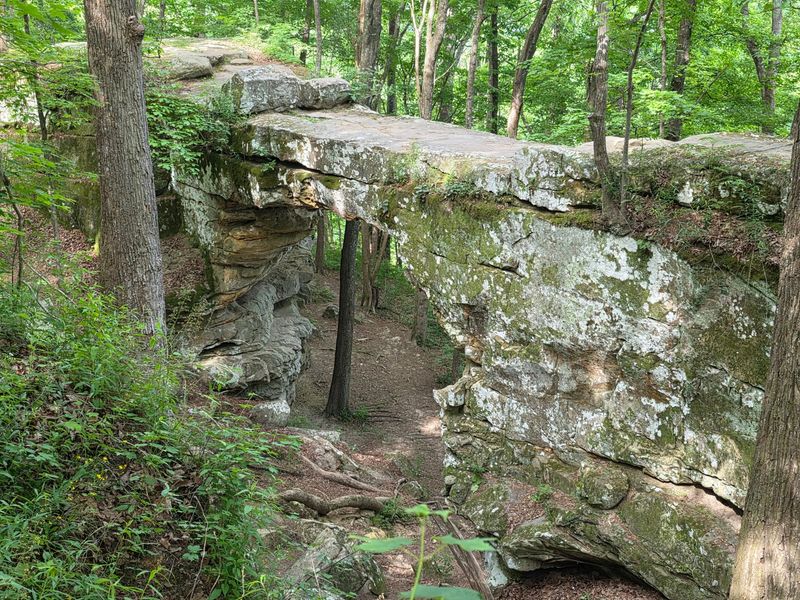
A sandstone arch spans roughly 50 feet across a wooded ravine, with enough clearance underneath for hikers to walk through without ducking. Natural Bridge near Sewanee is a classic example of how erosion can turn solid rock into delicate-looking sculpture.
The bridge began as a fin of sandstone, a ridge left standing after streams carved away the rock on either side. Over time, weathering and erosion hollowed out the center, leaving the arch you see today.
Sandstone is a relatively soft rock, easily worn down by wind, rain, and frost. In this case, water seeping through cracks in the stone froze during winter, expanding and cracking the rock from the inside.
Repeated freeze-thaw cycles gradually widened the cracks, and pieces of rock fell away, opening up a void. Eventually, the void grew large enough to create a passage through the ridge, and the Natural Bridge was born.
The process is still ongoing, though the changes are imperceptible on human timescales.
Visiting Natural Bridge is a short hike from the trailhead, and the path leads through a forest of oak, hickory, and pine. As you approach, the arch comes into view through the trees, a graceful curve of stone framed by greenery.
You can walk underneath and look up at the rock overhead, marveling at the fact that this fragile-looking structure has stood for thousands of years. Ferns and mosses cling to the damp stone, and if you visit after a rain, water drips from the arch in a gentle shower.
Geologists study natural bridges to understand how landscapes evolve and how long rock formations can last. Every arch has a lifespan, from the moment it opens until the day it collapses.
Natural Bridge near Sewanee is somewhere in the middle of that cycle, mature enough to be stable but young enough that it will likely stand for many more centuries. The Cumberland Plateau is dotted with similar formations, each one a temporary sculpture in an ever-changing landscape shaped by water, ice, and time.
11. Big Bone Cave – Van Buren County
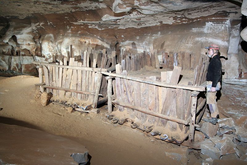
Big Bone Cave earned its name from the massive skeletal remains of prehistoric animals found inside, including giant ground sloths and mastodons that wandered into the cavern thousands of years ago and never found their way out. Today, the cave is a protected Tennessee State Natural Area, and its passages stretch for miles through the limestone bedrock of the Cumberland Plateau.
The cave system formed over millions of years as groundwater dissolved the soluble rock, carving out chambers, tunnels, and underground streams.
Limestone caves are common in Tennessee because much of the state sits atop ancient marine sediments that solidified into carbonate rock. When rainwater, slightly acidified by carbon dioxide, seeps into the ground, it slowly dissolves the limestone along cracks and bedding planes.
Over geological time, these dissolving pathways widen into caves. Big Bone Cave is part of a much larger network of underground passages that honeycomb the plateau, though many remain unexplored and unmapped.
The cave’s entrance is a gaping mouth in the hillside, large enough to swallow a house, and stepping inside feels like entering a different world. The temperature drops immediately, and the air smells of damp earth and stone.
Daylight fades quickly as you move deeper, and the passages branch off in multiple directions, some wide and easy to walk, others narrow and requiring crawling. Stalactites hang from the ceiling in some rooms, and flowstone coats the walls in frozen ripples, evidence of water that has been dripping and depositing minerals for millennia.
Big Bone Cave has a long history of human use as well. Native Americans explored the cave and left behind artifacts, and during the Civil War, miners extracted saltpeter from the cave sediments to make gunpowder.
Later, the cave became a tourist attraction, though access is now restricted to protect the fragile environment and the bat populations that roost inside. The cave is still active geologically, with water continuing to dissolve rock and reshape the passages, ensuring that Big Bone Cave will look different a thousand years from now than it does today.
12. Clifty Creek Gorge – Morgan County
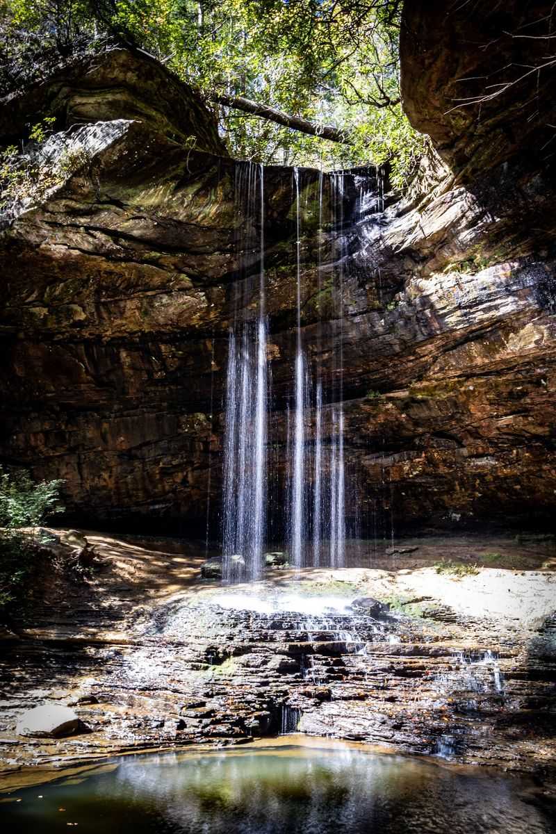
Clifty Creek has spent millions of years sawing through the sandstone of the Cumberland Plateau, creating a rugged gorge that drops steeply from the plateau rim to the valley below. The creek is small, especially during dry spells, but over geological time, even modest streams can carve deep canyons if the rock is soft enough and the time is long enough.
Clifty Creek Gorge is a textbook example of how persistent erosion shapes landscapes, one flood at a time.
The sandstone here is part of the same ancient rock layers that cap much of the Cumberland Plateau, deposited as sand in river deltas roughly 300 million years ago. When the region was later uplifted, streams began cutting downward, following the path of least resistance through fractures and softer rock layers.
Clifty Creek found a route through the plateau and has been deepening its channel ever since, grinding away at the bedrock with sand and gravel carried in its flow.
Hiking into Clifty Creek Gorge is an adventure in vertical terrain. The trail descends steeply through a forest of hardwoods and hemlocks, crossing and recrossing the creek as it tumbles over boulders and small waterfalls.
The walls of the gorge rise on either side, layered sandstone cliffs that show the horizontal bedding of the ancient sediments. In places, the creek has undercut the cliffs, creating overhangs and rock shelters where the softer shale layers have eroded away faster than the harder sandstone above.
Waterfalls punctuate the gorge, each one a step in the creek’s long journey downward. Some are delicate ribbons that shimmer over moss-covered ledges, while others are more forceful plunges into deep pools.
The sound of falling water echoes off the rock walls, and in the spring, wildflowers bloom in the damp soil along the creek banks. Clifty Creek Gorge is still being carved, every rainstorm adds a little more erosion, and every flood moves a few more stones downstream, continuing the work that has been shaping this landscape since long before humans arrived to witness it.