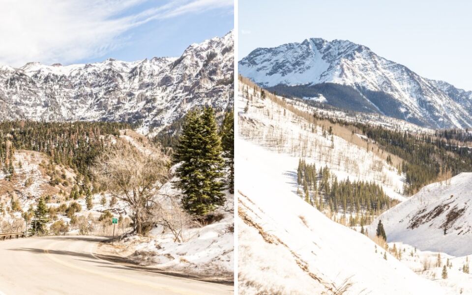
Some roads get you somewhere. This one makes you earn every mile. In the San Juan Mountains of southwest Colorado, a stretch of pavement climbs over high passes with tight hairpin turns, steep drop-offs and very few guardrails.
Plenty of Front Range drivers have heard the stories, and plenty have gripped the wheel a little harder than they planned. The reward is a run of mountain scenery that ranks among the most dramatic anywhere in the state. Keep reading for the road’s name, its gold-rush backstory, the towns along the way, the passes worth slowing down for, and practical tips that can help make the drive calmer and less crowded.
1. A Legendary Ribbon of US 550
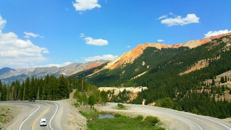
Colorado has no shortage of scenic drives, yet one stretch earns its reputation one curve at a time.
The Million Dollar Hwy, Colorado, USA, is the name locals and travelers give to a portion of US Highway 550 in the San Juan Mountains of southwest Colorado. The best-known section runs roughly 25 miles between the towns of Ouray and Silverton.
Many people use the nickname for the longer run from Ouray to Durango as well. Either way, the heart of the drive is that high, twisting segment over the mountains.
The road is part of the San Juan Skyway, a scenic byway loop that circles through this corner of the state. That loop links mining towns, high passes and wide valleys into one long day or a relaxed weekend.
What sets this stretch apart is not distance but character. It is narrow, steep and full of switchbacks, with sections carved right into the mountainside.
For a Colorado resident looking for a big adventure without leaving the state, few drives deliver as much in so few miles.
2. The Mystery Behind a Pricey Nickname
Nobody agrees on exactly how the road got its million-dollar label, and that is half the fun.
One popular story says the original roadbed was filled with ore-rich material from nearby mines, worth a fortune if anyone had processed it.
Another version points to the high cost of building a road through such rugged terrain. Carving a route into these cliffs was no bargain.
A third tale claims an early traveler said they would not drive it again for a million dollars. Given the drop-offs, that one is easy to believe.
The roots of the route go back to the mining boom of the late 1800s. Toll roads were built to haul ore and supplies between the mining camps, and Otto Mears is widely credited with building early toll routes in the region.
Today the pavement follows much of that historic corridor. Old mine buildings and tailings still dot the hillsides, quiet reminders of the silver and gold that first drew people up here.
So pick your favorite origin story and repeat it at every pullout.
3. Ouray, the Northern Gateway
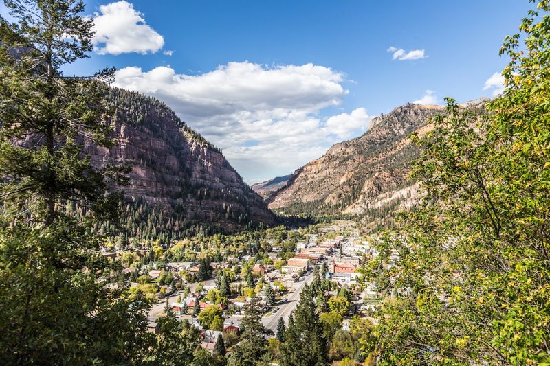
Tucked into a steep box canyon, Ouray makes a fitting starting line for the drive south.
The town is often called the Switzerland of America because of the towering peaks that wrap around it. Its historic main street still carries the look of its mining-era past.
Many drivers stop here first to fuel up, stretch and get mentally ready. Once the climb begins south of town, the road wastes no time getting serious.
Ouray is known for its hot springs pool, which makes a relaxing reward after a day behind the wheel. The surrounding area is also popular for hiking, jeep trails and ice climbing in winter.
Just outside town, Box Canyon Falls is a short side trip that fits nicely into a road day.
For residents coming from the Front Range, Ouray works well as an overnight base. Arriving the evening before means tackling the passes in the morning with fresh eyes and less traffic.
Consider it the deep breath before the big climb.
4. Uncompahgre Gorge and Its Sheer Walls
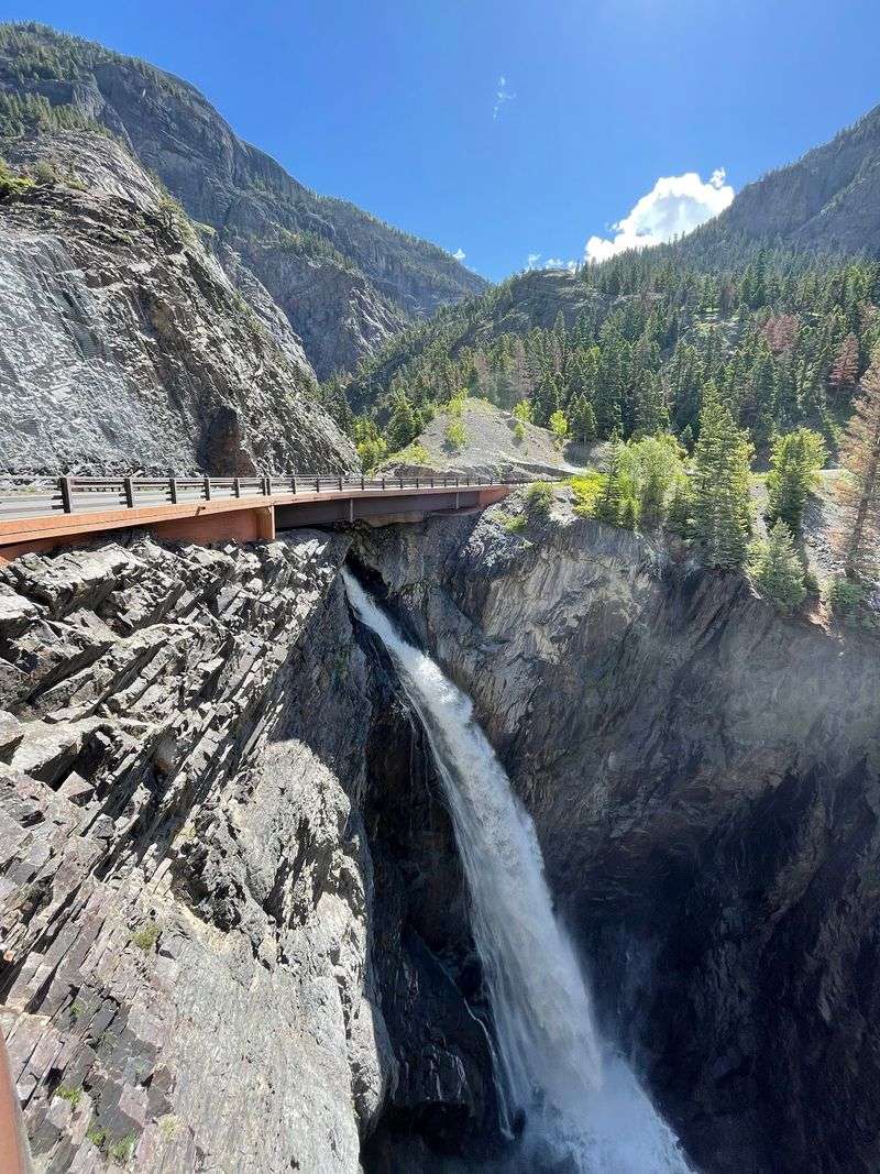
Barely a few miles out of Ouray, the road starts acting like it has something to prove.
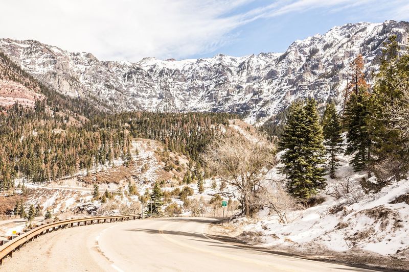
South of town, US 550 climbs through the Uncompahgre Gorge. Here the pavement is cut into steep canyon walls, with the river far below.
This is where many first-timers discover why the drive has such a reputation. Shoulders are slim, guardrails are often missing, and the edge can sit right beside the lane.
Southbound drivers travel on the inside lane through much of this section, close to the rock wall. Northbound traffic gets the outside lane, nearer the drop.
That detail matters for nervous passengers. Some people plan their direction based on which side of the road feels more comfortable.
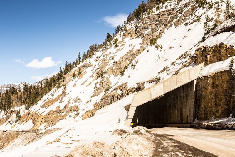
A short tunnel and a series of curves add to the drama. Pullouts are limited, so it helps to save photo stops for designated spots rather than braking on a blind bend.
The gorge is short, but it tends to set the tone for everything that follows.
5. Red Mountain Pass at Over 11,000 Feet
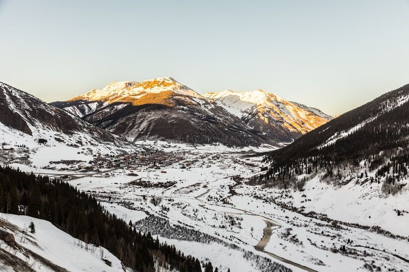
Here is a fun fact for the next trivia night: Red Mountain Pass tops out at 11,018 feet.
The pass is the high point of the classic Ouray to Silverton stretch. It sits between the two towns and marks a major crossing in the San Juans.
The name comes from the nearby Red Mountains, whose slopes show striking reddish and orange tones from mineral deposits in the rock.
Around the pass, old mining structures stand out against the slopes. The Red Mountain mining district was once busy with activity, and some historic sites remain visible near the road.
At this altitude, weather can shift quickly, even in summer. Afternoon storms are common in the mountains, so a morning crossing is often a smart plan.
Altitude also affects people differently. Drinking water and taking breaks can help, especially for anyone driving up from lower elevations the same day.
Reaching the summit feels like a small victory lap, and there is still plenty of road ahead.
6. Switchbacks Without Guardrails
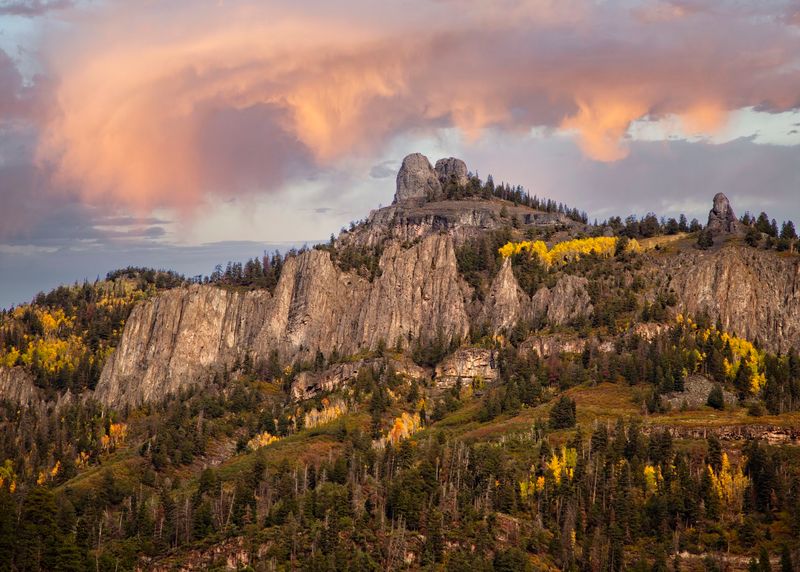
Ask anyone who has driven it what they remember first, and the answer is usually the curves.
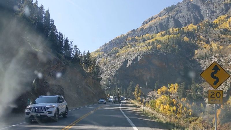
The Million Dollar Hwy is packed with hairpin turns and sharp switchbacks. Speed limits drop low in many spots, and those limits deserve respect.
Much of the route lacks guardrails. One common explanation is snow removal, since plows need somewhere to push heavy snow off the road.
That missing barrier is what turns knuckles white. It also gives drivers and passengers wide, uninterrupted views across the valleys.
A few habits can make the drive smoother:
Use lower gears on long descents to save the brakes. Stay in your lane on curves, and pull over at safe spots to let faster drivers pass.
Large RVs and trailers can find some sections challenging. Drivers of bigger rigs may want to research the route carefully before committing.
Patience is the real secret weapon here, and it costs nothing.
7. Silverton’s Mining-Town Welcome
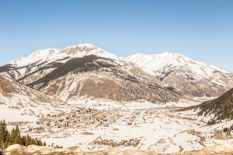
After the climb, the road drops into a wide valley and a town that looks like it never fully left the 1800s.
Silverton sits at more than 9,300 feet and is one of the highest towns in the state. It began as a mining camp and still keeps much of its historic look.
The town is a National Historic Landmark District. Its streets and buildings reflect its roots as a hub for the surrounding mines.
Silverton is also the northern end of the Durango and Silverton Narrow Gauge Railroad. During the train season, passengers arrive and spend a few hours exploring before heading back.
For drivers, it is a natural midpoint. A stop here offers a break from the curves and a chance to walk around before continuing south toward Durango or turning back to Ouray.
Mining history buffs can find museums and nearby mine tours in the area.
A town this high and this proud of its past makes the halfway mark feel well earned.
8. Molas Pass and the Road to Durango
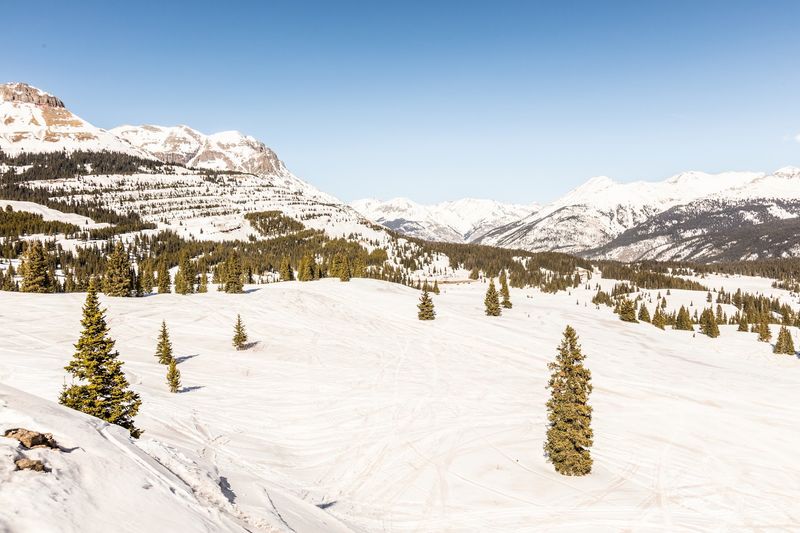
Silverton is not the end of the story for drivers who keep heading south.
Beyond town, US 550 climbs again over Molas Pass, which reaches about 10,900 feet. The overlook areas here show off sweeping mountain views and small alpine lakes.
Next comes Coal Bank Pass, another high crossing before the road gradually descends toward the Animas Valley.
This southern portion is generally considered less intense than the gorge near Ouray. The curves are still there, but many drivers find it a bit more relaxed.
Purgatory Resort sits along this route, a ski area that also offers summer activities. It makes a handy landmark on the way down.
The drive ends in Durango, a larger town with plenty of services. From there, travelers can continue on the San Juan Skyway loop or head home.
Think of this stretch as the encore after the main act.
9. Autumn Gold and Shoulder-Season Calm
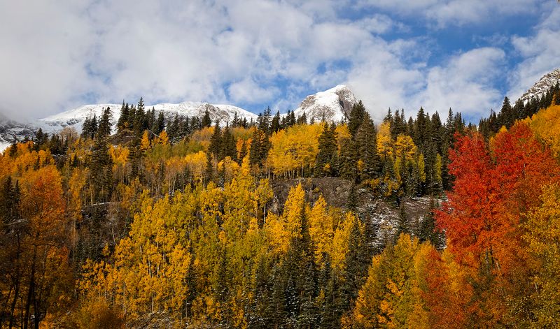
Timing can change this drive from busy to blissfully quiet.
Summer brings the most traffic, with road trippers, RVs and tour groups sharing the narrow lanes. Weekends in July and August can feel crowded at popular pullouts.
Fall is a favorite season for many Colorado residents. Aspen groves on the slopes typically turn gold in mid to late September, though timing varies each year.
Weekdays during this window may offer fewer cars and calmer stops.
Late spring can be quieter too, though snow may linger at the passes. Checking road conditions before leaving is always wise.
Winter is a different story. The road stays open most of the year, but snow, ice and avalanche control can cause closures, and chain laws may be in effect.
Drivers without winter experience may want to save this one for dry pavement.
Pick the right week, and the mountains might feel like a private showing.
10. Who This Drive Suits Best
Not every road is for every driver, and that is perfectly fine.
Confident drivers who enjoy mountain roads tend to love this route. It rewards focus with some of the most dramatic scenery in the San Juans.
Retirees and couples with flexible schedules have an advantage. Midweek trips can mean less traffic and more time at each stop.
Parents looking for a grown-up getaway may find Ouray or Silverton an easy overnight spot. A slow drive and a quiet mountain town make a simple escape.
Nervous passengers often do better with a plan. Some prefer to ride on the inside lane by heading southbound from Ouray.
Anyone with a strong fear of heights may want to research the route first, or consider letting someone else take the wheel.
Budget-minded travelers will like that the drive itself is free. The main costs are fuel, food and any lodging along the way.
In short, the right mindset matters more than the right car.
11. Practical Notes Before the First Curve
A little preparation goes a long way on a road with this many surprises.
There is no fee to drive the Million Dollar Hwy. It is a public highway open year-round, though weather closures do happen.
From Denver, reaching Ouray usually takes around five to six hours by car, depending on route and conditions. Many Front Range residents split the trip with an overnight stop.
Fuel up in Ouray, Silverton or Durango. Services between towns are limited.
Cell coverage can be spotty in the mountains, so downloading maps ahead of time helps.
Checking the Colorado Department of Transportation road condition updates before leaving is a smart habit, especially outside summer.
Bring layers, water and snacks. Mountain weather can change fast, and a short delay can stretch longer than expected.
Plan for more time than the mileage suggests. Low speeds, photo stops and slow traffic all add up.
Treat the clock as a suggestion, and the drive gets a lot more fun.
12. A Road Worth Every Gripped Mile
Some drives fade from memory by the next week. This one tends to stick around for years.
The Million Dollar Hwy packs history, high passes and mining towns into a short stretch of pavement. It asks for patience and steady hands, and it gives a lot back.
For Colorado residents, it is a big adventure that does not require a plane ticket. A weekday trip in the shoulder season may offer calmer roads and easier stops.
Ouray, Silverton and Durango each add their own flavor of small-town character. Together, they turn a scenic drive into a full getaway.
Not everyone will love the drop-offs, and that is okay. Planning direction, timing and pace can make a big difference in comfort.
Those who take it slow usually find the switchbacks worth the effort.
Somewhere between the first hairpin and the final descent, the nervous laughter tends to turn into plans for a second trip.
Share this story