Some trails in Central Oregon come with a quiet warning built right in: watch where your boots land. Rattlesnakes call this high-desert canyon home, and hikers have spotted them stretched across the very paths people use every day. That is no reason to stay away, because this park ranks among the most loved outdoor places in the state, with towering cliffs, a winding river, and more than 12 miles of trails.
Climbers travel here from far away, families come for easy rim walks, and brave hikers tackle a ridge with a name that says it all. Keep reading to learn which trail to pick, when to arrive, what the parking costs, and how to share the path safely with the locals that rattle.
A Canyon Near Bend Worth the Detour
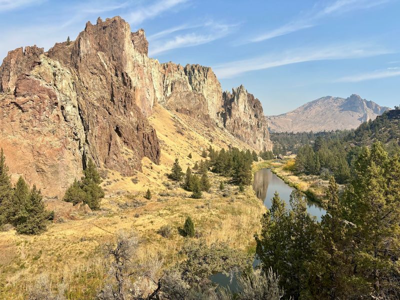
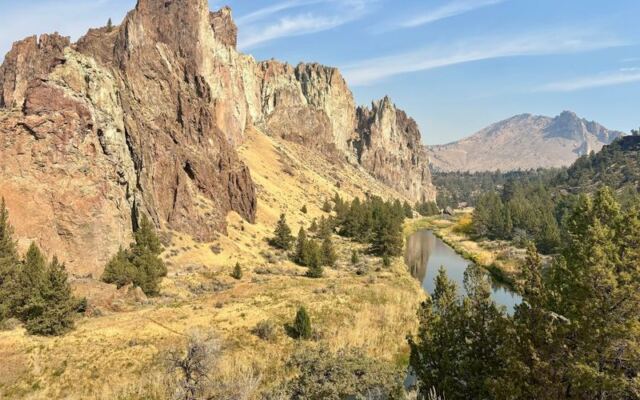
Some Oregon landmarks earn their fame slowly, and others grab it with a single skyline of cliffs. Smith Rock State Park sits at Crooked River, OR 97760, in Central Oregon, a short trip from Bend.
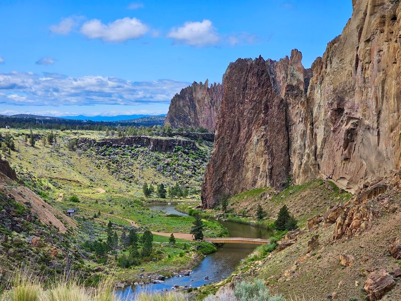
The park is a river canyon known for rock climbing, hiking trails, and primitive campsites. Its cliffs are made of welded tuff, and the Crooked River curves right below them.
Size can be a funny thing here. The park is not enormous on a map, yet it holds enough to fill a whole weekend.
Trails add up to more than 12 miles, and climbers can choose from over 2,000 routes. That mix keeps casual walkers and serious athletes busy in the same canyon.
Hiking is the most talked-about activity by a wide margin, with rock climbing close behind. The views come up again and again too, which makes sense given the dramatic shapes rising from the desert floor.
For Oregonians, it is the kind of familiar place that people return to year after year. Out-of-state guests often hear it named as the top spot to see in the state, and the canyon tends to back up that claim.
Rattlers on the Path
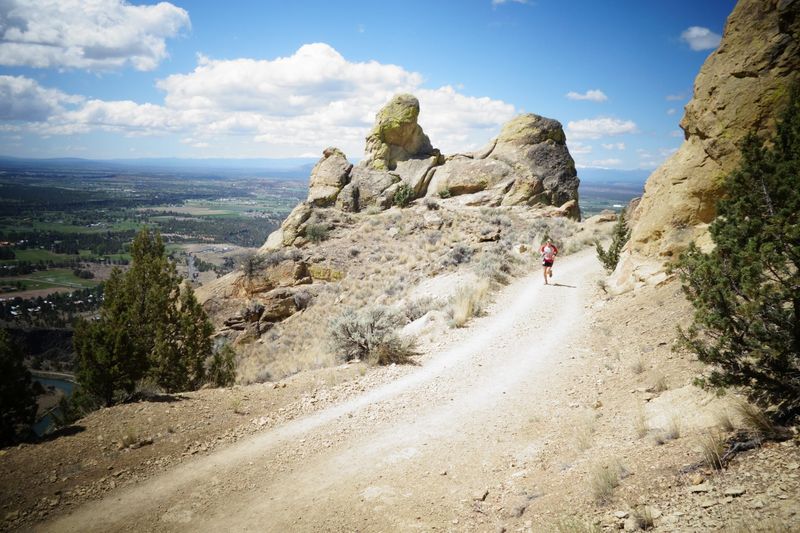
Two rattlesnakes on one hike is not a typical souvenir, but that is exactly what some trail users have reported here. The snakes are a real part of life in this canyon.
Rattlesnakes come up often enough in trail talk that they deserve a spot in any visit plan. They share the same dry, rocky ground that makes the park so striking.
The best defense is simple attention. Watch the trail ahead, especially on narrow stretches where rocks and brush crowd the edges.
Keep a respectful distance if one appears. Give it room, wait for it to move along, and let it keep its spot without any fuss.
Children and dogs need extra eyes on narrow paths. Staying on marked trails also helps everyone avoid surprises in the brush.
None of this should scare anyone off. It simply means that the phrase about keeping your eyes down is good advice in more ways than one, since the footing can be loose too.
Misery Ridge Lives Up to Its Name
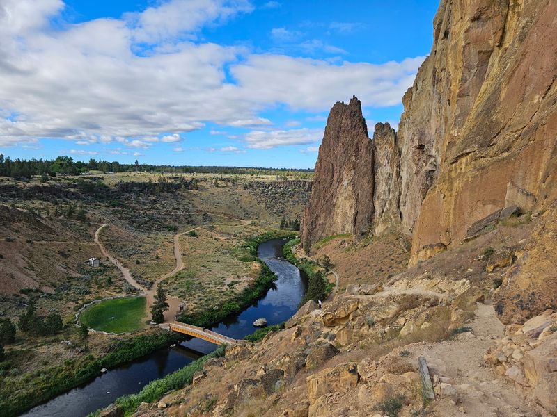
Few trail names are this honest. Misery Ridge is the hike most people mention, and it climbs about 600 feet in roughly one mile to the top.
The route is steep, with many switchbacks and some sections of steps. Plenty of hikers call it scary at points, yet they also say they are glad they pushed through.
A popular plan links Misery Ridge with the River Trail. The full loop runs about 3 to 4 miles, which sounds short until the incline shows up.
Many suggest going counterclockwise. That way the hardest climbing comes first, then the descent leads down to an easier walk along the water.
The way down can be slippery, with loose soil on several parts. Hiking poles help casual hikers, and good shoes with traction are a must.
Plan for at least three hours for the loop from the parking area. Some feel it is too cliffy for young kids, so families should judge carefully before heading up.
The payoff at the summit is a sweeping view that makes the burning legs worth it.
Monkey Face and Other Stone Characters
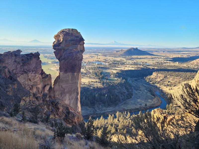
Rock formations rarely get nicknames as memorable as Monkey Face. The tall spire is one of the park’s most recognized shapes, and it comes into view along the Misery Ridge route.
Hikers who reach the far side of the ridge often stop to stare at it. Many describe that view as a highlight of the entire day.
The rest of the canyon is full of vertical, colorful walls. These welded tuff cliffs rise in ridges and towers that look different from almost every turn of the trail.
Part of the fun is how quickly the scene shifts. One moment the trail feels rugged and rocky, and a short time later it opens to wide Central Oregon views or drops to a greener riverside path.
Photographers find plenty to work with. Sunrise and sunset are favorite times for catching the cliffs at their best.
Drone fans should check the rules first, because flying closes for nesting season from January through July.
A Climber’s Home Turf
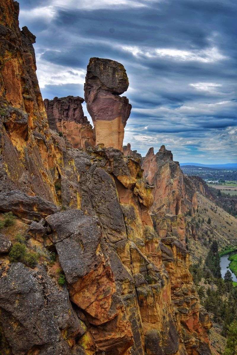
Ask a climber about Oregon, and this canyon will likely come up within seconds. The park is renowned as a rock climbing destination, with more than 2,000 routes on its cliffs.
Climbing is one of the most common reasons people visit. Ropes, helmets, and chalk bags are a regular part of the trail scene.
The walls draw climbers of many levels, and plenty plan full weekends around time on the rock. Many call it a paradise for the sport, and the numbers support that.
Hikers who do not climb still enjoy the show. Watching people work their way up the cliffs adds another layer of interest to any walk.
Climbers and trail users alike tend to treat the land with care. Leave No Trace habits show up across the park, which helps keep the canyon in good shape.
For newcomers to the sport, the visitor center staff can share helpful ideas about the area and its activities.
Easier Paths Along the Rim and River
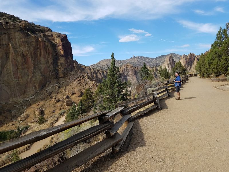
Not every great view requires a lung-busting climb. A walking trail along the top lets people take in the canyon without hiking down at all.
That path works well for strollers or anyone who wants a relaxed outing. It still delivers big views of the cliffs and river below.
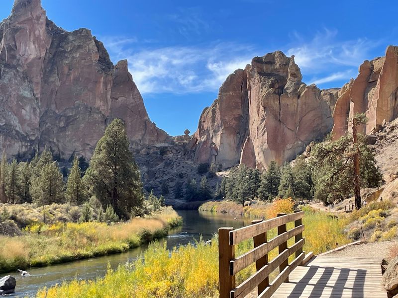
Down in the canyon, the River Trail follows the Crooked River and offers a gentler pace. Some routes have a bit more shade, though the paths can be narrow.
Wildlife adds a fun bonus. River otters get mentioned often, so keep an eye on the water.
The range of trails means groups with mixed abilities can all find something. Kids tend to enjoy exploring, and parents get their scenery too.
Picnics are another easy option for a slower day. A blanket and a view of the cliffs can be a perfectly good plan.
Beating the Heat and the Crowds
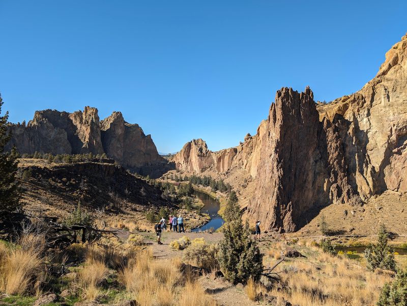
Shade is the rarest resource in this canyon. There is no tree canopy over most trails, so summer sun can get intense once it climbs higher.
Early morning is the smart move in warm months. A hot day in early September has caught more than a few people off guard.
Water matters more than anything else on the packing list. Signs remind people to carry it, and bringing extra is wise.
A hat, sunscreen, and snacks round out the basics. Sturdy hiking shoes help with steep and loose sections.
Crowds are the other challenge. The park stays busy, even on a weekday in December, and peak times can fill the lots.
Shoulder season visits, like a Friday afternoon outside summer, can feel much calmer. Arriving early helps with both temperature and parking.
Parking Fees, Facilities, and the Bivouac
Good planning starts at the parking lot. Day-use parking costs $10 per car for Oregon residents and about $12 for out-of-state drivers, with card payment accepted.
An Oregon State Parks annual parking permit is another option for frequent visits. For locals, that can make repeat trips easier on the budget.
The park has several parking lots, but space can run short later in the day. Late arrivals may need to park farther from the trailheads.
Restrooms and portable toilets are available, though some sit a fair walk from the main lots. Extra water and Wi-Fi are also on site.
The bivouac campground offers primitive camping with showers, bathrooms, sinks, and a spot to charge phones. Shared prep and dining areas give it a friendly community feel.
A gift shop and a visitor center with knowledgeable staff complete the setup. For current details, check the official Oregon State Parks website.
Why This Canyon Keeps Calling
Some places simply hold onto people. With a 4.9-star standing across more than 8,000 opinions, this canyon clearly does.
The appeal comes from variety packed into a compact space. Climbers, hikers, families, and photographers all leave with something.
Care for the land seems to be part of the culture here. Some campers even keep an eye on invasive plants along the river, hoping restoration can protect native species.
That kind of attention matters for a place so many Oregonians count as their own. Keeping it healthy keeps it ready for the next generation.
So pack water, lace up good shoes, and pick a trail that fits the day. Then watch the path closely, because the rattlesnakes were here first, and they seem to enjoy the views too.
Share this story