Some of the best hikes in the Columbia River Gorge do not need a permit, a long drive, or a full day off work. One of them sits along historic Route 30 near Corbett, tucked into a quiet forest that once served as a family’s summer retreat. The trail here loops past two waterfalls, crosses a string of wooden footbridges, and climbs to views of the Gorge itself.
The lower falls take about five minutes to reach from the parking lot, so even a quick stop pays off. The longer loop rewards anyone with an hour or two to spare. Stick around to learn where to park, which trail to choose, when the water runs strongest, and why this small, free stop keeps showing up on must-see lists.
It is the kind of familiar Oregon place worth knowing well, and worth protecting.
A Quiet Estate on Historic Route 30
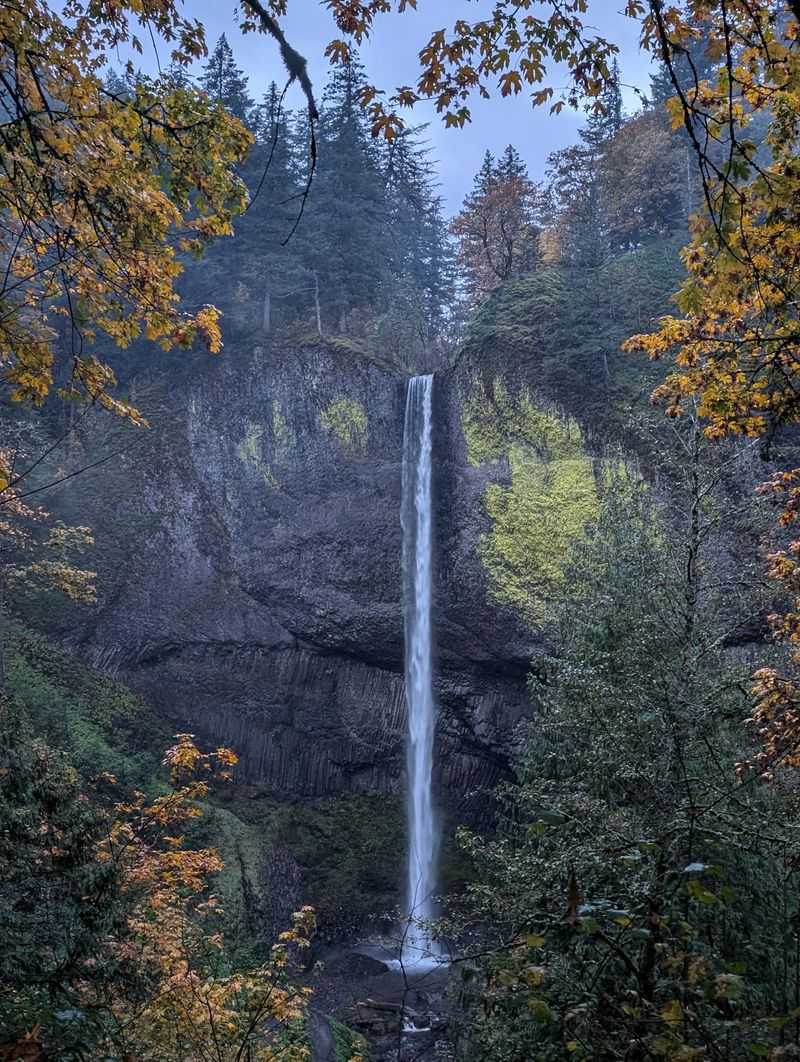
Plenty of travelers race past this exit on their way to bigger names, and that is exactly why it feels like a secret.
Guy W. Talbot State Park sits on the Historic Columbia River Hwy, Corbett, OR 97019, in the Columbia River Gorge east of Portland. It is a secluded, wooded state park built for picnicking and hiking.
The park lands along the old scenic route also known as historic Route 30. That road links a chain of trails, parks, and waterfalls, and this stop holds its own among them.
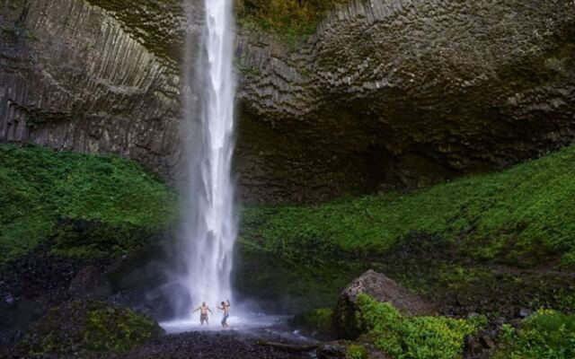
Its main draw is Latourell Falls, which actually comes as a pair. There is a lower falls close to the parking area and an upper falls deeper in the woods.
A loop trail ties the two together. Along the way, hikers cross wooden footbridges, pass through shaded forest, and reach high points with views of the Gorge.
The appeal here is range. A family can stretch their legs for ten minutes, while a hiker can spend a relaxed morning on the full loop.
Picnic tables, restrooms, and parking round out the basics. Everything needed for a simple, low-cost outing is right here, so the only real question is how far to walk.
From Summer Retreat to Public Forest
Long before it carried a state park sign, this land was somebody’s summer getaway.
The park is a former summer estate, and its name honors Guy W. Talbot. Today the grounds cover roughly 220 acres of woods, trails, and open picnic space.
That history explains the layout. Instead of a crowded trailhead, the park has the feel of a private property that opened its gates to everyone.
The shift from private retreat to public park is a preservation story in its own right. Land that could have stayed closed now belongs to every Oregonian who pulls off the old highway.
Families still use it the way an estate would be used. They spread out at picnic tables, take a short walk, and settle in for an afternoon away from the city.
On hot days, the shaded grounds offer welcome relief. The park stays more comfortable than many open spots in the region when temperatures climb.
Keeping places like this in good shape depends on the people who use them. Leave no trace, pack out what you bring, and leave the old estate a little better than you found it.
Lower Latourell Falls and Its Basalt Wall
Five minutes. That is all it takes to go from car door to waterfall here.
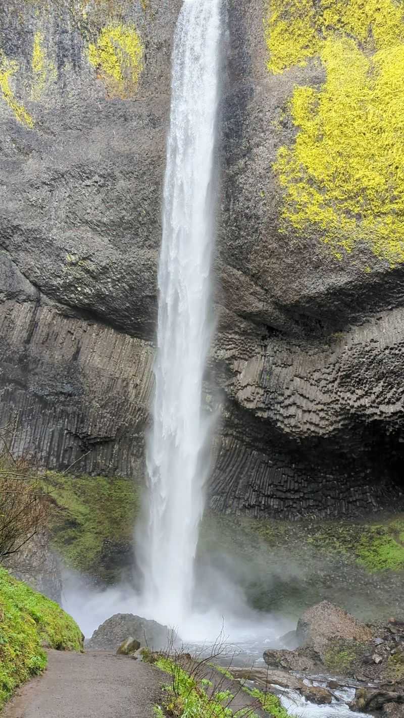
A short downhill path leads from the parking lot to the view of Lower Latourell Falls. It is one of the easiest waterfall payoffs in the Gorge.
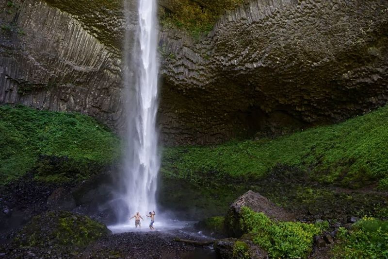
The real star might be the rock behind the water. The cliff is made of columnar basalt, with geometric columns jutting out of a cave-like hollow behind the falls.
Those formations took enormous natural forces to create. Standing in front of them puts the deep history of the Gorge on full display.
Two ways to see the falls exist from the start. Stairs near the lot lead up to an overlook, while a trail to the right of the stairs heads down toward the base and keeps going.
Getting close comes with a catch. The spray near the bottom is strong, so a raincoat is a smart idea for anyone who plans to linger.
For a quick stop, this alone justifies the exit. For everyone else, it is just the opening act.
Four Footbridges Across the Creek
Count them as you go, because the bridges are half the fun.
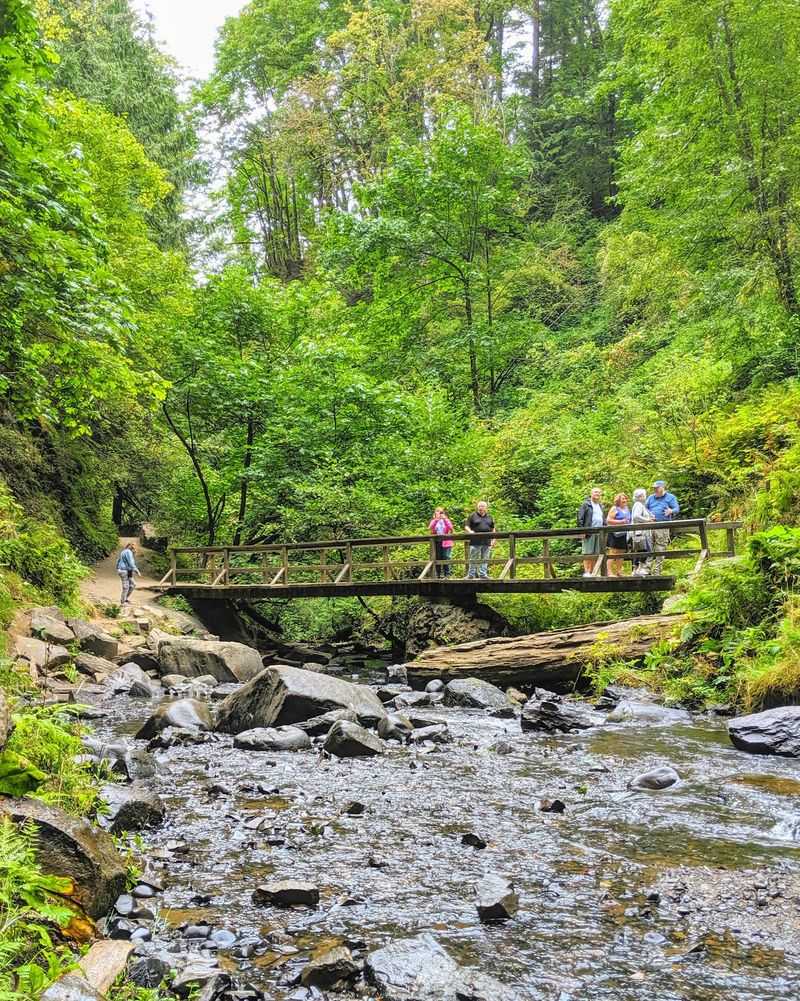
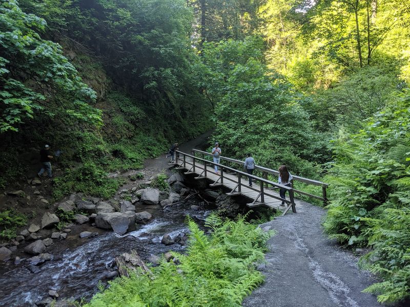
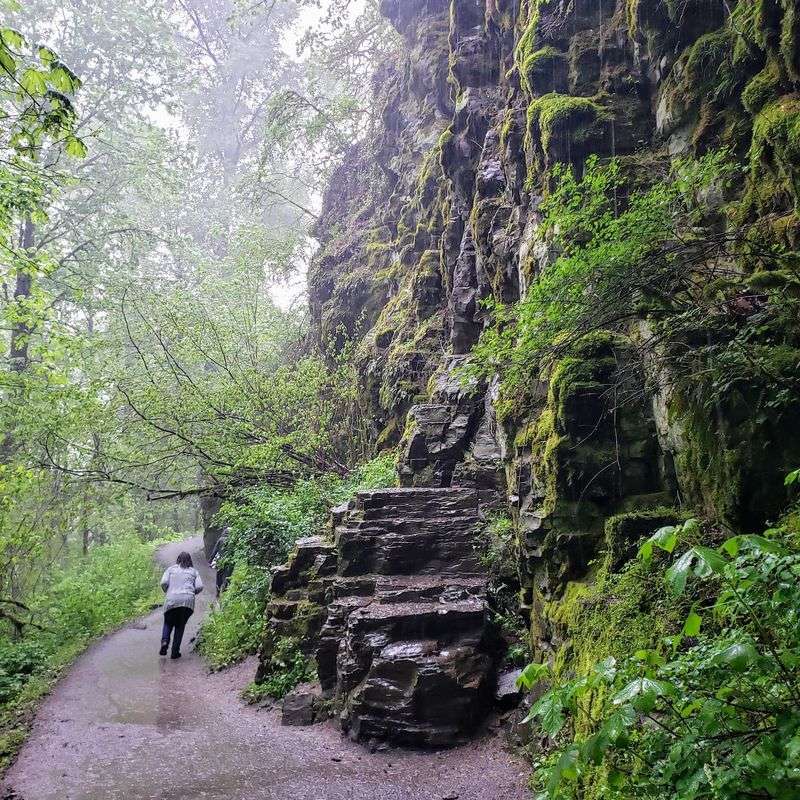
The loop through the park crosses wooden footbridges as it winds along the creek between the two waterfalls. Each crossing breaks up the walk and offers a fresh angle on the water below.
One bridge has earned a small fan club of its own. The mossy bridge near the lower falls shows up again and again in trip photos, with the waterfall visible nearby.
Paths run on both sides of the stream. Depending on which parking area you start from, you can pick either bank and still reach the upper falls.
About halfway, there is also a spot where the stream can be crossed on logs to reach the opposite trail. It is handy, though the bridges remain the steadier choice.
Camera owners should plan extra time. The trail offers many photo opportunities, and the bridges frame the creek and forest especially well.
Bridges like these need care to last. Staying on the path and keeping off fragile moss helps the next group enjoy the same crossings.
Upper Falls You Can Walk Behind
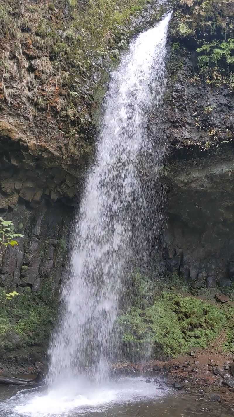
The second waterfall plays hard to get, and it is worth the chase.
Upper Latourell Falls sits about 0.8 miles from the parking lot each way, according to the trail sign there. The walk follows the creek through shaded forest.
The falls drop in two sections. Better still, the trail lets you walk right underneath them, which makes this one of the more memorable stops on the route.
The area near the base can get a little muddy. Sturdy shoes make the final stretch more comfortable.
On hot summer days, standing near the falls brings the temperature down noticeably. Hikers have found real relief here when it was in the 90s elsewhere.
Fewer people make it this far than see the lower falls. That means more room to pause, take photos, and enjoy the water without a crowd.
After this, the loop keeps going, and the best views are still ahead.
The Full Loop and Its Gorge Views
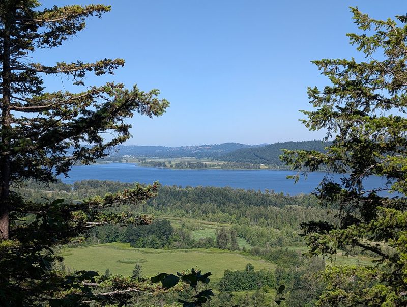
Commit to the whole circuit and the trail hands out a bonus round.
The loop runs about 2.4 miles with moderate elevation gain. It connects both waterfalls and climbs to points with wide views of the Columbia River Gorge.
Effort comes in short bursts. Depending on the route, the hike can feel hard for five to ten minutes and then settle into an easy pace.
Most of the trail is shaded. That keeps the walk pleasant even in warmer months.
The paths are well maintained and easy to follow. Getting lost would take real effort, and cell reception has held up along the route.
Hikers who complete the loop tend to call it the highlight of the visit. The combination of two falls, creek crossings, and high viewpoints packs a lot into a modest distance.
Plan on an unhurried pace. There is no prize for speed here, only more chances to stop and enjoy the scenery.
Winter Flow Versus Summer Shade
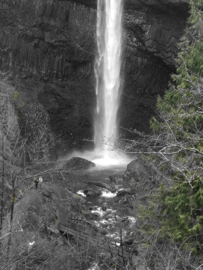
Here is a twist: the gray months may be the best time to go.
In winter, Latourell Falls runs with impressive flow and power. The lower falls send out a strong misty breeze that reaches well beyond the base.
Many hikers consider the falls even more striking in the colder months. Higher water makes both drops look fuller and more dramatic.
Summer brings its own advantages. The shaded forest stays cooler than open areas, which makes it a solid escape on hot days.
Trails here hold up well, and some hikers have noted the route stays largely free of mud. Still, the area right under the upper falls can be slick in any season.
A rain jacket works year-round. Spray from the lower falls does not care what month it is.
So which season wins? The honest answer is both, and a return trip in the opposite season is a good excuse to come back.
Easy Wins for Families and Beginners
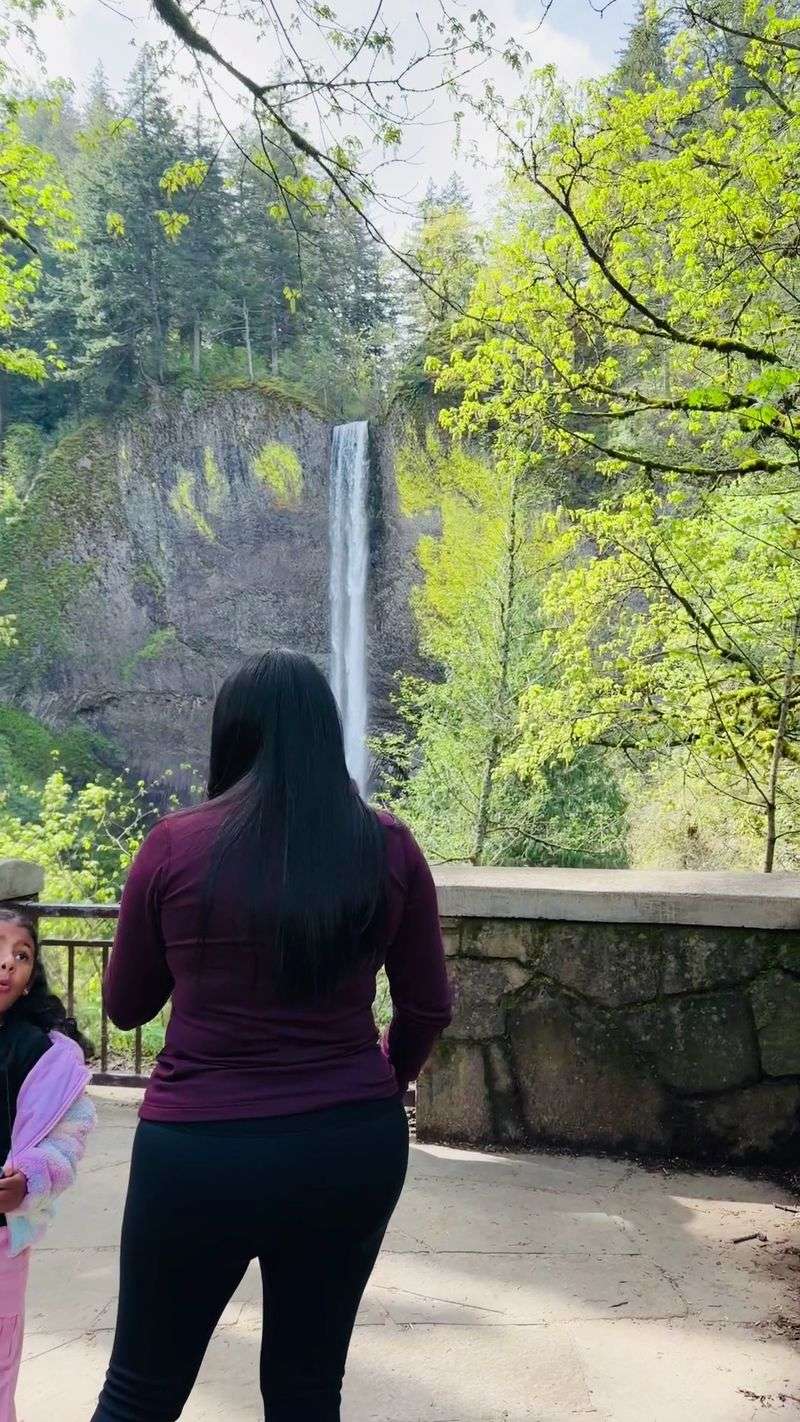
Not every great hike needs trekking poles and an energy bar stash.
The park suits beginners well. The short walk to the lower falls is manageable for children and older relatives who want a big view without a long climb.
Family hikes are a common sight here. Kids get a waterfall, a cave of basalt columns, and bridges to cross, all within a short distance.
For those ready for more, the loop offers a step up without being punishing. It works as a confidence builder for new hikers.
Restrooms and picnic tables make longer stays easy. A family can hike, eat lunch, and head home without hunting for facilities.
The forest walk has a peaceful quality that helps everyone slow down. Groups with mixed abilities can split up, with some heading to the upper falls and others resting near the lot.
Free, close to Portland, and simple to navigate, it is the kind of outing that keeps a weekend affordable.
Hours, Parking, and No Permit Needed
Good news for anyone tired of booking permits weeks ahead.
The park does not require a waterfall permit to park here. That makes it an easy addition to a Gorge road trip without extra planning.
Gates are open daily from 7:30 AM to 9 PM, seven days a week. Early arrival is a smart move on busy weekends.
The main parking lot is on the small side. Even so, people generally manage to find a spot, and the park has more than one area to park.
Restrooms are available on site, so it doubles as a handy pit stop along historic Route 30. Picnic tables sit close by for a break before or after the hike.
For current conditions or questions, the Oregon State Parks website lists details for this park. Checking before you leave can save surprises.
With no fee to fuss over and free parking, the biggest cost of the trip is the gas to get there.
Why This Smaller Stop Deserves the Detour
Bigger names nearby grab the headlines, but this park quietly earns its loyal following.
It sits close to well-known spots like Angels Rest, Vista House, and Multnomah Falls. Yet it tends to be less crowded, which gives it a calmer pace.
The park holds a 4.8-star average from more than a thousand people. Many call it a must stop on any trip through the Gorge.
What makes it work is variety in a small space. Two waterfalls, unusual basalt columns, wooden footbridges, and Gorge views all fit into a loop shorter than three miles.
It is also simple. No permit, open every day, and a waterfall within five minutes of the car.
Places like this are part of what makes everyday life in Oregon feel rich without costing much. Keeping trails clean and respecting the former estate helps it stay that way.
Next time the old highway calls, take the exit, cross a few bridges, and see both falls for yourself.
Share this story