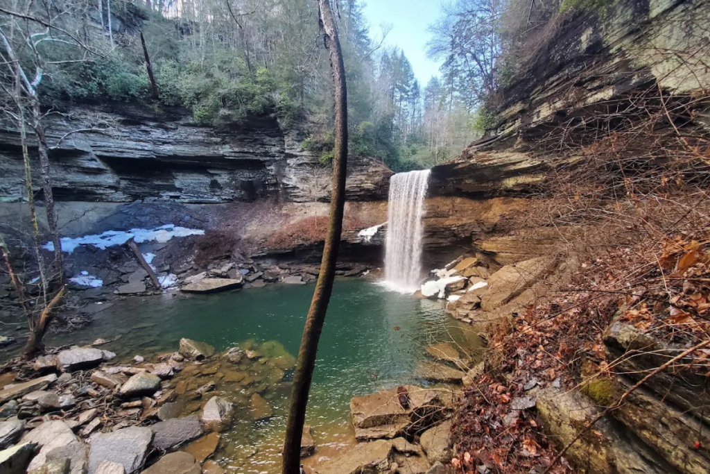
Tennessee hides some of the most stunning landscapes in the South, shaped over millions of years by rivers, rainfall, and the slow movement of stone. From towering waterfalls to underground lakes, these places show the raw power of nature at work. Each one tells a story of erosion, earthquakes, and the patient forces that carved gorges, opened caves, and sculpted cliffs.
Whether you’re planning your next adventure or just curious about the wild beauty in your own backyard, these thirteen spots are proof that Tennessee’s natural wonders are worth every step of the journey.
1. Fall Creek Falls State Park — Spencer
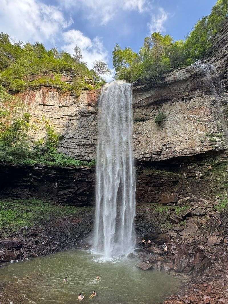
Standing at the edge of Fall Creek Falls feels like looking into another world. The water drops 256 feet into a rocky basin below, creating mist that rises back up and catches the light. It’s one of the highest waterfalls east of the Mississippi, and the sheer drop makes it unforgettable.
The park spreads across more than 26,000 acres of the Cumberland Plateau, with gorges, bluffs, and miles of trails connecting multiple waterfalls. Cane Creek Falls, Piney Falls, and Cane Creek Cascades are all within hiking distance. Each one has its own character, carved by different streams cutting through layers of sandstone and limestone over thousands of years.
Overlooks along the rim trails give you sweeping views of forested valleys and cliff walls that seem to go on forever. The geology here is all about erosion—water wearing down soft rock beneath harder capstone, creating the dramatic drops and deep canyons. You can see the layers in the stone, each one representing a different chapter in the plateau’s ancient past.
Trails range from easy paved paths to rugged backcountry routes, so there’s something for everyone. The gorge loop takes you down to the base of the falls, where you can feel the spray and hear the roar up close. It’s a steep climb back up, but the view from below is worth every step.
This place is a classic example of how water shapes the land. Over millions of years, creeks have carved their way through solid rock, leaving behind waterfalls, caves, and cliffs. Fall Creek Falls is the centerpiece, but the entire park is a showcase of what time, water, and stone can create together.
2. Burgess Falls State Park — Sparta
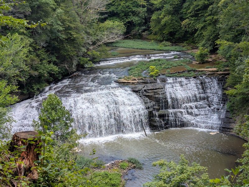
Burgess Falls doesn’t ease you into the scenery—it builds up to one massive, roaring finale. The Falling Water River drops through a series of cascades, each one more dramatic than the last, before plunging 136 feet over a limestone ledge. The final waterfall is loud, powerful, and impossible to look away from.
The trail follows the river downstream, passing three smaller falls before reaching the main event. Along the way, you’ll see how the water has carved through layers of rock, creating shelves, pools, and narrow channels. The geology is on full display, with exposed bedrock and sharp ledges that show the river’s relentless work.
The gorge itself is deep and steep-walled, with cliffs rising on both sides of the river. Trees cling to the rocky slopes, and in fall, the color is spectacular. The overlook platform gives you a front-row seat to the main waterfall, with the river crashing into the pool below and sending up clouds of mist.
This is one of those places where you can really see the power of moving water. Over thousands of years, the Falling Water River has cut through solid rock, creating a landscape that’s both beautiful and a little wild. The falls are especially impressive after heavy rain, when the volume of water turns the cascade into a thundering wall of white.
The park is compact but packed with scenery. The hike is just over a mile, mostly paved or boardwalk, making it accessible for most visitors. But the payoff is big—this is one of Middle Tennessee’s most dramatic water-carved landscapes, and it’s all right there within easy reach.
3. The Lost Sea — Sweetwater
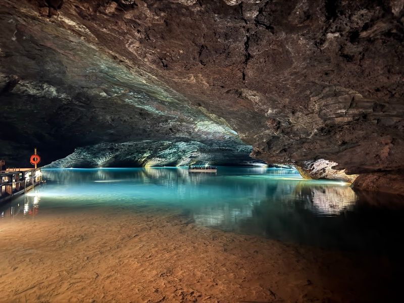
Few places capture the “water and stone” theme quite like the Lost Sea. Hidden inside Craighead Caverns, this underground lake is the largest in the United States, stretching through passages that divers have explored for more than 13 acres. But most of what lies beneath remains a mystery, with unmapped sections disappearing into darkness.
The cavern itself formed millions of years ago as acidic water dissolved limestone, creating chambers, tunnels, and formations. Stalactites hang from the ceiling, stalagmites rise from the floor, and flowstone drapes the walls like frozen curtains. The lake sits in one of the largest rooms, its surface calm and glass-like, reflecting the cave walls above.
Tours take you deep underground, where the temperature stays a constant 58 degrees year-round. You’ll walk through passages lined with ancient formations before boarding a glass-bottom boat for a ride across the lake. The water is incredibly clear, and the boat glides silently over submerged rocks and drop-offs that disappear into the depths.
Rainbow trout swim in the lake, a surprising sight this far underground. They were introduced decades ago and have thrived in the cold, clean water. Seeing them glide through the darkness adds to the surreal feeling of being in a completely hidden world.
The Lost Sea is a reminder that Tennessee’s water-carved wonders aren’t all above ground. This cavern system was shaped by the same forces that created the state’s gorges and waterfalls—just over a much longer timescale. Water dissolved the rock, carved the passages, and filled the lake, creating a landscape that feels almost otherworldly.
4. Big South Fork National River and Recreation Area — Oneida
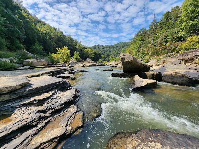
Big South Fork is massive—125,000 acres of gorges, bluffs, arches, and rivers that stretch across the Tennessee-Kentucky border. The Big South Fork of the Cumberland River carved this landscape over millions of years, cutting through layers of sandstone and shale to create one of the most dramatic river canyons in the eastern United States.
The gorge walls rise hundreds of feet above the river, exposing thick bands of rock that tell the story of ancient seas, river deltas, and shifting continents. Erosion has shaped the sandstone into cliffs, overhangs, and natural arches, some of which are large enough to walk through. The Twin Arches trail leads to two of the most impressive, both carved by wind, rain, and freeze-thaw cycles over thousands of years.
Water is the main character here. The river twists through the gorge, creating rapids, pools, and quiet stretches where the current slows. Side streams tumble down from the plateau, forming waterfalls and feeding into the main channel.
The combination of moving water and layered rock creates endless variety in the landscape.
Overlooks like East Rim and Honey Creek give you sweeping views of the gorge, with forested ridges rolling into the distance. The scale is hard to grasp until you’re standing at the edge, looking down at the river far below. It’s one of those places where you can really feel the age of the land.
Trails range from easy riverside walks to rugged backcountry routes that take you deep into the wilderness. You can hike, paddle, camp, or just explore the rock shelters and old homestead sites scattered throughout the park. Big South Fork is a showcase of erosion, geology, and the unstoppable power of a river carving its way through stone.
5. Rock Island State Park — Rock Island
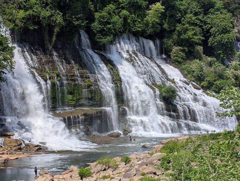
Rock Island sits at the meeting point of three rivers, and the result is a landscape shaped entirely by fast-moving water. Great Falls is the centerpiece—a wide, powerful cascade where the Caney Fork River drops over a limestone ledge in a rush of white water. It’s not a single plunge, but a series of ledges and channels that create a chaotic, beautiful scene.
The park also features Twin Falls, where two streams converge and drop side by side into a rocky gorge. The sound is constant—rushing water, echoing off stone walls, filling the air with energy. Trails wind along the river and up to overlooks where you can see the falls from above.
The geology here is all about layers. Limestone and shale stack up in horizontal bands, and the river has exploited the softer layers, carving through them to create the falls and gorges. Over time, the water has worn the rock into smooth channels, potholes, and sculpted ledges that look almost intentional.
This area has a long history of human use, too. The Collins River Dam and the old cotton mill ruins are reminders that people have been harnessing the power of this water for centuries. But the natural forces are still the dominant feature, and the landscape continues to change with every flood and storm.
Rock Island is one of those places where you can watch geology in action. The river is constantly working, grinding away at the rock, moving sediment, and reshaping the land. The falls are the most visible result, but the entire park is a showcase of water’s ability to carve, polish, and transform stone over time.
6. Virgin Falls State Natural Area — Sparta
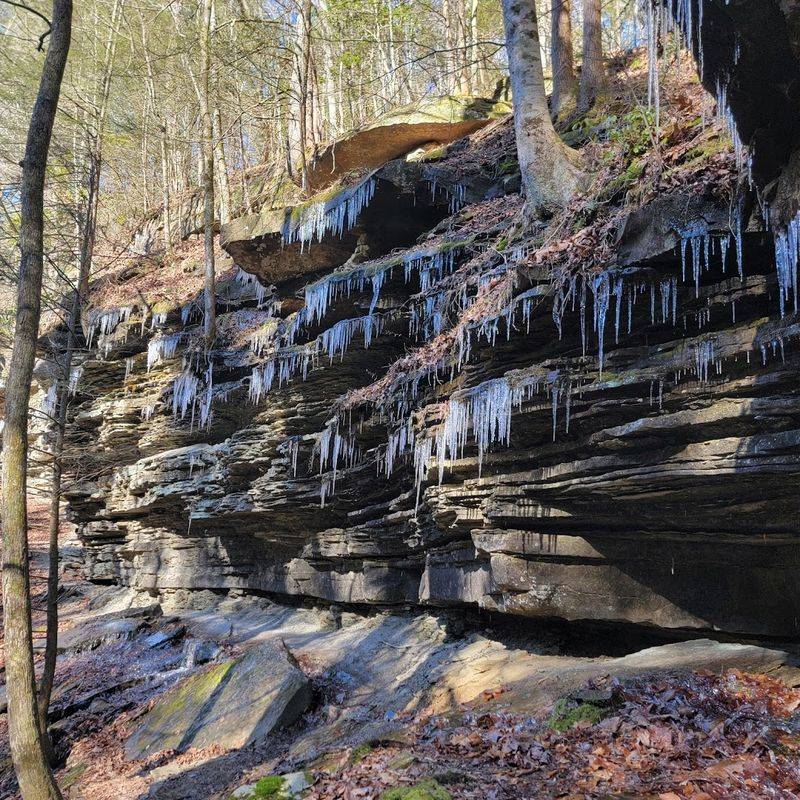
Virgin Falls might be the strangest waterfall in Tennessee. Water doesn’t flow down from a creek or stream—it pours out of a cave halfway up a cliff, drops 110 feet into a pool, and then vanishes underground again. It’s a waterfall that appears and disappears, carved by a hidden stream that spends most of its time beneath the earth.
The hike to reach it is rugged and remote, about eight miles round trip through the Caney Fork River gorge. Along the way, you’ll pass other waterfalls, rock shelters, and cave openings, each one adding to the sense that this is a landscape shaped entirely by underground water. Big Laurel Falls and Sheep Cave are both worth exploring, and the trail itself follows ridges and descends into valleys carved by ancient streams.
The geology here is karst—limestone riddled with caves, sinkholes, and underground channels. Rainwater seeps into the ground, dissolves the rock, and creates hidden passages that can stretch for miles. Virgin Falls is one of the few places where you can actually see this process in action, with water emerging from darkness, falling through open air, and then disappearing back into the stone.
The pool at the base of the falls is clear and cold, fed by the underground stream. In dry weather, the flow can slow to a trickle, but after heavy rain, the waterfall roars. The surrounding cliffs are draped with moss and ferns, and the whole scene has an almost mythical quality.
This is a place that reminds you how much of Tennessee’s landscape is shaped by water you can’t see. The caves, the gorges, the waterfalls—they’re all connected by underground rivers and streams that have been carving through the rock for millions of years. Virgin Falls is just one small window into that hidden world.
7. Savage Gulf State Park — Beersheba Springs
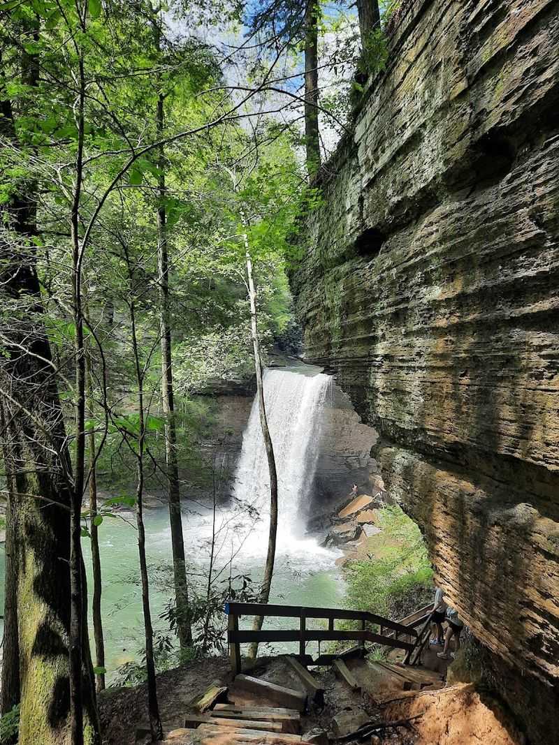
Savage Gulf lives up to its name. This is one of the wildest, most rugged landscapes on the Cumberland Plateau, with deep gorges, sheer cliffs, and miles of backcountry that feel completely untouched. Three main gorges—Savage Gulf, Collins Gulf, and Greeter Falls Gulf—converge here, each carved by streams that have spent millions of years cutting through sandstone.
The walls of the gorges rise hundreds of feet, exposing thick layers of rock that show the plateau’s ancient past. Water has carved the stone into overhangs, natural bridges, and narrow slot canyons. Waterfalls drop from the rim into the gorge below, and side streams tumble over moss-covered ledges.
Greeter Falls is one of the highlights, a two-tiered cascade that plunges into a rocky amphitheater. The upper falls drop over a sandstone ledge, and the lower falls continue down into a pool surrounded by cliffs. The trail to the base is steep and slippery, but the view from below is worth the effort.
Old-growth forest covers much of the park, with massive hemlocks, oaks, and poplars towering over the trails. The combination of deep shade, rocky terrain, and constant moisture creates a habitat that feels almost primeval. Ferns, mosses, and wildflowers cover the ground, and the air is cool and damp even in summer.
Savage Gulf is a place for serious hikers. The trails are long, steep, and challenging, with rocky scrambles and creek crossings. But the payoff is a landscape that feels truly wild, shaped entirely by water, time, and stone.
8. The Stone Door — Beersheba Springs
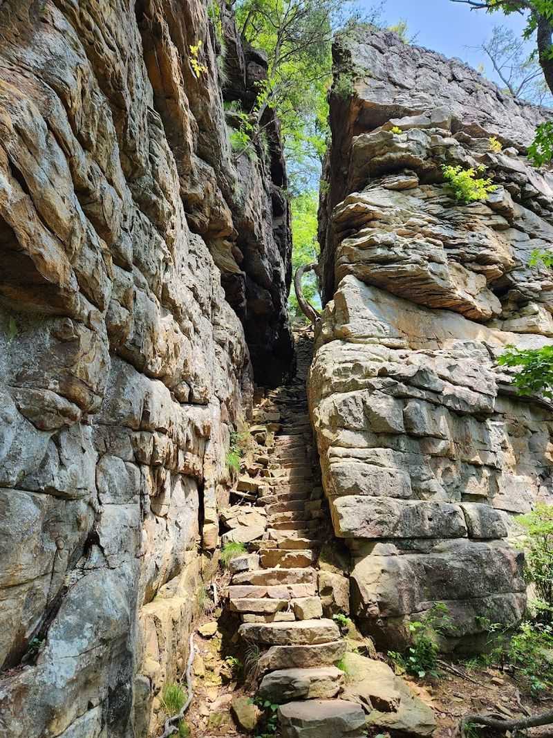
The Stone Door is one of those places that stops you in your tracks. It’s a narrow crack in a massive sandstone cliff, just wide enough to squeeze through, and it opens onto a view that stretches for miles. On one side, you’re standing on solid ground. On the other, the earth drops away into a deep gorge with layered cliffs and endless forest.
This natural doorway formed through a combination of erosion and weathering. Water seeped into cracks in the sandstone, froze and expanded, and slowly widened the gap over thousands of years. The result is a passage that feels almost intentional, like someone carved a doorway into the plateau.
The view from the other side is spectacular. You’re looking down into a canyon carved by Big Creek, with cliffs stacked in horizontal bands of tan, gray, and rust-colored stone. The gorge walls drop hundreds of feet, and the forest below looks like a green carpet stretching to the horizon.
Trails lead along the rim and down into the gorge, passing rock shelters, waterfalls, and overlooks. The Stone Door Trail is relatively short, just a few miles round trip, but it packs in some of the best scenery on the plateau. The combination of cliffs, forest, and open sky makes it feel like you’re standing on the edge of the world.
This is a landscape shaped by slow, patient forces. Water, wind, and ice have been working on this rock for millions of years, carving the gorge, opening the Stone Door, and sculpting the cliffs into their current form. It’s a reminder that even the hardest stone eventually gives way to the elements, and the result is something beautiful and unexpected.
9. Cummins Falls State Park — Cookeville
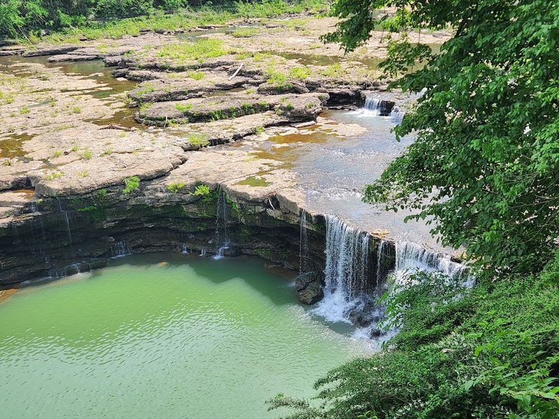
Cummins Falls is one of those places that rewards the effort. Getting there means hiking down a rocky trail and wading through the Blackburn Fork River, scrambling over boulders and navigating slippery rocks. But once you reach the falls, the scene is worth every careful step.
The waterfall spreads wide across a series of stair-stepped ledges, with water spilling down in sheets and ribbons. The rock is layered limestone, worn smooth by the constant flow, and the pool at the base is deep and clear. In summer, it’s a popular spot for swimming, with people perched on rocks and wading in the shallows.
The gorge itself is beautiful, with cliffs rising on both sides of the river and trees clinging to the rocky slopes. The trail follows the river upstream, passing smaller cascades and pools before reaching the main falls. The sound of rushing water fills the gorge, echoing off the stone walls.
This is a place where you can really see the power of erosion. The river has carved through solid rock, creating a deep channel and exposing the layers beneath. Each ledge in the waterfall represents a different layer of stone, some harder and more resistant, others softer and easier to wear away.
Cummins Falls is also a reminder that water-carved landscapes are still changing. After major floods, the river rearranges boulders, carves new channels, and reshapes the gorge. It’s a dynamic system, constantly in motion, and the waterfall you see today is just one snapshot in a process that’s been going on for thousands of years.
The combination of rugged beauty, accessible adventure, and visible geology makes this one of Tennessee’s most beloved natural wonders.
10. Tennessee River Gorge — Chattanooga
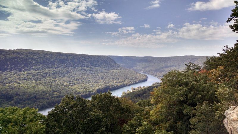
The Tennessee River Gorge has earned its nickname—”Grand Canyon of Tennessee”—for good reason. This massive gorge stretches for 26 miles as the river cuts through the Cumberland Plateau, creating a canyon that’s both wide and deep. The scale is impressive, with forested ridges rising hundreds of feet above the water and the river winding through in broad, sweeping curves.
The geology here is all about the river’s power. Over millions of years, the Tennessee River has carved through layers of sandstone, limestone, and shale, exposing the plateau’s ancient structure. The canyon walls show the horizontal bands of rock, each layer representing a different period in the region’s geological history.
Signal Point and Prentice Cooper State Forest offer some of the best overlooks, with views that stretch for miles. From the rim, you can see the river far below, reflecting the sky and snaking through the forested canyon. The combination of water, rock, and green is stunning, especially in fall when the trees turn color.
The gorge is also home to diverse ecosystems, with habitats ranging from rocky bluffs to riverside wetlands. Rare plants cling to the cliff faces, and the forest supports a wide variety of wildlife. The Tennessee River Gorge Trust protects much of the land, preserving it as a natural area for future generations.
This is one of the largest water-carved landscapes in the state, and it’s a testament to the unstoppable force of a river. The Tennessee River has been shaping this gorge for millions of years, grinding away at the rock, moving sediment, and creating a canyon that rivals anything in the eastern United States. It’s a landscape that demands respect and rewards exploration.
11. Reelfoot Lake State Park — Tiptonville
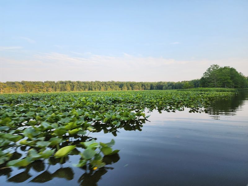
Reelfoot Lake didn’t form the usual way. Instead of erosion or glaciers, this lake owes its existence to one of the most powerful earthquakes in American history. In 1811 and 1812, the New Madrid earthquakes shook the region so violently that the land sank, the Mississippi River temporarily flowed backward, and a shallow depression filled with water.
The result is Reelfoot Lake, one of Tennessee’s most unusual natural wonders.
The lake is shallow, rarely more than a few feet deep, and filled with bald cypress trees that rise from the water like ancient sentinels. Their trunks are thick and gnarled, their roots spread wide beneath the surface, and their branches draped with Spanish moss. In fall and winter, the trees turn rust-colored, creating a stark, beautiful contrast against the gray water.
This is a landscape shaped by catastrophe, but it’s also incredibly alive. The shallow water and abundant vegetation create a rich habitat for fish, birds, and other wildlife. Reelfoot is one of the best places in the state to see bald eagles, especially in winter when they gather to fish.
Great blue herons, egrets, and osprey are common, and the lake is a stopover for migratory waterfowl.
Boat tours take you through the cypress forest, weaving between the trees and across open water. The stillness is remarkable—no current, no rapids, just quiet water reflecting the sky and the trees. It’s a completely different kind of water-carved landscape, shaped not by slow erosion but by sudden, violent geological forces.
Reelfoot Lake is a reminder that Tennessee’s natural wonders come in many forms. This one was born from earthquakes and shaped by water, and it’s unlike anything else in the state.
12. Ruby Falls — Chattanooga
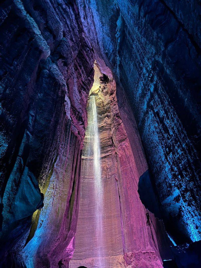
Ruby Falls is Tennessee’s most famous underground waterfall, hidden deep inside Lookout Mountain. The cave system formed millions of years ago as water dissolved limestone, creating passages, chambers, and formations. But the waterfall itself wasn’t discovered until 1928, when a cave explorer broke through a rock wall and found water falling 145 feet from the ceiling into a pool below.
The tour takes you through narrow passages lined with stalactites, stalagmites, and flowstone formations. The cave is lit with colored lights that highlight the textures and shapes of the rock, and the path winds deeper and deeper into the mountain. The air is cool and damp, and the sound of dripping water is constant.
When you reach the waterfall, the space opens up into a tall chamber with the water cascading down from a crack in the ceiling. The falls are lit with spotlights, and the effect is dramatic—water falling through darkness, echoing off the stone walls, and disappearing into a pool at your feet. It’s a surreal sight, and it’s hard to believe you’re standing hundreds of feet underground.
The geology here is classic karst—limestone riddled with caves and underground streams. Water has been carving these passages for millions of years, dissolving the rock and creating the chambers and formations you see today. Ruby Falls is just one part of a much larger cave system, most of which remains unexplored.
This is one of Tennessee’s most popular attractions, and for good reason. It combines cave formations, underground water, and dramatic lighting into an experience that’s both educational and awe-inspiring. Ruby Falls is proof that some of the state’s most beautiful water-carved landscapes are hidden beneath the surface, waiting to be discovered.
13. Ozone Falls State Natural Area — Crab Orchard
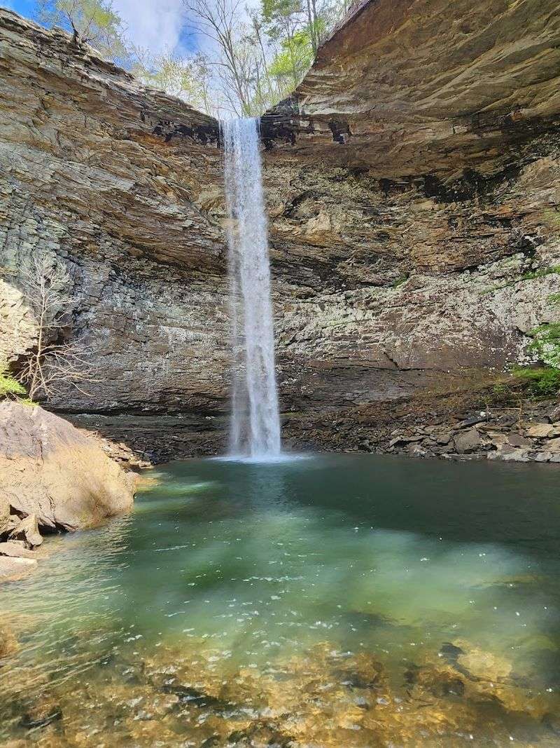
Ozone Falls is raw and wild, a 110-foot plunge that drops from a sandstone caprock into a rocky amphitheater below. The waterfall is surrounded by cliffs on three sides, creating a natural bowl that amplifies the sound of falling water. It’s one of those places that feels hidden, even though it’s right off the highway.
The geology is classic Cumberland Plateau—horizontal layers of sandstone stacked on top of each other, with the harder caprock forming the lip of the falls. Below the caprock, softer rock has eroded away, creating an overhang and the amphitheater-like space around the pool. Over time, the waterfall has carved deeper into the gorge, and the caprock continues to erode, slowly moving the falls upstream.
A short trail leads to the top of the falls, where you can stand on the edge and look down into the gorge. The view is dizzying, and the sound of the water is loud and constant. Another trail descends to the base, where you can see the falls from below and feel the spray on your face.
The surrounding cliffs are covered with moss, ferns, and small trees that cling to cracks in the rock. The pool at the base is clear and cold, fed by Fall Creek, which continues downstream through a narrow gorge. The whole area feels remote and untouched, even though it’s easily accessible.
Ozone Falls is a perfect example of how water carves through stone. The creek has been working on this rock for thousands of years, grinding away at the softer layers and creating the dramatic drop you see today. It’s a landscape in motion, constantly changing, and it’s one of Tennessee’s most photogenic waterfalls.