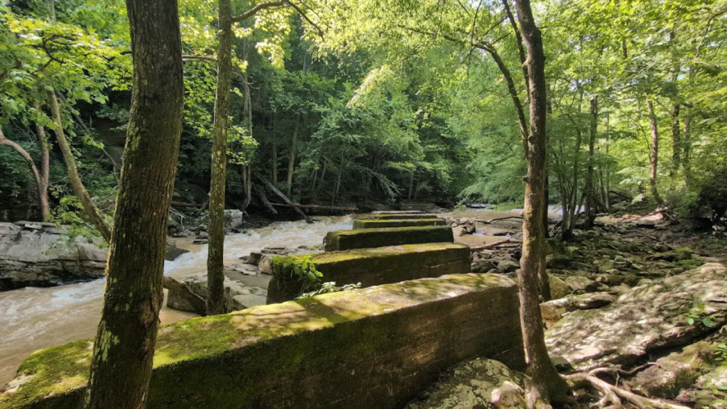
Hidden in the hills near Dayton, Tennessee, an old railroad bed tells stories of coal miners, forgotten industry, and a time when these quiet forests echoed with the sounds of work. Today, Laurel Snow State Natural Area preserves both the natural beauty and the industrial past of this rugged gorge.
Hikers who follow the trail wind through towering cliffs, past crumbling mining relics, and alongside rushing water that once powered an entire operation.
An Old Railroad Route Leads Into Tennessee’s Mining Past
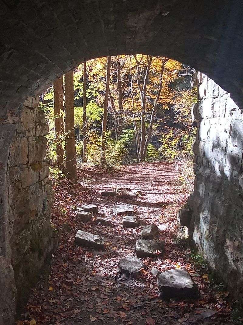
Walking the trail at Laurel Snow feels different from other Tennessee hikes right from the start. The path follows what used to be a narrow-gauge railroad that hauled coal and coke out of these mountains over a century ago. You’re literally stepping through history with every footfall, tracing the same route that miners and loaded rail cars once traveled daily.
The railroad served a thriving coal operation that carved deep into the hillsides here. Workers blasted tunnels, extracted coal, and processed it into coke for industrial use. The railroad was their lifeline, connecting this remote gorge to markets and civilization beyond.
Without it, the entire operation would have been impossible.
Today, the old rail bed makes for surprisingly easy hiking, especially in the first stretch. The grade stays gentle because trains couldn’t handle steep climbs. That engineering decision from the 1800s now benefits modern hikers who want a manageable trail that doesn’t immediately punish their knees.
As you walk, try to imagine the scene during peak operations. Smoke rising from furnaces, the clatter of rail cars, voices echoing off canyon walls. The forest has reclaimed most of the evidence, but the bones of that industrial past remain visible if you know where to look.
This isn’t just a nature walk. It’s a journey into Tennessee’s industrial heritage, a reminder that these peaceful mountains once rang with the sounds of hard labor and dangerous work. The railroad bed you’re hiking was built by hand, often by workers who lived in rough camps nearby.
Their legacy is the trail itself, preserved now for a completely different purpose than they ever imagined.
The Trail Winds Through A Gorge Filled With History
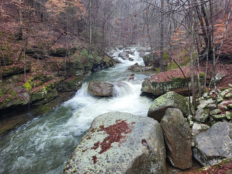
Richland Creek carved this gorge over thousands of years, slicing through layers of rock to create the dramatic landscape you see today. The gorge walls rise steeply on both sides, creating a corridor that funnels wind and water through the canyon. It’s the kind of place that makes you feel small in the best possible way.
But nature isn’t the only force that shaped this landscape. Human activity left its mark too, particularly during the late 1800s and early 1900s when mining operations transformed parts of the gorge. The combination of natural beauty and industrial remnants gives Laurel Snow a character unlike typical wilderness areas.
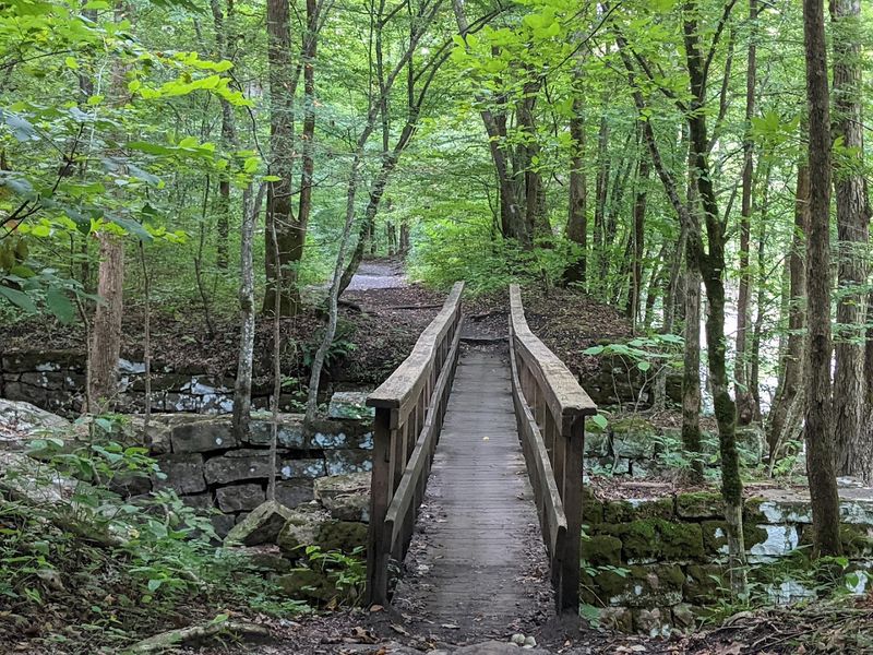
The trail hugs Richland Creek for much of its length, crossing back and forth on sturdy bridges. Water is everywhere here, tumbling over rocks, pooling in quiet eddies, rushing past boulders the size of cars. During wetter months, the creek becomes a constant roaring companion.
In drier times, it settles into a more contemplative murmur.
Rock formations dominate the scenery. Massive boulders litter the gorge floor, some broken free from the cliffs above, others worn smooth by centuries of water flow. Climbers love this area for bouldering, and you’ll often spot them working their way up challenging routes with nothing but crash pads below.
The gorge also served practical purposes for the mining operation. The creek provided water for processing and cooling. The narrow canyon concentrated operations into a manageable area.
The steep walls offered some protection from weather. Everything about this location made sense for 19th-century industry, even if it seems remote and wild today.
Weathered Remains Reveal A Once-Bustling Coal Operation
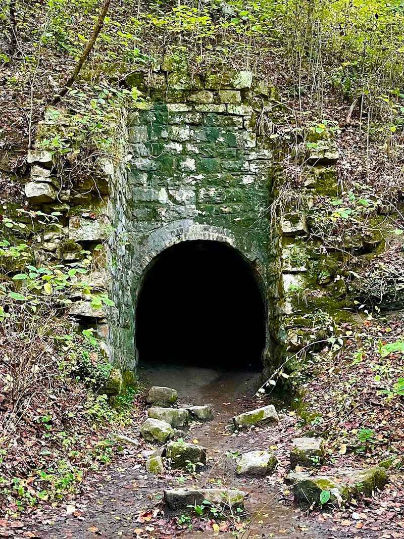
About a mile into the hike, you’ll encounter the most striking reminder of the area’s industrial past: a dark tunnel entrance lined with brick, leading straight into the mountainside. This is one of the old mine shafts, and it’s genuinely eerie. The opening yawns like a mouth, and even on bright days, the darkness inside seems absolute.
Most hikers pause here, peering into the blackness, debating whether to venture inside. Some do, armed with headlamps and a sense of adventure. The tunnel extends back into the mountain, cold and damp, with walls that still show pick marks from the miners who carved it.
It’s a powerful connection to the past, standing where workers once toiled in dangerous conditions.
Beyond the main tunnel, other remnants scatter through the area. Crumbling stone walls mark where buildings once stood. Rusted metal fragments poke through the leaf litter.
What appears to be an old coke oven sits partially collapsed, its brick structure slowly being reclaimed by vegetation. Each piece tells part of the larger story.
The operation here wasn’t small. At its peak, dozens of workers lived and labored in this gorge. They extracted coal, processed it into coke (a fuel made by heating coal in the absence of air), and shipped it out via the railroad.
The work was grueling, dangerous, and essential to Tennessee’s industrial development.
Now nature is winning back the territory. Trees grow from the tops of old walls. Moss covers brick surfaces.
The forest floor slowly buries what humans built. In another century, much of this evidence may disappear entirely, making these ruins all the more precious for understanding Tennessee’s mining heritage.
Laurel Falls Adds A Scenic Reward Along The Way
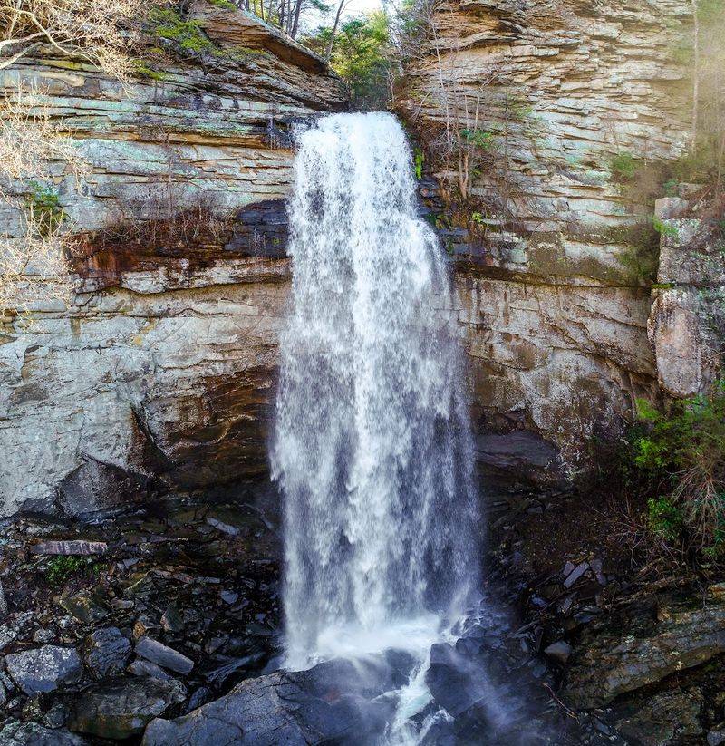
After roughly three miles of hiking, the trail brings you to Laurel Falls, and the sight stops people in their tracks. Water plunges over a rocky cliff face in a wide, white curtain, crashing into a pool below before continuing downstream. The sound is tremendous, especially after rain when the falls are running full force.
Getting to the falls requires some effort beyond just distance. The trail gets steeper after you cross the large bridge over Richland Creek. The terrain shifts from easy railroad grade to more traditional mountain hiking, with rocks to navigate and elevation to gain.
But the payoff is worth every bit of effort.
Many hikers make Laurel Falls their turnaround point, and it’s easy to understand why. The falls provide a natural destination, a clear goal that feels satisfying to reach. The area around the base offers good spots to rest, eat lunch, and soak in the scenery before heading back.
What many visitors don’t realize is that you can actually climb to the top of Laurel Falls. It requires scrambling over large boulders and finding the right route, which isn’t marked or maintained. But adventurous hikers who make the climb get rewarded with a completely different perspective, standing above the drop where water launches into space.
The falls themselves change character with the seasons. Spring runoff makes them powerful and dramatic. Summer reduces them to a more modest flow.
After heavy rain, they roar with impressive force. Even in drier conditions, though, Laurel Falls maintains its beauty, and the surrounding rock formations and forest create a scene that’s worth the hike regardless of water levels.
Steep Cliffs And Forest Views Keep The Hike Interesting
The gorge walls at Laurel Snow rise dramatically on both sides of the trail, creating a sense of being enclosed by the landscape. These aren’t gentle slopes but proper cliffs in many sections, with exposed rock faces that climb hundreds of feet above the creek. Looking up at them from the trail below gives you a real sense of the geological forces that shaped this area.
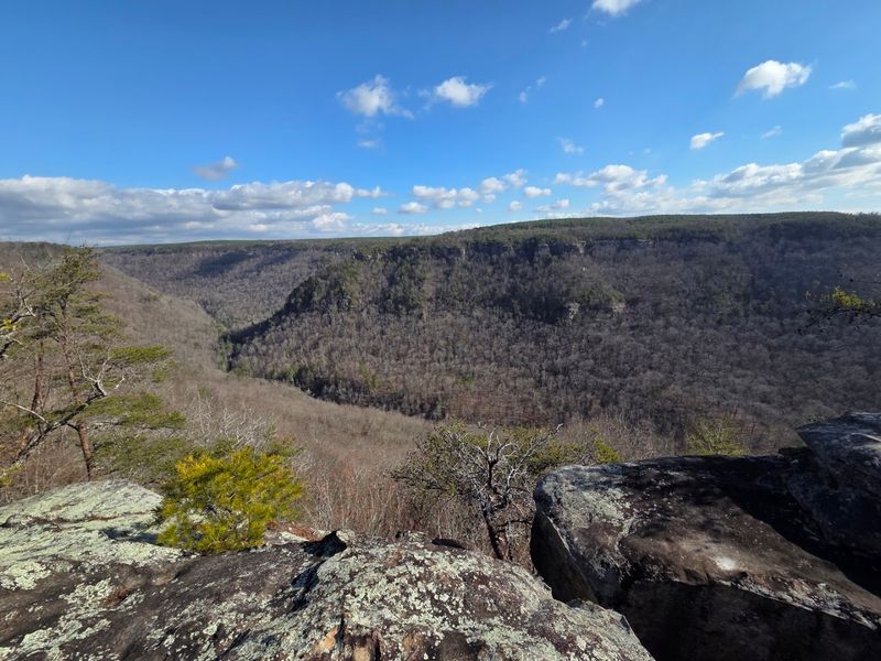
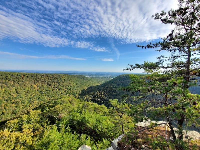
For those who want even more dramatic views, side trails lead to overlooks like Buzzard Point. These require additional hiking and elevation gain, but they deliver perspectives that the main trail can’t match. Standing at Buzzard Point, you can see across the gorge to distant ridges, with layers of mountains fading into blue haze on the horizon.
The forest itself adds to the visual interest throughout the hike. Hardwoods dominate, creating a canopy that provides welcome shade in summer and explodes with color in fall. Spring brings wildflowers to the forest floor, dotting the landscape with unexpected bursts of color.
Even winter has its appeal, with bare trees revealing rock formations and distant views that summer foliage conceals.
Rock formations appear constantly along the trail, not just in the form of cliffs but also as massive boulders and interesting geological features. Some rocks show clear stratification layers, like pages in a stone book recording millions of years of sediment deposition. Others have been sculpted by water and weather into shapes that invite imagination.
The combination of vertical relief, varied forest, rushing water, and exposed rock creates a hiking experience that never feels monotonous. Every bend in the trail reveals something new, whether it’s a particularly impressive boulder, a small cascade, or a view up the gorge walls to the sky above.
The 4.2-Mile Route Offers Just The Right Amount Of Adventure
The round trip to Laurel Falls and back covers about 4.2 miles, though distances vary slightly depending on which source you consult and exactly where you start and stop. It’s a distance that feels substantial without being overwhelming, perfect for hikers who want a real outing but don’t need to commit to an all-day epic.
The first portion of the trail, following the old railroad grade, goes down easy. It’s relatively flat, well-maintained, and suitable for a wide range of fitness levels. Families with older kids often tackle this section without much trouble.
The terrain consists mostly of packed dirt with some rocky sections, but nothing too technical.
After the big bridge crossing, things change. The trail gets steeper and rockier as it climbs toward Laurel Falls. This is where you’ll earn the views and the waterfall.
Hikers should expect to watch their footing more carefully, step over roots and rocks, and feel their heart rate increase on the uphill sections.
Most people complete the round trip in two and a half to four hours, depending on pace and how long they linger at various stops. Fast hikers who push straight through can do it quicker. Those who stop to explore the mine entrance, take photos, eat lunch at the falls, and generally soak in the experience will take longer.
The moderate difficulty rating feels accurate. This isn’t a beginner’s first hike, but it’s also not an extreme challenge requiring special skills or equipment. Decent fitness, proper footwear, and reasonable caution are enough.
The trail offers just enough challenge to feel like an accomplishment without being intimidating or dangerous for prepared hikers.
A Few Tips Will Help You Make The Most Of Your Visit
Parking is the single biggest challenge at Laurel Snow. The lot fills up fast, especially on weekends and during peak seasons. Reviewers consistently mention arriving to find no spaces available, forcing them to turn around and abandon their hiking plans.
The solution is simple but requires discipline: arrive early, ideally before 10 a.m., or better yet, by 8 a.m. when the area opens.
The access road deserves its own warning. It’s narrow, rutted, and full of potholes. Drive slowly and carefully, especially if you’re in a low-clearance vehicle.
The road is passable for regular cars if you take your time, but aggressive driving will punish your suspension. This rough approach actually helps limit crowds somewhat, since not everyone wants to deal with it.
Footwear matters more than you might think. The trail includes plenty of rocky sections, roots to navigate, and potentially slippery spots near water. Hiking boots with ankle support are strongly recommended.
Trail runners might work for experienced hikers, but regular sneakers will leave your feet sore and increase your risk of turning an ankle.
Water and snacks are essential. There’s no place to buy anything once you’re on the trail, and the hike takes several hours. Bring more water than you think you’ll need, especially in warm weather.
The creek water looks tempting but should be filtered or purified before drinking.
The area is popular with rock climbers, so don’t be surprised to see people with crash pads heading to bouldering spots. There are also designated campsites available by reservation if you want to extend your visit overnight. The gate closes around 8 p.m., but overnight parking is permitted for campers.
Check current conditions and hours before visiting, as they can change seasonally.