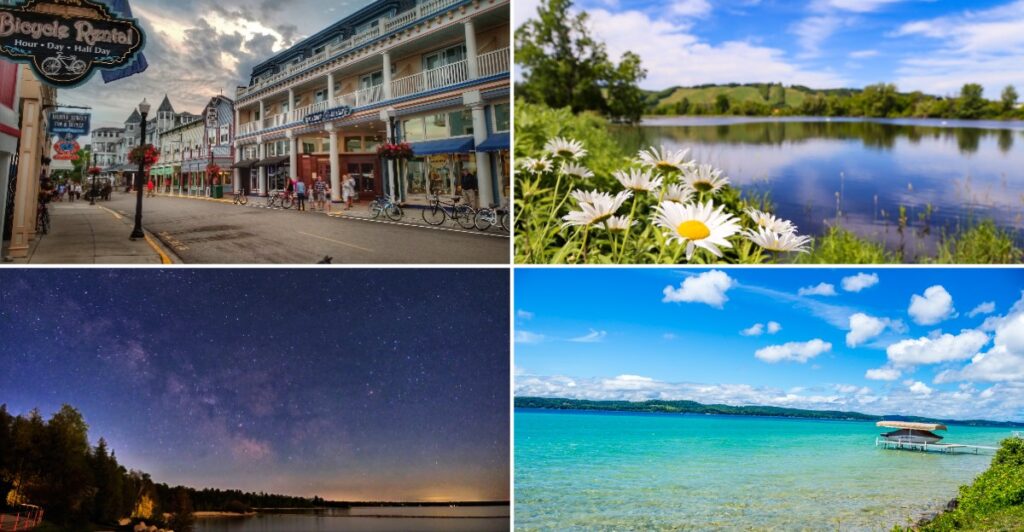
Michigan makes a strong first impression long before you reach its most famous views. Across the state, towering dunes, forested waterfalls, historic lighthouses, clear inland lakes, and four Great Lakes shorelines create scenery that changes dramatically from one region to the next. The appeal comes from that variety, because a single trip can move from sandy overlooks and small towns to dark-sky parks and rugged Upper Peninsula wilderness.
Even familiar places can feel completely different with the season. For anyone wondering why Michigan belongs in the conversation about America’s most beautiful states, these landscapes and landmarks make the case one stop at a time.
1. Mackinac Island: Where Cars Took a Permanent Vacation
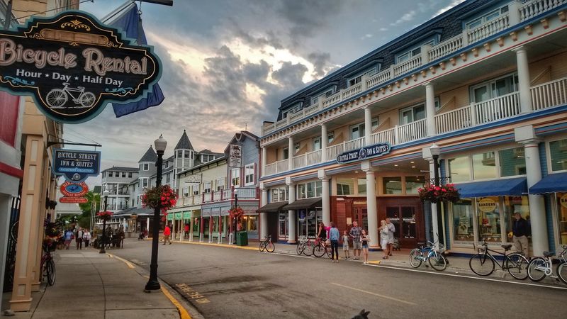
Clip-clop. Clip-clop. That sound replaces car horns the second you step off the ferry, because motor vehicles have been banned on Mackinac Island for well over a century.
Horses, bikes, and your own two feet are how you get around.
Sitting in Lake Huron between the Upper and Lower Peninsulas, the island packs a lot into a small space. Victorian houses with wide porches line the streets. Fudge shops pour sweet batches onto marble slabs right in the front windows, and the smell drifts out onto the sidewalk.
Biking the road that loops around the island is one of the best ways to spend a morning. The route is roughly eight miles long and mostly flat, so you don’t need to be an athlete. You’ll pass rocky beaches, clear blue water, and spots where you can stop to skip stones.
Arch Rock is a must-see. This natural limestone arch towers high above the shoreline, framing the lake like a picture window. Climbing the stairs to the viewing area takes some effort, but the view pays you back.
History fans can explore Fort Mackinac, an old military post perched on a bluff over the harbor. Costumed guides sometimes fire cannons and muskets, which tends to make kids jump and then beg to hear it again.
Here’s a tip from those who’ve been: stay past the last ferry if you can. Once the day crowds head home, the island quiets down, and evening walks along the water turn peaceful and golden.
Rent a bike early, since the shops get busy by late morning in summer. Pack a light jacket too, because breezes off Lake Huron can cool things down quickly, even in July. And yes, buy the fudge.
Locals jokingly call tourists fudgies for a reason.
2. Upper Peninsula Waterfalls That Roar, Trickle, and Glow
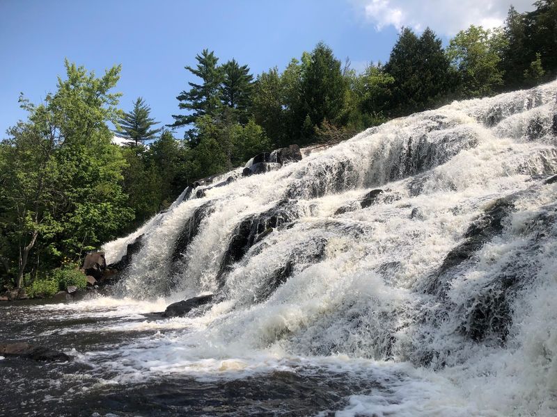
Count them up and you’ll find around 300 waterfalls scattered across the Upper Peninsula. Some are wide and powerful. Others are tiny ribbons of water slipping down mossy rocks deep in the woods.
Tahquamenon Falls gets the most attention, and for good reason. The Upper Falls stretch about 200 feet across, with a drop of nearly 50 feet. The water looks brown, almost like root beer, thanks to tannins that leak out of cedar swamps upstream.
It’s completely natural, and the foam at the bottom even looks like a frothy drink.
A few miles downstream, the Lower Falls split around a small island. You can rent a rowboat and paddle over to explore it, which is a fun twist most waterfall trips don’t offer.
Head west and things get rugged. The Porcupine Mountains hold falls along the Presque Isle River, where water carves through dark rock in twisting chutes. Near Munising, you can reach several falls with short, easy walks, making it a great area if you have little hikers in your group.
Timing matters. Spring snowmelt turns many falls into thundering giants, usually from April into May. By late summer, some shrink down.
Fall brings bright red and orange leaves that frame the water like a painting.
Bring sturdy shoes, since trails can be muddy and rocks near the water get slippery. Bug spray is also smart from June through July, when mosquitoes and black flies show up hungry.
Winter visitors get a surprise treat. Many waterfalls freeze into giant blue and white ice sculptures. Some adventurous folks even go ice climbing on them, though looking from a safe trail works just fine too.
Pick one region, map out three or four falls, and make a day of chasing them.
3. Lighthouses Standing Guard on the Great Lakes
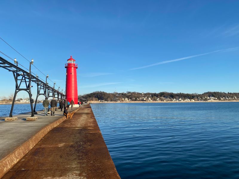
Long before GPS, sailors on the Great Lakes trusted a blinking light on the horizon to keep them off the rocks. Michigan has more lighthouses than any other state, with well over 100 still standing along its shores.
Each one has a personality. Some are tall white towers on rocky points. Others sit at the end of long concrete piers, painted bright red so ships can spot them in fog.
A few look like cozy houses with a light room stuck on top.
Big Sable Point Lighthouse near Ludington is a favorite. Its black and white striped tower rises above sand dunes, and you’ll walk about a mile and a half along a sandy path to reach it. That walk makes arriving feel earned.
On the Upper Peninsula, Split Rock gets confused with Minnesota, but Michigan has its own drama. Whitefish Point Light Station sits near the area where many ships sank, including the famous Edmund Fitzgerald in 1975. The museum there tells the stories of storms and survivors.
Many lighthouses let you climb to the top during summer months. The stairs are often narrow and spiral tightly, so take your time. At the top, wind whips around you and the lake spreads out in every direction.
Fun fact: lighthouse keepers once lived on site with their families, trimming wicks and polishing lenses every night. Some lighthouses now offer volunteer keeper programs, where you can stay and help run tours for a week or two.
Plan a lighthouse road trip by sticking to one coastline. The Lake Michigan shoreline from St. Joseph up to Mackinaw City is loaded with them. Check hours ahead of time, because many close tower access in late fall.
Bring a camera at sunset. Lighthouses glowing against orange skies make some of the best photos in the state.
4. Inland Lakes Sprinkled Everywhere
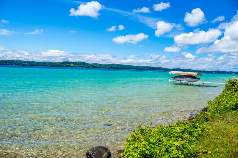
Toss a dart at a Michigan map and there’s a good chance it lands near a lake. The state has more than 11,000 inland lakes, so you’re rarely more than a short drive from a dock, a beach, or a quiet cove.
These smaller lakes have a different vibe from the giant Great Lakes. Water is often calmer and warmer, which makes swimming easier for kids. Mornings bring glassy surfaces perfect for kayaks and paddleboards.
Torch Lake is a local legend. On sunny days, its water glows a bright turquoise color that looks borrowed from the Caribbean. A sandbar near the south end draws boaters who anchor and splash around in waist-deep water.
Houghton Lake is the largest inland lake in the state and turns into a winter village when it freezes. Ice shanties pop up across the surface, and anglers fish for walleye and perch through holes in the ice.
Up north, lakes like Higgins and Crystal show off clear water where you can see the sandy bottom several feet down. Further into the woods, tiny lakes with no cottages offer total quiet, broken only by loons calling at dusk.
Families have been heading up north to lake cabins for generations. Renting one for a week is a classic Michigan summer move. Expect campfires, card games on rainy nights, and early mornings with a fishing pole.
A few practical tips: book cabins early, since popular lakes fill up by spring. Check for boat launch fees and local rules about invasive species, like cleaning your boat before moving it between lakes.
Fishing licenses are required for anyone 17 and older. They’re easy to buy online and help support the lakes you’re enjoying. Pack water shoes too, because some lake bottoms are rocky or weedy near shore.
5. A Coastline Longer Than You’d Ever Guess
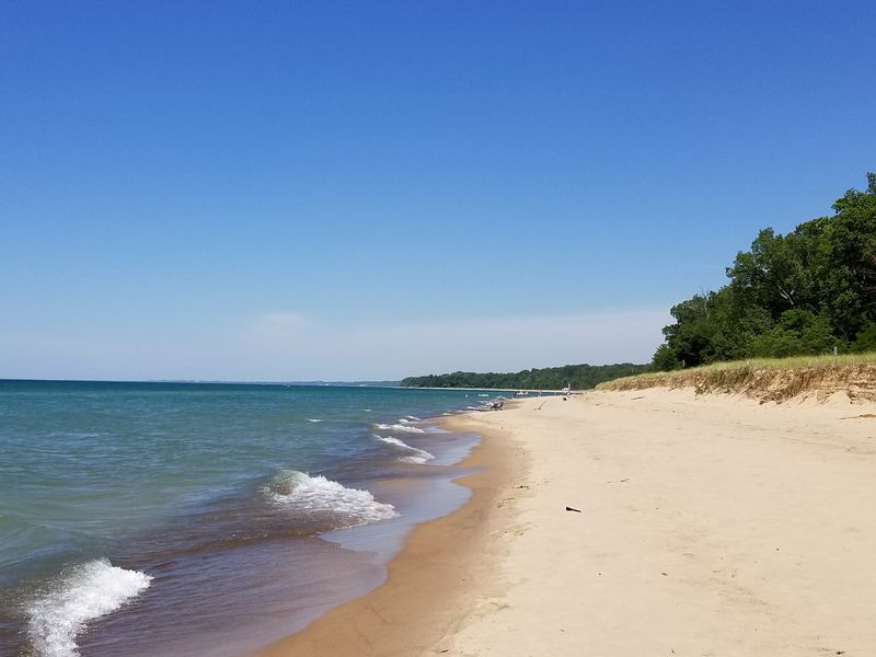
Here’s a fact that surprises plenty of people: Michigan has more freshwater shoreline than any other state, over 3,200 miles of it. Only Alaska beats it for total coastline in the country.
Four of the five Great Lakes touch Michigan. Lake Superior, Lake Michigan, Lake Huron, and Lake Erie each bring their own style. Superior is cold, deep, and wild.
Lake Michigan has soft sand beaches and sunsets over the water. Huron offers quiet bays and rocky shores.
Standing on the beach, you’ll swear you’re at the ocean. You can’t see the other side. Waves crash, sometimes big enough for surfing during fall storms.
The big difference? No salt, no sharks, and no sticky skin after swimming.
Grand Haven, Holland, and South Haven are beach towns on the west coast with wide sandy shores and long piers. Walking out to the red pier lights at sunset is practically a tradition.
Rock hounds love the coast too. Lake Superior beaches hide agates with colorful bands. Along Lake Michigan near Petoskey, you can hunt for Petoskey stones, the state stone, which show a honeycomb pattern of ancient coral when wet.
Before heading into the water, check beach flags and local warnings. Rip currents happen on the Great Lakes, especially near piers and on windy days. Many beaches post red flags when swimming is unsafe.
Water temperature changes a lot. Lake Michigan can feel great in August but chilly in June. Superior stays cold almost all year, so wading may be enough.
For the best experience, pick a beach town, grab a spot early, and stay for sunset. Bring a cheap mesh bag for collecting stones and a blanket for when the sun drops and the breeze picks up.
6. Forests and State Parks Built for Wandering
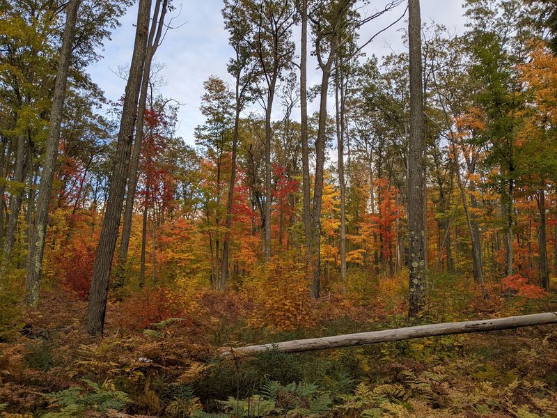
Roughly half of Michigan is covered in forest. That adds up to millions of acres of pine, maple, birch, and oak waiting to be explored on foot, bike, or snowshoe.
The state park system is huge, with more than 100 parks and recreation areas. A single Recreation Passport, added to your vehicle registration, gets you into all of them. It’s one of the best deals around.
The Porcupine Mountains Wilderness State Park in the western Upper Peninsula is the biggest. It holds old-growth forest, rivers, and the famous Lake of the Clouds overlook, where a blue lake sits cradled between forested ridges. In fall, the view looks like someone spilled a box of crayons.
Hartwick Pines near Grayling protects a stand of old white pines. Some of these trees have been growing for hundreds of years. Walking among them gives you a sense of what Michigan looked like before logging took most of the big trees in the 1800s.
Closer to cities, parks like Holland State Park and Warren Dunes offer easy day trips. You don’t need to drive five hours to find trails.
Wildlife spotting adds extra fun. Keep your eyes open for white-tailed deer, wild turkeys, bald eagles, and in the north, even black bears or moose. Stay quiet in the early morning for your best chances.
Camping is popular, so reserve sites early, sometimes months ahead for summer weekends. Rustic cabins and yurts are also available in many parks if tents aren’t your thing.
Bring layers, since forest shade feels cooler. Download trail maps before going, because cell service drops in remote areas. Ticks are around in warm months, so check yourself after hikes.
Pick a park within a couple of hours of home and try a new trail each season.
7. The Mackinac Bridge, Five Miles of Steel and Sky
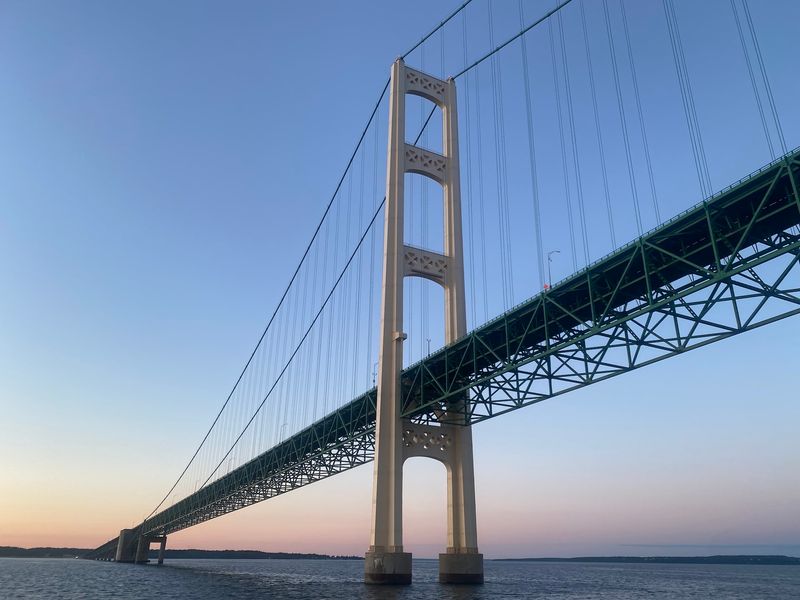
Mighty Mac. That’s the nickname locals use for the Mackinac Bridge, and once you see it, you’ll understand why. Stretching about five miles across the Straits of Mackinac, it connects the Lower Peninsula to the Upper Peninsula.
Opened in 1957, it’s one of the longest suspension bridges in the Western Hemisphere. Its two main towers rise over 550 feet above the water. Before it existed, people waited hours, sometimes much longer, for ferries to carry their cars across.
Driving over it is a thrill. The road sits high above the water, and the inside lanes have open steel grates you can peek through. Nervous drivers can actually request help, and a bridge worker will drive your car across for you.
That service has been around for years.
Views from the bridge show Lake Michigan on one side and Lake Huron on the other. On clear days, you can spot Mackinac Island floating off to the east.
Want to walk it? Every Labor Day, the bridge hosts a walk where thousands of people cross on foot. It’s the only day of the year you’re allowed to walk across, and many families make it a yearly tradition.
For photos, head to the parks at either end. Bridge View Park in St. Ignace and the shoreline near Mackinaw City both offer great angles. At night, the bridge lights up with strings of glowing lights along its cables.
Wind can be strong on the bridge, and officials sometimes limit traffic during storms. Check conditions if the weather looks rough.
There’s a toll to cross, so have payment ready. And if you’re coming from the south, crossing the bridge is the unofficial moment your Upper Peninsula adventure begins. Roll the windows down and enjoy the breeze.
8. Four Seasons, Four Totally Different States
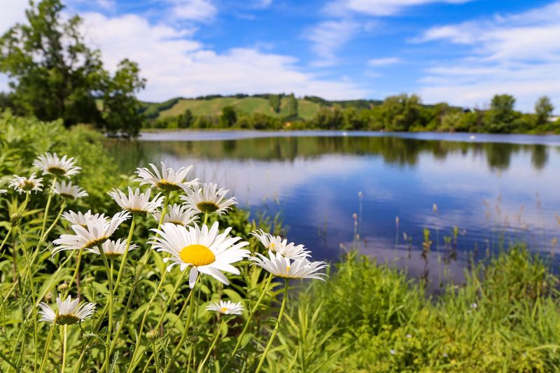
Ask a Michigander about the weather and you might hear the classic joke: if you don’t like it, wait five minutes. Jokes aside, the state gets four strong seasons, and each one changes the scenery in a big way.
Spring arrives slowly. Snow melts, rivers swell, and wildflowers like trillium carpet forest floors with white blooms. Cherry and apple orchards near Traverse City burst into pink and white flowers in May.
Summer is lake season. Long days stretch past 9 p.m. in June, giving you extra hours for swimming, boating, and campfires. Farmers markets fill up with sweet corn, blueberries, and cherries.
Traverse City even calls itself the Cherry Capital of the World.
Fall might be the showstopper. Maple, oak, and birch trees turn red, orange, and gold. Color starts in the Upper Peninsula in late September and moves south through October.
Cider mills open up, serving fresh cider and warm donuts that have fans lining up every weekend.
Winter brings a different kind of fun. Lake-effect snow piles up near the Great Lakes, sometimes reaching more than 200 inches a year in parts of the Upper Peninsula. Skiing, snowmobiling, sledding, and ice fishing take over.
Frozen waterfalls and icy shorelines turn into sculptures.
Each season gives you a reason to return to the same spot. A beach that’s perfect for swimming in July might show ice caves in February. A trail with spring wildflowers blazes with color by October.
Pack smart for any trip. Layers are your best friend, since temperatures can swing a lot in one day. A rain jacket handles spring, sunscreen covers summer, a fleece works for fall, and warm boots are a must for winter.
Try visiting one favorite place in every season for a full picture.
9. Pictured Rocks National Lakeshore and Its Painted Cliffs
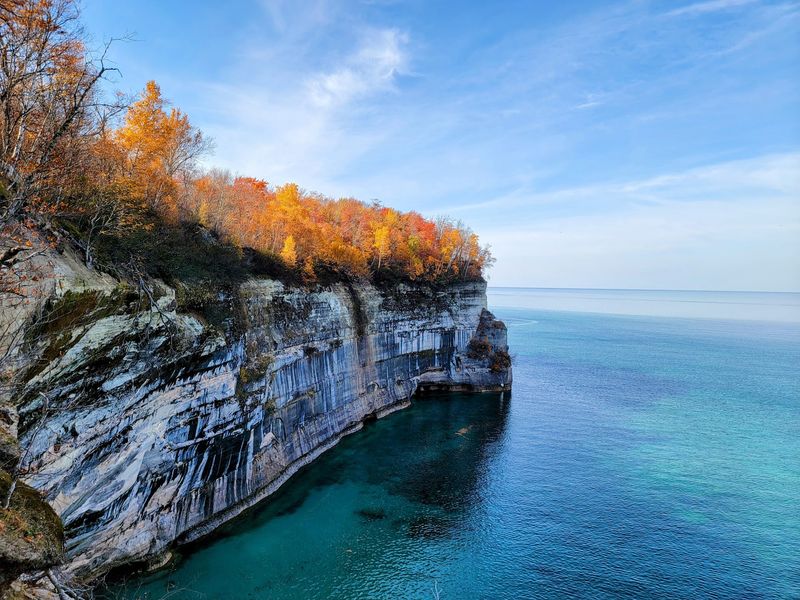
Imagine cliffs that look like a giant took a paintbrush and splashed stripes of orange, green, white, and black down the rock. That’s Pictured Rocks National Lakeshore, stretching along Lake Superior near Munising.
The colors come from minerals seeping through the sandstone. Iron leaves red and orange streaks, copper adds green and blue, and manganese creates darker stains. Some cliffs rise around 200 feet above the water.
It became the first national lakeshore in the United States in 1966. Today it covers more than 40 miles of shoreline packed with beaches, waterfalls, and forest trails.
The best way to see the cliffs is from the water. Boat tours leave from Munising and cruise past famous spots like Miners Castle, Chapel Rock, and Battleship Row. Guides share stories about shipwrecks and how the formations got their names.
Kayaking gets you even closer. You can paddle under arches and into small caves. Lake Superior is cold and can get rough fast, so guided kayak trips are the smart choice for beginners.
Prefer land? The Chapel Loop hike is about 10 miles and takes you past Chapel Falls, Chapel Rock, and clifftop views. Shorter walks to Miners Castle overlook work great for families.
Twelvemile Beach and Miners Beach offer sandy spots to relax. The water is clear but very chilly, even in August, so a quick dip will wake you up fast.
Summer weekends get crowded, so arrive early for parking at popular trailheads. Fall is a great alternative, with bright leaves and fewer people.
Bring a picnic and plan for the full day. Cell service can be spotty, so download maps before you leave Munising. Book boat tours ahead of time in peak season, since they often sell out.
10. Rock Formations and Cliffs Carved by Time
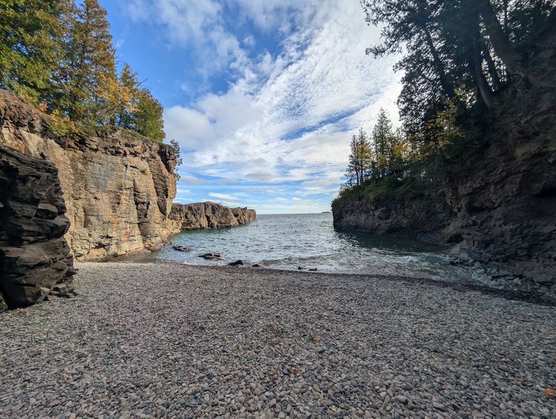
Some of the oldest rocks on Earth sit in Michigan’s Upper Peninsula. Parts of the region contain rock more than two billion years old, shaped by volcanoes, glaciers, and endless pounding waves.
That long history left behind some wild shapes. Along Lake Superior, you’ll find sea stacks, caves, arches, and cliffs that drop straight into the water.
Presque Isle Park in Marquette is a local favorite. Its red and black rock cliffs hang over the lake, and brave swimmers jump from Black Rocks into the chilly water. Watching is just as fun if you’d rather stay dry.
Up on the Keweenaw Peninsula, the shoreline turns jagged and dark. Ancient lava flows created basalt rock, and the area once had some of the richest copper deposits in the world. Old mine tours let you head underground to see where workers dug for metal.
Farther east, the Lower Peninsula has its own surprises. Along Lake Huron near Alpena and Rogers City, limestone shores hold fossils from ancient seas. Look closely and you might spot tiny shells and coral pressed into the rocks.
Grand Island, a short ferry ride from Munising, is circled by tall cliffs and hidden coves. You can bike or hike around it, stopping at overlooks that show off the rocky edges.
Safety comes first near cliffs. Edges can crumble, and some drops are much higher than they look. Stay on marked trails, keep a close eye on kids, and skip climbing on wet rocks.
Rock collecting is a fun hobby here, but rules vary. Picking up small stones is usually fine on many beaches, but national parks often limit what you can take. Check the rules first.
For the best light on the cliffs, visit in early morning or late afternoon, when the colors pop.
11. Charming Small Towns With Big Personality
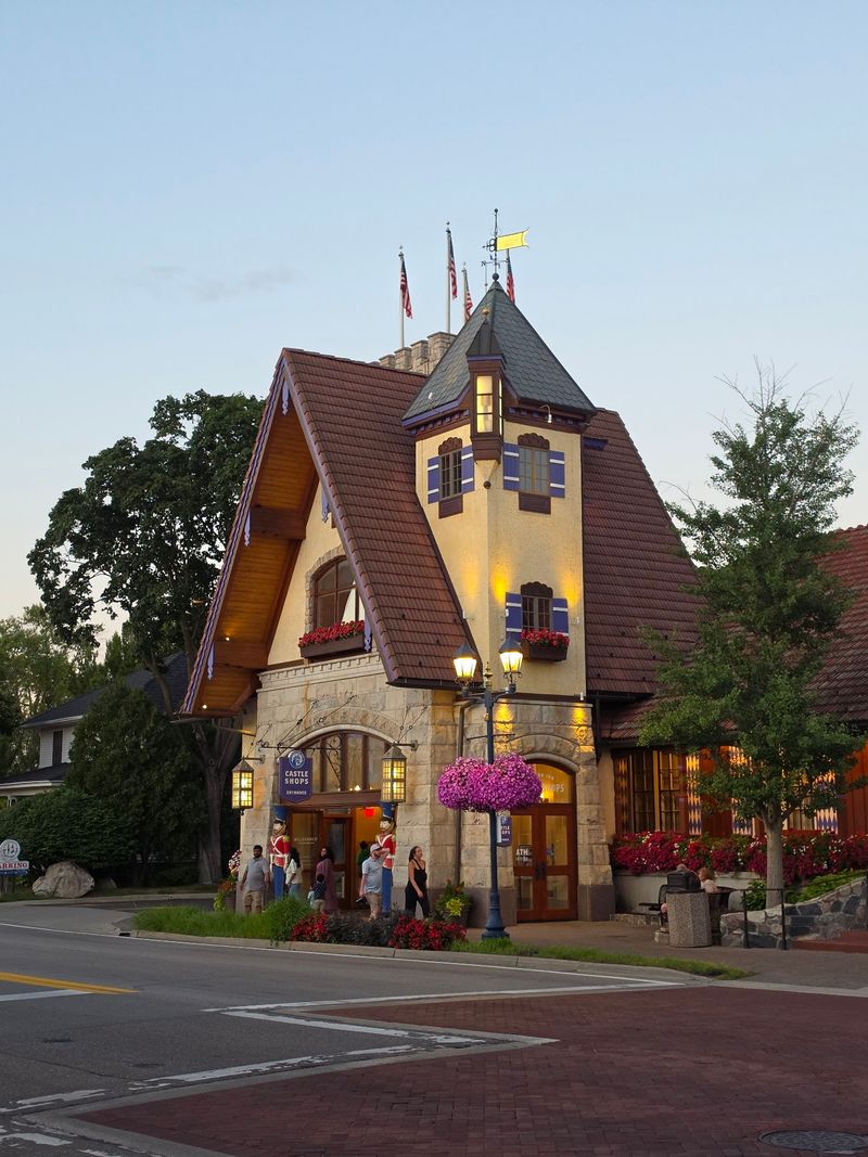
Bavarian chicken dinners in one town. Tulips by the millions in another. Michigan’s small towns each have their own quirky identity, and hopping between them makes for a great road trip.
Frankenmuth, nicknamed Little Bavaria, looks like a slice of Germany. Buildings have timber frames, a glockenspiel tower plays music, and family-style chicken dinners are a big tradition. It’s also home to Bronner’s, a massive Christmas store that stays open almost all year.
Holland goes all in on its Dutch heritage. Each May, the Tulip Time Festival brings millions of blooms, wooden shoe dancers, and a working Dutch windmill called De Zwaan.
Up north, Petoskey and Harbor Springs sit on Little Traverse Bay. Their downtowns feature old brick buildings, art galleries, and ice cream shops with views of the water. Sunsets over the bay draw folks to the waterfront every evening.
Leland’s Fishtown is a tiny historic fishing village with weathered wooden shanties along a river. You can grab smoked fish, watch boats come in, and catch a ferry to the Manitou Islands.
Saugatuck has a strong artsy feel with galleries, a hand-cranked chain ferry, and access to Oval Beach. Marshall, in southern Michigan, is known for its many historic homes from the 1800s.
Small towns shine when you slow down. Park the car, walk Main Street, and talk with shop owners. Locals often share the best places to eat or a scenic spot that won’t show up in guidebooks.
Check event calendars before you go. Many towns host summer concerts, farmers markets, and fall harvest festivals. Weekends during festivals can get packed, so book hotels early.
Bring a little cash too. Some small bakeries, farm stands, and roadside stops still prefer it, and you won’t want to miss a fresh cherry pie.
12. Scenic Drives Through Forests and Along Shorelines
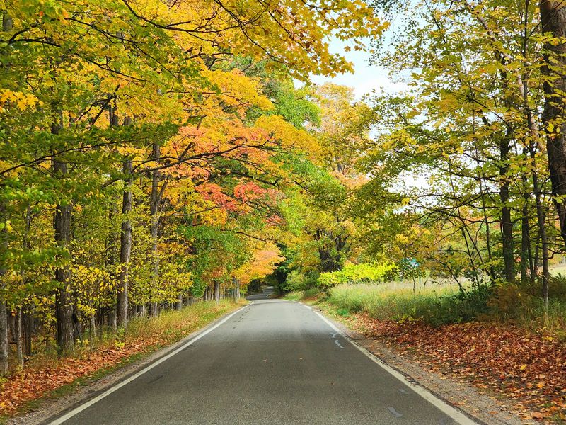
Roll down the windows on M-119 in the fall and you’ll understand why locals call it the Tunnel of Trees. The narrow road winds about 20 miles between Harbor Springs and Cross Village, with branches arching overhead like a leafy ceiling.
There are no painted center lines on parts of the route, and the curves come often. Take it slow. Glimpses of Lake Michigan peek through the trees, and small pullouts let you stop for photos.
The Pierce Stocking Scenic Drive inside Sleeping Bear Dunes is another favorite. It loops about seven miles through forest and dunes, with overlooks that show sand bluffs dropping toward the lake far below.
US-41 heading up the Keweenaw Peninsula ends at Copper Harbor, passing old mining towns, forests, and rocky shores. Brockway Mountain Drive nearby climbs to one of the highest roadways between the Rockies and the Alleghenies, with wide views of Lake Superior.
Along the Lake Huron side, US-23 is called the Sunrise Coast. Lighthouses, small harbors, and quiet beaches line the way, and early risers get to watch the sun pop up over the water.
M-22 near Leelanau is famous enough that people put its road sign on shirts and stickers. It passes wineries, cherry farms, beaches, and sweet little towns.
Plan for stops, not just driving. Farm stands, scenic overlooks, and roadside parks are part of the fun. Some of the best moments happen when you pull over spontaneously.
Fill up your gas tank before heading into remote areas, especially in the Upper Peninsula, where stations can be far apart. Watch for deer, especially at dawn and dusk.
Fall color drives are popular, so weekdays tend to be quieter. Bring snacks, a good playlist, and a paper map as a backup.
13. Dark Skies and a Shot at the Northern Lights
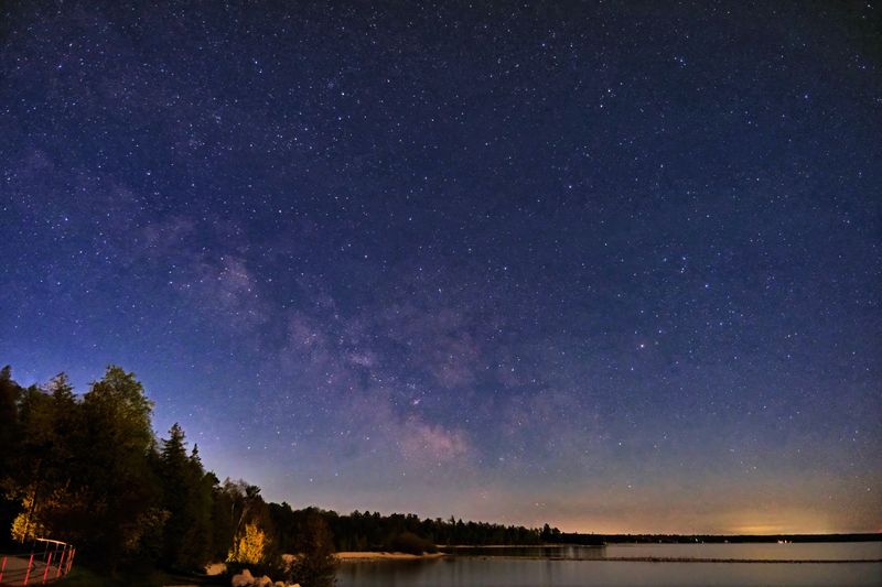
Picture green ribbons of light dancing over Lake Superior while stars fill the sky above. In Michigan, that scene isn’t just a dream. The northern lights, also called the aurora borealis, show up here more often than many people realize.
The aurora happens when particles from the sun hit Earth’s atmosphere, creating glowing colors. Most often you’ll see green, but pink, purple, and red can appear during strong displays.
To see it, you need dark skies, and Michigan has plenty. Headlands International Dark Sky Park near Mackinaw City is one of the best-known spots. It’s open every day and night of the year, with a viewing area right along Lake Michigan.
The Upper Peninsula offers even darker conditions. Areas around Copper Harbor, Marquette, and Whitefish Point have little light pollution and wide views to the north, which is exactly the direction you’ll want to face.
Even without the aurora, dark sky nights are stunning. The Milky Way stretches across the sky like a cloudy river. Meteor showers like the Perseids in August can bring dozens of shooting stars an hour.
Checking the forecast helps a lot. Space weather apps and websites track solar activity using a scale called the Kp index. Higher numbers mean a better chance of seeing the lights farther south.
Clear skies matter too. Clouds can block everything, so check weather forecasts the same day.
Bring warm clothes, even in summer, since nights near the lakes get chilly. A blanket or camping chair makes waiting more comfortable. Turn off your phone screen or use red light mode to keep your eyes adjusted to the dark.
Phones can capture auroras better than your eyes sometimes. Use night mode and hold still, or use a small tripod.
14. Sleeping Bear Dunes National Lakeshore and Its Towering Sand
According to an Anishinaabe legend, a mother bear and her two cubs swam across Lake Michigan to escape a fire. The mother made it to shore and waited on a bluff, but her cubs never arrived. The Great Spirit created two islands, North and South Manitou, to mark the cubs, and the mother bear became a dune.
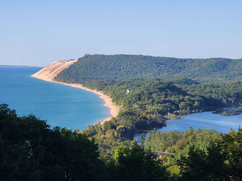
That story gave Sleeping Bear Dunes its name. Today, the national lakeshore covers about 35 miles of Lake Michigan coastline near Empire and Glen Arbor.
The Dune Climb is the most famous challenge. You trudge up a steep wall of sand that feels harder than it looks. Running back down is the reward, and kids usually race to the bottom laughing.
Want a bigger adventure? The full Dune Climb trail continues about 3.5 miles round trip to Lake Michigan. It’s tough, with hot sand and steep hills, so bring plenty of water and start early.
Some bluffs rise roughly 450 feet above the lake. Overlooks along the Pierce Stocking Scenic Drive show the sand dropping straight to clear blue water. Signs warn you not to slide down, because climbing back up can take over an hour.
Glen Haven, a restored village, features an old general store and a maritime museum showing lifesaving rescues from the past.
The Sleeping Bear Heritage Trail is a paved path great for biking, connecting towns and beaches without traffic.
In 2011, viewers of a national TV show voted it the Most Beautiful Place in America, which says plenty about how it stacks up.
Bring sunscreen, sunglasses, and closed shoes, since sand gets hot in summer. A park pass is required, and you can buy one at visitor centers. Stay for sunset, when the dunes turn soft gold.