A weather station on one small hill outside Boston has been recording conditions since 1885. That makes it the oldest continuous weather record in the United States, and it sits right on a summit with a skyline view.
That detail hooked me fast. Then I learned that a famous American painter made a river bend near a Massachusetts summit look like pure magic back in 1836, and a classic novel connects to a hike on another peak.
These mountains are not giant by Western standards. Yet many of them still serve up views of several states, distant city towers, and hawks streaming past by the thousands in fall.
I love that you can drive to some tops and earn others with a good climb. So which summit fits your kind of adventure, the easy cruise or the sweaty scramble?
1. Mount Greylock State Reservation
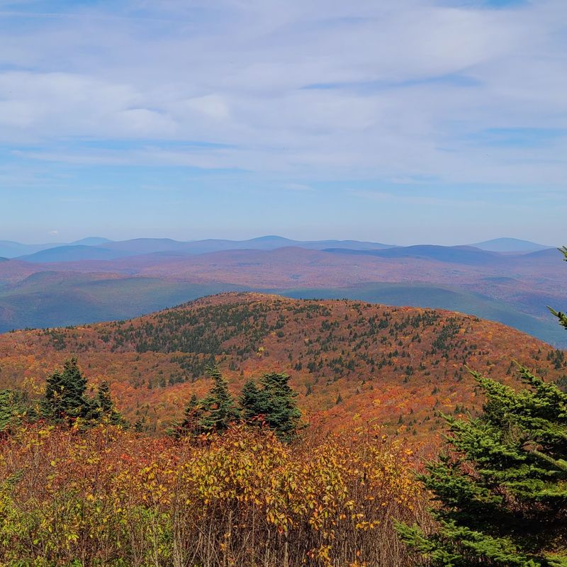
Bragging rights start here, since Mount Greylock is the tallest peak in Massachusetts at 3,491 feet. On a clear day, you can look across five states from the top.
Five states from one spot? That sounds like a geography quiz you can actually enjoy.
Views can stretch up to about 90 miles, so pick a clear, dry day if you can. Hazy summer afternoons may soften the far edges of the scene.
Getting up top is flexible. A scenic auto road climbs to the summit during its seasonal opening, which is great for families or tired legs.
Hikers have even more choices. The reservation holds more than 70 miles of trails, so you can pick a short stroll or a long, leg-burning climb.
Right at the peak stands the Veterans War Memorial Tower. Built in 1932, the 93-foot granite tower looks a bit like a giant chess piece guarding the hills.
It honors the state’s veterans, so take a quiet moment there. The tower also makes a handy landmark for photos.
Curious about the mountain’s past? A visitor center offers exhibits on its history, which gives the view a little extra meaning.
Want to stay longer than one afternoon? A hike-in primitive campground lets you sleep closer to the stars.
Just remember that hike-in means you carry your gear. Pack light, bring layers, and expect cooler air at the summit than in the valley below.
Fall foliage season is a crowd favorite for good reason. The Berkshire hills turn red, orange, and gold, and the view feels like it was painted overnight.
Check road status before you go, since the auto road runs only part of the year. A little planning keeps your summit dreams on track.
Address: 30 Rockwell Road, Lanesborough, MA 01237
2. Wachusett Mountain State Reservation
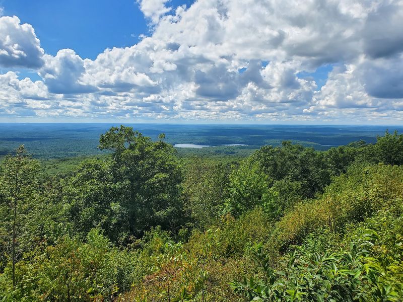
Boston and the Berkshires in the same glance sounds greedy, right? Wachusett Mountain makes it possible from 2,006 feet up in central Massachusetts.
The summit offers sweeping 360-degree views. That means you can just keep turning and the scenery keeps going.
On a clear day, look east for the Boston skyline. It appears small and faraway, like a tiny city on a shelf.
Turn north and you may spot Mount Monadnock in New Hampshire. Swing west and Mount Greylock may show up on the horizon too.
Spotting three big landmarks from one rock is a fun game. Bring binoculars if you want to make it a real contest.
A seasonal summit road can carry you most of the way up. That option suits younger kids, grandparents, or anyone who prefers views without the sweat.
Prefer to earn it? The reservation has around 17 miles of hiking trails winding through the woods.
Trails here range in steepness, so read the map before choosing. Some paths are friendly, while others will remind your calves they exist.
Since the peak sits fairly central in the state, it makes a handy day trip from many towns. You won’t need to cross the whole map to reach a big view.
Morning visits can bring clearer air and calmer summits. Late afternoon light, on the other hand, can make the hills glow in soft colors.
Either way, pack water and a jacket. Summits catch wind, even when the parking lot feels pleasant and still.
Wachusett proves you don’t need the tallest mountain for a jaw-dropping lookout. Sometimes a good location matters more than raw height.
Address: 345 Mountain Road, Princeton, MA 01541
3. Joseph Allen Skinner State Park
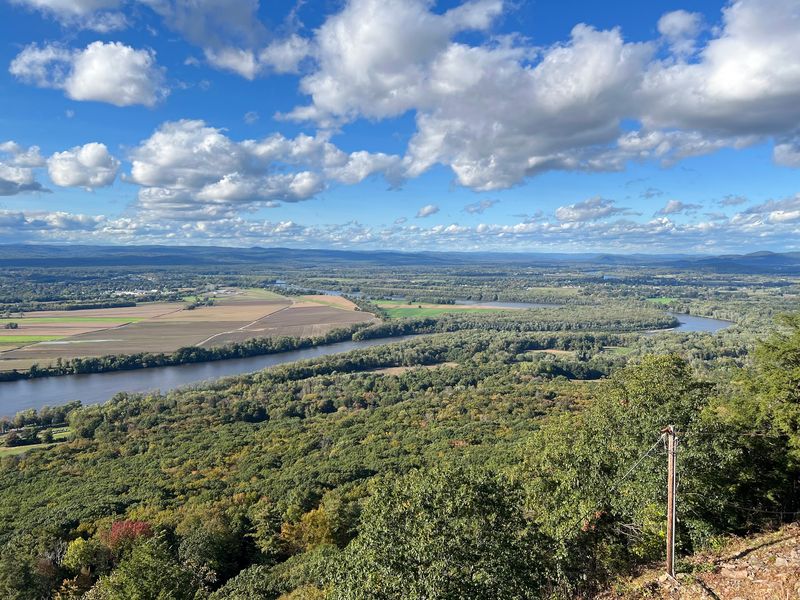
Art fans, this one’s for you. In 1836, painter Thomas Cole made the Oxbow of the Connecticut River famous, and his view came from Mount Holyoke.
Today you can stand near that same scene inside Joseph Allen Skinner State Park. It’s a bit like stepping into a museum painting, minus the velvet rope.
The views sweep across the Connecticut River Valley and the Pioneer Valley. You’ll also see the Holyoke Range rolling along like a green ripple.
Up top sits the historic Summit House. Its story as a mountaintop hotel goes back to 1851, when travelers came to admire this very view.
Imagine guests in long coats and fancy hats climbing up for scenery. People have been chasing this vista for well over a century.
Getting there is easier than in those old days. A seasonal auto road leads to the top when it’s open.
Hikers have plenty to explore as well. The park area connects to more than 40 miles of trails, so you can stretch the visit into a full outing.
Try bringing a sketchbook or a phone camera with a good zoom. The Oxbow curve looks especially striking from above.
Is your goal a calm afternoon? Grab a spot near the Summit House and simply watch shadows move across the farms below.
Fall paints the valley in bright colors. Spring and summer bring deep greens that make the river stand out even more.
Check road dates before heading over. The drive is seasonal, so off-season visits mean using your own two feet.
Thomas Cole had the right idea. Some views are worth remembering forever.
Address: 10 Skinner State Park Road, Hadley, MA 01035
4. Mount Sugarloaf State Reservation
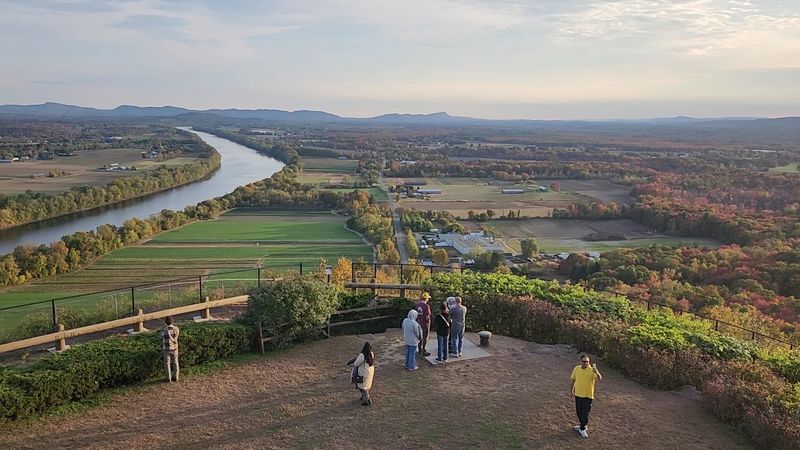
Small mountain, big personality. Mount Sugarloaf rises only 652 feet, yet its steep sandstone face looks dramatic above the valley floor.
Those reddish cliffs stand out against the flat farmland nearby. It’s the kind of shape that makes you pull the car over.
From the top, you can gaze across the Connecticut River Valley. Mount Tom and the Holyoke Range show up in the distance.
The river below curves through fields in a classic New England scene. It looks almost like a model train set, just without the trains.
An observation tower gives you an even higher perch. Climb it for wider angles and better photos.
A picnic pavilion is also on site. Pack sandwiches and you’ve got lunch with a view that beats any cafeteria.
Driving up is possible on the seasonal auto road. That’s a nice option when you want maximum scenery with minimum effort.
Hikers can choose from several trails to the summit. The routes are short, but some get steep, so wear shoes with good grip.
History adds depth here. The Pocumtuck people considered this mountain sacred, which is a good reason to visit with respect.
Stay on marked trails and carry out what you carry in. Small habits help protect a place with such deep meaning.
Sunset is a favorite time for many visitors. The western light can make the sandstone and fields glow.
Need a quick win on a busy day? Sugarloaf delivers a big payoff without eating your whole schedule.
Address: 300 Sugarloaf Street, South Deerfield, MA 01373
5. Mount Norwottuck
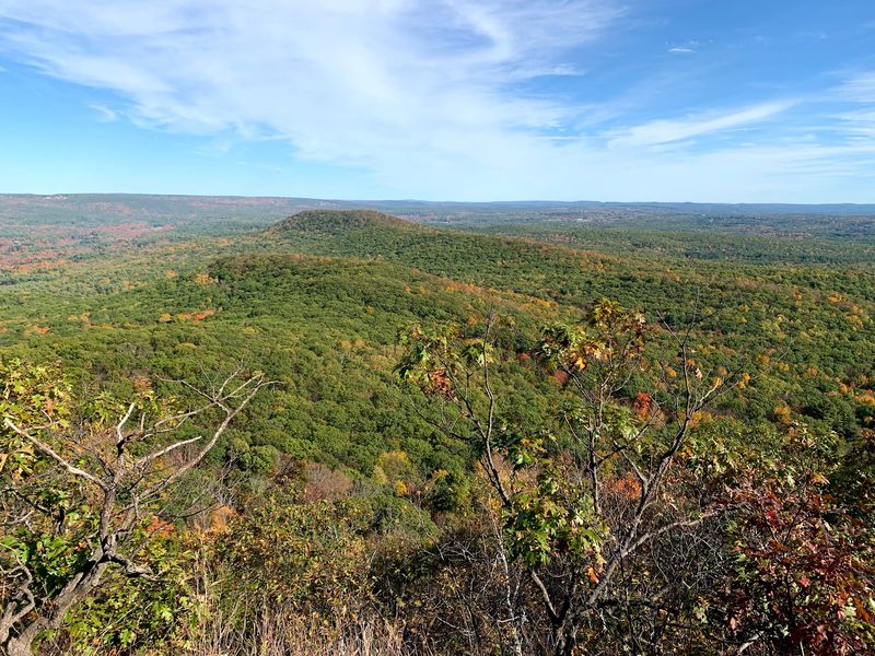
Caves, cliffs, and a crown of rocky ledges? Mount Norwottuck packs a lot of adventure into one hike.
It’s the highest point in Mount Holyoke Range State Park. Many hikers say it offers some of the best views in the Pioneer Valley.
From the ledges, you’ll see farm fields stitched across the land. Small towns sit tucked among them, with the Berkshires fading into the west.
The rock here is traprock, a dark volcanic stone. It forms rugged cliffs that make the range look tougher than its height suggests.
Then come the Horse Caves. These overhanging rock shelters sit along the trail and add a dose of mystery to the trip.
Local legend links the caves to stories from Shays’ Rebellion. Whether every tale holds up or not, they make a great trail-side chat.
Trail lovers have plenty of room to roam. The park has more than 30 miles of blazed paths.
Part of the route follows the New England Trail. That long-distance path crosses the region, so you’re walking a small piece of something bigger.
Start at the Notch Visitor Center, where you can grab maps and get oriented. It’s a smart first stop before the climb.
Expect rocky footing near the top. Sturdy shoes and steady steps will keep the hike fun.
No road leads to this summit, so the view feels truly earned. That’s half the fun, honestly.
Bring a snack for the ledges. You’ll want time to sit and soak in the valley.
Address: Notch Visitor Center, 1500 West St., Amherst, MA 01002
6. Goat Peak
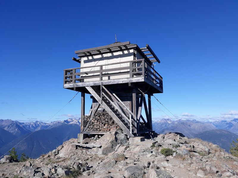
September brings a sky show at Goat Peak. During the fall hawk migration, watchers sometimes count thousands of raptors passing over.
Birds gliding by on the wind make for a pretty incredible way to spend an afternoon. Bring binoculars and a little patience.
Goat Peak sits within Mount Tom State Reservation. Its lookout tower stands 42 feet tall, and the original version dates back to 1928.
Climbing the tower lifts you above the treetops. Suddenly the forest opens into a wide panorama.
Look west toward Easthampton. You can also spot the Seven Sisters range and even the UMass Amherst campus in the distance.
Finding a college campus from a mountain tower is oddly satisfying. It’s like a real-life map with buildings for pins.
Several trails lead to the peak. One option includes a paved path starting from the Visitor Center, which helps if you want a smoother walk.
Other routes feel more rugged and woodsy. Choose based on your energy level and how much mud you’re willing to meet.
Hawk watchers often gather here in fall. If you’re new to birding, a field guide or app can help you name what you see.
Broad-winged hawks are a big part of the migration story in this region. Spotting a swirling group can be a thrill.
Even outside migration season, the view holds up nicely. Summer greens and winter clarity both offer their own charm.
Remember, towers can feel breezy. Hold onto your hat and your phone.
Address: 125 Reservation Road, Holyoke, MA 01040
7. Monument Mountain
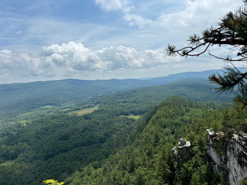
Literary history took a hike here in 1850. Nathaniel Hawthorne and Herman Melville climbed Monument Mountain together, and that meeting is often linked to the making of Moby-Dick.
A famous friendship on a mountaintop? That’s a story worth retelling at the summit.
The reservation covers 503 acres in the Berkshires. Its high point is Peeskawso Peak at 1,642 feet.
The summit ridge feels narrow and rocky. Pale cliffs drop away and make the whole place look a little wild.
Views stretch across the Housatonic River Valley. You’ll also take in the Berkshires, the Taconic Mountains, and even the Catskills of New York on clear days.
Keep your eyes up, too. Hawks and bald eagles may soar overhead, riding currents along the cliffs.
The land holds deep meaning for the Mohican people. Treat the trails with care and respect while you visit.
Three hiking trails give you options. Some routes climb steadily, while others take a gentler path through the forest.
The rocky top calls for careful steps. Keep a close eye on kids near the edges.
Want a fun idea? Bring a short excerpt from a Hawthorne or Melville book and read it up top.
Fall paints the valley in big blocks of color. Spring brings fresh green and quieter trails.
Monument Mountain blends story, scenery, and adventure in one tidy package. Few hikes give you that much to talk about.
Address: Route 7, Great Barrington, MA 01230
8. Mount Race
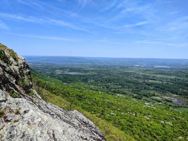
Cliff lovers, meet your new favorite ridge. Mount Race has an eastern escarpment that rises nearly 2,000 feet above the valley.
That steep wall of rock creates huge open views. You may feel like you’re standing on the edge of the world.
The peak reaches 2,370 feet in the southern Taconic Mountains. It sits within Mount Everett State Reservation in far southwestern Massachusetts.
The Appalachian Trail crosses right over the rocky summit. So yes, you can say you hiked part of the famous AT.
Long-distance hikers pass through here on journeys of thousands of miles. You might cross paths with someone carrying a huge pack and a big story.
Hiking is the main way to reach this summit. There’s no easy drive, so plan for a real workout.
The climb can be challenging, especially for beginners. Start early, carry plenty of water, and give yourself time to rest.
Rocky ledges line much of the ridge. Stay back from the edges, since the drop is no joke.
Your reward is wide scenery over western Massachusetts. Farms, forests, and far hills spread out below.
Clear days make the view especially sharp. Cloudy days can still feel moody and dramatic in their own way.
Pack layers, since ridges catch wind fast. A light jacket can make lunch on the ledge much more pleasant.
This hike isn’t a stroll, and that’s the point. The effort makes the payoff feel even sweeter.
Address: Route 41 (South Undermountain Road), Sheffield, MA
9. Mount Watatic
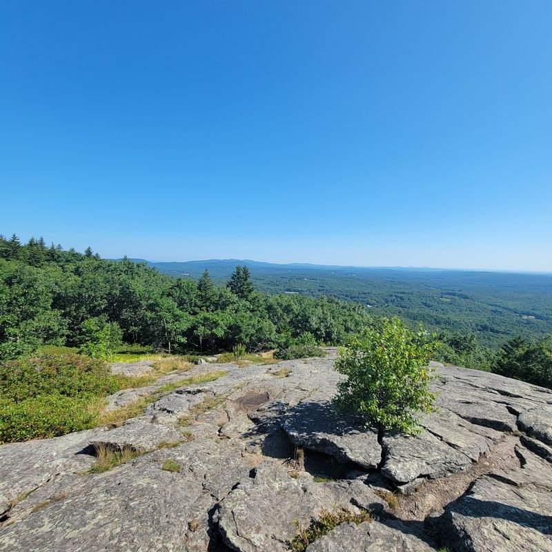
A bald summit sounds like a bad haircut, but on Mount Watatic it’s great news. The open top means nothing blocks your 360-degree view.
The mountain rises 1,832 feet near the New Hampshire border. It’s a monadnock, which means a lone peak standing above lower land around it.
From the summit, look east for the Boston skyline. South, you’ll spot Mount Wachusett, and west you may see Mount Monadnock.
North brings the Wapack Range into view. Four directions, four landmarks, one very satisfied hiker.
Trail fans will like the connections here. Watatic links into both the Wapack Trail and the Midstate Trail.
That makes it a fun starting point for longer adventures. You could come back again and again and explore new paths each time.
Fall brings another big draw. Mount Watatic is a top spot for watching hawk migration in the Northeast.
Bring binoculars and a folding pad to sit on. Birding takes patience, but the sky can surprise you.
Hiking and other non-motorized activities rule here. Leave the engine noise behind and enjoy the quiet.
The climb is manageable for many families. Still, some sections get steep and rocky, so wear proper shoes.
Sunrise hikes can feel magical on an open summit. Watching light spill across the hills is hard to beat.
Massachusetts saved one of its friendliest big views for this northern corner. It’s well worth the drive.
Address: MA-119, Ashburnham, MA 01430
10. Tully Mountain
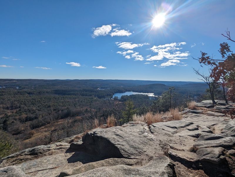
Lakes, ponds, and far-off peaks all crowd into one frame at Tully Mountain. It’s like the landscape decided to show off at once.
This monadnock stands 1,163 feet tall in north central Massachusetts. An exposed ledge near the summit faces east and opens wide.
From that ledge, you can scan the Millers River valley. Mount Monadnock, Mount Wachusett, and the Wapack Range also join the lineup.
Water steals plenty of attention too. Tully Lake, Packard Pond, and Tully Pond sparkle below the trees.
Counting ponds from up high becomes a fun little game. Kids might enjoy guessing which one is which.
The mountain sits along the Tully Trail, a loop of about 22 miles. Most people hike just a slice of it.
Along the full loop, you’ll find waterfalls and other scenic spots. It’s a great reason to come back for a second trip.
The hike up Tully Mountain is often called moderate. That means some effort, but not an all-day battle.
Many hikers begin at the parking area at the end of Mountain Road. It’s a handy launch point for the summit climb.
Pack a snack for the ledge. Sitting there with a view of lakes and peaks is a top-tier lunch break.
Morning light hits the east-facing view nicely. Early starts also mean cooler temps in summer.
Tully may be less famous than some peaks. Still, its watery view could become your secret favorite.
Address: Mountain Road, Orange, MA
11. Great Blue Hill
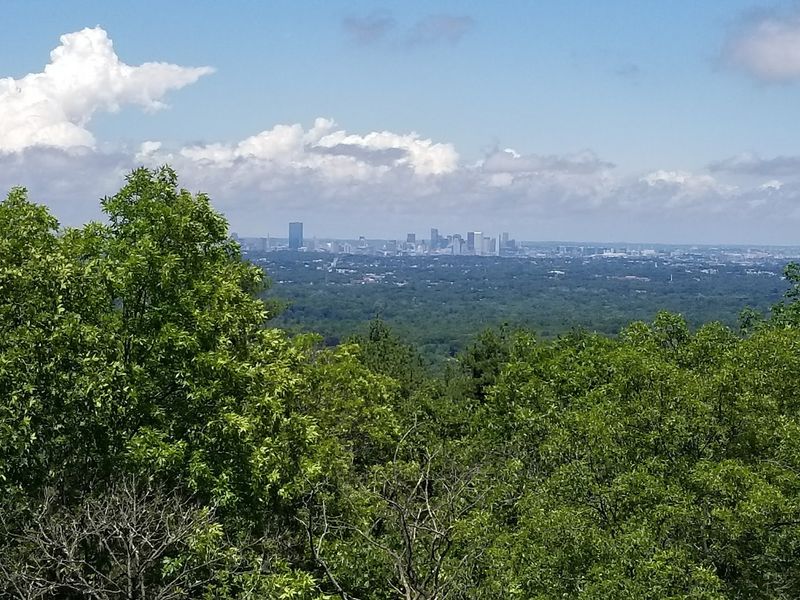
Weather nerds, rejoice. The Blue Hill Meteorological Observatory has recorded weather on this summit since 1885.
It’s the oldest continuous weather record in the United States. It’s also a National Historic Landmark, which is pretty fancy for a hilltop.
Great Blue Hill stands 635 feet tall. That makes it the highest of the 22 hills in the Blue Hills Reservation.
The reservation covers about 7,000 acres just minutes from Boston. Big nature this close to a big city feels like a cheat code.
From the rocky summit, the Boston skyline pops into view. You’ll see much of the metro area spread out below.
City views from a forest trail make a fun contrast. One moment you’re among trees, the next you’re spotting skyscrapers.
Trail options are huge. The reservation offers around 125 miles of paths for every kind of hiker.
Some routes up Great Blue Hill are steep and rocky. Others take a gentler, longer climb, so pick what fits your crew.
Many visitors start near Houghton’s Pond, a popular recreation area. It makes a handy base for exploring the hills.
Because it’s close to the city, you can squeeze in a hike after work. Quick escapes like that are pure gold.
Clear days give the sharpest skyline views. After a rain shower, the air can look extra crisp.
Massachusetts ends this list with a view that blends history, city, and forest. Not bad for a hill you can reach before lunch.
Address: Houghton’s Pond Recreation Area, 840 Hillside St, Milton, MA 02186
Share this story