Folks who say Oklahoma is flat have clearly never driven the switchbacks above Poteau.
Just outside this small town in the southeastern corner of the state, a road winds up a forested slope to a summit that locals proudly call the highest hill on the planet.
The drive costs nothing, the overlook stretches across river valleys and distant mountain ranges, and autumn turns the whole climb into a colorful day trip.
Keep reading to learn the quirky story behind the claim, what waits at the top, and how to tackle those tight turns safely.
1. A Summit Hiding in Plain Sight
Poteau sits quietly in Le Flore County, but one landmark makes the town hard to forget.
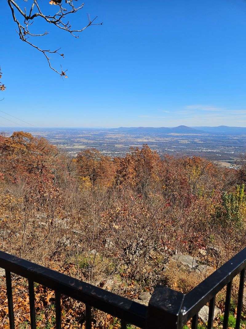
Rising just outside the city, Cavanal Hill is a mountain peak area listed at Oklahoma 74953, United States, in the southeastern part of the state.
The spot works as a combined summit, hiking, and mountain-biking area.
It also carries a history as a former mining area, and its top offers broad river valley views.
Getting to the high point does not require hiking boots.
A paved road climbs the slope, so the summit is fully vehicle accessible for families, road-trippers, and anyone who prefers four wheels over two feet.
That accessibility is a big part of the appeal.
A family can leave the house in the morning, enjoy the overlook by lunch, and still be home for supper, depending on where they start.
The drive from Oklahoma City is long but doable as a day trip, and people do make the journey for the views alone.
Those closer to Fort Smith or the lake country of southeastern Oklahoma will find it an even easier outing.
Poteau treats the hill as its signature attraction.
Once the road starts curving upward, it becomes clear why the town hangs its reputation on this particular bump in the landscape.
2. One Foot Short of a Mountain
Here is a fun bit of local bragging.
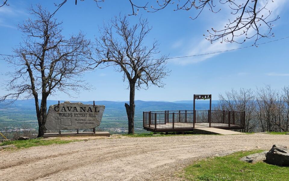
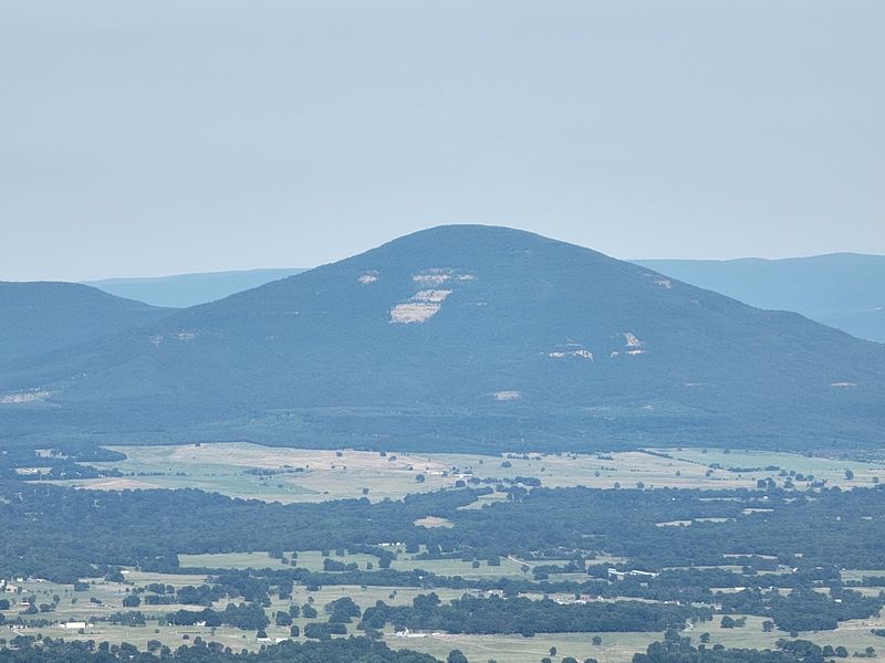
Cavanal Hill is widely promoted as the world’s highest hill, measuring around 1,999 feet.
The math behind the nickname is the whole joke.
By a common definition, a landform needs to reach 2,000 feet to earn the title of mountain, so Cavanal falls short by a single foot.
Local lore adds a playful twist.
A popular tale credits a man named Mr. Kerr with bringing in a bulldozer to trim the summit, supposedly turning a short mountain into a record-setting hill.
How much of that story is fact and how much is campfire fun remains part of the charm.
Some official listings even give the peak a different elevation, so the numbers may depend on who is measuring and from where.
None of that slows down the photo crowd.
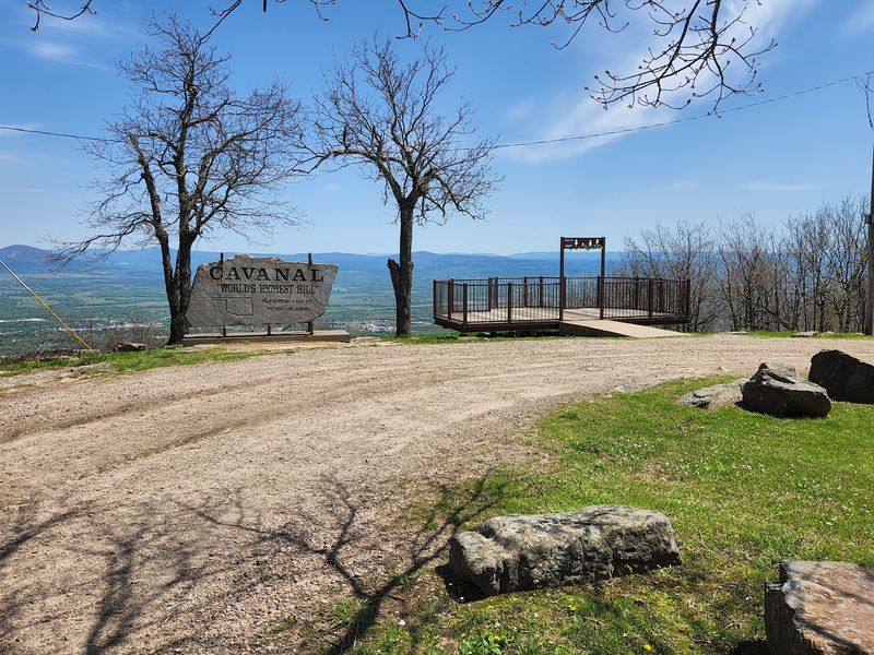
The summit sign is a favorite backdrop, and many people make the climb mainly to snap proof that they stood atop the planet’s tallest hill.
Kids especially tend to love the idea of a hill that almost became a mountain.
It is a great conversation starter for the ride home, and a quick online search afterward can turn the trip into a mini geography lesson.
3. Switchbacks, Curves, and a Little Courage
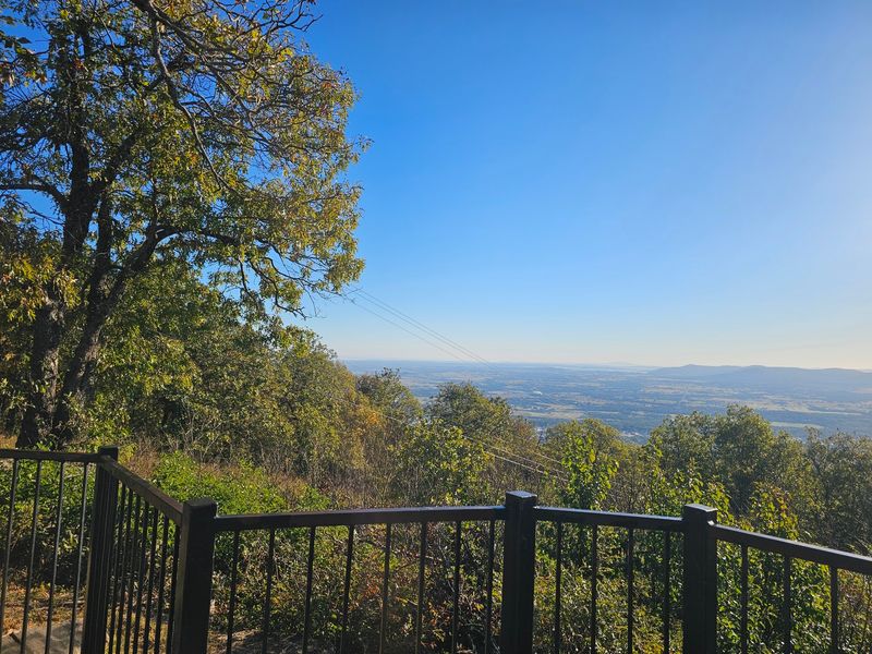
The road up is half the adventure.
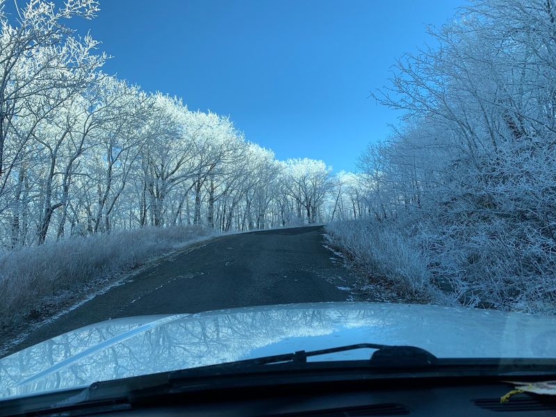
It winds back and forth across the slope with tight turns, some of them close to hairpin sharp.
Plenty of drivers call the climb fun, and that is a fair description.
Still, the grade is steep, and the curves demand slow, steady driving.
There is room for two cars to pass in opposite directions.
The catch is that the pavement has no painted lines, so it pays to stay aware of how much space a vehicle is taking up.
Road conditions have varied over the years.
Some stretches have been described as smooth blacktop all the way, while more recent accounts mention torn-up asphalt, gravel, dirt, and potholes around the halfway point.
Motorcycle riders should take extra care on those rougher sections.
Cars with low clearance may also complain a bit, though most vehicles make the trip without trouble.
A simple plan helps:
Go slow on every curve.
Watch for oncoming traffic before each bend.
Save the sightseeing for pull-offs rather than the driving lane.
Conditions can change with weather and maintenance, so checking local updates before heading out is a smart move.
Patience on the way up makes the payoff at the top that much better.
4. The Overlook and Its Simple Comforts
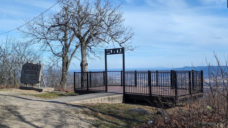
Past a cluster of telecom towers, the road ends at a modest summit area.
Nobody should expect a visitor center or gift shop, and that simplicity suits the place.
The top features a viewing deck and an overlook facing out across the valley.
A covered area offers shade for a quick snack or a water break.
Around four picnic tables sit near the edge, along with a few benches.
Families often pack a lunch and turn the stop into a hilltop picnic.
Honesty matters here, too.
Some people have pointed out that the tables could use updating and that litter sometimes collects at the summit.
A few have also noted that trees and brush have grown in front of parts of the view over the years.
The scene from the deck can depend on recent trimming.
One helpful habit makes a difference.
Bringing a spare bag and carrying out a little extra trash keeps the hilltop nicer for the next carload.
Bottom line, there is not a lot to do once at the summit.
Most folks spend a short while soaking up the panorama, snapping pictures, and resting at a table before heading back down.
5. What You Can Spot From Up Top
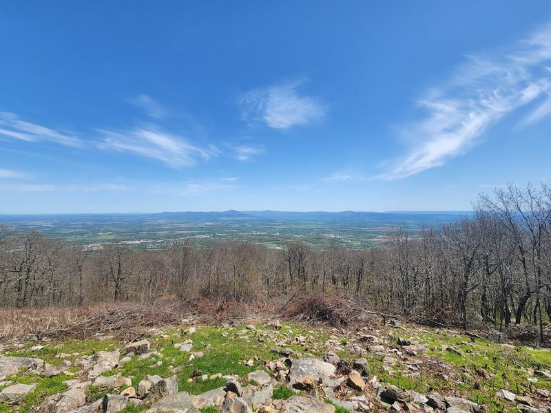
Bring a sense of direction, because the summit doubles as a giant map.
On a clear day, the landmarks below start lining up one after another.
From the first turnout on the drive down, looking northwest, Short Mountain and Kerr Lake come into view.
Those two make easy anchors for getting oriented.
Facing north, the AES power plant serves as a handy reference point.
Farther out, the two Spiro water towers and the Redlands railroad bridge appear in the distance.
The Wild Horse Mountain range also stretches across part of the horizon.
It is a strong reminder that eastern Oklahoma is packed with ridges and valleys.
A pair of binoculars is well worth tossing in the car.
Large birds are known to circle around the hilltop, and binoculars help with spotting both wildlife and faraway landmarks.
Because there is little signage at the top pointing out features, a bit of homework before the trip pays off.
Kids can turn the scene into a scavenger hunt, checking off the lake, the towers, and the bridge.
Few views in the region tie together lakes, railroads, and mountain ranges in one sweep.
It is the kind of panorama that proves the state is far from flat.
6. Autumn on the Climb
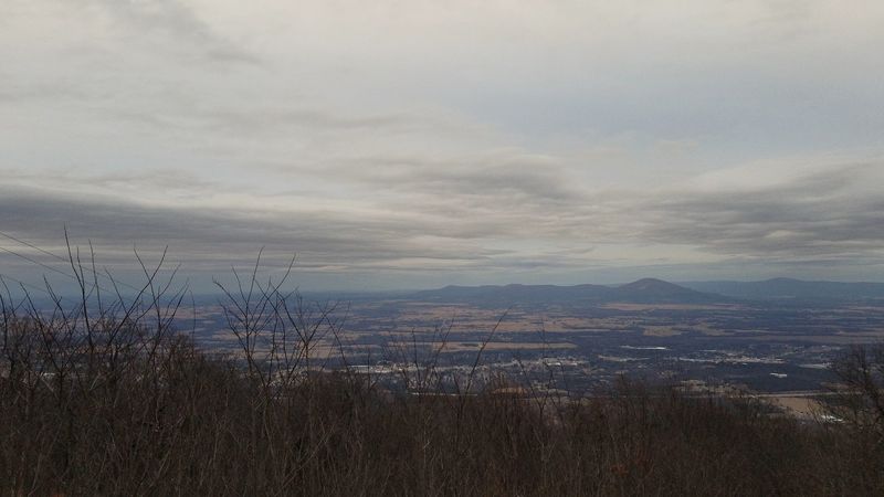
Fall may be the hill’s best season.
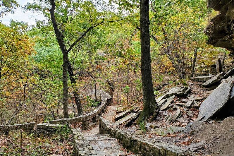
The forested slopes around the road make the climb a natural leaf-peeping route in southeastern Oklahoma.
Timing the trip takes a little luck, since peak color shifts from year to year with weather.
Checking local foliage updates before leaving is the safest bet.
The appeal is simple.
A drive that already ranks as scenic picks up extra color, and the summit view adds the valley’s autumn patchwork below.
Families on a budget will appreciate that the scenic drive itself carries no admission fee, based on how the hill is commonly promoted.
Policies can change, so a quick check never hurts.
Cooler weather also makes the summit picnic tables more inviting.
A thermos and sandwiches go a long way on a crisp afternoon at the overlook.
Photographers will want to stop at turnouts rather than in the road.
The tight curves leave little shoulder, and safety beats the perfect shot every time.
Pairing the drive with a stroll through Poteau or a stop at nearby lakes rounds out a full fall day.
It is an easy way to swap the usual pumpkin patch outing for something with a little elevation.
7. Sunset Seekers and Homes on the Slope
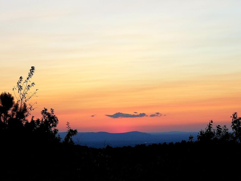
Evening may be the hill’s secret weapon.
Many people suggest planning the trip to reach the top around sunset for the most memorable view.
The overlook faces wide open valley country, which makes the end of the day especially photogenic.
Arriving a little early helps secure a good spot near the edge.
One caution comes with that plan.
Driving down tight, unlined curves after dark requires extra attention, so leaving a margin of daylight is wise.
On the way up, the scenery is not limited to trees.
Several homes line parts of the slope, and some of them rank among the most eye-catching houses in the state.
Those properties are private, of course.
Admiring from the road is fine, but pulling into driveways or lingering in front of homes is not.
For longtime locals, the hill holds plenty of memories.
Some return decades after a teenage evening trip and find the daytime view surprisingly different.
That mix of nostalgia and fresh discovery keeps people coming back.
A sunset at the top can turn an ordinary weekend drive into a family tradition worth repeating.
8. Who Will Love This Detour
Not every outing needs a full itinerary.
Cavanal Hill is a short, satisfying stop, and that makes it a great fit for certain kinds of travelers.
Road-trippers looking for a last-minute detour often find it well worth the time.
It is a little out of the way, yet the experience tends to justify the extra miles.
Families who want a cheap outing will appreciate the free scenic drive and picnic tables.
Kids get a quirky world record story and a summit to brag about.
Photographers have plenty to work with, including the famous sign and the valley panorama.
One heads-up: graffiti has appeared on the sign, though framing shots from a distance helps.
Hikers and mountain bikers can also explore the trail routes associated with the area.
Anyone planning to ride should research current trail conditions first.
Travelers seeking a full day of activities at one site may feel the summit is brief.
Pairing the hill with other Poteau-area stops solves that.
Overall, the hill rewards curiosity more than a strict schedule.
Show up with snacks, a camera, and a relaxed attitude, and the visit tends to deliver.
9. Planning Notes and a Fond Farewell
A little preparation keeps this trip smooth.
Start by setting navigation to Cavanal Hill near Poteau and allowing extra time for the slow, winding climb.
No official hours or fees appear in the available information.
The summit drive is promoted as free, but conditions and access may change, so checking with local sources before driving is wise.
Pack the basics:
Water and snacks for the covered area.
Binoculars for birds and landmarks.
A trash bag to leave the summit cleaner than you found it.
Drive cautiously, especially on two wheels.
Rough patches, potholes, and gravel have been reported around the middle of the road.
Directional signage is limited, both on the way and at the top.
Downloading a map and reading up on the view ahead of time fills in those gaps.
With its 4.6-star reputation among people who have made the climb, the hill clearly wins hearts despite its rough edges.
It is not polished, and it does not pretend to be.
What it offers is a free drive, a playful record, and a view that stretches toward lakes and mountain ranges.
For an Oklahoma family proving their state has some altitude, that is a pretty tall order filled.
Share this story