Texas used to be home to some of the most beautiful water-filled natural areas in the country. Springs bubbled up crystal-clear, rivers carved through limestone, and lakes stretched for miles under the big sky. But years of drought, increased demand, and changing weather patterns have transformed many of these once-lush spots into shadows of their former selves, leaving behind cracked earth and faded memories of what used to be.
1. Blue Hole Regional Park
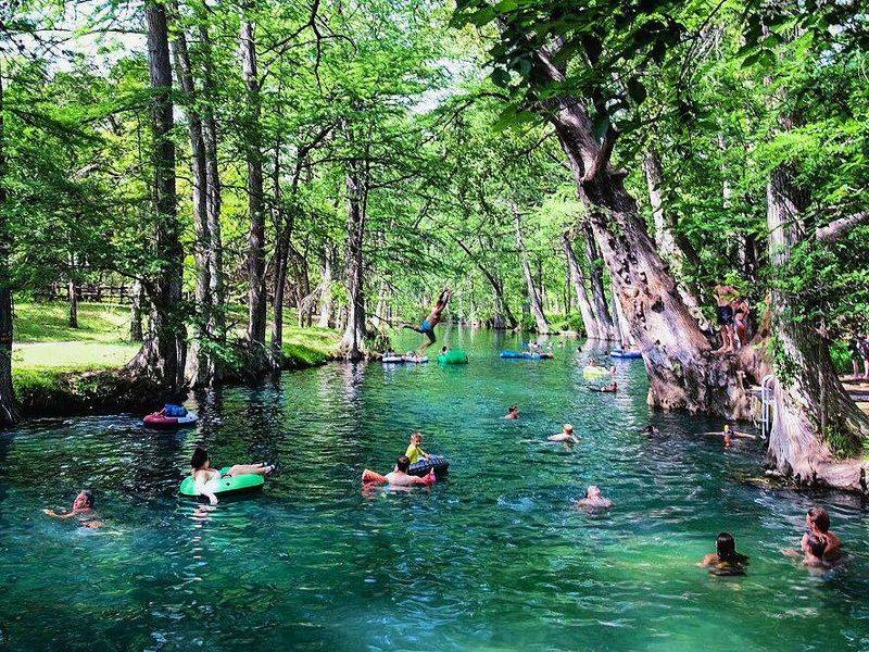
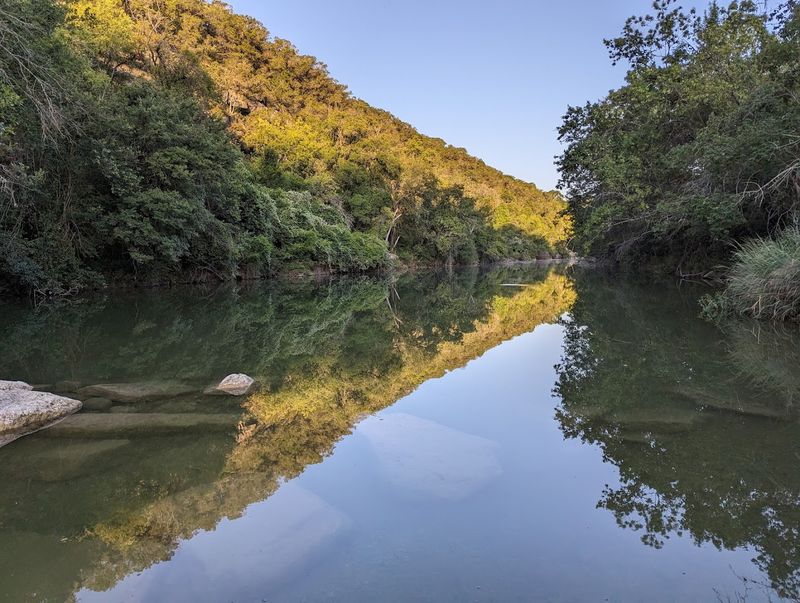
Remember when Blue Hole was the place everyone wanted to cool off on a scorching summer day? Families packed picnic baskets, kids squealed as they jumped into the deep, clear water, and the cypress trees provided perfect shade. That version of Blue Hole feels like a distant memory now.
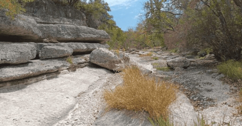
The water level has dropped so dramatically that what used to be a swimmer’s paradise is now mostly exposed rock and sediment. Where there was once a depth of over 20 feet in some spots, you’ll now find shallow pools that barely cover your ankles. The drought hasn’t been kind to this Wimberley gem.
Local residents talk about the old days with a mix of nostalgia and sadness. They remember when the spring-fed waters stayed cool even in August, when you could float for hours without touching bottom. These days, the park still attracts visitors, but they come more for the trails and the history than for swimming.
The surrounding landscape tells the story too. Trees that depended on consistent water access are struggling, their roots exposed in places where soil has eroded away. The wildlife that once thrived here has had to adapt or move on entirely.
Climate experts point to this spot as a prime example of how Texas waterways are changing. Reduced rainfall, higher temperatures, and increased water usage from nearby communities have all played a role. Some wonder if Blue Hole will ever return to its former glory, or if this is the new normal.
Still, there’s something haunting about visiting now. You can almost hear the echoes of laughter and splashing, see the ghosts of summer days past in the worn limestone and empty creek bed.
2. Jacob’s Well
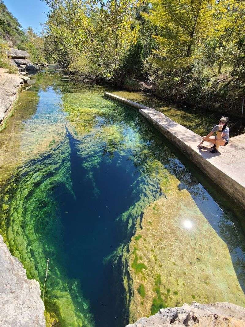
Jacob’s Well earned its reputation as one of the most dangerous dive sites in Texas, but it was also one of the most stunning. The artesian spring pumped out thousands of gallons per minute, creating a perpetual flow that kept the well full and the surrounding creek running strong. Divers came from all over to explore the underwater cave system.
Now? The flow has slowed to a trickle compared to what it used to be. There have been multiple years where Jacob’s Well actually stopped flowing completely, something that hadn’t happened in recorded history until recent decades.
The well still draws curious visitors who want to peer into its depths, but the experience is nothing like it was twenty or thirty years ago. The water level sits much lower, and the once-constant gurgle of fresh spring water has quieted. On really dry years, you can see rocks and cave features that used to be completely submerged.
Scientists have been studying Jacob’s Well to understand what’s happening beneath the surface. The Trinity Aquifer that feeds it is being pumped for drinking water and agriculture, and rainfall hasn’t been sufficient to recharge it at the rate it’s being used. It’s a sobering equation.
The organization that manages the area has had to implement strict conservation measures. Swimming is now limited to preserve what water remains, and diving has additional restrictions. These rules would have seemed unthinkable in the well’s heyday.
Long-time locals share stories of swimming there as kids, of the water being so clear you could see all the way down, of never imagining it could run dry. Their stories feel almost mythical now, like tales from another world entirely.
3. Las Moras Springs
For more than a century, Las Moras Springs provided enough water to sustain Fort Clark and the surrounding community. Spanish explorers named them “the blackberry springs” because of the lush vegetation that thrived around the water. The springs created an oasis in an otherwise harsh landscape, producing millions of gallons daily.
Walk through the area today and you’ll struggle to believe those historical accounts. The main spring that once flowed so reliably has been reduced to occasional seeps and small pools. Where there used to be a substantial creek, you’ll find mostly dry channels lined with cracked mud.
The springs supported not just the fort but also agriculture, wildlife, and recreation for generations. Old photographs show people swimming, picnicking beside flowing water, and enjoying the natural beauty. Those images look like they could be from a completely different location.
What happened? A combination of factors, really. The aquifer that fed the springs has been heavily pumped for decades.
Reduced rainfall in the region means less recharge. Climate change has shifted weather patterns, making droughts longer and more severe.
Fort Clark Springs, the community that grew up around the historic site, has had to adapt drastically. Water that was once abundant is now carefully managed and rationed. The lush landscaping that characterized the area has given way to more drought-tolerant plants.
Environmental historians point to Las Moras as a cautionary tale about taking water for granted. The springs seemed inexhaustible, a permanent feature of the landscape. But permanent turned out to be temporary when conditions changed faster than anyone anticipated.
The transformation serves as a stark reminder of how quickly natural resources can disappear.
4. Barton Creek Greenbelt
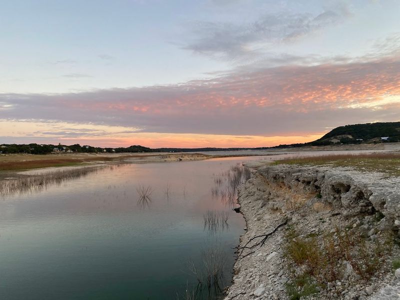
Austin’s Barton Creek Greenbelt used to guarantee one thing: water. Whether you were hiking, swimming, or just exploring, you’d encounter flowing water, deep swimming holes, and that refreshing creek sound that made the whole experience magical. Locals treated it like their personal waterpark, knowing exactly which spots had the best pools.
These days, finding actual flowing water in the greenbelt can be hit or miss. During dry periods, which seem to be more frequent and longer lasting, large sections of the creek bed sit completely exposed. Those famous swimming holes?
Many of them are now just collections of rocks and sediment.
The change has been gradual enough that newcomers might not realize what’s been lost, but long-time Austinites definitely notice. They remember when you could count on Sculpture Falls having enough water to actually fall, when Campbell’s Hole was deep enough for cliff jumping, when the creek flowed year-round without fail.
The Edwards Aquifer, which feeds Barton Springs and the creek, is under tremendous pressure. Austin’s population has exploded, and with it, water demand. Add in extended drought conditions and you’ve got a recipe for diminished flow.
Even in wet years, the creek doesn’t maintain the levels it once did.
The greenbelt remains popular because the trails are still beautiful and accessible, but the experience has fundamentally changed. Instead of planning swimming trips, people now check flow reports to see if there’s even water present. Dogs that used to splash through creek crossings now walk across dry rock.
Park officials have had to post warnings during dry periods about the dangers of stagnant pools and remind visitors that what little water remains needs protection. It’s a far cry from the days when the biggest concern was whether the water might be too cold.
5. Paluxy River (Dinosaur Valley State Park)
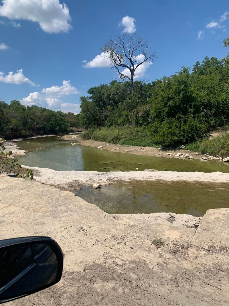
The Paluxy River gave Dinosaur Valley State Park its fame. The river’s flow would expose dinosaur tracks in the limestone riverbed, creating an incredible window into prehistoric Texas. Families would wade through the water, spotting tracks and imagining the massive creatures that made them millions of years ago.
Lately, though, the river has been so low that the tracks are almost always exposed, which sounds good until you realize it means there’s barely any river left. What should be a flowing waterway is often just a series of disconnected puddles and long stretches of completely dry riverbed.
The park used to be a summer destination for cooling off as much as for the dinosaur tracks. Kids could splash in the river while parents kept an eye out for tracks in the shallows. The Paluxy wasn’t a huge river, but it was reliable, and it made the whole experience more enjoyable.
Now visitors walk across the riverbed in areas where they used to swim. The tracks are easier to see, sure, but the magic of discovering them through clear, flowing water is gone. Instead, you’re walking on cracked limestone, trying to stay hydrated while you imagine what this place looked like when water was plentiful.
The drought conditions have been so severe that the park has had to close certain areas at times. Without water flow, the ecosystem that depends on the river struggles. Fish populations have crashed in some sections.
The trees and plants along the banks show stress from the lack of moisture.
Rangers talk about the old days when the river would actually flood after heavy rains, when you couldn’t access certain track sites because the water was too high and moving too fast. Those problems seem almost quaint now, when the bigger concern is whether there will be any water at all.
6. Rio Grande
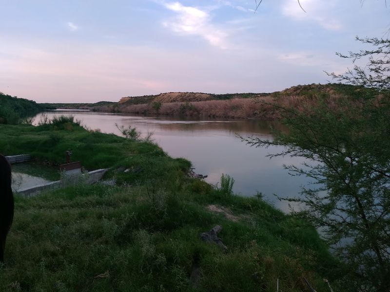
Calling the Rio Grande a “grande” river feels almost ironic these days. This massive waterway that forms Texas’s southern border used to be a legitimate river, wide and flowing, supporting communities and ecosystems on both sides. Historical accounts describe a river that could be dangerous to cross, that flooded regularly, that sustained life across a huge region.
Travel along the Rio Grande today and you’ll find sections where you can literally walk across without getting your knees wet. The river has shrunk so dramatically that it’s sometimes hard to even identify where the main channel is supposed to be. Sandbars and islands have emerged where there used to be continuous water.
The transformation has been devastating for border communities that depended on the river for agriculture, drinking water, and their way of life. Towns that grew up along its banks now face water shortages and economic hardship. The river that was supposed to be a permanent resource has become unreliable.
Multiple factors have contributed to the Rio Grande’s decline. Upstream dams and diversions take water before it reaches Texas. Both the U.S. and Mexico draw heavily from the river for agriculture.
Climate change has reduced snowpack in the Rocky Mountains, where the river originates, meaning less water flows down to begin with.
The environmental impact extends beyond just the water itself. The riverside ecosystem, which includes unique plant and animal species, is collapsing in many areas. Birds that migrated along the river corridor are finding less habitat.
Fish species are disappearing entirely from sections that have dried up.
Old-timers on both sides of the border share memories of swimming in the Rio Grande, of fishing trips that yielded impressive catches, of the river being a genuine barrier that commanded respect. Their grandchildren see a very different reality, one where the “Grand River” is often just a muddy trickle struggling to survive.
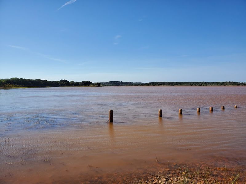
7. Lake Abilene
This lake served as the city’s primary water source and a popular recreation spot for decades. Boaters, fishermen, and families treated it as a reliable getaway, a place where you could count on finding water and fun any time of year. The lake had boat ramps, fishing piers, and all the infrastructure you’d expect from a well-used reservoir.
But if you visit now, you’ll see boat ramps leading to nothing but cracked earth. The lake has receded so far that many of the access points are completely useless. What used to be underwater is now exposed lakebed, and the water that remains is concentrated in a much smaller area than the lake was designed for.
The city of Abilene has had to confront a harsh reality: their lake might not be viable long-term. They’ve invested in alternative water sources and infrastructure because Lake Abilene can no longer be counted on. That’s a huge shift for a community that built its water security around this reservoir.
The drop in water levels has been so severe that old structures and items that were submerged when the lake was full have reappeared. People have found old roads, foundations, and artifacts from before the lake was created. It’s like watching history resurface as the water disappears.
Recreational use has plummeted because, well, there’s not much lake left to use. The fish population has concentrated in the remaining water, which sounds good for fishing except that the water quality has declined and the ecosystem is stressed. It’s not the same experience it used to be.
Weather patterns haven’t helped. The region has experienced extended dry periods with insufficient rainfall to refill the reservoir. Even when rain does come, it’s often not enough to make up for the water that’s been lost to evaporation and use.
Lake Abilene stands as a stark example of how quickly a water source can fail when conditions change.
8. Medina Lake
Created in the 1910s, it became famous for its clear water, excellent fishing, and beautiful limestone surroundings. Communities grew up around the lake, property values reflected waterfront access, and businesses catered to the steady stream of visitors who came to enjoy the water.
Then the lake essentially disappeared. Not all at once, but gradually and then suddenly, Medina Lake dropped to single-digit capacity levels. Places that had been underwater for nearly a century were exposed to air.
Boat docks stood on dry land, sometimes dozens of feet from the nearest water.
The impact on lakeside communities was catastrophic. Homes that were purchased for their water access suddenly overlooked barren lakebed instead. Marinas and businesses closed because there was no lake to support them.
Property values crashed as the main attraction vanished.
The lake’s decline revealed a sobering truth about Texas water management. Medina Lake was designed to irrigate farmland downstream, but the combination of drought, increased demand, and aging infrastructure meant there wasn’t enough water to keep the lake full while meeting other obligations. Something had to give, and the lake lost.
During the worst years, you could walk across the lakebed and explore areas that had been underwater for generations. People found old structures, roads, and remnants of the original valley that was flooded to create the reservoir. It was fascinating from a historical perspective but devastating for everyone who depended on the lake.
Recent years have seen some recovery when rainfall returned to normal levels, but the lake hasn’t consistently maintained the levels it once did. The experience has left residents wary, knowing that another drought could bring back the empty lakebed. The reliability that once defined Medina Lake is gone, replaced by uncertainty.
9. Lake Buchanan & Old Bluffton
Lake Buchanan holds a unique place in Texas history as the oldest of the Highland Lakes and the second largest. When it was created in the 1930s, it flooded the town of Bluffton, promising residents that their sacrifice would bring prosperity to the region through reliable water and power. For decades, that promise seemed to hold true.
But severe droughts have dropped Lake Buchanan to levels that exposed the ruins of old Bluffton multiple times in recent years. Foundations of buildings, the old cemetery that was supposedly relocated, streets and sidewalks—all emerged from the water like ghosts from the past. It was eerie and sad, a physical reminder of what was given up and what might be lost again.
The lake’s primary purpose is water supply for downstream users, including Austin, so when drought hits, Lake Buchanan bears the brunt. Water is released to meet obligations, and the lake level drops dramatically. Communities around the lake watch helplessly as their waterfront disappears and their economy suffers.
Boat ramps that were designed for much higher water levels become unusable. The Lower Colorado River Authority has had to extend ramps and create new access points, but it’s a constant battle against dropping levels. Marinas struggle to stay operational when the water keeps receding.
The fishing that made Lake Buchanan famous has been impacted too. When water levels drop, fish habitat is reduced, and the population dynamics change. Tournaments that used to draw competitors from across the state have been cancelled or relocated because the lake conditions deteriorated.
Local residents have mixed feelings about seeing Old Bluffton resurface. There’s historical interest and curiosity, but it’s overshadowed by the anxiety of knowing that the exposed ruins mean their water source is failing. The novelty of exploring a ghost town wears off quickly when you realize it represents a crisis, not just a curiosity.
10. Hamilton Pool Preserve
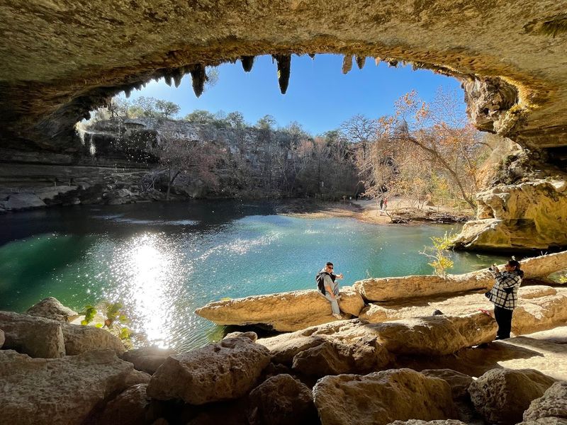
The collapsed grotto, the waterfall cascading over the limestone overhang, the emerald-green pool below—it was the stuff of postcards and Instagram dreams. People would reserve spots months in advance just to experience it.
The waterfall doesn’t always fall anymore. During dry periods, which have become more common, the flow reduces to a trickle or stops entirely. The pool level drops, exposing rocks and reducing the swimming area.
What should be a lush, water-filled paradise can look downright sad when the water isn’t cooperating.
The preserve had to implement a reservation system partly because of the water issues. Too many visitors were impacting an already stressed ecosystem. When water levels are low, swimming is sometimes prohibited entirely to protect what little water remains and the species that depend on it.
The creek that feeds Hamilton Pool originates from the same aquifer system that’s being pumped heavily for development and agriculture in the surrounding area. As that aquifer is drawn down, the springs and seeps that create Hamilton Pool’s flow are diminished. It’s a direct connection between water use and the loss of natural beauty.
Long-time visitors notice the difference immediately. They remember when the waterfall was always flowing, when the pool was consistently deep and cold, when you didn’t have to worry about whether there would be enough water to swim. Those days feel like they’re slipping away.
Travis County Parks, which manages the preserve, has had to balance access with conservation. They’ve increased education about the fragile nature of the site and the importance of protecting water resources. But education doesn’t make it rain or refill the aquifer.
The irony is that Hamilton Pool’s popularity has grown even as its water resources have declined. More people want to see it, but there’s less of it to see. It’s become a symbol of what Texas stands to lose if water management doesn’t improve.
11. Pedernales Falls
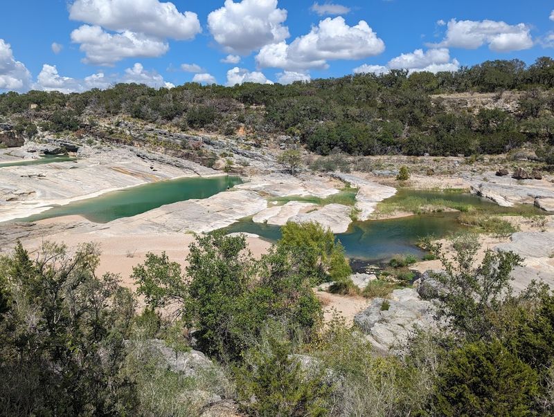
Named for its striking cascades, Pedernales Falls State Park features the river tumbling over layered limestone into pools and waterfalls. When the river was running strong, it was spectacular—water rushing over the rocks, creating that powerful sound and mist that makes waterfalls so appealing.
Visit during a dry spell and you might not see any falls at all. The river can drop so low that water barely trickles over the limestone, and the pools below dry up completely. What should be a dramatic natural feature becomes just a series of dry rock ledges.
The park still attracts visitors for hiking and camping, but the main attraction—the falls themselves—is often disappointing. Rangers have to manage expectations, explaining that the falls are seasonal and dependent on rainfall upstream. But “seasonal” has started to mean “rarely” in recent years.
The Pedernales River watershed has been impacted by the same factors affecting waterways across Texas: drought, increased water use, and reduced aquifer levels. The river depends on both surface runoff and spring flow, and both have been diminished. Even after significant rain, the flow doesn’t last as long as it used to.
Photographers who used to capture stunning images of the falls in action now often find themselves shooting dry landscapes instead. The dramatic before-and-after comparisons that have circulated online show just how much has changed in a relatively short time. It’s visual proof of the transformation.
The ecosystem around the falls has adapted as best it can, but the stress is visible. Trees along the riverbank show signs of drought stress. Wildlife that depended on consistent water access has had to find alternatives or move on.
The park’s character has fundamentally changed.
There’s always hope that a wet year will bring the falls back to their former glory, and occasionally that happens. But those years are becoming the exception rather than the rule, and each dry period seems to last longer than the last.
12. Lake Travis
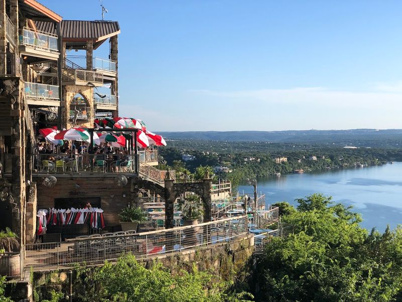
Known as the jewel of the Highland Lakes, Lake Travis is where Austin comes to unwind and have fun. For decades, it meant endless summer weekends, packed marinas, waterfront restaurants with boats tied up to the docks, and a recreation economy that thrived on reliable water. Travis was the lake that rarely disappointed.
Then came the drought years that changed everything. Lake Travis dropped to levels that seemed impossible, losing more than 50 feet of depth in some areas. Boat ramps ended in mid-air, high above the water.
Marinas had to close because there was no way to access the lake. The famous “Devil’s Cove” party spot became a rocky beach.
The visual impact was stunning in the worst way. Cliffs that had been underwater for half a century were suddenly exposed, showing layers of limestone and creating a landscape that looked almost alien. Docks sat on dry land, sometimes hundreds of feet from the nearest water.
It was apocalyptic.
The economic fallout hit hard. Businesses that catered to lake-goers struggled or closed entirely. Property values for lakefront homes plummeted when “lakefront” meant overlooking a barren expanse instead of water.
The entire culture of Lake Travis was threatened.
Recovery came eventually, when rainfall patterns improved and the lake refilled, but the experience left scars. People who lived through the low years remain anxious about water levels, checking them obsessively during dry spells. The assumption that Lake Travis would always be full was shattered.
Water management authorities learned harsh lessons about the limits of the Highland Lakes system. Lake Travis serves as the region’s water supply backup, which means it gets drawn down to serve cities and agriculture when other sources fail. That makes it vulnerable in ways that recreational users didn’t fully appreciate before.
The lake has become a symbol of Texas water challenges—popular, important, but ultimately at the mercy of rainfall and competing demands that sometimes leave recreation as the lowest priority.