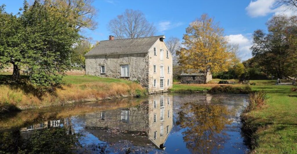
A canal still holds water beside the empty lane, but no mule teams are coming around the bend. Instead, Waterloo Village greets visitors with shuttered workshops, silent porches, and old houses gathered beneath a thick wall of trees.
The scene feels less like a conventional museum and more like a community whose residents stepped away and never returned. Yet this secluded corner of Sussex County was hardly quiet in the 1800s.
It stood beside one of America’s most ambitious canals, serving boat crews hauling coal and other cargo across northern New Jersey. Waterloo’s commercial pulse eventually faded, but many of its buildings survived, leaving behind an unusually complete picture of canal-era life.
Today, the preserved village sits within Allamuchy Mountain State Park, surrounded by thousands of protected acres. The isolation is genuine, the silence occasionally eerie, and the history much richer than the “ghost village” label suggests.
Waterloo Village Hides Between Two Mountains
The drive toward Waterloo becomes noticeably quieter as houses thin out and the woods close in around the road. By the time the village appears, wedged between Allamuchy Mountain and Schooley’s Mountain in the Musconetcong River Valley, modern New Jersey feels surprisingly far away.
The mailing address says Stanhope, but the historic site lies in Byram Township, near the point where the Musconetcong River separates Sussex and Morris counties. That tucked-away geography is a big part of its unusual character.
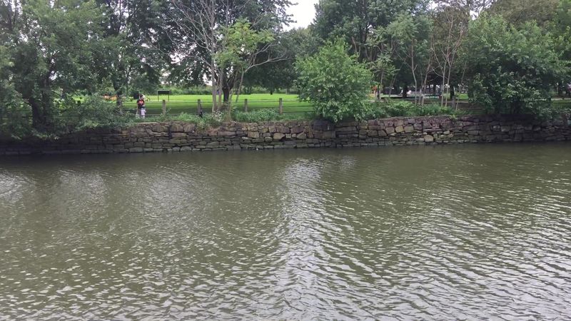
Thousands of acres of state parkland surround the property, insulating the old buildings from the strip malls, traffic lights, and dense neighborhoods found elsewhere in North Jersey. The Musconetcong River bends past the grounds, while a water-filled section of the Morris Canal runs alongside the village.
Forest trails branch away from the historic core, and the Waterloo Vernal Pool provides seasonal breeding habitat for frogs, salamanders, and other amphibians. Deer often wander into the open fields, and native wildflowers soften the edges of the old road in warmer months.
None of this means Waterloo is truly lost or inaccessible. There is a parking area, a visitor center, and organized programming during parts of the year.
Still, an ordinary weekday can make the village feel remarkably empty. Footsteps carry.
Water moves through the old channel. Wind rattles leaves around buildings that no longer function as stores or homes.
The experience changes again in fall, when red and orange foliage frames the white clapboard structures and deepens the sense that the entire settlement has been sealed inside its own small world.
The Morris Canal Turned This Quiet Settlement Into a Busy Trading Stop
Waterloo’s location mattered long before anyone began preserving it for visitors. When the Morris Canal opened in 1831, the settlement sat near the midpoint of a 102-mile transportation route running between Phillipsburg on the Delaware River and Jersey City on the Hudson.
Mule-drawn boats carried Pennsylvania anthracite coal eastward while iron ore, farm products, timber, and manufactured goods moved between communities across northern New Jersey. Waterloo became the canal equivalent of a highway service stop.
Crews could buy supplies, arrange repairs, rest animals, eat, drink, and sleep before continuing a journey that took roughly five days from end to end. The Smith family, which owned much of the property, recognized the opportunity early.
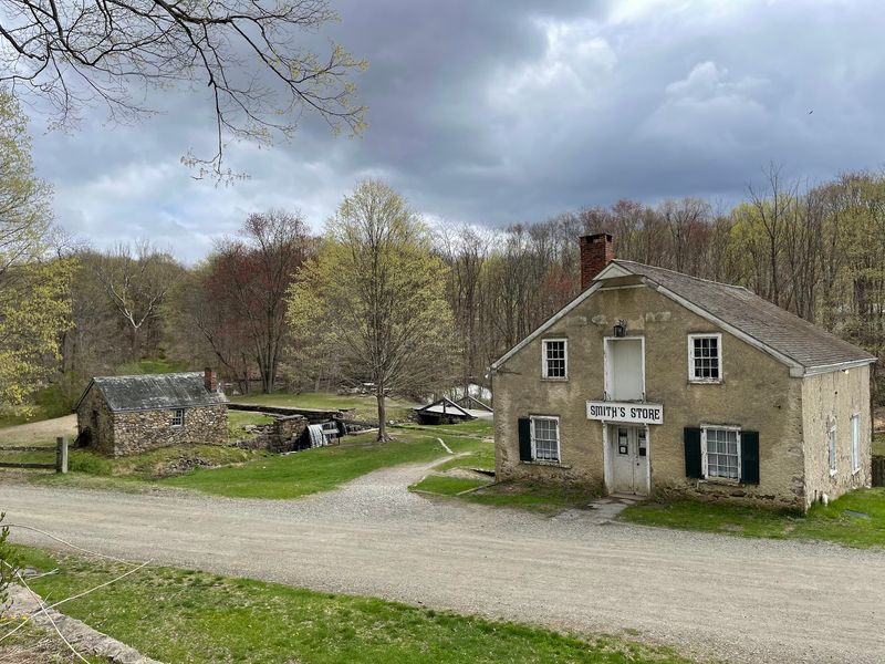
The Smith Store opened around 1831 and stood beside the canal embankment, making it convenient to transfer merchandise between boats, wagons, and shelves. A blacksmith kept tools, wagon parts, and mule equipment in working order.
The gristmill and sawmill used local waterpower, while an inn and tavern accommodated laborers, travelers, and longer-term boarders. The canal itself was an engineering feat.
Northern New Jersey’s rough terrain required boats to overcome a total elevation change of 1,674 feet. Twenty-three locks and 23 water-powered inclined planes helped lift and lower vessels across the Highlands, sometimes moving a loaded boat vertically by as much as 100 feet.
Near Waterloo, boats crossed the Musconetcong River and passed through Lock 3 West, with mules using a separate bridge to regain the towpath. At its busiest, this was not a sleepy country lane.
It was a working transportation hub filled with cargo, animals, machinery, shopkeepers, boat crews, and the constant business of keeping freight moving.
The Railroad Age Left Waterloo Village Behind
The number that best captures the Morris Canal’s rise is 889,220. That is approximately how many tons of cargo traveled along the waterway in 1866, its peak year for both tonnage and profit.
Coal accounted for more than half of that total, and iron ore contributed another enormous share. Waterloo prospered because the canal did, but the same transportation revolution that created the village eventually made it unnecessary.
Railroads could carry larger loads faster, follow more direct routes, and continue operating during weather that brought canal traffic to a standstill. A frozen waterway was not much help when factories and homes still needed coal.
The Lehigh Valley Railroad leased the Morris Canal in 1871, and although boats continued running for decades, the long decline had already begun. By the opening years of the 20th century, annual cargo totals were only a fraction of their 1860s peak.
New Jersey took control of the canal in 1922, and the waterway was drained in the spring of 1924. Without the boat crews, freight, and businesses that depended on them, Waterloo lost its reason for being a commercial center.
Families moved on, buildings fell quiet, and the community gradually became the place visitors see today. Calling it abandoned is understandable, though not entirely precise.
Waterloo was eventually restored and interpreted as a historic site rather than simply left to collapse. It joined the National Register of Historic Places in 1977 and later became part of the state park system.
That preservation is why the village feels so uncanny now. The road, canal, houses, store, and workshops still suggest a functioning community, but the industry that tied them together disappeared more than a century ago.
Historic Homes and Workshops Still Line the Empty Road
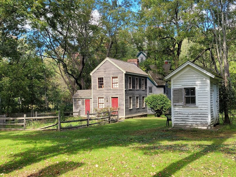
A walk through Waterloo reveals more than a scattering of picturesque old buildings. The village preserves the pieces of an entire working community, and each structure helps fill in a different part of the story.
The Smith Store stands among the most important. Built around the time the canal began operating, it supplied residents and passing boat crews while also serving as a convenient point for handling freight.
Nearby, the blacksmith shop recalls the daily repair work needed in a place dependent on mules, wagons, hand tools, and machinery. The gristmill ground grain with waterpower, while the neighboring industrial buildings supported lumber and plaster production.
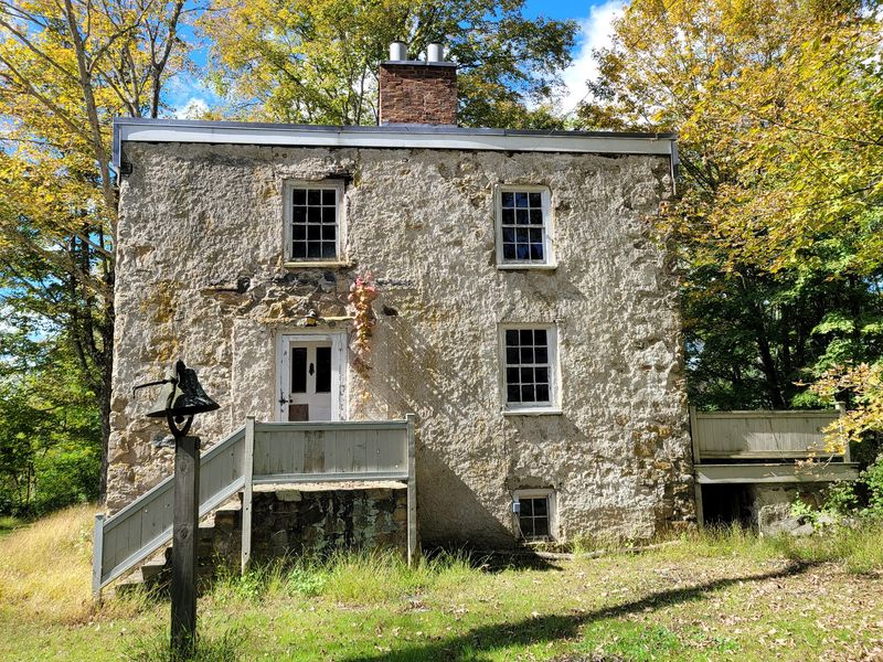
Residential architecture shows just how varied life could be within a small settlement. The stone tenant house provided comparatively modest quarters for workers and their families.
At the other end of the scale, the Peter D. Smith House, erected around 1870, displays a fashionable mansard roof associated with the Second Empire style.
The Seymour Smith House adds another grand Victorian presence, while the Smith homestead incorporates much older fabric dating to the area’s ironworking years. The Waterloo Methodist Church, established in 1859, still stands with its cemetery nearby.
There is also the Rutan Cabin, a late-18th-century log dwelling moved from Frankford Township to Waterloo in 1988. Its chestnut logs, clay chinking, and compact rooms present a much rougher version of early North Jersey life.
Several interiors are accessible only during tours or scheduled programs, so a casual visit may involve viewing some buildings from outside. Even then, the empty porches, mismatched rooflines, canal edge, and narrow village road create an absorbing walk.
Waterloo does not look like a neat collection assembled behind museum walls. It looks like a real town that stopped growing.
Winakung Reveals the Valley’s Much Older Lenape History
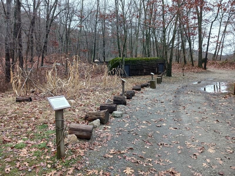
The canal era occupies only a small slice of the human story in the Musconetcong Valley. Long before the first freight boat passed Waterloo, Lenape communities lived throughout what is now New Jersey and the wider Delaware Valley.
Winakung, the reconstructed Native woodland setting at Waterloo, shifts attention away from the 19th-century shops and houses to that much deeper past.
Its name is commonly translated as “Place of Sassafras,” and the interpretive area uses structures, objects, and demonstrations to explore Lenape life before intensive European settlement transformed the region.
Bark-covered wigwams and longhouses illustrate how homes were built from woodland materials. Gardens, cooking areas, fishing displays, and hunting tools show how families drew food and other essentials from the land without treating the forest as an empty wilderness.
Corn, beans, and squash were cultivated, while fish, game, nuts, berries, and useful plants supplemented the harvest. Wood, bark, stone, bone, and plant fibers became shelter coverings, containers, cordage, tools, and clothing.
This is not merely a preface to the canal story. Indigenous history in the region reaches back thousands of years, and many familiar local names—including Musconetcong, Allamuchy, Hopatcong, Netcong, and Kittatinny—reflect that enduring presence.
Winakung also gives visitors a clearer way to read the surrounding landscape. The river becomes a food source and travel corridor.
The forest becomes a pantry, pharmacy, workshop, and building supply. Programs may include hands-on interpretation of wilderness skills, woodland resources, foodways, and Lenape village life, although access can depend on the day and scheduled activities.
Placed beside Waterloo’s preserved canal community, Winakung makes an important point quietly but firmly: the story of this valley did not begin when industry arrived.
What to Know Before Visiting Waterloo Village
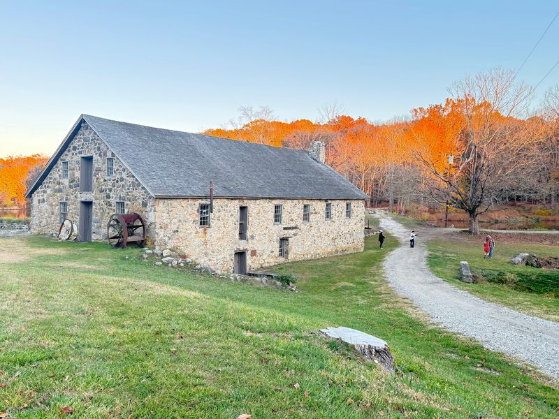
A bit of planning separates a satisfying Waterloo visit from arriving to find every historic interior locked. The grounds are generally open daily from dawn to dusk, and admission and parking are free.
Visitors can still walk the village road, follow the canal, see the buildings from outside, and connect with nearby trails when formal programming is not running. For the fuller experience, weekends are the better bet.
Guided tours are generally offered on Saturdays and Sundays from June through September between 10 a.m. and 3:30 p.m. The Visitor Interpretive Center typically opens on weekends from May through October during the same hours.
The Canal Society of New Jersey operates its museum and selected exhibits on a more limited schedule, so anyone hoping to see the canal artifacts, gristmill, or preserved section of a Morris Canal boat should confirm the day’s openings before making a special trip.
Start at the visitor center when it is open and pick up a map, since the property extends beyond the most obvious row of houses.
Wear shoes suited to unpaved, uneven, and occasionally hilly paths. Accessibility varies among the historic structures, and visitors who need specific accommodations can contact the site in advance at 973-347-1835.
Leashed dogs are permitted on the grounds. There is no village restaurant waiting at the end of the walk, so bringing water and a packed lunch makes sense; shaded benches and picnic tables provide places to stop.
Waterloo Village sits at 526 Waterloo Road in Stanhope, and a car is by far the simplest way to reach it. On a quiet day, the practical comforts recede quickly, leaving little more than the canal, the wooded hills, and a road lined with the remains of a town built for traffic that no longer comes.