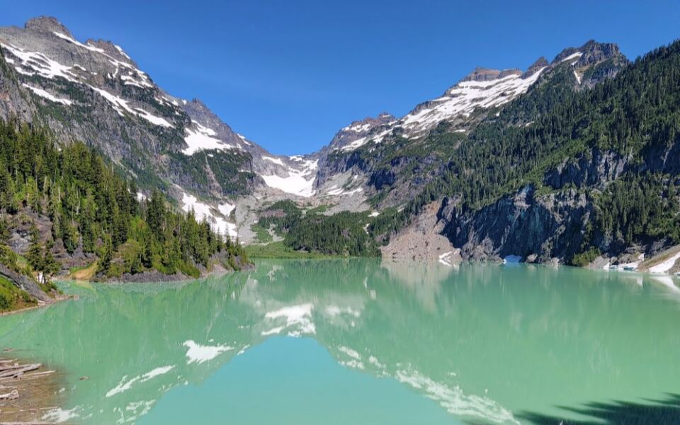
Getting to this turquoise lake means climbing a ridge, then heading downhill to the water. It’s worth remembering that descent while you’re sitting on the shore.
You’ll have to climb back out before the hike home is done.
With roughly 3,300 feet of elevation gain, this is an outing that asks for a full day’s attention. Even reaching the trail involves a long gravel-road drive, with cell service fading as the forest closes around you.
But the lake gives you something specific to look forward to. The trees open onto milky blue-green water surrounded by towering peaks, with a glacier tucked against the far shore.
It’s the kind of setting I’d want time to sit with after working so hard to reach it.
That pause by the water is only one part of the day, though. The ridge, the descent, and that uphill stretch on the return all shape the experience.
Looking at the whole route makes the color waiting at the end feel even more remarkable, and helps explain what reaching it really takes.
That Color Is Real, And It Comes From A Glacier
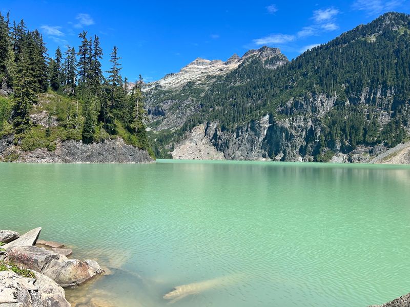
Blue-green water this bright usually needs a filter. The Blanca Lake Trailhead near Gold Bar, Washington, leads to a lake that skips the editing entirely.
Columbia Glacier sits at the far end of Blanca Lake. As the ice moves, it grinds rock into a powder called glacial flour.
Those tiny particles float in the water and scatter sunlight. The result is a milky turquoise shade that shifts with the sky and the season.
Sunny days bring out the brightest color. Clouds and fog can mute it, so checking the forecast before you go really pays off.
The lake sits inside the Henry M. Jackson Wilderness.
That protected status keeps the area wild, with no roads or buildings crowding the shoreline.
Monte Cristo Peak, Kyes Peak, and Columbia Peak rise around the basin. Together they frame the water like a giant stone bowl.
Your first look happens fast near the end of the trail. One moment you’re picking through trees, and the next, that color stops you cold.
Fun fact for your trail buddies: blanca means white in Spanish. It’s a funny name for a lake known for its blue.
Your Thighs Will Have Opinions About These Switchbacks
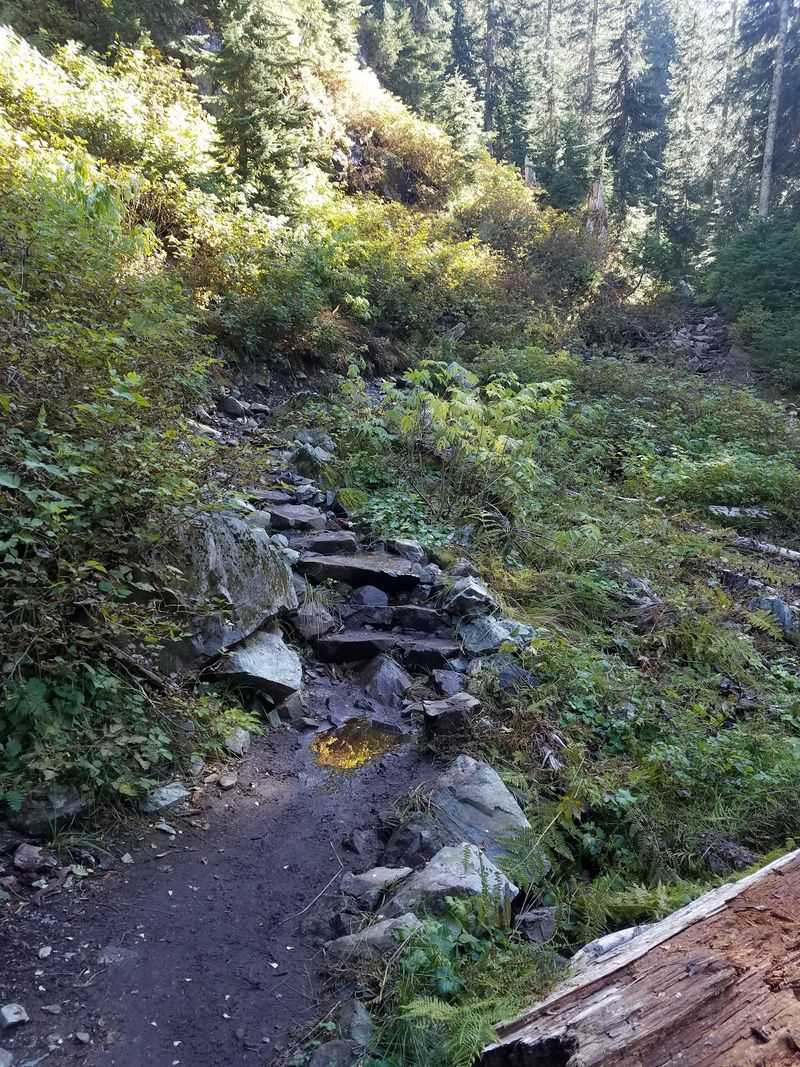
Switchbacks start almost right away. The trail climbs steadily through the forest with very little flat ground to rest your legs.
Washington Trails Association lists the round trip at about 7.5 miles. It also notes roughly 3,300 feet of elevation gain, which explains the burning calves.
The surface keeps you busy too. Roots, rocks, and big steps show up often, and rain turns sections slick and muddy.
Plan for a long day. Many hikers need most of the daylight hours to climb, enjoy the lake, and return safely.
Trekking poles help a lot here. They save your knees on the descents and give you balance over tangled roots.
Sturdy hiking boots matter just as much. Sneakers can work in dry weather, but good grip makes the steep parts far less stressful.
Pace yourself early instead of racing the first mile. Short, steady breaks beat one dramatic collapse halfway up.
Here’s a quiet bonus. Big old trees line much of the climb, so you get shade and scenery while you puff along.
Virgin Lake Gives You A Breather Before The Big Drop
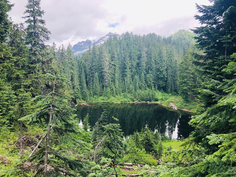
Relief arrives at the top of the ridge. After the long climb, the trail levels out near little Virgin Lake.
The pond is small and quiet, surrounded by subalpine trees and meadows. Mountain views start opening up, and you can finally stand up straight.
Many hikers stop here for a snack. It makes a smart spot to refuel before the next section tests a different set of muscles.
Now comes the sneaky part. Blanca Lake sits below the ridge, so the trail drops roughly 600 feet to reach the shore.
That descent is steep and rocky in places. Slow, careful steps work better than speed, especially if the ground is wet.
Keep the math in mind before heading down. Every foot you descend becomes a foot you’ll climb again on the way back.
Save some energy and water for that return climb. It feels much harder after a long lunch and a few hundred photos.
Still, the final stretch delivers the payoff. Peeks of turquoise through the trees will pull you forward like a magnet.
Bring Patience For The Bumpy Road To The Trailhead
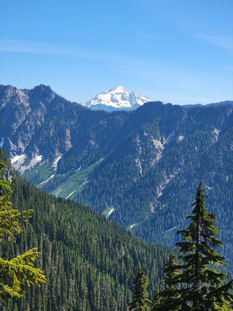
Getting there counts as part of the adventure. The trailhead sits at the end of Forest Road 63, a gravel route deep in the woods.
Most drivers come up Highway 2 to Skykomish. From there, Beckler Road climbs north before the turn toward the trailhead.
The official listing uses Blanca Lake Trailhead, Gold Bar, WA 98251, United States. The actual parking area lies well beyond town, so plan your route ahead.
Potholes can be large on the gravel stretches. The trailhead is currently inaccessible by car because of road closures and bridge damage.
Road conditions change from year to year. Washouts have closed parts of the forest roads before, so check current reports before leaving home.
Your phone may lose signal after the last towns. Download offline maps and directions while you still have service.
Fill your gas tank early too. Services are scarce once the pavement ends, and nobody wants a fuel-gauge panic in the forest.
Expect dust on dry summer days. A freshly washed car won’t stay shiny for long.
Grab A Pass Before You Lace Up
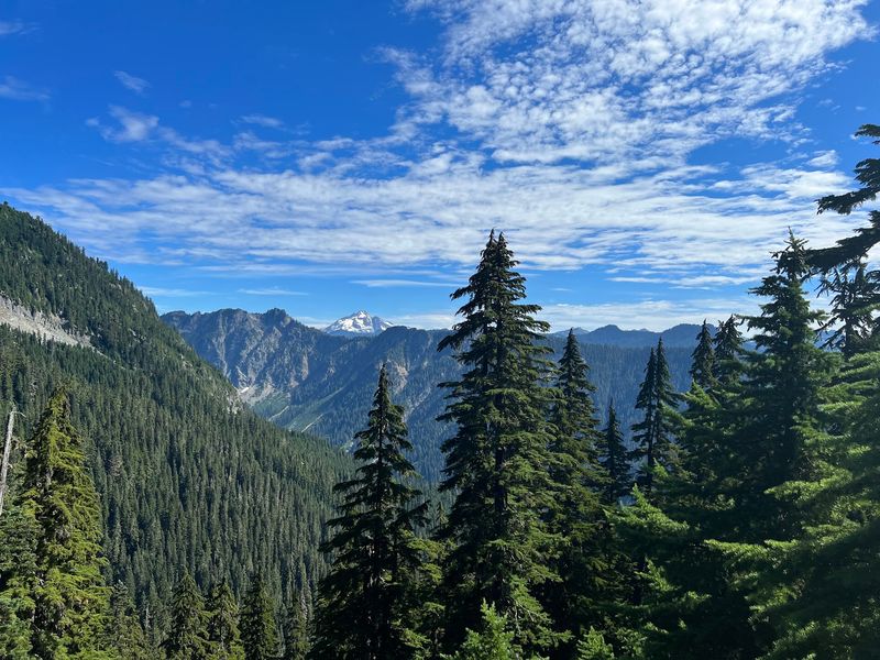
Paperwork isn’t exciting, but it keeps your day smooth. Parking at the trailhead requires a Northwest Forest Pass.
An America the Beautiful interagency pass also works. Display it clearly in your vehicle before heading up the trail.
Buy your pass before the trip. Cell service is unreliable here, so sorting it out at home saves headaches.
The area falls within Mount Baker-Snoqualmie National Forest. Rangers manage the trail and parking, so passes help support upkeep.
The Forest Service asks visitors to sign the trailhead register before hiking.
Permits help land managers track how many people use the area. That information guides decisions about trail work and restoration.
The lot can fill up on summer weekends. Arriving early gives you better odds of finding a space and more daylight for the hike.
Weekdays tend to feel calmer overall. If your schedule allows, a midweek visit may give you a little more breathing room at the lake.
Huckleberry Snacks Grow Right Along The Trail
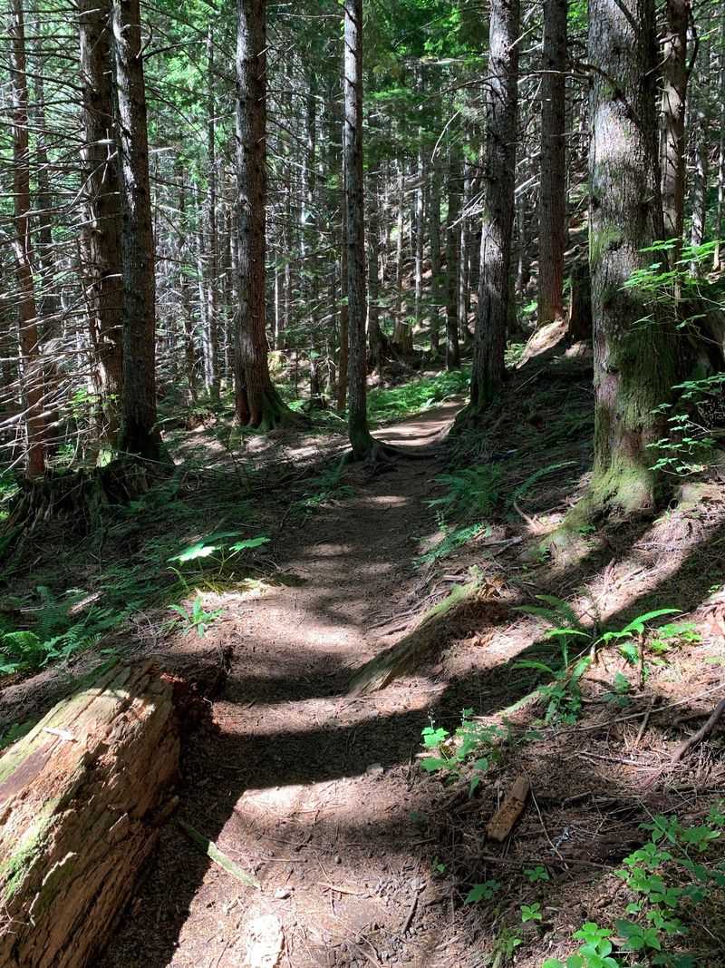
Late summer adds a tasty bonus to the climb. Huckleberry bushes grow along parts of the trail, especially higher up.
The berries usually ripen in August and early September. Timing varies with snowmelt and weather, so some years bring more than others.
Only pick berries you can identify with certainty. If you’re unsure, admire them and keep walking.
Leave plenty for wildlife too. Birds, chipmunks, and bears depend on these berries for energy before winter.
Speaking of wildlife, keep your eyes open on rocky slopes. Marmots and pikas often live in alpine terrain like this.
Store food carefully and never feed animals. Human snacks can harm them and teach bad habits.
Bugs also love summer in the Cascades. Mosquitoes can be fierce near the water, so pack bug spray and long sleeves.
Autumn brings another treat as the huckleberry leaves turn red and orange. The slopes glow with color, and the crowds often thin out.
Cold Water Swims Are For The Brave Only
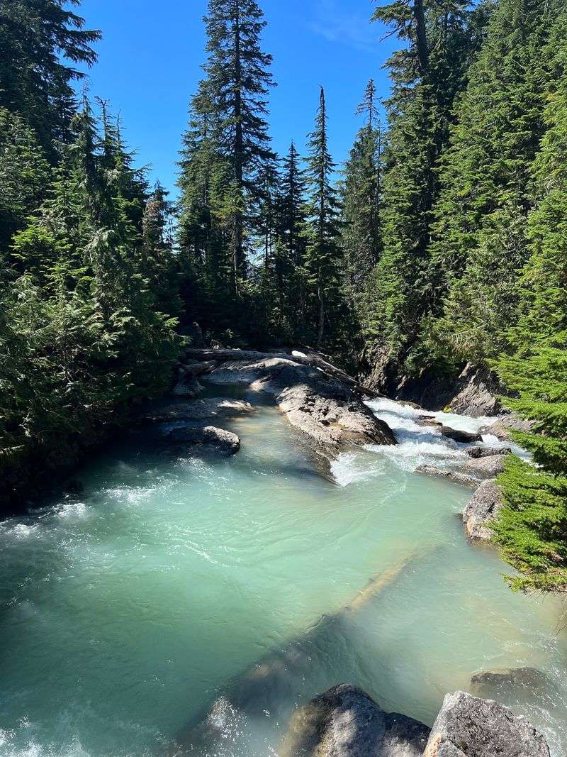
Glacier water feels exactly as cold as it sounds. Some hikers take a quick dip in summer, but expect a shocking chill.
Bring a towel and dry layers if you plan to swim. Mountain weather can shift quickly, and wet clothes cool you down fast.
A logjam sits near the lake’s outlet. Walking across it may look fun, but slippery logs can be risky.
The shoreline is rocky with limited flat spots. Find a safe perch for lunch and enjoy the view of the glacier across the water.
Shore exploring offers plenty of reward too. The color changes as you move around, from bright turquoise to softer jade.
Practice Leave No Trace while you’re there. Pack out all trash, including fruit peels and wrappers.
Fragile plants grow near the shore. Stick to established paths so the area can recover from heavy use.
Above all, watch the clock. Lingering is tempting, but you still have that climb back up to the ridge ahead.
Overnight Plans Need A Little Extra Homework
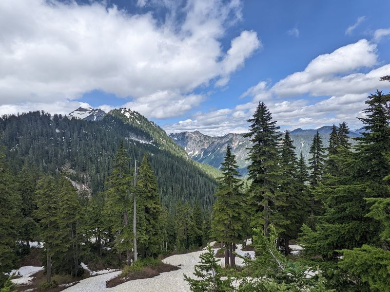
Camping near the lake sounds dreamy, and it’s possible with planning. Rules here are designed to protect a heavily visited area.
Camping is prohibited within half a mile of Blanca Lake. Established sites near Virgin Lake are an alternative.
Many backpackers use sites near Virgin Lake on the ridge instead.
Check current Forest Service rules before your trip. Regulations can change as restoration work continues.
Wilderness rules limit group sizes in the Henry M. Jackson Wilderness.
Keeping groups small reduces damage to plants and soil.
Campfires are prohibited at Blanca Lake, so bring a backpacking stove for cooking. A small backpacking stove handles cooking without scarring the land.
Overnight trips let you see the area in softer light. Sunsets and sunrises can make the ridge feel peaceful and calm.
Pack warm layers even in summer. Nights in the Washington Cascades often drop to chilly temperatures.
Carrying a full pack up those switchbacks adds challenge. Lighter gear makes a real difference, so trim the extras before hitting the trail.
Timing Your Trip Makes All The Difference
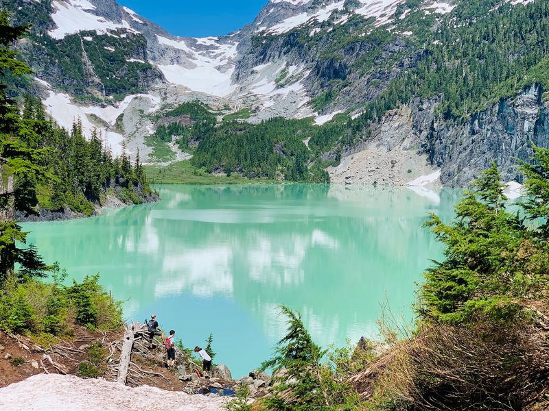
Snow hangs around longer than many people expect. Early summer can still bring snow patches near the ridge and lake.
July through September usually offers the best conditions. The trail tends to be drier, and the lake’s color shines in sunlight.
Winter turns the area into a different world. Snow and ice can make the steep sections dangerous, and roads may become impassable.
Start early no matter the season. Daylight runs out faster than you think on a long, steep hike.
Carry a headlamp just in case. Phone flashlights drain batteries quickly and don’t light the trail well.
Pack the essentials, including plenty of water, snacks, and a map. Rain gear and a first aid kit are smart too.
Let someone know your plans before you leave. Limited cell service means help may be slow to reach you.
Get it right, and you’ll stand beside one of Washington’s most striking alpine lakes. That turquoise view makes every sore muscle feel completely worth it.
Share this story