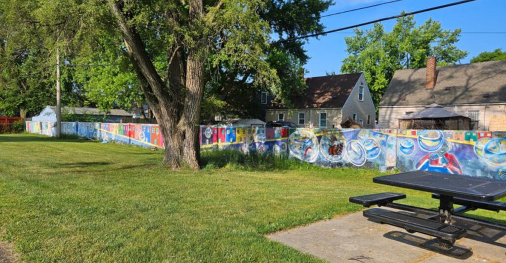
Detroit has landmarks that celebrate triumph, creativity, and reinvention, but the Birwood Wall tells a much harder story. Near Eight Mile Road, this concrete barrier stretches for roughly half a mile through a quiet residential area, carrying one of the city’s most painful and important chapters.
Built in 1941, the wall was created to separate a Black neighborhood from a white one, tied to the racist housing practices and federal lending policies that shaped American cities for generations. For years, many people outside the community barely knew it existed.
Today, the wall stands as a designated historic landmark and a sobering reminder of how segregation was not just written into policy, but built directly into the landscape. It is the kind of place that asks visitors to slow down, look closely, and reckon with the history still standing in plain sight.
A Wall Built From Bias: The Origin Story
Before a single brick was laid, the plan behind the Birwood Wall had already decided who belonged where. In 1941, a real estate developer named James Doyle wanted to build homes for white families in a northwest Detroit neighborhood near Eight Mile Road.
The problem, according to federal lending standards at the time, was that a Black neighborhood sat too close by.
The Federal Housing Administration had policies that essentially redlined communities of color, refusing to back mortgage loans in or near predominantly Black areas. To qualify for federal financing, Doyle proposed a solution that was as blunt as it was cruel: build a concrete wall to physically separate the two communities.
The FHA agreed, and construction began.
The wall runs approximately half a mile along Birwood Street, standing about six feet tall and built from poured concrete. It was not a property fence or a garden divider.
Its entire purpose was racial exclusion, a government-sanctioned boundary that told Black residents they were considered a financial liability by the very institutions meant to help Americans build wealth through homeownership.
Understanding that origin makes standing next to the wall a different experience than reading about it. The structure looks unremarkable at first glance, the kind of long concrete barrier you might pass without a second thought.
But the story embedded in it reframes everything. Federal money, private development, and racial policy combined in 1941 to produce a half-mile monument to inequality that still stands today in Michigan.
Gerald Van Dusen documented this history in depth in his book “Detroit’s Birwood Wall: Hatred and Healing in the West Eight Mile Community,” which remains one of the most thorough accounts of how the wall came to exist and what it meant to the people who lived in its shadow.
Concrete Evidence of Redlining in Detroit, Michigan
Redlining is a term that shows up frequently in conversations about systemic racism, but the Birwood Wall makes it physical. Most examples of redlining exist in documents, maps, and policies.
This wall is different. You can walk up and touch it.
The term itself comes from the practice of literally drawing red lines on city maps to mark neighborhoods deemed too risky for investment, almost always because Black families lived there. Banks and federal agencies used these maps to deny loans, block insurance coverage, and prevent Black homeowners from building equity.
The Birwood Wall was the architectural result of that same logic applied to a specific plot of land in Detroit.
When the FHA required the wall as a condition for financing, it was not acting outside the norm. It was following a nationwide playbook that shaped American cities for decades.
The difference in Detroit is that the playbook left behind a visible, permanent structure instead of just paperwork buried in an archive.
Neighborhoods on both sides of the wall were affected in distinct ways. The white families who moved into the new development gained access to federally backed loans, rising property values, and generational wealth.
The Black families on the other side were systematically excluded from those same opportunities. That gap in wealth accumulation did not disappear when the wall stopped being enforced.
Its effects rippled forward through generations.
Walking along Birwood Street today, the wall runs parallel to quiet residential blocks. The houses nearby are modest and lived-in, the kind of neighborhood that has held its community together through significant economic pressure.
The wall itself, now covered in murals, stands as concrete proof that redlining was never just a policy on paper. It was a boundary drawn in cement.
Murals That Transformed the Surface of Segregation
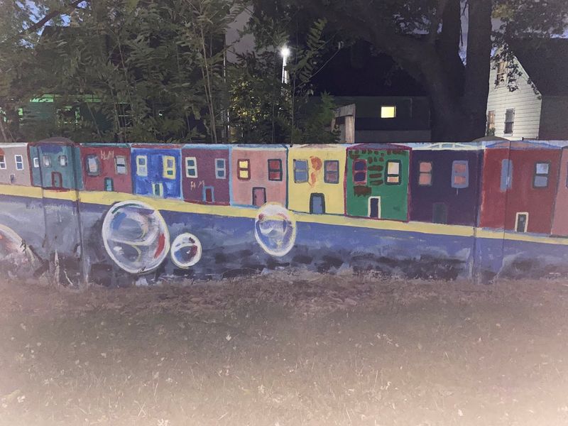
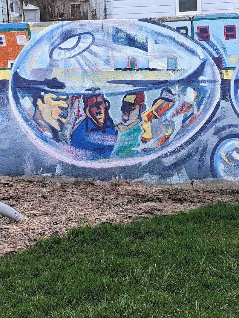
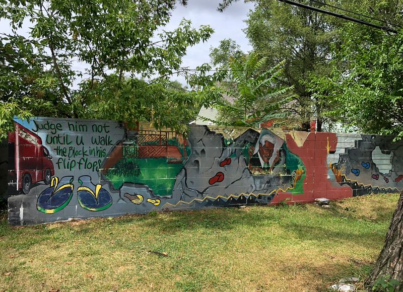
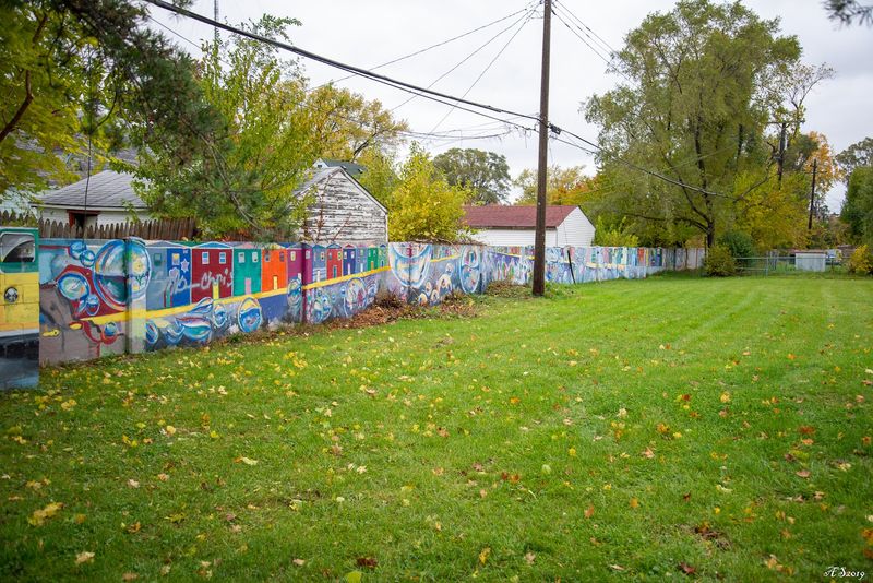
Paint changed the conversation around this wall without erasing what it represents. At some point after the wall’s original purpose faded, community members and local artists began covering its concrete surface with murals, turning a symbol of exclusion into a canvas for expression.
The result is layered and complicated in the best possible way.
The murals vary in style and subject. Some feature portraits of community members and neighborhood figures.
Others incorporate cultural imagery, patterns, and scenes of everyday life in the West Eight Mile area. None of them are slick or gallery-polished, and that rawness is part of what gives them weight.
These are not decorations placed by a city beautification committee. They grew from the community itself.
One visitor put it plainly: the artistic quality of the murals is not really the point. The point is standing in front of a wall that was built to separate human beings and seeing that same wall covered in their faces, their stories, and their presence.
The murals flip the original intention without pretending the history did not happen.
That tension is visible in real time. A structure designed to say “you do not belong here” now carries images that insist on belonging.
The community did not tear the wall down or ignore it. Instead, they claimed it, which is a form of resistance that requires looking the history directly in the face.
Not every mural has survived the years in perfect condition. Weather and time have worn some sections more than others.
But the overall effect along the wall’s length is still striking, especially for first-time visitors who arrive without knowing what to expect. The murals do not soften the history.
They make it impossible to look away from it.
The 2022 Historical Marker and Why Recognition Took So Long
For most of the wall’s existence, there was no official marker, no government sign, and no public acknowledgment that this structure had any historical significance. People who grew up in the neighborhood knew what it was.
Researchers and historians knew. But for the broader public, the Birwood Wall was largely invisible in the official record.
That changed in 2022 when a historical marker was finally installed at the site. The designation formalized what the community had long understood: this is not just a concrete wall in a Detroit neighborhood.
It is a documented piece of American history tied directly to federal housing policy, racial segregation, and the mechanics of inequality that shaped cities across the country.
The delay itself says something. Decades passed before the wall received any kind of official recognition.
During that time, it sat in a residential neighborhood without interpretation, without context for outsiders, and without the infrastructure that other historical sites typically receive. Some reviews from visitors over the years noted the absence of any signage, expressing frustration that a site this significant had been left unmarked for so long.
The marker’s arrival in 2022 brought new attention, including news coverage that introduced the wall to audiences who had never heard of it. But recognition alone does not address the broader concerns some community members have raised about the site’s condition and the resources allocated to its upkeep and preservation.
Historical designation is a starting point, not a finish line. The marker gives visitors context and gives the site a place in the official record.
Whether that recognition translates into meaningful investment in the surrounding community is a separate and ongoing question. The wall waited eighty years for a plaque.
The neighborhood has been waiting longer for equitable resources.
What the West Eight Mile Neighborhood Looks Like Today
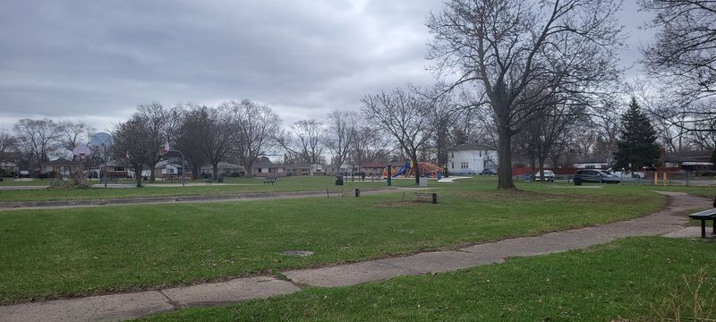
Standing on Mendota Street near the wall, the surrounding neighborhood feels like a place that has absorbed a lot of history and kept going anyway. The houses are close together, with mature trees lining the sidewalks and small front yards that show signs of careful attention.
This is a lived-in community, not a preserved exhibit.
The West Eight Mile area has faced the same economic pressures that hit many Detroit neighborhoods hard over the past several decades. Population shifts, disinvestment, and the long aftermath of policies like redlining left marks that go well beyond a single concrete wall.
But the neighborhood has maintained a strong sense of identity, and residents who grew up here often speak about it with genuine affection and pride.
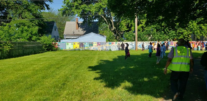
The small park area near the wall is accessible and open, but it is not a polished tourist destination. There is limited parking nearby, and the site does not have a visitor center or guided tour infrastructure.
For some, that simplicity is part of the experience. For others, it highlights the gap between the site’s historical importance and the resources dedicated to it.
Community block clubs and local advocates have pushed for improvements over the years, calling for better landscaping, playground equipment, and safer conditions for seniors and children who use the space. Those conversations are ongoing and reflect a broader tension between historical recognition and practical neighborhood investment.
The wall itself runs along the back edge of the park area, easy to find once you know where to look. First-time visitors often describe the experience of rounding the corner and seeing it for the first time as unexpectedly powerful.
The wall does not announce itself. It simply stands there, patient and concrete, waiting to be understood.
How to Visit and What to Expect When You Arrive
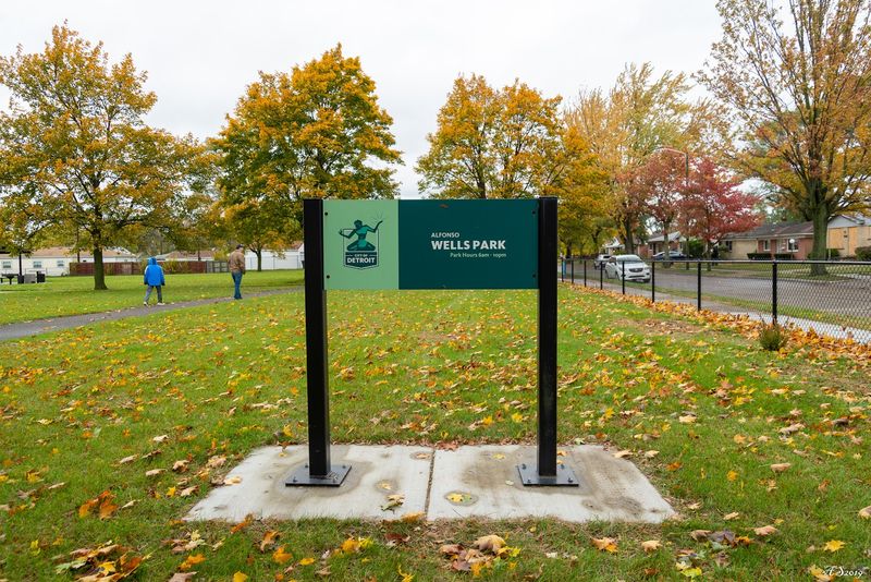
Getting to the Birwood Wall is straightforward, but it helps to know what you are walking into. The address associated with the site is 20194 Mendota Street in Detroit, and the wall runs along Birwood Street in the West Eight Mile neighborhood.
Plugging either street into a navigation app will get you close enough to find it on foot.
Parking is limited in the surrounding residential area, so plan to park on a nearby street and walk a short distance. The visit itself does not take long.
Most people spend somewhere between ten and twenty minutes walking the length of the wall, reading the historical marker, and taking in the murals. There is no admission fee, no ticket booth, and no scheduled hours.
The site is outdoors and accessible during daylight.
Coming with some background knowledge makes the experience significantly more meaningful. Reading about the wall’s history before you arrive, or picking up Gerald Van Dusen’s book on the subject, gives you a framework for interpreting what you are seeing.
Without that context, the wall can look like an ordinary concrete barrier with some painted artwork on it. With that context, every inch of it means something different.
The site is open to everyone and sees a mix of visitors, from Detroit residents revisiting a piece of their city’s past to out-of-town travelers who stumbled across it while researching the area. There are no crowds, no audio tours, and no souvenir stands.
The experience is quiet and self-directed, which suits the subject matter.
Bringing children is entirely appropriate. The wall opens a conversation about fairness, housing, and history that is relevant at any age.
Younger visitors often ask direct questions that lead to some of the most honest discussions adults can have about this chapter in American life.
Why This Wall Matters Beyond Detroit’s Borders
The Birwood Wall is a Detroit story, but its implications stretch far beyond city limits. Segregation walls, redlined maps, and racially restrictive housing covenants were not unique to Michigan.
They were tools used across the United States to concentrate wealth in white communities and systematically exclude Black families from the same opportunities. Detroit just happens to have left one of those tools standing in plain sight.
That visibility is rare and historically valuable. Most of the physical infrastructure of segregation has been demolished, paved over, or quietly erased.
The Birwood Wall survived, which makes it an unusually direct point of contact with a history that many Americans learn about in abstract terms but rarely encounter in physical form.
Scholars, educators, and journalists have increasingly turned to the wall as a teaching tool precisely because it makes the abstract concrete, literally. When students visit and stand next to a structure built by a federal policy designed to keep Black families from accumulating wealth, the textbook definition of systemic racism takes on a different weight.
There is also something important about the fact that the wall still stands in a living neighborhood, not a museum. The people who live nearby are not exhibits.
They are residents whose families navigated the consequences of this wall across generations. That proximity between history and present-day community is not incidental.
It is the whole point.
No city has a monopoly on this kind of history. But Detroit, through the Birwood Wall, has one of the clearest surviving examples of how housing segregation was physically constructed in mid-century America.
Recognizing that does not require turning the site into a spectacle. It only requires showing up, paying attention, and being willing to sit with what the wall actually represents.
Share this story