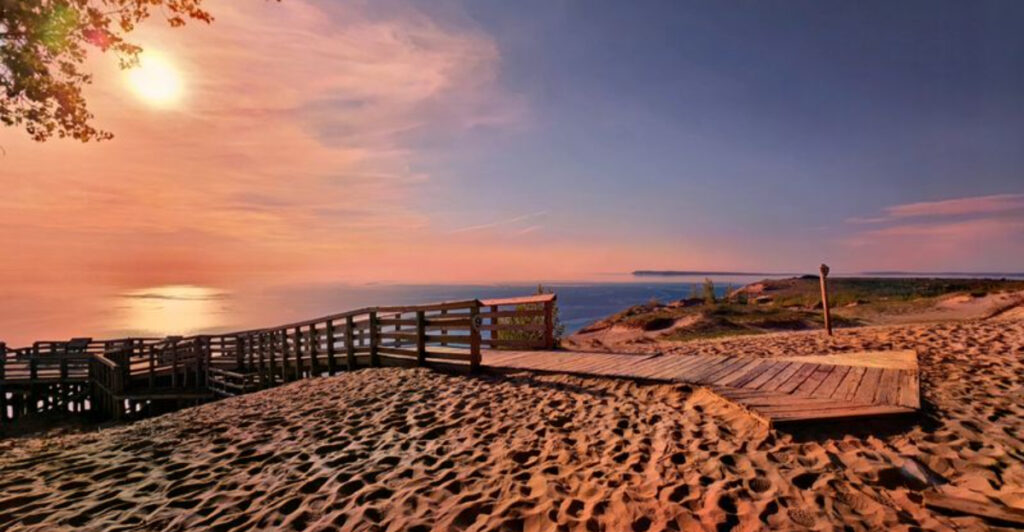
Michigan’s M-22 highway is one of those rare roads where the drive itself is the destination. Stretching along the northwestern Lower Peninsula, it winds past towering sand dunes, sparkling Lake Michigan shoreline, and two of the state’s most celebrated wine regions.
Whether you’re chasing sunsets over open water or hunting for the perfect Pinot Noir, this route delivers something memorable at every mile marker. Pack a cooler, roll down the windows, and let Michigan’s most scenic highway do the rest.
The M-22 Corridor: Michigan’s Most Celebrated Scenic Drive
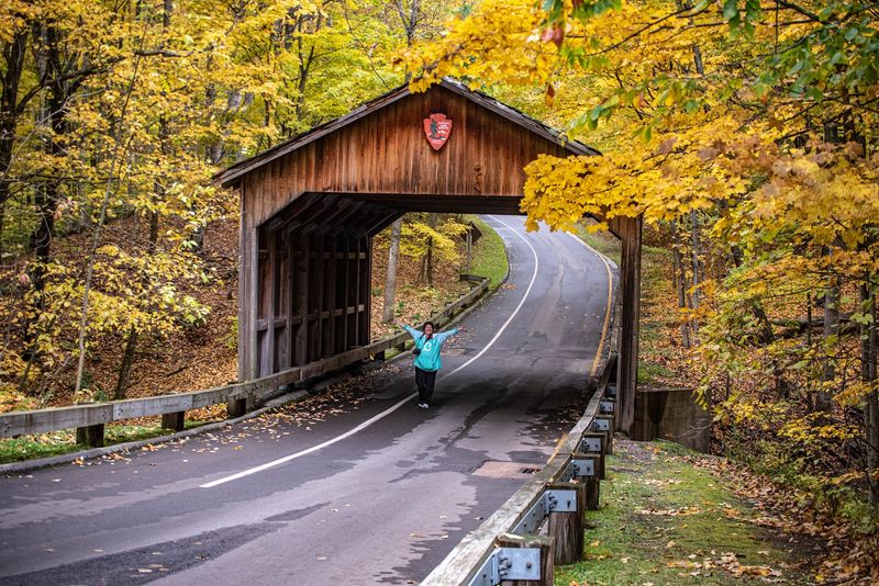
Pull up a map of Michigan’s northwestern Lower Peninsula and you’ll notice a thin highway hugging the coastline like it was drawn by someone who refused to take the boring route. That’s M-22, a 116-mile state highway that begins near Manistee and loops through Benzonia, Frankfort, Empire, Glen Arbor, and Suttons Bay before connecting back to Traverse City.
It’s not a shortcut to anywhere — it’s a deliberate meander through some of the most visually striking terrain in the Midwest.
The road earned its cult status honestly. Locals slap the M-22 logo on bumper stickers and hats not just as a regional badge, but as a genuine declaration of love for a stretch of pavement that rewards slow travel.
Cornfields give way to cherry orchards, which give way to towering bluffs, which give way to vineyard rows that catch the afternoon light like brushstrokes on canvas.
What separates M-22 from other scenic byways is its variety. Within a single afternoon, a driver can pass through a working harbor town, stop at a freshwater beach with Caribbean-blue water, and end up sipping a dry Riesling at a hilltop winery.
The terrain shifts constantly — rolling hills, forest corridors, open farmland, and sudden lake vistas appear without warning.
Summer brings the biggest crowds, but shoulder seasons offer their own rewards. Fall color peaks here in late September and early October, when the maples and birches along the corridor explode into reds and oranges that frame every overlook dramatically.
Spring brings cherry blossoms and far fewer cars. Even winter, when snow blankets the dunes, turns M-22 into something almost otherworldly for those willing to brave the cold roads.
Sleeping Bear Dunes: The Towering Giants That Anchor the Route
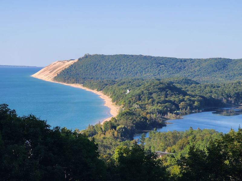
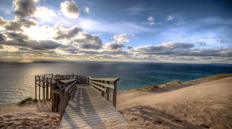
Standing at the base of the Sleeping Bear Dunes and looking up, the scale is genuinely hard to process. These dunes rise as high as 460 feet above Lake Michigan, making them among the tallest freshwater coastal dunes in the world.
They’re perched on glacial bluffs that were carved out during the last ice age, which gives them a foundation far more dramatic than typical beach dunes found along ocean coastlines.
The most famous stretch sits within Sleeping Bear Dunes National Lakeshore, a federally protected park that spans 35 miles of Lake Michigan shoreline and includes two offshore islands — North and South Manitou. The park was named after an Ojibwe legend about a mother bear who swam across Lake Michigan with her two cubs, only to wait on shore as her cubs, now the Manitou Islands, never made it to land.
Climbing the dunes is a rite of passage for visitors, but it’s genuinely harder than it looks. The loose sand grabs at every step, and the summit keeps appearing just over the next ridge.
What greets climbers at the top, though, is a panoramic view of Lake Michigan so wide and blue it barely looks real. On clear days, the Manitou Islands float in the distance like low green ships.
The Dune Climb, located just off M-22 near Empire, is the most accessible entry point, with a parking area and marked trail. More experienced hikers take on the Sleeping Bear Heritage Trail, a paved multi-use path that runs 27 miles through the park.
Either way, the dunes demand time and comfortable shoes — flip-flops will lose every argument with this terrain.
Lake Michigan Views That Stop Traffic — Literally
There’s a pull-off along M-22 near Glen Haven where drivers consistently stop mid-trip to stare. Not because anything is happening — no boats, no dramatic weather, no wildlife.
Just Lake Michigan sitting there in a color that doesn’t quite match any standard description of freshwater. Depending on the light and time of day, it shifts between deep cobalt, pale turquoise, and a milky jade that makes people reach for their phones before they’ve even stepped out of the car.
Lake Michigan is the third-largest of the Great Lakes and the only one entirely within the United States. Along the M-22 corridor, it’s never far from view, and several formal overlooks give travelers a chance to stop safely and take it all in.
The Empire Bluff Trail offers one of the most dramatic perspectives — a 1.5-mile round trip through forest that opens onto a bluff edge with an unobstructed 180-degree view of the lake and dune ridge.
The beaches along this stretch are also worth noting for their unusual character. Unlike ocean beaches, these shores have no tides, no salt, and no seaweed drift.
The water is cold even in summer, often hovering around 65 to 70 degrees Fahrenheit at peak season, but the clarity is remarkable. In shallow areas near the shore, the sandy bottom is visible at depths that would be murky in most other lakes.
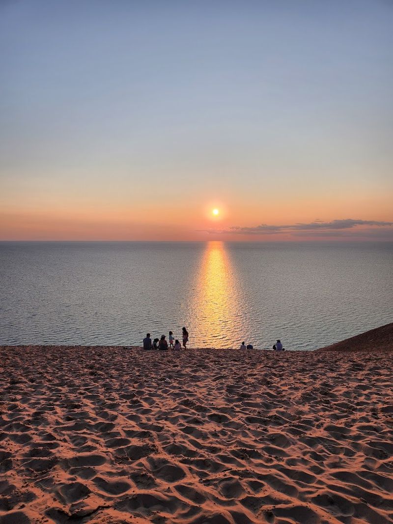
Sunset timing along M-22 is practically a competitive sport among regular visitors. Because the route faces west for much of its length, sunsets over the water are front and center every evening.
The stretch near Sleeping Bear Point tends to produce the most dramatic color displays, particularly in late summer when the atmospheric haze thins and the horizon goes full orange.
Leelanau Peninsula Wineries: Vineyard Country Right Off the Route
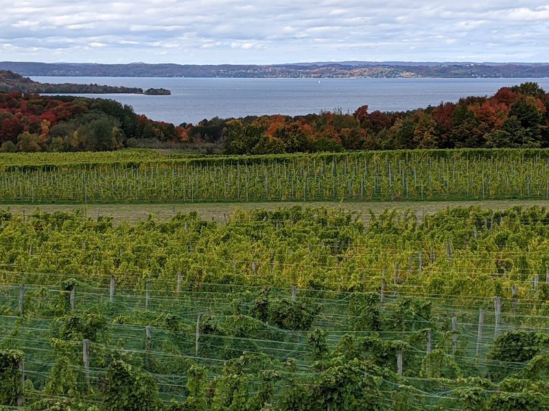
The Leelanau Peninsula juts northward from the M-22 corridor like a thumb reaching into Lake Michigan, and it happens to be one of the most productive wine regions in the entire Midwest. More than 25 wineries operate across this narrow strip of land, taking advantage of the lake effect climate that keeps temperatures moderated, extends the growing season, and gives the grapes a complexity that surprises first-time visitors expecting something simple.
Riesling is the peninsula’s calling card, and the dry and off-dry versions produced here hold their own against well-regarded European counterparts. Pinot Grigio, Pinot Noir, and Chardonnay also perform well in this climate.
Several wineries along the M-22 corridor have tasting rooms with outdoor decks that face the water, making the experience as much about the setting as the wine in the glass.
Chateau Fontaine, Shady Lane Cellars, and Bel Lago are among the well-established names on the peninsula, though newer producers continue to emerge. The region’s wine trail is loosely organized but easy to navigate — most tasting rooms are within a short drive of each other, and many are open daily from late spring through fall.
Weekends in July and August see the heaviest traffic, so mid-week visits offer a more relaxed experience.
The peninsula’s agricultural character adds texture to the wine trail experience. Between vineyards, the road passes cherry orchards, apple farms, and farmstands selling produce that was picked that morning.
Several wineries collaborate with local chefs for food pairings or seasonal events that blend the culinary and viticultural sides of the region into something genuinely satisfying. Bringing a cooler and planning a longer afternoon here is a practical and rewarding strategy.
Old Mission Peninsula: The Second Wine Region Along M-22’s Southern Arc
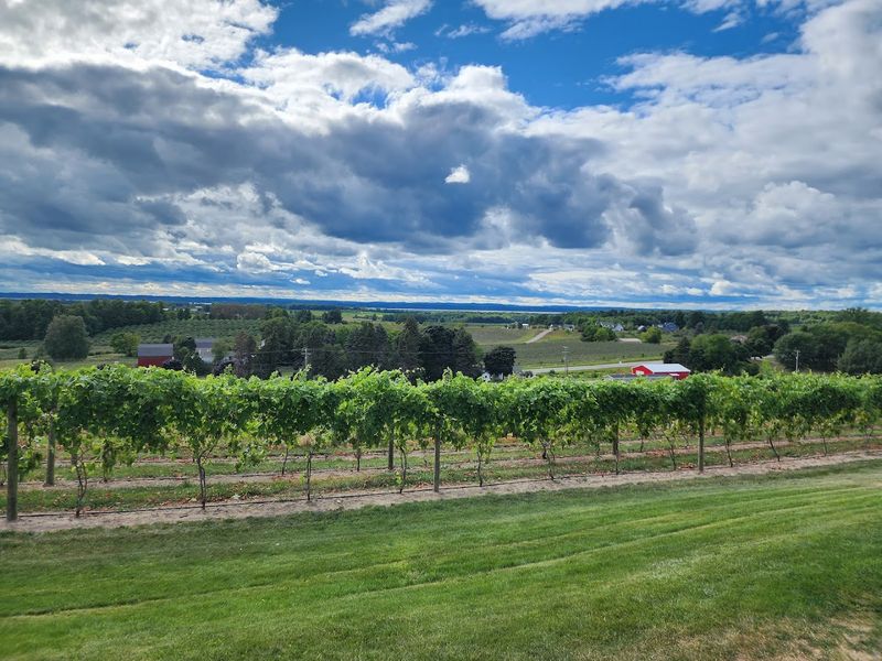
Where Leelanau gets the spotlight, Old Mission Peninsula quietly earns its own devoted following. This narrow 18-mile peninsula divides Grand Traverse Bay into two arms and sits almost exactly on the 45th parallel — halfway between the equator and the North Pole — a geographic detail that winemakers here cite as a key reason the terroir produces such consistently expressive fruit.
M-22 connects to this region as the route curves toward Traverse City, making it a natural second stop on any wine-focused road trip.
Old Mission has fewer wineries than Leelanau, but the concentration of quality is notable. Brys Estate, Chateau Chantal, and Black Star Farms’ Old Mission location are frequently mentioned by serious wine drinkers as standout producers.
Chateau Chantal in particular occupies a hilltop position with sweeping views of both bays — east and west — making it one of the most visually striking winery settings in the state.
The peninsula’s climate benefits from being surrounded by water on three sides, which buffers against the hard freezes that can damage vines. The result is a longer growing window that allows grapes to develop more nuanced flavors.
Gewurztraminer, Pinot Blanc, and late-harvest dessert wines are among the specialties that visitors consistently single out as worth seeking.
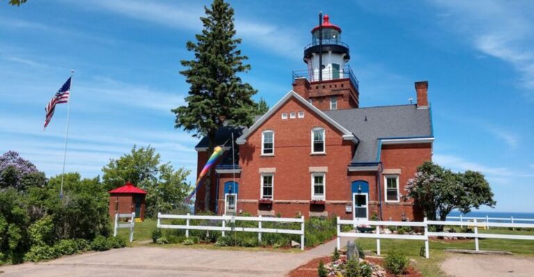
Beyond wine, Old Mission offers a lighthouse at its northern tip that dates to 1870 — one of the most photographed landmarks in northern Michigan. The surrounding Old Mission Peninsula State Park provides hiking access to the shoreline and bluff trails.
Combining a winery tour with a walk to the lighthouse and a picnic on the bay makes for a full day that covers food, scenery, and local history without feeling rushed or overplanned.
Planning Your M-22 Road Trip: Timing, Towns, and Practical Tips
Driving all 116 miles of M-22 in one shot is technically possible, but anyone who tries it without stopping is missing the entire point. The route is best treated as a two-day experience at minimum, with overnight stays in towns like Frankfort, Glen Arbor, or Suttons Bay breaking the journey into manageable and enjoyable segments.
Each of these towns offers lodging options ranging from lakeside motels to boutique inns, and all have at least one good restaurant worth planning around.
Glen Arbor sits near the heart of Sleeping Bear Dunes National Lakeshore and functions as a natural base camp for dune exploration. Empire, just a few miles south, is smaller but has a National Park Visitor Center that provides trail maps, current conditions, and ranger programs during summer months.
Frankfort, at the southern end of the scenic stretch, has a working harbor, a beach with a breakwater pier, and a small downtown with coffee shops and local retailers.
The National Park entrance fee covers access to most of the Sleeping Bear Dunes facilities including the Dune Climb and Heritage Trail. Annual passes are available and worth considering for anyone planning multiple visits.
Parking at popular spots fills up fast on summer weekends, particularly at the Dune Climb lot, so arriving before 9 a.m. avoids most of the congestion.
Cell service is inconsistent along parts of M-22, particularly in forested stretches between towns. Downloading offline maps before departure is a practical move.
Gas stations are spaced out enough that a half-tank rule is worth following. The route has no tolls, no complicated navigation, and no shortage of places to pull over — the main challenge is simply deciding when to stop and when to keep going.
Share this story