Tucked along the northern shore of Lake Huron in Presque Isle County, Besser Natural Area is one of Michigan’s most quietly fascinating outdoor destinations. A short loop trail winds through old-growth forest before spilling out onto a sandy beach — but the real surprise is what the trail passes along the way: the scattered remnants of Bell, a 19th-century logging town that simply vanished.
The hike is easy enough for toddlers yet rich enough in history and scenery to hold adult attention from start to finish. If you’ve never heard of this place, you’re about to add it to your must-visit list.
The Ghost Town of Bell: Michigan’s Forgotten Logging Village
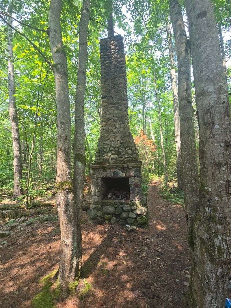
Long before the trail existed, Bell was a working town. During the late 1800s, the lumber industry tore through northern Michigan with remarkable speed, and Bell rose up along the Lake Huron shoreline as a direct result of that boom.
At its peak, the community had a sawmill, homes, a post office, and enough residents to fill a cemetery that still stands nearby.
When the timber ran out, the people left. Buildings were abandoned, nature moved in, and Bell effectively ceased to exist as a functioning place.
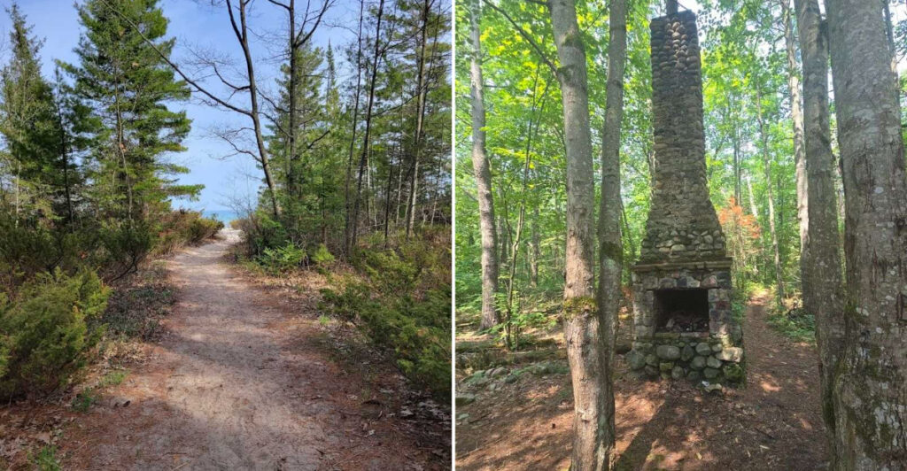
Today, Besser Natural Area preserves what little remains — mostly stone foundations and cellar depressions hidden beneath decades of forest growth.
Walking the trail, you pass these remnants without much fanfare. There are no dramatic interpretive signs or reconstructed buildings.
The ruins sit quietly among the roots and leaf litter, easy to miss if you’re not paying attention. That understated quality actually makes the experience more powerful — the forest has reclaimed nearly everything, and the silence feels earned.
Across the road from the main trailhead, a two-track path leads to the Bell Cemetery. The walk over is narrow in places but not difficult, and the cemetery itself is a sobering reminder that real families once called this stretch of lakeshore home.
Weathered headstones stand among the trees, some still legible, others worn smooth by more than a century of northern Michigan winters.
Bell isn’t famous. It doesn’t appear on most tourist maps.
But for anyone curious about the human stories layered beneath Michigan’s forests, this ghost town offers a rare, unpolished window into what the logging era actually left behind — not just stumps, but entire communities quietly swallowed by time.
The Trail Itself: A One-Mile Loop Anyone Can Handle
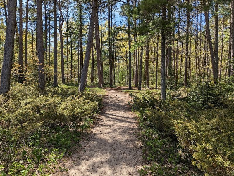
At just over a mile, the loop trail at Besser Natural Area doesn’t ask much of your legs. The path is well-maintained, clearly marked, and flat enough that a two-year-old can complete it without a stroller — which actually happens here regularly.
That accessibility is part of the appeal, but it doesn’t make the hike feel dumbed down or underwhelming.
The forest surrounding the trail is the real draw on the walking portion. Besser Natural Area protects a stand of old-growth white pines and hemlocks that were never logged, which is genuinely rare in this part of Michigan.
These trees are massive — tall, straight, and draped in a quiet that feels different from the second-growth forests most hikers encounter elsewhere in the state.
The trail surface shifts between packed dirt and sections of exposed root and rock, particularly near the shoreline. Footwear with decent grip makes the rocky beach transition smoother, especially after rain.
On wet days, toads appear in surprising numbers along the path, and the forest floor takes on a rich, mossy quality that rewards slower walking.
A separate spur path branches off toward the beach, giving hikers a choice between completing the full loop or cutting directly to the water. Most people do both, looping through the forest first and then spending time at the lake before heading back to the parking area.
The trail connects at its far end to a two-track route that eventually reaches another recreation area several miles away, opening up longer options for those who want them.
For families, solo hikers, or anyone short on time but hungry for a genuine outdoor experience, the loop delivers more variety per mile than its modest length suggests.
Old-Growth Forest That Survived the Logging Era
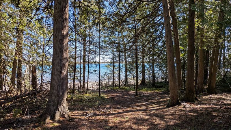
Most of Michigan’s original forest was stripped bare during the 19th-century lumber rush. What grew back is healthy and beautiful, but it’s not the same as what was there before.
Besser Natural Area holds something increasingly uncommon in the Great Lakes region: a genuine old-growth stand that loggers never touched.
The white pines here are enormous. Their trunks climb straight and thick before branching out far overhead, creating a canopy that filters sunlight into something soft and diffused.
Walking beneath them produces a specific kind of quiet — not silence exactly, but a muffled, cathedral-like stillness that feels distinct from ordinary Michigan woodland.
Hemlocks fill in the understory in places, keeping the forest floor cool and shaded even in midsummer. The ground beneath these trees tends to stay damp, which supports a dense layer of moss, ferns, and decomposing wood that gives the whole area a lush, almost primordial texture.
It looks exactly like what a forest is supposed to look like before humans start managing it.
This old-growth character is one reason Besser Natural Area carries the “natural area” designation rather than simply being called a park or trail. The Michigan Department of Natural Resources manages it with an eye toward preservation rather than development, which is why there are no paved paths, no interpretive kiosks crowding the trailhead, and no manicured landscaping softening the edges.
For anyone who has spent time in heavily developed recreation areas, the rawness here registers immediately. The trees are doing exactly what trees do when left alone for centuries — growing large, falling, rotting, and feeding the next generation.
That cycle, uninterrupted and ongoing, is the quiet spectacle Besser Natural Area puts on display every single day.
Where the Trail Meets Lake Huron: The Beach at the End
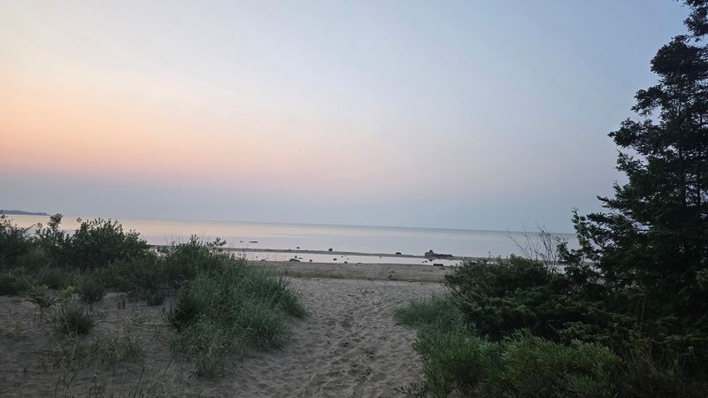
The trail doesn’t just loop through the woods and send you back to your car — it delivers you directly to the shore of Lake Huron, and the contrast hits hard. One moment you’re moving through dark, canopied forest; the next, you’re standing on an open beach with the lake spreading out in front of you, wide and brilliantly lit.
The beach itself is a mix of textures. Sandy sections appear in patches, smooth and pale, inviting enough that kids kick off their shoes without being asked.
But much of the shoreline is covered in smooth, colorful stones — agates, jasper, and other rock types that draw serious rock hounders to this stretch of Lake Huron. The variety is genuinely impressive, and low water years tend to expose even more of the rocky substrate for collecting.
The water is shallow near shore and clear enough to see the bottom several feet out. On calm days, swimming is comfortable and the visibility underwater is striking.
On windy days, the waves build quickly and the rocks underfoot become slippery, so conditions can shift the experience considerably. Checking the forecast before arrival makes a real difference if swimming is the goal.
No lifeguard is on duty at this beach. That’s worth knowing if you’re bringing young children, but it also means the atmosphere stays relaxed and uncrowded.
On most days, the beach is quiet — a handful of visitors spread out with plenty of space between them, which is increasingly hard to find on popular Great Lakes shorelines during summer.
Just offshore, the outline of a sunken ship is visible in the shallower water on calm days, adding one more layer of intrigue to an already well-stocked stretch of northern Michigan coastline.
The Sunken Shipwreck Visible From Shore
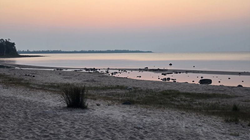
Not every short nature trail ends with a shipwreck. At Besser Natural Area, the beach delivers one as a bonus — no boat or snorkeling gear required.
Just offshore, the remains of an old wooden vessel rest in the shallows of Lake Huron, visible on calm days from the beach itself.
There are actually two wrecks associated with this stretch of shoreline. One sits in a small, sheltered pond-like area closer to land, while the other lies farther out in the lake.
The shallower wreck is the easier one to observe, with its dark wooden ribs and hull structure sitting just beneath the surface in water clear enough to reveal the lakebed around it. On a still morning with good light, the detail is remarkable.
Swimming out to the deeper wreck is possible but not always practical. Choppy conditions make the swim challenging, and the rocky bottom near shore requires careful footing.
The wrecks themselves are not marked with buoys or interpretive signs, which keeps the discovery feeling organic — you round a bend on the beach, look out, and suddenly realize there’s a ship down there.
The history of these particular wrecks isn’t extensively documented at the site, but the presence of wooden vessels in northern Lake Huron is consistent with the region’s long maritime history. This part of the lake saw significant commercial traffic during the lumber era, and shallow rocky shorelines claimed more than a few boats over the decades.
For families with kids, the wreck is an instant conversation starter. For anyone with even a passing interest in maritime history or underwater photography, it’s a genuinely compelling detail that elevates Besser Natural Area well beyond a standard woodland walk.
Rock Hounding, Wildlife, and Quiet Surprises Along the Way
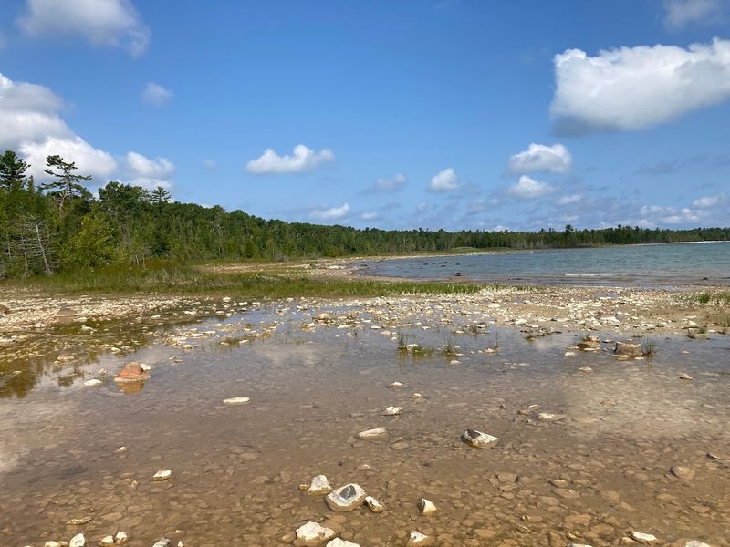
Besser Natural Area rewards the kind of visitor who moves slowly and pays attention. The beach alone offers enough variety to keep a curious person occupied for an hour — smooth stones in shades of red, orange, cream, and grey line the waterline, and dedicated rock hounders make regular trips specifically to search this stretch of Lake Huron shoreline for agates and other collectible specimens.
The rocky sections of beach require careful footing, particularly when wet. Slippery stones near the water’s edge are the most common minor hazard at this site, and the uneven terrain makes it worth wearing shoes with real grip rather than sandals if you plan to explore the full shoreline rather than sticking to the sandy patches.
Wildlife sightings are a regular part of the experience here, though not in a managed or predictable way. Water snakes bask on the warm rocks near the shoreline.
On rainy days, toads emerge in large numbers along the forest trail. The old-growth canopy supports bird species that favor mature timber, and the quiet of the area makes it easier to notice what’s moving in the branches overhead.
The natural area’s relatively low visitor numbers compared to more popular Michigan parks mean wildlife encounters happen at a natural pace rather than being crowded out by foot traffic. The parking area is modest in size, and the trail doesn’t have the capacity to absorb large tour groups, which keeps things genuinely calm on most days.
Rain doesn’t ruin a visit here — it transforms it. The forest floor deepens in color, the moss brightens, and the whole place takes on a moody, atmospheric quality that dry summer days don’t quite replicate.
Bringing a rain jacket and staying flexible with conditions opens up a noticeably different side of Besser Natural Area.
Planning Your Visit to Besser Natural Area in Presque Isle, Michigan
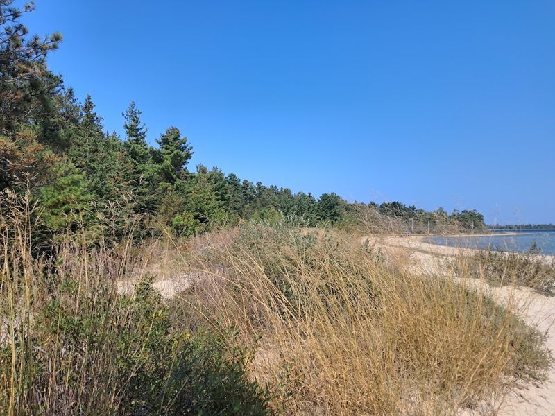
Besser Natural Area sits at 12057 E Grand Lake Rd in Presque Isle, Michigan — a rural stretch of the northern Lower Peninsula that takes some commitment to reach. The nearest larger town is Rogers City, roughly 20 miles to the southwest.
The drive up is scenic and the roads are manageable in good conditions, but the access road is unpaved and can become impassable after heavy snow or during early spring thaw.
The parking area is gravel, free to use, and large enough to handle a reasonable number of vehicles without feeling cramped. Restrooms are available on site, which matters on a trail this far from town.
Arriving early on summer weekends is a practical move — the lot isn’t enormous, and the combination of beach access and trail variety means this spot draws a steady stream of visitors during peak season.
The trail is accessible year-round in theory, but winter visits require preparation. The access road doesn’t get plowed regularly, and deep snow can make the forest sections difficult to navigate without snowshoes.
Late spring through early fall offers the most reliable conditions, with late summer and early fall being particularly good for rock hounding when lake levels expose more of the rocky shoreline.
No entrance fee is charged, and no reservation is required. Dogs are welcome on the trail with standard leash rules applying.
The loop trail is short enough that most visitors complete it in under an hour, but the beach has a way of extending that estimate considerably once people settle in and start exploring the shoreline.
Cell service in this area is limited, so downloading an offline map before leaving is a practical step. The trail is well-marked and easy to follow, but the remote setting means self-sufficiency matters more than it would closer to a city.
Share this story