Texas isn’t all flat prairies and endless horizons. Head west and you’ll discover mountain roads that twist through high desert peaks, dramatic canyons, and wide-open skies that stretch forever. These drives turn a simple trip into an adventure worth savoring, where every curve reveals something new and the journey becomes just as memorable as the destination.
1. Davis Mountains Scenic Loop (Fort Davis)
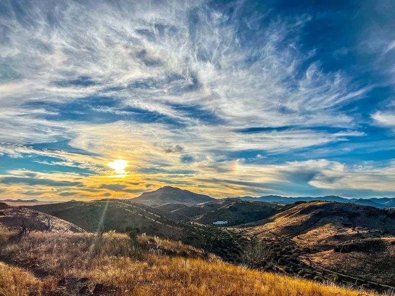
This 74-mile loop wraps around some of the most stunning peaks in West Texas, climbing through grasslands dotted with yucca and juniper before opening up to sweeping views that’ll make you forget you’re still in Texas. The route connects Fort Davis, McDonald Observatory, and Davis Mountains State Park, giving you plenty of reasons to pull over and explore.
Starting from the town of Fort Davis, the loop takes you up to nearly 6,800 feet in elevation. You’ll pass through cattle ranches, old homesteads, and landscapes that shift from golden grasslands to rocky outcrops in minutes. The air gets cooler as you climb, and on clear days, you can see for miles across the Chihuahuan Desert below.
McDonald Observatory sits near the highest point and offers some of the darkest night skies in North America. Even if you don’t stop for a star party, the drive up there is worth it just for the views. The road curves gently through the mountains, never feeling rushed or overcrowded.
Wildlife sightings are common here. Keep an eye out for mule deer, javelinas, and roadrunners darting across the pavement. Hawks circle overhead, riding thermals above the peaks, and if you’re lucky, you might spot a pronghorn antelope grazing in the distance.
Plan for at least two hours if you’re just driving through, but give yourself half a day if you want to stop and soak it all in. Pack water, snacks, and a camera. Cell service gets spotty in places, so download maps ahead of time and let someone know your route before heading out into these beautiful, remote mountains.
2. Ross Maxwell Scenic Drive (Big Bend National Park)
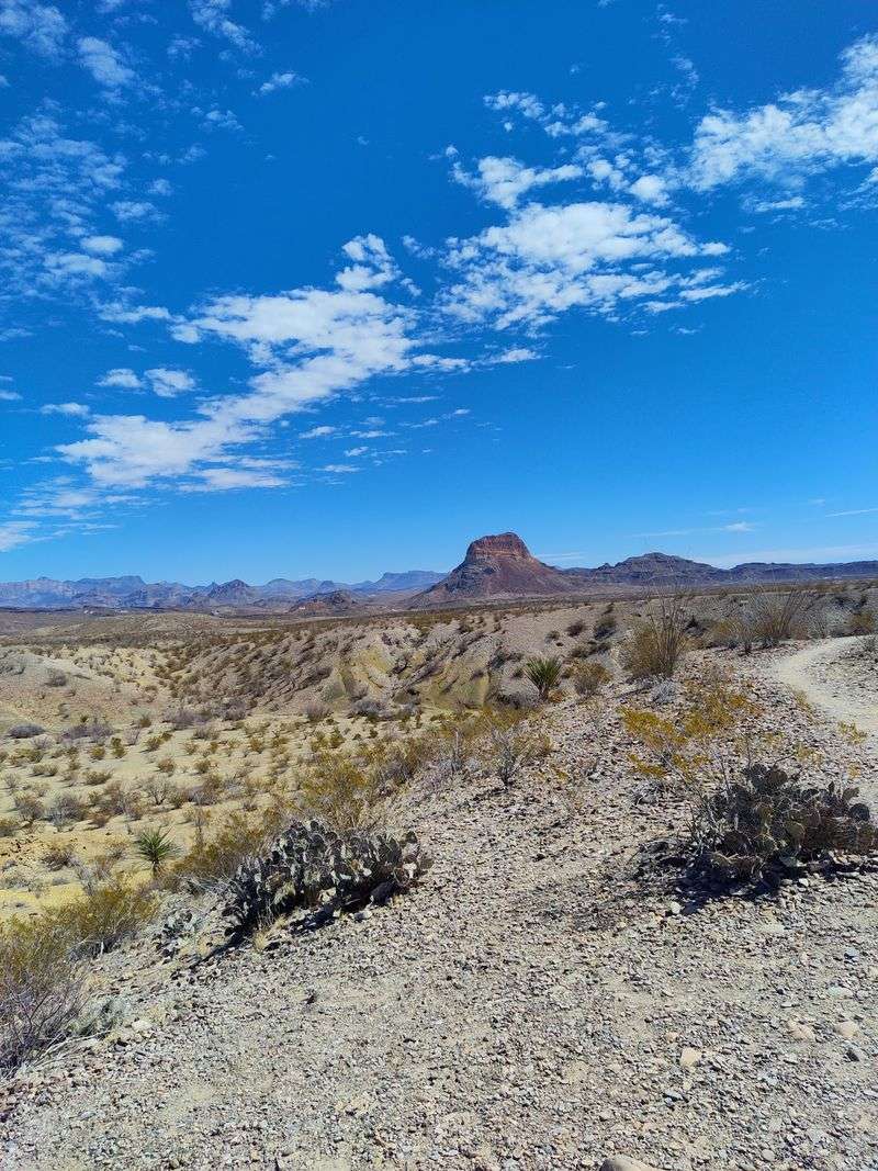
Thirty miles of pure geological wonder, this route slices through volcanic badlands and ancient lava flows that look like they belong on another planet. Starting from the main park road, Ross Maxwell Scenic Drive heads south toward the Rio Grande, passing landmarks that tell millions of years of Earth’s story in layers of red, orange, and purple rock.
Early morning light hits the Mule Ears Peaks just right, turning them golden against the deep blue desert sky. These twin volcanic plugs rise dramatically from the valley floor and serve as a natural landmark you’ll see from different angles throughout the drive. The road dips and climbs through arroyos and washes, each turn revealing new rock formations or distant mountain ranges.
Halfway down, you’ll reach the Sotol Vista overlook, where the entire southern expanse of the park spreads out before you. From this vantage point, Mexico’s Sierra del Carmen mountains form a jagged purple line on the horizon. It’s one of those spots where you realize just how vast and wild this corner of Texas really is.
Further along, the road passes through Burro Mesa and past the trailhead for the famous Window pour-off. The landscape shifts from volcanic rock to sedimentary layers, each band of color marking a different era. Creosote bushes, ocotillo, and prickly pear cacti dot the slopes, their resilience a testament to desert survival.
The drive ends at Castolon and Santa Elena Canyon, where sheer limestone walls rise 1,500 feet straight up from the river. Give yourself three hours minimum for this drive, more if you plan to hike any of the short trails along the way.
3. Rim Road (El Paso)
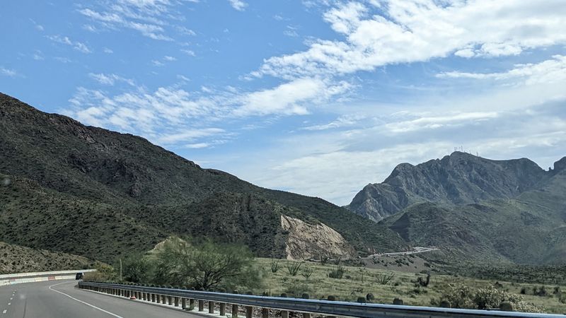
Perched high above El Paso, this four-mile stretch of pavement clings to the eastern edge of the Franklin Mountains, offering views that swing between rugged desert peaks and the sprawling city below. On one side, you’ve got the raw, rocky spine of the Franklins. On the other, the entire El Paso valley spreads out like a map, with Juarez, Mexico visible just across the border.
The road starts near the Wyler Aerial Tramway and winds along the ridgeline at elevations topping 5,000 feet. Curves come quick and tight, so keep your speed reasonable and your eyes on the pavement. But when you do pull over at one of the overlooks, the views are absolutely worth the careful driving.
You’ll see the Rio Grande snaking through the valley, I-10 cutting east-west through the city, and the scattered neighborhoods climbing up the lower slopes. At night, the city lights create a glowing carpet that stretches to the horizon, and the sunsets here paint the desert in shades of orange, pink, and deep purple.
Hikers and mountain bikers share the area, so watch for people crossing the road near trailheads. The Franklin Mountains are home to desert bighorn sheep, though spotting one takes luck and patience. More common are roadrunners, lizards, and the occasional jackrabbit hopping through the scrub.
Because this road sits entirely within Franklin Mountains State Park, you’ll need to pay the park entrance fee. Bring water, especially in summer when temperatures soar well past 100 degrees. Early morning and late afternoon offer the best light for photos and the most comfortable temperatures for exploring this spectacular urban wilderness drive.
4. Highway 80 (Sierra Blanca)
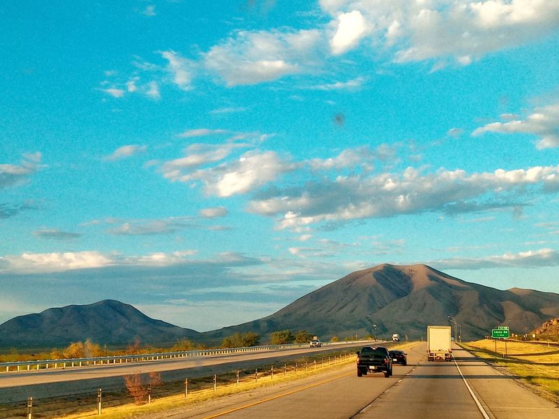
Cutting through the high desert between Van Horn and El Paso, Highway 80 runs parallel to the railroad tracks and straight toward Sierra Blanca, the white-capped peak that dominates the horizon for miles. This isn’t a winding mountain road, it’s a wide-open desert highway where the mountains feel both close and impossibly far away at the same time.
The landscape here is all about space and sky. Flat stretches of creosote and mesquite give way to distant mountain ranges that change color throughout the day. Sierra Blanca itself rises to 6,893 feet, its pale limestone cap visible from dozens of miles away, serving as a natural compass point for anyone traveling this ancient corridor.
The town of Sierra Blanca sits at the base of the mountain, a small railroad community that’s seen better days but still holds onto its frontier character. Stop at the historical marker to learn about the area’s role in westward expansion, or just grab a cold drink and watch the freight trains rumble through on their way to California.
East of town, the highway climbs gradually through rolling hills dotted with yucca and sotol. Pronghorn antelope are common here, often visible in small herds grazing near the roadside. They’re the second-fastest land animals on Earth and can hit 60 miles per hour when spooked, so give them space if you see them near the pavement.
This drive works best as part of a longer journey rather than a destination itself. The beauty here is subtle and grows on you, the kind of landscape that feels empty at first but reveals layers of texture and color the longer you look. Pack patience, water, and an appreciation for wide-open spaces.
5. U.S. Route 62 (Guadalupe Mountains)
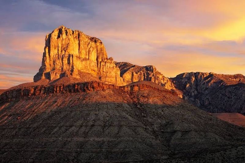
Running along the western edge of the Guadalupe Mountains, Route 62 delivers one of the most dramatic mountain backdrops in Texas. The sheer limestone cliffs of El Capitan and Guadalupe Peak, the state’s highest point at 8,751 feet, rise thousands of feet straight up from the desert floor, creating a wall of rock that dominates the landscape for miles.
The highway itself follows an old Butterfield Overland Mail route, and you can still see remnants of that frontier history scattered along the roadside. The mountains here are part of an ancient fossilized reef from the Permian period, making them around 260 million years old. Those white and gray bands you see in the cliffs are actually the remains of marine organisms from when this area sat at the bottom of a shallow sea.
As you drive north from the park entrance, the road curves gently through the foothills, passing through grasslands and scattered juniper trees. The mountains loom to your left, their faces catching the afternoon sun in ways that highlight every crack, ledge, and canyon carved into the limestone. Hawks and ravens ride the updrafts along the cliffs, and if you’re driving in fall, you might catch the maples in McKittrick Canyon turning brilliant red and gold.
The drive gets even better as you approach the New Mexico border, where the highway cuts through the Salt Flat, a massive white expanse that creates an otherworldly contrast against the dark mountains. Pull over at one of the roadside turnouts and just listen. The silence here is profound, broken only by wind and the occasional passing vehicle.
Plan this drive for late afternoon when the sun lights up the western faces of the peaks. Bring binoculars for wildlife watching and plenty of water, especially in summer.
6. River Road (Big Bend Ranch State Park)
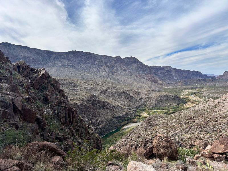
This isn’t your typical paved scenic drive. River Road is a 51-mile dirt and gravel route that follows the Rio Grande through some of the most remote and rugged terrain in Texas. It demands a high-clearance vehicle, plenty of time, and a sense of adventure, but what you get in return is access to landscapes that few people ever see.
Starting from Lajitas, the road immediately drops into a world of towering canyon walls, volcanic rock formations, and the muddy brown ribbon of the Rio Grande winding through it all. You’ll cross through narrow canyons where the walls close in tight, then burst out into wide valleys where the mountains stretch away in every direction. Mexico is right there across the river, close enough to wave at anyone you see on the other side.
The road surface ranges from smooth packed dirt to rocky, rutted sections that’ll rattle your teeth if you’re going too fast. Take it slow, especially through the washes and creek crossings. Flash floods can make this route impassable during rainy periods, so check conditions before you go and never attempt it if storms are forecast.
Wildlife thrives in this isolated corridor. Roadrunners sprint across the path, javelinas root around in the brush, and desert bighorn sheep occasionally appear on the cliffsides above. Birds are everywhere, from black vultures circling overhead to colorful vermilion flycatchers darting among the riverside vegetation.
Plan for five to seven hours to complete the full route, and carry two spare tires, extra food and water, and a detailed map. Cell service is nonexistent out here. This is raw, unfiltered Big Bend country, the kind of place where you feel completely disconnected from the modern world and utterly connected to the ancient landscape around you.
7. U.S. Route 385 (Fort Stockton to Big Bend National Park)
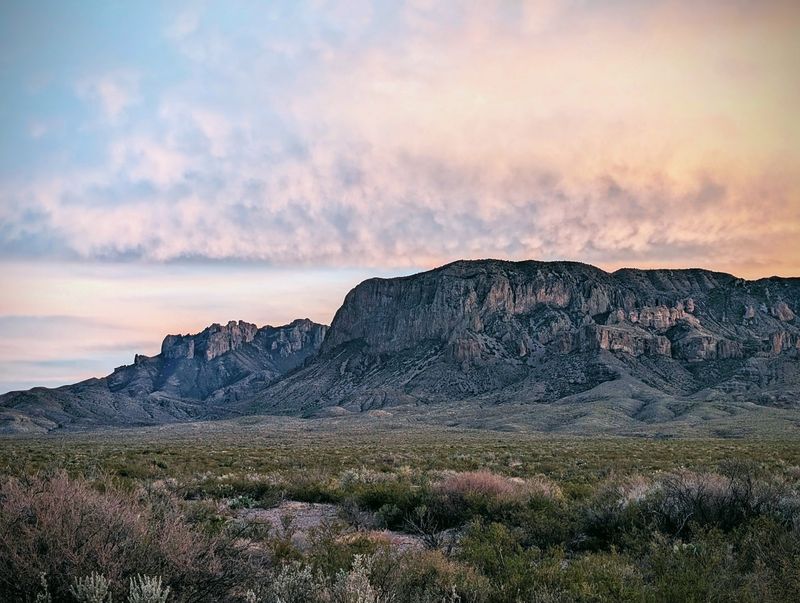
Stretching 140 miles from Fort Stockton down to the entrance of Big Bend National Park, Route 385 is the kind of drive that reminds you just how big Texas really is. This is high desert country, where the horizon seems impossibly far away and the landscape shifts gradually from rolling grasslands to rugged mountains as you head south.
The first half of the drive takes you through ranch country, where windmills dot the plains and cattle graze behind endless fences. The road is straight and fast here, with little to break up the view except the occasional historical marker or ranch entrance. But that emptiness has its own appeal, a meditative quality that lets your mind wander while the miles roll by.
Past Marathon, things start to change. The Glass Mountains appear to the west, their white gypsum peaks glowing in the sunlight. The road begins to dip and rise with the terrain, and the vegetation shifts to include more ocotillo, sotol, and various cacti.
You’re entering true Big Bend country now, and the mountains ahead grow larger with each passing mile.
The Santiago Mountains come into view as you approach Persimmon Gap, the northern entrance to Big Bend National Park. These ancient peaks mark the boundary between the high desert and the Chihuahuan Desert proper, and the change is visible in the landscape. Colors deepen, rock formations become more dramatic, and the sense of isolation intensifies.
This drive works best when you’re not in a hurry. Stop in Marathon for lunch at the historic Gage Hotel, pull over at roadside overlooks to stretch your legs, and keep your eyes on the sky for golden eagles and other raptors. Carry extra water, gas up before leaving Fort Stockton, and embrace the solitude of one of Texas’s most remote highways.
Share this story