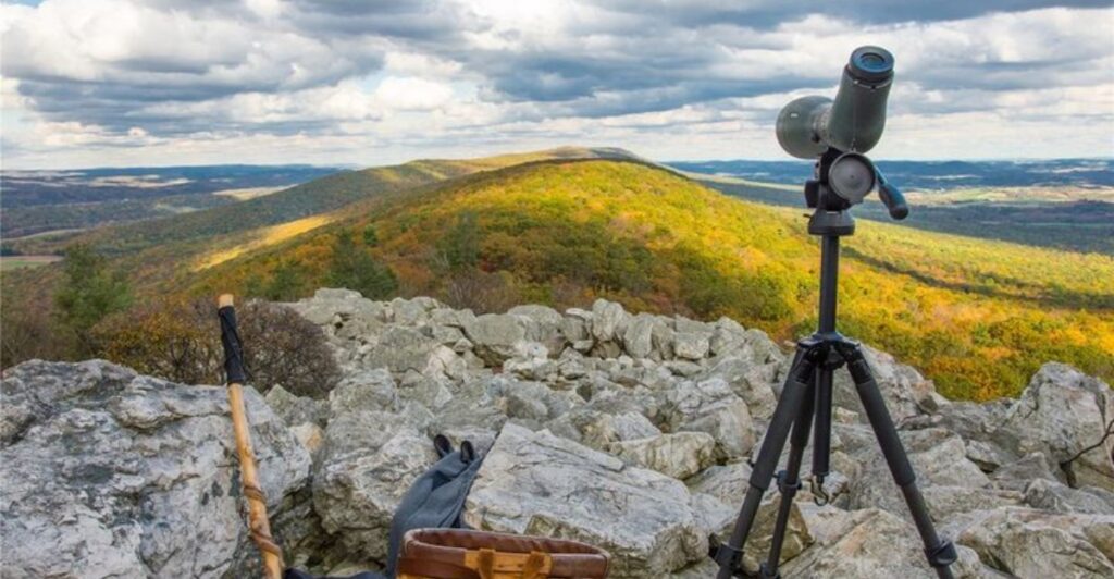
Fall turns Pennsylvania’s forests into a bright patchwork of red, orange, and gold, and a walk through those woods can bring you past rushing waterfalls, rocky overlooks, quiet streams, and deep valleys that look even better beneath a clear autumn sky, especially when you take time to notice the small details along the way. But those same beautiful trails can hide a few surprises, because fallen leaves cover loose stones and tree roots, rain makes rock steps slippery, and shorter days leave less time to finish a hike before darkness settles over the forest, while cool mornings can become much colder once the sun drops behind a ridge.
From the creekside paths at McConnells Mill to the steep Turkey Paths above Pine Creek, the hikes below offer memorable views along with places where slowing down, wearing sturdy shoes, following posted rules, and checking current trail conditions can make a real difference, whether you are planning a family outing, a quiet walk with a friend, or a longer adventure that tests your legs. Choose a route that fits your experience, carry water and a warm layer, download a map before leaving home, and give yourself permission to turn around when conditions feel wrong, because the best fall hike is not the one with the most miles or the boldest photograph, but the one that lets you enjoy Pennsylvania’s changing colors and return safely with enough energy to start thinking about your next visit to another beautiful corner of the state.
1. Kildoo Trail at McConnells Mill State Park, Portersville
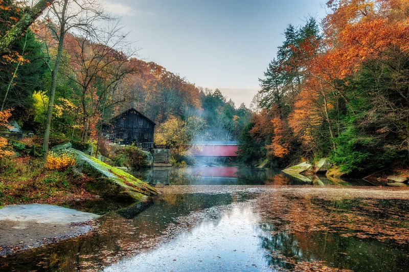
The sound of rushing water makes an ordinary woodland walk feel like a small adventure.
Along Kildoo Trail, Slippery Rock Creek threads through a rugged gorge, with huge boulders and bright fall leaves creating a scene worth slowing down for.
The route begins near the historic mill and follows the creek through uneven terrain.
A roughly three mile loop can include a crossing at the covered bridge and another at the suspension bridge, but confirm your route on the current park map before starting.
Here, the biggest concern is footing rather than distance.
Rocks can stay damp even after the rain stops, and a thin layer of leaves may cover gaps, roots, or slick stone surfaces that are hard to spot from a few steps away.
Wear hiking shoes with reliable tread and keep your hands available for balance.
Trekking poles may help on rough stretches, though you should place their tips carefully between rocks instead of assuming every patch of leaves hides solid ground.
Stay out of the creek, even when the water looks shallow or a boulder seems like a good photo spot.
Strong currents and slippery banks make this a poor place for wading, and stepping closer to the water rarely improves a picture enough to justify the risk.
Families should keep children nearby, especially where the path narrows beside the creek.
Give other hikers room to pass at wider spots, and avoid rushing just because the trailhead attractions make the area feel more developed than the surrounding gorge actually is.
Before leaving Portersville, check park alerts and the weather forecast.
Start early enough to enjoy the mill area without squeezing your return into fading daylight, and turn around if rising water, ice, or slippery conditions make the route uncomfortable.
The gorge rewards patient steps far more than a fast pace.
2. Seneca Trail at Cook Forest State Park, Cooksburg
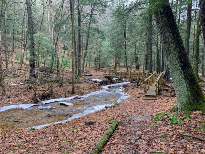
Some forests make you look up before you take another step.
Cook Forest has that effect, with towering trees rising above a woodland floor where autumn leaves gather around roots, rocks, and the edges of the trail.
Seneca Trail offers a more demanding outing than its peaceful surroundings might suggest.
The approximately one mile route includes steep terrain and connects with other park trails, so study the map rather than treating every nearby path as part of the same easy walk.
Expect climbs that can leave you breathing harder, followed by descents that ask for careful foot placement.
Fallen leaves soften the appearance of the ground without softening the roots underneath, and damp soil can make a sloping section surprisingly slippery.
A slower pace suits this setting anyway.
Pause on stable ground to admire the mix of evergreen needles and changing hardwood leaves, then watch the trail again when you start moving.
Looking upward while walking is an easy way to miss a root.
Choose shoes that grip well, and bring a light insulating layer for shaded stretches.
Deep forest can feel cooler than the parking area, especially after rain or late in the afternoon, when sunlight disappears from the trail before the sky grows dark.
If you plan to connect your hike with the fire tower or Seneca Point area, check the mapped links and current access rules first.
Nearby attractions do not make every connecting route short, and a casual side trip can add more climbing than expected.
Keep your group together at junctions and carry a downloaded map as a backup.
For a comfortable fall visit, allow extra time for the steep sections and choose a turnaround point before anyone gets worn out.
The tall trees will still provide plenty to remember, even if you leave the longer trail connections for another day.
3. Pole Steeple Trail at Pine Grove Furnace State Park, Gardners
A short trail can still give your legs a serious workout.
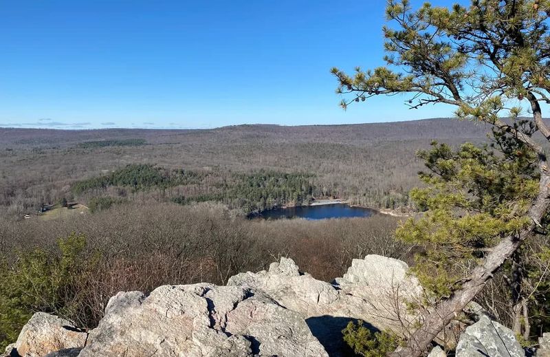
The climb to Pole Steeple proves that point, trading a modest distance for a steep approach and a rocky overlook with a wide view of Pennsylvania’s autumn woods.
From the trailhead near Laurel Lake, the main route climbs about three quarters of a mile to the outcrop.
It lies in Michaux State Forest beside Pine Grove Furnace State Park, a useful detail when checking maps, trail notices, and the right parking location.
The reward is a striking perch above the surrounding forest, with Laurel Lake visible below.
Before focusing on the view, notice where the stable walking surface ends and the exposed rock begins.
There is no reason to approach the drop for a good photograph.
Loose stones and leaves deserve attention during the climb, but the descent may require even more care.
Tired legs, a downhill slope, and hidden rocks are a troublesome mix, so shorten your steps and resist following faster hikers at their pace.
Wear sturdy footwear and carry water even if you expect a quick outing.
A snack can help younger hikers recover before heading down, and a wind resistant layer is useful when the exposed overlook feels much colder than the sheltered trail below.
Keep children close at the summit and dogs securely leashed.
Crowded fall weekends can make the rock feel busy, so wait for space rather than stepping onto an awkward ledge to get around another group or fit everyone into a picture.
If the rock is wet, frosty, or icy, skipping the summit is a sensible choice.
Check your return route before leaving the top, since connecting trails can lengthen the trip.
With dry conditions and a patient pace, this compact climb offers a big view without requiring an entire day on the trail.
4. Lookout Trail at Hawk Mountain Sanctuary, Kempton
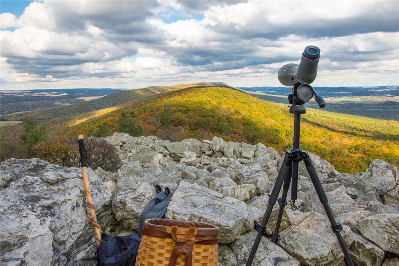
Bring binoculars, but remember to watch your feet between sightings.
Autumn at Hawk Mountain pairs colorful ridge views with the chance to see migrating raptors, making it tempting to keep your eyes on the sky instead of the rocky ground.
The Lookout Trail leads toward the sanctuary’s well known observation areas, including North Lookout.
The walk from the visitor area to North Lookout is about one mile each way, and the rough footing means that distance can take longer than a neighborhood stroll.
Check admission details, opening hours, weather updates, and trail rules before traveling to Kempton.
Hawk Mountain is a sanctuary rather than a state park, and pets are not permitted on its trails.
Planning around those differences helps prevent an unwelcome surprise at arrival.
Expect stones, uneven steps, and places where balance matters more than speed.
Shoes with firm soles make the route more comfortable, while a small backpack leaves your hands free.
Stop completely before raising binoculars or a camera near a rocky slope.
At the lookouts, find a secure place to stand or sit without blocking the trail.
Wind can feel sharp along the ridge, even on a pleasant afternoon, so pack a warm layer and protect loose hats or lightweight belongings from sudden gusts.
Busy migration days add another challenge: people moving at different speeds through limited space.
Give observers room, follow staff guidance, and let quicker walkers pass only where the footing allows.
Children should stay beside an adult around exposed rock and overlook edges.
You do not need to reach every viewing area to enjoy the visit.
Ask staff which options fit your group, especially if someone has balance concerns or limited stamina.
A shorter outing with time to watch birds can be more rewarding than a rushed climb followed by an uncomfortable, tiring descent.
5. Shades of Death Trail at Hickory Run State Park, White Haven
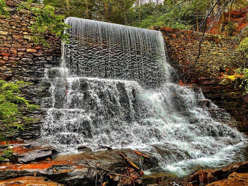
The name sounds like a Halloween dare, but the real challenge is much less dramatic: keeping your balance.
Small cascades, shaded creek bends, and thick woodland make this trail especially appealing when autumn colors brighten the spaces between evergreen shrubs.
Shades of Death Trail runs about one and a tenth miles one way through Hickory Run State Park.
An out and back walk doubles that distance, so remember that the number on the map may describe only the trip in one direction.
Despite its modest length, the route is rated difficult by the park.
Roots, rocks, narrow stretches, and changes in elevation keep it from being a smooth family stroll.
The pleasant sound of nearby water should not distract you from checking each step.
Rain can leave the stone surfaces slick, and shaded spots may stay wet long after open areas dry.
Step onto flatter rock when possible, avoid mossy surfaces, and use a handhold only after checking that the branch or support is solid.
A waterproof shoe is helpful, but traction matters more than keeping every drop out.
Carry a spare pair of socks if wet feet bother you, and pack belongings so you are not juggling a phone, water bottle, and snack on rough sections.
Stay on the marked trail instead of cutting toward cascades for photographs.
Stream edges can crumble or hide slippery stone, while unofficial shortcuts damage plants and often lead to worse footing.
Take pictures from a stable position where you can pause without blocking others.
For families, make the return decision before children become tired or cold.
There is no need to finish the entire route to enjoy its water and woodland scenery.
Check current park notices, allow generous daylight, and remember that the spooky name is less relevant than the ordinary hazards hiding beneath a beautiful carpet of leaves.
6. High Rocks Trail at Ralph Stover State Park, Pipersville
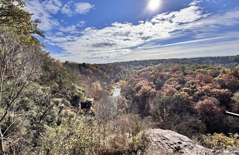
A sweeping gorge view can arrive before you feel as though you have taken a major hike.
At High Rocks, that easy access is part of the appeal, but it can also make visitors underestimate the seriousness of the cliffs.
The High Rocks area of Ralph Stover State Park overlooks Tohickon Creek near Pipersville.
Trails around the rim provide views into the wooded gorge, where autumn color fills the slopes and the creek appears far below through openings in the trees.
Use the current park map to choose your route and parking area.
Ralph Stover has separate areas, and heading to the wrong entrance can create confusion or an unplanned walk.
Do not assume every path you see follows the same safe, marked overlook route.
The central rule is simple: respect fencing, signs, and cliff setbacks.
Leaves can hide the exact edge of a drop, and a rock that looks broad from behind may slope toward open space.
Stay well back even when other visitors move closer.
Rock climbing occurs in this area, but that does not make cliffside scrambling suitable for ordinary hikers.
Avoid copying climbers or following narrow paths toward climbing access points.
Specialized equipment and experience are very different from a good pair of walking shoes.
Keep dogs leashed and children within easy reach near overlooks.
When taking a group photo, pick a spot with ample level ground behind everyone, rather than asking someone to step backward toward the view.
Wind and crowding are reasons to increase your distance from the edge.
After rain, take extra care around muddy sections and exposed stone.
A relaxed visit with several safe viewing stops is enough to enjoy the gorge, so skip any questionable side path.
The strongest memory should be the brilliant canopy below, not a moment when getting one more picture felt more important than secure footing.
7. Canyon Vista Trail at Worlds End State Park, Forksville
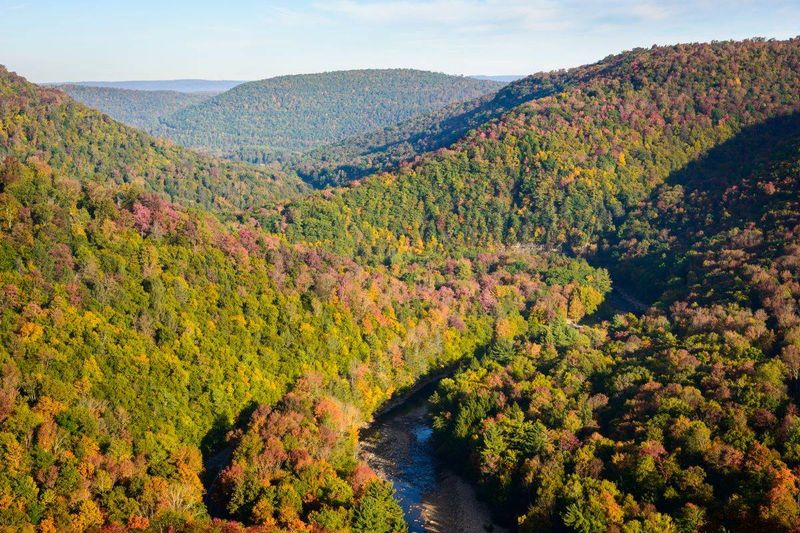
Your legs earn the view on this one.
A climb through the forest leads toward a broad look over the Loyalsock Creek valley, where fall color spreads across the hills in layers that seem to keep going beyond the next ridge.
Canyon Vista Trail is an approximately four mile loop at Worlds End State Park.
It is a challenging route with rocky sections and substantial climbing, so plan it as a real hike rather than a quick walk to a roadside viewpoint.
Bring a park map and check the trail junctions as you go.
The surrounding area has several hiking options, and a wrong turn can add distance when you are already tired.
A downloaded map is useful where a phone cannot maintain a reliable signal.
The climb may feel warm, but the overlook can be breezy and cool.
Pack a layer you can put on during a break, along with enough water and food to keep your energy steady.
Waiting until you feel drained makes the return harder.
Watch for loose rocks hidden beneath the leaves, especially while descending.
Small, controlled steps reduce the chance of sliding, and poles can help if you are comfortable using them.
Do not rush downhill simply because the hardest climbing seems to be behind you.
At Canyon Vista, enjoy the panorama from secure ground and keep away from exposed edges.
If you explore nearby rock formations, stay on established routes and avoid squeezing into gaps or climbing surfaces made slippery by moisture, leaves, or an early freeze.
Build your schedule around the slowest member of the group.
Start with enough daylight for breaks and a careful descent, and reconsider the loop when heavy rain or cold conditions are expected.
A shorter park outing is a better choice than committing to a rugged circuit that no longer fits the weather or your energy.
8. Falls Trail System at Ricketts Glen State Park, Benton
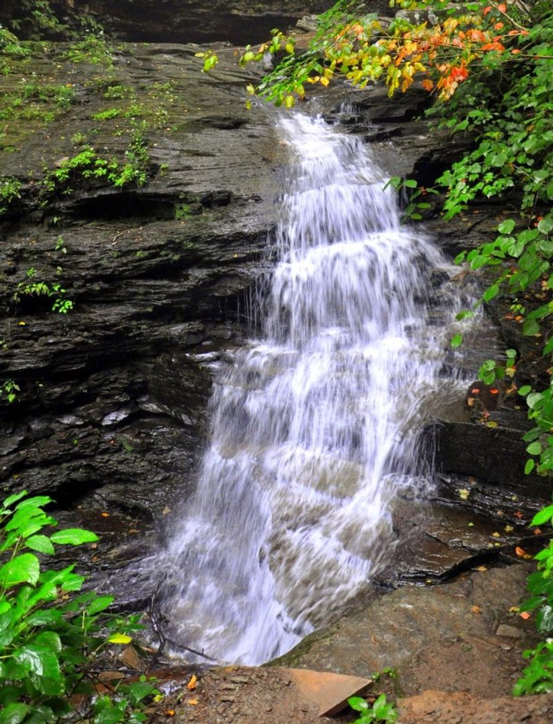
Waterfall after waterfall can make you forget how much trail remains.
Ricketts Glen delivers that kind of excitement, with tumbling water framed by autumn leaves, but its famous scenery comes with steep steps, wet rock, and real exposure.
The full Falls Trail System forms a hike of roughly seven miles, while a shorter circuit using the Highland Trail is about three miles.
Your distance depends on the starting point and route, so match the park map to your actual plan before setting out.
This is not a casual waterfall walk.
Stone stairways can be narrow and irregular, and some stretches have steep drops without railings.
Water spray, fallen leaves, and muddy shoes can make an already demanding surface harder to manage.
Choose footwear with excellent traction and leave smooth soled casual shoes behind.
Keep both hands free on difficult stretches, put your phone away while moving, and stop on a stable section before taking pictures.
A waterfall is never worth a backward step toward an edge.
Let other hikers pass where there is sufficient room rather than squeezing by on stairs.
Keep your group spaced enough that one person’s stumble will not knock into someone else, while keeping children close enough for direct supervision throughout exposed sections.
Check park alerts before your visit, particularly after storms or when freezing weather arrives.
The Falls Trail has special winter restrictions, and conditions can change before the calendar suggests winter.
Do not enter a closed section or assume a sunny parking lot means ice free gorge steps.
Carry water, food, warm clothing, and enough daylight for a slow finish.
If anyone struggles early, turn back before committing to more steep terrain.
Enjoying fewer waterfalls safely is a successful visit, and the sound of falling water will be just as memorable without racing to complete every mile.
9. Balanced Rock Trail at Trough Creek State Park, James Creek
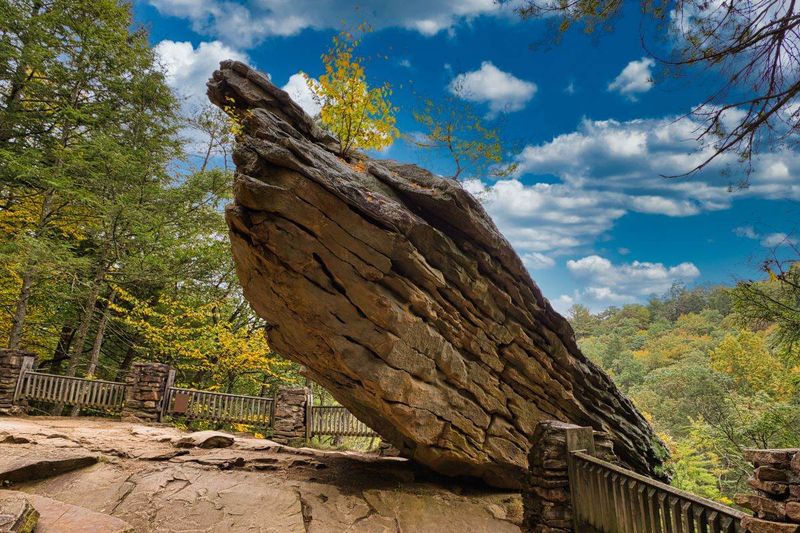
A giant boulder that seems to defy gravity gives this hike its memorable finish.
Getting there brings its own interest, with a creek crossing, woodland scenery, and rocky steps that deserve more attention than the trail’s short length suggests.
Balanced Rock Trail is about a quarter mile one way at Trough Creek State Park.
The route crosses Great Trough Creek on a suspension bridge and passes Rainbow Falls before climbing toward the rock, packing several sights into a compact outing.
Short does not mean level or effortless.
The climb includes uneven stone and places where leaves collect between steps, so take your time and look for firm footing.
Going down can be trickier than going up, especially when the rock is damp.
On the bridge, follow posted rules and cross without bouncing or crowding other visitors.
Keep dogs under control and give anyone who feels uneasy time to move at a comfortable pace.
A busy bridge is not the best place to stop for a long photo session.
Rainbow Falls may vary with recent rainfall, but wet conditions also raise the need for caution.
Admire the water from the trail rather than stepping onto slick streamside rocks.
A small cascade can still sit beside surfaces that offer very little grip.
At Balanced Rock, resist the urge to climb the formation or scramble below it for a dramatic angle.
Stay on the established path and choose a picture that shows the boulder against the forest.
The unusual shape is impressive without adding an unnecessary risk.
Bring water and supportive shoes even if this is only one stop on a larger park visit.
Check trail notices after storms, when branches or damaged surfaces may affect access.
For a comfortable afternoon, leave time to explore other approved park areas instead of rushing this climb and treating the descent as an afterthought.
10. Ferncliff Trail at Ohiopyle State Park, Ohiopyle
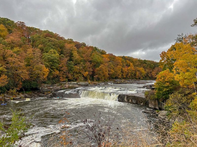
The river does much of the talking here.
As water rushes around the Ferncliff Peninsula, a woodland walk near Ohiopyle’s busy center becomes a quieter escape filled with turning leaves, textured rock, and changing views of the Youghiogheny River.
Ferncliff Trail makes an approximately two mile loop around the peninsula.
Its location near popular park attractions can make it feel like an easy addition to a sightseeing day, but the uneven sections deserve proper shoes and your full attention.
The riverside rock is the main reason to slow down.
Moisture, worn surfaces, and fallen leaves can create slippery patches, while the sound and movement of the water may draw your eyes away from the next step.
Pause before admiring the current.
Stay on the trail and well away from fast water.
Do not wade, test the shoreline for a better angle, or assume shallow looking areas are safe.
The Youghiogheny is powerful, and conditions near falls and rapids are not suitable for casual exploring.
Ferncliff is also a protected natural area with unusual plant life.
Enjoy what you see without picking plants or wandering off the route.
Staying on established surfaces protects the peninsula and helps you avoid fragile banks, hidden holes, and awkward rocky shortcuts.
Pack a light jacket for cool air coming off the river, and bring water even when shops seem close by.
Children should stay beside an adult on rough shoreline stretches, and leashed dogs need enough control that they cannot pull someone toward the water.
After heavy rain, check park updates and choose a different outing if the route is affected by high water or storm damage.
Allow time to finish before dusk, when roots and dark rock become harder to distinguish.
With steady steps, the loop offers an inviting mix of fall forest and river scenery without needing a long backcountry journey.
11. Turkey Path at Colton Point State Park, Wellsboro
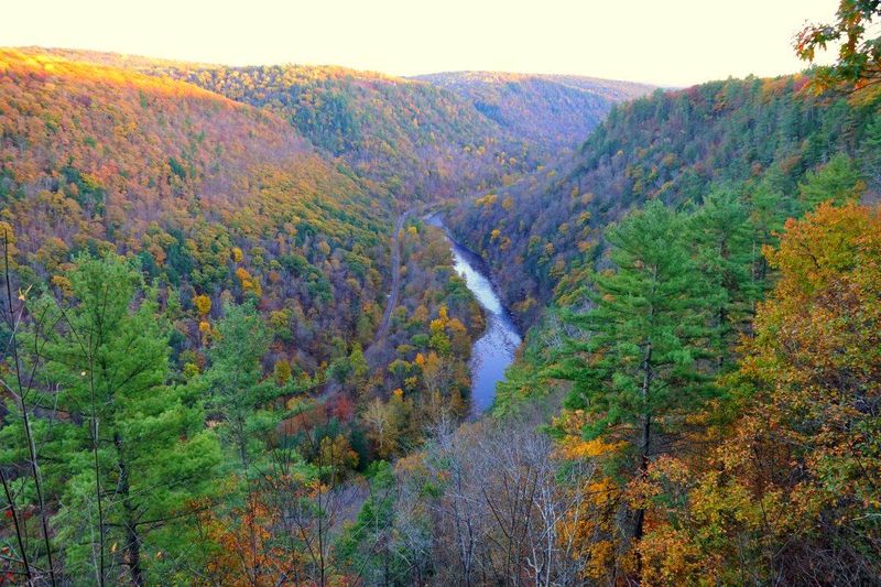
Going downhill first feels like getting the easy part for free.
On this Turkey Path, though, every step toward the bottom is a step you must eventually climb back, making energy planning just as important as watching the rocky trail.
Colton Point State Park sits on the west rim of Pine Creek Gorge near Wellsboro.
Its Turkey Path descends steeply for about one and a half miles toward Pine Creek, creating an approximately three mile round trip with a demanding return climb.
The route offers close woodland views and a waterfall along the way.
Fall leaves add color overhead and underfoot, but they also cover loose stone and roots.
Keep your gaze on the next few steps instead of letting the downhill slope carry you faster.
Decide on a turnaround point while you still feel strong.
Reaching the bottom is optional, and descending farther because the creek seems close can leave you facing a climb that exceeds your fitness.
A waterfall stop can make a satisfying shorter destination.
Carry enough water and a snack for the uphill return.
Take breaks before you become exhausted, and add a warm layer when stopping in the shaded gorge.
Sweaty clothes can cool quickly once your pace slows in autumn air.
Do not plan to cross Pine Creek to the Turkey Path on the opposite rim.
There is no bridge connecting the two park trails, and wading introduces serious risks from current, depth, and cold water.
Treat this hike as an out and back from Colton Point.
Check current trail conditions before leaving the rim, especially after rain or during early freezing weather.
Tell someone your plan and allow ample daylight for a slower ascent.
If anyone in the group doubts the climb back, enjoy the park’s rim overlooks instead, where the canyon’s autumn display remains impressive without a steep commitment.
12. Turkey Path Trail at Leonard Harrison State Park, Wellsboro
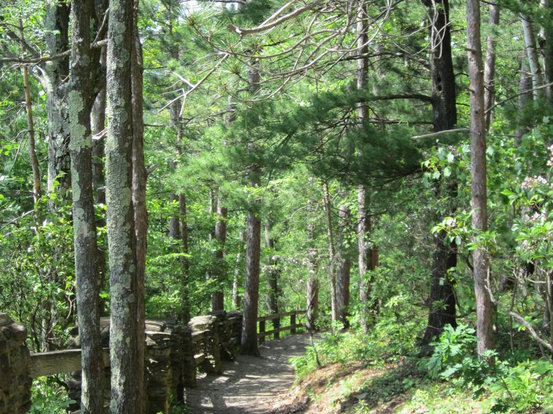
Wooden steps lead into a canyon that seems to grow taller around you.
The east side Turkey Path combines waterfalls with a steep descent, turning a visit to a famous overlook into a much more demanding fall adventure.
At Leonard Harrison State Park, the trail drops about one mile from the rim to the Pine Creek Rail Trail.
The round trip is roughly two miles, but the large elevation change makes those miles feel very different from a level woodland loop.
Stairs, switchbacks, and uneven ground require steady attention.
Wet leaves can collect on wooden treads, while shaded sections may develop frost or ice during cold weather.
Use available handrails where provided, and avoid assuming that built steps guarantee an easy descent.
Waterfalls along Little Fourmile Run give you good reasons to pause.
Take those breaks from designated trail areas or stable landings, not from streamside rocks.
Keep the walking route clear so other hikers can pass without stepping onto an unsafe slope.
The climb back is the part to plan around.
Bring water and food, pace yourself from the beginning, and turn around before fatigue makes your footing uncertain.
Children may enjoy the descent yet struggle on the return, so judge the outing by their climbing ability.
Check the park’s latest alerts before driving to Wellsboro, since closures and repair work can affect access.
Never go around a barrier, even if a map or older trip report says the trail is open.
Storm damage can make a familiar route unsafe.
Reaching the rail trail does not create a loop to Colton Point across the creek.
Return by the same path, leaving enough daylight for breaks on the ascent.
If the conditions or climb seem unsuitable, stay at the rim overlooks and enjoy the fall panorama there.
Choosing the easier view is good judgment, not a missed adventure.
Share this story