A flash of quartz or a streak of colorful jasper can turn an ordinary walk through western Colorado into an unexpected treasure hunt. Across desert hills, canyon country, forest roads, and rugged mountain passes, rockhounds can search for agate, mica, quartz, and other fascinating geological finds while surrounded by spectacular scenery.
Knowing where collecting is permitted matters, since regulations and land ownership can change between nearby areas. A little research and the right gear can make the adventure both safer and more rewarding. These 12 western Colorado rockhounding spots offer plenty of reasons to keep your eyes on the ground.
1. Mica Mine Trail / Bangs Canyon Area
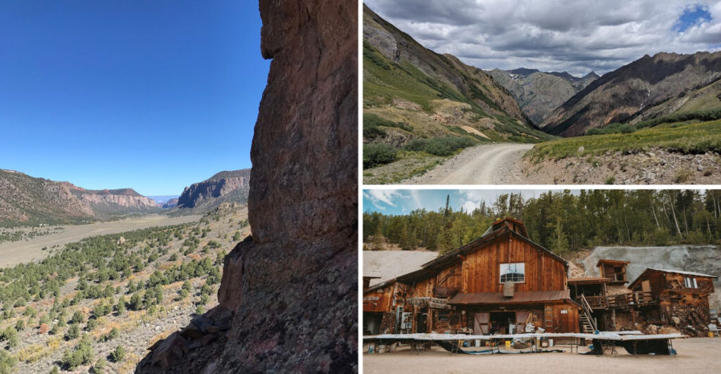
Sunlight bouncing off flakes in the dirt can stop a hiker in mid-step, and that sparkle is part of the fun here. The Bangs Canyon area near Grand Junction gives rock lovers a close look at exposed slopes, broken stone, and mineral-rich ground along a trail tied to the historic Mica Mine.
Even without taking anything home, the walk offers plenty to study, from glittering mica pieces to the shape and color changes in the canyon walls.
Footing can be loose in spots, so sturdy shoes make a big difference. A small hand lens, water, sunscreen, and a bag for trash are smarter to carry than a heavy bucket, especially since the historic mine itself should be treated as a place to view rather than a place to dig.
Many visitors enjoy slowing down and scanning the surface instead of rushing, because tiny details often stand out best when the sun hits at an angle.
Land rules matter here more than enthusiasm. Since this is BLM-managed country, collecting policies should be checked before removing any specimen, and that step is not just paperwork.
It helps protect historic features, keeps people off restricted ground, and lowers the chance of accidentally disturbing an area that should stay intact for everyone else to see.
Morning can be a good time to go, when temperatures are lower and shadows help texture pop out on the slopes.
Pair the outing with a simple goal, such as learning to identify mica by sight, and the trail becomes more than a hike. It turns into a hands-on geology lesson in one of the Grand Junction area’s most eye-catching canyon settings.
2. Marshall Pass Area
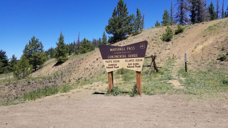
Up high around Marshall Pass, the road itself hints that this country has stories to tell. Mining history, railroad history, and broad views all mix together in a setting where exposed rock appears along cuts, slopes, and open ground.
For rockhounds, that combination makes the area appealing because the search never feels separate from the landscape around it.
The terrain can change fast from sunny and open to cool and shaded, so layers are useful even in summer. Rather than focusing on one exact target, many visitors do better by treating Marshall Pass as a learning zone, watching for differences in rock color, grain, and crystal texture as they move.
That slower approach fits the area well, especially where rougher spots, muddy sections, or afternoon weather can limit how far a person wants to wander.
Respect matters here because history is part of the draw. Recreational collecting should happen only on land where it is permitted, and that means staying clear of private property, historic structures, active mining claims, and any place where digging would damage old features.
A camera can be just as valuable as a rock bag in this kind of setting, since some of the best finds may be visual ones that should stay right where they are.
Maps help more than guesswork in the high country. Cell service may be weak, roads can be rough, and a pretty roadside pullout is not automatically a legal collecting place.
Go prepared with food, extra water, and a backup route. When the planning is solid, Marshall Pass offers a memorable day of mountain scenery, close-up geology, and the quiet thrill of looking closely at ground many travelers pass without really seeing.
3. Quartz Creek Pegmatite District
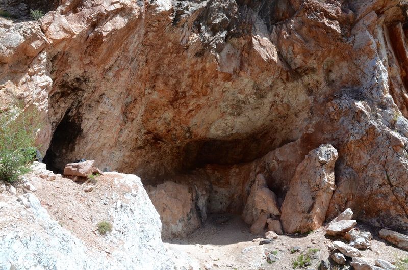
Few place names get collectors paying attention as quickly as a pegmatite district. Around Quartz Creek near Pitkin and Ohio City, those coarse-grained rock bodies have long drawn interest because they can hold eye-catching minerals such as mica, feldspar, beryl, and tourmaline.
Even for beginners, the area offers a great chance to notice how crystal size and rock texture can look very different from ordinary broken stone along a roadbank.
A careful eye helps more than brute force here. Pegmatites often stand out by their chunky appearance, with large crystals or blocks that look almost stitched together compared with finer surrounding rock.
Bringing a field guide, hand lens, and notebook can turn the outing into a practical lesson, since it is easier to remember a mineral when its color, shape, and setting are written down right away.
This district also calls for extra attention to land status. Colorado mineral country often includes a patchwork of private parcels and mining claims, so no one should assume an interesting outcrop is open for recreational collecting.
Verifying the exact site before taking anything is the smart move, and it saves trouble while helping protect places that may be actively worked or legally restricted.
Because the search area can feel broad, a simple plan keeps the day focused. Choose one road segment or one public location to study closely instead of bouncing around too much.
Surface observing alone can be rewarding, especially where broken fragments already reveal the rock’s crystal makeup. With patience, Quartz Creek becomes less about random luck and more about learning how pegmatites announce themselves in the landscape through color, grain, and bold mineral patterns.
4. Last Chance Mine Public Collecting Area
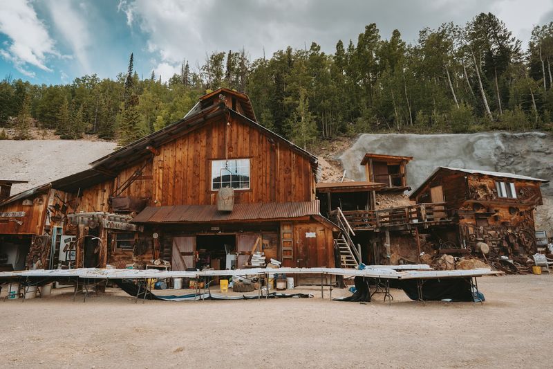
Not every rockhounding stop makes the rules so easy to understand. The Last Chance Mine near Creede stands out because it offers a dedicated public collecting area where visitors can search for minerals and keep what they find for a fee.
That setup removes some of the guesswork and gives beginners a more direct way to enjoy the hunt without wondering whether they are standing in the wrong place.
The possible finds add to the excitement. Amethyst, sowbelly agate, pyrite, galena, jasper, and other specimens can turn up here, so it helps to bring a small container with padding if delicate pieces appear.
Kids and first-time collectors often enjoy places like this because every scoop or careful scan of the ground carries real possibility, but adults tend to appreciate the convenience just as much.
Season matters, since the mine is generally open from late May into October. Checking current hours and conditions before driving over is a smart habit, especially in mountain country where weather and road situations can shift.
Closed-toe shoes, gloves, water, and sun protection all make the outing easier, and it is wise to set a budget before arriving so the collecting fee stays part of a simple plan.
One good trick is to slow down and compare textures instead of grabbing every colorful fragment. Metallic shine, glassy faces, unusual weight, and banded patterns can all point to something interesting.
A labeled bag or two helps keep finds organized later at home. For travelers who want a straightforward, hands-on stop near Creede, this public collecting area offers a rare mix of access, history, and honest treasure-hunt energy.
5. Pool Table Road Area
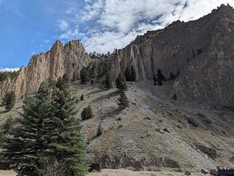
A roadside stretch can surprise people when the ground starts showing flashes of red, orange, cream, and brown. Around Pool Table Road near Creede, rockhounds have long searched for colorful agate, jasper, and other interesting surface material.
Local geology information points specifically to the area around the 4½-mile marker as a place where agate and jasper may be found scattered across the ground. The appeal here is simple: plenty of eyes-on-the-ground exploration surrounded by the rugged scenery that makes the Creede area so striking.
Exposed rock, steep mountain formations, and weathered slopes reveal just how geologically varied this part of Colorado can be. Even when the search stays focused on loose surface material, the surrounding landscape provides plenty to study.
Surface hunting works especially well when the light is right. Early morning or late afternoon can make waxy textures and banding easier to spot, while harsh midday sun may flatten everything into the same dusty tone.
A brimmed hat, sturdy pants, gloves, and small collection bags can make a slow search more comfortable. Restraint is part of good practice here.
Stay on confirmed public land where collecting is allowed, and check current land status and mining claims before removing anything. In an active mineral district, a quiet patch of ground may still carry restrictions.
Study loose material carefully, compare pieces by luster, texture, and pattern, and enjoy the search. Not every attractive stone will be agate, which is part of the fun.
Pool Table Road rewards patience, sharp observation, and the curiosity that can turn an ordinary roadside stop near Creede into a satisfying hunt.
6. Ouray National Forest Rockhounding Area
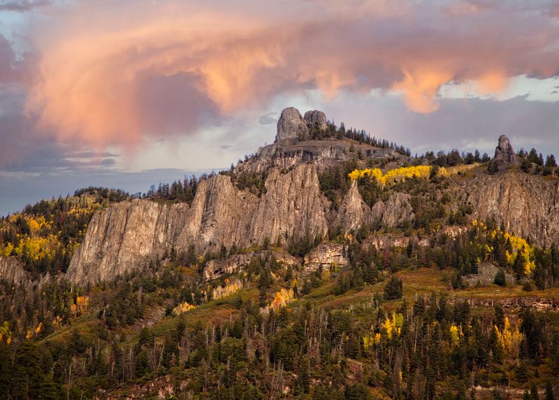
Steep mountains and mineral color go together naturally around Ouray. Public lands near town place collectors in one of Colorado’s most famous mining landscapes, where quartz and other colorful specimens may reward careful searching.
Even people who only know Ouray for scenery quickly notice that the ground itself is part of the attraction, with rock cuts, talus, and varied slopes showing strong changes in texture and color.
Because the terrain is dramatic, staying realistic about effort matters. Short walks near accessible public areas can be plenty interesting, especially for families or beginners who want to study rock types without committing to a long climb.
A simple kit works well here: water, layers, gloves, a hand lens, and bags labeled by location so finds do not turn into a mystery pile later.
Local visitor information specifically encourages rockhounding, but that invitation comes with responsibility. Private property, existing claims, and land-management rules still apply, so checking where recreational collecting is allowed should happen before the first specimen goes into a pack.
That extra step is not a buzzkill. Around a place as well known as Ouray, it is the difference between a respectful outing and a careless one.
Weather can change the whole day in a hurry, especially in the mountains. Start earlier than you think you need to, watch the sky, and avoid pushing into rough terrain just because a slope looks colorful from a distance.
Slow scanning often beats scrambling anyway. Around Ouray, some of the best moments come from noticing a clear quartz point in a patch of rubble or a bright mineral stain against gray stone.
7. Grand Junction BLM Public Lands
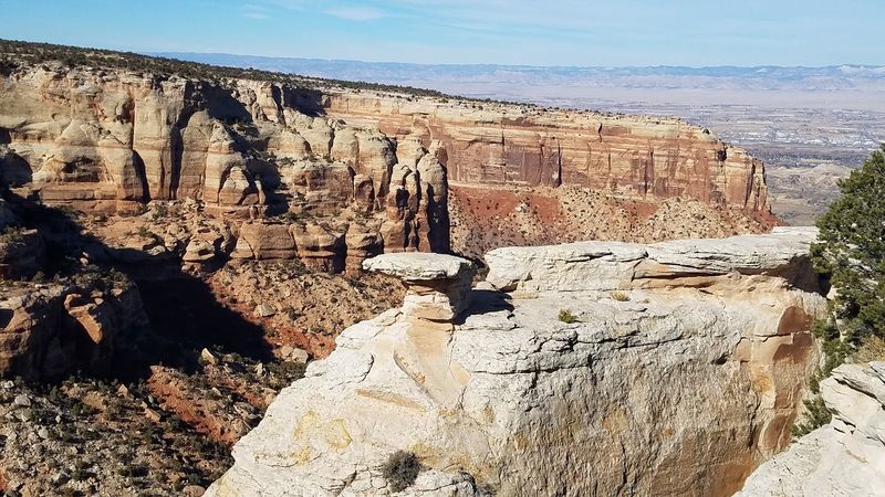
Just outside Grand Junction, the city drops away and the geology takes over. Large stretches of BLM-managed public land extend across the surrounding desert, where open slopes, washes, ridges, and exposed rock create plenty of opportunities to explore Western Colorado’s varied geology.
For rock enthusiasts, that combination of accessible terrain and dramatic scenery makes the area an appealing place to slow down and study the landscape. The ground can seem fairly uniform from a distance, but walking carefully reveals much more detail.
Erosion exposes different layers, textures, colors, and rock fragments, while washes and naturally disturbed ground can provide interesting places to observe what lies beneath the surface.
There is no guarantee that every outing will produce collectible material, so curiosity and careful observation are more useful here than arriving with one particular specimen in mind.
Good route planning matters just as much as a sharp eye. BLM maps can help identify public parcels, but land ownership, active mining claims, developed recreation areas, and other restrictions can affect where recreational collecting is allowed.
Current land status and collecting regulations should always be confirmed before removing rocks or mineral specimens rather than assuming every piece of BLM-managed ground is open to collecting. One advantage of exploring around Grand Junction is the variety of terrain within a relatively compact region.
Bring plenty of water, sun protection, sturdy shoes, and a reliable map, then give yourself time to examine the details underfoot. Even when the day produces more observations than specimens, these public lands offer an accessible introduction to the fascinating geology of Western Colorado.
8. De Beque BLM Public Lands
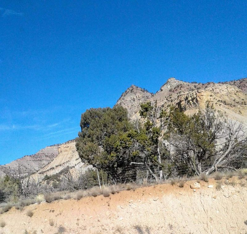
Big mesas and wide valleys give the country around De Beque a bold first impression. Beyond the scenic drive, BLM-managed public land in this part of the Western Slope offers exposed ground that can catch the eye of any curious collector.
The appeal is not only in what might be found, but also in how clearly the land shows its layers, breaks, and weathered surfaces.
This is a strong pick for people who enjoy the hunt itself. Instead of expecting one famous collecting pocket, visitors can explore mapped public routes, stop at promising spots, and examine loose material with a more observant pace.
Desert conditions call for practical choices, though, including extra water, sun protection, solid tires, and a simple turnaround plan in case a road looks rougher than expected.
The BLM’s dedicated De Beque travel-management map is especially helpful here. Using it makes it easier to distinguish public routes and organize a responsible outing before leaving home.
That step can save time on the ground and helps prevent accidental travel into places where access is limited or unclear. It also encourages a better habit overall: pairing curiosity with map-reading instead of guessing from roadside impressions.
For rockhounds, De Beque works best as a patient scan rather than a hurried search. Check washes, roadcuts, and naturally exposed patches where loose material gathers, but leave any questionable area alone until land status is certain.
A day in this country can be quiet, dry, and wonderfully open, which is exactly why preparation matters. With the right plan, De Beque offers a satisfying mix of geology, scenery, and responsible public-land exploring.
9. Palisade BLM Public Lands
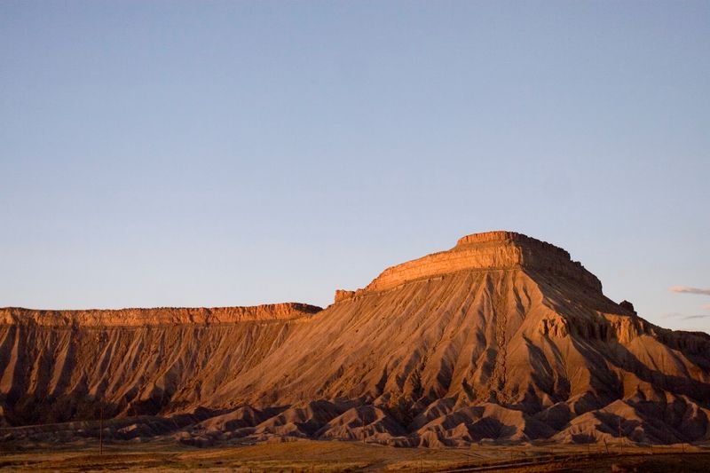
Palisade is famous for fruit and vineyards, but the land beyond town tells a rougher story. Dry slopes, shallow washes, and exposed rock on nearby BLM public lands give mineral hunters a very different kind of local flavor.
It is the kind of place where a person can start with a scenic drive and end up spending an hour crouched over a patch of gravel that suddenly looks more interesting than expected.
Conditions here reward steady observation. Look for color contrast, smooth weathered pieces, odd textures, and fragments that stand out from the general slope material.
Because vegetation can be sparse and shade limited, early starts usually make the day easier. A lightweight daypack with water, sunscreen, gloves, and a small towel for dusting off finds can go a long way.
Planning should happen before boots hit the ground. The BLM’s Palisade travel-management map is a useful tool for selecting a route, and it should be paired with current land information plus mining claim status before choosing where to collect.
Public lands can sit close to other ownership types, so relying on a quick glance from the roadside is not enough when responsible collecting is the goal.
One of the nicest things about the Palisade area is contrast. In a short stretch, the view can shift from green valley agriculture to dry, rocky public country that invites a slower kind of attention.
That change in setting helps sharpen the experience. Instead of racing toward one famous spot, visitors can study the terrain piece by piece.
Palisade’s BLM lands offer a practical outing for collectors who enjoy open scenery, map work, and the simple thrill of finding color in dusty ground.
10. Stony Pass Area
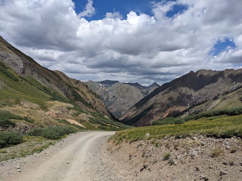
Some rockhounding trips start with a bucket list location and then turn into a weather lesson, a road test, and a mountain memory all at once. The area around Stony Pass near Creede and Silverton has that kind of personality.
Rugged alpine terrain, colorful exposed rock, and huge views make the journey nearly as memorable as any specimen that might go home in a pack.
Preparation matters here more than optimism. High elevation can slow people down, rough roads can chew up plans, and weather may flip from bright sun to cold wind surprisingly fast.
Layers, food, water, a spare tire, offline maps, and a realistic turnaround time are not extras in this country. They are basic tools for a safer and more enjoyable day.
Land status can also be complicated, which means the most attractive pullout is not automatically a legal collecting site.
Recreational collecting should be verified carefully before removing material, especially in a region shaped by mining history, mixed ownership, and changing access conditions.
Historic features, private land, and claimed areas all deserve a wide margin of respect. Once those pieces are handled, Stony Pass delivers a memorable kind of searching.
The colors in alpine rock can be striking, and even surface material along exposed ground may be interesting enough to inspect closely with a hand lens.
Still, this is not the place to rush, overextend, or chase every promising slope. Pick a manageable area, keep an eye on the sky, and enjoy the combination of geology and altitude. Around Stony Pass, the best skill is not speed. It is judgment, followed closely by patience.
11. Unaweep Canyon BLM Public Lands
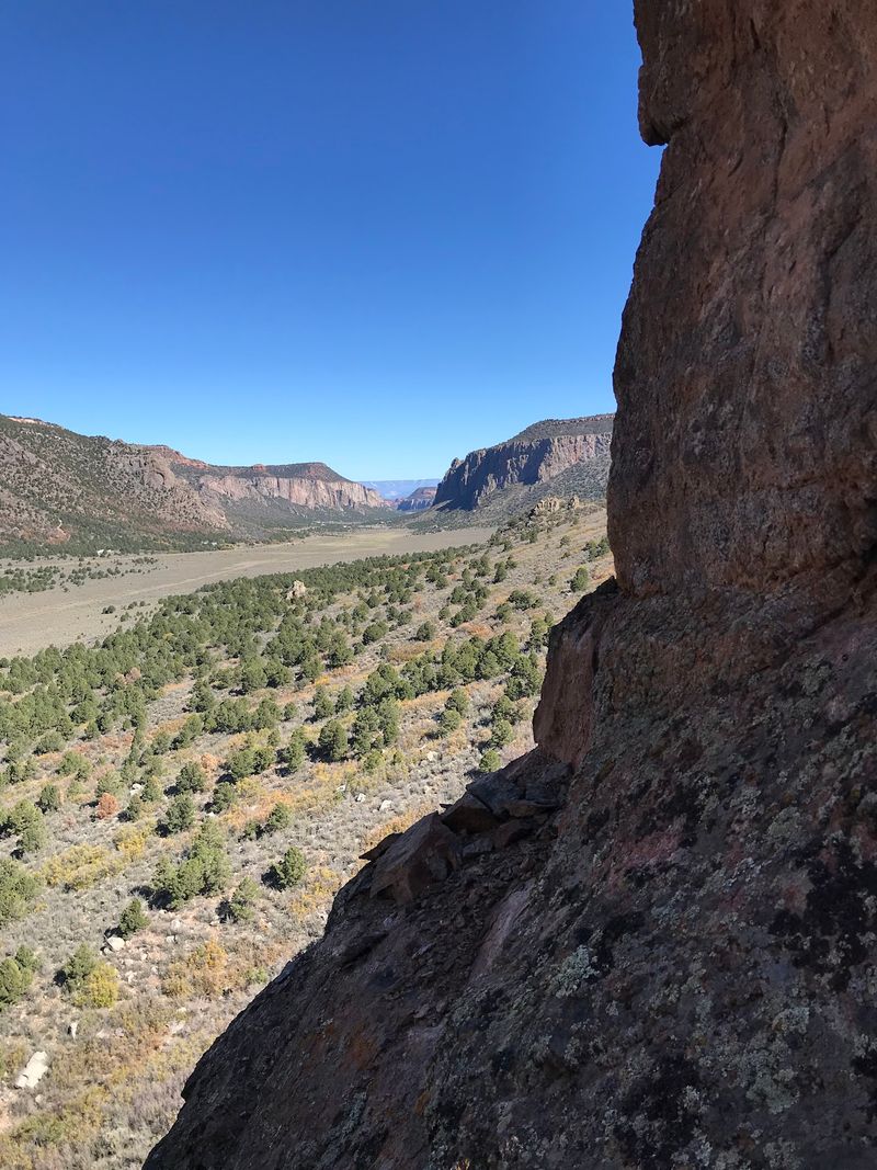
Towering canyon walls do half the work before anyone even steps out of the vehicle. The BLM public lands around Unaweep Canyon near Gateway draw attention fast because the exposed geology is so bold and easy to appreciate.
For people fascinated by rocks and minerals, this landscape offers a chance to study stone on a grand scale and then zoom in to the smaller details underfoot.
The setting encourages curiosity, but a measured approach works best. Pullouts, washes, and open patches of ground can be good places to observe surface material, especially when light reveals texture in the canyon walls and rubble below.
Since the area can feel remote, it helps to bring extra water, tell someone the plan, and keep vehicle needs in mind before committing to side roads.
Unaweep is included in the BLM Grand Junction Field Office travel-management map system, which is a useful starting point for planning. Even so, visitors should verify the precise parcel and current collecting rules before removing material.
That extra check matters because public land management can involve route designations, local restrictions, and boundaries that are not obvious from the scenery alone.
One smart strategy is to treat the canyon as both a viewing trip and a collecting trip, with observation leading the day. Notice how color bands, fracture patterns, and loose rock change from one section to the next.
Taking photos alongside careful notes can be just as rewarding as filling a bag, especially when the geology is this dramatic. Unaweep offers a strong mix of visual impact, roadside access, and the kind of close-looking that makes rockhounding more interesting than simply picking up the first bright stone.
12. North Fruita Desert BLM Public Lands
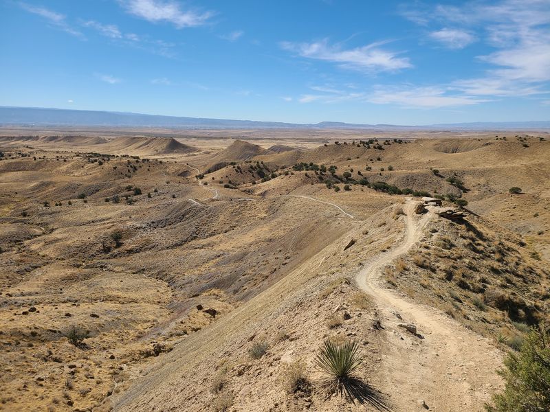
North of Fruita, the landscape opens wide and stays honest about what it is: dry, exposed, and full of ground worth studying.
The North Fruita Desert BLM public lands give rock enthusiasts another accessible Western Slope option where geology is easy to see and simple to approach. It is a place where a short outing can still feel productive because so much of the surface is visible.
That openness can be a real advantage for beginners. Instead of pushing through thick forest or steep brush, visitors can read the terrain more clearly, checking washes, eroded slopes, and naturally broken areas for changes in color and texture.
Good shoes still matter, and so does sun protection, because the same open setting that improves visibility also leaves little shelter on hot, bright days.
The dedicated North Fruita Desert travel-management map is one of the most useful tools for planning here. Pairing that map with current land-status information helps keep collectors on appropriate public ground, and it is still necessary to confirm that recreational collecting is allowed before keeping any finds.
Responsible rockhounding starts with knowing where boots are standing, not with assuming all public-looking desert is open for removal.
Fruita’s nearby services make logistics easier than at some remoter spots, which can take pressure off newer collectors. That said, the best approach is still a deliberate one.
Pick a manageable area, move slowly, and compare pieces carefully instead of scooping at random. The North Fruita Desert may not rely on alpine drama or mining-town history for its appeal.
Its strength is accessibility, wide views, and exposed geology that rewards anyone willing to look down and pay attention.
Share this story