Fall reveals a side of Texas that might surprise even longtime residents. Wild maple trees turn brilliant shades of red, bald cypress trees glow with rusty orange foliage, and golden cottonwoods bring a splash of color to rugged canyon landscapes. It’s a completely different picture from the Texas most people imagine.
As summer heat gives way to cooler temperatures, some of the state’s most scenic destinations become even more inviting. Winding mountain roads, peaceful lakes, and dramatic desert landscapes offer plenty of reasons to get outside and enjoy the season.
Whether you’re looking for colorful fall foliage, breathtaking overlooks, or a relaxing drive through the countryside, Texas has no shortage of beautiful places to explore. Some of the most memorable views are found far from the usual tourist stops.
These six Texas road trip destinations showcase the state’s incredible variety of landscapes, from the cypress-lined waters of East Texas to the towering mountains of West Texas. Each offers a different way to experience the beauty of fall in the Lone Star State.
Lost Maples State Natural Area
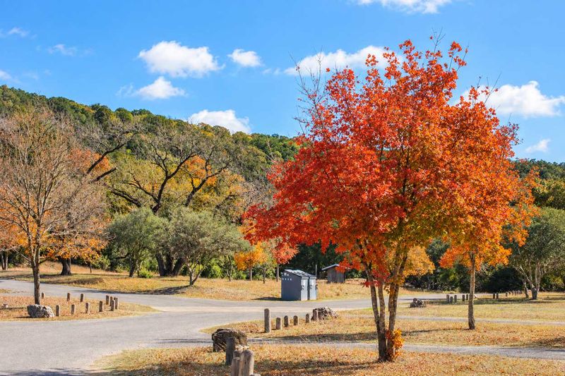
Bigtooth maples are an unexpected sight in the Texas Hill Country, yet here they are, blazing red in a canyon west of San Antonio. Scientists consider them a relict population, left behind when the climate warmed after the last Ice Age.
Lost Maples State Natural Area protects these trees along the Sabinal River near the tiny community of Vanderpool. Leaves usually peak from late October to mid-November, though timing shifts with rain and temperature.
The park posts fall foliage reports online, so you can check before you hit the road. Smart move, since a long drive to see green leaves would sting a little.
Weekends in peak season get very busy. Reserve a day pass ahead of time through Texas State Parks, or you could be turned away at the gate.
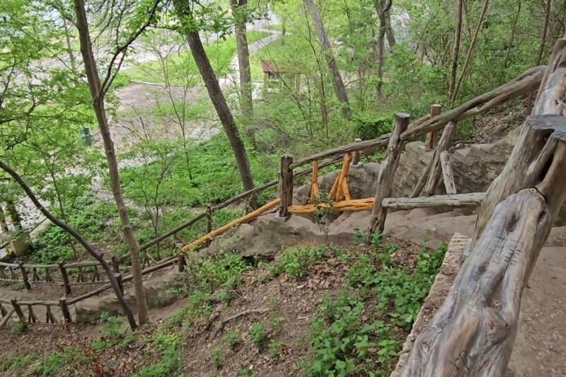
Once inside, the Maple Trail is a short, easy stroll right through the color. Hikers wanting more of a workout can take the East Trail up to overlooks above the canyon.
Now for the road trip part. Nearby Ranch Roads 335, 336, and 337 form a loop nicknamed the Twisted Sisters, famous for steep hills and sharp curves.
The loop runs roughly 100 miles through rugged Hill Country, with river crossings and sweeping views. Motorcyclists flock to it, but motion-sick passengers might want the front seat.
Cell service fades in parts of this region, so download your maps before leaving. Fill up the gas tank in a larger town too, because stations are spread thin out here.
Pack layers, since fall mornings in the canyon can start chilly and turn mild by lunch. Bring water and snacks for the trails, and plan for a full day.
Go on a weekday if you can swing it. You’ll trade crowds for quiet trails and far more elbow room near those famous red leaves.
Address: 37221 FM 187, Vanderpool, TX 78885
Guadalupe Mountains National Park
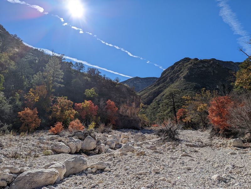
The highest point in Texas sits inside a national park that most people can’t find on a map. Guadalupe Peak rises 8,751 feet, but in fall, the real star hides in a canyon below.
McKittrick Canyon is often called one of the prettiest spots in the state when autumn arrives. Bigtooth maples flash red and orange, while velvet ash and oaks add shades of yellow.
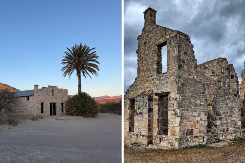
The trail to historic Pratt Cabin covers about 4.8 miles round trip and stays fairly gentle. Push on to the Grotto, and the hike stretches to roughly 7 miles.
Peak color usually lands from late October into early November. The park gets crowded during this window, especially on weekends, so arrive early.
One sneaky detail catches travelers off guard. The park runs on Mountain Time, one hour behind most of Texas.
The McKittrick Canyon gate also opens and closes at set times, and there’s no camping in the canyon. Check the park’s current hours before you go, or you might end up admiring the scenery through a locked gate.
The drive itself is wild and lonely. Highway 62/180 cuts across empty desert, then the mountains appear like a giant wall rising from the flat ground.
Services are scarce, so fill your tank in El Paso, Carlsbad, or Van Horn. Pack more water than you think you need, plus snacks and a full picnic lunch.
Wind can howl through these mountains, so a light jacket is a smart idea even on sunny days. Sturdy shoes help too, since the trail crosses rocky streambeds.
Start at Pine Springs Visitor Center for maps and trail updates. Then drive a few miles to the McKittrick Canyon turnoff and get ready for color you never expected in the desert.
Address: 400 Pine Canyon Rd, Salt Flat, TX 79847
River Road
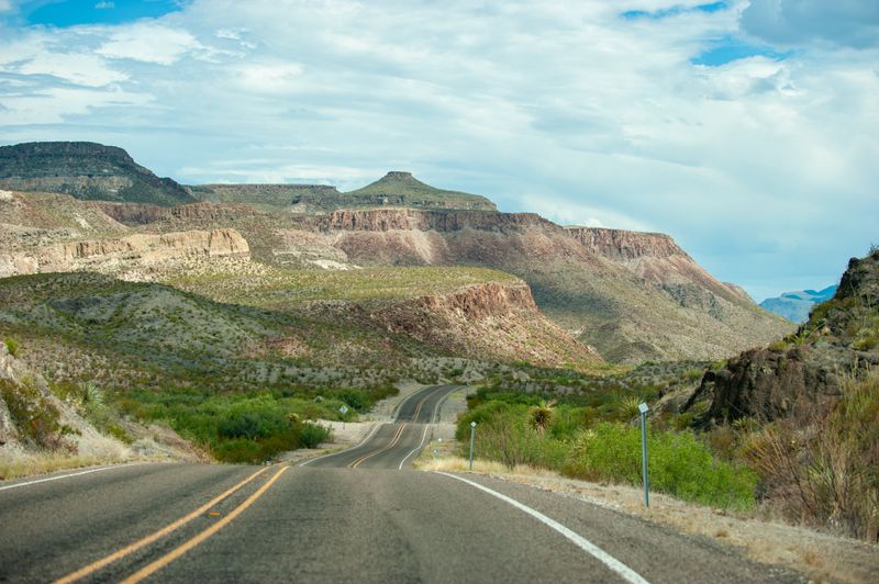
Few roads in America hug a river border as closely as FM 170. It’s known as the River Road, and it twists along the Rio Grande between Lajitas and Presidio for about 50 miles.
Summer heat in this corner of Texas can be rough, often climbing past 100 degrees. Fall cools things down, making stops for hikes and photos far more pleasant.
Start at Barton Warnock Visitor Center on the eastern end. The center offers exhibits on Chihuahuan Desert plants and animals, plus maps for the drive ahead.
Soon after, the road enters Big Bend Ranch State Park, one of the largest state parks in Texas. Cliffs, mesas, and volcanic rock tower over the asphalt.
Then comes the Big Hill, with a grade of around 15 percent. It’s among the steepest stretches of paved highway in the state, so take it slowly and enjoy the dramatic view from the top.
Want a quick hike? Closed Canyon is a short trail into a narrow slot canyon, with towering walls that squeeze closer as you go.
The Hoodoos Trail is another easy stop, with strange rock formations and river views. Both work well for families who need a stretch break.
Fall light makes the colors here pop. Late afternoon sun turns the cliffs gold and orange, so time your drive for golden hour if you can.
Gas stations are rare, so top off in Lajitas, Terlingua, or Presidio. Cell signal drops out in long stretches too.
Carry plenty of water, even in cooler months. The desert air stays dry, and you’ll get thirsty faster than you expect.
Watch for wildlife and loose livestock on the pavement. Slow driving is the safest choice, and frankly, the scenery deserves your full attention anyway.
Address: 21800 FM 170, Terlingua, TX 79852
Davis Mountains Scenic Loop
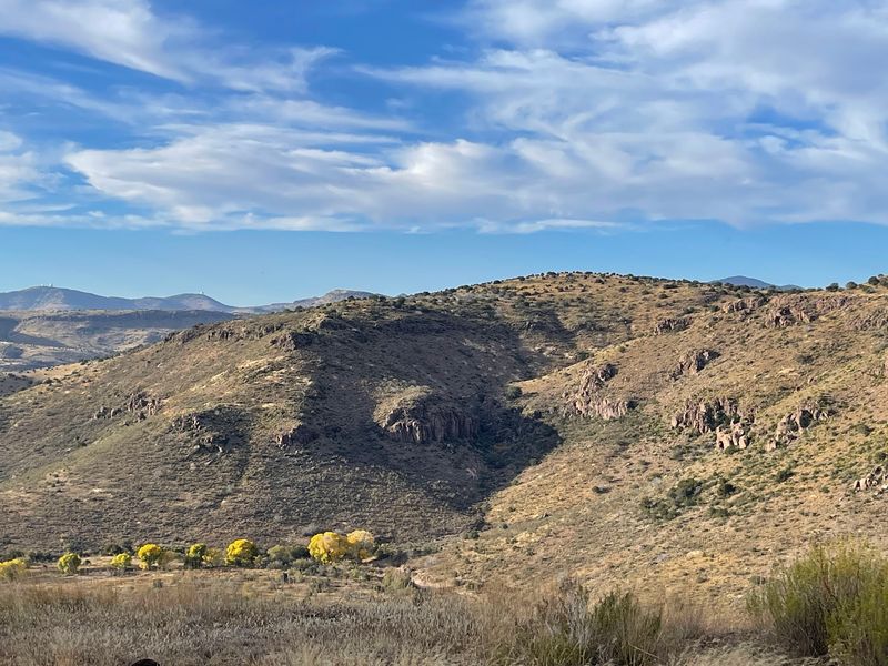
The highest public road in Texas doesn’t lead to a ski lodge. It leads to giant telescopes at McDonald Observatory, perched on Mount Locke near the town of Fort Davis.
That road is part of the Davis Mountains Scenic Loop, a 75-mile drive through some of the prettiest high country in the state. Fall brings crisp air, golden grasses, and skies so clear they almost look fake.
Plan to start in Fort Davis and head out on State Highway 118. The route winds past rocky peaks, grassy valleys, and oak-covered slopes before looping back on Highway 166 and Highway 17.
Davis Mountains State Park sits right along the way. Skyline Drive inside the park climbs to sweeping overlooks, and it’s a great spot for a picnic.
Back in town, Fort Davis National Historic Site preserves a frontier military post from the 1800s. You can wander restored buildings and get a feel for life on the old frontier.
Now for the real reason to stay late. McDonald Observatory hosts star parties on select evenings, where you can peer through telescopes at planets, galaxies, and star clusters.
Tickets often sell out, so book early. Dress in layers, because nights at this elevation get chilly quickly.
The observatory also offers daytime tours and solar viewing programs. Check the current schedule before you go, since hours and programs change by season.
Wildlife can show up along the loop, including pronghorn and mule deer. Keep your speed down, particularly near dawn and dusk.
Gas and food options are limited outside Fort Davis and Alpine. Fill up before you start, and pack snacks for the scenic pullouts.
A little extra time goes a long way here. Spend the night nearby, and you’ll get the drive by day and the stars by night, which feels like winning twice.
Address: 3640 Dark Sky Dr, Fort Davis, TX 79734
Caddo Lake State Park
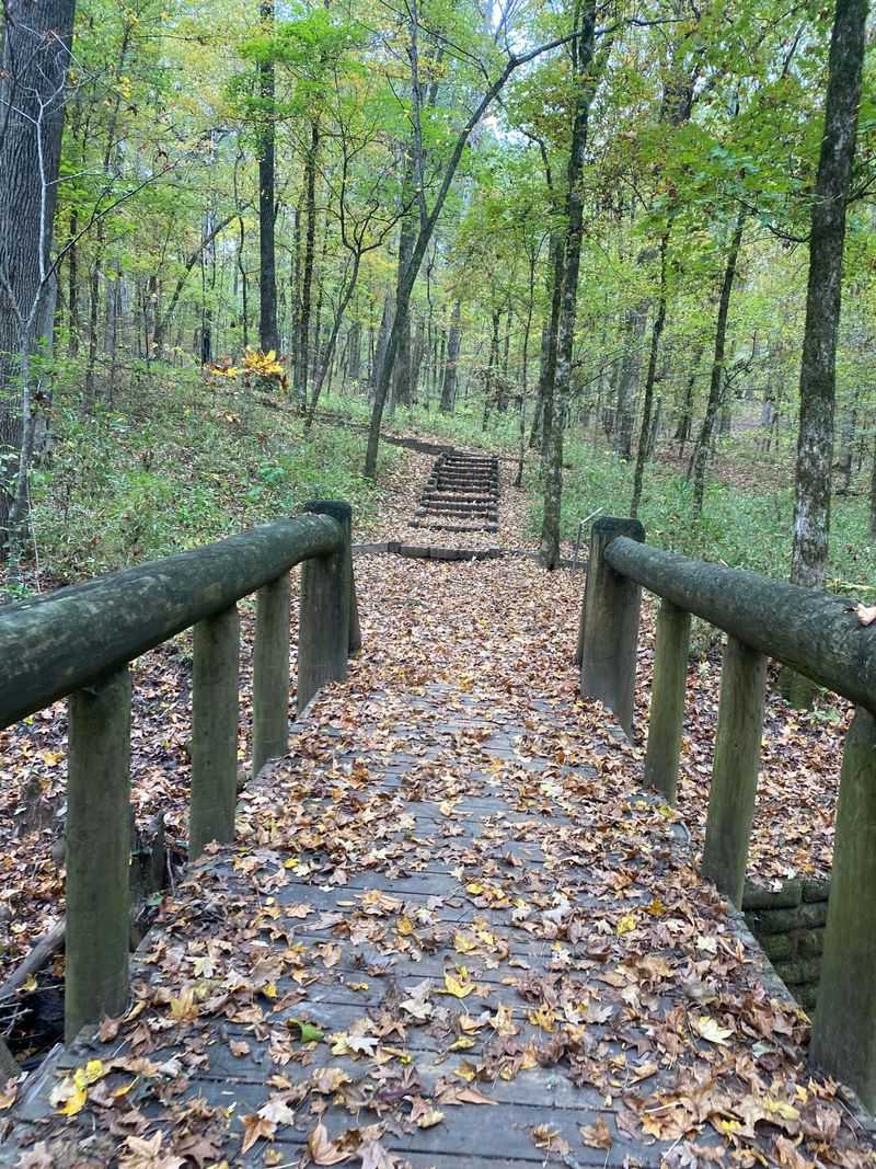
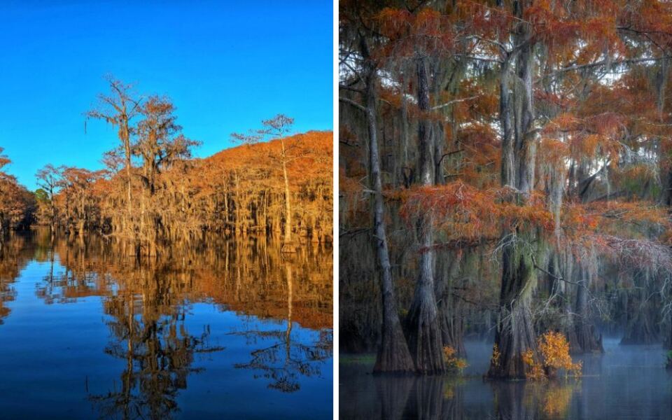
Bald cypress trees are conifers that drop their needles in winter, and before they do, they turn a rusty cinnamon color. At Caddo Lake State Park, a whole forest of them rises straight out of the water, wearing beards of Spanish moss.
The scene looks more like Louisiana than the Texas most people picture. Fair enough, since the lake sits right on the state line.
Color usually peaks in November, a bit later than many fall destinations. That timing makes it a great late-season trip after other spots fade.
The best views come from the water. The park rents canoes, and mapped paddling trails wind through a maze of bayous, sloughs, and cypress groves.
Prefer dry land? Hiking trails loop through the forest, and the Saw Mill Pond area offers easy viewing spots for photos.
History buffs get a bonus. The Civilian Conservation Corps built many of the park’s log cabins and pavilions during the 1930s.
Turtles, herons, and alligators call the lake home. Keep a respectful distance from wildlife, and never feed the gators, no matter how hopeful they look.
Mosquitoes can linger in East Texas well into fall. A bottle of bug spray belongs in your bag right next to the sunscreen.
Make it a road trip by adding nearby Jefferson, a historic town known for its brick streets and old homes. It’s a short drive from the park and fun for an afternoon stroll.
For a scenic approach, take back roads through the Pineywoods instead of rushing on the interstate. Tall pines, sweetgums, and oaks line the way, and some put on their own fall show.
Cabins and campsites fill up during peak color weekends. Book well ahead, and bring a camera with plenty of battery life.
Address: 245 Park Road 2, Karnack, TX 75661
Palo Duro Canyon State Park
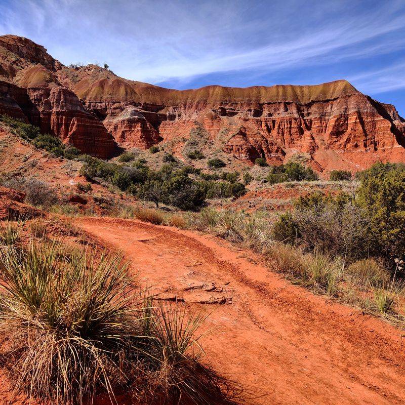
The second-largest canyon in the United States isn’t in Arizona or Utah. It’s in the Texas Panhandle, a short drive from Amarillo, where flat farmland suddenly drops away into a giant gorge.
Palo Duro Canyon stretches about 120 miles long and reaches depths of around 800 feet. Layers of red, orange, yellow, and white rock stack up like a giant layered cake.
Fall adds another layer of color. Cottonwoods along the canyon floor turn bright gold, glowing against those red cliffs.
Cooler temperatures matter here too. Summer can roast hikers on exposed trails, while fall days often feel just right for exploring.
The park road winds from the rim down to the canyon floor. Stop at the visitor center near the rim for one of the best wide views.
The famous Lighthouse Trail leads to a towering rock formation that became an icon of the park. The round trip runs about six miles, with little shade, so start early.
Mountain bikers and horseback riders share many of the trails here. Keep an eye out, and give everyone a friendly wave.
Wildlife sightings can include mule deer, wild turkeys, and roadrunners. The Texas horned lizard lives in the region too.
Rain can cause the park’s low-water crossings to flood quickly. If water covers the road, turn around and wait it out.
Make a full weekend of it in nearby Canyon. The Panhandle-Plains Historical Museum is known as the largest history museum in Texas, with fossils, art, and pioneer exhibits.
Weekends in fall can draw crowds, and campsites may fill. Reserve ahead, and pack a jacket for chilly evenings on the canyon floor.
Sunset here is worth planning around. When the light hits those cliffs, the whole canyon looks like it caught fire in the best possible way.
Address: 11450 State Hwy Park Rd 5, Canyon, TX 79015
Share this story