Eighteen wooden steps rise from a Sussex County wetland to a suspension bridge that seems to float above Pochuck Creek. Elsewhere, an old railroad trestle carries walkers 80 feet over a rocky gorge, and a narrow path squeezes beside traffic on an iron bridge built when Chester A.
Arthur was president. New Jersey’s most memorable trail crossings are not merely practical ways to get over water or highways.
They are destinations in their own right, turning an ordinary walk into something with height, history, and just enough drama. Some sway gently beneath your shoes.
Others preserve the bones of rail lines that once moved iron ore, coal, and passengers across the state. A few stretch all the way over the Delaware or Hudson rivers, delivering interstate views without requiring a car.
From marshland boardwalks to century-old steel spans, these eight routes prove that sometimes the finest part of a trail is the moment the ground disappears beneath it.
1. Pochuck Boardwalk and Suspension Bridge
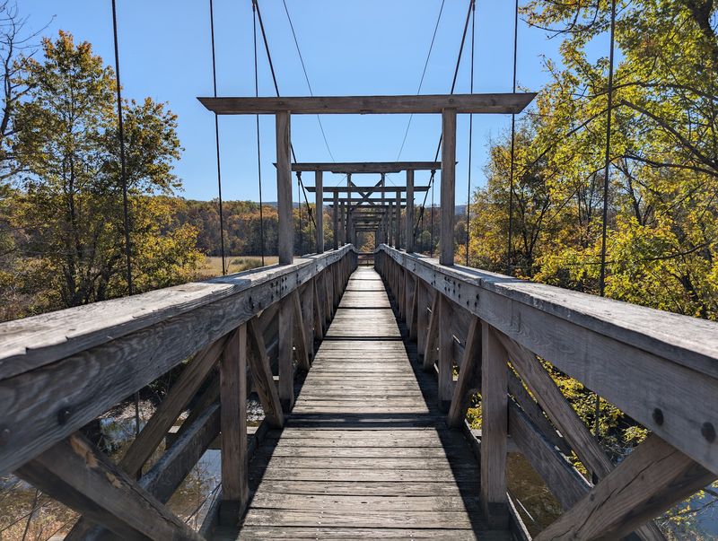
For most of this Vernon walk, your feet barely touch solid ground. The Appalachian Trail glides across the Pochuck Valley on an elevated wooden boardwalk, threading through cattails, open marsh, and pockets of shady woodland before reaching the route’s star attraction.
Eighteen steps climb to a 144-foot suspension bridge over Pochuck Creek, where the view opens across the wetlands and the structure provides just enough movement to make the crossing feel adventurous.
The bridge is sturdy, but it still delivers that unmistakable bounce that makes children hurry ahead and adults instinctively reach for the railing.
This is one of the gentlest ways to experience the Appalachian Trail in New Jersey. A simple out-and-back along the boardwalk covers roughly two miles, although ambitious hikers can continue toward the steep Stairway to Heaven climb and Pinwheel Vista.
Staying low has its own rewards, especially when turtles, frogs, waterfowl, or even a bald eagle make an appearance. The main access point is along Route 517, where parking is limited to designated roadside spaces and fills quickly on pleasant weekends.
An alternate approach from Canal Road adds mileage but may reduce the parking scramble. Visit after a dry stretch, bring insect repellent in warm weather, and expect the exposed boardwalk to feel breezier than the surrounding woods.
2. Institute Woods Swinging Bridge Trail
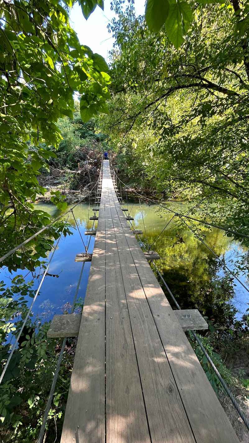
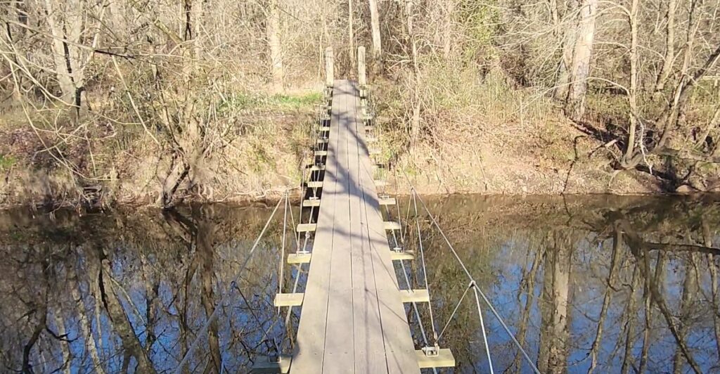
A suspension bridge feels delightfully unexpected in Princeton, particularly when it appears at the end of a quiet woodland path rather than on a rugged mountain route.
The River’s Edge Trail follows Stony Brook through Institute Woods to an approximately 80-foot swinging bridge tucked beneath a leafy canopy.
It is an easy crossing with a playful wobble, and the brook below supplies the kind of soundtrack that makes walkers linger halfway across. The bridge also carries an intriguing piece of local intellectual history.
It was part of a trail project associated with Founders’ Walk, dedicated in 1950 by J. Robert Oppenheimer, who directed the neighboring Institute for Advanced Study.
Albert Einstein also walked in these woods during his years at the institute. A loop of just over two miles can combine River’s Edge Trail, Founders’ Walk, and the broad Trolley Track Trail, while longer wandering is possible across more than eight miles of interconnected paths.
Princeton Battlefield State Park provides a convenient starting point and adds the Clarke House and Revolutionary War landscape to the outing. Conditions matter here: the woods and neighboring wildlife refuge occupy a floodplain, so mud and standing water are common after sustained rain.
The trail system is not marked at every turn, making a map useful despite the modest distance. Come for the swinging bridge, but leave enough time for the tulip trees, birdlife, and wonderfully unhurried detours.
3. Columbia Trail
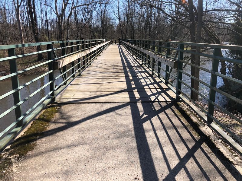
The bridge above Ken Lockwood Gorge does not reveal itself gradually. One moment, the Columbia Trail is carrying you along a shaded former railroad bed; the next, the trees pull back and a steel span launches across the South Branch of the Raritan River.
Roughly 260 feet long and elevated about 80 feet above the water, it offers one of the grandest trail crossings in the state. The river tumbles between steep, wooded slopes below, particularly impressive after rain or during spring runoff.
This dramatic structure owes its existence to the Central Railroad of New Jersey’s High Bridge Branch, completed in the 1870s to transport iron ore.
A wooden trestle once occupied the site, but after a spectacular 1885 train wreck sent an engine and cars into the gorge, the crossing was eventually rebuilt with steel supports.
Trains are gone, leaving hikers, cyclists, and horseback riders to enjoy the engineering. The larger Columbia Trail extends about 15 miles between High Bridge and Washington Township in Morris County, but reaching the gorge does not require covering the whole route.
Starting in High Bridge produces an appealing out-and-back with a gentle railroad grade, crushed-stone footing, and river views along the way. The town trailhead has parking and places to grab food afterward.
For peak scenery, aim for October color or a crisp morning when mist hangs over the gorge.
4. Paulinskill Valley Trail
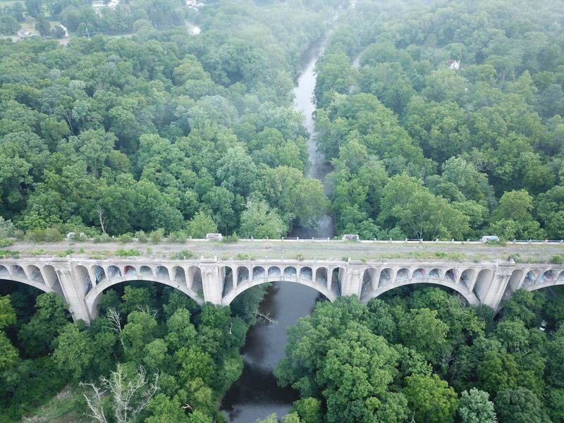
Railroad history is written directly into the route of this long, wonderfully rural trail. The corridor once belonged to the New York, Susquehanna and Western Railway, and its former bridges now carry walkers, cyclists, and horseback riders over streams, roads, and stretches of the Paulins Kill.
Weathered stonework, old bridge abutments, and the straight, forgiving grade make the line’s original purpose easy to recognize even where the tracks have vanished.
The trail runs for roughly 27 miles across Sussex and Warren counties, but it works best as a collection of shorter outings rather than a single march.
Sections near Blairstown, Marksboro, and Warbasse Junction combine wooded crossings with farmland, marshes, and glimpses of the river. The surface changes from packed dirt and cinders to grassier patches, so conditions can become soft after rain.
Those irregularities are part of its appeal: this feels less polished than a suburban greenway and more like a rail corridor slowly being reclaimed by the countryside. The enormous Paulins Kill Viaduct near Hainesburg is another compelling piece of transportation history along the route.
The trail passes beneath this monumental concrete structure rather than over it, creating a striking contrast with the smaller former railroad spans used underfoot. Bring water and download a map before setting out, as amenities and signage vary.
Early fall is especially rewarding, when golden fields and turning leaves frame the surviving masonry and steel.
5. Sussex Branch Trail
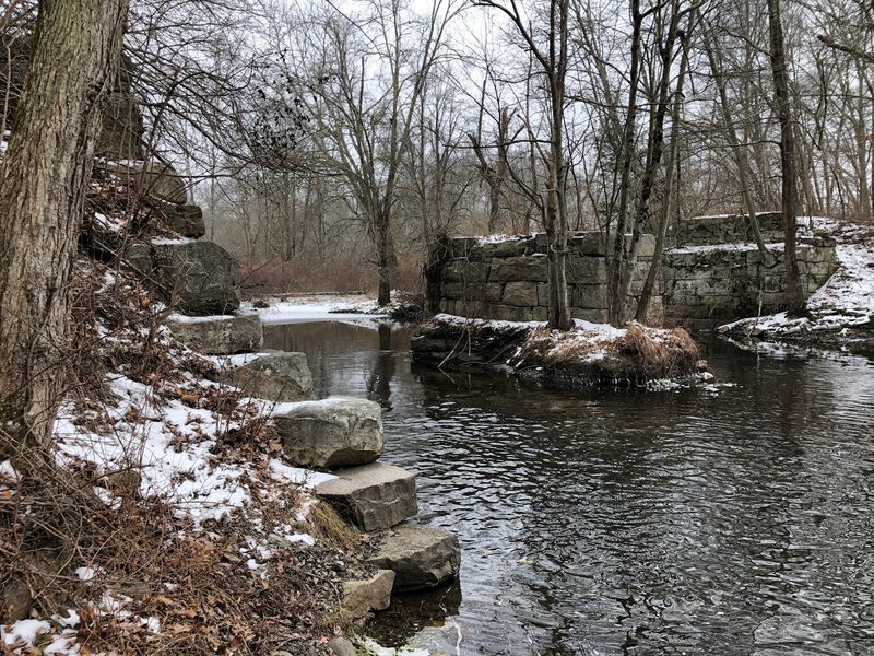
You can still feel the railroad beneath this trail, even without rails under your shoes.
The route follows the former Sussex Branch of the Erie Lackawanna system for approximately 20 miles, crossing waterways on old rail-era alignments and passing through rock cuts that were carved for locomotives rather than weekend hikers.
Those engineered features give the trail a satisfying sense of purpose: curves are broad, grades are manageable, and every bridge feels like another clue to how freight and passengers once moved through northwestern New Jersey.
One of the most enjoyable stretches runs near Kittatinny Valley State Park, where the corridor passes through forests, wetlands, and open fields alive with birds.
Farther along, Waterloo Village supplies a fitting historical anchor, with preserved canal buildings and the Morris Canal landscape nearby. The trail also connects with the Paulinskill Valley Trail, allowing cyclists to build a much longer rail-trail adventure.
Underfoot, expect crushed stone, packed earth, and occasional rough or muddy areas rather than uninterrupted pavement. Hybrid or gravel bicycles suit it better than narrow road tires, while walkers will appreciate the mostly gentle terrain.
Road crossings interrupt the route in places, so do not assume every mile is isolated from traffic. Parking is available at several access points, making a one-way shuttle or customized out-and-back easy to arrange.
In late spring, the green corridor feels almost tunnel-like; in autumn, the old cuts and bridge approaches become framed in color.
6. Calhoun Street Bridge Walkway
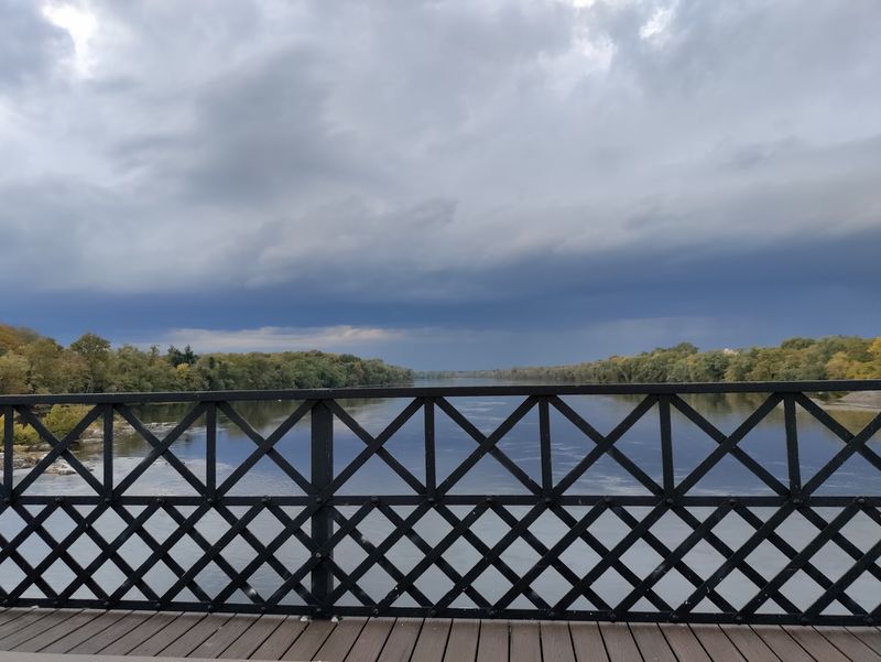
Few walks deliver this much ironwork in such a short distance. The Calhoun Street Bridge stretches from Trenton to Morrisville, Pennsylvania, carrying a pedestrian walkway through a sequence of narrow steel trusses above the Delaware River.
Built in 1884, the bridge is listed on the National Register of Historic Places and still possesses the intricate, riveted character of an era when infrastructure was designed with a little flourish. Crossing it is an exercise in contrasts.
The Delaware moves broadly below, the Trenton skyline rises nearby, and modern traffic rolls through a structure more than a century old.
The bridge once carried trolleys and formed part of the Lincoln Highway, giving today’s walk a direct connection to several chapters of regional transportation history.
At approximately a quarter mile, the span itself is not a long hike, but it fits neatly into a larger urban walk along the riverfront or a route connecting downtown Trenton with paths on the Pennsylvania side.
The walkway is narrow, and passing other pedestrians may require a bit of cooperation, especially when bicycles are involved.
Traffic noise is part of the experience, but so are unusual views of the bridge’s steel framework and the water between its beams.
Parking requires more planning than at a park trailhead; using a downtown Trenton garage or beginning from a nearby riverfront area is generally easier than searching beside the bridge.
Sunset adds warm light to the rust-colored metal and makes the return crossing especially photogenic.
7. Tacony-Palmyra Bridge Walkway
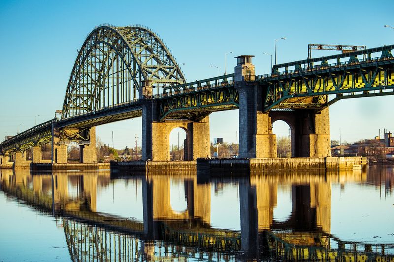
Half bridge crossing, half lesson in industrial design, this Delaware River route puts pedestrians beside one of South Jersey’s most recognizable transportation landmarks. The Tacony-Palmyra Bridge opened in 1929, replacing the ferry service that once linked Palmyra with Northeast Philadelphia.
Its mix of steel arch, viaduct sections, and a working bascule span makes it far more visually complicated than a straightforward highway bridge. The pedestrian walkway allows walkers and cyclists to experience those components at close range while gaining broad views upriver and downriver.
The full crossing is a little under a mile each way when the approaches are included, making it substantial enough for an outing without demanding an entire day. On the New Jersey side, Palmyra Cove Nature Park adds wooded paths, river overlooks, and wetlands to the itinerary.
Combining the park with an out-and-back bridge crossing creates a satisfying blend of wildlife and heavy engineering: herons and egrets on one side, millions of pounds of steel on the other. The walkway is exposed to wind, sun, and traffic noise, so choose a mild day and secure hats before stepping onto the span.
Cyclists should move cautiously around pedestrians, particularly on narrower sections. Because the bridge can open for marine traffic, delays are possible and are honestly part of the fun if you enjoy watching large machinery work.
This is not a quiet forest hike, but few New Jersey walks offer a better close-up of a functioning historic drawbridge.
8. George Washington Bridge Shared-Use Path
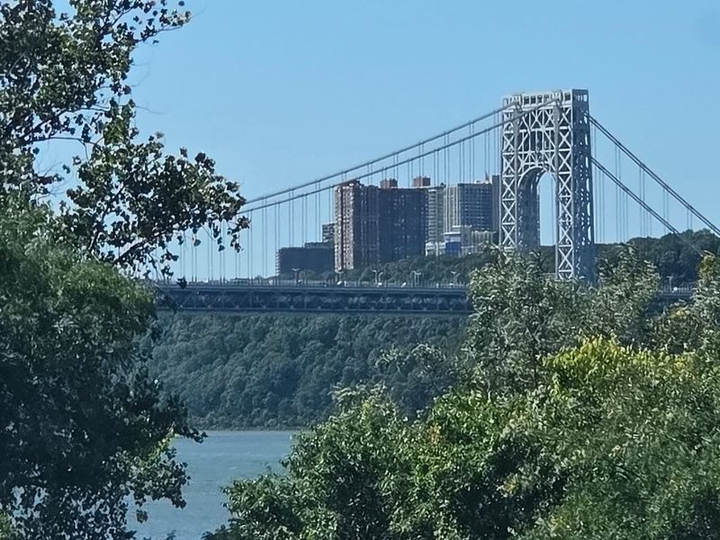
The Hudson appears enormous from the middle of this crossing. To the south, Manhattan rises beyond the river; to the north, the Palisades form a long wall of dark rock and trees.
The George Washington Bridge’s shared-use path turns that panorama into a walk or ride that begins in Fort Lee and ends in upper Manhattan, all while passing through the massive steelwork of a span opened in 1931. The bridge itself is the experience here.
Suspension cables sweep overhead, towers frame the skyline, and the steady hum of traffic reinforces the sheer scale of the structure.
Recent improvements to the northern path added wider approaches, gentler ramps, seating, and upgraded access, making the crossing easier to navigate for pedestrians and cyclists.
A round trip is approximately three miles, though connecting routes can stretch the day considerably. On the New Jersey side, Fort Lee Historic Park offers overlooks and Revolutionary War history, while trails in Palisades Interstate Park can add wooded mileage and a much steeper workout.
Across the river, Manhattan’s Hudson River Greenway opens the door to a longer urban ride or walk. The path can become busy, particularly with fast-moving cyclists, so keep right and stay alert when stopping for photos.
Wind is often stronger above the water than it is in Fort Lee, and shade is limited. Go early on a clear morning for lighter traffic, crisp skyline views, and the rare pleasure of walking from New Jersey to New York without descending to river level.
Share this story