Tennessee roads wind through mountains, valleys, and forests that change with every season. Whether you want fall colors blazing across ridgelines or spring wildflowers lining the pavement, these drives deliver views that make you pull over just to soak it all in.
Pack some snacks, fill up the tank, and get ready to see why Tennessee’s backroads are just as famous as its music.
1. Foothills Parkway – Great Smoky Mountains
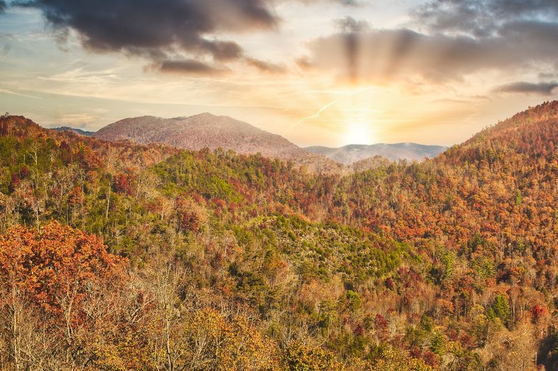
Foothills Parkway hugs the western edge of the Smokies, offering ridge-top views without the crowds you’ll find deeper in the park. The route stretches in sections, with the most popular being the segment between Walland and Wears Valley.
You’ll climb above the tree line in spots, giving you unobstructed panoramas of wave after wave of blue-green mountains.
Fall brings out the best in this drive. Maples, oaks, and hickories turn the hillsides into patchwork quilts of red, orange, and gold.
Spring is equally stunning, with dogwoods and redbuds dotting the forests in white and pink. Even summer has its charm, with hazy mornings that give the Smokies their name.
Pull into one of the many overlooks and you’ll see why this parkway was decades in the making. Construction started in the 1960s but wasn’t completed until 2018, making it one of the longest road projects in national park history.
The wait was worth it.
Wildlife sightings are common here. Keep an eye out for white-tailed deer, wild turkeys, and black bears, especially during early morning or late afternoon drives. If you’re lucky, you might spot a hawk riding the thermals above the ridges.
The road itself is smooth and well-maintained, with gentle curves that make it perfect for a leisurely drive. There are no gas stations or restaurants along the way, so plan accordingly.
Bring water, snacks, and a camera with plenty of battery life.
Sunset is magical up here. The sky turns shades of pink and purple, and the valleys below fade into shadow while the peaks still glow with light.
It’s the kind of view that makes you forget about whatever was stressing you out back home.
Whether you’re a local looking for a weekend escape or a visitor exploring Tennessee for the first time, Foothills Parkway delivers scenery that sticks with you long after you’ve headed back down the mountain.
2. Cherohala Skyway – Tellico Plains to the North Carolina Line
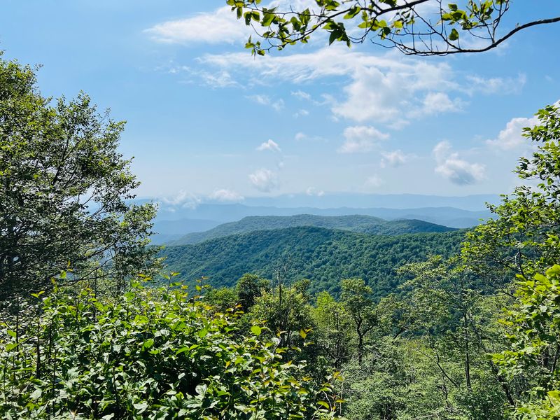
Cherohala Skyway climbs from Tellico Plains into the clouds, crossing the Cherokee and Nantahala National Forests before dropping into North Carolina. At 5,390 feet, the highest point offers views that stretch for miles in every direction.
On clear days, you can see into four states.
This 43-mile route is less traveled than the nearby Tail of the Dragon, making it ideal for drivers who want scenery without the motorcycle traffic. The road is wide and well-paved, with sweeping curves that feel more relaxing than adrenaline-pumping.
You can actually enjoy the views without white-knuckling the steering wheel.
Spring wildflowers carpet the roadside in April and May. Trilliums, violets, and flame azaleas add bursts of color to the green forests. Summer brings cool temperatures at the higher elevations, a welcome break from the heat down in the valleys.
Fall is peak season here, and for good reason. The skyway cuts through some of the most vibrant foliage in the Southeast.
Plan your trip for mid-October if you want to catch the colors at their best. Weekdays are less crowded than weekends.
There are several overlooks where you can stop and stretch your legs. Santeetlah Overlook on the North Carolina side is particularly stunning, with views of the lake below and mountains beyond.
Huckleberry Knob offers a short walk to a grassy bald with 360-degree views.
Winter can be tricky. The skyway is maintained year-round, but snow and ice can close sections without much warning.
Check conditions before you go if you’re driving between November and March. Even in good weather, temperatures at the top can be 15 to 20 degrees cooler than in the valleys.
Pack a picnic and take your time. This isn’t a drive you want to rush. The whole point is slowing down and remembering what Tennessee looked like before highways and strip malls took over.
3. Newfound Gap Road – Gatlinburg Through Great Smoky Mountains National Park
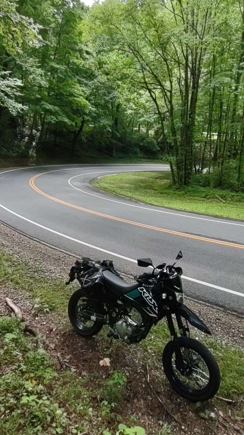
Newfound Gap Road is the only route that cuts straight through Great Smoky Mountains National Park, connecting Gatlinburg, Tennessee, to Cherokee, North Carolina. It’s 31 miles of mountain scenery that changes with every twist and turn.
You’ll start in the touristy bustle of Gatlinburg and end up deep in old-growth forest where the air smells like rain and moss.
The road climbs over 3,000 feet in elevation, topping out at Newfound Gap itself, where you can stand on the state line and look back at where you came from. There’s a parking area here, and on weekends it fills up fast.
Arrive early if you want a spot.
Wildlife is everywhere. Deer graze in the meadows near Cades Cove Loop Road, which branches off partway through the drive.
Black bears are a common sight, especially in late summer when they’re fattening up for winter. Keep your distance and never feed them, no matter how cute they look.
One of the best stops is the Chimney Tops Trail parking area, where a short hike takes you to rocky outcrops with sweeping views. If you’re not into hiking, just pull over at one of the many turnouts.
The views are worth it even if you never leave your car.
Fall foliage here is legendary. The park’s mix of elevations means colors start at the top in late September and work their way down through October. You can actually chase the peak colors by driving higher or lower depending on the week.
Spring brings wildflowers and rushing streams. Waterfalls that trickle in summer become roaring cascades in April. The rhododendrons bloom in June, turning the roadsides into tunnels of pink and white.
Traffic can be heavy, especially on summer weekends and during October. Patience is key.
This isn’t the place to be in a hurry. Roll down the windows, breathe in the mountain air, and enjoy the fact that some places still look the way they did a hundred years ago.
4. Natchez Trace Parkway – Near Nashville and Franklin
Natchez Trace Parkway follows an ancient trail used by Native Americans, explorers, and traders for thousands of years. The Tennessee section runs from just south of Nashville down to the Alabama line, passing through Franklin and some of the prettiest countryside in Middle Tennessee.
No billboards, no stoplights, just 444 miles of protected land that looks much like it did when pioneers walked this route.
The speed limit is 50 mph, which feels slow at first but makes sense once you start noticing the details. Stone walls built by hand in the 1800s.
Fields where Civil War battles were fought. Creeks that still run clear enough to see the rocks on the bottom.
There are dozens of pull-offs and historical markers along the way. The Meriwether Lewis Monument marks the spot where the famous explorer died under mysterious circumstances in 1809.
The Old Trace Drive is a short detour onto the original sunken path, worn down by centuries of foot traffic and wagon wheels.
Birch Tree Falls is a quick roadside stop where a small waterfall tumbles over moss-covered rocks. It’s especially pretty after a rain. Bring bug spray in summer; the mosquitoes can be fierce near the water.
Cyclists love this road. The shoulders are wide, the traffic is light, and the scenery is unbeatable.
On weekends you’ll see groups of riders tackling the gentle hills. Drivers and cyclists share the road peacefully here, a rarity in Tennessee.
Fall colors arrive in late October and early November. The hardwood forests along the trace turn brilliant shades of yellow and orange. Spring is equally beautiful, with dogwoods and redbuds blooming in the understory.
Pack a lunch and stop at one of the picnic areas. There are no restaurants or gas stations on the parkway itself, so plan your stops in nearby towns like Franklin or Leipers Fork.
The whole point is getting away from the commercial clutter and remembering what Tennessee looked like before it was paved over.
5. Ocoee Scenic Byway – Along the Ocoee River
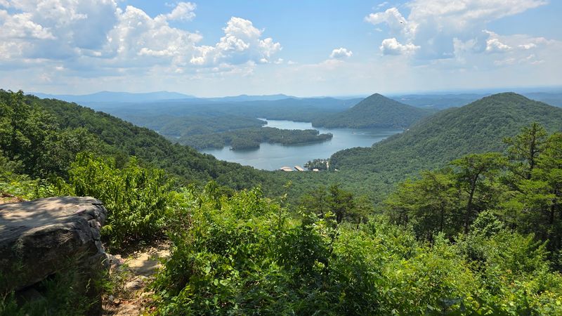
Ocoee Scenic Byway follows the Ocoee River through the Cherokee National Forest, tracing the same route that hosted the 1996 Olympic whitewater events. The river churns alongside the road, its rapids visible through the trees.
On summer weekends, you’ll see rafters bouncing through the waves, their shouts of excitement echoing off the canyon walls.
This 26-mile stretch of Highway 64 is all about the water. The road hugs the riverbank, dipping and climbing with the terrain. Pull-offs let you stop and watch the action, whether that’s kayakers navigating Class III rapids or families wading in calmer pools downstream.
The byway starts near Cleveland and heads east into the mountains. As you climb, the forest gets thicker and the air gets cooler.
Hemlock and rhododendron shade the road, creating tunnels of green that open up to sudden views of the river below.
Fall is spectacular here. The hardwoods on the hillsides turn gold and red, contrasting with the evergreens and the blue-green water. Mid-October is usually peak color, but the exact timing shifts depending on the weather.
There are several spots where you can get out and explore. The Ocoee Whitewater Center is worth a stop, with exhibits about the Olympic events and trails that lead down to the river.
The old copper mining town of Copperhill sits at the eastern end of the byway, a quirky little place with a few cafes and antique shops.
Summer gets busy. Rafting companies run shuttles up and down the road, and parking at popular put-in spots can be tight. Weekdays are quieter if you want to avoid the crowds.
Winter is the hidden gem season. The rafting companies shut down, the tourists disappear, and you get the road almost to yourself.
The river still rushes, the mountains still loom, but now it’s peaceful enough to hear the water over the wind.
Bring a camera and take your time. This is one of those drives where the journey really is the destination.
6. Cumberland National Scenic Byway – Upper Cumberland
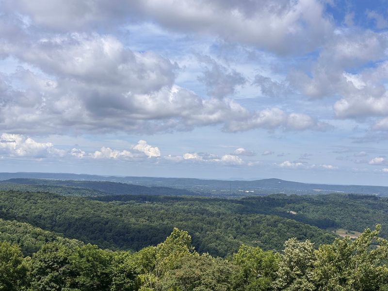
Cumberland National Scenic Byway loops through the Upper Cumberland region, crossing the Cumberland Plateau on roads that wind past farms, forests, and small towns that time seems to have forgotten. This 90-mile route isn’t as dramatic as some mountain drives, but it offers a quieter kind of beauty, the kind you find in rolling pastures and century-old barns.
The byway passes through Crossville, known as the Golf Capital of Tennessee, before heading north through Grassy Cove, a stunning valley surrounded by mountains on all sides. Grassy Cove is one of the largest natural sinkholes in North America, though it doesn’t look like a hole from ground level.
It looks like a postcard of rural America, with cows grazing and silos standing against the sky.
Waterfalls are scattered along the route. Cumberland Mountain State Park has several short trails that lead to cascades tucked into the forest. Ozone Falls is a side trip worth taking, a 110-foot waterfall that plunges into a natural amphitheater of rock.
The byway is especially pretty in spring when wildflowers blanket the roadsides. Trilliums, lady slippers, and jack-in-the-pulpits bloom in the shaded spots, while open fields fill with daisies and black-eyed Susans.
Fall brings the usual color show, though it’s more subtle here than in the Smokies.
Small towns along the route offer a glimpse into Tennessee’s past. Stop in Crab Orchard or Pleasant Hill for a meal at a local diner or a browse through an antique shop.
These aren’t tourist towns; they’re real places where people still know their neighbors.
The road itself is well-maintained but narrow in spots. You’ll share it with logging trucks and farm equipment, so keep your speed reasonable and stay alert.
This isn’t a drive for people in a hurry. Pack a cooler and plan to picnic somewhere along the way. There are plenty of spots where you can pull off and enjoy the view, whether that’s a mountain overlook or a quiet creek.
7. Sequatchie Valley Scenic Byway – Southeast Tennessee
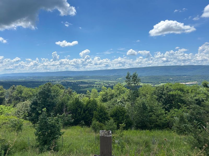
Sequatchie Valley Scenic Byway runs the length of the Sequatchie Valley, a 150-mile-long valley carved between the Cumberland Plateau on one side and the Tennessee Valley Divide on the other. The road follows the valley floor, with mountains rising on both sides like walls.
It’s one of the most unusual geological features in the state, and the drive gives you a front-row seat.
The byway starts near Pikeville and heads south through Dunlap, a small town that serves as the gateway to the valley. From there, the road stretches south through farmland and forest, passing through communities that still depend on agriculture and timber.
Fall Creek Falls State Park is a must-stop along the route. The park has the highest waterfall in the eastern United States, a 256-foot cascade that drops into a gorge surrounded by forest.
There are trails for all skill levels, from easy walks to challenging hikes that take you deep into the backcountry.
The valley itself is a patchwork of farms, fields, and forests. Cows graze on hillsides, barns sag under the weight of years, and creeks meander through pastures. It’s the kind of scenery that makes you want to slow down and pay attention.
Spring is wildflower season. The roadsides explode with color, from purple ironweed to yellow coneflowers. Summer brings fireflies by the thousands, turning the fields into light shows after dark.
The byway is less traveled than some of Tennessee’s other scenic routes, which means you’ll have stretches of road almost to yourself. That’s part of the appeal.
This is a drive for people who want to escape the crowds and see a part of Tennessee that hasn’t been overrun by tourists.
There are a few small towns along the way where you can stop for gas or a meal. Don’t expect chain restaurants or big grocery stores. What you’ll find are local diners, country stores, and people who are happy to give you directions or recommend a good fishing spot.
Take your time and enjoy the quiet. This is Tennessee the way it used to be.
8. Norris Freeway – Norris and Norris Lake
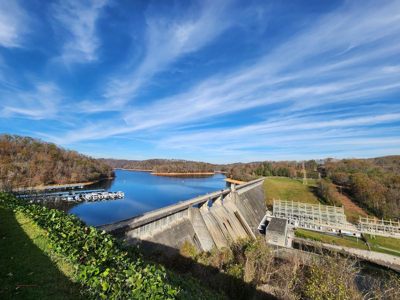
Norris Freeway connects the town of Norris with Interstate 75, passing through the Norris Lake area and some of the prettiest countryside in East Tennessee. Built in the 1930s as part of the Tennessee Valley Authority’s Norris Dam project, the freeway was one of the first limited-access roads in the state.
It still feels like a step back in time, with stone bridges and tree-lined shoulders that haven’t changed much in 90 years.
Norris Lake is the main attraction here. Created by Norris Dam, the lake has 800 miles of shoreline and water so clear you can see the bottom in shallow areas.
The freeway offers glimpses of the lake through the trees, though you’ll want to stop at one of the overlooks for a better view.
Norris Dam State Park is worth a visit. The park has hiking trails, a swimming beach, and a museum that tells the story of the TVA and its impact on the region.
The dam itself is an engineering marvel, and tours are available if you want to see the inner workings.
The town of Norris is a planned community built to house workers during the dam’s construction. It’s tiny but charming, with a few shops and cafes that cater to visitors.
The Lenoir Museum in the park has exhibits on Appalachian life before the TVA changed everything.
Fall colors here are outstanding. The forests around the lake turn brilliant shades of red, orange, and yellow, and the reflections on the water double the impact.
Mid-October is usually the best time, though it varies from year to year.
Spring brings wildflowers and blooming dogwoods. Summer is all about the lake, with boaters and swimmers taking advantage of the clear, cool water. Winter is quiet, with the park and freeway almost deserted except for locals.
The freeway itself is short, just 15 miles or so, but it’s worth driving if you’re in the area. Combine it with a visit to the dam or a day on the lake, and you’ve got a perfect East Tennessee getaway.
9. East Tennessee Crossing / Tennessee’s Wilderness Road – Northeast Tennessee
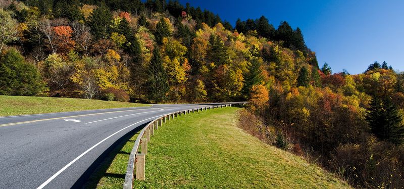
East Tennessee Crossing, also known as Tennessee’s Wilderness Road, follows the route Daniel Boone and other pioneers used to push into the western frontier. The byway runs through the mountains of Northeast Tennessee, passing through small towns and valleys that still feel remote even today.
This is Appalachia at its most authentic, with mountain culture alive in the music, food, and way of life.
The route starts near Rogersville, one of Tennessee’s oldest towns, and heads north through Kingsport and into the Clinch Mountains. The road climbs and dips, offering views of ridges that seem to go on forever.
In some spots, you can see three or four mountain ranges layered in the distance, each one a little hazier than the last.
Historical markers along the way tell the story of the pioneers who walked this route in the 1700s. It wasn’t an easy journey.
They faced rough terrain, unpredictable weather, and the constant threat of conflict with Native American tribes who had lived here for centuries.
Cumberland Gap National Historical Park sits at the northern end of the byway, where Tennessee, Kentucky, and Virginia meet. The gap itself is a natural pass through the mountains, and standing there, you can understand why it was so important to westward expansion.
Trails lead to overlooks with views that stretch for miles.
The byway passes through several small towns where Appalachian culture is still strong. Stop in Sneedville or Ewing for a taste of local life.
You might catch a bluegrass jam session or stumble on a church potluck. People here are friendly and proud of their heritage.
Fall is the best time to drive this route. The hardwood forests turn every shade of red, orange, and yellow, and the mountain air is crisp and clean.
Spring is beautiful too, with dogwoods and redbuds blooming on the hillsides.
This isn’t a drive for people looking for luxury or convenience. It’s for those who want to see a part of Tennessee that’s still wild and rugged, where the past isn’t something you read about in books but something you can still feel in the land.
Share this story