A bald eagle over a wild-rice marsh, an abandoned railroad grade disappearing into the woods, and a river tumbling around boulders beneath old hemlocks are not scenes that require crossing the Delaware. New Jersey has plenty of river trails where the water does most of the scenery work, yet many of them sit well outside the usual weekend-hike rotation.
Some follow broad tidal rivers through South Jersey marshland. Others trace cold North Jersey streams past old mills, mining remnants, waterfalls, and forgotten rail corridors.
A few are so close to developed neighborhoods that the sudden quiet feels almost suspicious. The common thread is that these walks give you something more interesting than another loop through anonymous woods.
You have moving water beside you, history underfoot, and usually far fewer people than at the state’s headline hiking destinations. For an easy afternoon wander or a longer boots-on-the-ground outing, these 12 river trails deserve a spot on the list.
1. Maurice River Bluffs Preserve: South Jersey With a Little Height
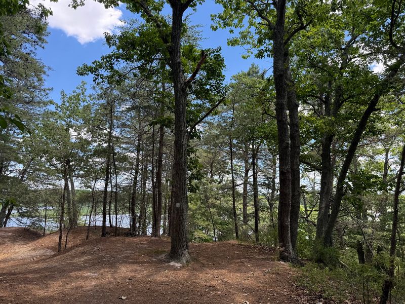
Southern New Jersey does not usually get credit for hills, which makes the first climb at Maurice River Bluffs feel like the landscape is playing a trick on you. The preserve rises above the Maurice River outside Millville, with rounded bluffs, wooded slopes, ponds, marshes, and more elevation change than most hikers expect this far south.
Roughly five miles of marked hiking trails can be stitched together into different-length outings, with the Blue, Red, Orange, White, and Yellow routes passing through noticeably different terrain. The river is the star, especially where the trails reach overlooks and lower areas near the water.
Wild-rice marshes spread along the Maurice, and the preserve sits on an important migration corridor for songbirds and raptors. Ospreys and bald eagles are both regular possibilities, particularly around the river and floating dock.
The human history is surprisingly visible too. Remnants of an old stone farmhouse, former sand-mining operations, railway foundations, and pilings remain scattered around the property.
A large parking lot off Silver Run Road makes access straightforward, and the preserve is open during daylight hours throughout the year. Hiking trails are foot-traffic only, while a separate six-mile mountain-bike system handles riders.
Come after a dry spell if you want easier footing on the steeper pieces, and save a few minutes for simply standing near the river rather than treating the place as a mileage exercise.
2. Musconetcong Gorge Preserve: A River Walk With Some Muscle
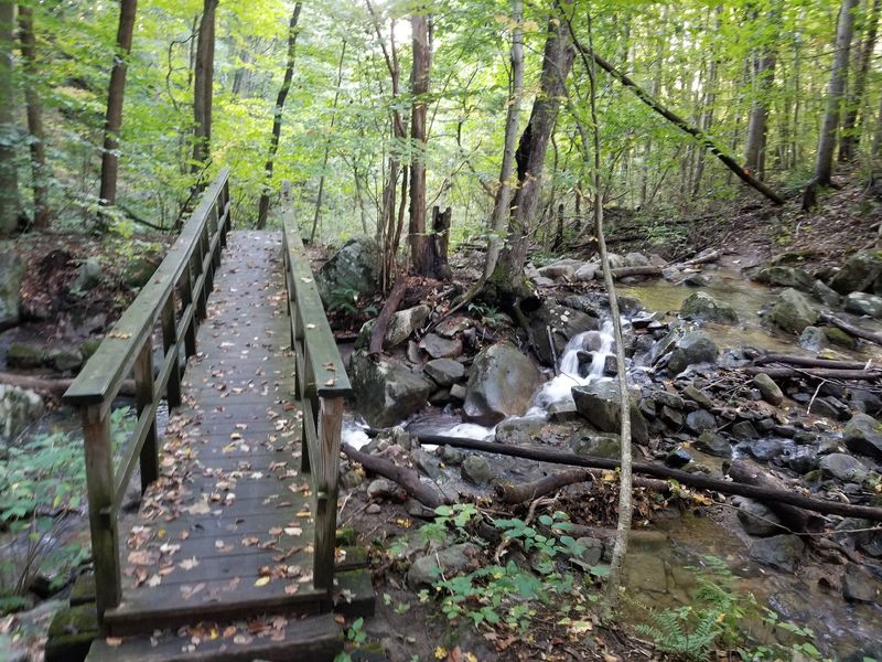
This is the one to pick when “river trail” sounds a little too gentle. Musconetcong Gorge Preserve, straddling Holland and Bethlehem townships in Hunterdon County, packs rocky climbs, stream crossings, cascades, and substantial elevation changes into a relatively compact trail system.
About 4.1 miles of trails wind through the preserve, and several sections are rated moderate to difficult rather than casual-walk territory. Pine Run, Scout Creek, and other watercourses cut through the ravine before feeding the Musconetcong, giving the woods that damp, fern-covered look that feels especially good after rain.
The flip side is that rocks and slopes can become slick, so this is a place for real shoes rather than whatever sneakers happen to be in the trunk. The ridge sections offer a completely different experience from the valley floor, with steeper, rockier hiking and glimpses across the surrounding terrain.
Deer, wild turkeys, woodpeckers, hawks, and amphibians all use the preserve, while mosses and wildflowers thrive around the seeps and ravines. Main parking is available on Dennis Road in Bloomsbury, and the park is open from sunrise to sunset with no admission fee.
There are no restroom facilities, which is worth knowing before setting out. If you want a river hike that feels properly wild without requiring an all-day expedition, the gorge delivers a lot in a few miles.
3. Paulinskill Valley Trail: Follow the Old Railroad Rhythm
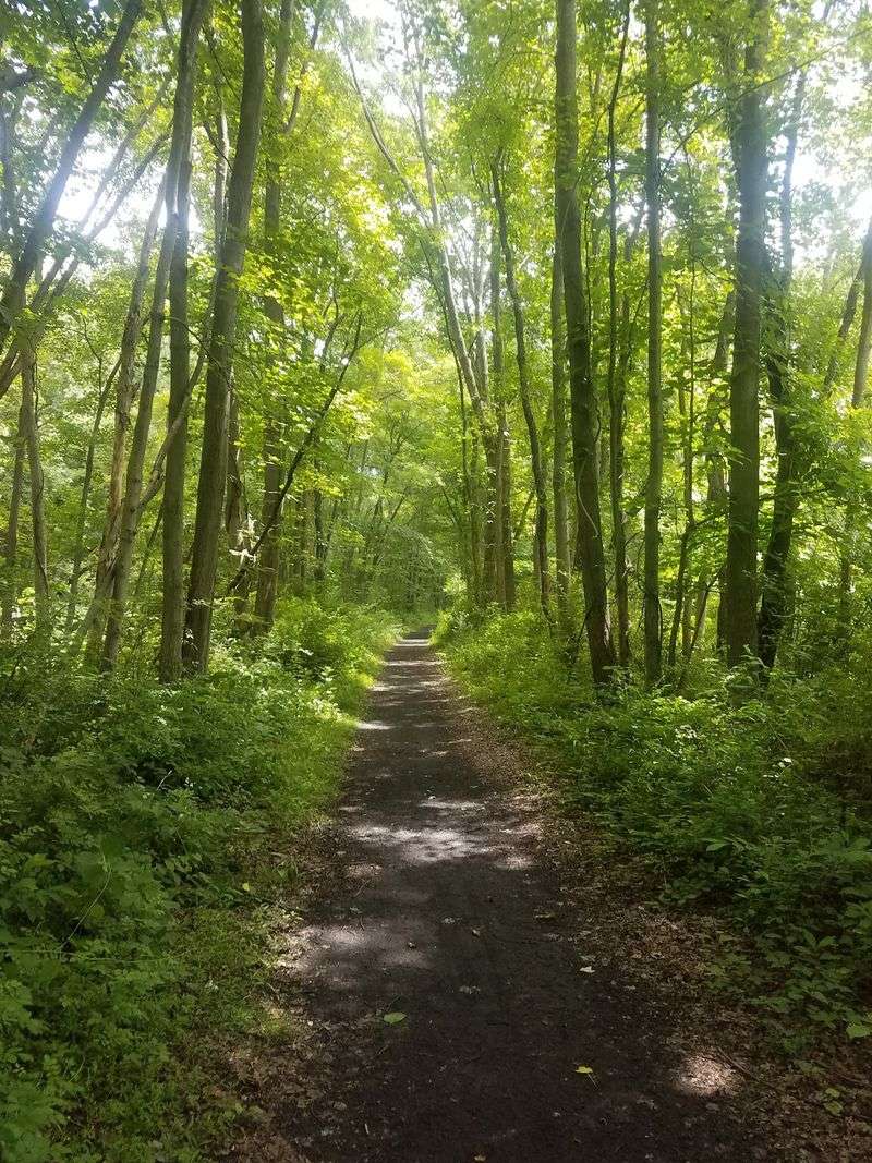
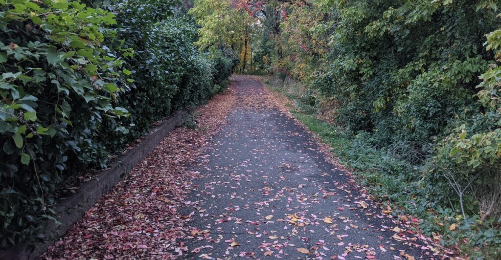
The old railroad never completely disappears here. Even after the tracks were pulled up, the straight grades, cuts through the landscape, old bridge crossings, and scattered railway remnants left behind a route that feels different from a typical woodland hike.
The Paulinskill Valley Trail stretches roughly 27 miles through Warren and Sussex counties, following the Paulins Kill through farmland, wetlands, forests, and small towns. Nobody needs to tackle the whole thing.
In fact, its length is one of the reasons it works so well as a choose-your-own-adventure outing: pick an access point, walk for an hour or two, and turn around whenever lunch starts sounding more appealing than mileage. The former rail bed is generally level and made up of cinder, dirt, grass, and crushed surfaces, making it friendlier than New Jersey’s rockier mountain trails.
Hikers share the route with cyclists and horseback riders, and winter can bring cross-country skiers. River crossings are among the best parts, especially when the otherwise enclosed corridor suddenly opens onto water.
Railroad history adds another layer, with old structures and infrastructure appearing along the way rather than being gathered into one formal historic site. One current planning note matters: a portion between Lambert Road and Gwinnup Road has been closed since September 16, 2026, for ash-tree remediation, so checking conditions before choosing a segment is smart.
The rest still offers plenty of room to wander.
4. Black River Trail at Cooper Gristmill: Water With a History Lesson
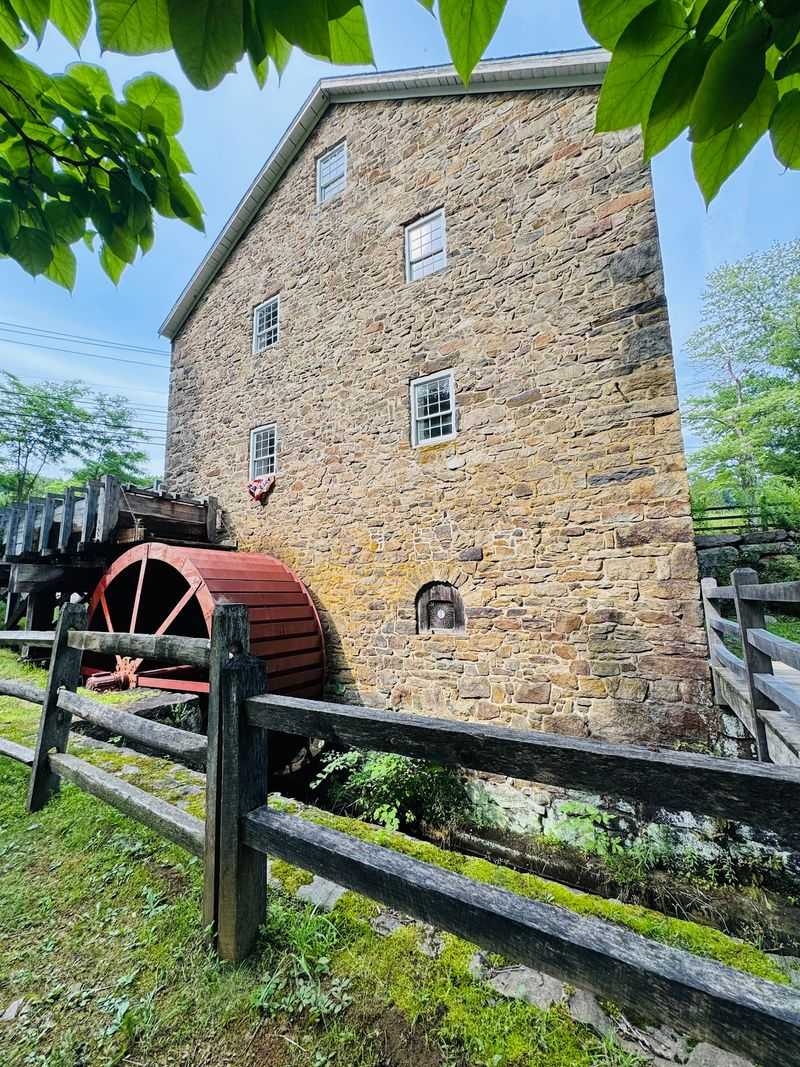
Start with a working 19th-century gristmill and things get interesting before the hike even begins. Cooper Gristmill in Chester Township stands beside the Black River, and the trail heading downstream quickly trades the mill grounds for wooded riverbanks and traces of the area’s industrial past.
Blue-blazed sections follow the water through Black River County Park, eventually picking up portions of old railroad rights-of-way that once served local iron mines. That is what gives this walk its personality: one minute you are watching water work around rocks and tree roots, and the next you are walking a corridor cut for industries that have been gone for generations.
Kay’s Pond and the nearby remnants of old mining activity make worthwhile targets for hikers who want to push beyond a simple river stroll. Longer loop combinations in the broader park system can reach around six miles, while shorter out-and-back walks from the mill work perfectly well for anyone who only has an hour.
Expect roots, rocks, rolling terrain, and occasional road-walking on longer routes rather than a manicured riverside path. Parking is available beside Cooper Gristmill on Route 24, which also makes the mill an easy landmark for meeting friends.
The river here eventually becomes the Lamington farther downstream, but around Chester it still carries the Black River name. Spring runoff and autumn color are particularly good excuses to come, though the shaded valley earns its keep in summer too.
5. Batsto River Trail: The Pine Barrens Turn Down the Volume
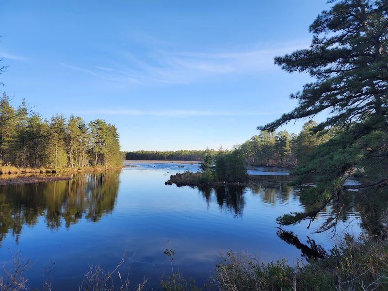
The water in the Pine Barrens has its own color palette. Tea-dark rivers slide between sandy banks, cedar swamps, pitch pines, and blueberry undergrowth, turning an ordinary-looking forest walk into something unmistakably South Jersey.
Around Batsto Village in Wharton State Forest, hikers can use several trails to get close to the Batsto River and the wetlands around it. The four-mile Batsto White Trail is an especially useful option, leaving the historic village through pine-oak forest before dropping toward the river north of Batsto Lake and skirting an Atlantic white cedar swamp.
Look for beaver signs along the wetter sections and listen for Pine Barrens treefrogs when conditions are right. Shorter routes around Batsto work well for families or anyone combining a walk with time in the historic village, while hikers wanting more mileage can connect into Wharton’s much larger network.
The forest’s flat profile can be deceptive: sandy footing can make a few miles feel longer than the elevation chart suggests, particularly in warm weather. Bring water, insect repellent, and a downloaded map if you plan to roam beyond the short village loops.
One important distinction for 2026 visitors is that portions of the Batsto River itself have faced paddling closures because of obstructions; that does not mean the surrounding hiking trails are automatically closed. For walkers, this remains one of the best places to see a New Jersey river landscape that looks nothing like the rocky waterways farther north.
6. Rancocas State Park North Shore Trails: A Creekside Breather
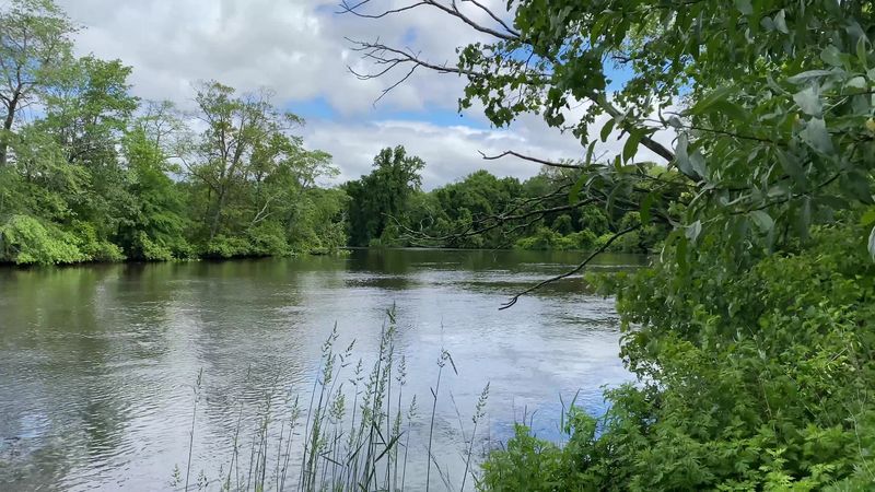
Freshwater tides are the quiet surprise at Rancocas State Park. Along the North Branch of Rancocas Creek, the water pushes into broad marshland surrounded by hardwood forest, creating a landscape that changes subtly depending on when you show up.
The park has more than 17 miles of official trails spread among its different sections, and the routes around the natural area are the ones to seek out when you want creek views rather than simply mileage. Trails move between upland woods, low wet areas, sandy bluffs, grassy openings, and tidal marsh, which keeps even a short outing from feeling repetitive.
The self-guided interpretive trail is a good introduction, but wandering farther through the network gives you a better sense of how large and undeveloped the creek corridor really is. Birdlife is a major part of the appeal.
Wetlands and woods support everything from songbirds to waterfowl, while the creek banks offer places to slow down and look rather than march straight through. Fishing is permitted along Rancocas Creek in the park, so hikers will occasionally share access points with anglers.
Because there are several trail systems and entrances, looking at the park map before driving over saves the classic New Jersey problem of arriving at the right park but the wrong parking area. It is especially good in fall, when the hardwood color reflects off the creek and the marsh grasses turn gold instead of simply going brown.
7. Riverside Trail At Hacklebarney State Park
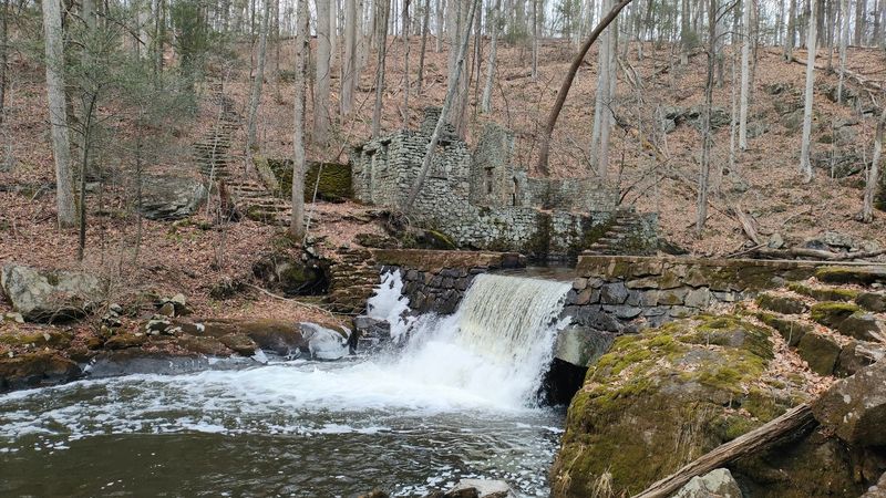
Water does not politely flow through Hacklebarney. It squeezes around giant boulders, drops into pools, collects tributaries, and makes enough noise in the ravine that conversations occasionally have to compete with it.
The 1.8-mile Riverside Trail is the best way to get close to that action. It follows the Black River along with Trout Brook and Rhinehart Brook, using a narrow dirt path through one of North Jersey’s classic hemlock-lined ravines.
Small waterfalls, fishing spots, pools, and rocky stream edges appear throughout the route, and connecting trails make it easy to build a longer loop. Three Pools Trail is only about 0.12 mile but drops directly toward a series of flat-water pools between cascades.
Waterfall Trail is even shorter and leads toward falls on Trout Brook. In other words, this is not a park where the interesting section sits three miles from the parking lot.
You get to the good stuff quickly. Hacklebarney has nine official trails totaling roughly five miles, so it is easy to spend half a day linking them without repeating every step.
The park is open daily from sunrise to sunset, admission is free, and bikes are not allowed on the hiking trails. Portable sanitation units are currently available while a new restroom facility is being planned.
After rain, the rocks can be slick and stream levels can change the feel of the Riverside Trail considerably. That is part of the fun, but sturdy footwear earns its keep here.
8. Hackensack River Greenway: Nature Beside the Neighborhood
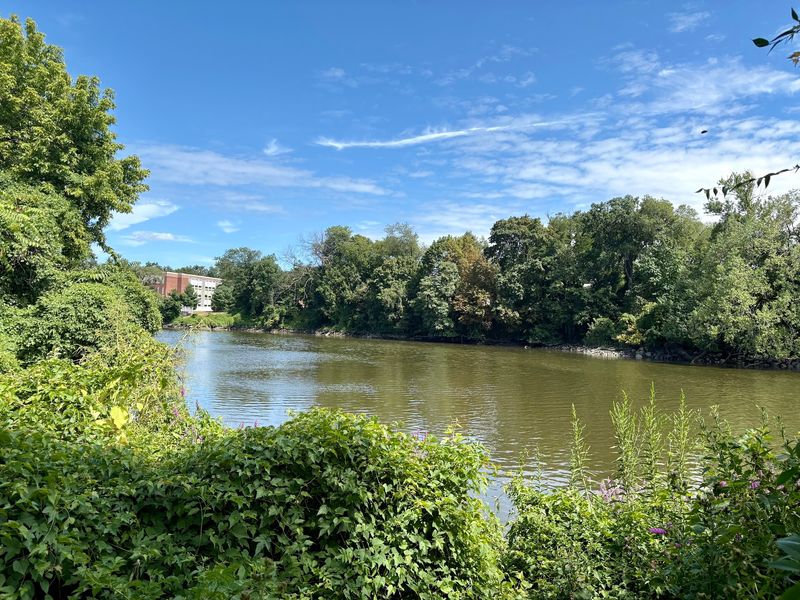
There is something slightly rebellious about finding a nature walk squeezed between suburban North Jersey and the Hackensack River. In Teaneck, the Hackensack River Greenway runs for about 3.5 miles through municipal parks and the Fairleigh Dickinson University campus, creating a pedestrian corridor where the river keeps appearing through trees and marshy edges even though busy streets are never very far away.
This is not a wilderness hike, and that is exactly why it belongs on the list. You can fit it into an ordinary afternoon without turning the outing into a full expedition.
The route blends pedestrian walkways with more natural trail sections, passing native vegetation, interpretive signs, and green buffers created to protect the river from surrounding development. Those signs add context about local plants, wildlife, and historical features, turning what could have been a simple exercise path into something with a stronger sense of place.
The greenway also represents decades of local effort: the idea dates back to residents pushing for better recreational use of the river in the 1970s, with Teaneck formally establishing an advisory board in the 1990s. Today it connects three municipal parks and the university grounds, with the larger ambition of eventually linking river paths in neighboring communities.
For walkers who assume Bergen County riverfront means traffic, condos, and parking lots, this stretch is a useful corrective. Go early, take your time through the greener segments, and let the nearby suburbs disappear whenever the trail dips toward the water.
9. Manasquan River Linear Park: A Shore-Area Detour Worth Taking
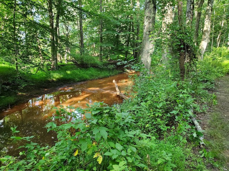
The Manasquan Reservoir gets most of the attention in Howell, which leaves the river corridor itself easier to overlook. The Manasquan River Greenway protects more than 540 acres along the river, with access points on Southard Avenue, West Farms Road, Ketcham Road, and Havens Bridge Road around Farmingdale and Howell.
The land has largely been left in a natural state, so this is less about a polished promenade and more about getting into woods and floodplain habitat beside a surprisingly quiet river. Fishing and small-watercraft access are important uses of the greenway, and hikers exploring around the access areas get a much less engineered experience than the reservoir’s popular perimeter loop.
The river can be shallow, obstructed, and change character with water levels; even paddlers are warned that fallen trees and natural obstacles may require portages. On foot, those same conditions create the feeling of following a genuinely untamed stream rather than a landscaped waterfront.
The surrounding preserved land is also valuable wildlife habitat, particularly where forest and wetlands meet. Parking locations are spread out rather than concentrated at one giant visitor center, so decide which access point you want before leaving home.
Portions of the property may also be used for seasonal deer hunting, including during the 2026–27 season, making blaze orange a sensible addition when dates overlap. If the nearby reservoir feels too busy, this is where you go to meet the actual river that gives it its name.
10. Passaic River Parkway: Find the River Between Daily Stops
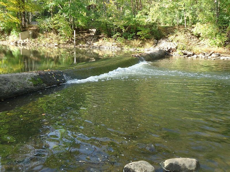
The Olmsted influence shows up in unexpected corners of Union County, including a river corridor that was imagined as part of an “emerald necklace” nearly a century ago.
Passaic River Parkway follows protected land along the river through Berkeley Heights, New Providence, and Summit, creating pockets of trail where dense suburban development gives way to woods, wetlands, meadows, and water.
More than 400 acres were acquired along the river beginning largely in the 1960s, and the long-term idea has been to connect those pieces into an increasingly continuous riverside system. That unfinished quality is part of what makes exploring it interesting.
This is not one neatly branded trail with a dramatic start and finish. Instead, sections appear through the parkway, letting walkers dip into parts of the Passaic that many residents know mostly from road bridges.
Wildlife is better than the location might suggest. Biological surveys have documented hundreds of plant, fungi, insect, fish, reptile, amphibian, and mammal species in the parkway, and some sections include a wildflower meadow, bird boxes, a bird blind, and river access.
The landscape is generally more about quiet observation than challenging hiking, making it a good choice when you want an hour outdoors rather than a summit. Parking and trail configuration vary by section, so checking the current county map before choosing an entry point is worth the small effort.
The payoff is seeing a surprisingly green side of the Passaic without leaving the suburbs behind by more than a few minutes.
11. Crosswicks Creek Greenway: Follow the Water, Not the Crowd
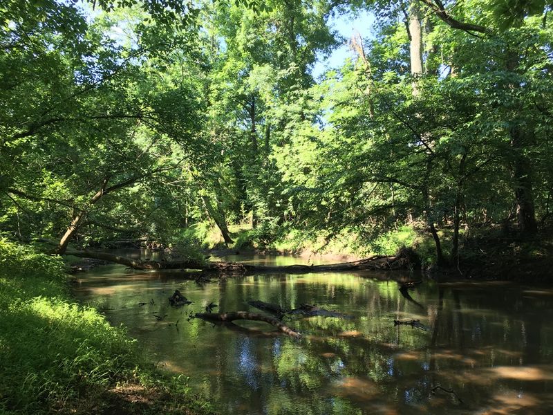
Farm fields rather than subdivisions frame much of this creek corridor, which immediately sets Crosswicks apart from many greenways closer to the Turnpike. The preserve stretches along Crosswicks Creek in Upper Freehold Township, where thousands of acres of protected land and surrounding preserved farmland help maintain a broad rural landscape.
The greenway begins near the County Route 537 bridge and follows both sides of the creek in portions of the park, with informal trails leading through woods, fields, and low areas close to the water. Do not expect paved paths, elaborate trail furniture, or a café conveniently waiting at the halfway point.
The appeal is precisely that it still feels a little rough around the edges. Some stretches can be muddy or overgrown depending on the season, and trail conditions are better suited to hikers who do not mind paying attention to where they step.
For a short taste, easy loops of roughly a mile are possible in parts of the greenway, while the broader preserved corridor rewards people willing to explore beyond the most obvious path. The nearby Upper Freehold countryside also makes this an easy trail to pair with a drive through the area rather than a standalone all-day mission.
Spring brings greener creek banks; fall gives the fields and woods a warmer, more open look. Either way, the lack of blockbuster attractions works in its favor.
Crosswicks is the kind of place you visit because you want a creek, some trees, and fewer people asking whether you are almost at the overlook.
12. Peek Preserve: Maurice River Views at a Listening Pace
A locked-looking gate is not the most encouraging welcome to a nature preserve, but keep going. Harold N.
Peek Preserve outside Millville protects 344 acres around a bend in the Maurice River, and the walk from the entrance quickly leaves the roadside behind for pine woods, cedar swamp, hardwood swamp, and one of South Jersey’s impressive wild-rice marshes. Multiple trails branch from the preserve road, eventually bringing hikers toward river overlooks and Jenkins Landing.
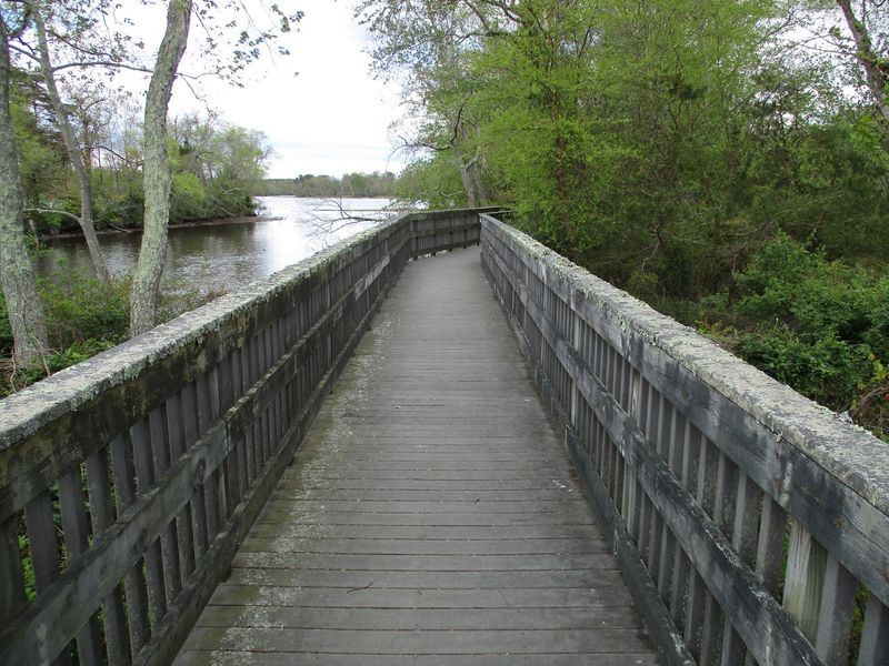
The latter is worth seeking out for its 160-foot boardwalk and observation platform, where the marsh opens up and the Maurice becomes the obvious reason the property was protected in the first place. Bald eagles are a real possibility here rather than a marketing fantasy, and the wetlands also draw migrating birds throughout the year.
The walking is generally easy, with sandy soil, pine needles, and relatively little elevation change. A roughly three-mile outing can cover much of the main trail network, while a shorter route works when time is limited.
One seasonal detail is important: the Red Cedar Overlook area can close from January through July to protect a bald eagle nesting site, so respect the signs rather than treating them as optional suggestions. Admission is free, and the preserve is open from dawn to dusk.
Maurice River Bluffs sits across the river, but Peek has a completely different personality: flatter, marshier, quieter, and more intimate with the water. It is an excellent final stop for anyone who thought New Jersey river hiking required mountains.
Share this story