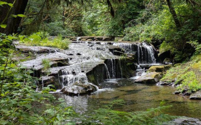
Somewhere past the twists of a long, paved road outside a small Oregon town, the phone signal gives up and the forest takes over. There is no data out here, and nobody seems to miss it. A creek runs beside a rocky path, waterfalls stack up one after another, and families spread lunch on the rocks without checking a single screen.
Quiet like this used to be easy to find, and now it takes a drive and a little planning. Oregonians know how rare it is to keep a place like this open, free, and familiar. Keep reading for the route, the parking puzzle, the trail closures, and the small tricks that make a visit go smoothly.
The payoff is a slow morning by the water that costs nothing but time and good shoes.
A Free Forest Escape Off Sweet Creek Road
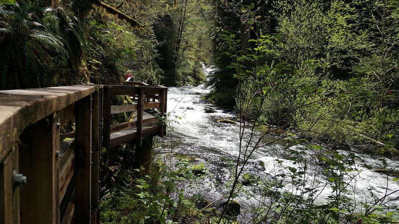
Some of the best places in Oregon still do not charge a cent at the gate. Sweet Creek Falls Trailhead sits on Sweet Creek Rd, Mapleton, OR 97453, in the forested country of western Oregon.
The spot is listed as a hiking area within the Siuslaw National Forest system. It stays open 24 hours a day, every day of the week.
Parking is free, which matters more than ever as day trips get pricier. A family can load the car, drive in, hike, and leave without paying a parking fee.
Mapleton itself is a small community, and the trailhead is reached by a road that branches off Highway 126. The trip from the highway takes roughly 15 minutes.
From Eugene, the drive runs a little over an hour. That puts it within reach for a weekend morning without an overnight stay.
The place has earned a 4.8-star standing across more than 600 public write-ups. Waterfalls come up again and again, followed closely by talk of an easy hike and a family-friendly path.
Free, open, and beloved by locals, it is the kind of place worth protecting simply by showing up respectfully.
The Long, Winding Approach
Patience starts long before the first footstep. The road leading to the trailhead is long, and plenty of drivers mention being surprised by just how long it feels.
Sweet Creek Road begins as two lanes. After the first park entrance, it narrows to a single lane, though it stays paved the whole way.
The route is full of twists and turns. In winter, frost and ice can coat the pavement early in the morning, so slower driving pays off.
On busy days, cars line up along that one-lane stretch near the lots. Pulling over politely and giving others room keeps things moving.
The scenery between Highway 126 and the trailhead is a highlight on its own. Many arrivals say the drive was half the fun.
One practical note sits near the top of any checklist. There is no cell data out here, so download maps and directions before leaving town.
Treat the drive as the opening act, not an obstacle, and the whole day starts on the right foot.
Two Trailheads, One Important Detour
Here is the twist that catches first-timers off guard. The pin on the map leads to the lower trailhead, and that section of trail has been closed due to damage.
The good news is that the restroom and picnic tables at that lower spot remain open. Signage there points drivers further up the road.
The upper lot and trailhead sit about half a mile up Sweet Creek Road. From there, the falls are a short walk away.
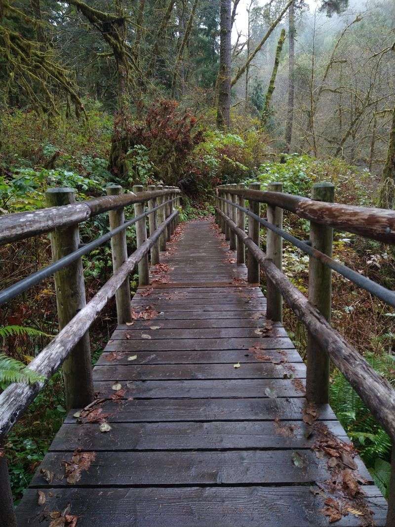
Closures have shifted over time. At one point a bridge was out and later repaired, and more recently the upper trail washed out in a section, limiting how far one can go.
A damaged catwalk also restricts full traversal, though only slightly. Rangers have even parked at the blocked entrance on busy days to steer people toward the open one.
Before heading out, check the Siuslaw National Forest recreation page for current conditions. Plans built around old information can mean a wasted trip.
A little homework turns a possible letdown into a smooth, easy arrival.
Waterfalls Built for Lingering
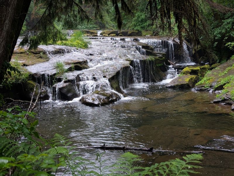
Forget towering plunges that steal the whole show. The falls along Sweet Creek win people over in a subtler way.
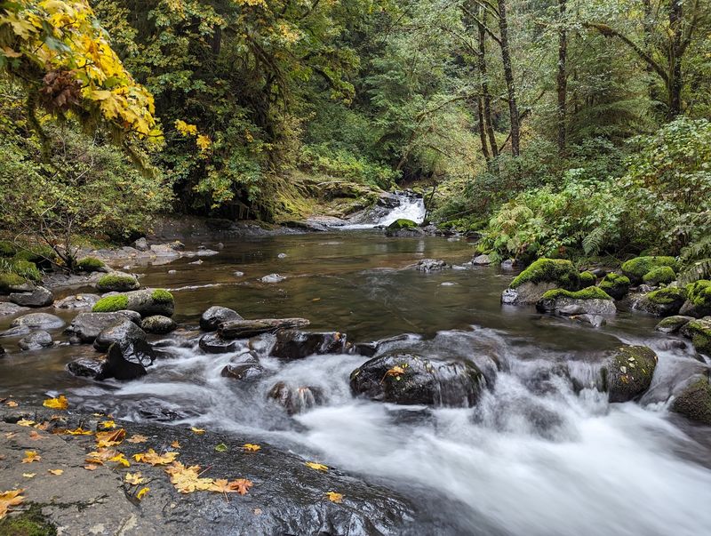
Water seeps from moss-covered rock, and a collection of cascades lines the creek as the trail climbs. The final, larger fall tends to be the one people remember most.
Waterfall chasers who have toured much of Oregon sometimes rank this spot among their favorites. The appeal lies in the variety packed into a short distance.
Winter and early spring bring high water, with the creek running full after wet weather. Even in dry late summer, the falls keep flowing more than many expect.
There is also an upper viewpoint above the falls. It is reached by a steeper, narrower path, and it is best left to sure-footed, able-bodied hikers.
Some hikers skip it entirely after hearing the view is limited. Stopping at the last big fall works perfectly well for most groups.
Bring a camera and leave the stopwatch at home, because these falls reward the unhurried.
Roots, Rocks, and a Creekside Path
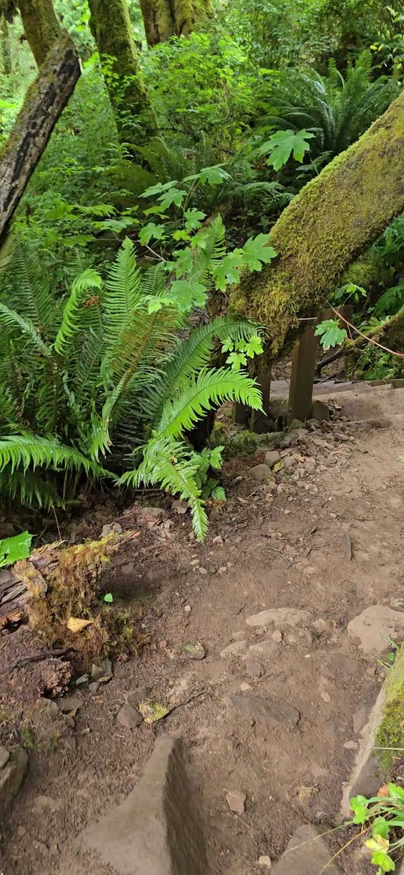
Easy does not mean smooth. The trail runs out and back along the creek, and it is packed with exposed roots and rocks.
From the lower lot, the full hike was about 1.3 miles round trip before the closure. From the upper lot, the falls are less than half a mile away.
Most people finish in 45 to 60 minutes. Those who stop to explore the water can easily stretch that to three or four hours.
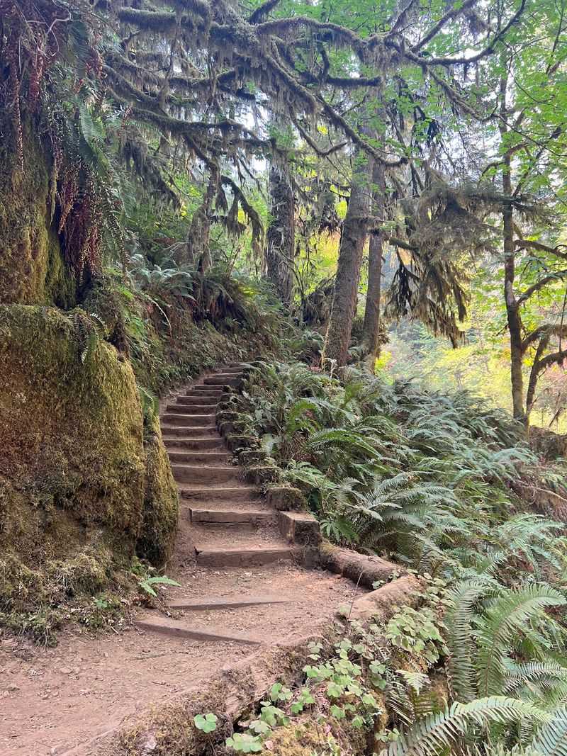
Some stretches are narrow, with few places to let others pass. Mud shows up after rain, and the winding uphill sections can get wet and slippery.
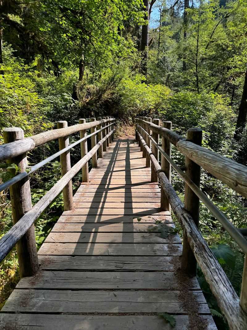
Railings are missing along most of the route. The path is generally well maintained and easy to follow, but careful footing is a must.
Walking sticks are a smart addition, especially for older hikers. Good knees and sturdy shoes make the whole thing feel like a pleasant stroll.
Watch the ground, then look up often, because the path rewards both.
Swimming Holes and Summer Days
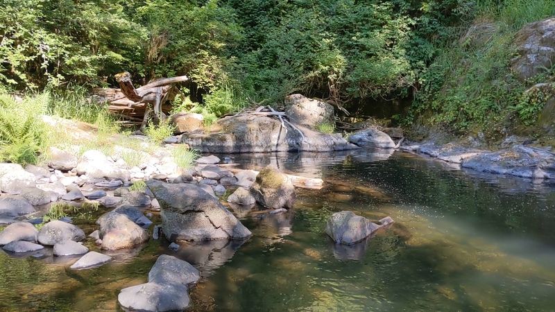
Summer turns this creek into a natural water park. Rock swimming holes appear along the hike, and many are clear and surprisingly deep.
The water starts chilly, then becomes hard to leave. Some folks jump off rocks into the pools, while others simply wade along the creek bed.
Families often arrive with water toys and packed lunches. A whole day by the creek is easy to fill.
Water shoes and a bathing suit belong in the bag. Plenty of first-timers leave wishing they had packed them.
Even hot days in the 80s feel more comfortable under the forest canopy. That shade makes midsummer outings far more manageable.
Common sense still applies around slippery rocks and deeper pools. Keep an eye on kids and choose entry points carefully.
On a warm afternoon, the short hike quietly becomes the side dish to a long creekside swim.
Tall Trees and Tiny Residents
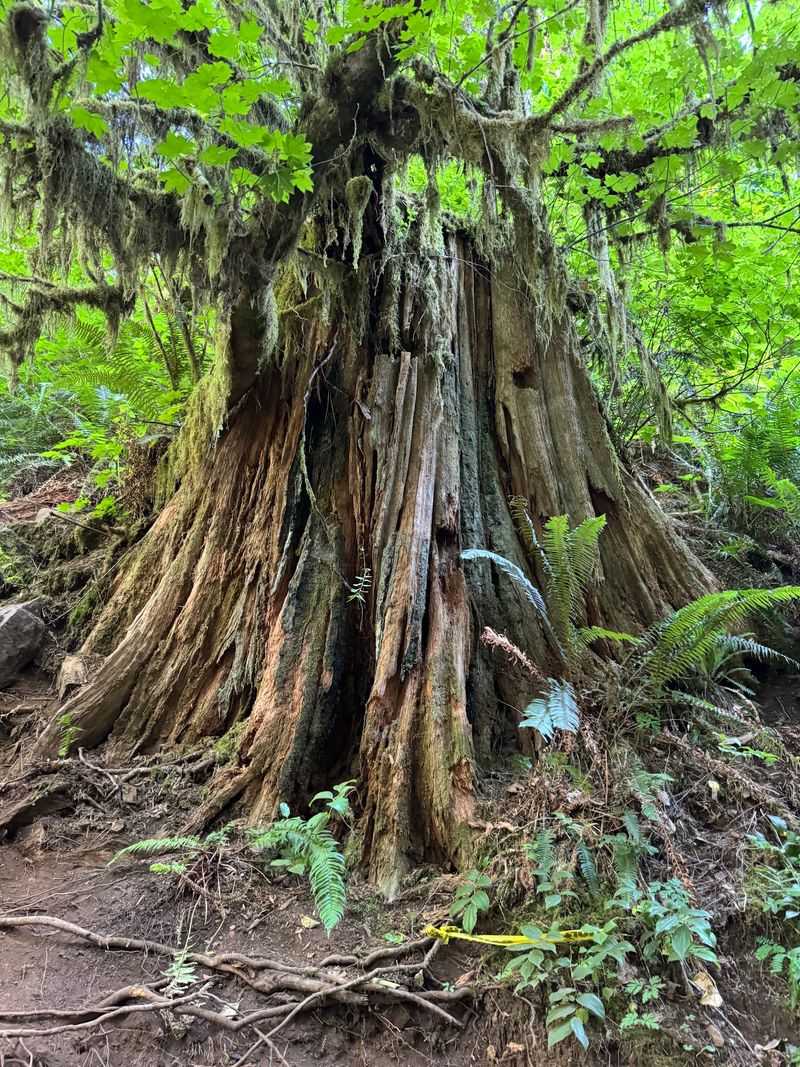
Not every highlight is a waterfall. The trail wanders under tall Douglas-fir, alder, and bigleaf maple, which keep much of the route shaded.
Banana slugs make regular appearances along the path. They are a crowd favorite with kids, and slow enough to photograph easily.
On some days, park rangers set up a table along the path. They have shared pictures and examples of beaver prints and details about water quality.
Those pop-up talks turn a simple walk into a small outdoor lesson. Kids and adults alike tend to linger.
One plant deserves attention for the wrong reasons. Poison oak is abundant along the trail, so stay on the path and learn to spot it.
Many people describe the hike as a fine chance to forest bathe. The canopy and the steady creek make slowing down feel natural.
Look closely at the ground every so often, since the smallest locals often steal the show.
Who the Trail Suits Best
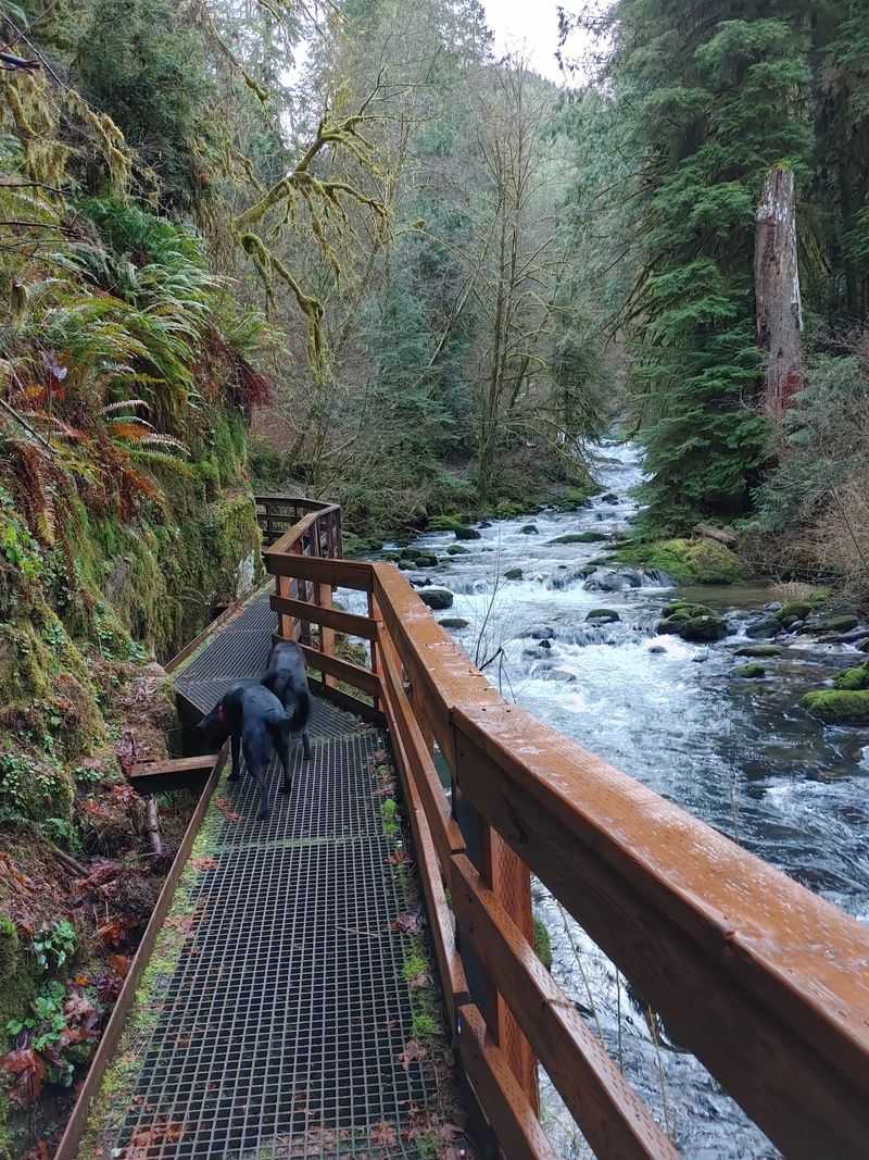
Families, dog owners, and waterfall fans all find their place here, with a few caveats. The hike is short and not strenuous, which keeps it popular with groups of mixed ages.
It works well for older kids and experienced hikers. Younger children can manage too, but parents should stay close because of the missing railings.
Strollers are not a good fit. Roots, rocks, and narrow spots make wheels more trouble than help.
Dogs are a common sight on leash. On narrow stretches, keeping pets and children under control helps everyone pass safely.
Newcomers from drier states often describe the stillness as the best part. A quick picnic by the water can turn an ordinary morning into a memorable one.
People with balance issues should bring poles and take their time. Turning back early is always an option.
Choose the right pace and this trail fits almost any group that values calm over crowds.
Parking, Restrooms, and Car Safety
Timing decides how the visit begins. The first lot holds only about six cars, while the upper lot fits roughly 15 to 20.
Weekends fill up fast. Arriving before 11 a.m. gives the best shot at a spot, and weekdays are noticeably quieter.
Restroom facilities are limited. The lower trailhead has a vault toilet, and a portable toilet has served the smaller upper lot at times.
Cleanliness of those facilities varies, so packing hand sanitizer and tissues is wise. Plan bathroom stops in town as a backup.
Posted signs warn of car break-ins, and the area has a reputation for theft. Leave valuables at home or carry them on the trail.
Bring water and snacks too, since there are no services at the trailhead. Self-sufficiency keeps the day stress-free.
A little preparation in the parking lot protects both the car and the calm that comes after it.
A Quiet Worth Keeping
Places like this do not stay special by accident. They stay that way because people treat them with care.
Sweet Creek offers a free, open-all-day escape with waterfalls, swimming holes, and shady forest. It asks only for patience on the road and attention on the trail.
Closures and repairs show that the trail needs ongoing work. Respecting signs and staying on open sections helps that work move forward.
Pack out every scrap of trash and keep dogs leashed. Those small habits protect the creek for the next family.
Go early, go midweek if possible, and check conditions before leaving. Download offline maps, wear solid shoes, and bring a towel.
For Oregonians watching familiar outings grow more expensive, a spot like this is a reminder of what still belongs to everyone.
Leave it as peaceful as you found it, and it will be waiting for the next quiet morning.
Share this story