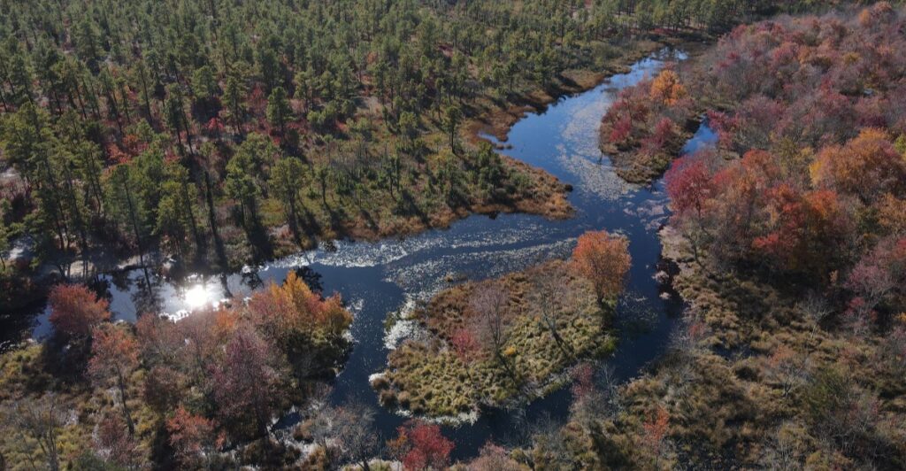
The water looks like someone brewed an enormous pot of tea beneath the pine trees. That rich amber color winds through Wharton State Forest, slipping past cedar swamps, sandy banks, and stretches of wilderness that feel surprisingly far from the New Jersey Turnpike.
Covering more than 120,000 acres across Burlington, Camden, and Atlantic counties, Wharton is the largest unit in New Jersey’s state park system. It is big enough to hold historic villages, abandoned settlements, lengthy hiking trails, campgrounds, swimming areas, and rivers where the loudest interruption may be a paddle tapping the side of a canoe.
Yet this place is not polished or overly packaged. Roads turn sandy, phone service grows unreliable, and the forest expects visitors to pay attention.
That is precisely the appeal. Wharton offers the kind of South Jersey adventure where one ordinary Saturday can feel like a chapter from a much better story.
Wharton State Forest Is New Jersey’s Wildest Escape
Here is the first thing to understand about Wharton State Forest. It is not a tidy neighborhood park with one loop trail, a playground, and a parking lot visible from every bench.
The forest covers roughly 122,880 acres, making it the largest property managed by the New Jersey State Park Service. Its boundaries spread across three counties and protect a substantial piece of the Pinelands National Reserve, a landscape unlike anything else in the state.
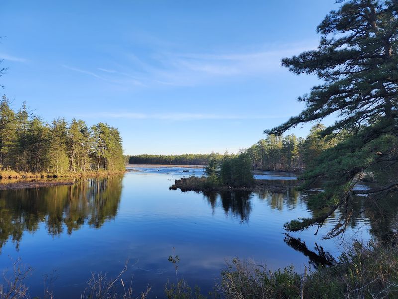
The scenery is classic Pine Barrens. Pitch pines grow from pale, sandy soil.
Atlantic white cedars crowd wet lowlands, while blueberry bushes, ferns, and fragrant sweet pepperbush fill the understory. Depending on the season, visitors might hear spring peepers, spot a bald eagle over open water, or catch a white-tailed deer disappearing between the trees.
The forest also provides habitat for less commonly seen residents, including barred owls, river otters, and timber rattlesnakes. Wharton feels untamed partly because its most interesting corners are separated by miles of woods.
Batsto Village sits near the southern end, while Atsion Recreation Area lies farther north along Route 206. Between them is a network of hiking paths, waterways, and sandy roads.
Only designated roads are open to vehicles, and those roads can become deeply rutted or flooded. A regular sedan and a spontaneous detour are not always a winning combination.
First-time visitors should choose one main destination instead of attempting to conquer the whole forest in a day. Batsto works well for history and shorter walks.
Atsion is the better starting point for swimming, camping, and several longer adventures. Carry a downloaded or printed map, pack more drinking water than seems necessary, and check current alerts before leaving home.
Cell reception has a habit of vanishing exactly when the forest starts getting interesting.
More Than 120,000 Acres of Pine Barrens Beauty
Long before New Jersey became shorthand for diners, traffic, and crowded shore towns, this region was shaped by sand, water, and fire. Wharton preserves that older identity on a scale that can be difficult to grasp.
Its acreage is nearly twice the size of Newark, and much of it remains a patchwork of pine forest, cedar swamp, bog, river, and quiet backroad. The landscape does not deliver its beauty with dramatic cliffs or mountain overlooks.
It works more subtly. Sunlight flashes across waist-high blueberry shrubs.
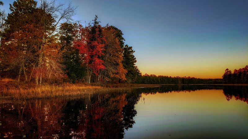
Pine needles soften the trail underfoot. In summer, white water lilies gather along dark ponds, while autumn brings rusty scrub oak, red maples, and cranberry-colored groundcover.
Winter strips the forest down to silver branches, green pines, and long sightlines that disappear during the growing season. The Pine Barrens’ sandy soil drains water quickly, but a shallow underground aquifer feeds its streams and wetlands.
Those conditions support specialized plants, including orchids, sundews, and pitcher plants. The forest’s pitch pines are equally well adapted.
Some can sprout again after a fire, an essential skill in an ecosystem where periodic burns have shaped the land for centuries. One local detail catches many newcomers off guard.
The rivers and ponds may look brown, but the color does not mean they are muddy or polluted. Tannins released by cedar roots, pine needles, and other decaying vegetation stain the water a clear reddish brown.
Scoop some into a transparent container, and it can resemble iced tea. Wharton rewards close attention more than hurried sightseeing.
Pause beside a cedar swamp, and the forest starts revealing itself in layers—the buzz of insects, the knock of a woodpecker, the resinous smell of sun-warmed pine, and perhaps the faint movement of water beyond the trees. Nothing demands attention, yet somehow everything gets it.
Follow Scenic Trails Through a Storybook Landscape
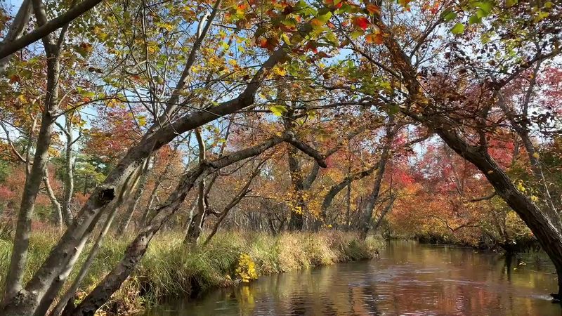
Pink blazes are serious business in South Jersey. They mark the Batona Trail, whose name comes from “Back to Nature,” and guide hikers for more than 50 miles through the Pine Barrens.
The full route crosses Wharton, Brendan T. Byrne, and Bass River state forests, but hikers do not need to commit to a multi-day trek to experience it.
Several access points make shorter out-and-back walks possible. For a substantial day hike, the Mullica River Trail runs roughly 9.5 miles between Atsion and Batsto.
The path passes through pine woods, skirts wetlands, and offers glimpses of the river without requiring steep climbs. Do not let the flat terrain inspire overconfidence.
Soft sand can make each mile feel longer, summer humidity can be punishing, and ticks are active through much of the year. Anyone hiking the route one way will also need to arrange a vehicle shuttle.
Batsto offers gentler options. Trails begin near the visitor center and wind around Batsto Lake, through the forest, and past traces of former industries and settlements.
The walking routes near the village are especially useful for mixed-age groups because visitors can pair an easy woodland ramble with the historic buildings. Atsion also has shorter paths near the recreation area, including connections to longer forest trails.
Trail markings help, but a map remains essential. Wharton’s flat landscape can make one sandy road look remarkably like the last three.
Downloading a map before arrival is wise because reception is inconsistent, and keeping a portable battery in the backpack is even wiser. Orange is also a smart clothing choice during hunting seasons.
The best walking weather arrives in late fall, winter, and early spring, when mosquitoes retreat, and the forest feels open and bright. Summer hikers should start early, carry at least two liters of water for a longer route, and avoid brushing against vegetation.
Whatever the season, stay on marked paths. Sensitive plants grow close to the trail, and those inviting side tracks have an annoying tendency to become confusing very quickly.
Paddle Along Tea-Colored Rivers and Quiet Lakes
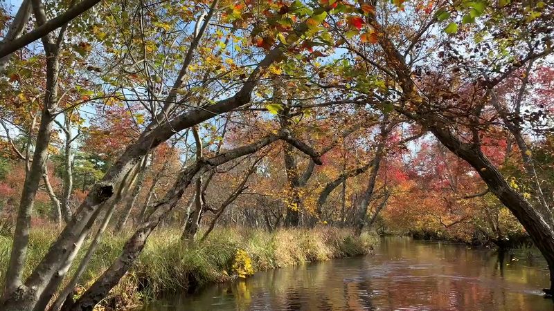
From water level, the forest changes character. Cedar branches lean over narrow channels, sandy banks appear around bends, and sunlight turns the dark river coppery orange.
The Batsto, Mullica, Wading, and Oswego rivers all pass through or alongside Wharton, giving paddlers routes that range from calm beginner outings to long, twisting journeys through remote wetlands. The Batsto River is a favorite because it delivers a proper Pine Barrens experience without whitewater.
Popular launch points include Quaker Bridge and Hampton Furnace, with takeouts near Batsto Village. Exact distance and paddling time depend on the chosen section, water level, fallen trees, and how often the group stops.
A typical half-day run can easily stretch longer when the current is slow, or the channel narrows. The Mullica River offers another memorable route.
Paddlers can travel between Atsion and Pleasant Mills, passing forest campsites and stretches where roads and buildings disappear completely. That seclusion is wonderful, but it makes preparation important.
Bring a waterproof map, secure phones and keys in a dry bag, and carry food and drinking water. The river water may look like sweet tea, but it should not be treated as such.
Local canoe outfitters simplify the logistics by providing rentals, life jackets, transportation, and pickup at designated locations. Reservations are sensible on warm weekends, when boats and shuttle spaces can fill.
Conditions also change after storms, so checking water levels and route obstructions before launching can save an awkward afternoon. Those who prefer a gentler outing can stay on Atsion Lake or Batsto Lake, where the broad water and wooded shoreline still provide the Pine Barrens mood without committing to a river journey.
Swimming is permitted at Atsion’s guarded beach only when lifeguards are on duty, and the area is officially open. On any of these waters, personal flotation devices are essential.
The rivers are usually calm, but submerged logs, sharp turns, and chilly shoulder-season water deserve respect.
Step Back in Time at Historic Batsto Village
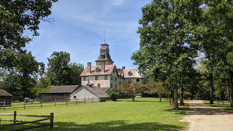
In 1766, Batsto was not a picturesque place to spend an afternoon. It was an industrial settlement built around an iron furnace, with smoke, heat, workers’ homes, and the constant movement of raw materials.
The ironworks eventually produced household goods and supplies for the Continental Army during the Revolutionary War. Nearly 260 years later, the settlement remains one of the most fascinating places in the Pine Barrens.
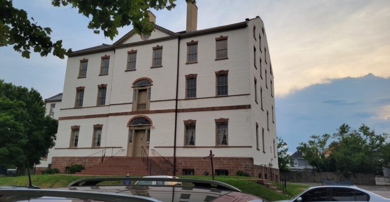
More than 30 historic structures stand around the village, including workers’ houses, a general store, gristmill, sawmill, blacksmith shop, barn, post office, and the imposing Batsto Mansion. The mansion grew over several generations rather than appearing all at once, which explains its unusual collection of architectural styles and rooms.
Industrialist Joseph Wharton purchased Batsto in 1876, along with enormous tracts of surrounding land, and used the house as his country residence. Wharton had ambitious plans for the region.
He hoped to tap the Pinelands’ water supply and sell the water to Philadelphia. New Jersey blocked the export of its water, but his land purchases ultimately helped create the state forest that now carries his name.
The village is compact enough to explore on foot, and the grounds can be visited without committing to a mansion tour. Inside the visitor center, exhibits explain bog iron, glassmaking, local wildlife, and the people who lived and worked here.
Guided mansion tours are offered on select days, and schedules can change seasonally, so this is one detail worth confirming before making the drive. Batsto is most atmospheric when visitors wander beyond the central lawn.
Follow the path toward Batsto Lake, look inside the post office, and notice how the workers’ houses sit in relation to the mansion. The village was not a decorative collection of buildings.
It was a company town where status, labor, business, and domestic life all occupied the same small patch of sandy ground.
Spend the Night Beneath the Pinelands Sky
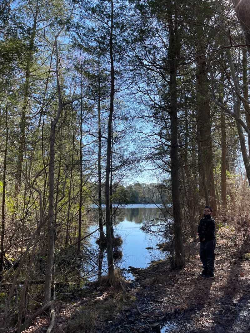
Darkness arrives differently in Wharton. The last light catches the pine trunks, frogs begin calling from the wetlands, and the gaps between campsites seem to widen.
Without the glow of a shopping center around the corner, even familiar constellations look sharper. Camping turns a day trip into something more immersive, especially after evening visitors have packed up and the forest settles into its nighttime rhythm.
Atsion Family Campground is the most approachable option for many visitors. Located near Route 206, it has 50 tent and trailer sites, along with fire rings, picnic tables, toilets, and showers.
The campground is close to Atsion Lake and the recreation area, making it convenient for families who want forest time without carrying every possession several miles into the woods. Wharton also maintains wilderness campsites at locations including Mullica River, Lower Forge, Batona, Goshen Pond, and Buttonwood Hill.
Amenities vary, and several areas are reached by hiking, paddling, or traveling designated sand roads. These are not miniature resorts.
Campers should expect basic facilities, bring drinking water where required, and understand their route before sunset. Reservations are required and can be made through New Jersey’s state park reservation system.
Rates, pet-friendly site availability, minimum stays, and seasonal facility access can change, so confirming the details for the specific campground is important. Fires are allowed only where authorized and may be restricted when wildfire danger rises.
The Pine Barrens burns easily, particularly during dry and windy spring weather. Night also brings a few practical realities.
Food should be stored securely, ticks require a final check, and a flashlight is indispensable once the fire fades. Pack out every scrap of trash and avoid dragging firewood across state lines, since moving wood can spread destructive insects.
Then let the forest do the rest. Wind moves through the pitch pines with a low, steady hush, an owl calls somewhere beyond the campsite, and the tea-colored rivers continue slipping through the dark.
Share this story