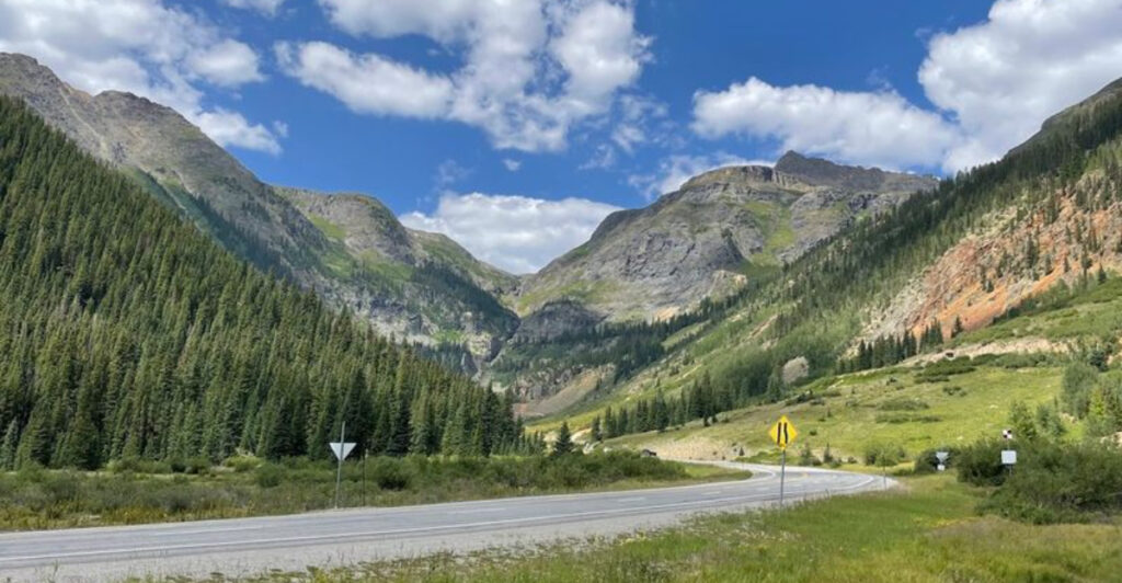
Some of Colorado’s most spectacular scenery is found from behind the wheel rather than at the end of a hiking trail. Stretching between Ouray and Silverton, the Million Dollar Highway winds through the heart of the San Juan Mountains, where towering peaks, sheer cliffs, historic mining landscapes, and dramatic switchbacks create one of America’s most unforgettable scenic drives.
Every curve reveals another breathtaking panorama, making the journey just as rewarding as the destinations along the way. Whether you’re chasing fall colors, summer wildflowers, or snow-dusted alpine vistas, this iconic Colorado highway delivers remarkable views from start to finish.
The Drop-Offs Start the Story
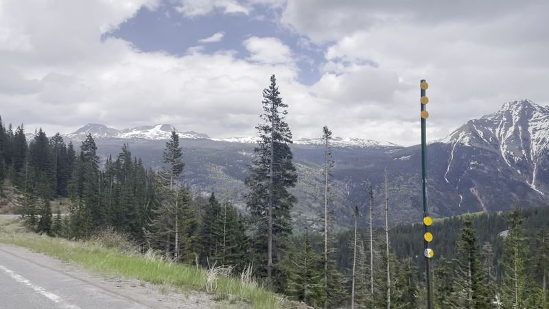
The Million Dollar Highway announces itself with exposure. South of Ouray and around the higher curves near Silverton, the road hugs mountain walls so tightly that the open side can look almost unfinished, with little separating your lane from a long plunge into raw San Juan terrain.
That visual edge is the first reason this stretch commands attention. Unlike wide scenic byways built for leisurely gliding, this one asks for full concentration.
Lanes can feel narrow when an RV, work truck, or tour bus appears around a bend, and the absence of guardrails on some sections sharpens every glance through the windshield. You are not just looking at the mountains here. You are moving inside them.
The surrounding landscape adds scale in a hurry. Gray and rust-colored slopes rise in fractured layers, streaked by talus, old cuts, and lingering snow patches in colder months, while valley floors sit far below in ribbons of dark green.
Each turn resets the frame, switching from boxed-in rock faces to broad openings that reveal ridge after ridge. That constant shift is a big part of the road’s grip. The drive never settles into a single visual rhythm, so your eyes keep adjusting to new distances, new textures, and new levels of drama.
Even in clear weather, the scene carries a slightly unruly quality, as if the route were threaded through terrain that still resists being tamed.
Near Silverton, that tension between pavement and wilderness becomes especially vivid. The town sits in a high basin, but the approaches feel carved out of severe country, where cliffs, avalanche paths, and abrupt elevation changes shape the drive.
Before you even think about stops, photos, or history, the road has already established its main point: this is Colorado scenery with teeth.
Colorado’s Tight Curves and Big Altitude
This road earns its thrill less through speed than geometry. Curves arrive in a quick, deliberate sequence, many of them blind enough to keep your hands steady on the wheel and your eyes fixed ahead, while the altitude changes the whole sensation of movement.
At over 11,000 feet near Red Mountain Pass, the landscape looks close enough to touch and impossibly large at the same time.
You can sense the climb in more than one way. Engines work harder, weather can change with very little warning, and the air carries that high-country sharpness that makes every turnout feel cooler, brighter, and cleaner.
Even short pauses outside the car remind you that this is not a casual lowland drive dressed up with mountain views. The road design follows the terrain instead of overpowering it.
Rather than long engineered sweeps, many sections feel fitted into existing folds, cut slopes, and ledges, which keeps the drive visually intimate even when the surrounding panoramas open wide.
That relationship between roadway and mountain is part of why each curve feels consequential. Near Silverton, the highway also becomes a moving lesson in mountain scale.
Peaks stack tightly around the basin, and the route threads among them with a mix of steep approaches, descending vistas, and sharp transitions from sun to shadow.
A bend can hide an entire valley until the last second, then reveal broad tundra benches and dark drainage lines below.
If you arrive expecting one uninterrupted scenic pullback, the reality is better. The Million Dollar Highway works in bursts: close rock, sudden depth, a quick crest, then another tilt into open space.
That rhythm keeps the drive active, physical, and unmistakably Colorado, not just because of the views, but because the elevation shapes every mile.
Red Mountains, Mine Scars, and the Color of the San Juans
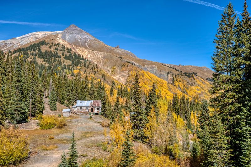
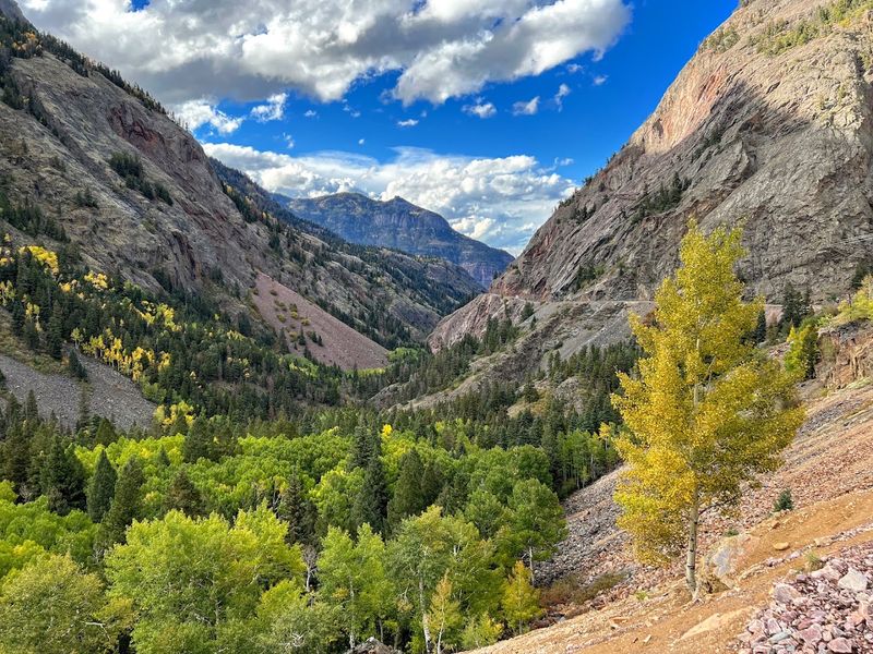
One of the highway’s most striking features is color. The slopes around Red Mountain Pass and the approaches near Silverton are not simply gray rock and pine, but a layered mix of iron-red soil, burnt orange bands, charcoal scree, pale stone, and deep green pockets tucked into drainages.
In changing light, whole mountainsides can look brushed with copper dust. Those hues are tied to the region’s geology and mining past, and the road puts both in plain view.
Old tailings, weathered structures, and cuts carved into the mountains remain visible in places, giving the scenery a worked, scarred appearance instead of a polished postcard finish. That roughness is a large part of the appeal.
The San Juans here do not present as gentle rounded peaks. They rise in broken faces and steep gullies, with water channels slicing through unstable slopes and loose rock spread across wide fans below.
When clouds move over the ridgelines, the reds deepen, the shadows sharpen, and the old industrial marks become even more noticeable against the alpine setting.
Silverton adds context without softening the scene. This was mining country long before it was a scenic driving legend, and the highway still carries that legacy in the visual details around it – abandoned-looking cuts, exposed earth, and mountains that seem split open rather than smoothly sculpted.
The result is beauty with a hard edge. That edge separates this drive from many other famous mountain roads. The views are grand, but they are also textured by extraction, weather, and difficult terrain, which gives the route a specific identity.
You are not looking at generic Rockies scenery here. You are looking at a colorful, battered, high-altitude landscape where geology and history remain visible from the driver’s seat.
Silverton Gives the Highway a Human Scale
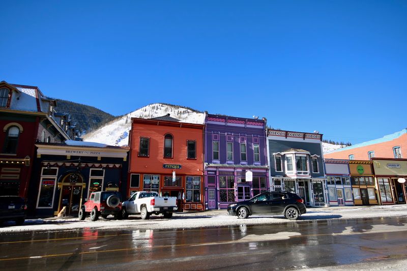
After miles of cliffs, passes, and open mountain drama, Silverton changes the scale. The town sits in a high valley ringed by peaks, and arriving there after the intensity of the road creates a useful contrast: suddenly the vast landscape narrows into streets, storefronts, rail history, and a place where mountain travel becomes daily life rather than spectacle.
That matters because the Million Dollar Highway is not an isolated scenic stunt. It connects real communities shaped by winter weather, mining roots, tourism, and the logistics of living in steep country.
Silverton helps you understand the road as infrastructure as much as attraction, especially when work vehicles, supply trucks, and locals use the same twisting pavement as sightseers.
The town also frames the surrounding mountains in a different way. From within Silverton, those peaks feel less like distant scenery and more like walls defining the basin, directing weather, sunlight, and travel routes.
You can see how the highway’s dramatic approaches are part of a larger geographic system rather than a single famous stretch of road floating on its own.
There is visual texture here too. Historic facades, broad dirt shoulders, old rail connections, and the open valley setting all link back to the same rugged economy that shaped the region.
Instead of interrupting the experience, Silverton grounds it, giving the highway a lived-in context that makes the surrounding danger and beauty more believable.
For drivers, Silverton is also a natural reset point. It breaks the route into manageable sections, offers a chance to check weather or simply breathe, and lets your eyes readjust before the next climb or descent.
That pause improves the drive because the highway’s most dramatic scenery lands even harder when you have a human-sized place in the middle of it.
When to Drive for the Sharpest Views
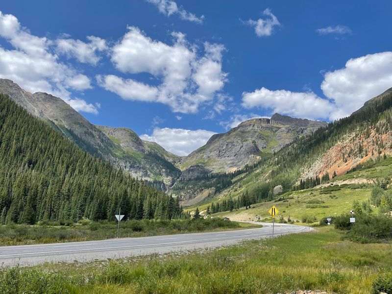
Timing changes this road more than many first-time drivers expect. Early morning can bring crisp light and cleaner visibility across the San Juans, while late afternoon often deepens contrast on the red slopes and throws long shadows through valleys and cuts.
Midday is brighter, but it can flatten some textures that make the route look so dramatic in photos and in person.
Weather matters even more than light. Summer and early fall usually give the easiest access, yet mountain conditions can still shift quickly with rain, fog, or sudden temperature drops at higher elevations.
A clear start in Silverton does not guarantee the same conditions near Red Mountain Pass, where clouds can lower the visual range and change the mood of the drive within minutes.
Season also determines how much of the landscape you notice. Snowbanks, wet pavement, and leftover runoff emphasize the severity of the terrain, while dry late-season conditions reveal more color in the slopes, mining scars, and loose rock fields.
During fall, patches of aspen can add bright yellow accents, especially in lower sections and protected draws. Traffic patterns deserve attention too.
A quieter window in the morning often makes the route easier to enjoy because you spend less time negotiating around slower vehicles or waiting behind lines near pullouts.
If you want space to absorb the scenery rather than stare at brake lights, that practical choice matters almost as much as the weather forecast.
The best plan is simple: treat the highway like a mountain route first and a photo opportunity second. Build in extra time, keep expectations flexible, and be willing to pause when the sky opens or the ridgelines sharpen.
On a good day, the road near Silverton can look spectacular at any hour, but the clearest views usually reward patience, not rushing.
How to Experience the Route Without White-Knuckling Every Mile
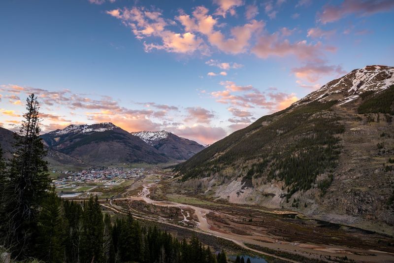
The smartest way to enjoy the Million Dollar Highway is to stop trying to conquer it. This is not a road that rewards distraction, hurried schedules, or aggressive lane choices, especially around Silverton where grades, curves, and exposure can stack up quickly.
If you approach it as a series of short visual chapters instead of one uninterrupted thrill ride, the experience improves immediately.
Use designated pullouts whenever possible rather than slowing unpredictably for photos. The views come often enough that you do not need to react to every opening, and planned stops let you actually absorb details such as distant waterfalls, fractured ridgelines, old mining traces, or the way light shifts across the red slopes.
Looking with both feet on the ground is part of the route’s appeal. Passengers can help make the drive smoother. Let them handle maps, quick snapshots, and weather checks so the driver can focus on curves, oncoming traffic, and changing pavement conditions.
That simple division of attention turns a stressful trip into a more readable one, especially on busier days when motorcycles, oversized vehicles, and sightseeing traffic share the same narrow mountain corridor.
Comfort also changes with direction and pace. Some travelers prefer one direction because the drop-offs or lane positioning feel less intense, while others simply benefit from taking the route slowly and breaking it up with Silverton as a midpoint.
There is no prize for finishing fast, and the road is too visually rich to treat like a commute. If heights make you tense, the answer is not necessarily to skip it. Good weather, a calm start time, and frequent pullovers can make the highway feel manageable without reducing its impact.
The route still delivers the cliffs, colors, and alpine scale it is famous for, just with enough breathing room to enjoy them instead of gripping the wheel in silence.
Why This Stretch Refuses to Blend In
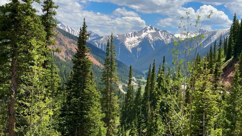
Plenty of mountain roads are scenic. Very few combine exposure, altitude, color, history, and constant motion as tightly as the Million Dollar Highway near Silverton.
That combination is why the route stands apart even in a state full of famous drives. Its power starts with contrast. One moment the road presses against a rock wall, the next it opens to broad valley views, then just as quickly it bends into another ledge carved high above a drainage.
You are never given enough sameness to drift into autopilot, visually or mentally. The surrounding mountains help, but they are only part of the effect.
The San Juans look wilder and more fractured than many postcard versions of Colorado, and the visible mining history adds texture that polished resort corridors often lack.
Instead of a neatly packaged scenic experience, this stretch offers a landscape that still appears difficult, useful, and slightly defiant.
Silverton strengthens that identity. Because the highway serves a real mountain town in a remote basin, the route carries a practical seriousness beneath the tourism appeal.
It functions as access, connection, and weather-exposed lifeline, which gives the scenery more weight than a purely recreational road might have.
Then there is the pacing. The drive delivers repeated payoffs without becoming repetitive, and each mile seems to adjust the balance between beauty and tension.
That balance is hard to manufacture and even harder to forget once you have seen cliffs, scarred slopes, and high ridgelines stacking up outside the window.
In the end, this road does not need hype to justify itself. It simply places you inside a rugged slice of southwest Colorado where geography dictates every curve and every view.
Around Silverton, the Million Dollar Highway is not memorable because it tries to impress you. It is memorable because the landscape gives it no other option.
Share this story