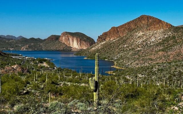
Some of the best road trips in Arizona do not need a plane ticket, a hotel, or a week off work. This one starts less than an hour east of downtown Phoenix and runs only about 42 miles. In that short stretch, the pavement climbs past jagged peaks, drops toward deep blue reservoirs, and eventually turns into a gravel road carved into canyon walls more than a century ago.
It was built for hauling dam supplies, not for weekend fun, which makes its scenery feel like a happy accident. Valley locals drive past the turnoff on their way to somewhere else all the time. Keep reading for the history, the best stops, the road conditions, and the one catch every driver should check before leaving the driveway.
1. A Mountain Road Hiding in Plain Sight
Plenty of Phoenix drivers know the exit sign but have never actually taken the turn. That is a shame, because the Apache Trail is one of the most scenic short drives in the state.
Officially, the route sits in Arizona, USA, and travels largely as State Route 88. It begins in Apache Junction on the eastern edge of the Valley and heads northeast toward Theodore Roosevelt Lake.
Along the way, it passes through the Superstition Mountains and the Tonto National Forest. The road is famous for being partly unpaved, which gives it a backcountry character that few highways near a major metro area can match.
The total run is roughly 40 to 42 miles, depending on where you start counting. That modest number fools people.
Because of tight curves, steep grades, and gravel surfaces, the drive often takes far longer than the mileage suggests. Many locals treat it as a full day trip rather than a quick spin.
Best of all for budget watchers, driving the road itself costs nothing. Fees may apply at certain recreation sites along the way, but the scenery from the car is free.
So the first stop on this journey is simply the decision to turn east instead of heading home.
2. Built for Wagons, Not Weekenders
Long before anyone called it scenic, this road had a job to do. In the early 1900s, crews built it to haul supplies to the construction site of Roosevelt Dam on the Salt River.
The dam was a major piece of the Salt River Project, which helped bring a dependable water supply to the growing Phoenix area. Freight wagons carried equipment and materials over the rugged terrain.
The dam was completed in 1911 and named for President Theodore Roosevelt. Once the heavy hauling ended, the route gradually shifted into a destination for travelers who wanted to see the backcountry.
The name comes from the Apache people, whose homelands included this region. Early promoters leaned into that name when marketing the drive to tourists in the decades that followed.
Here is a fun bit of perspective for Valley residents. The water flowing through canals across Phoenix and Mesa today owes part of its story to the road you can drive on a Saturday morning.
That connection gives the trip a little more weight than an ordinary scenic loop. It is a working road that turned into a sightseeing classic, and history buffs tend to find that twist just as interesting as the views.
3. Superstition Peaks on the Passenger Side
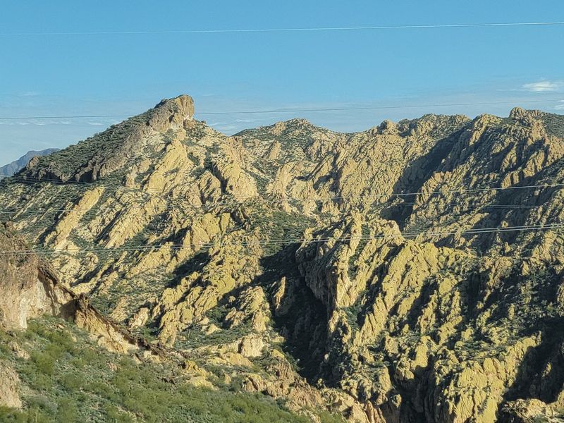
Almost immediately after leaving Apache Junction, the Superstition Mountains take over the windshield. These rugged peaks are among the most recognizable landmarks in the eastern Valley.
The range is volcanic in origin, which explains the dramatic cliffs and towering rock formations. Weavers Needle, a well-known spire, can be spotted from various points in the area.
Early in the drive, Lost Dutchman State Park sits just off the road. The park takes its name from the legendary lost gold mine story that has floated around these mountains for generations.
Trailheads there give hikers a chance to stretch their legs before the curvier sections begin. The park charges an entry fee, so check current rates before you go.
For drivers who prefer to stay behind the wheel, the roadside views alone deliver plenty. Pullouts let you stop safely and snap photos without blocking traffic.
This early stretch is fully paved and relatively easy. It works well as a warm-up for the more adventurous miles ahead.
Families with younger kids sometimes turn around after this point, and that is fine. Even a short out-and-back offers a satisfying taste of the Superstitions without committing to the whole route.
4. Canyon Lake and Its Blue Surprise
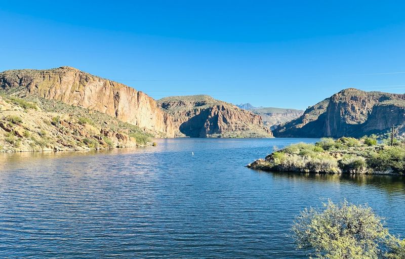
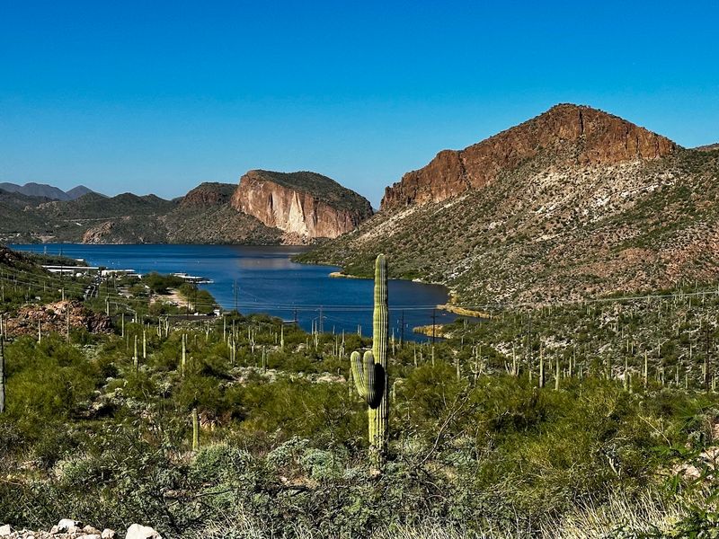
Around a bend, the desert suddenly gives way to water. Canyon Lake is one of the first big highlights on the route, and it tends to catch first-timers off guard.
The lake was formed by Mormon Flat Dam on the Salt River, completed in the 1920s. Steep canyon walls rise right up from the shoreline, making it one of the more dramatic reservoirs in the region.
This is where the trip shifts from looking to doing. Boating, kayaking, and fishing are popular here, and there is a marina area that supports lake activities.
A steamboat-style tour vessel has long operated on the lake, offering narrated cruises through the canyon. Schedules and prices can change, so it pays to check ahead.
Parking at some recreation sites in Tonto National Forest may require a Tonto Pass. Rules vary by site, so look for posted signs when you pull in.
Summer weekends can get busy at the lake, especially with boaters from across the Valley. An early start often means easier parking and calmer conditions.
Even a quick stop for photos is worth it. The contrast between the cliffs and the water is one of the defining scenes of the entire drive.
5. Tortilla Flat, Population Tiny
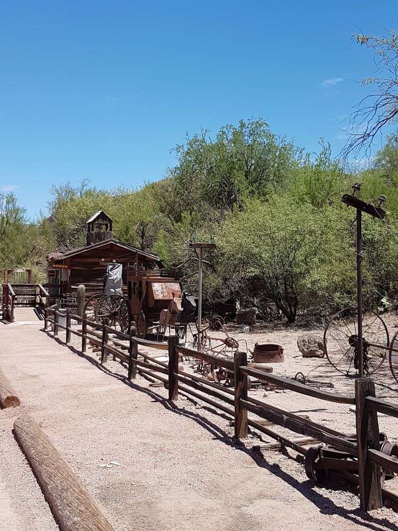
Blink and you might miss it. Tortilla Flat is a tiny community along the trail with a population that usually fits on one hand, or close to it.
It began as a stagecoach stop during the era when the road served the dam project. Today, it is a popular rest stop for drivers and motorcyclists working their way along the route.
The settlement has an old-west look that makes it a favorite photo stop. Small shops and a general store give travelers a chance to take a break.
For many day-trippers, Tortilla Flat acts as a natural turnaround point. The road stays paved to this area and a little beyond, so drivers in standard cars can reach it without much worry.
It also makes a handy checkpoint for planning. Past this point, conditions get rougher and services become scarce, so it is smart to top off supplies and use the facilities here.
Weekends can draw crowds, especially in cooler months when motorcycle groups head out from Phoenix and Mesa. Weekdays tend to be quieter.
Small as it is, this stop carries a big personality. It feels like a postcard from the road’s freight-hauling past, still open for business.
6. Where the Pavement Calls It Quits
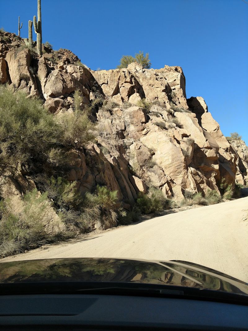
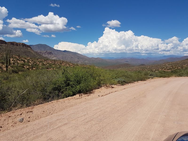
A few miles past Tortilla Flat, the asphalt ends and the gravel begins. This is where the Apache Trail earns its reputation.
Roughly 20-plus miles of the route are unpaved. The surface can include washboard sections, loose gravel, and narrow stretches with steep drop-offs and few guardrails.
Many drivers have completed the dirt section in regular passenger cars during good conditions. Even so, a vehicle with higher clearance can make the ride more comfortable, and slow speeds are a must.
Large RVs and trailers are generally a poor fit for this part of the road. Tight curves and steep grades leave little room for long vehicles.
Weather matters too. Rain can make the dirt slick and can cause washouts, so checking the forecast is part of the plan.
Cell service can be spotty in the canyon. Downloading maps ahead of time and telling someone your route are simple steps that make the day smoother.
None of this should scare off a careful driver. It just means the unpaved miles reward patience, a full tank, and a relaxed schedule, which is exactly how this road is meant to be enjoyed.
7. Fish Creek Hill, the Famous Grade
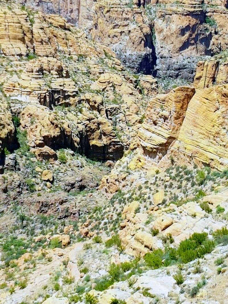
Ask anyone who has driven the full route about the most memorable stretch, and Fish Creek Hill usually comes up first. It is a steep, narrow grade cut into the canyon wall.
The road drops sharply here, with tight turns and a big canyon view off one side. A scenic viewpoint at the top has long been a popular place to stop and take in the scale of the landscape.
Drivers often describe this section as the moment their hands tighten on the wheel. Going slow and using lower gears on the descent is the standard advice.
Now for the big catch. In 2019, the Woodbury Fire and later flooding damaged portions of the road, and the stretch that includes Fish Creek Hill has been closed for an extended period since then.
The Arizona Department of Transportation has been working on repairs and evaluating the route. Status can change, so checking ADOT’s current road information before you leave is essential.
Even with the closure, travelers can still reach parts of the trail from both ends. Plan your trip around what is open rather than assuming you can drive straight through.
When the grade is accessible, it is the kind of road that ends up in your camera roll for years.
8. Apache Lake Out Past the Crowds
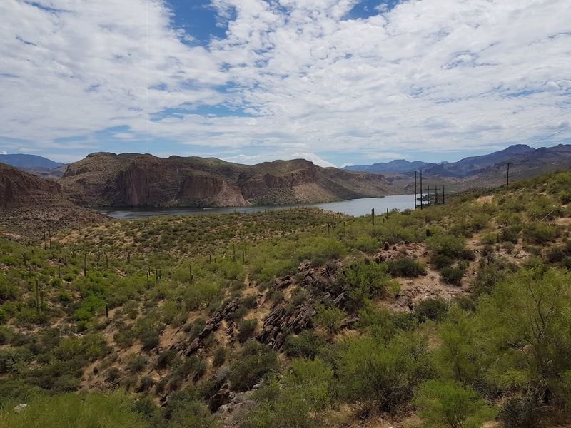
Farther east, the trail reaches Apache Lake, a long, narrow reservoir that feels more remote than Canyon Lake. It was formed by Horse Mesa Dam on the Salt River.
Because reaching it involves more driving, the lake tends to see fewer people. That makes it appealing for anglers, campers, and paddlers who want a bit more space.
There is a marina area on the lake, and camping options exist in the surrounding forest. Availability and services can vary, so it is smart to confirm before counting on them.
With the middle section of the trail closed in recent years, many travelers have reached Apache Lake from the eastern side near Roosevelt instead. Coming in that way avoids the closed stretch.
That approach requires a longer loop through other highways, such as State Route 87 and State Route 188, depending on your starting point. Phoenix drivers should budget extra time.
Fishing in Arizona requires a valid state fishing license for most anglers. Have that sorted before you cast a line.
For locals who think every lake near Phoenix is packed on weekends, Apache Lake is a pleasant correction. It rewards the extra effort with elbow room.
9. Roosevelt Dam at the Finish Line
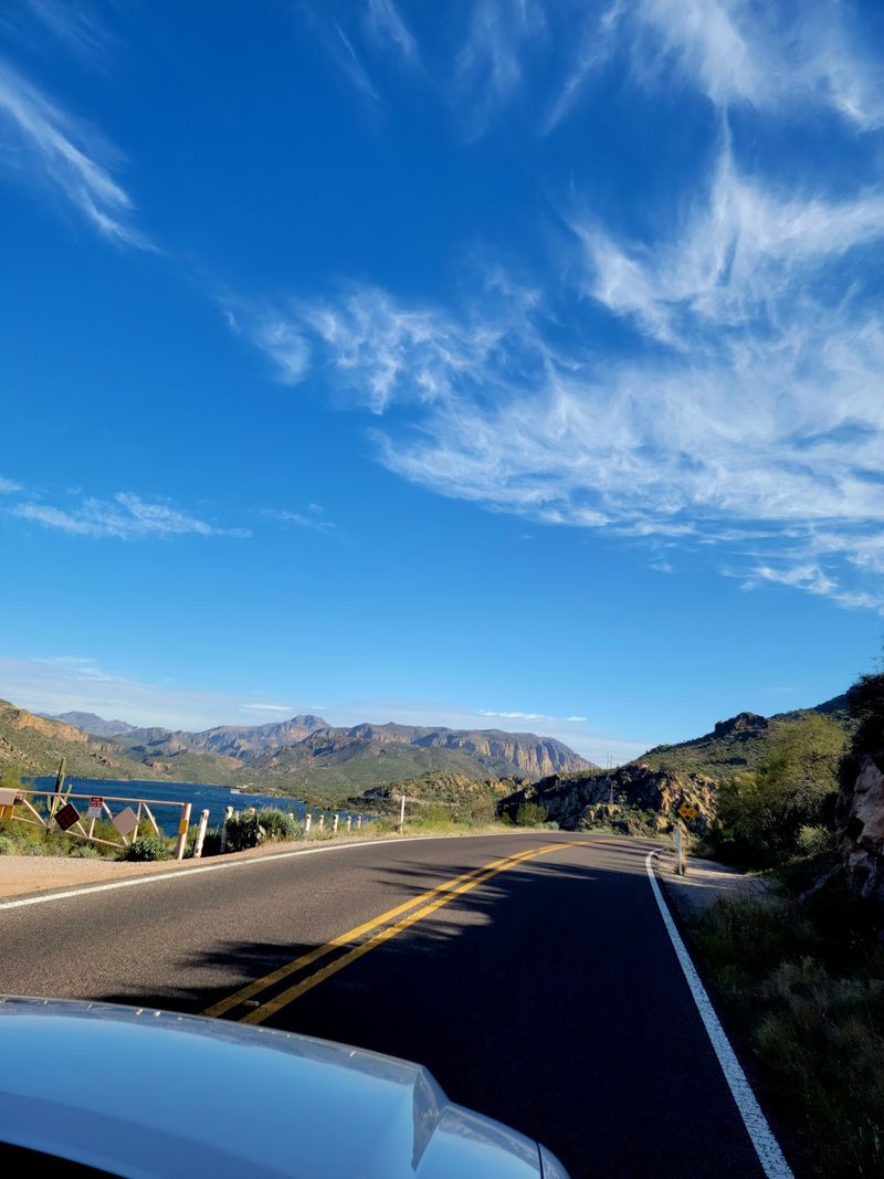
The road’s original destination still stands at the end of the line. Theodore Roosevelt Dam holds back Theodore Roosevelt Lake, the largest lake located entirely within Arizona.
The dam was first completed in 1911 as a masonry structure. Decades later, it was modified and raised, giving it the appearance it has today.
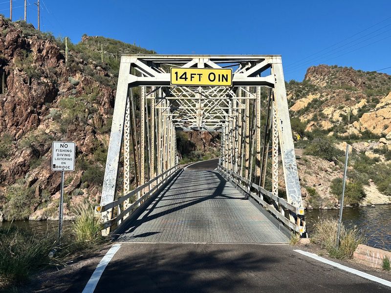
Nearby, a bridge spans the lake and offers a striking view of the dam and the water. It is a popular photo stop for anyone finishing the drive.
Roosevelt Lake is a major hub for boating, fishing, and camping. A visitor center in the area has historically offered exhibits about the dam and the region.
Arriving here closes the loop on the road’s story. The supplies hauled over the trail more than a century ago helped build what you are looking at.
From this end, travelers can continue on other highways back toward the Valley, making a full-day loop possible. Distances on that return are significant, so plan for a long day.
For history fans, this is the payoff. The road and the dam belong together, and seeing both on the same trip makes the whole adventure click into place.
10. Who Gets the Most Out of This Drive
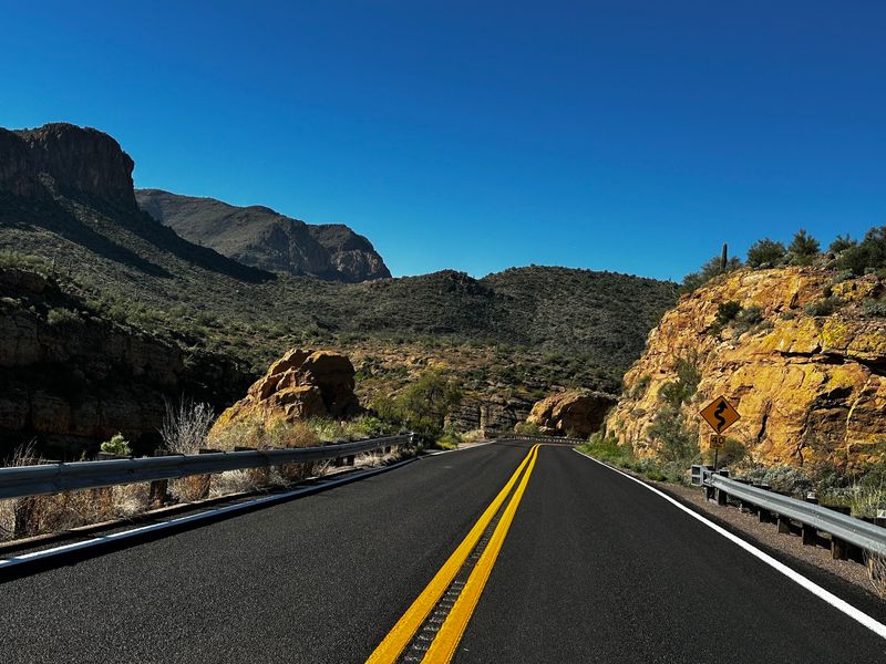
Not every road trip suits every traveler, and that is especially true here. The Apache Trail favors people who enjoy slow travel and frequent stops.
Photographers tend to love it, since nearly every curve reveals a new angle on the mountains and lakes. Hikers find trailheads in the Superstitions and around the forest.
Water lovers have Canyon Lake, Apache Lake, and Roosevelt Lake to choose from. Motorcyclists often ride the paved western stretch to Tortilla Flat.
Families with kids can enjoy the paved portion easily. The gravel and closed sections are better suited to confident drivers who do not mind narrow roads.
Nervous passengers may want to sit on the mountain side when possible. Some of the drop-offs are significant, and a calm co-pilot makes the trip more pleasant.
Budget-minded locals have a lot to like here as well. Driving the route is free, and many stops cost little or nothing beyond possible parking passes.
In short, this road rewards curiosity over speed. Travelers who treat it as an outing instead of a shortcut usually head home with the best stories.
11. Timing, Passes, and the Road Status Check
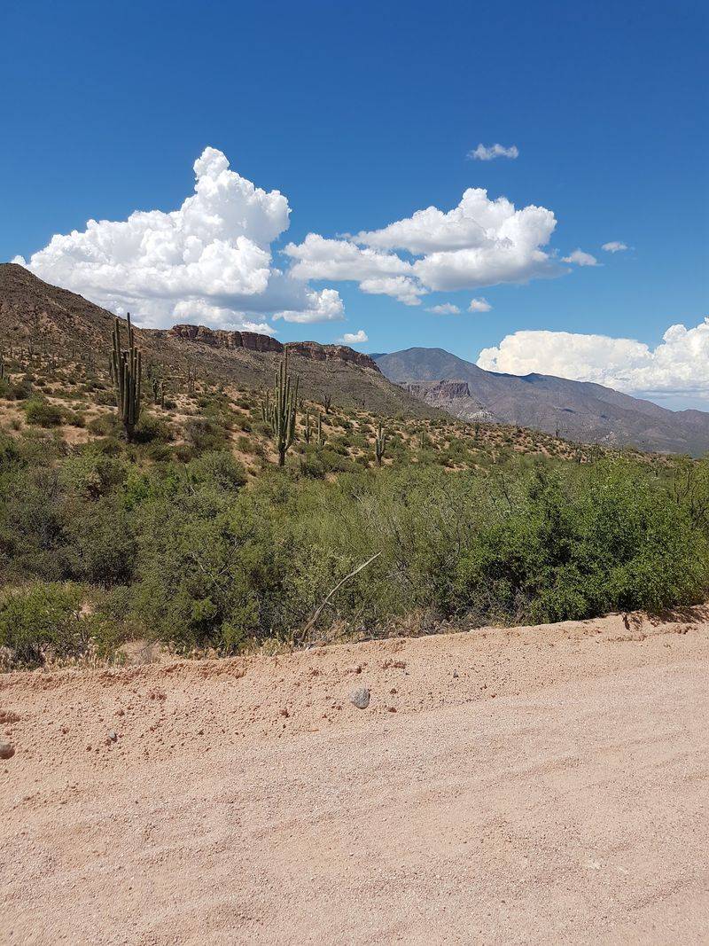
Smart timing can make or break this trip. For Phoenix and Tucson day-trippers, fall, winter, and spring are generally the most comfortable seasons to go.
Summer heat in the low desert can be intense, and the canyon offers limited shade. During hot months, an early morning start is the safer choice.
Apache Junction is typically under an hour from central Phoenix, depending on traffic. From Tucson, expect a longer drive of a couple of hours to reach the starting point.
Before leaving, check the Arizona Department of Transportation for current closures on State Route 88. The section damaged in 2019 has affected through-travel for years.
Some recreation sites in Tonto National Forest require a Tonto Pass for parking. These passes can be purchased from authorized vendors and online, so look into it ahead of time.
Bring plenty of water, snacks, and a full tank of gas. Services are limited once you pass Tortilla Flat.
A spare tire in good shape is a wise addition for the gravel miles. Paper maps or downloaded directions help when the cell signal fades.
A little preparation keeps the focus on the views instead of the logistics.
12. A Short Road With a Long Memory
Forty-some miles does not sound like much on paper. Yet this road manages to pack mountains, lakes, history, and a little adventure into a single day.
It started as a supply route for a dam that helped shape modern Phoenix. Today, it offers locals a free and close-to-home way to see some of the most dramatic scenery in the region.
The closures since 2019 add a wrinkle, but they do not erase the appeal. Plenty of the trail remains reachable from both ends, and each section has its own highlights.
Start with the paved miles to Canyon Lake and Tortilla Flat if you are new to the route. Save the eastern approach to Apache Lake and Roosevelt for a second trip.
Either way, the drive tends to make people rethink what a road trip needs to be. Big distances and hotel stays are optional.
What matters most is time, patience, and a willingness to pull over often. The Superstitions will still be there, and so will the curves.
So the next time the exit sign flashes by on the way home, consider taking the turn. The Apache Trail has been waiting more than a century for you to notice.
Share this story