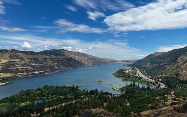
Some of the best views in Oregon take hours of sweaty climbing to earn. This one takes a parking brake. High above the Columbia River near the small town of Mosier, a clifftop pullout hands over a sweeping look at the Gorge, a famous looping road, and distant snowy peaks, all a few steps from your car.
It costs nothing to visit, it never closes, and in spring the hills around it turn into a wildflower show that draws photographers from across the Northwest. There is also a catch or two, mostly involving wind strong enough to snatch a hat off your head and a car door out of your hand. Keep reading to learn where it is, how to get there, when to go, and what to pack so a quick stop turns into a favorite Oregon memory.
A Free Front Row Seat Above Mosier
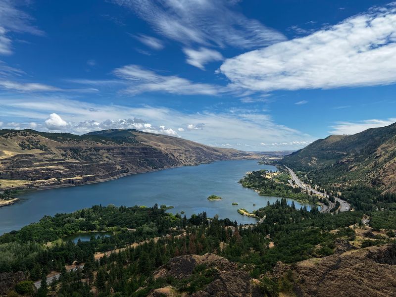
Every great road trip needs a place where the car stops and the jaws drop. In the eastern Columbia River Gorge, that place is Rowena Crest Viewpoint, at 6500 Historic Columbia River Hwy, Mosier, OR 97040, in the state of Oregon.
The overlook is part of the Oregon State Parks system. It sits high above the Columbia River, where the land opens into wide views of cliffs, water, and sky.
Officially, it is listed as a scenic spot. In practice, it works as a pullout, a photo stop, a trailhead, and a place to simply stand and stare.
The best part for budget-minded Oregonians is the price tag, because there isn’t one. Entry is free, and the gates never close.
That combination matters at a time when so many outings seem to come with a fee. Here, a family can spend twenty minutes or two hours without opening a wallet.
It also helps that the place is beloved. Out of nearly 1,500 opinions shared online, it holds an average close to a perfect score, which is rare for any roadside stop.
So what exactly makes a simple pullout earn that kind of loyalty? The answer starts with the road that leads up to it.
The Road That Ties Itself in Knots
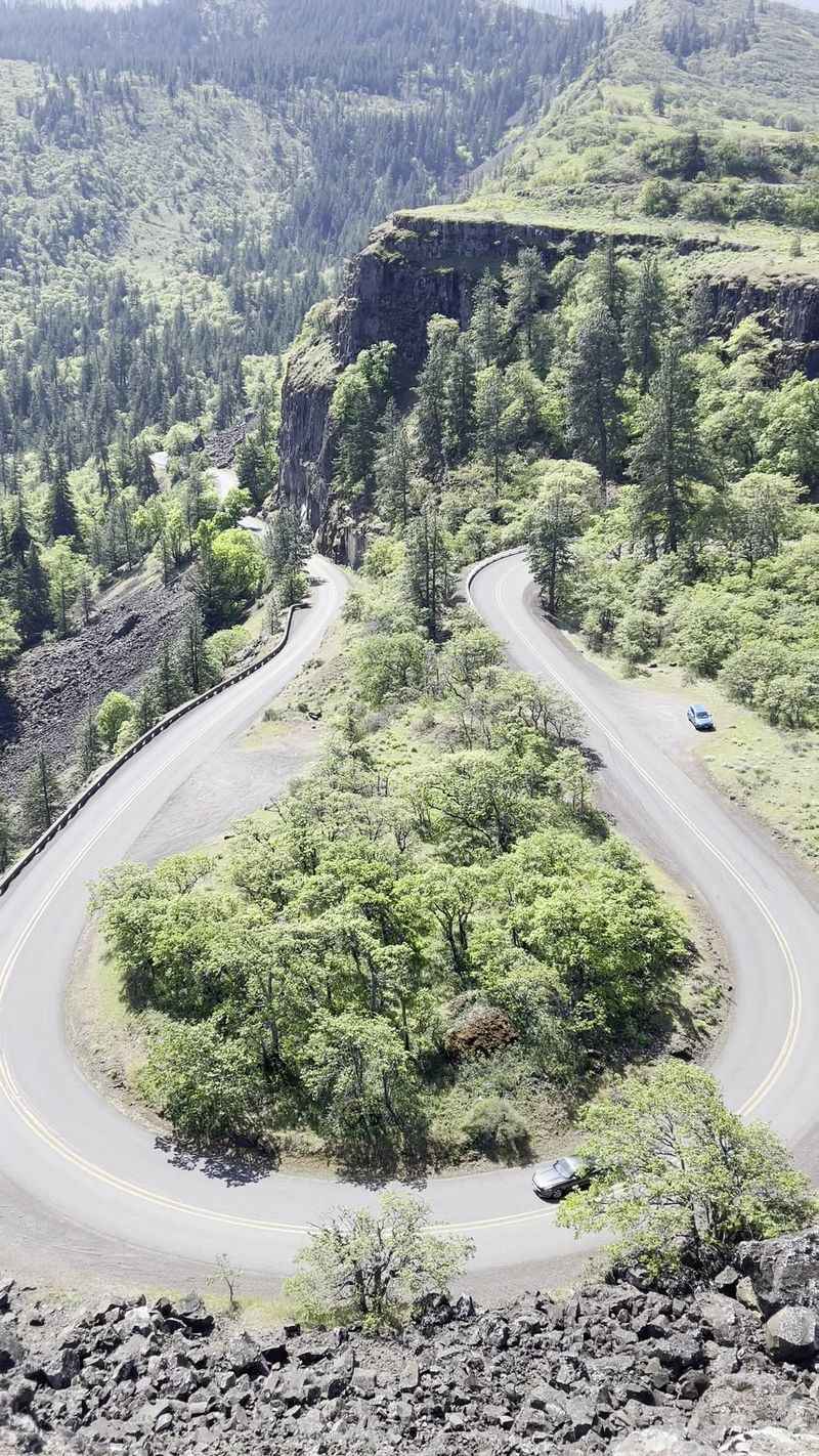
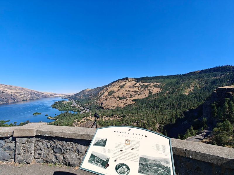
Below the overlook, the pavement does something unusual. The Historic Columbia River Highway, also known as Highway 30, bends into a horseshoe-shaped set of curves called the Rowena Loops.
From the top, those loops look like a ribbon someone dropped on the hillside. They have become one of the most photographed road features in the Northwest.
The drive itself is part of the fun. Hairpin turns and plenty of twists make the climb feel like a scenic cruise rather than a commute.
The switchbacks heading back down get just as much love as the climb up. Many people treat the descent as a bonus round.
A word of caution for anyone prone to car sickness, though. All those curves can be rough on sensitive stomachs, so a window seat and a slower pace can help.
Cyclists love this stretch too. Expect to share the road with bicycles, and give them plenty of room on the bends.
The loops show off the shape of the land in a way a straight highway never could, and that land has quite a backstory of its own.
Cliffs Carved by Ancient Floods
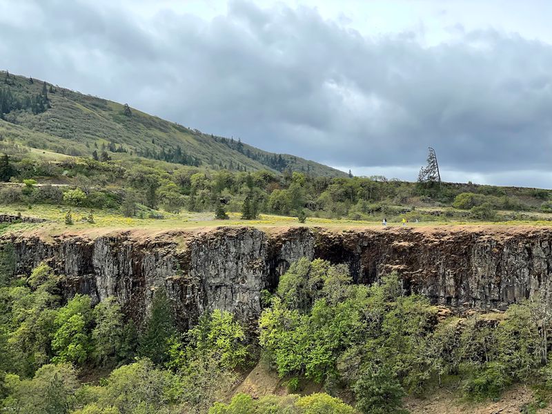
The scenery here did not happen quietly. The dark basalt cliffs around the viewpoint were shaped by ancient floods that tore through the Gorge long ago.
That violent past left behind steep walls, layered rock, and a broad plateau. The result is the dramatic stage that frames the river today.
Standing at the edge, the scale becomes clear. The river sits far below, and the cliffs drop away in bold tiers.
It is one of those spots where geology stops being a school subject and starts being a view. Even kids who groan at the word rock tend to stop and look.
Families should keep a close eye on little ones, however. The area has plenty of cliffs, and the edges deserve respect.
The road up is considered safe, even if it hugs some steep terrain. The danger zones are the open edges near the top, not the pavement.
Those same floods also opened up a view that stretches far beyond the cliffs themselves.
A Panorama in Every Direction
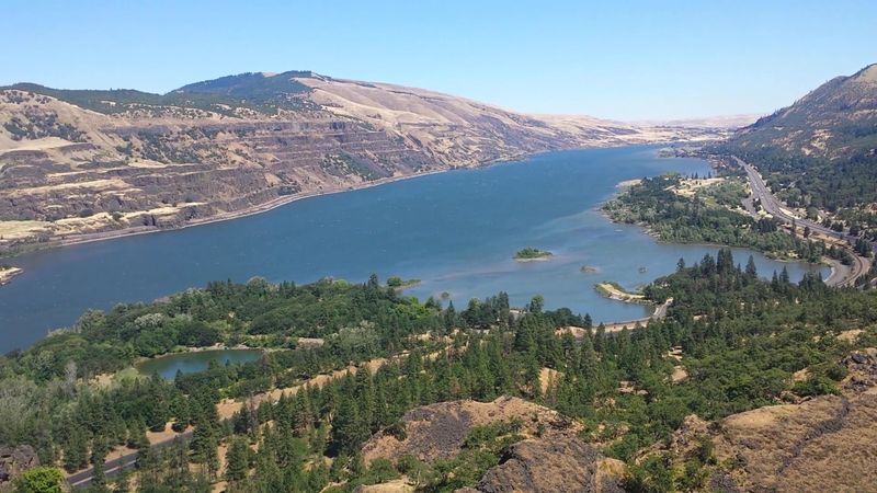
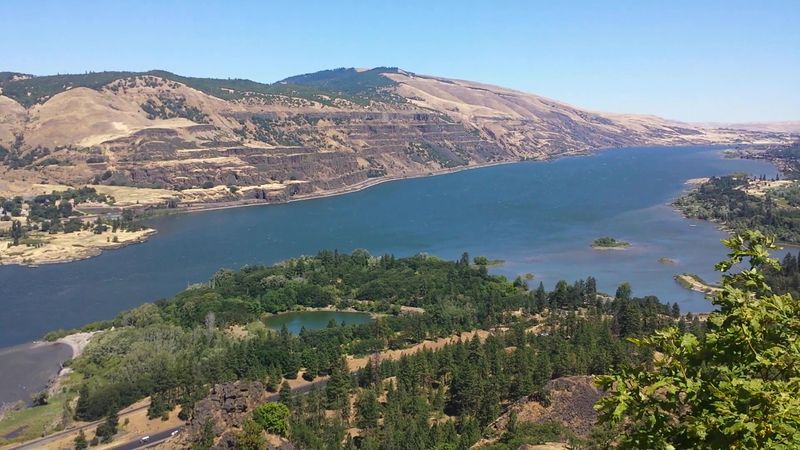
Turn left, turn right, then turn all the way around. The views from the crest stretch in nearly every direction across the Columbia River.
The river is the star, running wide through the Gorge. Across the water, the hills of Washington rise on the far shore.
Sharp eyes can also pick out where the Klickitat River meets the Columbia. It adds another layer to an already busy view.
The views of the Gorge come up again and again when people describe this place. It is the main reason most cars pull over in the first place.
A fair warning keeps expectations honest. Some feel the scene is similar to what passing drivers glimpse from the road.
Still, there is a difference between a glance through a windshield and a long look with your feet planted. The open plateau gives time and space to take it all in.
And on clear days, the panorama gets an extra pair of guests on the horizon.
Two Snowy Peaks on the Skyline
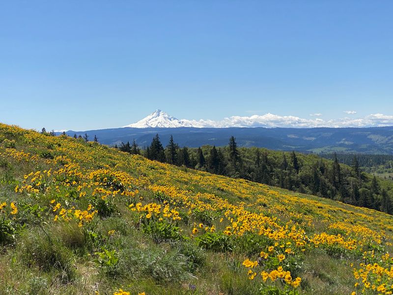
Here is a fun bonus that many first-timers do not expect. On a clear day, the area around the crest can show off two snowy mountains.
Mount Hood is the headliner. The best look at it comes from the climb above the viewpoint, which rewards effort with a wider horizon.
Seeing a snowcapped peak from a dry, open plateau makes for a striking contrast. It is a reminder of how many landscapes squeeze into this part of Oregon.
Photographers love this pairing. A foreground of rocky hills and a background of white summits makes for an easy winning shot.
Weather plays a big role, of course. Clouds and haze can hide the mountains, so clear mornings tend to be the safest bet.
Patience can pay off here. Sometimes waiting a few minutes lets a cloud drift away from a summit.
Those mountain views are even better when the ground at your feet bursts into color, which brings us to spring.
Spring’s Yellow and Purple Takeover
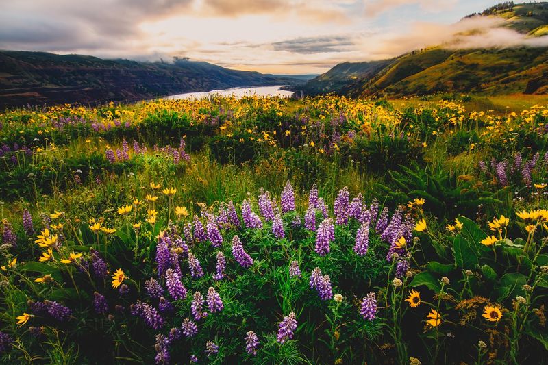
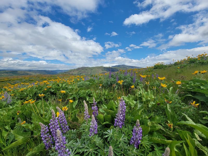
Come spring, the plateau puts on its best outfit. Balsamroot in yellow and lupine in purple spread across the hills.
The wildflower season is a huge part of the crest’s reputation. It ranks among the most photogenic locations in the state during bloom time.
Mid-May is a popular window for catching the flowers. Timing can vary from year to year, though, so the peak may come earlier or later.
Missing the main show is not a disaster. Even after peak bloom, several flowers usually stick around.
A little honesty helps here too. The bloom can be lovely without matching the dramatic superbloom photos that float around social media.
Those online images often capture a perfect year at a perfect angle. Expecting a pleasant display rather than a blanket of color keeps the trip happy.
The flowers are a big draw, and the best way to see them up close is on foot.
Gateway to the Tom McCall Preserve
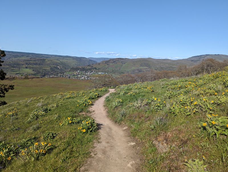
The viewpoint doubles as a doorway. It serves as a trailhead for the Tom McCall Preserve, a nature preserve known for its spring wildflowers.
That makes the crest more than a pullout. It is the starting line for anyone who wants to trade the car for boots.
One trail heading into the preserve covers about two miles on a gentle slope. Many drivers wish they had saved time for it after seeing it from the parking area.
Dog owners need to plan ahead. Dogs are not allowed in the Tom McCall Preserve.
That rule helps protect the delicate plant life the preserve is known for. Leaving pets at home or planning a different walk keeps everyone happy.
The preserve offers a closer look at the flowers that color the hills. It also delivers quieter moments away from the busy overlook.
For those who want a bigger challenge, the trail continues upward toward a well-known summit.
The Climb Toward McCall Point
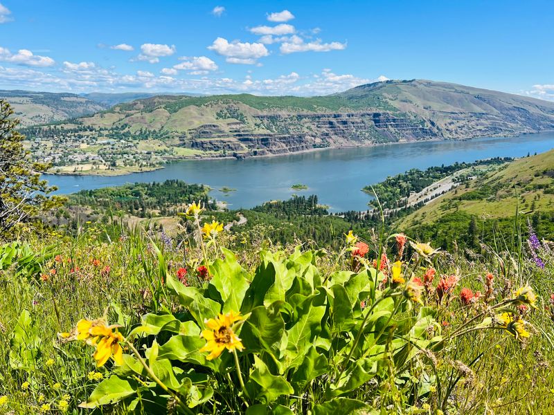
No hike is required to enjoy the crest. For the restless, though, a ridge walk up to McCall Point offers a bigger reward.
The round trip runs about four miles as an out-and-back trail. Plan on roughly two hours to complete it.
It is steeper than many expect. The effort is described as challenging but not too difficult, which puts it within reach for many active walkers.
Walking sticks come highly recommended. They help with the grade on the way up and the footing on the way down.
The payoff includes wide views, springtime flowers, and that famous look at Mount Hood. Many hikers call it well worth the extra work.
Starting early is smart. Morning hours help beat both the crowds and the heat that can build on the open slopes.
Before heading out, there are a few trail residents worth knowing about.
Ticks, Rattlesnakes, and Trail Smarts
Nature here is gorgeous, and it is also fully staffed with wildlife. Rattlesnakes are a known presence along the trails.
Staying on the path and watching where you step goes a long way. Keeping hands out of rocky crevices is another simple habit.
Ticks are the smaller but sneakier concern. Dogs walking the trails near the flowers have come home with unwanted passengers.
A quick tick check after any walk is a good idea. That goes for people, kids, and pets alike.
Long pants tucked into socks can help in grassy areas. Light-colored clothing also makes it easier to spot anything that hitched a ride.
None of this should scare anyone away. Thousands enjoy the area every year with a little awareness and common sense.
Of all the local characters, though, one shows up more than any other, and it cannot be seen at all.
The Wind Never Takes a Day Off
Of everything people talk about at the crest, nothing comes up more than the wind. It is mentioned more than the views, the flowers, or the trails.
The open plateau catches gusts sweeping through the Gorge. On many days, it can feel like the hilltop is trying to blow visitors back down the road.
Car doors are the first casualty. Open them slowly and hold on tight, because a strong gust can swing them wide.
Loose items deserve the same care. Papers, hats, and snacks wrappers inside the car can fly out and disappear in seconds.
A jacket is a must, even when the valley feels warm. The top can turn cool quickly when the wind picks up.
Secure your phone strap and camera gear before stepping to the edge. Wind and cliffs are not a winning combination for dropped devices.
The wind is part of the personality here, and so is the crowd it never seems to scare off.
Who Gets the Most Out of a Stop
Some places suit one type of traveler. The crest welcomes almost everyone.
Road trippers can treat it as a quick break. A stop might last one minute or twenty, and still feel worthwhile.
Photographers chase golden hour light here. The loops, the river, and the cliffs give plenty to frame.
Families find it an easy add-on to a bigger trip. Some call it a nice extra rather than a must-see, which is a fair way to set expectations.
Hikers get a real trail with real views. Wildflower fans get a seasonal show that keeps them coming back.
Even a brief pause pays off. Finding a quick spot to park and enjoy the scene for twenty minutes can brighten a long drive.
The crest has also given some people a front seat to rare moments, including one dramatic day across the river.
A wildfire once started on the far side while people watched from the overlook, an eye-opening reminder of how much of the Gorge this spot can see.
Getting There From I-84
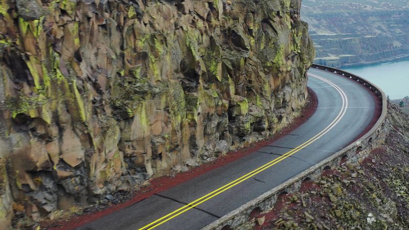
Finding the crest is refreshingly simple. Take exit 69 off Interstate 84 near Mosier.
From there, follow the route about 7.5 miles to reach the viewpoint. The drive climbs onto the Historic Columbia River Highway and its curves.
Many travelers urge others to leave the interstate behind for this detour. The contrast between a busy freeway and a winding scenic road is half the appeal.
The route has steep, cliffy stretches. Even so, the road itself is considered safe for careful drivers.
Take the curves slowly and watch for cyclists. Bikes are common, especially on nice days.
Plenty of parking is available at the top. On busy spring weekends, though, spots can fill, so arriving early helps.
Once parked, it is worth knowing what is and is not waiting at the top.
Hours, Costs, and What to Pack
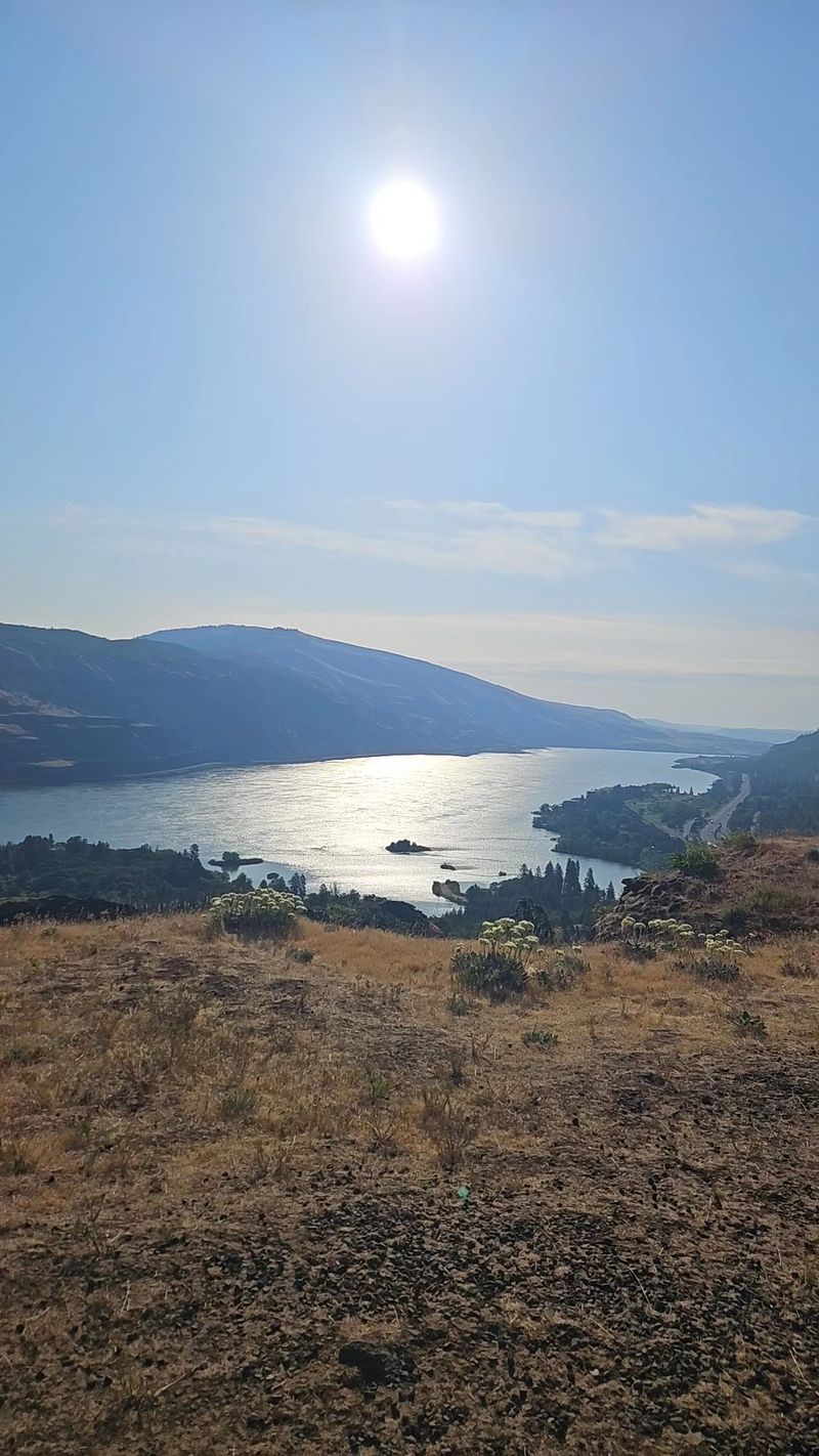
Good news first. The viewpoint is open 24 hours a day, seven days a week, and visiting is free.
That makes it easy to fit into any schedule. Early birds can catch quiet mornings, and late travelers can still pull in.
Facilities are basic, so plan accordingly. Restroom access is uncertain at the top, with some mentioning one nearby and others finding none.
Garbage cans are not something to count on either. Packing out trash keeps this free spot clean for everyone.
A short packing list goes a long way. Bring a jacket for the wind, water for the trail, and walking sticks for the climb.
Sturdy shoes help on the hiking routes. A plan for pets matters too, since dogs cannot enter the preserve.
For questions about conditions, the Oregon State Parks website is a reliable place to check before heading out.
A Free Oregon Classic Worth Protecting
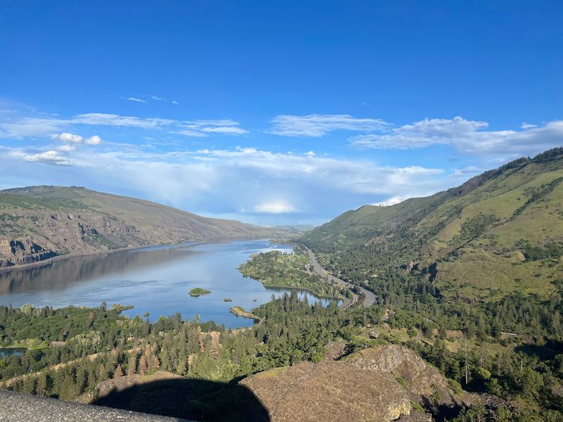
Plenty of places promise big views. Few deliver them so freely, so easily, and so reliably.
Rowena Crest offers a winding drive, a famous looping road, a river panorama, and a spring flower show. It also opens the door to a real hike for those who want more.
The wind will test your grip, and the bloom may not match every online photo. Those small quirks rarely dent the experience.
For Oregonians watching costs climb, a stop like this feels especially valuable. A full afternoon here costs nothing but a little fuel.
That kind of place deserves care. Packing out trash, staying on trails, and respecting the preserve keep it beautiful for the next family.
So next time I-84 starts to feel endless, take exit 69. The Gorge is waiting at the top, and it never locks the door.
Share this story