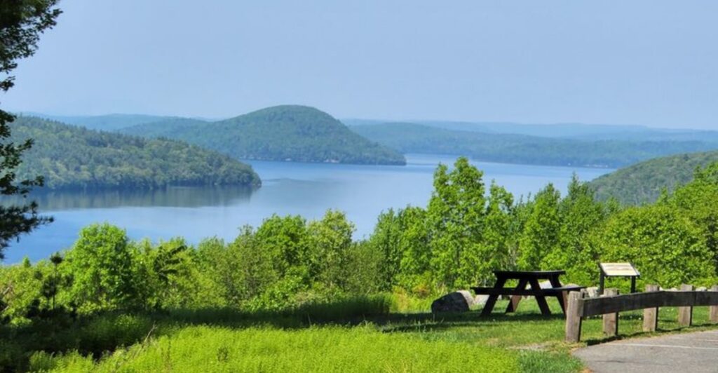
The calm water and wooded hills at Quabbin Reservoir hide a story that is anything but peaceful. Beneath this vast Massachusetts landscape lies the history of four towns that were disincorporated and cleared as the valley was transformed into a major drinking-water reservoir. Families had to leave, buildings disappeared, cemeteries were moved, and roads that once connected everyday communities faded from the map.
That history gives every overlook and quiet stretch of shoreline a deeper meaning. For anyone drawn to Massachusetts places where beautiful scenery comes with a powerful story underneath, Quabbin Reservoir is the kind of destination that makes you look twice.
A Massachusetts View With a Missing Valley
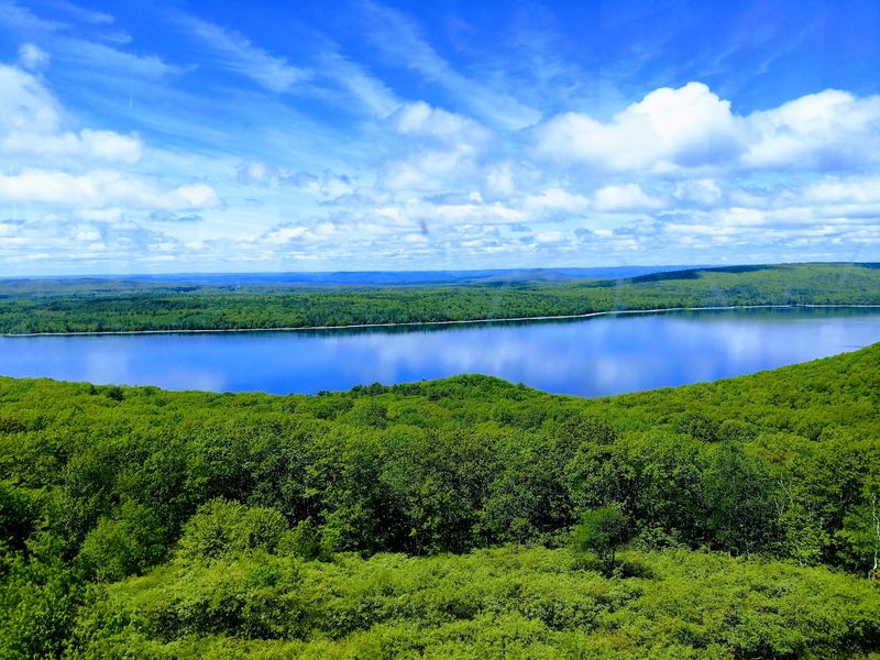
Your eyes reach the water before your mind catches up with its size. From the southern end of Quabbin Reservoir, wooded hills stretch around a broad sheet of blue, with islands breaking up the distance.
The view offers few clues that farms, roads, and town centers once occupied this valley. That contrast is the first surprise: a landscape that seems untouched was shaped by one of the largest water supply projects in Massachusetts history.
Start near Winsor Dam, where the open setting helps you understand the scale without needing a long hike. Look across the reservoir rather than only down at the shoreline, and notice how the hills form a natural bowl around the water.
Quabbin covers roughly 39 square miles when full. Its branching shape means you cannot take in the whole reservoir from one overlook, even when the air is clear and the far ridges stand out sharply.
On a windy day, small waves roughen the surface and the open dam area can feel cooler than the parking lot. Bring a light layer, especially in spring or fall, when sunshine can make the weather seem warmer than it actually is.
A phone camera will capture the scene, but including a section of the dam or a nearby tree gives the picture useful scale. Without that foreground, the enormous water surface can look surprisingly ordinary in a photograph.
Before moving on, try picturing the same view without water. Replace the shining surface with fields, houses, bridges, and roads running between settlements.
You do not need to imagine intact towns sitting on the bottom. Most buildings were removed before flooding, making the absence harder to see but no less real. The view begins with scenery; understanding it requires looking beyond what the water allows you to see today from this southern shoreline.
Four Town Names That Vanished From the Map
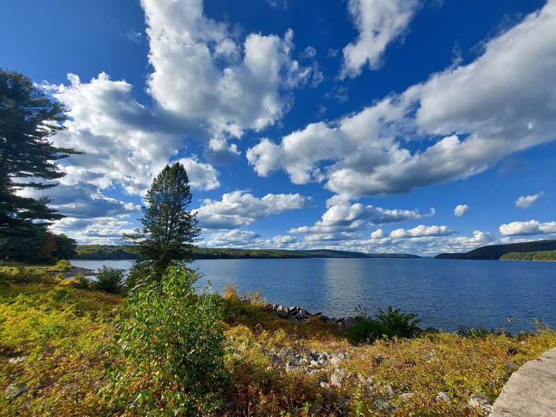
Dana, Enfield, Greenwich, and Prescott were real communities, not names invented for a history display. Each had its own daily routines, gathering places, and connections to the surrounding Swift River Valley.
All four towns were officially disincorporated on April 28, 1938. That legal step ended their existence as separate municipalities, while the reservoir project changed the land where their residents had lived.
Calling them flooded towns is useful shorthand, but it leaves out an important detail. Buildings were generally demolished or moved, vegetation was cleared from areas slated for flooding, and the valley was prepared before the water rose.
There is no complete underwater village waiting behind the blue surface. The disappearance happened through years of purchases, departures, demolition, and construction, not through a single dramatic rush of water into occupied streets.
Nor did every acre of the former towns end up underwater. Some higher land became part of the protected watershed, which explains why traces of old settlement can still exist above the reservoir.
For the clearest explanation, compare an old valley map with a modern Quabbin map. Roads that once connected neighbors may now lead toward water, while former hilltops appear as islands or stand along the protected shore.
The visitor center near Winsor Dam is a useful starting point for understanding those changes when it is open. Historical photographs help turn the town names into recognizable places, with houses, storefronts, and people standing in familiar-looking streets.
If you are visiting with children, ask them to find one old road and follow its route on both maps. That small exercise makes the change easier to understand than a list of dates alone. Keep the four names together as you explore: Dana, Enfield, Greenwich, and Prescott explain what the reservoir replaced, even when the landscape itself offers almost no obvious clues.
Moving a Home Meant More Than Packing Boxes
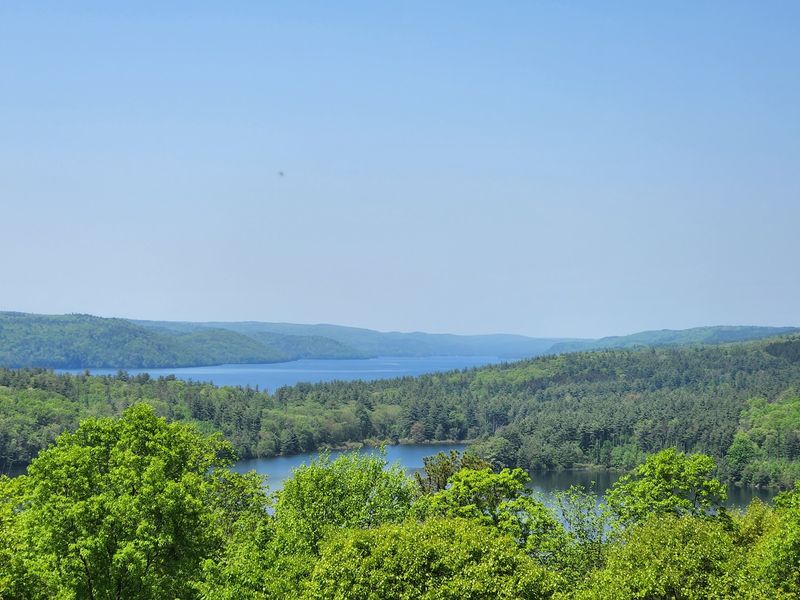
A moving box can hold dishes, but it cannot hold the road to your grandparents’ house. For families leaving the Swift River Valley, relocation meant losing the familiar arrangement of an entire community.
Homes and land were acquired for the reservoir project, and residents had to establish lives elsewhere. Payment could address property, but it could not recreate a neighborhood, a family farm, or the place where generations had gathered.
The removal extended to burial grounds. Thousands of graves were relocated, many to Quabbin Park Cemetery, so the coming water would not cover the old cemeteries.
That part of the story brings the project down to a human scale. Engineers were planning dams and water storage while families faced decisions involving both their living relatives and their dead.
Quabbin Park Cemetery offers a quieter way to learn about this upheaval. Walk respectfully, stay clear of active services, and read the older stones without touching or leaning on them.
Dates and family names show how long people had been connected to the valley before the reservoir existed. A cemetery visit also helps explain why the vanished towns remain meaningful to descendants, rather than being only a chapter in an engineering timeline.
For younger visitors, the illustrated book Letting Swift River Go can provide an approachable introduction to the loss of the valley. Reading it before the trip gives children a framework for understanding why such a beautiful place can also carry a difficult history.
Avoid reducing the residents to a simple story of willing sacrifice. People experienced the change differently, and the need for water did not erase the pain of leaving. Give this part of your visit its own time, separate from taking scenic photographs.
A few names on stone can explain the human cost more clearly than the reservoir’s enormous dimensions ever could.
Winsor Dam Turned a River Valley Into Storage
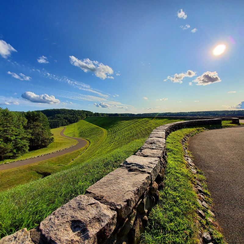
Stand beside Winsor Dam and the reservoir stops looking like a lake that simply happened to be here. The long embankment reveals the practical work behind the scenery: holding back water on a huge scale.
Winsor Dam and the Goodnough Dike closed gaps at the southern end of the valley. Together, these structures made it possible to collect water from the Swift River and surrounding watershed.
Construction took place during the 1930s, and the reservoir began filling in 1939. It reached full capacity in 1946, a useful reminder that creating Quabbin involved years of gradual change rather than one opening-day event.
At full capacity, the reservoir can hold about 412 billion gallons. The number is difficult to picture, so connect it to the view: the distant coves, islands, and shorelines all belong to the same vast storage system.
The dam is an earth embankment, not a towering concrete wall of the kind often shown in movies. Its broad shape and grassy surfaces can make the engineering seem understated until you consider how much water sits behind it.
Take a slow walk through the permitted public areas and compare the reservoir side with the land below the dam. That difference helps explain the structure’s job better than a close-up photograph of a railing or sign.
Water from Quabbin moves through a larger regional supply network serving metropolitan Boston and other communities. The reservoir was built far from many of the people who would benefit from it, which is central to understanding the project’s history.
Keep clear of restricted infrastructure and follow posted access instructions. Working water facilities are not places to explore beyond barriers, even when an empty path looks inviting. Here, the most revealing feature is also the simplest: a broad bank of earth separating an immense reservoir from the valley below it.
The No-Swimming Rule Explains the Whole Place
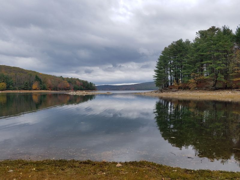
Leave the swimsuit at home. Quabbin’s clear water may look inviting on a hot afternoon, but this is a drinking water reservoir, and swimming is prohibited.
Dogs and other pets are also prohibited, so plan a different outing if your usual walking partner has four paws. These restrictions protect a public water supply, not just the appearance of a scenic park.
The surrounding forest has a job as well. Trees, soil, and protected land help limit pollution reaching the reservoir, making the watershed as important as the water you can see.
That protection has created extensive habitat for wildlife. Bald eagles are among the birds associated with Quabbin, while deer and other animals use the wooded areas around it.
Bring binoculars if you enjoy watching birds, but keep your expectations flexible. An eagle sighting is possible, not promised, and a distant bird resting in a tree may be easier to notice than one flying overhead.
Stay back from wildlife and never leave food to attract animals. Watching quietly from an allowed path gives you a better chance of seeing natural behavior without disturbing feeding or nesting areas.
Fishing and boating operate under specific rules in designated areas, rather than anywhere along the shore. If either activity is your goal, check current Massachusetts guidance for seasons, access points, permits, and equipment requirements before leaving home.
For a simple park visit, the easiest approach is to treat the water as something to observe, not enter. Stay on permitted routes, pack out every scrap of trash, and avoid assuming that a gap in the trees is an invitation to reach the shore.
Those limits shape the experience in useful ways. Instead of beach crowds and splashing, your attention shifts toward moving clouds, bird calls, and the forest that helps keep this enormous water supply clean for communities beyond Quabbin.
Follow the History Before You Follow a Trail
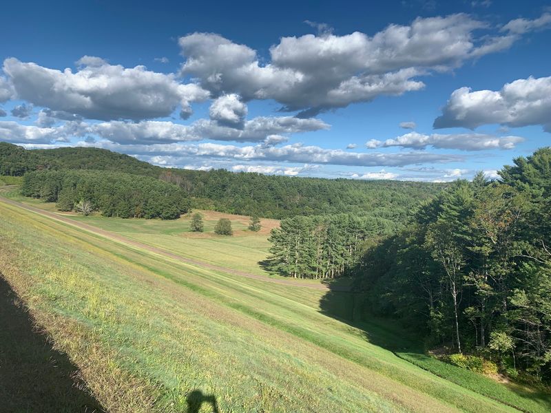
A little context changes the walk completely. Spend a few minutes learning about the former towns before heading toward the dam, and the water becomes more than a pleasant backdrop.
Begin at the visitor center when available, using its exhibits to connect the reservoir with the valley that came before it. Check opening information ahead of time, since access to the park and access to indoor exhibits are not necessarily the same.
Then choose a manageable walk around the southern park area. You do not need to cover miles to see the dam, study the shoreline, and get a sense of how the terrain holds the reservoir.
For families or anyone seeking an easier outing, start with the smoother public walking surfaces near the main visitor area. Conditions and accessibility vary, so confirm the route before assuming every path will work for a stroller or mobility device.
More ambitious walks require a current map. Quabbin has many numbered gates and access roads, and a route elsewhere around the reservoir may involve a separate drive rather than a short extension of your Winsor Dam visit.
Dana Common, a surviving former town-center site, is one historical destination within the wider reservation. Reaching it requires planning for a different access point; it is not beside the visitor center.
Stay on authorized routes and leave historic remains undisturbed. Old foundations and stone walls are clues to earlier land use, not souvenirs or invitations to scramble through unstable structures.
If your time is limited, resist building an itinerary around every gate and overlook. A focused visit can combine the exhibits, a dam walk, and a stop to study an old map.
That sequence gives you three useful perspectives: the people who lived here, the structure that changed the valley, and the landscape that exists today. Let the available daylight set your pace.
Plan for Daylight, Not Just a Pretty Sunset
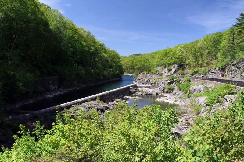
The best photograph is not much use if your car is behind a closed gate. Quabbin rewards a little planning, especially when late afternoon light tempts you to stay longer.
Use 100 Winsor Dam Rd., Belchertown, Massachusetts, for the southern visitor area. The reservoir has multiple access points, so entering only its name into navigation can send you somewhere other than the park entrance you intended.
Confirm current gate hours, visitor center hours, and closures before traveling. Do not assume a listed closing time applies to every facility or that sunset viewing is possible during every season.
Clear weather usually gives the strongest long-distance views. Haze can soften the far hills, while wind adds texture to the water and makes exposed walking areas feel colder.
Bring drinking water, comfortable shoes, sun protection, and a layer you can easily carry. In warmer months, use tick precautions and check yourself afterward, especially if your route includes grass or wooded trails.
Restroom availability can change with location and season. Check facilities when you arrive rather than discovering halfway through a walk that the nearest option is back near your parking area.
Pack out your trash and follow posted rules about food and permitted activities. Picnic arrangements can differ between areas, so do not bring a grill or assume every scenic clearing is an approved eating spot.
Allow extra time if you want to photograph the water, read exhibits, and visit the cemetery. Trying to squeeze all three into the final hour encourages rushing through the parts that explain the reservoir’s significance.
Quabbin stands out because its beauty and its history cannot be separated. A major water supply now occupies land where four towns once existed, and understanding both sides makes the visit richer. Arrive with time to look carefully, then leave before the gates close behind the day’s last light.